
Acreage: 270,05 km2
Concession blocks: 416 i 417
Coordinates
| No. point | x [PUWG92] | y [PUWG92] |
| 1 | 711178,20 | 235252,37 |
| 2 | 722315,00 | 228291,89 |
| 3 | 726795,89 | 235141,04 |
| 4 | 744543,90 | 223925,01 |
| 5 | 743860,81 | 223895,85 |
| 6 | 715541,91 | 222687,04 |
| 7 | 713598,33 | 222646,09 |
| 8 | 713598,27 | 222648,19 |
| 9 | 707295,80 | 222405,96 |
| 10 | 710286,46 | 232285,20 |
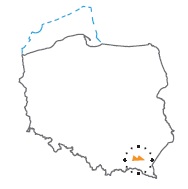
Location
Podkarpackie province:
- Strzyżów county, Niebylec commune (participation in the tender block: 13.319%)
- Rzeszów county, communes: Lubenia (14.887%), Tyczyn (0.278%), urban Błażowa (0.801%), Błażowa (30.059%), Hyżne (13.134%), urban Dynów (0.374%), Dynów (18.684%)
- Brzozów county, communes: Domaradz (0,058%), Nozdrzec (0,074%)
- Przemyśl county, commune Dubiecko (6,151%)
- Przeworsk county, commune Jawornik (2,181%)
Duration
Concession for 10 years, including:
- prospecting and exploration phase (5 years)
- extracting phase - after the investment decision
Petroleum play
I – flysch of the Skole Nappe
II – Carpathian Foredeep below Skole Nappe
III – Paleozoic-Mesozoic in the Carpathian basement
Source rocks
I – Spas Beds, Inoceramian Beds, Menilite Beds
II – clastic rocks of Upper Badenian and Lower Sarmatian
III – clastic rocks of Ordovician, Silurian, Lower Devonian and Middle Jurassic, clastic-carbonate rocks of the Middleand Upper Devonian and Lower Carboniferous
Reservoir rocks
I – Kuźmina Sandstones, Inoceramian Beds, Kliwa Sandstones
II – sand and sandstones of the Upper Badenian and Lower Sarmatian
III – Precambrian sandstones, carbonate rocks of the Middle Devonian, Upper Devonian, Lower Carboniferous and Upper Jurassic
Seal rocks
I – flysch: Spas Beds, Inoceramian Beds, Hieroglyphic Beds, Variegated Shales, Menilite Beds, Krosno Beds
II – claystone layers in autochthonous Miocene, rocks of the Stebnik Unit or flysch of the Skole Nappe above autochthonous Miocene interval
III – Ordovician and Silurian for Precambrian deposits; rocks of the culm facies, Triassic, Jurassic, autochthonous Miocene and Skole Nappe for Devonian and Carboniferous deposits; autochthonous Miocene rocks and Skole Nappe for Jurassic deposits
Trap type
I – structural or structural-lithological
II – structural and stratigraphic
III – structural and stratigraphic
The proposed minimum work program of prospecting and exploration phase
Stage I (12 months) - interpretation and analysis of archival geological data
Stage II (12 months) - execution of 2D seismic survey (100 km) or drilling of one well to the depth of 5000 m (TVD) with obligatory coring of perspective intervals
Stage III (24 months) - drilling of one well to the depth of 5000 m (TVD) with obligatory coring of perspective intervals
Stage IV (12 months) - performance analysis of the data obtained