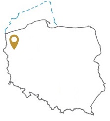
Acreage: 1171.72 km2
Concession blocks: 142, 162
Coordinates [1992]
| No. Point |
x [PUWG92] | y [PUWG92] |
| 1 | 607760,99 | 199928,41 |
| 2 | 605776,69 | 233253,30 |
| 3 | 570804,18 | 231298,33 |
| 4 | 572915,76 | 197736,11 |
Location
Zachodniopomorskie province:
- Gryfino county, communes: Banie (participation in the tender area: 17.62%), urban-rural Chojna (4.80%), urban-rural Gryfino (10.24%), Stare Czarnowo (0.32%), urban-rural Trzcińsko-Zdrój (6.34%), Widuchowa (4.65%)
- Myślibórz county, communes: urban-rural Myślibórz (14.99%), Nowogródek Pomorski (0.33%)
- Pyrzyce county, communes: Bielice (6.58%), Kozielice (8.07%), urban-rural Lipiany (6.06%), Przelewice (<0.01%), urban-rural Pyrzyce (16.19%), Warnice (3.75%),
- Stargard county, commune: Stargard (0.06%)
Duration
Concession for 30 years, including:
- prospecting and exploration phase (5 years)
- extracting phase (25 years)
Source rocks
I – organic-rich interbeds within the Zechstein / Main Dolomite
II – Lower Carboniferous clastones and mudstones, hypothetically Upper Carboniferous clastic rocks
Reservoir rocks
I – Zechstein / Main Dolomite carbonates
II – Carboniferous, Rotliegend and Weissliegend sandstones
Proposed minimum work program of prospecting and exploration phase
Stage I (12 months) – interpretation and analysis of archival geological data
Stage II (48 months) – conduct of geophysical investigations – 50 km 2D seismic survey or 25 km2 3D seismic survey; drilling of one well to the maximal depth of 4200 m TVD with obligatory coring of prospective intervals
