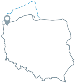
Acreage: 747.96 km2
Concession blocks: 62, 82, 83
Coordinates [1992]
| No. point | x [PUWG92] | y [PUWG92] |
| 1 | 691055,17 | 219674,19 |
| 2 | 692737,14 | 221619,12 |
| 3 | 693771,09 | 224785,26 |
| 4 | 695846,05 | 233241,52 |
| 5 | 697800,71 | 239098,78 |
| 6 | 689034,77 | 237808,88 |
| 7 | 688700,54 | 245043,47 |
| 8 | 687684,41 | 264181,99 |
| 9 | 684723,09 | 259134,45 |
| 10 | 673948,18 | 266614,09 |
| 11 | 675598,09 | 237055,20 |
| 12 | 673865,95 | 223383,30 |
| 13 | 673409,40 | 219824,29 |
| 14 | 677185,11 | 213499,78 |
| 15 | 687174,95 | 217946,87 |
| 16 | 685637,43 | 221987,20 |
| 17 | 688367,49 | 223047,42 |
| 18 | 689636,16 | 219042,50 |
| excluding the area bound by the following points: | ||
| 19 | 679335,20 | 223870,95 |
| 20 | 679746,86 | 224268,31 |
| 21 | 679040,45 | 224478,55 |
| 22 | 678251,69 | 224485,63 |
| 23 | 678251,81 | 224056,04 |
Location
Zachodniopomorskie province:
- Gryfice county, communes: Brojce (participation in the tender area: 6.60%), Gryfice (24.17%), Karnice (5.60%), Płoty (4.78), Rewal (1.67%), Trzebiatów (0.75%)
- Kamień Pomorski county, communes: Dziwnów (3.11%), Golczewo (3.09%), Kamień Pomorski (26.39%), Świerzno (18.72%), Wolin (5.12%)
Duration
Concession for 30 years, including:
- prospecting and exploration phase (5 years)
- extracting phase (25 years)
Structural stages
- Cenozoic
- Laramian (Permian and Mesozoic)
- Variscan (Devonian and Carboniferous)
- Caledonian (Lower Paleozoic)
Source rocks
I. Carboniferous claystones and mudstones
II. Main Dolomite mudstones, grainstones and boundstones
Reservoir rocks
I. Upper Carboniferous fluvial sandstones, Upper Rotliegend fluvial sandstones
II. Main Dolomite carbonate rocks
Trap type
I. mixed, structural-lithological-tectonic, unconventional – continuous
II. structural, structural-tectonic, facies
