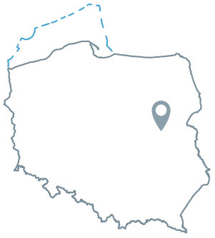
Acreage: 1200.0 km2
Concession blocks: 216, 217, 236, 237
Coordinates [1992]
| Nr punktu | x [PUWG92] | y [PUWG92] |
| 1 | 508667,07 | 687397,04 |
| 2 | 508667,07 | 722038,06 |
| 3 | 474026,06 | 722038,06 |
| 4 | 474026,06 | 687397,04 |
Location
Mazowieckie province:
- Mińsk Mazowiecki county, communes: Cegłów (participation in the tender area: 2.33%), Dobre (0.96%), Jakubów (0.34%), Kałuszyn (7.82%), Mrozy (8.14%)
- Siedlce city county, commune Siedlce city (0.55%)
- Siedlce county, communes: Kotuń (12.52%), Mokobody (9.94%), Siedlce (3.84%), Skórzec (6.74%), Suchożebry (2.32%), Wiśniew (0.76%), Wodynie (<0.01%)
- Sokołów Podlaski county, communes: Bielany (5.52%), Sokołów Podlaski city (0.29%), Sokołów Podlaski (3.45%)
- Węgrów county, communes: Grębków (10.89%), Korytnica (4.80%), Liw (9.03%), Węgrów (1.41%), Wierzbno (8.35%)
Duration
concession for 30 years, including:
- prospecting and exploration phase (5 years)
- extracting phase (25 years)
Structural stages
- Cenozoic
- Laramian (Permian and Mesozoic)
- Caledonian (Ediacaran and Lower Paleozoic)
- Precambrian
Source rocks
I – Silurian fine-grained clastic rocks (Pelplin Formation)
II – Upper Cambrian, Ordovician and Silurian fine-grained clastic rocks; fine-grained clastic interbeds in the Cambrian
Reservoir rocks
I – Silurian fine-grained clastic rocks (Pelplin Formation)
II – Middle Cambrian sandstones
Seal rocks
I – Silurian fine-grained clastic rocks
II – Upper Cambrian, Ordovician and Silurian fine-grained clastic rocks
