
Acreage: 691,38 km2
Concession blocks: 183
Coordinates [1992]
| No. point | x [PUWG92] | y [PUWG92] |
| 1 | 549450,19 | 244711,63 |
| 2 | 546785,65 | 241113,57 |
| 3 | 540242,75 | 241894,16 |
| 4 | 540873,53 | 247572,85 |
| 5 | 546430,59 | 247861,28 |
| 6 | 547712,18 | 259199,82 |
| 7 | 540414,53 | 256580,45 |
| 8 | 531745,15 | 262931,15 |
| 9 | 531753,26 | 263057,74 |
| 10 | 521496,05 | 262559,19 |
| 11 | 521556,67 | 262436,44 |
| 12 | 521365,66 | 247695,31 |
| 13 | 528872,38 | 239725,61 |
| 14 | 528621,24 | 236900,92 |
| 15 | 527049,18 | 228863,08 |
| 16 | 540948,98 | 229635,49 |
| 17 | 547125,25 | 229978,70 |
| 18 | 550209,91 | 230150,11 |
| excluding the area bound by the following points: | ||
| 19 | 537338,87 | 235938,86 |
| 20 | 537381,70 | 235451,89 |
| 21 | 537161,68 | 235262,61 |
| 22 | 536191,17 | 234978,91 |
| 23 | 535945,30 | 236140,79 |
| 24 | 536032,11 | 236456,84 |
| 25 | 536631,59 | 236671,44 |
| 26 | 537053,67 | 236400,94 |
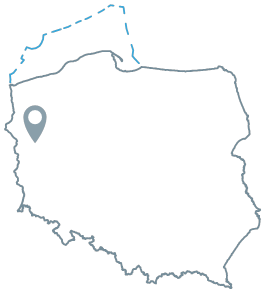
Location
Lubuskie province:
- Gorzów Wielkopolski county, communes: Bogdaniec (participation in the tender area: 15.46%), Deszczno (22.28%), Lubiszyn (1.61%), Santok (1.73%), Witnica (2.81%)
- Gorzów Wielkopolski city county, commune Gorzów Wielkopolski city (3.71%)
- Międzyrzec county, commune: Bledzew (20.58%), Skwierzyna (6.68%)
- Sulęcin county, communes: Krzeszyce (16.68%), Lubniewice (8.45%)
Duration
concession for 30 years, including:
- prospecting and exploration phase (5 years)
- extracting phase (25 years)