
The serial Shallow Geothermal Energy Potential Map (MPGN) at a scale of 1:50,000 will form the basis for estimating shallow geothermal resources with a view to applying optimal technologies and assessing Poland’s energy balance.
The MPGN comprises a spatial database and a borehole database.
- About project
- Objectives
- Methodology
- STATUS OF IMPLEMENTATION
- Results
- Data access
- How to cite
- SIGNIFICANCE OF THE PROJECT
About project
TITLE OF THE PROJECT
Map of Shallow Geothermal Energy Potential (MPGN) for Poland at a scale of 1:50,000. Phase I - ongoing task (2022-2025)
TIMEFRAME FOR THE CURRENT PHASE
01.12.2022 – 30.11.2025
CONTRACTING AUTHORITY/FUNDING AGENCY
Projects funded by the National Fund for Environmental Protection and Water Management (NFOŚiGW):
Assessment of the energy potential and environmental conditions for supporting the sustainable development of low-temperature geothermal energy (2017-2022) - pilot project
Map of Shallow Geothermal Energy Potential (MPGN) for Poland at a scale of 1:50,000. Phase I - ongoing task (2022-2025)
CONTRACTOR
Polish Geological Institute - National Research Institute
RECIPIENTS
The resulting thematic maps can be of significant assistance to:
- businesses and individual investors making preliminary assessments of the efficiency of geothermal energy projects,
- geological authorities in making official decisions regarding geological works projects designed to harness geothermal energy,
- local authorities in drawing up local strategies for the development of renewable energy sources or plans to reduce CO₂ emissions.
Objectives
The aim of the project is to carry out the tasks of the Polish Geological Survey (PSG), as set out in the Geological and Mining Law of 9 June 2011, in the field of geodiversity conservation and environmental geology (Article 162(1)(9) of the Geological and Mining Law)
The main objective of the project is for PGI-NRI to provide long-term support for the development of shallow geothermal energy systems - as one form of renewable energy - utilising the Earth’s natural heat in the form of ground-source heat pump systems - and, thereby, for PGI-NRI to contribute to the process of improving air quality in Poland by providing specialist planning tools for the quantitative and qualitative assessment of geological and thermal conditions.
The aim of the research is to produce GIS data layers comprising: Map of Shallow Geothermal Energy Potential and Maps of the feasibility of installing borehole heat exchangers, taking environmental conditions into account. The maps will be supplemented by a nationwide GIS database for low-temperature geothermal energy (BDGNT) and a layer created on the basis of an analysis of boreholes from the CBDH database in accordance with the 2013 PORT PC guidelines: thermal conductivity λ [W/mK] to a depth of 100 m below ground level.
Methodology
The current Guidelines for the preparation of maps of the potential and environmental conditions for low-temperature geothermal energy were drawn up in 2023 and can be downloaded HERE.
STATUS OF IMPLEMENTATION
AREAS OF STUDY
AREAS OF STUDY
As part of the pilot project, carried out between 2017 and 2022, maps were produced in sheet sections of the Detailed Geological Map of Poland at a scale of 1:50,000 and in sheet sections of the topographic map at a scale of 1:10,000 for urban agglomeration areas. The analysis covered the following areas:
- at a scale of 1:10,000
- Warsaw (90 sheets),
- Wrocław (48 sheets);
- at a scale of 1:50,000:
- the vicinity of Jelenia Góra (1 sheet),
- the vicinity of Bielsko-Biała and Żywiec (3 sheets),
- the vicinity of Rabka-Zdrój (2 sheets),
- the vicinity of Krynica-Zdrój (3 sheets).
The project currently underway is being carried out at a scale of 1:50,000 and covers the following areas:
- the area around Gdańsk (6 sheets),
- the area around Supraśl (2 sheets),
- the area around Mielnik (2 sheets),
- the area around Kazimierz Dolny (4 sheets),
- the area around Jelenia Góra (Sudetes) (5 sheets)

SHALLOW GEOTHERMAL ENERGY POTENTIAL MAPS AND MAPS OF THE FEASIBILITY OF INSTALLING BOREHOLE HEAT EXCHANGERS, TAKING ENVIRONMENTAL CONDITIONS INTO ACCOUNT
13 GIS information layers for individual areas:
-
maps of thermal conductivity λ [W/m·K] at depths of 40, 70, 100 and 130 m below ground level;
-
maps of specific thermal output qv [W/m] for 1800 hours of heat pump operation per year at depths of 40, 70, 100 and 130 m below ground level;
-
maps of specific thermal output qv [W/m] for 2100 hours of heat pump operation per year at depths of 40, 70, 100 and 130 m below ground level;
-
map of the feasibility of borehole heat exchanger installations, taking into account environmental conditions.
NATIONWIDE GIS DATABASE FOR LOW-TEMPERATURE GEOTHERMAL ENERGY (BDGNT)
Layers developed based on data contained in documentation held in the Central Geological Archive:
- locations of borehole heat exchangers (BHEs);
- representative borehole heat exchanger (BHE) profile, including the borehole record;
- locations of facilities equipped with ground source heat pumps (GSHPs);
- areas where facilities using low-temperature geothermal energy are located.
Additionally, a layer developed based on an analysis of boreholes from the CBDH database, in accordance with the 2013 PORT PC guidelines: thermal conductivity λ [W/m·K] to a depth of 100 m below ground level.
Results
On the basis of the study entitled ‘Instruction for making shallow geothermal energy potential and environmental conditions Maps', the following maps were produced:
- thermal conductivity maps λ [W/m·K] at depths of 40, 70, 100 and 130 metres below ground level - 138 sheets at a scale of 1:10,000 and 9 sheets at a scale of 1:50,000;
- maps of unit heat output qv [W/m] for 1,800 hours of heat pump operation per year at depths of 40, 70, 100 and 130 metres below ground level - 138 sheets at a scale of 1:10,000 and 9 sheets at a scale of 1:50,000;
- maps of unit heat output qv [W/m] for 2,100 hours of heat pump operation per year at depths of 40, 70, 100 and 130 m below ground level - 138 sheets at a scale of 1:10,000 and 9 sheets at a scale of 1:50,000;
- a map of the feasibility of installing borehole heat exchangers, taking environmental conditions into account - 138 sheets at a scale of 1:10,000 and 9 sheets at a scale of 1:50,000.
To supplement the geothermal potential maps, additional maps have been produced showing areas where potential geo-environmental conflicts may arise, where the drilling of borehole heat exchangers (BHE), and thus the installation of ground-source heat pumps (GSHPs), is possible without any contraindications, conditionally, or where there are clear contraindications to their installation. Maps of this type are therefore useful for the effective design of individual GSHP installations, as well as for determining - for example, by local authorities - the extent to which low-temperature geothermal energy can meet the heating demand of a given region or urban area.
Maps of shallow geothermal potential have been drawn up for the whole country.
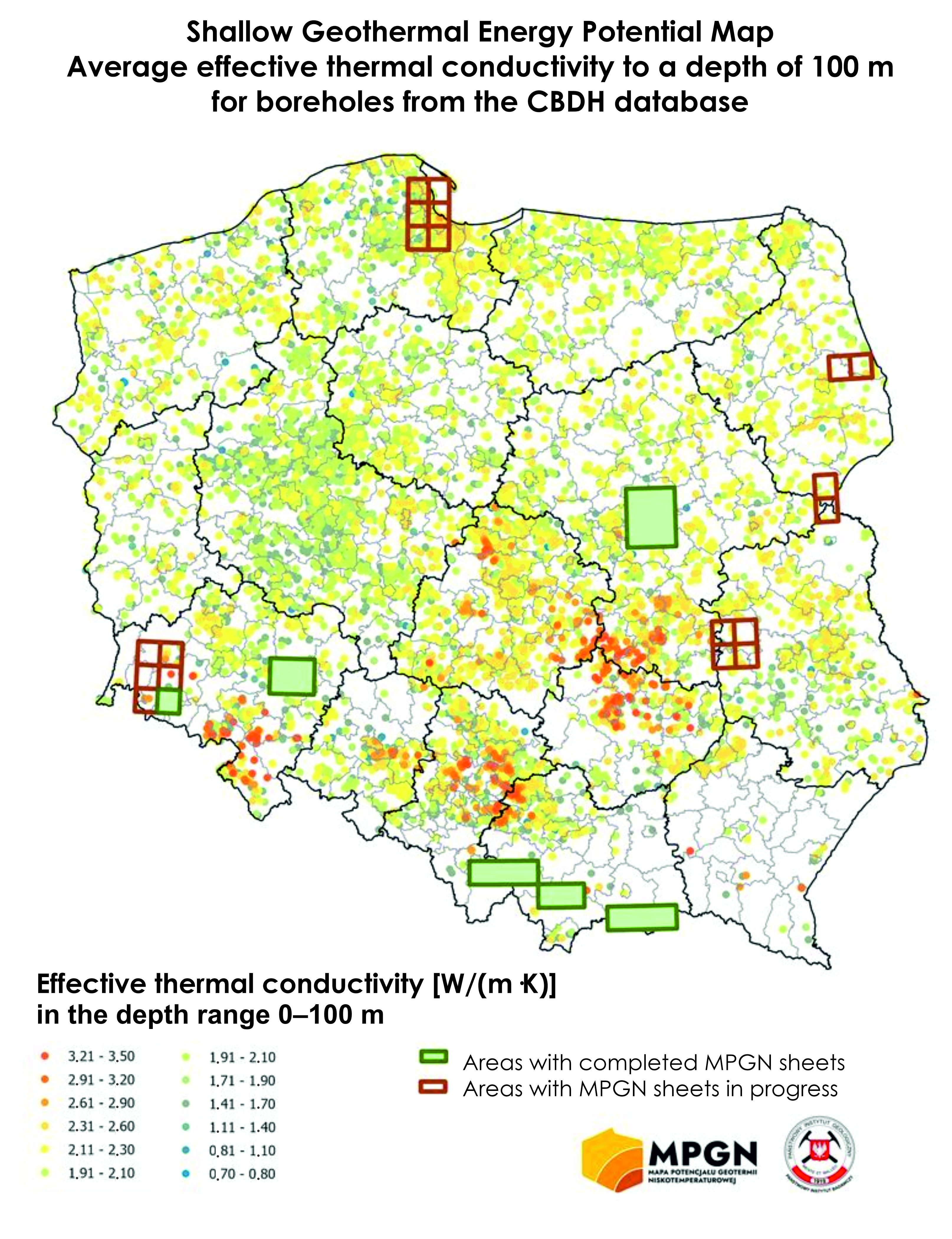
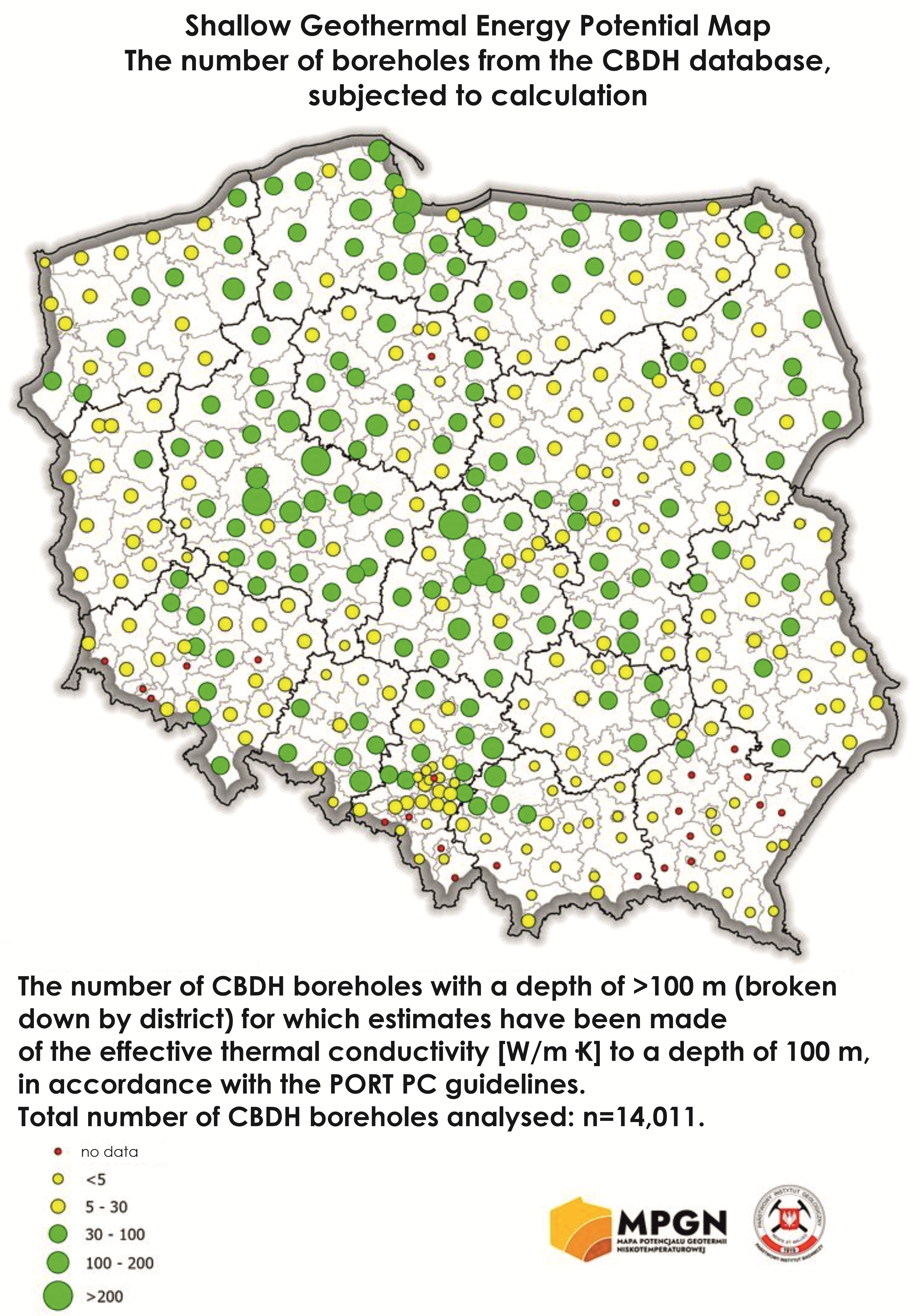
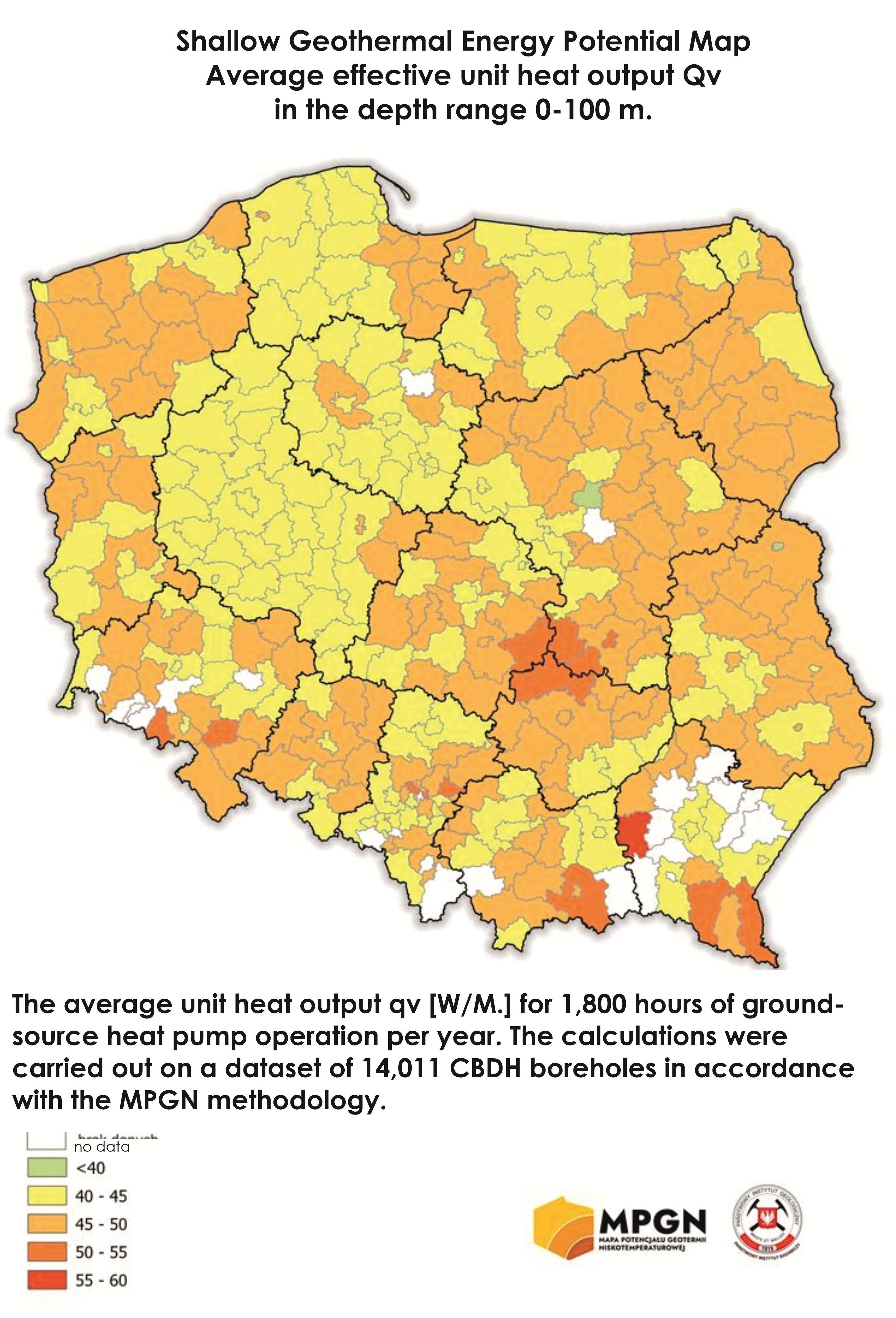
The maps are supplemented by a nationwide GIS database for low-temperature geothermal energy (BDGN), which includes geological records compiled for the purpose of extracting heat from the Earth, held in the Central Geological Archive. A total of 1,698 sets of documentation and 1,794 representative boreholes, together with their borehole logs, have been entered into the database.
The representative borehole records contain information on the location, x and y coordinates in the PL-1992 system, elevation (H), type of structure, investor, client, drilling system, date of drilling and other details, such as the documentation under which they were carried out. In addition, the sheet includes details of the geothermal infrastructure used in the relevant representative borehole.
Furthermore, for selected boreholes from the CBDH database (with depths exceeding 100 m), the effective thermal conductivity leff [W/m·K] was determined within the depth range of 0-100 m. This has resulted in a point map of low-temperature geothermal potential for Poland. The parameterisation was carried out on the basis of thermal conductivity conversion tables from the PORT PC Guidelines, 2013. In the pilot project, 14,011 boreholes from the CBDH database were converted
In the current project, the parameterisation will be carried out using the thermal conductivity conversion tables from the PORT PC Guidelines, 2021.
Data access
The data can be downloaded using the GeoLOG app, which is available free of charge for mobile devices from Google Play and the Google Play and App Store as well as through Portal CBDG - Geologia, under the tab GEOTHERMAL.
The geothermal information layers were created on the basis of 3D numerical modelling and spatial GIS analyses. The results of this work, presented in the form of maps and information layers, are the outcome of geostatistical calculations and, as such, provide only an approximate picture of actual conditions; consequently, they do not replace a detailed, local analysis carried out for the investment in question (location) at the stage of drawing up the Geological Works Design or other expert reports. PGI-NRI accepts no liability for any potential losses or lost profits arising from the use of the information provided.
The nationwide GIS database for low-temperature geothermal energy (BDGNT) contains basic information on boreholes drilled for the purpose of borehole heat exchangers (BHE), derived from archival documentation held in the Central Geological Archive. The provider accepts no liability for any errors in the information provided. It is recommended that the information be used for reference purposes only and that a detailed analysis of the source archival materials (where available) be carried out, together with fieldwork.
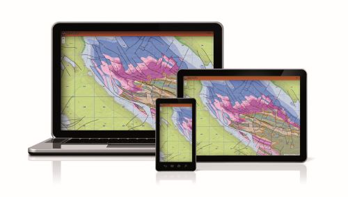
Mobile app GeoLOG

Map portal Geologia
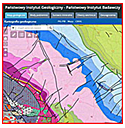
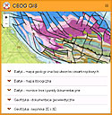
CBDG GIS
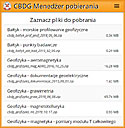
Download manager
How to cite
Ryżyński G. i in, 2017-2022 – Zadanie państwowej służby geologicznej. Ocena potencjału energetycznego i uwarunkowań środowiskowych dla wsparcia zrównoważonego rozwoju geotermii niskotemperaturowej.
SIGNIFICANCE OF THE PROJECT
Large-scale borehole drilling may pose numerous risks to usable groundwater aquifers (interconnection of aquifers, leaky installations and working fluid leaks, poorly executed grouting of the annular space around boreholes) and cause future problems related to adverse interactions between neighbouring geothermal systems and disruption of local soil thermal conditions.
Geothermal heat is one of the cleanest sources of renewable energy (RE), the use of which results in negligible emissions of gases and particulates into the atmosphere; for this reason, its rational utilisation in the form of ground-source heat pumps may enable the achievement of strategic objectives regarding air quality improvement and the reduction of CO₂ emissions.
The potential for utilising geothermal heat from near-surface formations - referred to as shallow or low-temperature geothermal energy - was previously the subject only of local studies aimed at their quantitative or qualitative assessment (the TransGeoTherm, GeoPLASMA-CE and MUSE projects, and the PSG task from 2018 to 2022). Projects and documentation currently being carried out under the Geological and Mining Law for the use of geothermal heat in ground-source heat pump systems serve only to describe the geological and thermal conditions at specific locations.