Maps
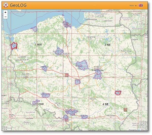 GeoLog – a mobile map viewer
GeoLOG is an application designed to make information from the Central Geological Database (CBDG) publicly available. All geological data in the GeoLOG application is sourced from the CBDG spatial data server and is categorised by specific fields. This application enables users to view geological and engineering data for selected parts of the country, including, amongst others:
- BDGI (Geo-engineering Database) boreholes,
- geological and engineering series at various depth levels,
- construction conditions,
- geomorphological features.
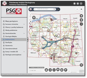 GEOLOGY – map viewer
The GEOLOGIA browser, which is based on mapping services, provides access to detailed information from the largest geological database – the CBDG. Categorised tabs allow quick access to many fields of geology. The process of viewing search results has been simplified; that is, it is possible to view them in tabular form with features such as sorting, filtering and even exporting to a file. Prepared and saved map compositions can also be embedded on websites by generating the appropriate code.
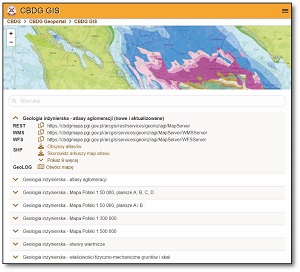 CBDG GIS App
The application is designed to enable the efficient searching and browsing of CBDG resources available online. It brings together information from all fields of geology, including engineering geology. The application is primarily based on the map services provided by the CBDG spatial data server. In the application’s map window, you can view the contents of a given dataset in real time and assess the performance of the mapping service that makes it available. Depending on the nature of the data, it may be made available via the following services: WMS, WFS or REST. Furthermore, within the CBDG GIS application, you can request spatial data for download in the form of a compressed SHP file.
EXTERNAL SERVICES
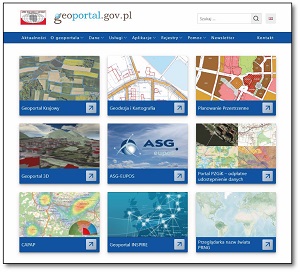 GEOPORTAL.GOV.PL
The www.geoportal.gov.pl website acts as the central hub of the Spatial Information Infrastructure, facilitating access to spatial data and related services.
GEOPORTAL.GOV.PL provides geospatial information in the form of redirects or references to external data (any websites containing spatial data registered in the system) and also functions as a data access point that identifies the data source (a so-called ‘one-stop’ service).
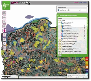 GDOŚ Geoservice (The General Directorate for Environmental Protection)
The General Director for Environmental Protection operates the Geoservice interactive map website, which presents spatial data relating, amongst other things, to nature conservation measures in Poland. As part of Geoservice, two services have been created in accordance with the open standards of the Open Geospatial Consortium, compliant with Directive 2007/2/EC of the European Parliament and of the Council of 14 March 2007 on Spatial Data Infrastructure in the European Community and the provisions of the Act of 4 March 2010 on Spatial Data Infrastructure:
- WMS viewing service: https://sdi.gdos.gov.pl/wms
- WFS download service: https://sdi.gdos.gov.pl/wfs
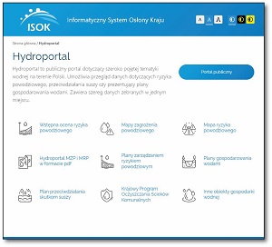 Hydroportal - ISOK
Hydroportal is a public portal covering a wide range of water-related topics in Poland. It enables users to view data on flood risk, drought mitigation and water management plans. It brings together a range of data in one place, including, amongst others:
- a preliminary flood risk assessment,
- flood hazard maps.
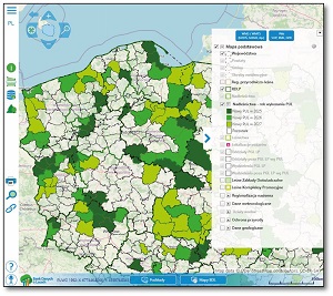 Forest Data Bank Portal)
The portal’s main purpose is to provide information on the condition of forests and development forecasts in the form of descriptive and spatial data. Consequently, the portal’s database contains the following data groups:
- Taxation data,
- Forecast data.
- Data from external sources relating to, for example:
- forest conservation,
- nature conservation.
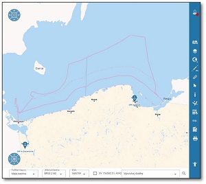 Spatial Information System of the Maritime Administration (SIPAM)
The Spatial Information System of the Maritime Administration public geoportal presents a set of spatial data compiled on the basis of maritime administration documents, which were produced as a result of carrying out tasks arising from the Act of 21 March 1991 on the maritime areas of the Republic of Poland and maritime administration. The data available on the public geoportal in real time is sourced from individual internal geoportals.