ABOUT PROJECT
The Lower Silesian Branch of PGI-NRI is currently carrying out work on the Detailed Geological Map of the Sudetes (SMGS).
Work is being carried out first on the oldest map sheets (i.e. those dating from the 1950s) which do not include explanatory notes.
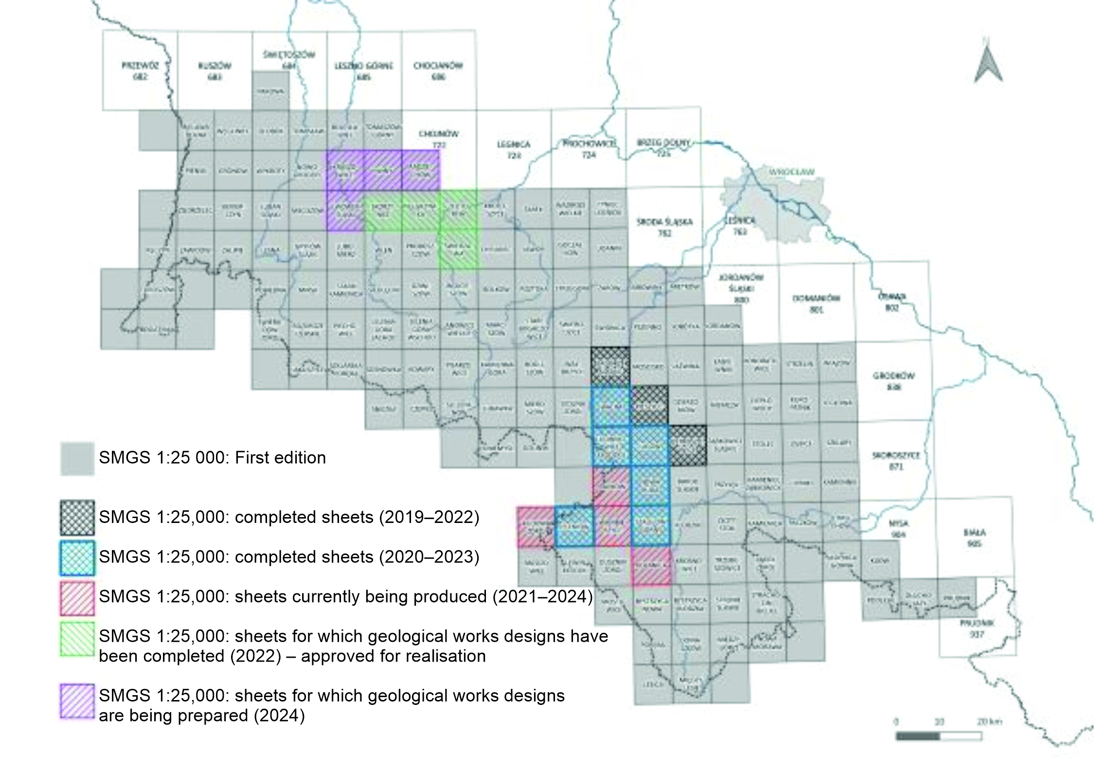 (An illustrative map of SMGS sheets, grouped by year of realization (Joanna Brytan, PGI-NRI)
The maps being produced are significantly altering our understanding of the geological structure of Lower Silesia, mainly due to the huge increase in geological data (boreholes, geophysical data) since the first edition of the map was produced.
To date, 13 SMGS map sheets have been produced. These are:
- Ostroszowice, Pieszyce, Zagórze Śląskie
- Walim, Ludwikowice Kłodzkie, Jugów, Nowa Ruda, Jeleniów, Szalejów Górny
- Radków, Polanica, Wambierzyce, Kudowa Zdrój
Geophysical surveys were carried out in selected areas of the sheets using two geophysical methods: electrical resistivity tomography (ERT) and refraction seismics (SRT-P).
In total, over 68 km of ERT lines and 62.5 km of seismic lines were surveyed (as shown in the table).
| Sheet name |
Number of ERT profiles |
Total length of ERT profiles |
Number of SRT-P profiles |
Total length of SRT-P profiles |
CBDG No. |
| Ostroszowice | 5 | 5090 | 4 | 5005 | 1698639 |
| Pieszyce | 5 | 5070 | 4 | 4845 | 1698642 |
| Zagórze Śląskie | 4 | 4200 | 4 | 4000 | 1698643 |
| Walim | 10 | 9000 | 6 | 6180 | 1711235 |
| Ludwikowice Kłodzkie | 4 | 4850 | 3 | 4320 | 1711175 |
| Jugów | 7 | 5565 | 4 | 5180 | 1711155 |
| Nowa Ruda | 4 | 4165 | 4 | 4050 | 1711195 |
| Jeleniów | 9 | 7535 | 6 | 6640 | 1710915 |
| Szalejów Górny | 6 | 5150 | 6 | 5510 | 1711215 |
| Radków | 7 | 5470 | 6 | 5250 | 1711035 |
| Polanica | 6 | 4300 | 6 | 3985 | 1710995 |
| Wambierzyce | 6 | 5200 | 5 | 5345 | 1711056 |
| Wambierzyce | 5 | 2500 | 2 | 2340 | 1710956 |
| 78 | 68095 [m] | 60 | 62650 [m] | ||
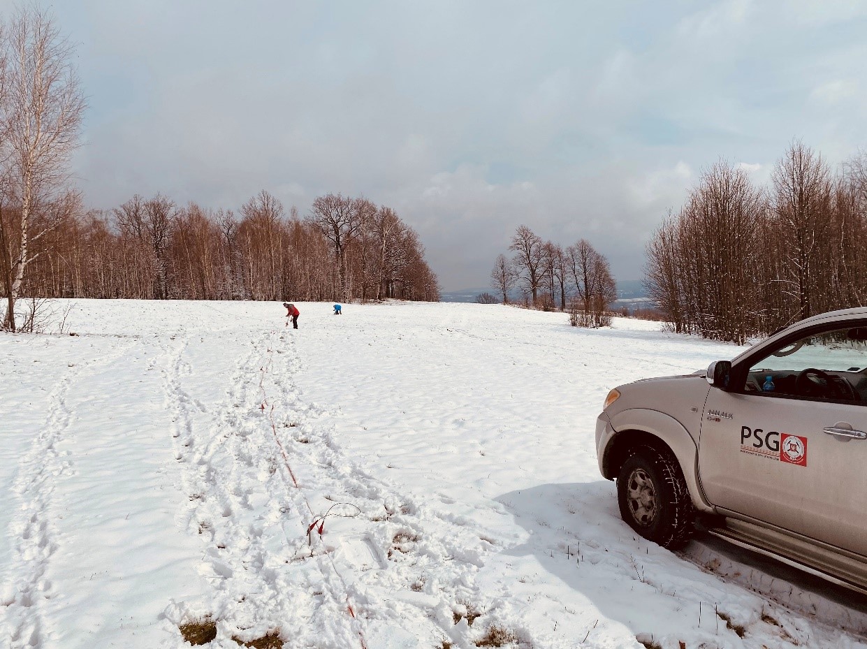
The geophysical survey was carried out in challenging and difficult terrain, which had a significant impact on the organisation and conduct of the surveys. The Sudetes region is characterised by numerous hard-to-reach locations where the lack of road infrastructure makes direct access by car impossible. Many of the measurement sites were located in mountainous terrain with steep gradients, which required the equipment to be transported over considerable distances in difficult terrain.

An additional challenge was posed by the extensive forested areas, which limited the possibilities for establishing survey profiles and made it difficult to lay out survey lines. Dense vegetation, uneven terrain and the presence of numerous natural obstacles, such as fallen trees, boulders and mountain streams, necessitated adjustments to working methods and made the surveying process more time-consuming.
Consequently, it was necessary to employ logistical solutions, such as manually transporting equipment to hard-to-reach locations, as well as flexibly adapting measurement techniques to the terrain. In some cases, it was necessary to modify the measurement set-ups or shorten the length of the measurement lines in order to adapt to the available space and avoid the difficulties associated with unrolling long measurement cables in dense woodland.
Weather conditions also affected the progress of the work - heavy rainfall could make the ground slippery and make it difficult to move around on steep slopes, whilst snow or frozen ground could make it difficult to push electrodes and geophones into the ground. All these factors meant that the fieldwork required a great deal of flexibility, proper planning and the commitment of the team in order to carry out the measurements effectively.
As a result of the work carried out, 13 sets of geophysical survey documentation were compiled, which served as a valuable source of data for geologists involved in geological mapping. The results obtained were used to produce geological maps, enabling a detailed understanding of the geological structure of the surveyed area.
The data were interpreted by the geologists responsible for documenting the given sheet, in collaboration with the authors of the documentation.
The results obtained (electrical resistivity profiles and refraction seismic tomography profiles) were cross-referenced with archival information (e.g. archival geological maps).
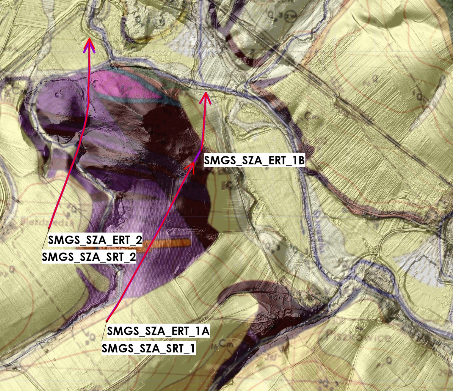 An example of an extracted fragment from a documentation map of geophysical surveys carried out on an NMT base,
alongside an archival geological map
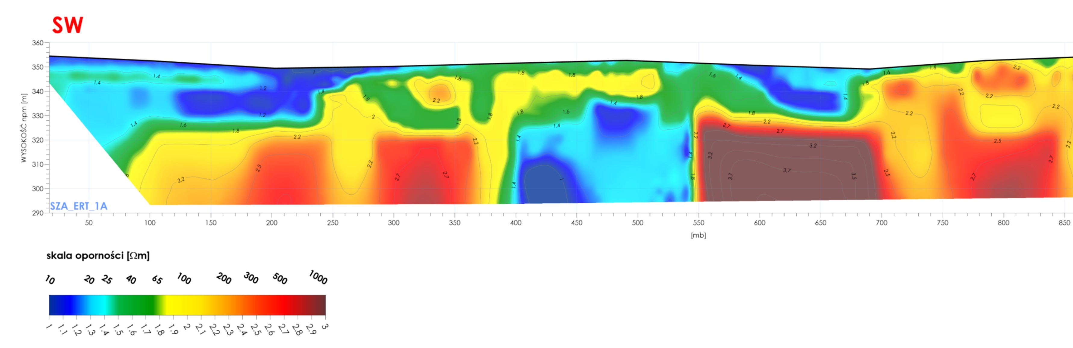
An extract from an electrical resistivity cross-section produced on the Szalejów Górny sheet
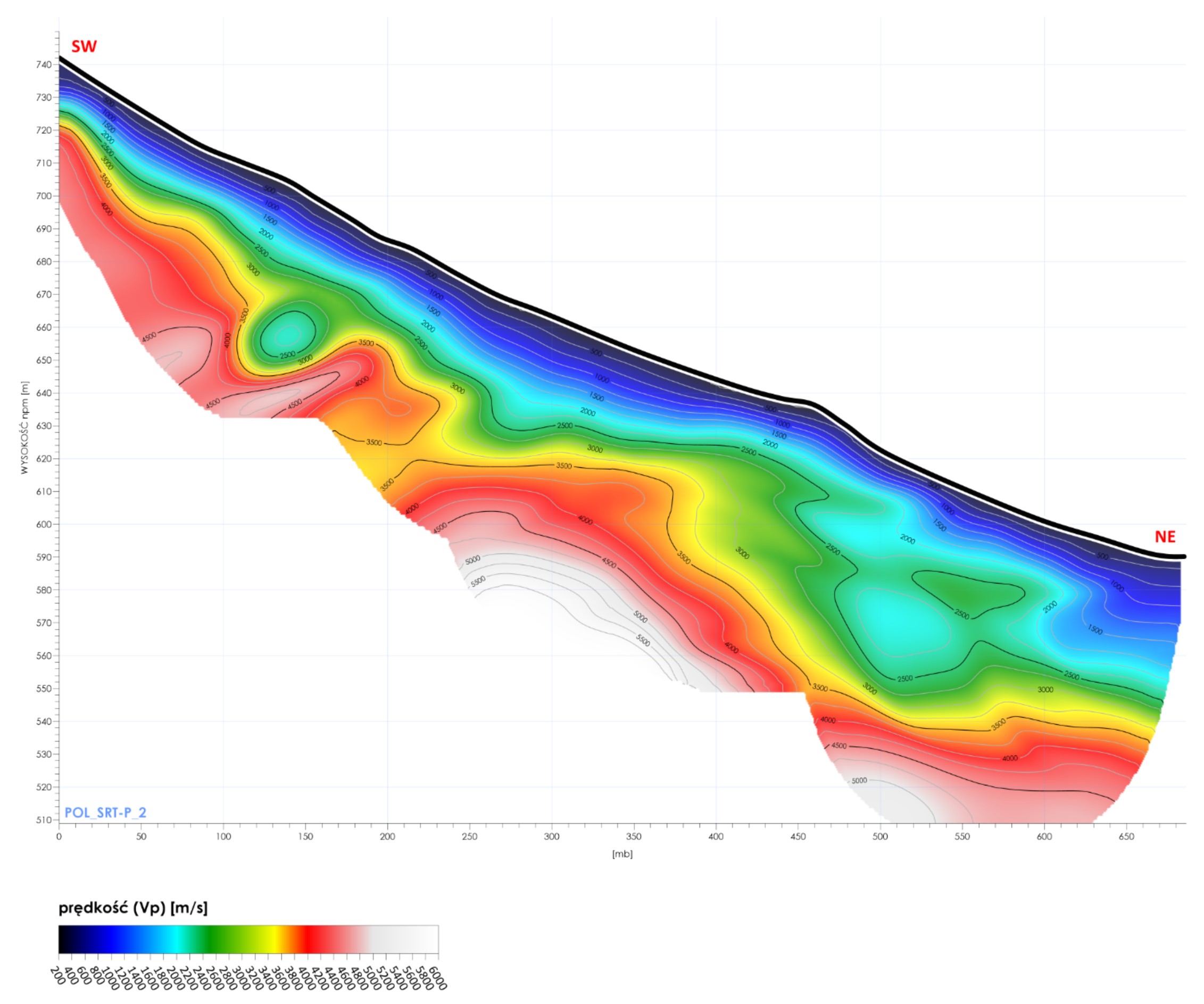 Fragment of a refraction survey cross-section on the Polanica sheet
The survey documentation has been produced as a digital document containing spatial data, digital files (grids) and digital attachments. The data has been prepared in a format that allows for its easy integration into various analytical environments.
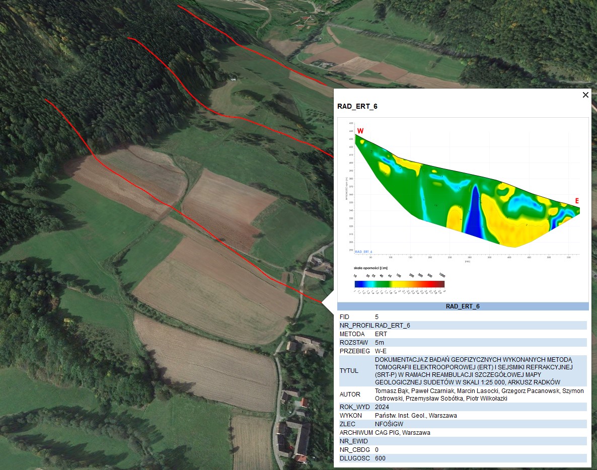 Example of geophysical profile tracings, including a preview of the survey results and information regarding the documentation
This year, geophysical work began on a further four survey sheets:
- Złotoryja
- Pielgrzymka
- Świerzawa
- Skorzynice,
bringing the total number of SMGS survey sheets processed to 17.
As part of the current project (2025-2026), exploratory and mapping boreholes (200 and 400 metres deep), shallow test pits, exploratory trenches and a series of laboratory tests, including dating, will be carried out. Geophysical surveys are also being conducted as part of the work.