


 On 8-12 July 2019, the world conference of users of ESRI software users (ESRI User Conference 2019) was held in San Diego, California (USA). This is an annual conference that brings together several thousand specialists in the field of spatial information systems (GIS) from around the world.
The scale of that event is truly impressive as its five day programme comprises well over 1,000 thematic sessions, several hundred GIS workshops and training sessions as well as industry fairs, where over 300 leading companies, universities and industry associations present their stands.
The plenary session of the ESRI UC 2019, dedicated to challenges of GIS technology and the new concept of implementing it, expressed by the motto "GIS-The Intelligent Nervous System", was attended by over 17,000 people. Moreover, over 26,000 people from across the U.S. and around the world signed in to watch a live Internet broadcast. The video material from this part of the congress can be viewed HERE >>.
This year, Grzegorz Ryżyński and Krzysztof Majer attended the conference to represent the Polish Geological Institute and receive the prestigious SAG 2019 Award (Special Achievement in GIS Award) granted by organizers to our institute. This distinction is awarded to institutions for outstanding achievements in the use of GIS technology.

Plenary session of the ESRI UC 2019 conference impressed with its momentum. The event organized at the San Diego Convention Center was attended by over 17,000 people and live broadcasting was watched by over 26,000 Internet users
The SAG 2019 Award was granted to the PGI-NRI for creating the Engineering-Geological Database (BDGI) (see http://geoportal.pgi.gov.pl/atlasy_gi). The database was created by the Engineering Geology Team of the Geological Risk Center at PGI-NRI. The BDGI was established as a part of tasks of the State Geological Service (PSG). The Engineering-Geological Database is a unique and largest collection of digital data on building conditions in Poland. BDGI consists of a borehole database and a spatial database. The source of data is geological and geotechnical documentation and the Central Geological Database.
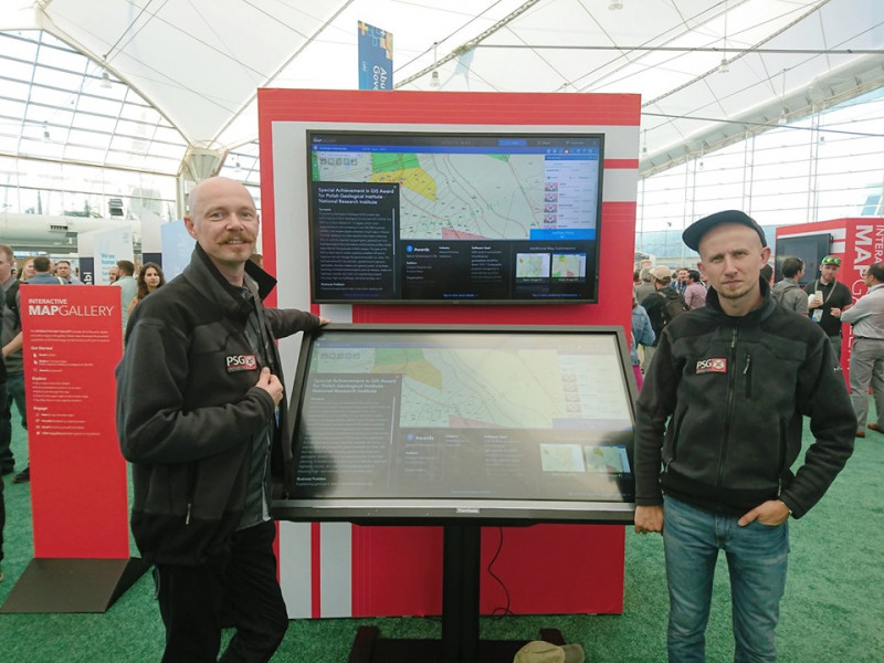
Poster session of the ESRI UC 201 conference. PGI-NRI delegates Krzysztof Majer and Grzegorz Ryżyński present the BDGI project presented in an interactive way at a stand in the Map Gallery
PGI-NRI was awarded the SAG 2019 prize for achievements in developing an automated universal process of compiling cartographic publications in the form of series and sheets of maps (Engineering-Geological Data Processing System - SPDGI). It can be re-implemented for the production of geological maps on other topics. Within the framework of the BDGI project, over 3,200 sheets of engineering geological maps at a scale of 1:10,000 were compiled. These sheets are available for downloading from CBDG servers with several clicks (atlasy.pgi.gov.pl).
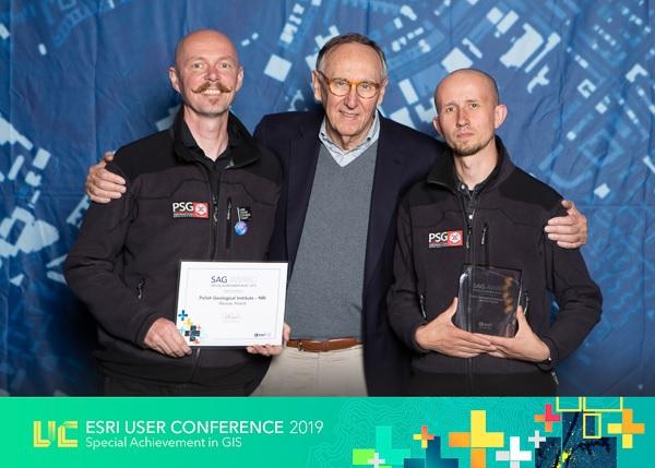
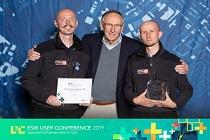
SAG 2019 Award Ceremony organized at the San Diego Convention Center. PGI-NRI delegates Krzysztof Majer and Grzegorz Ryżyński receive SAG Award from co-founder and CEO of ESRI Inc. Jack Dangermond
The opportunity to receive the SAG 2019 award directly from the hands of ESRI Inc. co-founder and CEO Jack Dangermond and participation in the award ceremony on 10 July 2019 were undoubtedly an honor for PGI-NRI representatives.
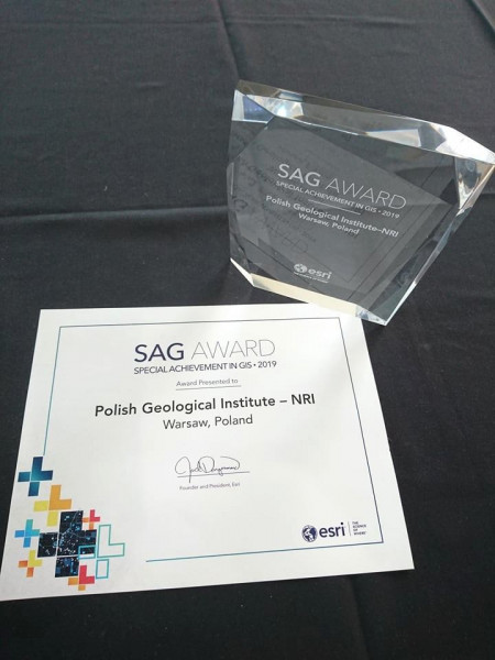
SAG 2019 award and diploma was granted to the PGI-NRI for innovative implementation of ESRI Production Mapping technology in the task "Geological and Engineering Database" of the Polish Geological Survey
The SAG award is an excellent motivation for PIG - PIB to implement subsequent innovative projects that are challenges in the implementation of GIS technology. The team responsible for creation of the Engineering-Geological Database (BDGI) would like to thank SoftProjekt and TAXUS IT for their cooperation in implementing the project and development of the engineering-geological data model.
See more:
• http://atlasy.pgi.gov.pl - project site Engineering-Geological Database (BDGI)
• http://geolog.pgi.gov.pl – Mobile GIS Web browser GeoLOG, map set: engineering geology
• http://geologia.pgi.gov.pl – bookmark: Budownictwo
• www.arcanagis.pl/geologia-w-smart-city - press on the BDGI project, published in the ArcanaGIS journal
Text: Grzegorz Ryżyński
Photos: Krzysztof Majer and Grzegorz Ryżyński
Translation: Grzegorz Ryżyński and Wojciech Brochwicz-Lewiński
 PGI-NRI offer
 Mineral resources of Poland
  Oil and Gas in Poland


 Subscribe to RSS Feed