


 Geologists have come to the aid of the inhabitants of the Wapno village in Wielkopolska, a part of which sank into the ground a few days ago. Specialists from the Geohazard Center of the Polish Geological Institute - National Research Institute (PGI-NRI) conducted the initial examination and analyses.
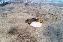
The collapse occurred on Friday, February 26th, 2021 at the site where an old salt and gypsum mine existed decades ago. Fortunately, no one was hurt. No property damage was reported either. So far the reasons for the sinkhole are not known. It can be assumed, however, that as a result of a large supply of fresh rainwater to the ground, some of the gypsum or salt from the salt dome, located under the Wapno village, dissolved. This in turn caused the ground to collapse and form a crater with an almost 30 m diameter and a depth that is still unknown. This is because the sinkhole is flooded by groundwater 5.5 m below its edge. A direct assessment of the depth is not possible, at least for now, due to the serious risk of landslides. However, it is known that sinkholes can reach up to several tens of meters of depth.
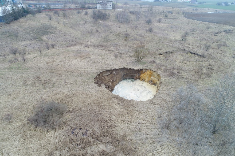
Sinkhole in Wapno - general view
Geologists from the Geohazard Center made remote aerial measurements of deformation using the photogrammetric method. They used a specialized drone used by the Polish Geological Survey also for detailed studies of landslides. This made it possible to estimate the loss of earth masses at over 1800 m3. Fortunately, the sinkhole does not threaten buildings or infrastructure located about 100 m away. The PGI-NRI specialists continue the aerial measurements, but they have also started examination using a ground-based laser scanner. Detailed results of the analysis will be known soon.
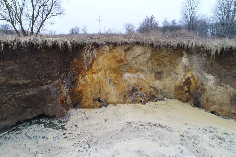
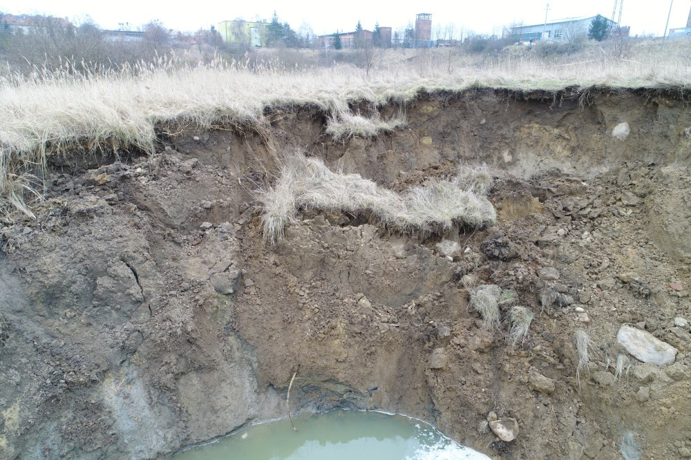
Scarp of the sinkhole - close-up
In the area of salt dome in Wapno, PGI-NRI geologists have repeatedly conducted subsurface observations and studies of deformation dynamics. Recently the salt dome was subjected to satellite observations as part of the "Interferometric monitoring of Polish terrain" project. Analysis of data from the Sentinel-1 satellite allowed the determination of the rate of land subsidence. From October 2014 to June 2020 the rate reached values from 3 mm to 8 mm per year. The maximum rate of subsidence was found precisely in the area of the inactive gypsum mining field where the present deformation occurred.
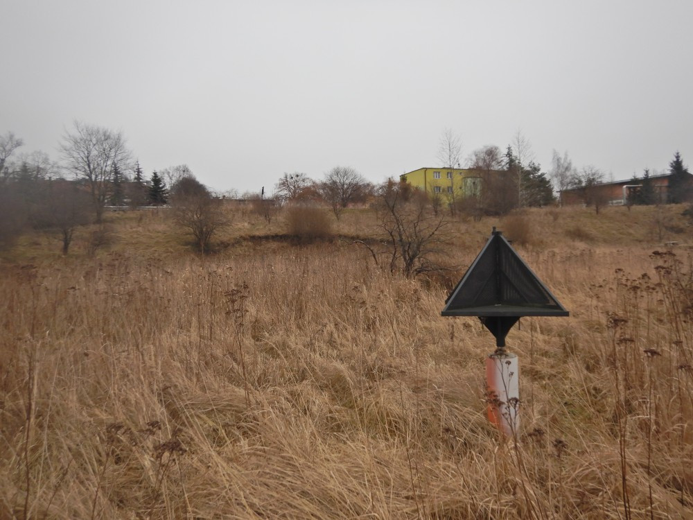
The excavation area is also monitored by satellite. Photo one of several interferometric reflectors
Aerial drone view:
The gypsum and salt mine in Wapno ceased operations in 1977 after the largest mining disaster to hit the town to date. The massive sinkhole, at least a dozen meters deep, which formed at the time, swallowed 40 houses. Fortunately, there were no casualties, but 1,400 residents were evacuated from the town. More sinkholes formed in 2007 and in 2017, however they were much smaller.
Translated by Tomasz Trzpil (PGI-NRI)
 PGI-NRI offer
 Mineral resources of Poland
  Oil and Gas in Poland


 Subscribe to RSS Feed