


 Based on the initiative by the Chief Geologist of the Country and Polish Geological Institute – NRI (PGI-NRI), the Polish Geological Cartography Platform (WPKG) is being developed as one of the tasks of the Polish Geological Survey (PSG). Its aim is to gather as many available geological maps and other cartographic products connected with geology as possiblein one database, systematize and present them online.
By doing so, the strategic resource of geological maps, which geologists of the Polish Geological Institute and of other scientific institutions dealing with geology have been systematically compiling for the last decades, will be secured and made widely available in modern forms and by means of modern digital tools. These resources will be made available free of charge in a simple and user-friendly way through a web application that also provides tools for searching, analyzing and downloading said resources. The entire project is funded by the National Fund for Environmental Protection and Water Management (NFOŚiGW). The WPKG platform is expected to be launched for users at the end of 2023.
Everybody who wants to implement an infrastructural investment project, install a heat pump or prepare a spatial development plan knows how important access to geological information is. The cartographic collections are used by entrepreneurs, local governments, scientists, students and other citizens who want to obtain data on geological structure of terrain, hydrogeological or environmental conditions. Access to thematically diverse geological maps with the possibility of their joint contextual analysis together with other reference data, e.g. administrative borders of the country or topographic maps, is a basic need in every geological undertaking - both applied and scientific. The phrase "geological map" is one of the most frequently searched phrases in PGI-NRI resources.
In 2016, following the economic, scientific and societal needs, the Polish Geological Institute – NRI was one of the first geological surveys in Europe to provide universal online access to geological serial sheet maps in the form of raster files (more than 5,000 map sheets). Currently, a comprehensive database of all known cartographic products is being developed together with a specialized GIS tool available online, which will make using them even easier.
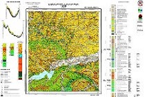
As part of the WPKG, by the end of 2023, a total of about 20,000 cartographic products in the form of raster and text files as well as spatial data services will be collected and made available. The Polish Geological Cartography Platform will combine the newest cartographic products and archival geological maps compiled by the PGI-NRI and other scientific institutions. The WPKG will make available, among others, the following materials: the Detailed Geological Map of Poland in the scale of 1:50,000, geological maps of Poland in the 1:200,000, 1:500,000 and 1:1,000,000 scales, the Polish part of the International Quaternary Map of Europe in the 1:2,500,000 scale (IQUAME), geological and geotechnical maps of the major agglomerations in Poland in the scale of 1: 10,000 prepared as part of Geological-Engineering Atlases, the Hydrogeological Map of Poland in the scale of 1:50,000, the Geoenvironmental Map of Poland in the 1:50,000 scale, the Map of flood-prone areas in Poland in the 1:50,000 scale, maps presenting raw materials and economic issues and other serial, review, regional and thematic maps.
Maps will be presented and made available in raster form (maps, annexes, sketches, explanations, cross-sections) and as search, browsing and download services. Key information layers for users will be available as efficient REST services. the WPKG will provide access to key reference data downloaded from other institutions necessary for parallel analysis, such as data from the Head Office of Geodesy and Cartography and the Institute of Meteorology and Water Management, along with geological data.
The WPKG, along with map analysis, will make it possible to analyze other geological data from the PGI-NRI databases, such as borehole data, Individual Groundwater Bodies, Major Groundwater Reservoirs, groundwater monitoring points, anthropopressure objects, geosites, etc. The user will be able to add and include their own data to the analysis and even save their own compositions.
The Polish Geological Cartography Platform will not only contain specific digital maps but also, through proper preparation of selected attributes in the database, a lot of useful information on lithology, age and genesis of rocks. Based on the above mentioned data, the WPKG web application will make it possible to perform many queries and spatial analyses with the use of well-known and commonly applied geostatistical functions used in GIS software.
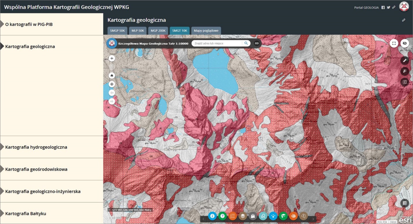
Screenshot of the test version of the Common Platform of Geological Cartography web application
It is planned to provide such functionality as: identification, selection, attribute information, data intersection/collision, delineation of buffers around objects, generation of statistics from area and point data, linking from spatial data to attribute data stored in database tables, and the generation of results in the form of diagrams, reports and maps.
The data range and functionality will also enable directing simple and complex queries to the database. This will make it possible to determine the location of objects corresponding to selected parameters, e.g. selected lithological subdivisions within a given administrative unit. The mechanism of browsing, searching and downloading data will be simplified by introducing additional search categories (e.g. by administrative units, map sheet division, selected keywords) and increased efficiency by using efficient GIS architecture, modern GIS server solutions, REST services and the development and use of file organization that is optimal from a technological point of view (data storage and download).
Based on an ongoing analysis of the users' needs, specific data configurations will be prepared and categorized for specific issues, for which support will be required. Additionally, each user will be able to save their own settings, and even obtain a unique link generated by the system, which makes it possible to recall the exact map they have previously configured. This means, for example, that a particular local-government entity can define and configure in the application its area of interest (e.g. run SMGP 1:50 000 map, MHP 1:50 000 map and borehole data on the GUGiK map base), download the unique link described above and return to the specified map view many times, or even make the link available on its website. Launching the link opens the WPKG application presenting a predefined range of maps with a view on a given local government entity. WPKG provides access to and visualization of data, as well as tools/functions required for analysis.
A significant improvement for individuals using the PGI-NRI cartographic resources online for scientific work will be the possibility of downloading, along with the maps themselves, also their list, i.e. a ready list of source materials used. In cooperation with many PGI-NRI experts a standard for citing maps and cartographic studies will be prepared. Thanks to it, by appropriately configuring product descriptions in the database, it will be clear for each map how it should be cited, the description in an appropriate format will be displayed and can be copied directly from the WPKG application. The commonly used publishing identifiers (ISBN, ISSN) and (for resources that have it) the digital object identifier DOI, which allows to easily find a scientific publication on the Internet and is used in international digital databases and scientific networks such as ORCID or ResearchGate, will be included here.
The works on a new version of IT system of the Detailed Geological Map of Poland in the 1:50,000 scale (SMGP) are carried out as part of the WPKG project as a separate but key material effect for development of geological maps. This will enable the mapping of a new methodology of work organization in the entire process of map production, inclusion of geo-database standard (GIS) in the stage of author’s works and launching of development works aimed at preparing the database for the continuous SMGP map spanning the entirety of the country.
In subsequent periods, WPKG users / interested parties will be invited to identify their needs by participating in targeted surveys and testing of future versions of the WPKG application, with a working online version already being developed and is currently undergoing internal testing.
Comments, suggestions and feedback are encouraged now at: This email address is being protected from spambots. You need JavaScript enabled to view it.
Text: Anita Starzycka, Piotr Gałkowski, Katarzyna Jóźwik, Józef Mikołajków
Translated by Tomasz Trzpil (PGI-NRI)
 PGI-NRI offer
 Mineral resources of Poland
  Oil and Gas in Poland


 Subscribe to RSS Feed