


 Another stage of reambulating the Geological Map of Poland 1:200,000 (MGP) was completed. As a result, 13 new map sheets and their explanations appeared in the Central Geological Database (CBDG).
The MGP 1:200,000 sheet numbers for which maps were recently made available are:: 6, 11, 18, 19, 25, 33, 35, 41, 43, 66, 71, 74. The sheet edition of the map consists of a surface map (Sheet A), an subterranean map (Sheet B), and explanatory text common to both maps.
All studies are now available online as downloadable JPG and PDF files.
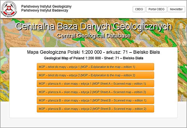
Maps and texts of MGP 1:200,000 Bielsko-Biała sheet (source: CBDG)
At the same time it was decided that the first historical edition of MGP will also be made available in the same way. This is a total of 57 maps (both boards A and B) and 41 texts. The standard "CBDG resources" tool was used for this, which is accessed from the CBDG GeoLOG mobile application (geolog.pgi.gov.pl) and the GEOLOGIA Portal (geologia.pgi.gov.pl).
For several years, it has also been possible to access spatial data for 10 MGP sheets using two map services: WMS (surface and subterranean maps, i.e. Plates A and B) and in the form of thematic layers in the CBDG GeoLOG mobile application and GEOLOGIA Portal.
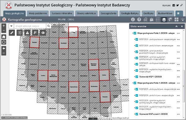
Index of MGP 1:200,000 in GEOLOGIA Portal (detailed data for 10 sheets)
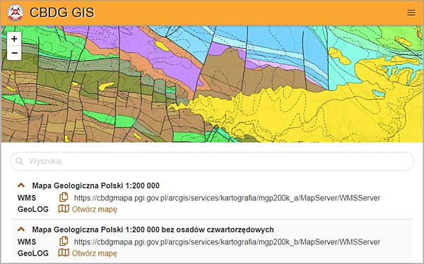
WMS service preview for the MGP 1:200,000 – subterranean map in the CBDG GIS application
CBGD GIS Application - User Manual (YouTube)
The history of the Geological Map of Poland in the 1:200,000 scale began in 1955. The inaugural sheet of the Detailed Geological Map of Poland was printed in 1969 (the Radom sheet) and subsequent sheets in the years 1971-1998. Since 2005, the process of reambulating the Detailed Geological Map of Poland, which covers the entire country, has been continued and comprises 77 sheets. Successive maps are enriched with information from new drillings and new sheets of The Detailed Geological Map of Poland 1:50,000. All tasks related to the reclamation of the Detailed Geological Map of Poland are planned to be completed by 2033.
The Geological Map of Poland in the 1:200,000 scale reflects contemporary knowledge of geological structure of the whole country and presents geological structure with accuracy sufficient to preliminarily determine the prospects for useful mineral occurrence, and hydrogeological and engineering-geological conditions. The map presents an agreed, coherent picture of regional geological structure of a given sheet as it relates to the geological structure of adjacent map sheets.
MGP is a basis for establishing updated assumptions for the geological structure of Poland and an accurate selection of areas for prospecting useful minerals and for general studies in regional geology, engineering geology, hydrogeology, geomorphology, soil science and geosciences. It is also useful for studies on basic geological issues, the compilation of special maps (metallogenic, tectonic etc.) in the 1:200,000, 1:250,000 and smaller scales, and for economic and spatial planning.
Text: Wojciech Paciura
Translated by Tomasz Trzpil (PGI-NRI)
 PGI-NRI offer
 Mineral resources of Poland
  Oil and Gas in Poland


 Subscribe to RSS Feed