


 Earthworks carried out during the construction of the so-called linear investments provide geologists with a unique opportunity to conduct research and identify the geological structure.
Along the walls of embankments and trenches, which often extend over many kilometers, one can almost easily see the rocks that comprise them, which makes it possible to reconstruct the geological history of a given region. Over the last 10 years, the Polish Geological Institute - NRI, in cooperation with the country's leading construction companies, has documented around 1000 kilometers of such exposures.
The identification of geological structure, cartographic works and preparation and publication of different scale geological maps, are some of the tasks of the Polish Geological Institute – NRI in fulfilling its function as the Polish Geological Survey. The published maps are used by state administration of all levels, scientific institutions, as well as by corporations and commercial companies operating in many sectors of economy.
In compilation of geological maps, the Institute makes use of the latest results of studies and technological achievements that facilitate the work of cartographers. Over the past 20 years, one source of data is geological survey work carried out for, so-called, linear investments. The expansion of the national transmission network, as well as the national road and freeway infrastructure being implemented in various regions of Poland provide geologists with a unique opportunity to observe geological structures. As a result of earthworks, slopes and trenches are often created which expose the sediments and rocks which comprise them.
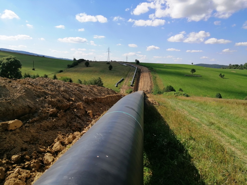
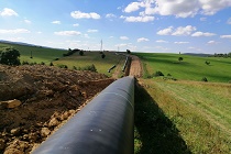
Construction of a gas pipeline on the Strachocina_Polish border section. Photo: Adam Kozłowski
Geological mapping of several hundred kilometers of exposures was conducted in recent years, mainly in the Carpathians, Sudety Mountains, Western Pomerania, Mazowsze, Warmia and Mazury, Suwałki and Lublin regions. The works were carried out mainly in investments implemented by Gaz-System for the Baltic Pipe network and the GIPL Poland-Lithuania gas pipeline, as well as in road investments such as S-1, S-5, S-7 and those connected with the construction of the S-19 road on the Via Carpatia route, supervised by the General Directorate for National Roads and Motorways.
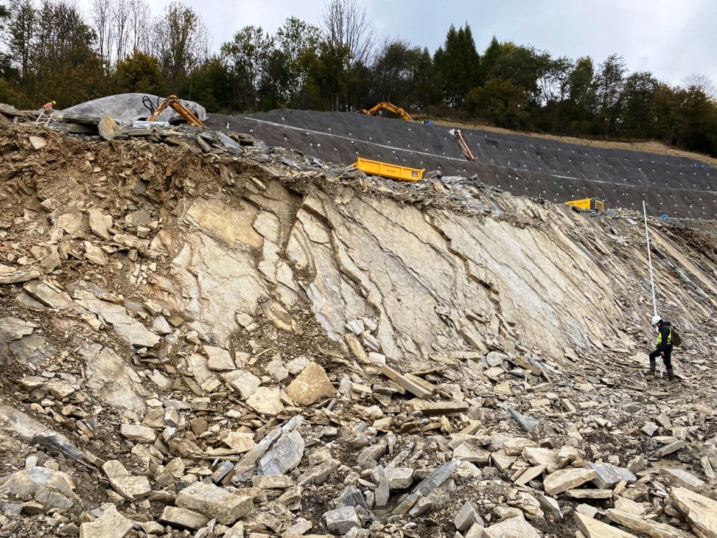
Crosscut of the S1 road, Węgirska Górka-Milówka section. Photo: Aleksander Gąsienica
Documentation work is conducted throughout the year, even under severe weather conditions. However, access to slopes and trenches is short-lived, as these exposures are usually reclaimed or backfilled. This affects the intensity and pace of the documentation work, which is determined by the pace of the works and access to exposures.
While implementing the project, for the first time PGI-NRI has used mobile devices in field work. The mobile application works thanks to the service prepared for the project and published by the Central Geological Database (CBDG). From the very beginning, all documentation is gathered in the database, which makes it possible to carry out office work also in a digital manner.
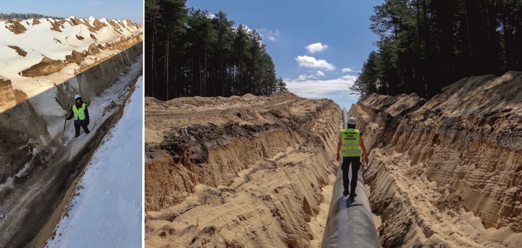
Documentation fieldwork is being conducted in adverse field conditions. Photos: Weronika Danel (1), Sylwia Palka (2)
During field work, geologists locate the documented sites along the project route. After locating, they fill out appropriate positions of a questionnaire (e.g. type and features of observed formations or phenomena), take photographs and collect samples for laboratory analyses. The collected data is instantly uploaded to the production database server, or after the field work is completed. Once the collected data have been uploaded, the next stage of supplementary work follows. Location processing is done digitally using PGI-NRI’s internal service or desktop GIS software.
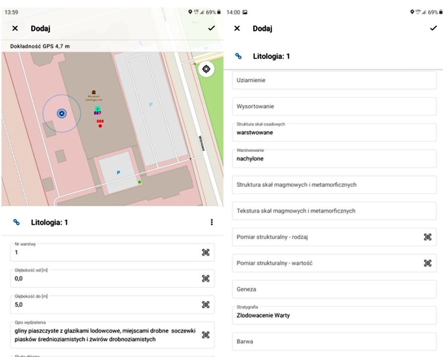
Screenshot of the mobile app with an example of a documentation location and a lithology table connected to it by a relationship
Entries organizing and supplementing the descriptions of locations are made. At selected locations, additional tables are completed (detailed lithology or analysis results) and additional profiles and geological cross-sections are prepared. Also created, are linear objects which contain summary and generalized information about the documented section and a panoramic photograph or geological cross-section.
Conducting work by means of applications on mobile devices allowed for work time optimization, improvement of quantity and quality of collected data and a reduction of accidental errors. The documentation produced as part of a "linear investments" project is an important source of data affecting the detailed knowledge of geological structure of Poland. The user can immediately locate elements of the documentation, select necessary information (domains in selected tables) and display information in a configuration of the user’s choice (on topographic maps, terrain models, etc.).
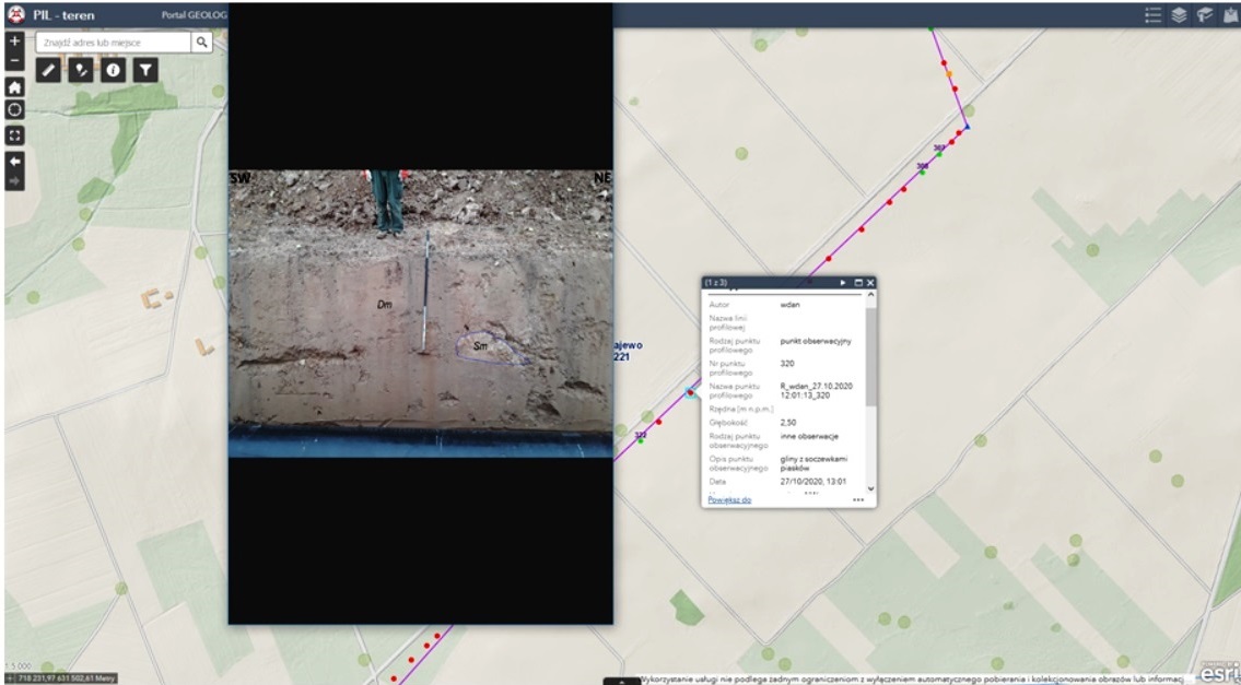
The PIL (Linear Investments Project) service is available through a web browser. Description of the location along with a preview of the photo of the exposure
The possibility to document sediments and rocks from exposures of linear investments provides a unique opportunity to observe their formation in a wide range, from glacitectonic deformation, to structural features of older rocks and many others. A significant value of carrying out this kind of cartographic work is the possibility to document so far unidentified tectonic zones and those postulated by geological maps. It is especially valuable as road or pipeline projects are often implemented in valley areas, usually poor in natural exposures.
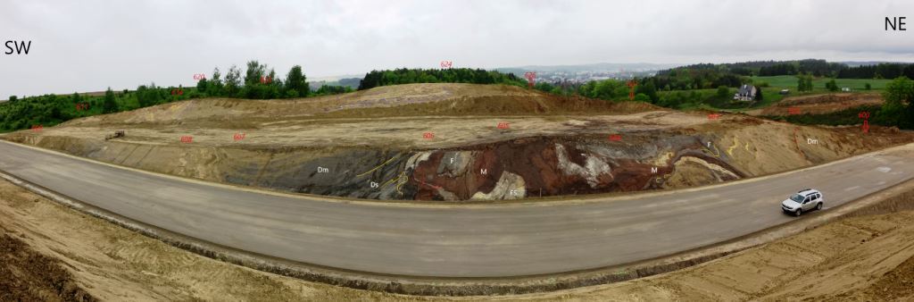
Slopes of a trench at the construction site of the ring road of Nowe Miasto Lubawskie. Strongly deformed stagnant sediments (red) and glacial till are visible (photo: Weronika Danel)
So far, undoubtedly one of the most spectacular results of geological research carried out along linear investments was the discovery near Gorzów Wielkopolski in lake sediments (132-115 thousand years old) of an almost complete rhinoceros skeleton (100 bones, skull, 24 teeth). The discovery occurred in May 2016, during the construction of the national freeway S3. The bones were excavated by PGI-NRI specialists after receiving information from the construction company (Badura et al., 2017).
Documenting the profile in lake sediments for palynological studies, Gorzów Wielkopolski ring road
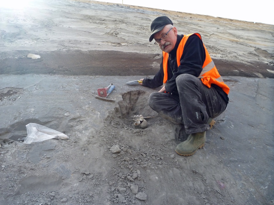
Rhinoceros bones in the sediments of the Eemian interglacial, Gorzów Wielkopolski bypass (photo: Dr Krzysztof Urbański, project manager)
Written by: Anna Bagińska, Krzysztof Urbański, Weronika Danel, Adam Kozłowski
Translated by: Tomasz Trzpil
Commented literature:
- Badura J., Ciszek D., Kotowski A., Przybylski B., Ratajczak U., Stefaniak K., Urbański K., 2017 - Szczątki nosorożca (Stephanorhinus sp.) oraz daniela (Dama dama) odkryte w osadach kopalnego jeziora eemskiego na Równinie Gorzowskiej. Przegląd Geologiczny, vol. 65, nr 4.
- Urbański K, Kowalska A., Horbowy K., Przybylski B., Badura J., Cwojdziński S., 2004 – Kartograficzne prace pilotażowe wzdłuż budowy autostrady A4 między Legnicą a Wrocławiem. Prz.Geol.52: 393.
![]()
Geological studies along linear investments are carried out as part of the task of the Polish Geological Survey entitled "Comprehensive acquisition of geological data from continuous exposures at linear investments and development of database in the manner enabling close correlation with the data bank of the Detailed Geological Map of Poland as the basic direction of activities of the Geological Survey in the field of shallow geology". The work is financed by the National Fund for Environmental Protection and Water Management.
![]()
This article was prepared under the project titled "National cooperation in the field of geology and promotion of activities of the State Geological Survey in 2021-2023" and was financed by the National Fund for Environmental Protection and Water Management
 PGI-NRI offer
 Mineral resources of Poland
  Oil and Gas in Poland


 Subscribe to RSS Feed