


 Detailed data acquisition conducted from the AUV as part of a multi-proxy analysis of prospective areas in the Atlantic has been successfully completed. The survey was conducted in cooperation with the Norwegian company Argeo Survey AS.
Under the contract, Argeo Survey AS (https://argeo.no/) performed near-seabed acquisition of high-resolution geophysical and environmental data for the exploration of massive sulphides in the Polish area, in accordance with the provisions and scope of the contract between the Ministry of the Environment of the Republic of Poland and the International Seabed Authority (ISA).
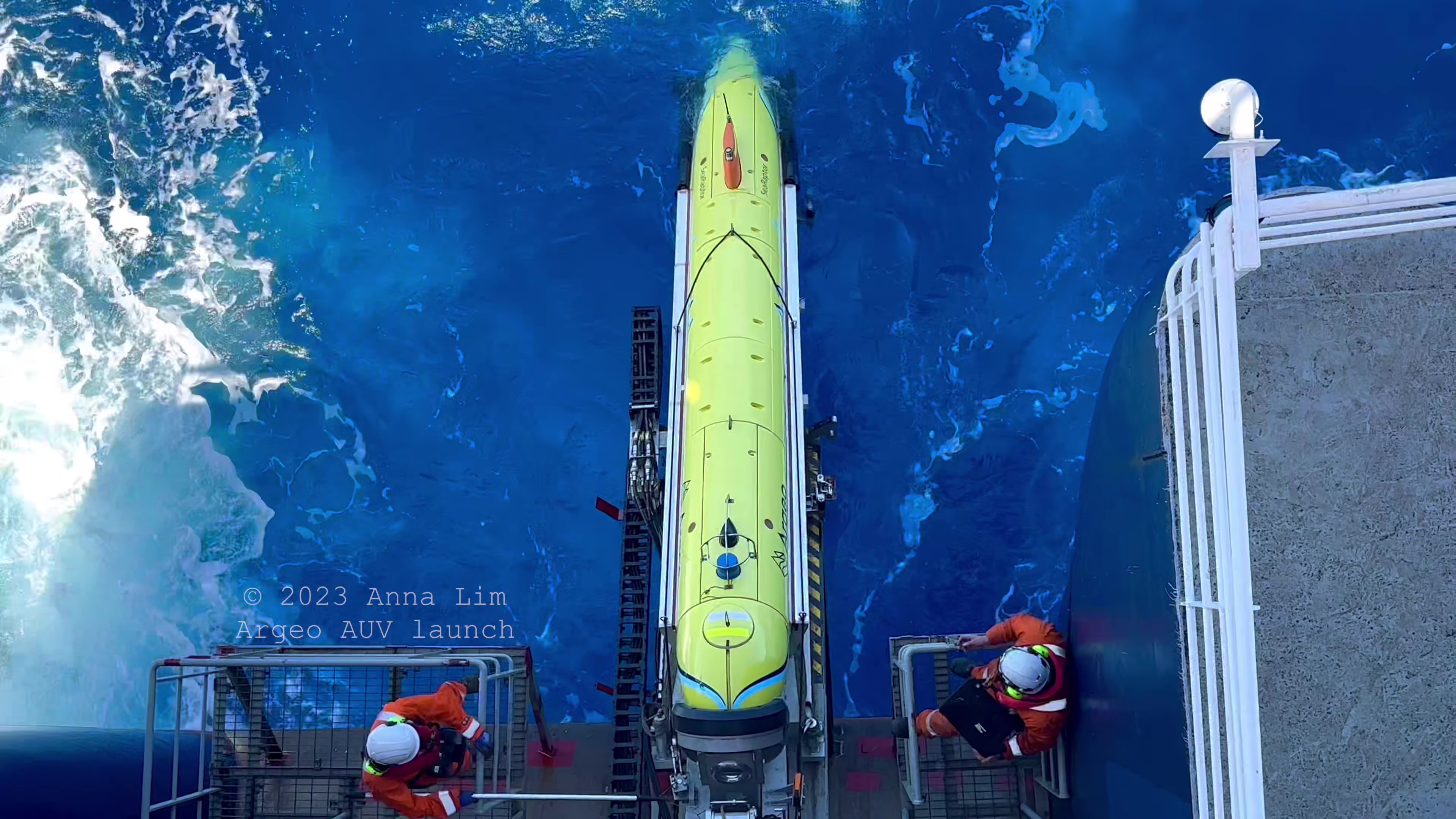
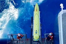
Deployment of the SeaRaptor 6000 AUV during the survey on the Mid-Atlantic Ridge (source: Argeo Survey)
The project was entrusted to the Polish Geological Institute - National Research Institute (PGI-NRI) and as part of the implementation of the National Raw Materials Policy (PSP2050).
The work was performed for the first three areas of interest (AOI 1-3) located in Cluster A, which were identified as prospective for occurrences of massive sulphides and hydrothermal activity based on the results of analysis of comprehensive data acquired during the first research cruise in 2022.
To carry out the task, an M/V Argeo Searcher was used, from the deck of which the survey and research work was carried out for nearly 8 weeks. Advanced systems of the autonomous underwater vehicle (AUV) were used for data acquisition in these demanding environmental conditions.
The use of AUVs in the search for massive sulfides is the most effective way to conduct prospective exploration in predefined areas. The accomplished work involved the use of two SeaRaptor 6000 AUVs from Teledyne Gavia, equipped with state-of-the-art sensors: min-SAS from Kraken; multibeam echosounder 200/400 T-50 from Reason; SBP - Benthos Chirp III; camera and laser from Cathx; self-compensating magnetometer from OFG; CTD; and environmental sensors from RBR for detecting hydrothermal activity in the water column; as well as Argeo Listen (SP), a passive electromagnetic sensing instrument, which together provided key information on the location of occurrences of massive sulphide accumulations. This type of equipment configuration and the resolution of the measurements allows the acquisition of the necessary data for environmental impact assessment and characterization of the identified mineral resources.
Data acquisition was conducted from the AUV located 20 - 100 m above the sea bottom and covered an area of 230 km2 with depths of 1400 - 3500 m below sea level. Despite the rough bottom surface with high elevations and slope gradients (>20%), about 1550 km of profile lines were collected, achieving the survey targets.
The resolution of the obtained bathymetric data (MBES) ranged from 25 cm to 1 m, whereas bottom images taken with synthetic aperture sonar (SAS) during the second phase of the cruise covered a total area of about 5 km2 and have an ultra-high resolution of 5 cm. The SAS was applied within eight areas and the results will be used for accurate microstructural interpretation and ROV (remotely operated vehicle) mission planning for further investigation.
Using the high-speed satellite link Starlink (SpaceX) and Argeo's unique SCOPE digital data access and management platform, a full flow of information was achieved between the vessel and crew, the Argeo team in Norway, and the PGI-NRI research team in Poland. The solution allowed for remote project management and included data transfer, joint discussions, and decision-making, as well as live visualization and update of preliminary results. One of the most important achievements of the work carried out is the discovery and acquisition of detailed data on a new inactive hydrothermal field, along with characteristic formations at the bottom and a number of other unidentified structures that require further identification.
The scope and quality of the geophysical and environmental data acquired are a major step forward in fulfilling Poland's international obligations, and the results will contribute to a better understanding of the deep-sea environment. With the research cruises carried out in 2022 and 2023, based on the unique survey data acquired, Poland has made significant achievements in this field. The discoveries made during the cruises make it possible to plan further detailed work, including the collection of research material for environmental and mineralogical analyses and exploration of the remaining prospective areas.
At this stage, plans are being finalized for the implementation of research in the Atlantic in 2023-2027, which will be carried out in cooperation with foreign research institutes, and the Polish deep-sea community. This approach will provide a high level and optimize the cost of the implemented reconnaissance of deep-sea areas aimed at the exploration of massive sulphides.
 PGI-NRI offer
 Mineral resources of Poland
  Oil and Gas in Poland


 Subscribe to RSS Feed