


 The tasks carried out within the framework of the Polish Hydrogeological Survey (PHS) have been positively assessed by the Minister in charge of water management, who, pursuant to Article 360 of the Act of 20 July 2017 – Water Law, supervises the activities of the PHS.
Topics of the tasks covered a broad spectrum of issues related to groundwater prospecting, balancing and protection.
In 2022, as part of the activities carried out by the Polish Hydrogeological Survey (PHS), the Polish Geological institute – National Research Institute (PGI-NRI) carried out 38 tasks, organised in six thematic groups, the scope of which resulted from the provisions of the Water Law Act. These tasks mostly concerned the area of the whole country, and their overriding objective was to ensure effective quantitative and qualitative protection of groundwaters and proper management of their resources, which form a base of drinking water supply for about 70% of the Polish population.
Conducted in 2022 activities included hydrogeological measurements, observations and studies, development of current analyses and assessments of the hydrogeological situation, preparation of hydrogeological maps of the first aquifer, reambulation of hydrogeological documentation identifying disposable groundwater resources, maintenance and updating of hydrogeological databases, as well as making hydrogeological data available. Results of much of this work have been submitted to the European Commission and the European Environment Agency as Polish contribution to planning documents in the area of water management.
We asked Andrzej Głuszyński – Director for the Geological Survey – which of the PHS tasks performed in 2022 was the most important one:
'All tasks conducted within the PHS are interlinked – substantively and organisationally – and of course all are important. However, if I must indicate the most important ones, it is certainly the completion of reambulation of hydrogeological documentation identifying the disposable groundwater resources for the three balance areas - the Dziwna River catchment area, the Gowienica River catchment area, the upper Vistula River catchment area, the Soła, Skawa and Czadeczka.
Another task is the creation of 20 sheets of the Hydrogeological Map of Poland at a scale of 1:50 000. In total, we have determined the hydrogeological conditions of the first aquifers counted from the ground surface for an area of about 6,200 km2. After the completion (in 2023) of the currently realized tranche, 102 sheets of this map will remain to fully cover the Polish territory.
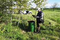
Mention should also be made here about the work performed as part of quantitative groundwater monitoring. Observations of groundwaters at nearly 1,200 research points provided us with almost 280,000 data on the depth of occurrence of these waters. They have formed the base for assessing the present hydrogeological situation of the country and forecasting its changes, which becomes particularly important in the period of hydrogeological lows.
The last group of tasks that require attention is the maintenance of databases and the provision of hydrogeological information. In 2022, among other things, users have generated in total around 200,000 reports on hydrogeological objects.'
We are inviting you to read the full text of the 2022 Report on the activities performed by the Polish Hydrogeological Survey.
Text: A. Bagińska, M. Woźnicka
 PGI-NRI offer
 Mineral resources of Poland
  Oil and Gas in Poland


 Subscribe to RSS Feed