


 At the end of June 2023, completed works in the next area of the task entitled 'Integration of geological and deposit data concerning hydrocarbon systems of Poland, their completion and analysis in the context of energy security – continuous task of the Polish Geological Survey (PGS) – Area No. 3'.
This area is situated in south-eastern part of the Koszalin – Chojnice tectonic zone (17 hydrocarbon licence blocks), a geological region of potentially high prospectivity for discovery of new hydrocarbon deposits. The third stage of this task covered analysis of integrated data in the amount of 972 2D seismic profiles (total length of 52874.73 km), 12 3D seismic images (area of 3327.69 km2).
Moreover, during the execution of the task, stratigraphic data, borehole trajectories, geophysical measurements, reservoir samples and hydrocarbon shows from 233 boreholes (total length of 590.834 km) were verified, 106 seismo-geological horizon roof maps, converted from analogue to digital form, from 19 geophysical studies were completed and entered into the interpretation system. The re-interpretation of 2D and 3D seismic material over the whole area under study was also performed.

Structural model of Area No. 3 made as part of the task 'Integration of geological and deposit data concerning hydrocarbon systems of Poland, their completion and analysis in the context of energy security – continuous task of the Polish Geological Survey (PGS) – Area No. 3'.
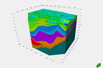
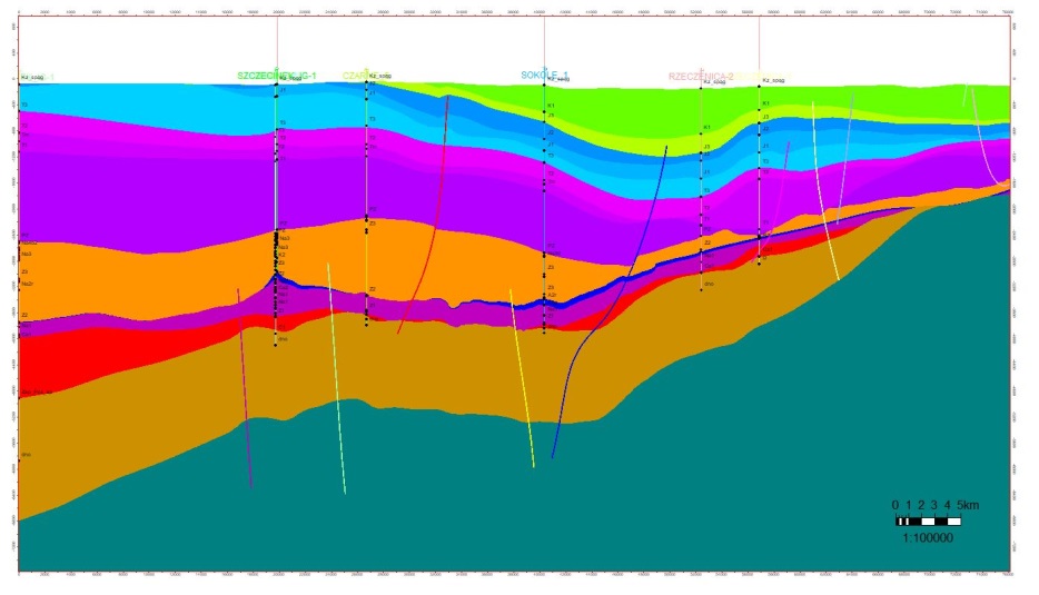
As a result of the studies a coherent three-dimensional picture of the structure of the Koszalin – Chojnice zone has been obtained, as well as a structural and parametric model (PHIT, VSH and TOC) for the whole area have been made. The studies also comprised verification of quality of digital seismic data and assessment of possibilities of reprocessing of these data, indicating the need to subject to this process the materials from the southern part of the area, however excluding from this group profiles which document the Damasławek salt dome. One of the cross sections through the model (SW-NE) showing the tectonic and thickness variation of the developed area.
Three-dimensional fault model obtained for area no. 3
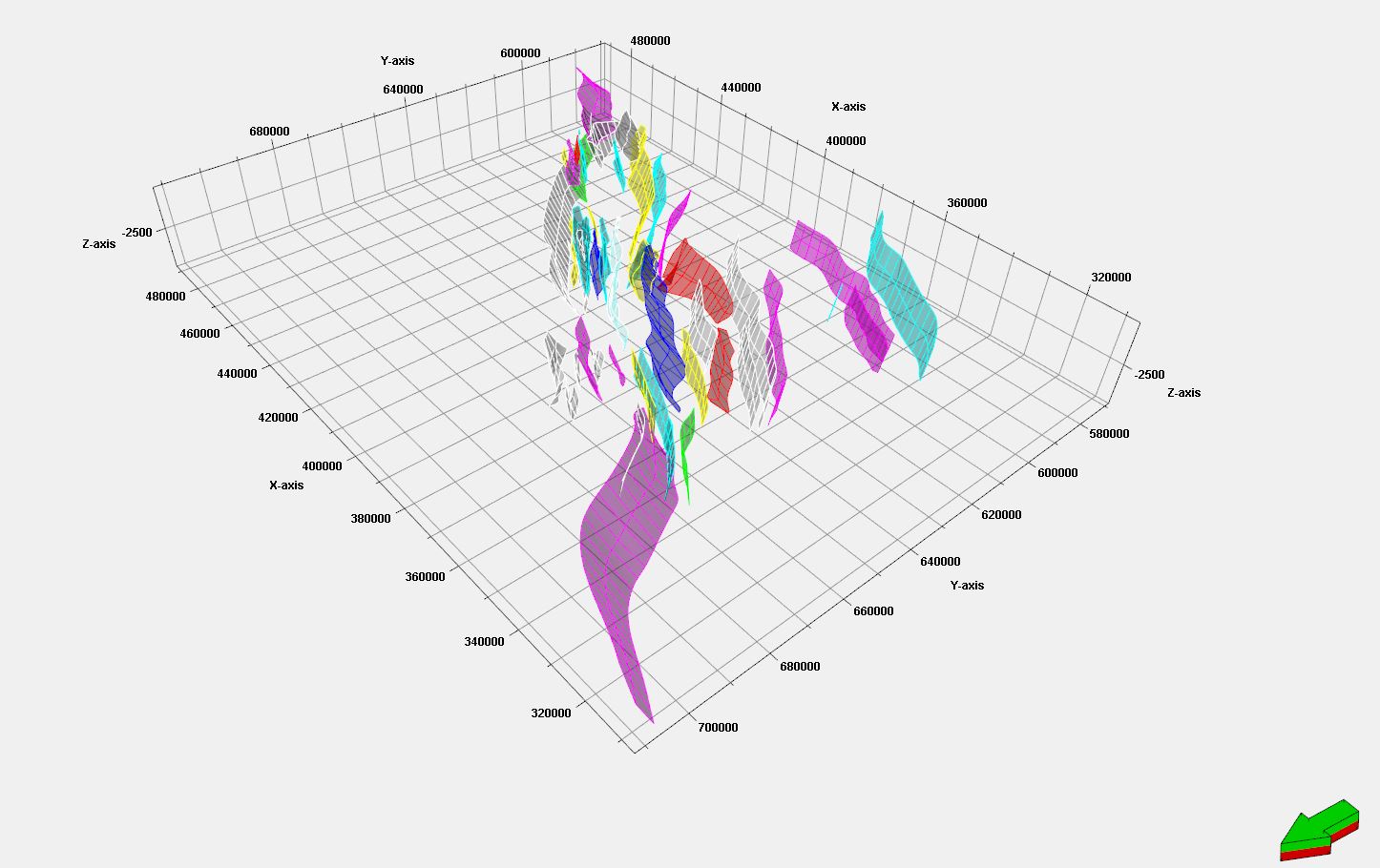
Three-dimensional fault model obtained for area no. 3
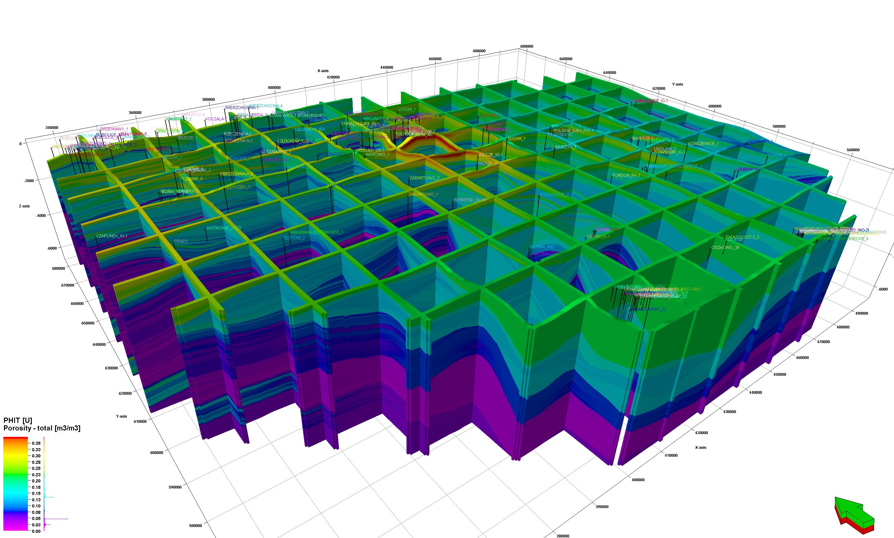
Parametric model of total porosity (PHIT)
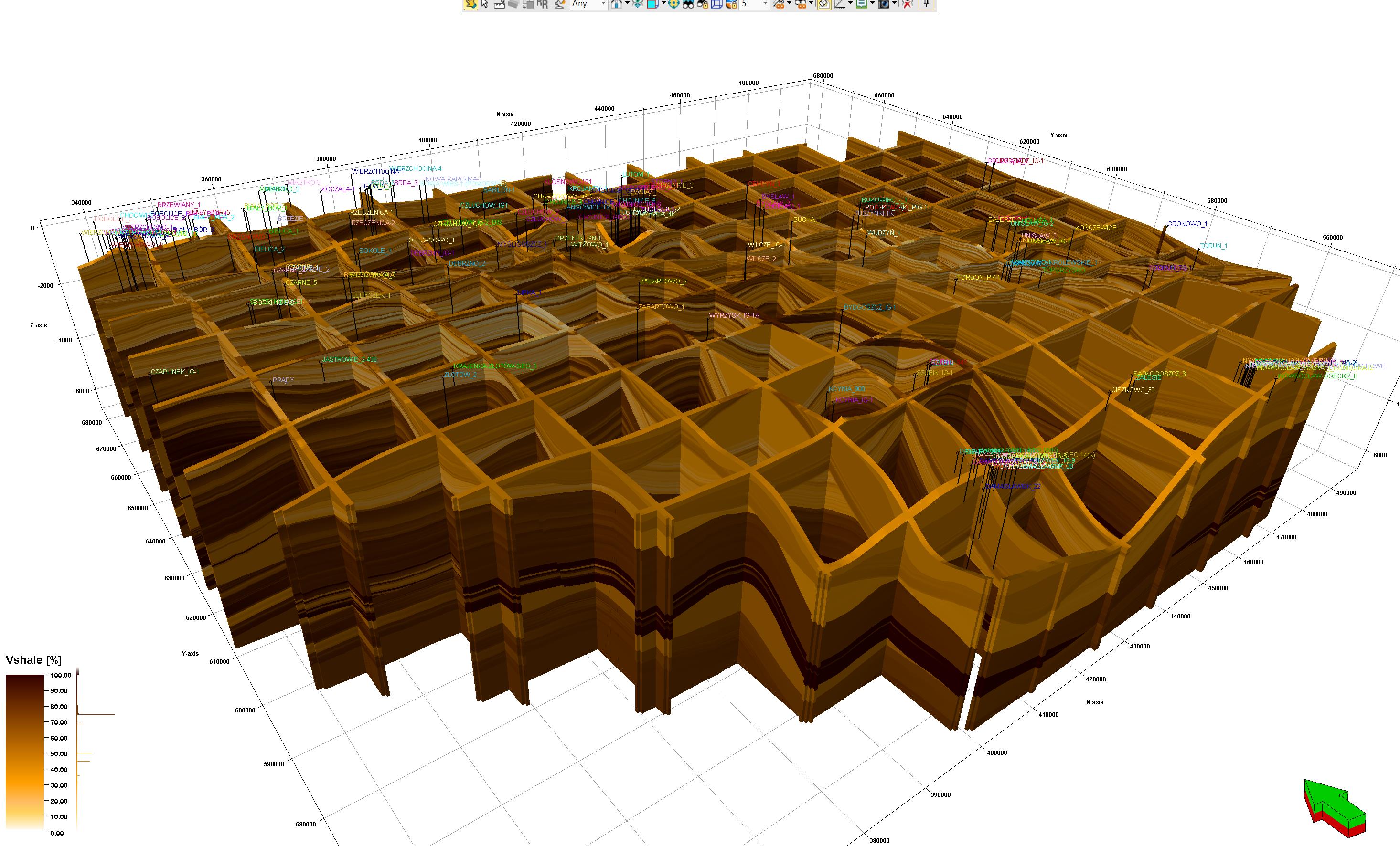
Parametric model of recharge (VSH)
The integrated geological and deposit data covering so far completed research areas 1, 2, 3 will be used in other tasks created within the framework of the Geological Survey duties, such as:
- 'Modelling of geological structure of sedimentary basins of Poland – model of geological structure of the Szczecin Basin – PGS continuous task'.
- 'Assessment of Poland's geological prospectivity in terms of the possibility of discovering new hydrocarbon deposits and preparation of materials for proceedings conducted with a view to granting hydrocarbon licences'.
- 'Geoenvironmental conditions for the use of thermal water energy in the area of the Mogileń-Łódź basin taking into account the impact of exploitation on usable aquifers'.
- 'Regional analysis of selected geological structures for synergy in hydrocarbon prospecting, geothermal energy use, underground substance storage and CO2 storage in the rock mass – Stage II: Identification of prospective zones and structures and estimation of prospective resources of hydrocarbon deposits of the north-western part of the Polish Lowlands'.
- '3D framework model of the geological structure of Poland as a basis for modern digital geological cartography'.
The use of the results of the just-completed study in so many tasks performed by the country's geological survey pleases the authors, but also confirms the need to continue the 'Integration ...' task for the next areas of our country – and this is planned.
 PGI-NRI offer
 Mineral resources of Poland
  Oil and Gas in Poland


 Subscribe to RSS Feed