 Polish Geological Institute-National Research Institute (PGI-NRI) has been actively supporting geologists from African countries for a decade. Implementing the PanAfGeo project initiated by the EuroGeoSurveys (EGS), it organises training courses on geodiversity conservation and educates geologists on geology of mineral resources, geochemistry or geothermal geology.
Artur Baranowski, PGI-NRI spokesperson, talks to Dr. Stanisław Wołkowicz, project leader on the Polish side, about the tasks carried out as part of the pan-African project.
Artur Baranowski (AB): You have been involved in the PanAfGeo 2 project for several years. What is this project?
Stanisław Wołkowicz (SW): It is an international geological training project dedicated to African countries, involving 12 countries from the European Union. It has been designed for three years, started in 2021 and its second phase is currently underway. The last training sessions will take place next year.
AB: So the project has a history. Where did the idea for it come from?
SW: It all started more than 10 years ago. After a series of international meetings, discussions, negotiations between the African Union and the European Union, specific arrangements were made. According to these, the Polish Geological Institute together with other European geological surveys undertook to organise training courses for geologists from African countries.
In the first phase, support to the Organisation of African Geological Surveys (OAGS) consisted, among other things, of assistance in identifying and estimating potential African mineral resources and verifying geological data. At the end of 2015, the report „Geological Potential of the African Geological Surveys” was finally approved. This gave a boost to the preparation of a pan-African project - PanAfGeo 2016-2019 - in which it was accepted that the main objective would be the training courses for African geological surveys personnel. The training courses were to be conducted in Africa and the project is expected to result in strengthened contacts between the geological surveys of Europe and Africa. The French Geological Survey (BRGM) became the Project leader and we were assigned the role of technical coordinator.
The first phase of the PanAfGeo Project was completed in December 2019 and our dream was to continue it smoothly, but a pandemic was in the way. I do not want to go into the very long history of cooperation between PIG-PIB and African countries, many interesting stories related to this can be found in the Institute's excellent publication "Polish geologists on five continents". The more recent ones are probably still waiting to be fictionalized.
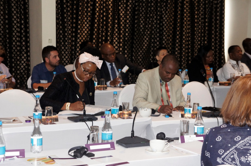
Kick-off meeting for the first phase of the PanAfGeo project in Windhoek, Namibia (May 2017)
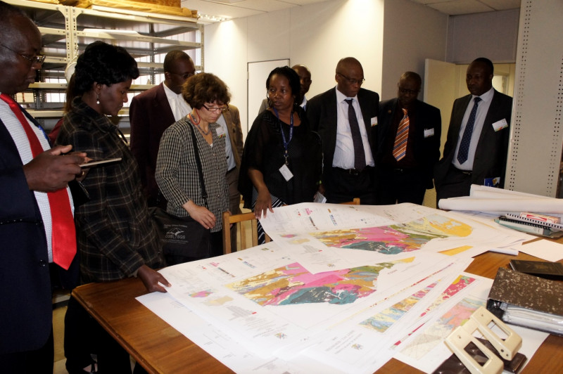
Participants at the meeting in Windhoek tour the archives of the Geological Survey of Namibia (May 2017)
AB: The project is aimed at the Organisation of African Geological Survey, so geologists from which countries?
SW: The project is pan-African, so it is dedicated to all 54 African countries. The current phase of the project is ongoing. We will know in a year's time how many countries will benefit from it. But the data from the first phase are impressive: 1,076 African geologists representing 49 countries took part in the training. There were more than three thousand willing participants. In the phase currently underway, we have still managed to erase a few white spots and increase the number of African countries participating in the project. This demonstrates the scale of interest and needs. Trainings are only organised within Africa and the choice of host countries is crucial. The rule applies: training can only take place in conditions of full security, in countries with full stability.
AB: What is the current role of the State Geological Institute in the second phase of the project? What activities are we involved in? What are we teaching our African colleagues?
SW: In the second phase of the PanAfGeo project, our role changed significantly. I have taken over from Dr Enrique Diaz Martinez of the Spanish Geological Survey (IGME-CSIC) to lead a working group on geodiversity conservation (Geoheritage), whose scope has been expanded. This working group is now called „New froniers in geosciences: geoheritage and geothermal energy”. As part of its work, four training courses have been planned between 2022 and 2024. Two training courses have already been held on the protection and conservation of geological heritage: in the Republic of Congo (in French) and in Angola (in Portuguese, in collaboration with the Geological Survey of Portugal - LNEG).
A few days ago I returned from a training course in Kigali (Rwanda), which was organised by a friend of our institute, Dr. Jonas Satkunas from the Lithuanian Geological Survey (LGT) on geohazards. Immediately after this training, I travelled to Zambia, where I was supporting Dr. Maria Joao Batista from the Portuguese Geological Survey (LNEG) in organising a training course on the geology of mineral deposits to be held in the Zambian Copperbelt in mid-March 2024.
As you can see from this, we participate in several other working groups. We are providing training in the broad areas of environmental geochemistry and geochemical mapping, critical raw materials and conflict metals, mineral deposit protection, deposit data management, waste mineral resources, principles of delineation of prognostic areas and prospective mineral deposits. Next year we are still to organise a training course on geothermal energy to be held in Uganda.
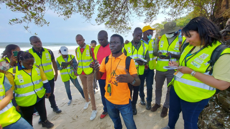
A young, very capable Congolese geologist, Boris B. Malonga explains the geological structure of the Coastal Basin (Bassin Cotier), whose formation is linked to the opening in the Lower Cretaceous of the South Atlantic. (May 2022)
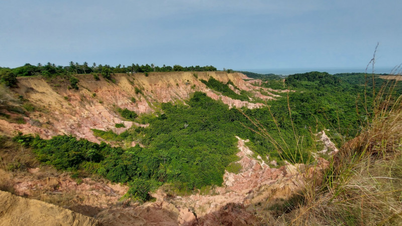
A very picturesque feature of the Coastal Basin (Bassin Cotier) are the erosional structures known as Gorges de Diosso, which stretch for many kilometres. These are to be the main attraction of the inanimate nature of the proposed Loango Geopark. (May 2022)
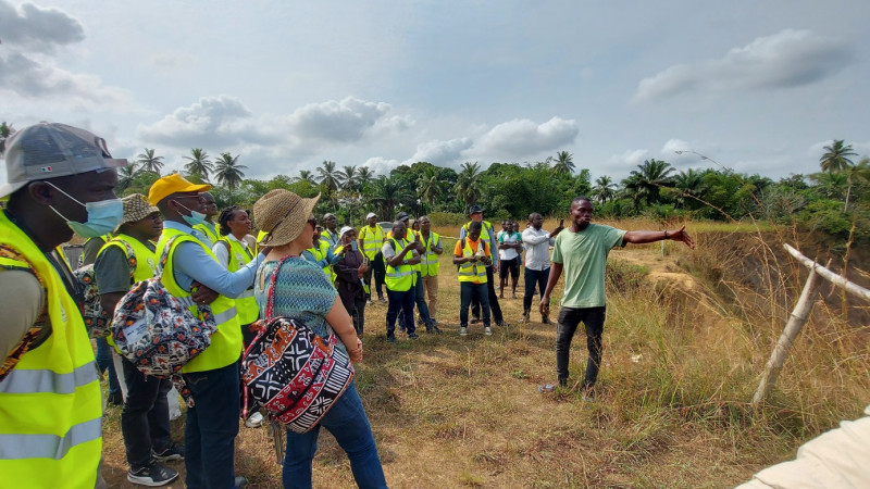
A resident from a nearby village explains the geological structure of the Gorges de Diosso to trainees. demonstrating expertise on the subject. This is proof that the geopark can create jobs for the local population. (May 2022)
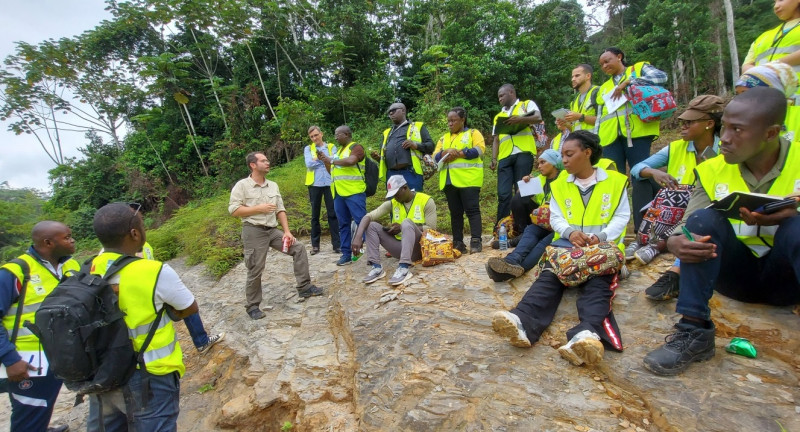
Dr Nicolas Charles of the French Geological Survey (BRGM), co-author of the geological map of the Mayombe chain (Chaine du Mayombe), explains its geological structure. (May 2022)
AB: To summarise - how many training courses have PGI-NRI representatives participated in?
SW: We have participated in nearly 10 training courses giving dozens of professional lectures. On the part of PGI-NRI, apart from myself, the following participated in the trainings: Irena A. Wysocka, Aleksander Biel, Wojciech Wołkowicz, Joanna Fajfer, Paweł Urbański and Karol Zglinicki. We should also not forget the very strong support of Dariusz Owcarz, who ensures that the funds spent are properly accounted for. This is an extremely complicated matter, as he has to deftly balance European accounting requirements with African habits regarding invoicing methods.
AB: Regarding the training in Pointe Noire in the Republic of Congo, we were hearing from EGS headquarters in Brussels and from Africa itself about its incredible extent. What was it like in reality?
SW: I must admit that this training was given unheard-of publicity. During its opening, a scientific cooperation agreement was signed between PGI-NRI and the local geological survey and a department of the Ministry of Extractive Industries and Geology. This prominence of the event resulted in the presence of numerous local official figures. Pierre Oba, Minister of State, Minister of Extractive Industries and Geology, played a major role in the event. He is a good friend of Poland and a supporter of closer economic cooperation with our country. It is worth considering cooperation with the Republic of Congo, as the country's raw material resources are complementary to the Polish economy and can provide us with security of supply in terms of several strategic raw materials.
Our training received a great deal of media coverage. Reports of the opening and closing ceremonies were front-page news on local television, and several minutes' worth of reports were aired, including statements by the trainees. It was possible to watch and listen to this information not only in French, but also in lingala and kikongo - popular local languages.
I invited Dr Özlem Adiyaman Lopes, who at UNESCO is responsible for geodiversity conservation issues and the development of geoparks around the world, to participate in this training. We trained 25 African geologists recruited from 14 countries. The work was extremely intense. In fact, I must stress the excellent cooperation with UNESCO during this phase of the PanAfGeo project.
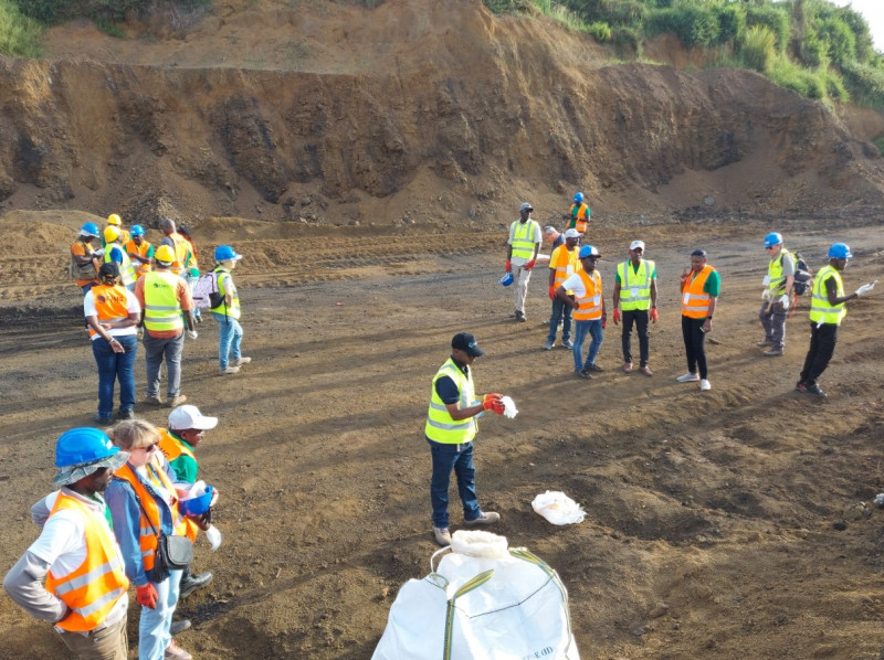
On the initiative of S. Wolkowicz, WP-E (New Frontiers in Geosciences: Geoheritage and Geothermal Energy) trainees extracted 1 m3 of rich manganese ores, currently classified as a critical element for the EU, from a mine waste dump in 20 minutes. Such an activity, carried out in consultation with the mining concession holder and local authorities, could be a practical implementation of the zero waste economy concept and a source of good earnings for local people. (April 2023)
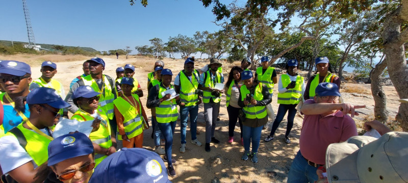
Alvaro Oliveira from the Geological Survey of Portugal(LNEG) explains the geological structure of the Huíla Province to the trainees in Lubango (Angola). (May-June 2023)
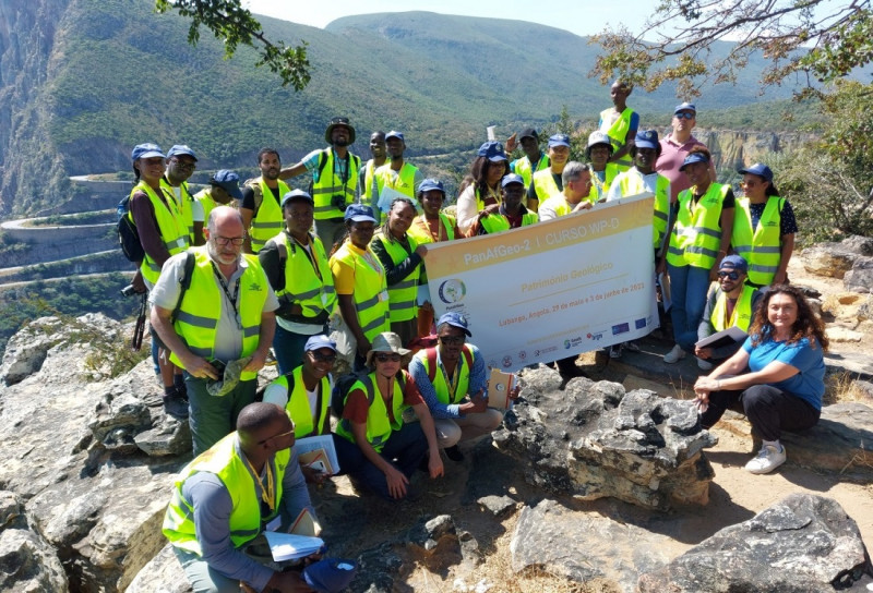
And the nature around was extremely beautiful.... So-called family photo against the Serra da Leba serpentines. (May-June 2023)
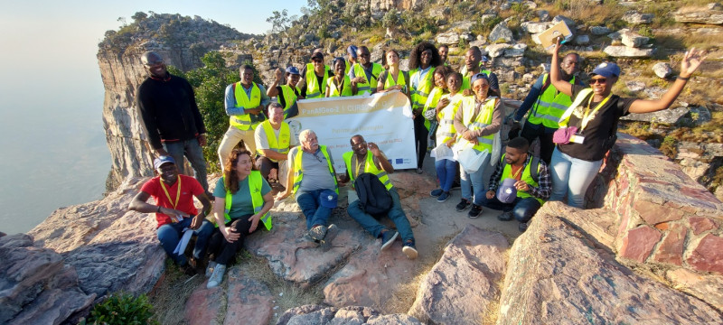
Family photo on the Tundavala Escarpment. The cliff, which stretches for many kilometres, is more than 1,000 metres high. In addition to being incredibly interesting from a geological point of view, as it can be assessed both from the point of view of geological heritage (a magnificent geostation) and a geohazardous object (rockfall), it is a fantastic place to watch sunsets. (May-June 2023)
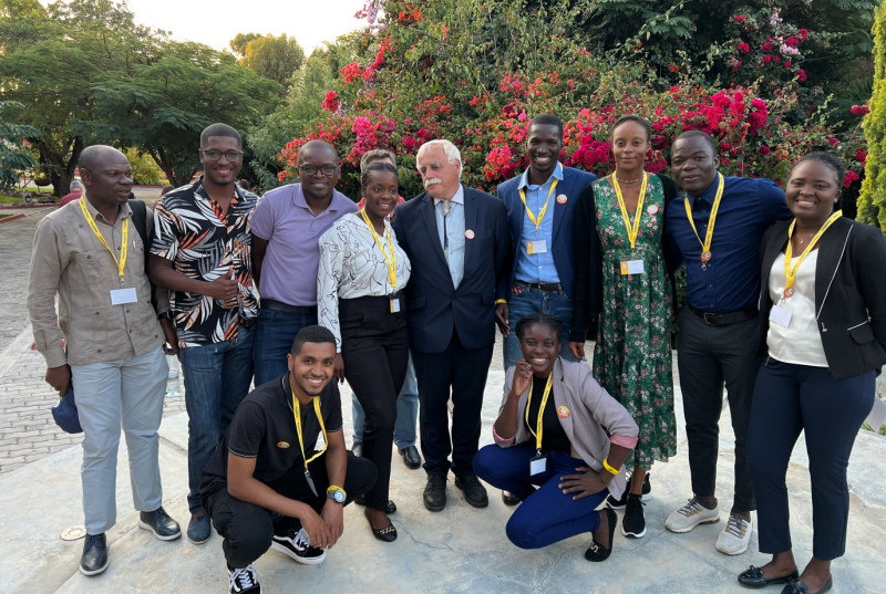
Stanislaw Wolkowicz, WP-D working team leader with a group of training participants in Lubango. (May-June 2023)
AB: You have a lot of experience in training African geologists. Please indicate what are their biggest concerns, professional problems? And what do they come from?
SW: My observations about the condition of geology in Africa are quite sad. The main problem is the lack of sufficient trained personnel and a very high turnover in employment. The staff we have trained often move on to private companies for financial reasons, or find employment with the ministry and practically stop working professionally. Another issue are the laboratories. In Africa, this is a gigantic problem. There are problems with the supply of high-end reagents, because there are none in Africa, and work is often ruined by power cuts. The shortage of qualified staff and fluctuation in the workforce does not help either.
AB: Which area of geology in Africa do you think needs particularly strong support? Is it geology of mineral resources, hydrogeology or perhaps geohazards?
SW: The whole of African geology needs strong support, but I would put geological mapping first. Most African countries have 20-25 per cent geological map coverage at a scale of 1:100 000. And if you don't have good geological maps, you don't have good information about mineral resources, geohazards, not to mention environmental pollution. In our project we also have a lot of trouble with geological mapping. You can't learn good mapping even in a one-month course. Moreover, in Europe we forget how to map, because all countries have had very detailed maps for a long time. In the project, mapping is taught by very good specialists from the Czech Geological Survey (CGS), often assisted by specialists from other countries, mainly France (BRGM), who have a lot of experience in mapping work in Africa.
The second important field is hydrogeology, because in huge areas the population suffers from a lack of good quality water, but this issue is usually dedicated to separate ministries and the geological service does not deal with it. Consequently, we do not organise training in this area. The same is true of oil and gas geology. Countries derive very large profits from these resources, of course, only those which have such deposits.
Support is undoubtedly needed for environmental protection, especially where there is large-scale exploitation of gold deposits using mercury by small-scale artisans. This is an activity that is extremely harmful to the environment both locally and globally, but is most often tolerated by local government authorities because it provides a means of livelihood for millions of people and ensures social peace. Our trainees are aware of the problem, which may give some optimism as they are the ones slowly coming to the fore in their countries.
Landslices are very common in Africa especially in the equatorial zone where there is very high precipitation and the weathering zone extends to a depth of several tens of metres. After zenithal rainfall, everything runs off, including roads and railways. Deforestation and desertification are another two problems, quite closely related, and are induced mainly by the short-sighted policies of local state authorities. This is a very broad problem difficult to present in a short interview.
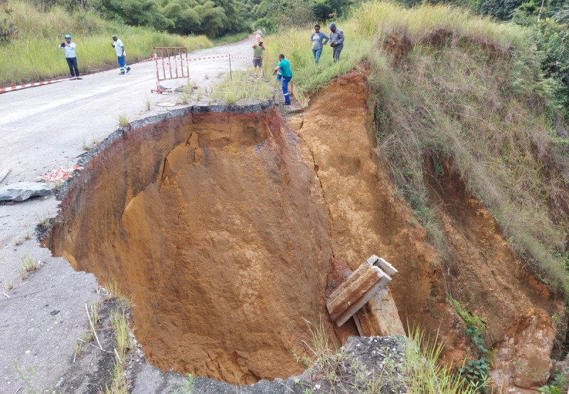
Landslides are a gigantic problem in Africa, especially in the equatorial part. The very high thickness of weathering and the very high amount of rainfall are extremely ruinous for infrastructure. Gabon, Moanda area. (April 2023)
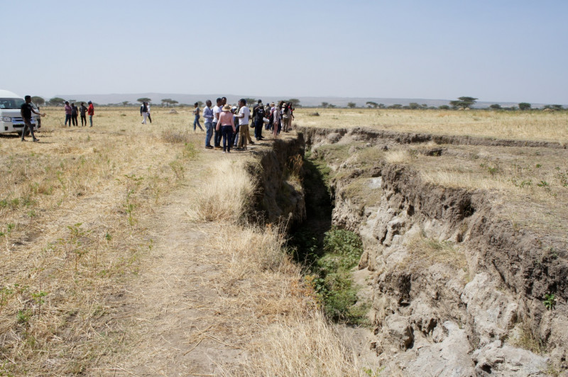
Ethiopia. A training group on an erosion structure that stretches for kilometres. Is this structure related to East African rift activity or is it an example of gully erosion? (November 2019)
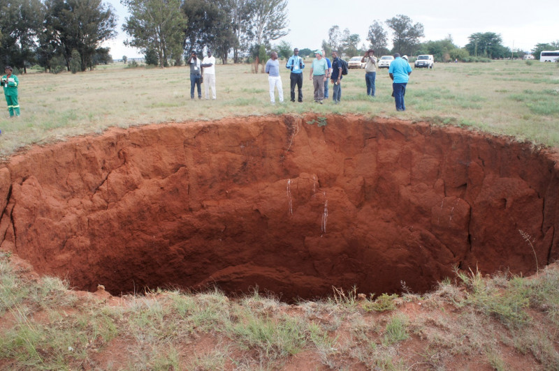
An erosion funnel about 15 m in diameter and about 65 m deep. In the circles of the PanAfGeo Project participants, it is named 'Jonas Sinkhole', after WP-Geohazards leader Dr Jonas Satkunas of the Lithuanian Geological Survey. The surroundings of Johannesburg, South Africa. (November 2017)
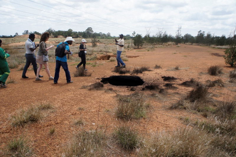
Underground coal seam fire. Johannesburg area, South Africa. (November 2017)
AB: What difficulties have you encountered in organising training on the ground in Africa?
SW: The first year of the project was almost lost due to the pandemic. Later on, it was possible to organise training, but the regulations related to the fight against Covid 19 within Africa were extremely cumbersome and costly for us. PCR tests were required on entry and on departure. Sometimes additional rapid tests were done at the airport immediately upon arrival. European vaccination certificates were not respected everywhere. All this generated high costs, which we incurred in the implementation of the project. Complications also arose when someone became ill.
Another issue is the problems with payment card processing in Africa. European banks classify many countries on the continent as highly corrupt, so withdrawing cash from an ATM there is impossible. Therefore, I happened to be travelling with pockets full of money. So the stress was high.
Yet another problem is the air connections within Africa. The pandemic has caused a significant reduction in air connections. The result is that, for example, trainees from Cameroon fly to Brazzaville via Addis Ababa, while travellers from Sao Tome and Principe visit Lisbon on occasion. The increase in ticket costs can be staggering.
AB: From what you say, it seems that the benefits are one-sided, benefiting mainly African geologists and African geological surveys. And do Poland and other European countries participating in the project have any benefits?
SW: The benefits of the Africans are obvious and easy to point out: they get ready-made knowledge in the form of well-prepared lectures, a very large amount of support material, a rich set of professional literature, all collected on one pendrive. They have the opportunity to meet in an international group, which many of them have not experienced before, they form groups on WhatsApp and this is a very important platform for exchanging information. They get certificates, which have a lot of value there.
We also benefit from this, but I am of the opinion that we should do more, especially on a global basis. Working for many years with various countries, I have established more or less close relations with many important people in positions of responsibility in the geological administration there. I was repeatedly urged to initiate cooperation of an economic nature in the field of raw materials. I have never kept such information to myself. On the contrary, I have shared my knowledge extensively by presenting numerous papers at conferences, writing articles and talking to Polish business representatives and important government officials. Africa is an excellent, direct resource for Europe, it is relatively close, it is thirsty for investment, it is rich in raw materials, and it is friendly to us. We Poles do not have the colonial ballast, which is known and appreciated there in Africa. It would certainly be worthwhile for us to be more open to cooperation. Of course, one should be cautious and foresighted, but that is why it is important to participate in projects such as PanAfGeo, to be active in them and to build good, friendly relations. In Africa, this is often more important than a signed contract, which, if not backed up by good personal relations, is sometimes dead.
AB: The project ends in August next year. Are there already plans for another third edition of it?
SW: I am observing a lot of interest on the part of representatives of the European Commission, the institution that funds all the work. This was very evident at the mid-term meeting that took place in May in Brazzaville. Although there is still more than a year to go before the end of the current phase (due to the pandemic, the project has been extended until December), preparations for the third phase of the project have already begun. It will have a significantly higher budget, training will continue to be provided in a big way, but the focus will be on mineral deposits. I had already taken the initiative a year earlier to prepare a comprehensive monograph on the „Geology of Africa”.
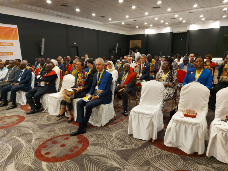
Mid-term conference meeting of the PanAfGeo 2 Project. In the foreground, Piotr Myśliwiec, Ambassador of the Republic of Poland accredited in Brazzaville (Republic of Congo). (May 2023)
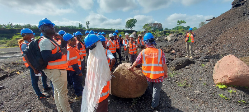
Giuseppe Delmonaco of the Italian Geological Survey (ISPRA) talks about the stability of the walls of the puzzolan exploatation open pit. (Cameroon, April 2022)
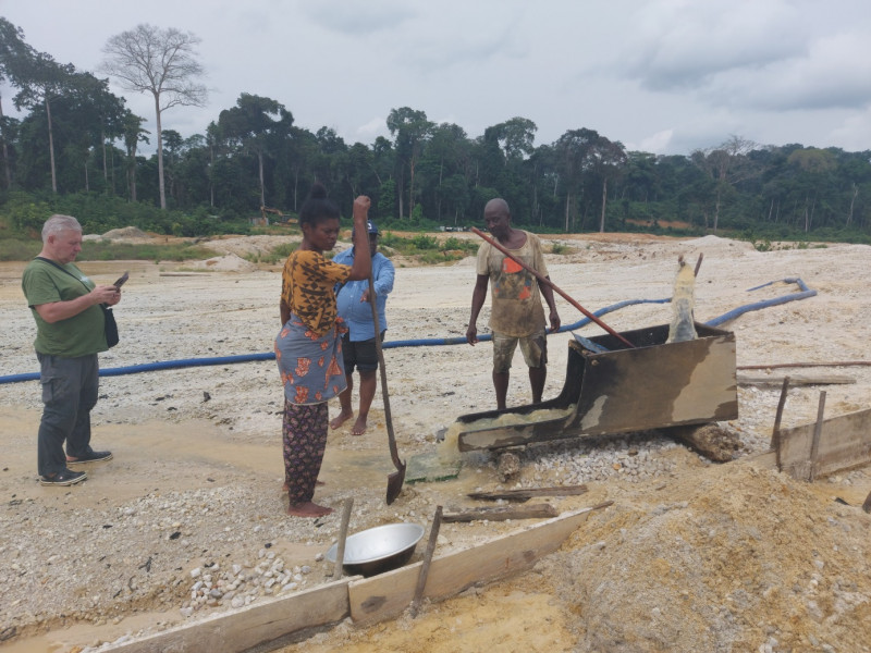
Photo 18: A Gabonese couple wash the river sediments from which the Chinese had previously extracted almost all the gold. A week's work will allow them to recover 2-3 grams of gold dust. (January 2022)
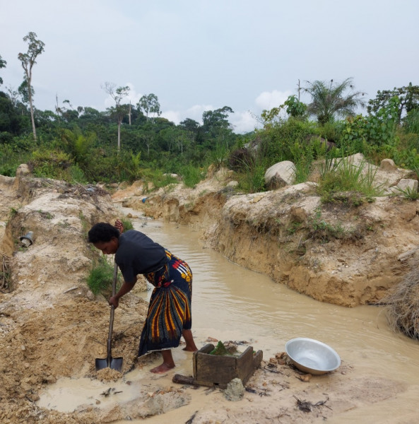
This Gabonese woman earns a living for her family by extracting gold from a placer deposit using mainly her own muscle power. (January 2023)
It is my dream that African geologists drawn from the geological surveys of their respective countries supported by their mentors and university colleagues will write comprehensive articles on the geological structure, resource potential, geohazards and geological heritage resources of their countries. These articles brought together in a single publication complemented by several overview papers capturing particular issues on a continental scale will constitute a unique monograph, serving a wide audience. The idea has already been promoted at several conferences, including the recently concluded 29th Colloquium of the African Geological Society, held in Windhoek, Namibia. More broadly, in terms of cooperation with Africa, we need to move to a higher level of scientific interaction, better promotion of European standards in the operation of geological surveys, care for the protection of deposits and the environment, all of which should serve economic development and improved living standards, both in Africa and in Europe.
AB: Thank you very much for the talk and I wish you continued success with your project.
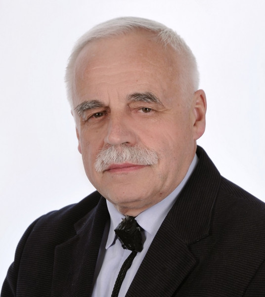
Dr hab. Stanisław Wołkowicz, prof. of the institute
He has been employed with the Polish Geological Institute since 1980. For many years he was the head of departments dealing with the geology of mineral deposits. He was a co-founder and for many years head of the Department of Environmental Geology. He is an expert in the geology of uranium ore deposits, economic geology, natural and artificial radioactivity in the human environment and environmental geochemistry. As a hobby he is interested in history of geological sciences, and together with his wife Dr Krystyna Wołkowicz he owns one of the largest collections of old geological maps in Poland. He has been working with African countries since 2006, initially as an aid project leader and currently as one of the main contractors of the PanAfGeo Project. He has authored or co-authored more than 250 articles, chapters in monographs and published conference abstracts. Since 2011, he has been a member of the Scientific Board of PGI-PIB, currently serving as its Vice-Chairman. He is a member of the Polish Geological Society, the Commission on the History of Science of the Polish Academy of Arts and Sciences, the International Commission on the History of Geological Sciences (INHIGEO) and the Geological Society of Africa (GSAf).
Photo. dr hab. Stanisław Wołkowicz


 PGI-NRI offer
 Mineral resources of Poland
  Oil and Gas in Poland


 Subscribe to RSS Feed