


 In the first half of 2023, the nearly four-year project of the state geological survey (PGS) titled "Integration of regional geological-mining data in the Upper Silesian Coal Basin for spatial modeling of natural resource deposits" was completed
The aim of this task was the urgent need to compile, in a unified reference system, verified data collected over 200 years in this region during exploration and intensive mining of coal and other resiurces. Dr. Zbigniew Małolepszy from the Upper Silesian Branch of PIG-PIB in Sosnowiec led the project.
During the project's meticulous implementation, the digital assets of the Central Geological Database (borehole database) expanded by 33,571 objects, amounting to a cumulative length of 3,146.6 km. The database incorporated 15,256 surface boreholes, 17,134 underground boreholes and 1,181 mine shafts, assuming they had verified locations, stratigraphy, and other attributes. Additionally, the locations of 7,294 previously stored boreholes and shafts were verified and corrected by a total distance of nearly 19 000 km.
One of the main achievements was the initiation of indexing borehole log scans at PIG-NRI by linking them to specific boreholes. From the scanned documentation in the National Geological Archive (NAG) and other archives, 47,714 borehole logs and tabulated summaries with information for 39,307 boreholes and shafts were indexed. These successful efforts continue at CBDG and NAG, and currently, almost 150,000 objects have their scans linked. They will be accessible in the emerging new version of the „borehole database” web application.
In total, information on 46,512 boreholes and shafts was processed, of which 42,554 (91.5%) passed the verification ordeal. The remaining unincorporated objects were marked in the CBDG borehole database and left for further work in the GZW area.
Information about boreholes was primarily sourced from the National Geological Archive, consisting of scanned geological and hydrogeological documentation and a collection of borehole folders. Supplementary to the National Geological Archive information were borehole logs that didn't make it to the geological documentation. Several thousand such boreholes were discovered in other archives.
Boreholes data were integrated with data from five databases: the CBDG borehole database, the CBDH hydrogeological object database, the "boreholes" sub-database in the geological-engineering BDGI database, as well as the borehole database from the digital compilation at the Upper Silesian Branch of PIG-PIB. Additionally, data from the PITAKA database, provided by geologists from PGNiG SA, was incorporated. Another database used for integrating shafts was a compilation of mine workings connected to the surface, made available for this project by archive of the State Mining Authority in Katowice.
The integration of data about boreholes and shafts wouldn't have been feasible without utilizing the WellMatch tool, developed specifically for this task to identify identical objects across different databases. This tool, a plugin for the QGis program, allows for intuitive identification of boreholes on maps.
A separate challenge was addressing the transformations of local coordinate systems traditionally used in mining, which historically presented numerous challenges in data localization and handling. To address this issue, transformations for several local coordinate system versions, including Sucha Góra, the Lwów system (KUL), Borowa Góra, and the 1965 systems in zones I and V, were developed into the 1992 and 2000/6 coordinate systems. These transformations are archived in NAG under inventory number 5527/2023.
Data on mining exploitation areas or mine workings were also supplemented, sourced from two previously conducted PGS tasks. The mining exploitation areas, covering a total of 330 km2, were expanded by over 2400 km2. Data from abandoned mine areas were digitized, while the exploitation boundaries from active mines were obtained from their surveying and geological departments.
The project involved integrating data on 670 faults within the GZW area by digitizing them from geological-mining maps and borehole profiles. A wide range of analytical and biostratigraphic data from boreholes and mine workings were integrated, including:
- 75,911 chemical-technological coal analyses,
- 4,641 reflectance measurements of vitrinite in 164 boreholes,
- 36,390 methane gas analyses,
- 2,454 rock temperature measurements in mine workings and thermal logs in 636 boreholes,
- 946 hydrogeological analyses in 516 boreholes,
- over 4,000 taxa of macrofauna and microfossils.
For accurate location of boreholes and shafts and digitization of tectonics and mine workings, 2030 maps were calibrated in the appropriate coordinate systems. These came from file of 16,226 geological-resource maps indexed in the project. Additionally, large-scale historical maps from the late 19th and early 20th centuries, showing the locations of boreholes and shafts, were sourced from external archives and calibrated.
Over 500 km of geophysical curves from 62 boreholes were digitized and borehole geophysics and 2D/3D seismic data were acquired from external resources.
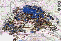
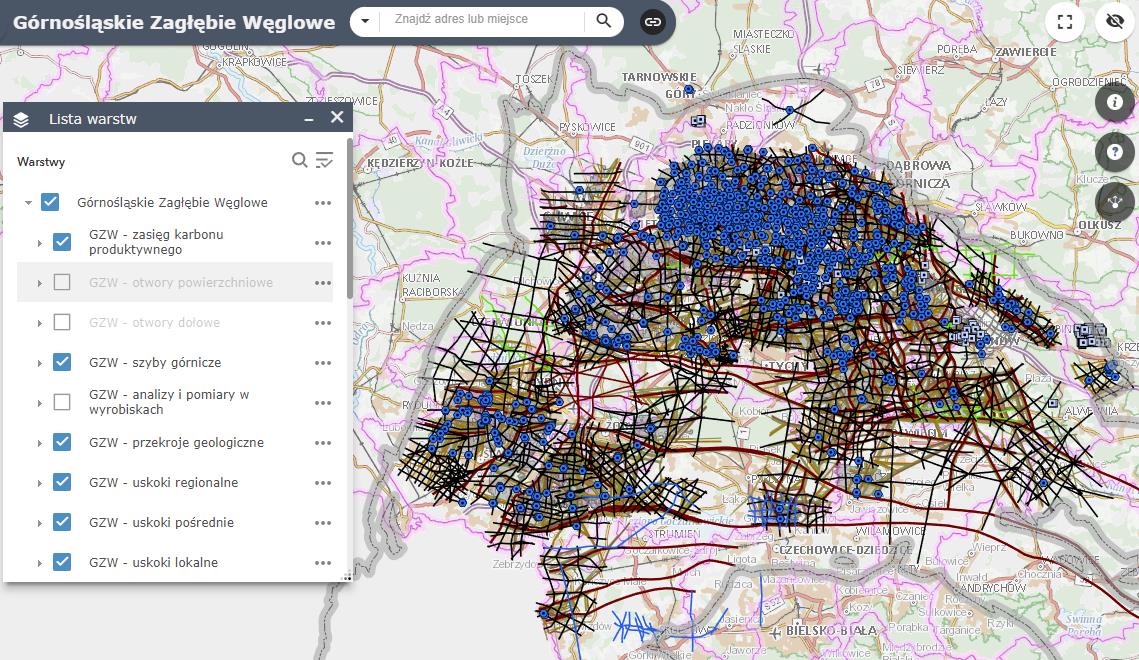
The collected and integrated data have been placed in a mapping service dedicated to GZW area https://geologia.pgi.gov.pl/gzw/.
It allows users to browse the task results and directly access some of them. Initially, the density of data on the map may seem overwhelming, but zooming into a selected area will help users navigate through the numerous information layers and their rich content.
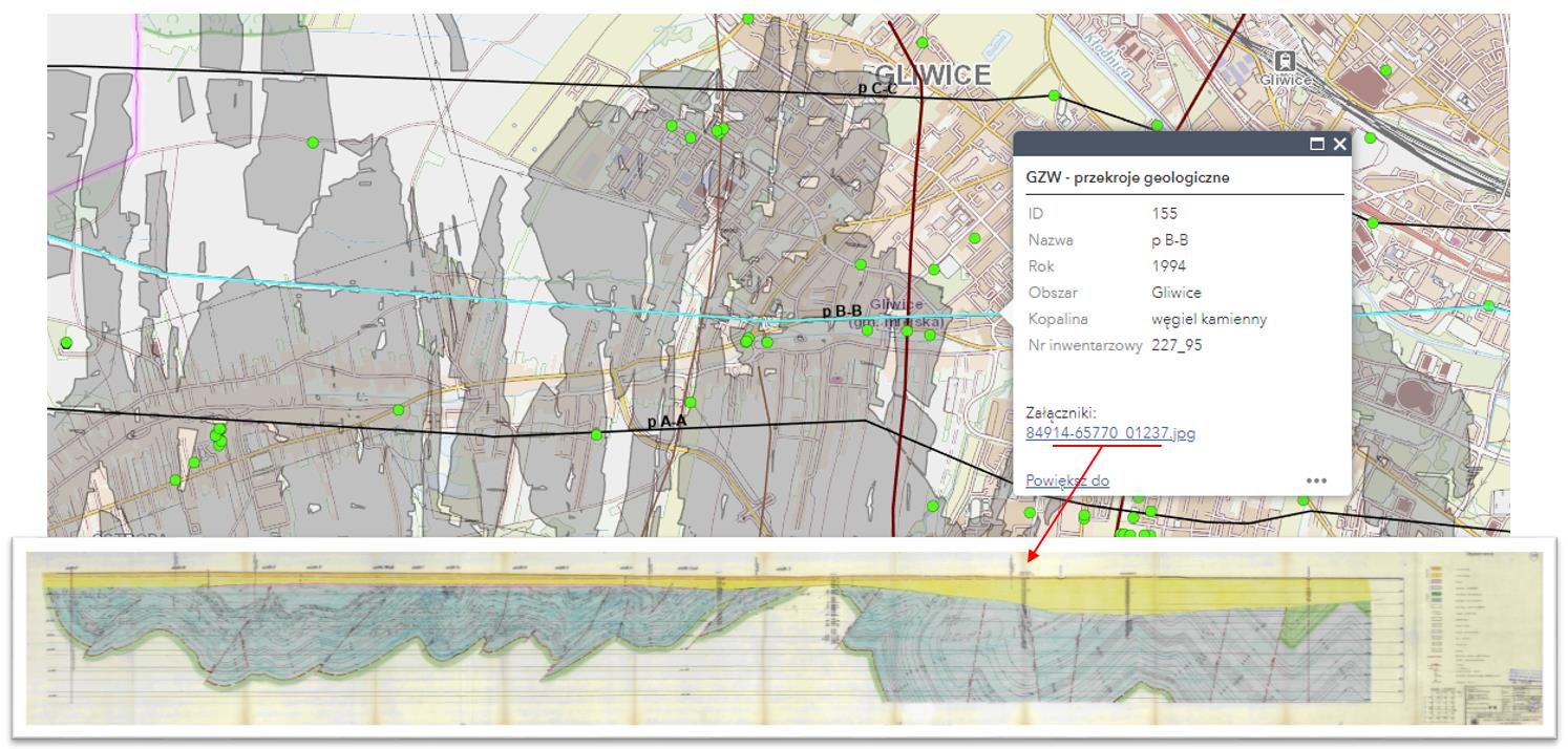
For instance, scans of 1051 geological cross-sections are available for display from a link in the information box about a selected cross-section line, as illustrated in the screenshot below.
The project continued work on the web based viewer for 3D geological maps and models https://geo3d.pgi.gov.pl/, enhancing its functionality, among other things, with visualizations of boreholes linked to data in the borehole database. The 3D geological model of basic elements of the regional structure and borehole data developed in this task is accessible at https://geo3d.pgi.gov.pl/gzw/index.html.
The collected, integrated, and verified data can facilitate the rapid implementation of various spatial studies, including resource-related ones, without the need for in-depth, time-consuming data credibility analysis. Experience shows that such analyses often consume a significant portion of work on the deposit model. The authors of the completed task hope that the data made available will streamline activities in many future projects. Moreover, integrated and online-accessible information about intensive mining, in the form of excavation extents and shaft locations, can assist in assessing surface deformation hazards in the Upper Silesian Coal Basin area.
Text: dr Zbigniew Małolepszy
 PGI-NRI offer
 Mineral resources of Poland
  Oil and Gas in Poland


 Subscribe to RSS Feed