


 After two years, the international grant "EGMS RASTOOL: European ground motion risk assessment tool” has ended. The project has resulted in data analysis tools from the Copernicus European Ground Motion Service, facilitating the identification of places where land surface deformations occur.
EGMS RASTOOL: European ground motion risk assessment tool (RASTOOL) - European Commission (europa.eu)
On February 29, 2024, a workshop organised by the Centre Tecnologic De Telecomunicacions De Catalunya, Spain, was held in Madrid to present new tools to support the automatic analysis of large point data sets from satellite radar interferometry processing.
Experts from the PGI-NRI Geohazards Centre attended the meeting, representing the state geological survey from Poland, which provided consultation for the test area in the project: the Polish-Czech border and the Upper Silesian Coal Basin.
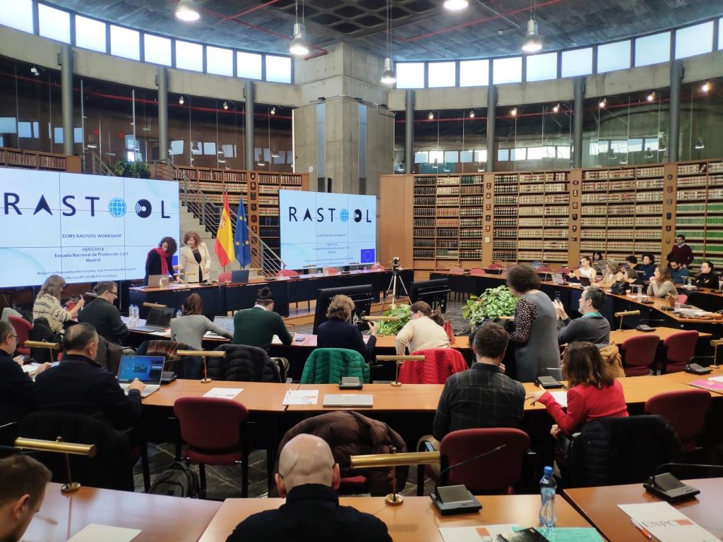
RASTOOL project workshop February 29, 2024. National School of Civil Protection, Madrid, Spain
European Ground Motion Service (link to Copernicus service: European Ground Motion Service - Copernicus Land Monitoring Service) provides information on natural and anthropogenic land surface movement phenomena in Europe with millimetre accuracy.
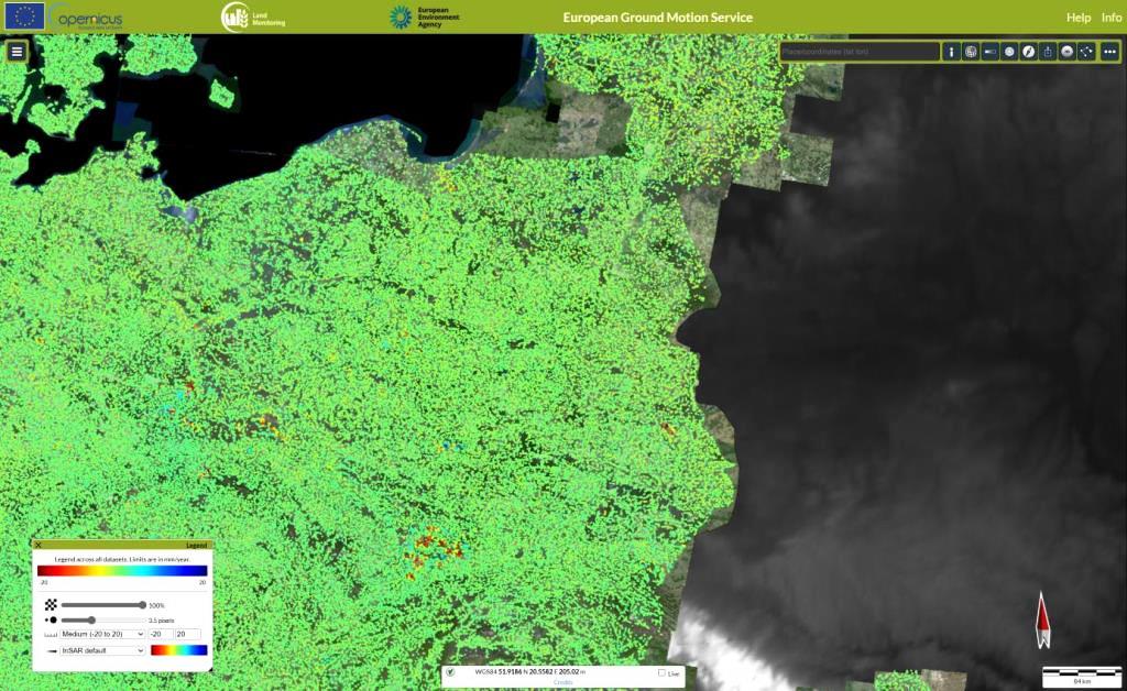
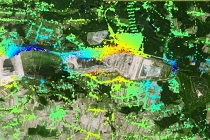
European Ground Motion Service Viewer - deformation data viewer. Zoom in to view of Poland. Green points indicate ground stability, blue lifting, yellow and red subsidence
EGMS provides free of charge annually updated products derived from the processing of Sentinel-1 scenes by satellite radar interferometry. Thanks to this, a wide range of users have access, in many cases for the first time, to nationwide results of land deformation measurements. However, past experience at national level with similar services has shown that while this type of product is appreciated by the scientific community, it is not well received or widely used by civil protection authorities.
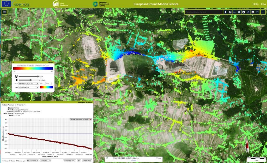
European Ground Motion Service Viewer - deformation data viewer. Example of data in an area where land surface changes are occurring. Belchatów mine. In the lower left corner, a time graph of the displacement of selected points
The service provides a very large amount of data, the analysis of which is time-consuming and difficult to interpret. To address this problem, the RATOOL project aims to equip the institutions concerned with the right tools to simplify EGMS data. This will enable civil protection authority specialists to automatically analyse the results and generate maps to support the assessment of the occurrence of deformation and risk in relation to geohazards.
It is also worth mentioning that PGI-NRI is implementing the project "Interferometric Monitoring of the Polish Land Surface", as a result of which it will be possible to download a map of deformations occurring in the country in the vertical and horizontal directions as early as June.
Text: Maria Przyłucka
 PGI-NRI offer
 Mineral resources of Poland
  Oil and Gas in Poland


 Subscribe to RSS Feed