 On June 17-22, PGI-NRI representative Katarzyna Jóźwik from the Department of Geological Cartography participated in the 9th International Conference on Cartography and GIS in Nessebar, Bulgaria.
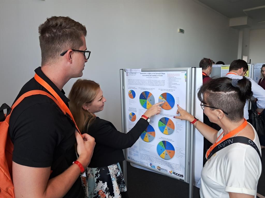
She chaired a plenary session entitled. "GIS for Geology, Natural Sciences and Ecosystems" and presented a poster entitled "Stakeholders Insights on the Geological Maps Accessibility and Usability in Poland".
This year's conference was attended by 140 people from 27 countries. They included representatives from both academia and public institutions as well as business and technology companies. The conference was organised by the Bulgarian Cartographic Association in cooperation with the International Cartographic Association (ICA).
The primary aim of the biennial conference is to gather knowledge and exchange experiences on the latest developments in cartography and GIS. The conference was divided into 17 thematic sessions on topics including: map design and production, photogrammetry and remote sensing, 3D cartographic modelling, cartographic visualisation, web cartography and digital atlases, geospatial analysis and data mining, GIS for geology. There were also 5 poster sessions and 4 meetings of ICA thematic committees.

Participants of the 9th International Conference on Cartography and GIS
A PGI-NRI representative attended a meeting of a commission operating under the aegis of the International Cartographic Association (ICA Commission on maps and the Internet). The commission studies and identifies trends in maps published on the Internet and online maps (these are two different cases), disseminates knowledge and prepares educational materials and workshops in this area.
- The poster I presented showed selected results of a survey carried out in the framework of the WPKG project to identify stakeholders' needs regarding the availability and use of geological maps in the context of PGI-NRI's efforts to bring cartographic data in line with international standards and the so-called FAIR principle. This principle implies that data should be easy to find, readily available (under open licences and in commonly used formats), interoperable and ready for reuse (Findable, Accessible, Interoperable, Reusable). The topics presented were met with great interest by the conference participants, according to whom the results of this type of analysis should be presented much more often and used as a basis for designing and choosing how to publish maps and cartographic data, explained Katarzyna Jóźwik.

Katarzyna Jóźwik presents a poster
The plenary session she chaired, entitled."GIS for Geology, Natural Sciences and Ecosystems" was filled with presentations on the support of GIS software in conducting analyses and delineating areas of varying characteristics in terms of landscape maps and flood risk maps, among others. Discussions included how maps and spatial data can be made available to external users, how they can be used for numerical terrain model analyses and geological and hydrogeological data.
- Several issues raised during the conference deserve special attention. For example, the issue of trust in maps according to their origin, i.e. how to “prove” to users that our data is up-to-date, accurate and factually correct. In addition, the use of artificial intelligence for mapping was worth noting. Globally, the term GeoAI is increasingly used to refer to the 'collaboration' of artificial intelligence (AI) with geospatial data. However, the examples presented at the conference indicate a lack of mature solutions in this area, particularly when it comes to AI's generation of polygons on maps based on preset written guidelines, although significant progress can be seen here compared to previous years, said Katarzyna Jóźwik.
Abstracts of all presentations and posters are available at: https://easychair.org/smart-program/9ICCGIS2024/
Text: Artur Baranowski


 PGI-NRI offer
 Mineral resources of Poland
  Oil and Gas in Poland


 Subscribe to RSS Feed