


 Huge resources of geological data, maps and information about the results of research of Polish Geological Institute, are at your fingertips. Completely free, without any login and password! Just pick up the phone or tablet and take advantage of the new application GeoLOG.
Central Geological Database (CBDG) is Poland's largest collection of digital data in various fields of geology and related sciences. One of the key activities undertaken within CBDG is a broad sharing of data via the Internet. Most of this data is a spatial data.
Constant and rapid increase in popularity of mobile devices leads to the phenomenon of effective support or even to crowd out conventional computers in many areas. Therefore, under the project CBDG was established yet another, the second mobile application to view the geological data on maps. Therefore, under the project CBDG was established yet another, the second mobile application for viewing geological data on maps. Experience gained during the use of the first mobile application Geologia (2012) and technological progress in the field of software dedicated for mobile devices have allowed to build a qualitatively new product an application GeoLOG. By increasing the efficiency of operations and new functionalities geologist greatly expands the possibilities of access to data.
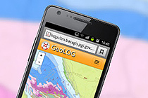
Application GeoLOG is available at: https://geolog.pgi.gov.pl/
The list of changes and improvements have been made in GeoLOG compared to the first application is long but just a normal, everyday operation shows the convenience of this tool. The main innovations implemented in the application:
- Dividing the information into thematic blocks for easy search among the many layers of information.
- Easily accessible information about the sets of maps
- Selecting the base map from a set of 8 different composition.
- Searching for a location on a map by typing geographical names, for example. Babia Gora or addresses such as Warsaw, Rakowiecka 4.
- Innovative mechanism to facilitate selection of small objects on the screen using the zoom effect within the selection radius depending on the length of your finger pressed (the mouse version of the desktop).
- The possibility of moving straight ahead, from the selected on the map object, to other specialized applications presenting detailed data about an object.
- High-quality maps legend dynamically generated using standard SVG instead of using raster file yet with a weaker quality.
- Editing functions allow the user to add custom tags on the map with descriptions and enriching content by the photos or movies.
- Collecting user's own map compositions on his device (phone, tablet, computer) in the tab "My Maps" as well as save them as files to be used later on other equipment
- GPS tracking witch markers.
- Optimizing the speed of downloading maps from the server by allowing switching display maps from PNG to JPG. JPG files have a smaller volume and thus can be quickly transmitted over the network, but does not allow the effective use of transparency. Therefore, they can be applicable in cases when you uses a single layer. For large map compositions consisting of multiple layers it is necessary to use PNG files that can maintain the transparency (this is the default setting in the application).
- Something that at first glance it is impossible to notice - a better and more efficient way to communicate user with the server. The previous way of downloading maps using WMS replaced by REST service, which affects the higher rate of loading maps.
In addition to new capabilities GeoLOG retains the functionality known from previous applications Geologia such as:
- Location using GPS and GSM signal
- Publication of your own maps on popular social networks or upload links to them by e-mail.
- Reading any additional maps using web services WMS.
- The possibility of using it as an ordinary application on standard PC.
The application GeoLOG contains (besides the basic maps) 13 thematic groups of geological data:
- Boreholes, research sites
- Surface geology
- Bedrock geology
- Engineering geology
- Hydrogeology
- Geophysics
- Baltic geology
- Mineral resources
- Geochemistry
- Geothermy
- Geohazards
- Geodiversity
- Historical maps
Each thematic group comprising several layers which often have a many sublayers. They are generated from 67. REST services. Including basic maps app contains more than 250 layers.
It is worth mentioning the fact that GeoLOG is the first application that has been built using running in PGI-NRI Continuous integration system. This environment has been implemented within the project CBDG by the way of building this application. The main components of this specific "software factory" are repositories of source code, such as SVN, Bitbucket, Github, version control systems: TortoiseSVN, Git, SourceTree, and issue tracking system, ie. bugtracker. Finally, Jenkins combines all in to an efficiently tool for automated testing and sotware development. This new software development process enables creation and facilitates the implementation of subsequent versions of the new software. This new way of software development facilitates this process and simplifies the deployment subsequent versions of the new software.
Text and translation: Wojciech Paciura
 PGI-NRI offer
 Mineral resources of Poland
  Oil and Gas in Poland


 Subscribe to RSS Feed