Engineering-geological Map of Poland at a scale of 1:50 000

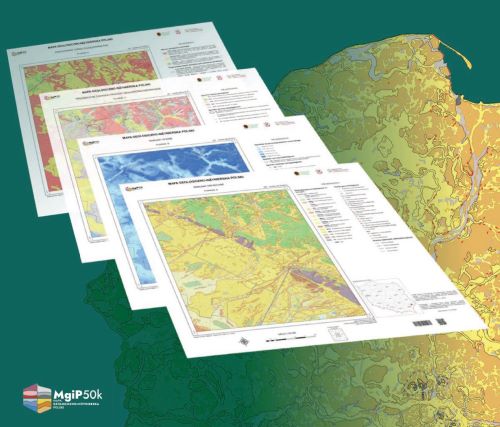
Engineering-geological Map of Poland at a scale of 1:50,000 (MgiP50k) - a digital cartographic project on geological and engineering conditions in Poland.
MgiP50k presents, in sheet format, a geological -engineering assessment of land areas, along with their geomorphological conditions, and describes construction conditions, major geodynamic and geological-engineering phenomena, as well as geological hazards, enabling a comprehensive understanding of geological, geological-engineering (geotechnical), and hydrogeological conditions.
- ABOUT PROJECT
- OBJECTIVES
- METHODOLOGY
- Status of Implementation
- Results
- Data Access
- How to cite
- SIGNIFICANCE OF THE PROJECT
ABOUT PROJECT
TITLE OF THE PROJECT
Development and preparation for the digital release of geological and engineering maps of Poland at a scale of 1:50,000 to expand the CBDG’s digital collection (ongoing task of polish geological survey)
TIMEFRAME FOR THE CURRENT PHASE
01.01.2024 – 31.12.2025
CONTRACTING AUTHORITY/FUNDING AGENCY
Projects funded by the National Fund for Environmental Protection and Water Management (NFOŚiGW):
Updating and preparing for the release of digital geological and engineering maps at scales smaller than 1:10,000 to expand the CBDG digital repository (2019 - 2021)
Development and preparation for the release of digital geological and engineering maps of Poland at a scale of 1:50,000 to expand the CBDG digital repository (2021 - 2023)
Development and preparation for the release of digital geological and engineering maps of Poland at a scale of 1:50,000 to expand the CBDG digital repository (ongoing task - continuation of the task) (2024 - 2025)
CONTRACTOR
Polish Geological Institute - National Research Institute
RECIPIENTS
Crisis Management Centers at various levels, the State Fire Service, local government and state administration bodies, universities and research institutions, the Polish Armed Forces, citizens of the Republic of Poland
OBJECTIVES
The objective of this task is
- to carry out the state’s responsibilities performed by the Polish Geological Survey in the area of collecting, making available, processing, and archiving geological information (Geological and Mining Law, Article 162, paragraph 1, points 2 and 3),
- to expand the digital collection of the Central Geological Database (CBDG), including the Geo-engineering Database (BDGI),
- to supplement the series of geological maps of Poland at a scale of 1:50,000 with geological and engineering map sheets,
- to enhance national security.
METHODOLOGY
The current version of the methodological guide (as of March 31, 2023), titled Engineering-geological Map of Poland at a scale of 1:50 000 - Methodology for Preparation, Publication, and Updating is available for download HERE
Status of Implementation
Engineering-geological Maps of Poland at a scale of 1:50 000

MgiP50k – Pilot sheets completed in 2021-2023
- 0027 - Gdańsk
- 0550 - Turek
- 0927 - Józefów
- 0991 - Zebrzydowice
MgiP50k – Sheets completed in 2024-2025
reissue of SmgiP (Detailed Engineering-geological Map of Poland):
- 0487 - Legionowo
- 0488 - Radzymin
- 0909 - Pyskowice
- 0910 - Bytom
- 0911 - Wojkowice
- 0943 - Katowice
in accordance with MPGN task:
- 0795 - Jelenia Góra
- 1012 - Bielsko-Biała
- 1013 - Lachowice
- 1014 - Sucha Beskidzka
- 1032 - Rabka
- 1033 - Mszana Górna
- 1052 - Muszyna
- 1053 - Tylicz
- 1062 - Leluchów with 1083 Leluchów S (Kamienica)
for offshore wind farms and first nuclear plant:
- 0003 - Łeba
- 0004 - Choczewo
- 0005 - Sławoszyno with 1070 - Sławoszyno N (Karwia)
for the needs of national defence:
- 0150 - Rudawka
- 0188 - Rygałówka
MgiP50k – sheets planned for 2026-2028
for the needs of national defence:
- 0039 - Czarnowo Średnie
- 0040 - Żytkiejmy
- 0041 - Wiżajny
- 0042 - Poszeszupie
- 0071 - Filipów
- 0072 - Jeleniewo
- 0073 - Puńsk
- 0074 - Widugiery
- 0108 - Suwałki
- 0109 - Krasnopol
- 0110 - Sejny
- 0111 - Veisiejai
- 0148 - Stacja Augustów
- 0149 - Rygol
- 0187 - Lipsk
- 0226 - Nowy Dwór
Results
Tangible outputs:



DIGITIZED MAP SHEETS
Digitized map sheets from the analog Detailed Engineering-geological Map of Poland (SmgiP) at a scale of 1:50,000:
- Sheet A: lithological and genetic classification of soils occurring at the surface and at a depth of 2 m, including geomorphological subdivisions,
- Sheet B: geological and engineering classification of construction areas, including their characteristics.
Sheets: Legionowo (0487), Radzymin (0488), Pyskowice (0909), Bytom (0910), Wojkowice (0911) and Katowice (0943)
Legionowo (0487)
The sheet is available in:
- mobile app GeoLOG
- map portal Geologia
- as a downloadable file
Radzymin (0488)
The sheet is available in:
- mobile app GeoLOG
- map portal Geologia
- as a downloadable file
Pyskowice (0909)
The sheet is available in:
- mobile app GeoLOG
- map portal Geologia
- as a downloadable file
Bytom (0910)
The sheet is available in:
- mobile app GeoLOG
- map portal Geologia
- as a downloadable file
Wojkowice (0911)
The sheet is available in:
- mobile app GeoLOG
- map portal Geologia
- as a downloadable ile
Katowice (0943)
The sheet is available in:
- mobile app GeoLOG
- map portal Geologia
- as a downloadable file
METHODOLOGICAL GUIDELINES
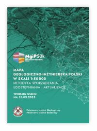 Engineering-geological Map of Poland at a scale of 1:50,000. Methodology for Preparation, Publication and Updating (as of March 31, 2023)
This methodology presents and adapts the principles for preparing the Engineering-geological Map of Poland at a scale of 1:50,000 (MgiP50k) to today’s needs and requirements. It serves as the document governing work related to the maintenance of the database for the Engineering-geological Map of Poland at a scale of 1:50,000 (BDMgiP50k) and cartographic production. The vector information layers created on this basis expand the digital resources of the Central Geological Database (CBDG), including the Geo-engineering Database (BDGI), while the MgiP50k map sheets produced from them supplement the standard 1:50,000-scale maps of Poland produced by PGI-NRI. Download
PILOT MAP SHEETS
Pilot sheets of the cartographic study “Engineering-geological Map of Poland at a scale of 1:50,000” (MgiP50k), sheets Gdańsk (0027), Turek (0550), Józefów (0927), Zebrzydowice (0991)
- Sheet A - soil conditions,
- Sheet B - hydrological conditions,
- Sheet C - adverse geological and engineering phenomena and processes,
- Sheet D - Suitability of the terrain for construction
Data Access
The data is available for download via the GeoLOG app, which is available free of charge for mobile devices on Google Play and App Store as well as through the Portal CBDG - Geologia under the BUIDLING tab.
The information presented on the MgiP50k sheets is for reference purposes only and under no circumstances can it replace the need to conduct geological-engineering and geotechnical investigations. The map is intended for use at a scale of 1:50,000 and smaller (e.g., 1:100,000, 1:200,000). Using the map at larger scales is inappropriate and may lead to false conclusions.
The provider assumes no liability for any defects in the MgiP50k map sheets made available. It is recommended that the information be used for reference purposes only and that a detailed analysis of the source archival materials (as available) be conducted, along with fieldwork.
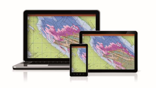
Mobile app GeoLOG

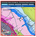
Map portal Geologia
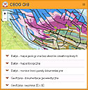
CBDG GIS
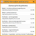
Download manager
SIGNIFICANCE OF THE PROJECT
Geological-engineering maps are cartographic studies that present a geological-engineering assessment of land areas, including their morphogenesis or geomorphological conditions. They describe the geological-engineering and/or construction conditions in a selected area, as well as the main geodynamic and geological-engineering phenomena and geological hazards. As a result, geological-engineering maps provide a comprehensive understanding of geological, geological-engineering (geotechnical), and hydrogeological conditions.
It should be emphasized that the role of geo-engineering maps is now significantly different from what it was just over a decade ago. These maps are no longer used solely to obtain data to support the design of building foundations. The country’s dynamic development, the increase in the number of planned strategic investments, and the geopolitical situation have brought about a shift in the approach to supraregional land use and spatial management.
Data from geo-engineering maps, especially those at medium and small scales (1:25,000, 1:50,000, and smaller), are in high demand. Among other things, this data is used for general land-use planning, strategic infrastructure planning, detailed design of construction projects (including strategic ones), and, notably, in defense structures.
The fact that geo-engineering maps are extremely important is evidenced by the fact that, just as in Poland, many countries produce geological-engineering and geotechnical maps-or maps containing such elements-with the assistance of geological services and institutes. Medium- and small-scale geological-engineering (geotechnical) cartographic studies (maps and/or layers) are used there in various sectors of science, the economy, and industry - ranging from land-use planning and natural resource management, through geological risk assessment, to civil engineering. Among the following countries are particularly noteworthy:
- Spain: The Geological and Mining Institute of Spain (IGME-CSIC) has produced engineering geological maps at scales of 1:25,000 and 1:50,000, which are used for natural resource management, land-use planning, and geological hazard assessment.
- France: The French Geological Survey (BRGM) has developed engineering geological maps at scales of 1:25,000 and 1:50,000 to support natural resource management and geological hazard assessment.
- United Kingdom: The British Geological Survey (BGS) has produced engineering geological maps at scales of 1:10,000 and 1:25,000, supporting major construction and civil engineering projects.
- Belgium: The Geological Survey of Belgium (GSB) has developed engineering geological maps at scales of 1:25,000 and 1:50,000, which are used for spatial planning, natural resource management, and geological hazard assessment.
- United States: The United States Geological Survey (USGS) has produced geological and engineering geological maps at scales of 1:24,000 and 1:50,000, which are essential for natural resource management and infrastructure planning.
- Germany: The Federal Institute for Geosciences and Natural Resources (BGR) has developed engineering geological maps at scales of 1:25,000 and 1:50,000, which are widely used in spatial planning and civil engineering.GME),
Additional examples include the Geological Survey of Canada (GSC), the Hellenic Survey of Geology and Mineral Exploration (HSGME) (formerly the Institute of Geology and Mineral Exploration, IGME), the General Directorate of Mineral Research and Exploration (MTA) of Türkiye, and many other geological surveys worldwide.
The 1:50,000-scale geological and engineering maps of Poland provide a comprehensive, clear, and easy-to-read presentation of geological and engineering conditions (the lithological composition of soils and rocks), geomorphological and hydrogeological (water-related) conditions, as well as adverse geological and engineering phenomena and processes (geological, geodynamic, and geological hazards). The content and layout of the geo-engineering maps are tailored not only for specialized users such as planners, urban planners, and designers, but are also accessible to decision-makers, government officials, and the general public.
From an institutional perspective, geological and engineering maps can be and are used, among others, by institutions such as: Crisis Management Centers at various levels, the State Fire Service, local government and state administration bodies, universities and research institutions, and the Polish Armed Forces, which, given the current situation of international tension, have special needs in this regard.
In summary, the objective justification for carrying out the project titled “Development and Preparation for the Digital Release of Geo-Engineering Maps of Poland at a Scale of 1:50,000 to Expand the CBDG Digital Collection - Ongoing Project, Continuation of the Project” are as follows, among others:
- The 1:50,000-scale geological and engineering map of Poland serves as an aid and foundation for spatial planning at the national administrative level, including central and provincial levels,
- The 1:50,000-scale Engineering-geological Map of Poland serves as an aid in planning and selecting locations for national, provincial, and county construction projects, with particular emphasis on strategic projects,
- The 1:50,000-scale Engineering-geological Map of Poland serves as an aid in teaching, educational, informational, and decision-making activities, The 1:50,000-scale Engineering-geological Map of Poland complements the series of geological maps produced at a scale of 1:50,000. It thus expands the cartographic set of maps illustrating the country’s geological structure and supplements the resources of the Central Geological Database,
- The 1:50,000-scale geological and engineering map of Poland serves as a resource and foundation for the Management of the Geospatial Intelligence and the team at the Military Geographic Center in implementing the provisions of Defense Standard NO-06-A015 (Terrain, Classification Principles: Terrain Assessment at the Operational Level) for the purpose of carrying out geographic security tasks for the Armed Forces of the Republic of Poland, to assist the task coordination team responsible for securing the “eastern border” of the Republic of Poland, with the aim of implementing the provisions of the National Deterrence and Defense Program. The Team’s work, according to information from the Ministry of National Defense’s Department of Infrastructure.