
Maps of mineral deposits occurrence
A set of maps of mineral deposits occurrence constitutes the supplement and the graphic representation of information contained in a publication ‘The balance of mineral deposits resources in Poland’.
Maps have been prepared on a basis of spatial information collected on a regular basis in the System of management and protection of mineral resources in Poland - MIDAS. Main data sources for the MIDAS System, regarding mineral deposits boundaries, are geological documentations of deposits. When a deposit contour cannot be obtained from a documentation, data sources are documents being sent to the Registry of mining areas and closed underground carbon dioxide storage facilities. The maps have been designed for mineral deposits covered by mining ownership (state ownership) – excluding groundwater allocated under minerals – and for the majority of remaining mineral deposits.
In parallel with ‘The balance…’, there are annually elaborated: four maps at scale 1:200,000, two maps at scale 1:500,000 and seven maps at scale 1:1,000,000. In addition, there has been a map presenting all documented mineral deposits in Poland prepared (at scale 1:1,800,000). The maps are being prepared with a state of deposits documentation and development as of the end of the previous year.
The first (I) group contains maps prepared at scale 1:200,000 on which deposits boundaries are presented using contours and signature marks. There are also information on a state of deposits development presented. The map of hard coal deposits occurrence in the Upper Silesian Coal Basin also defines an affiliation of an individual mine to a particular economic entity. The second (II) and third (III) groups contain maps at scale 1:500,000 and 1:1,000,000 on which deposits location is presented using point signatures. These maps contain also information on a state of deposits development and on the volume of deposits resources.
2025
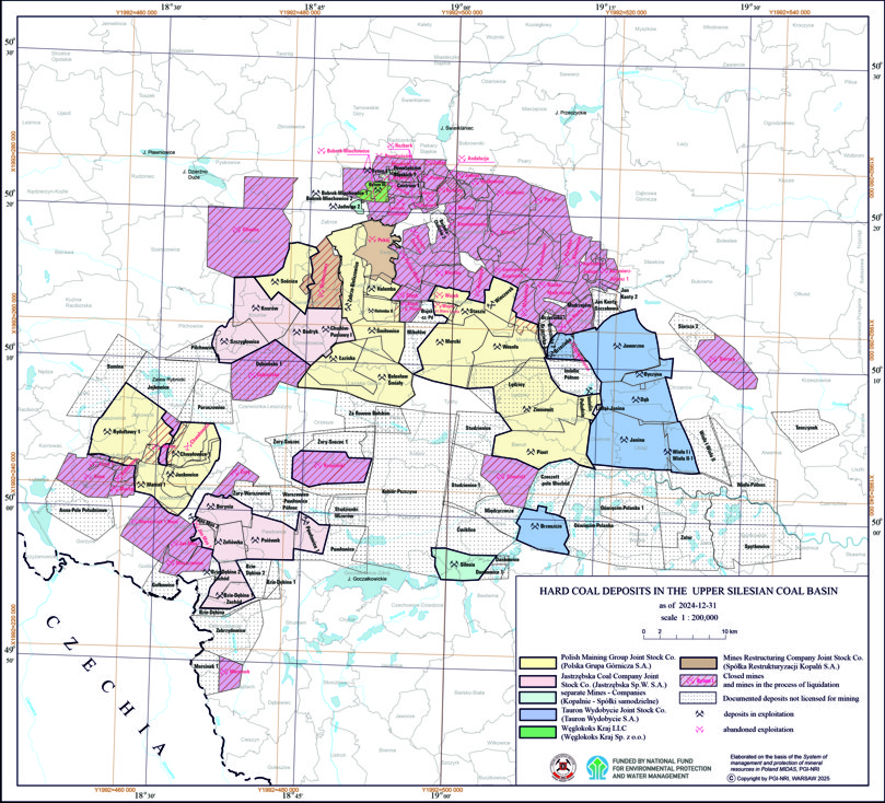
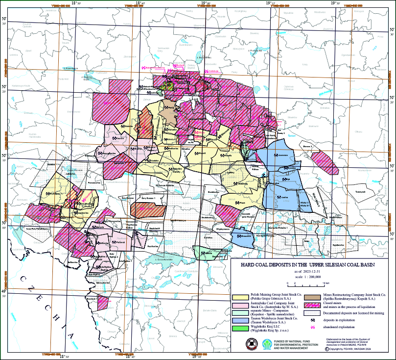
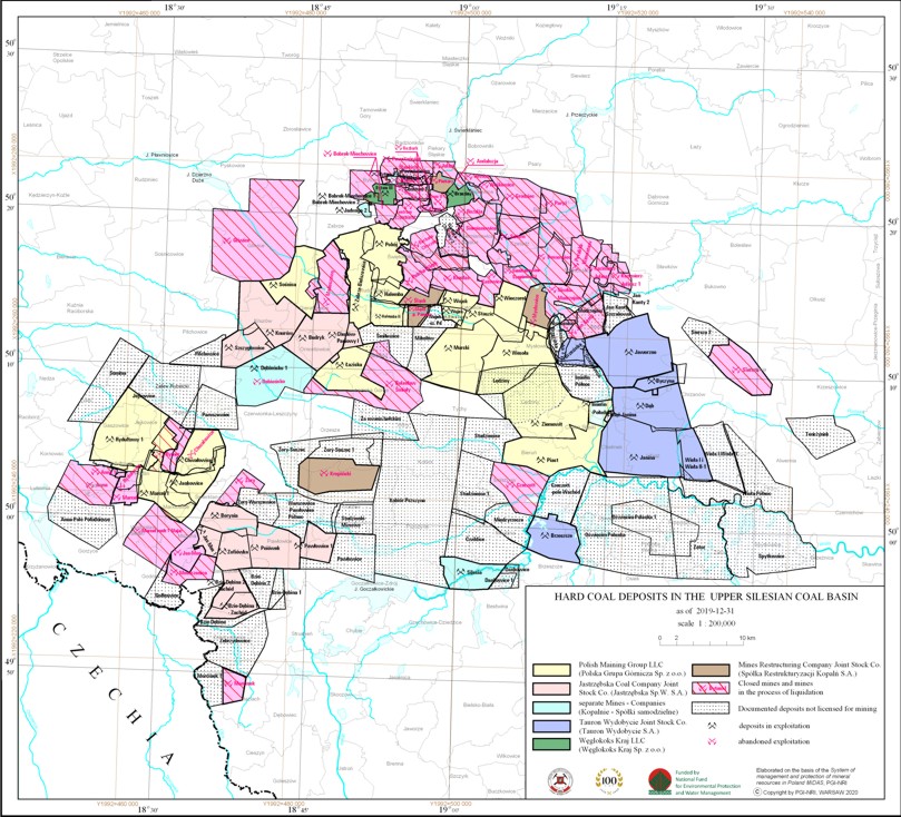
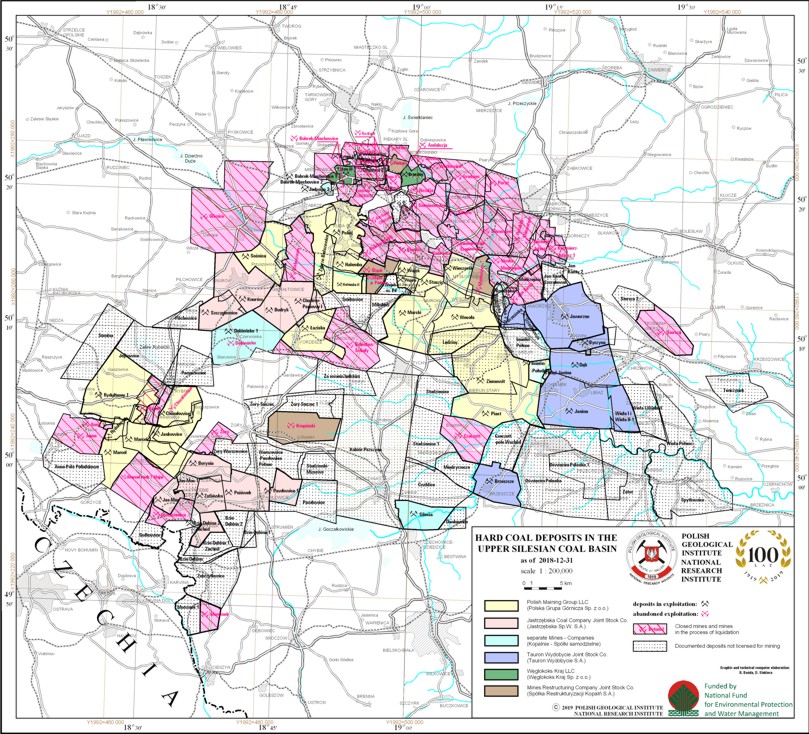
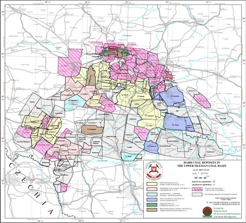
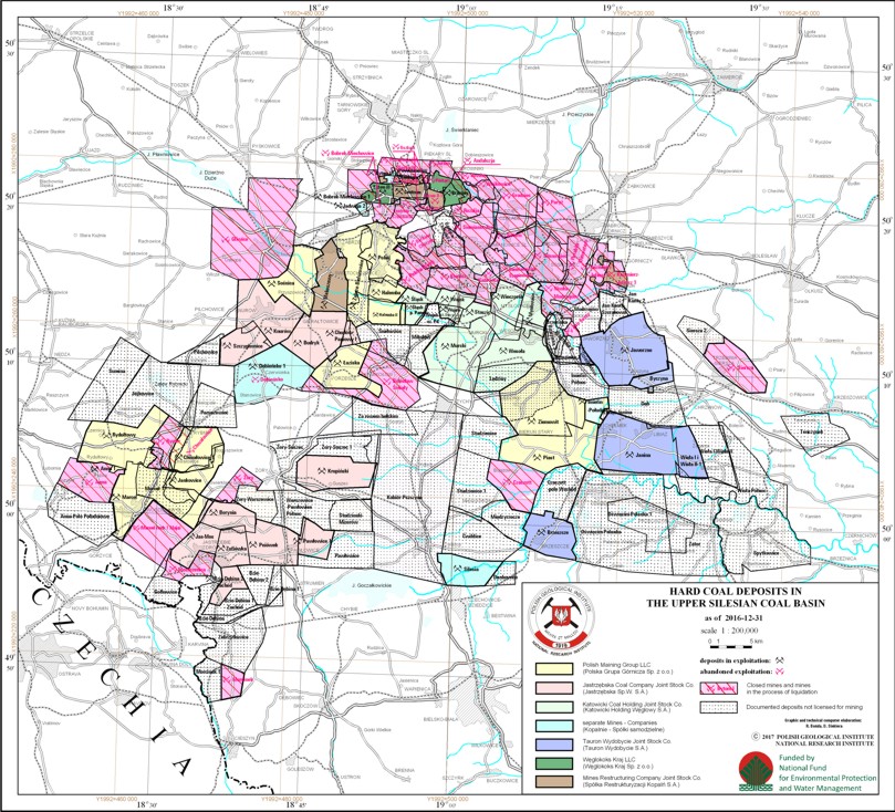
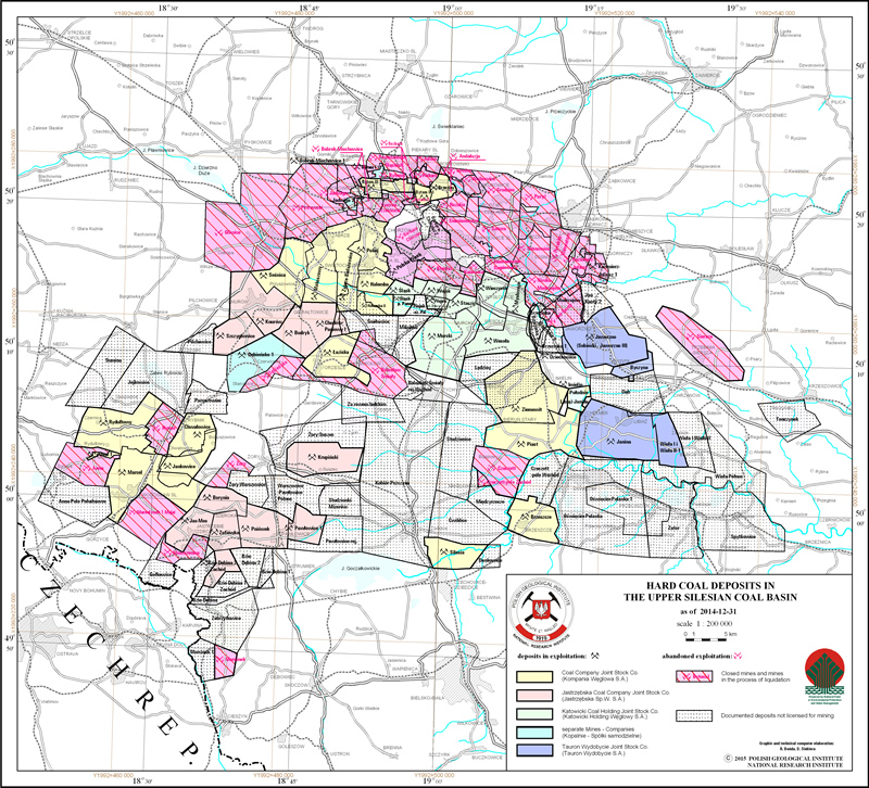
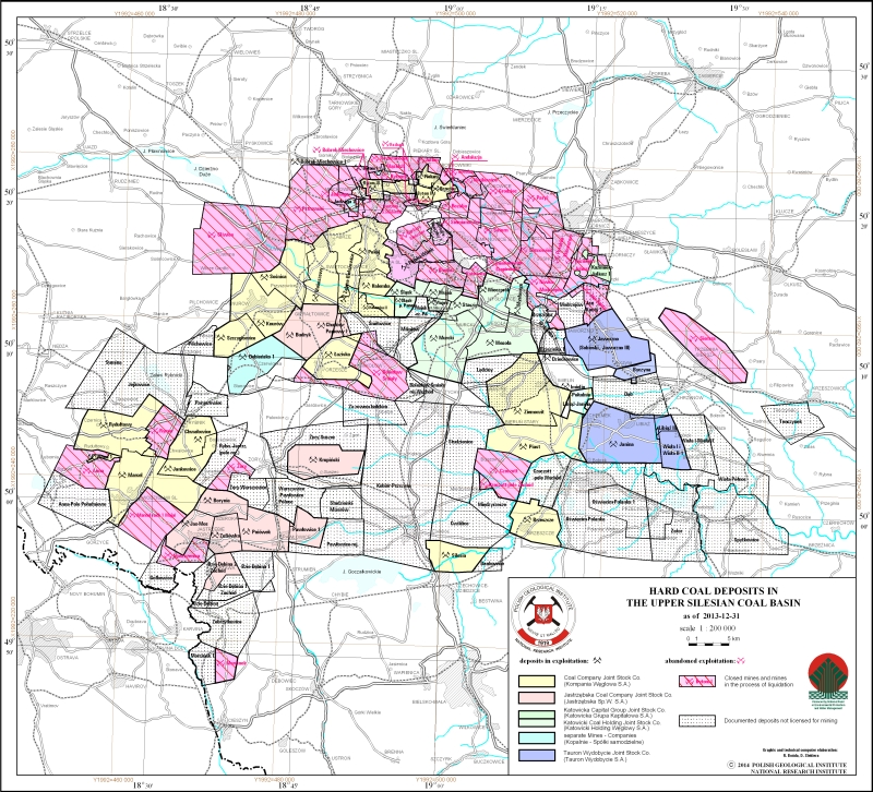
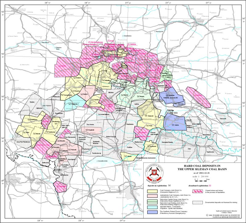
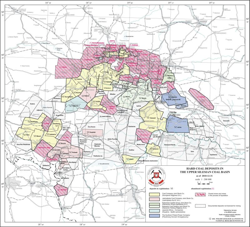
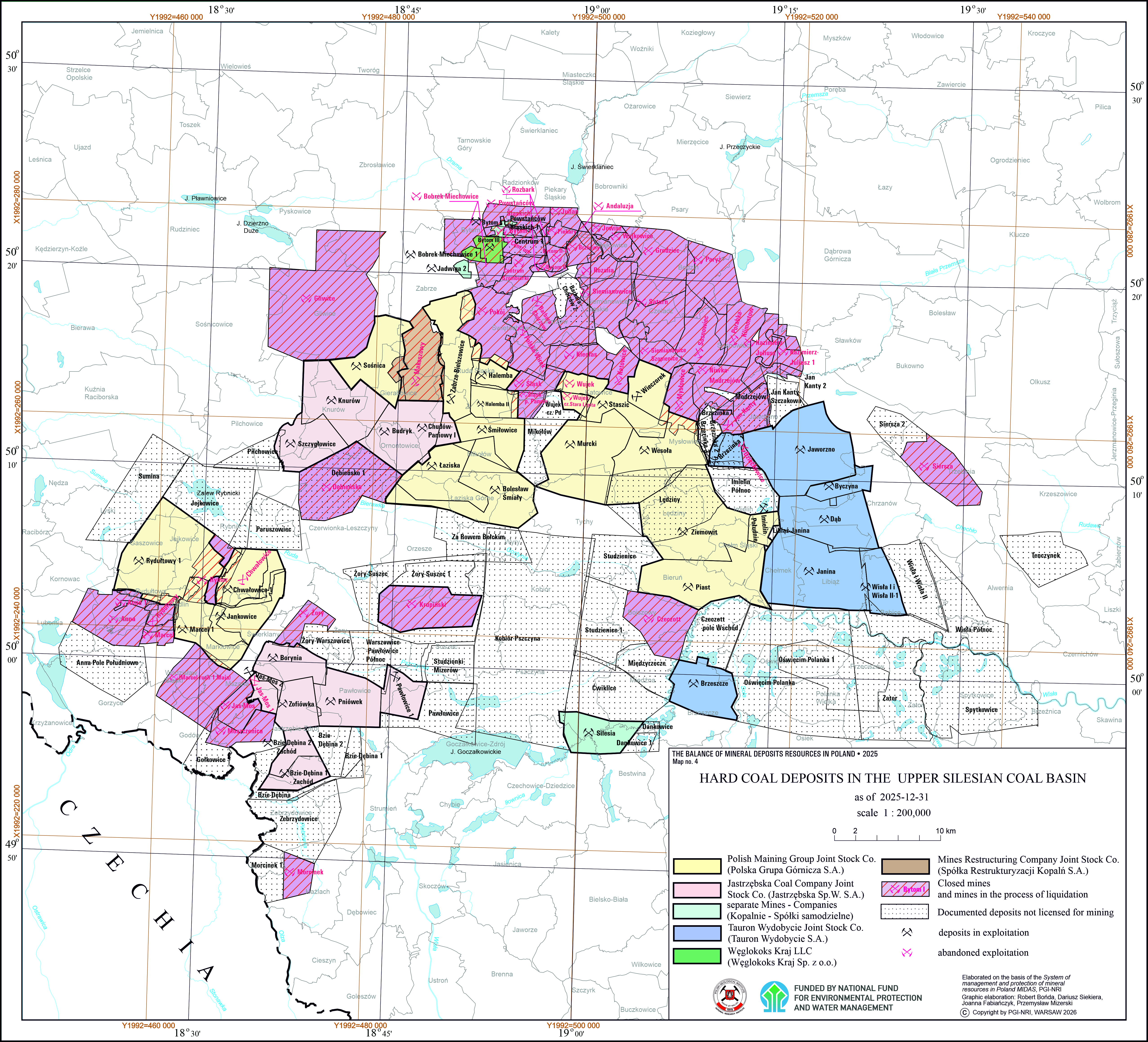
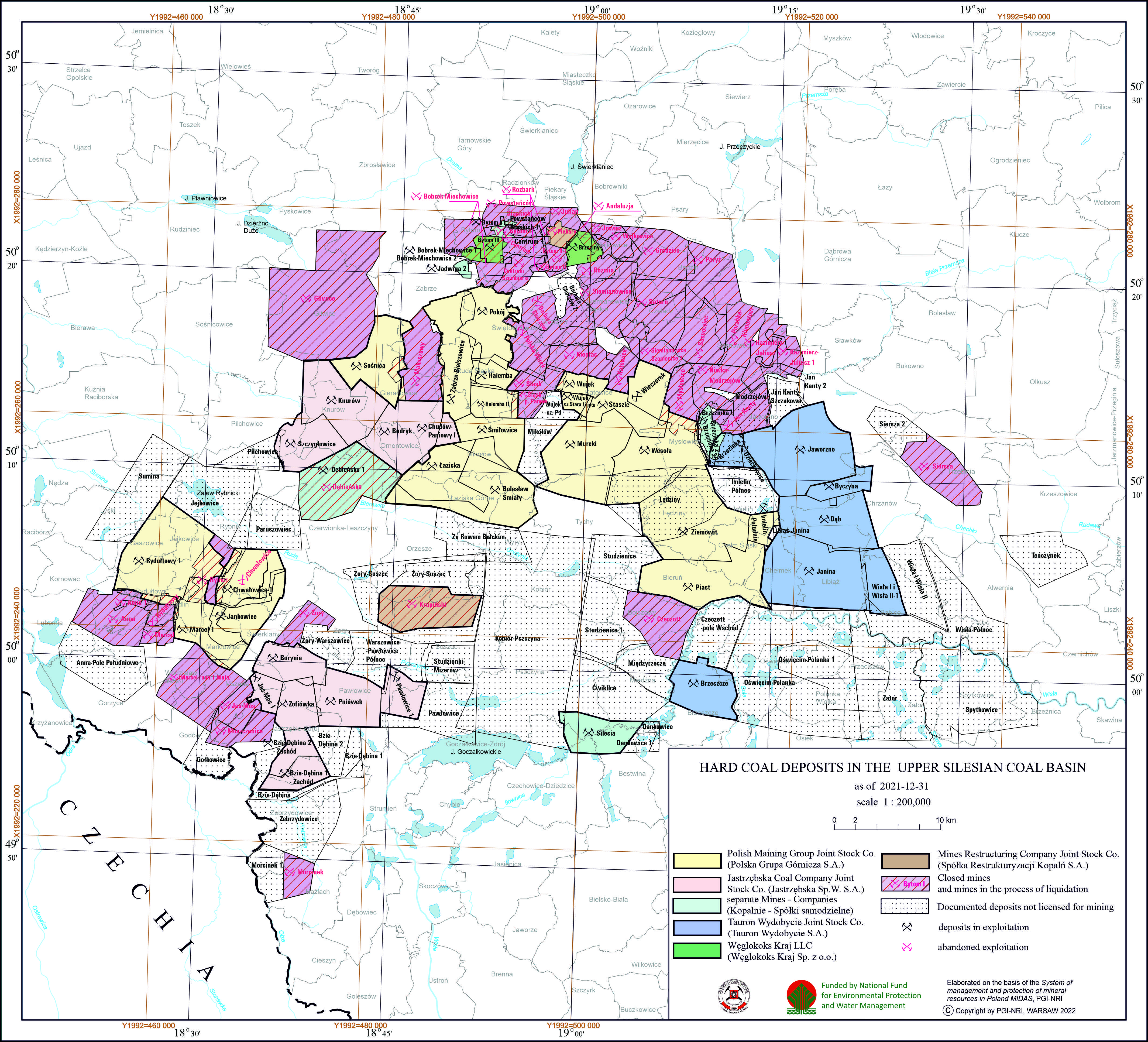
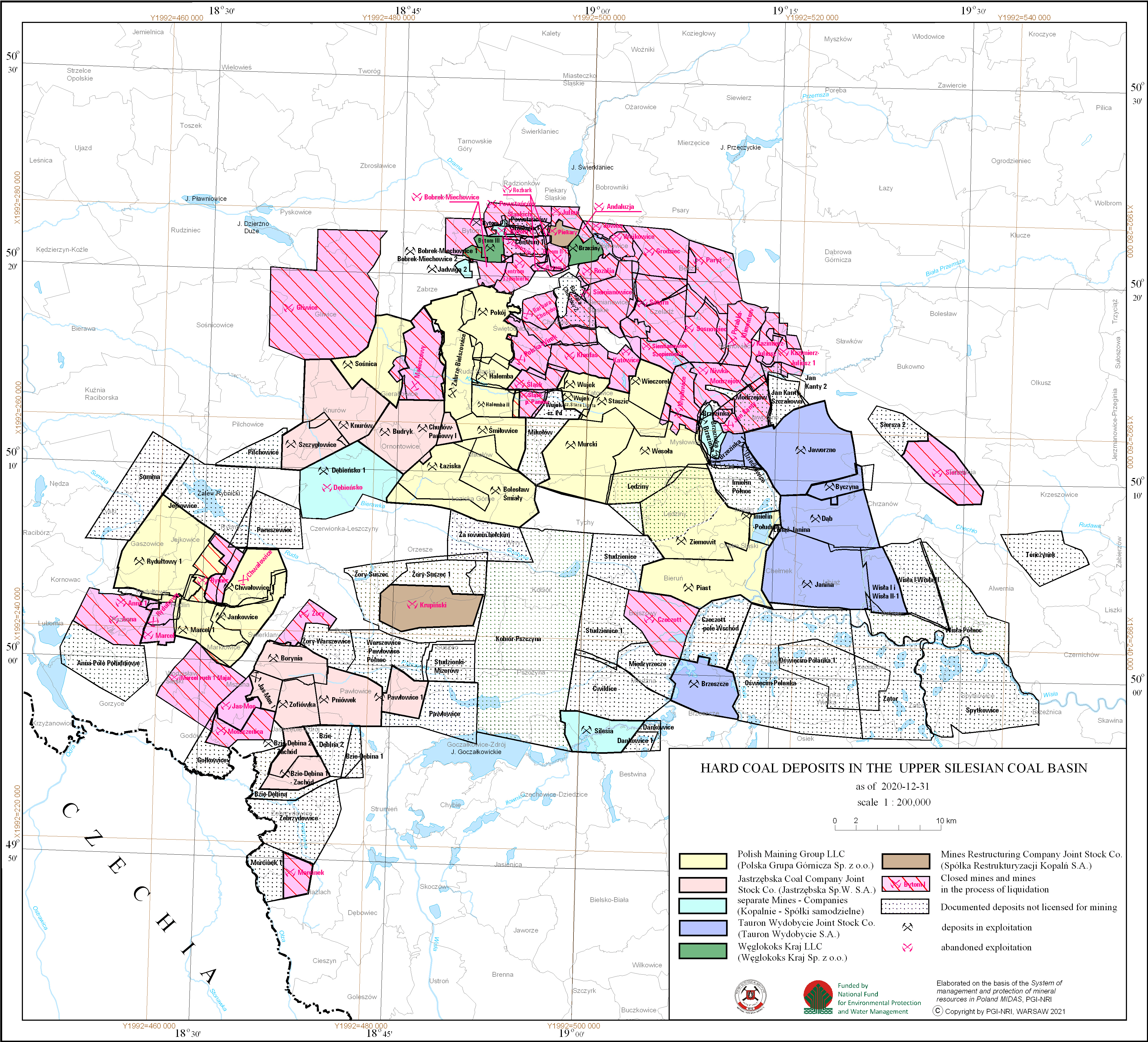
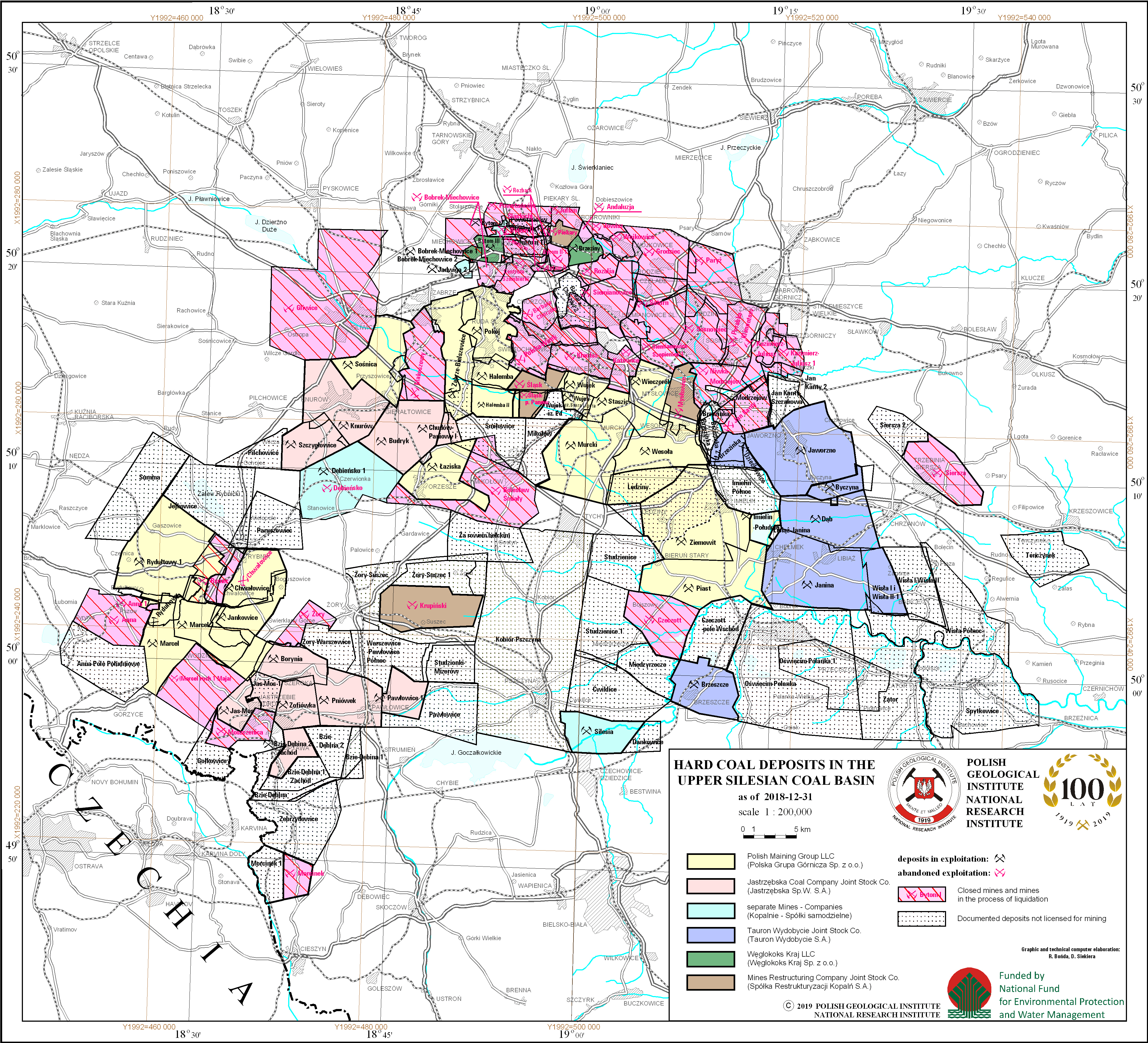
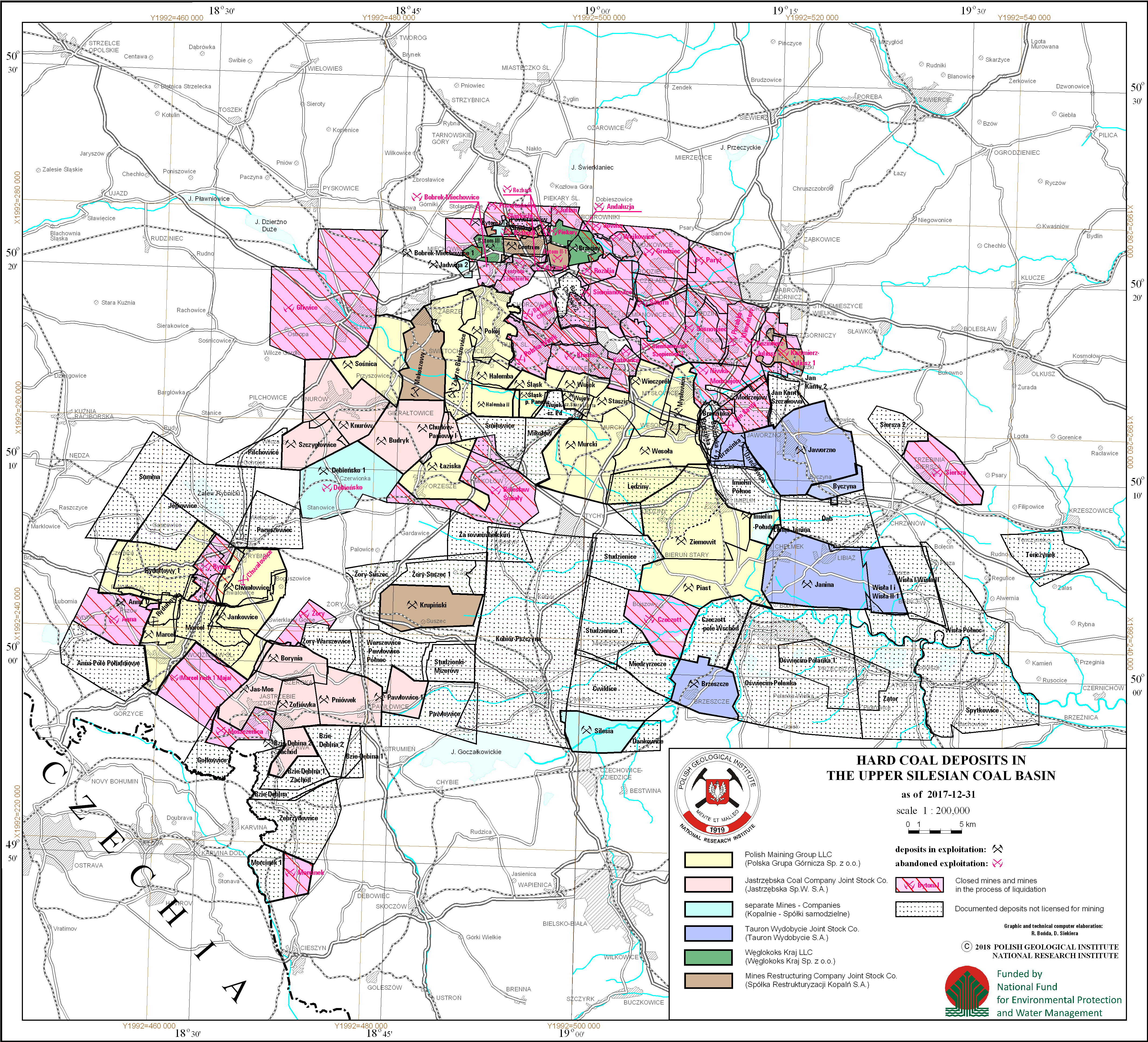
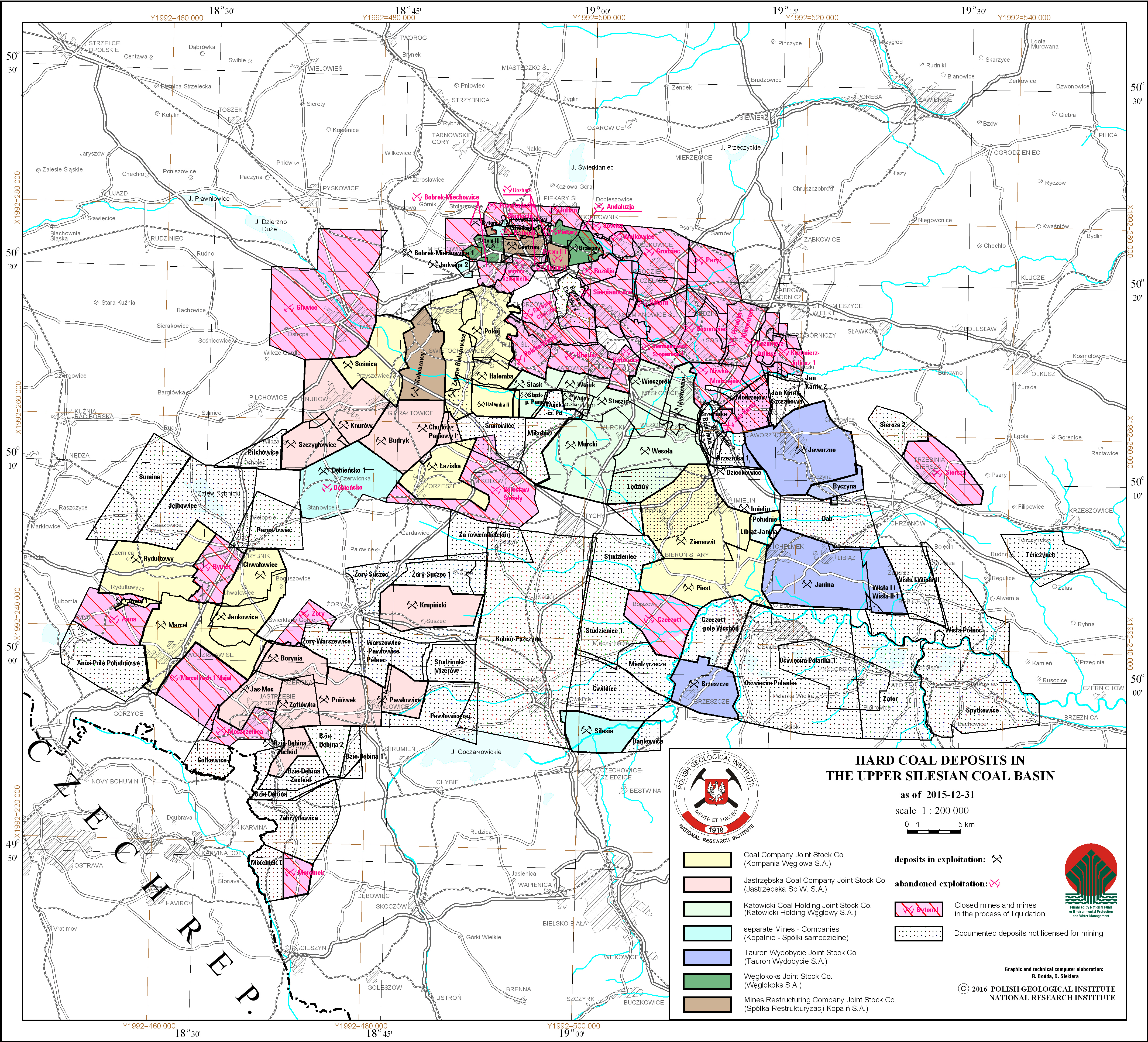
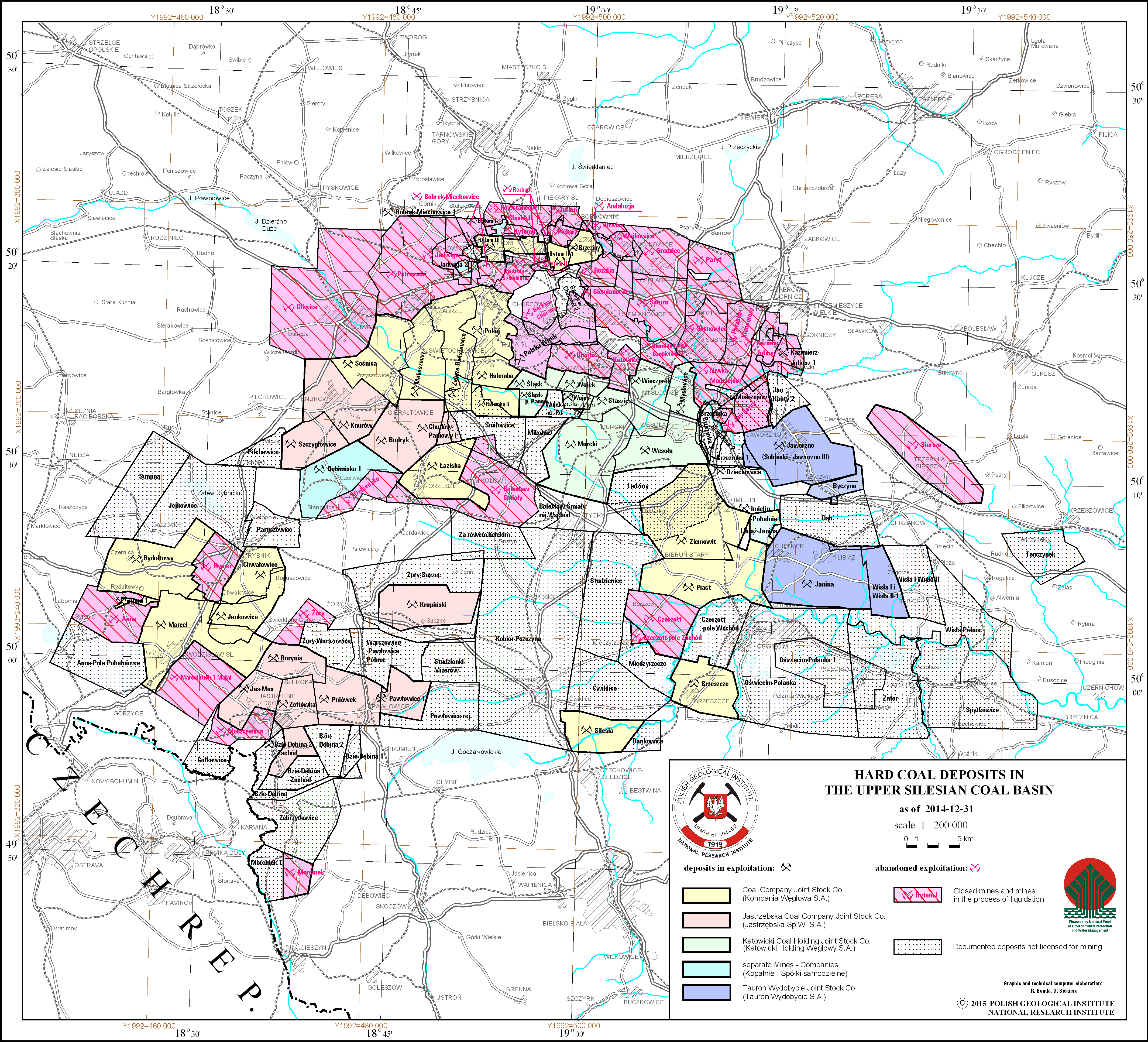
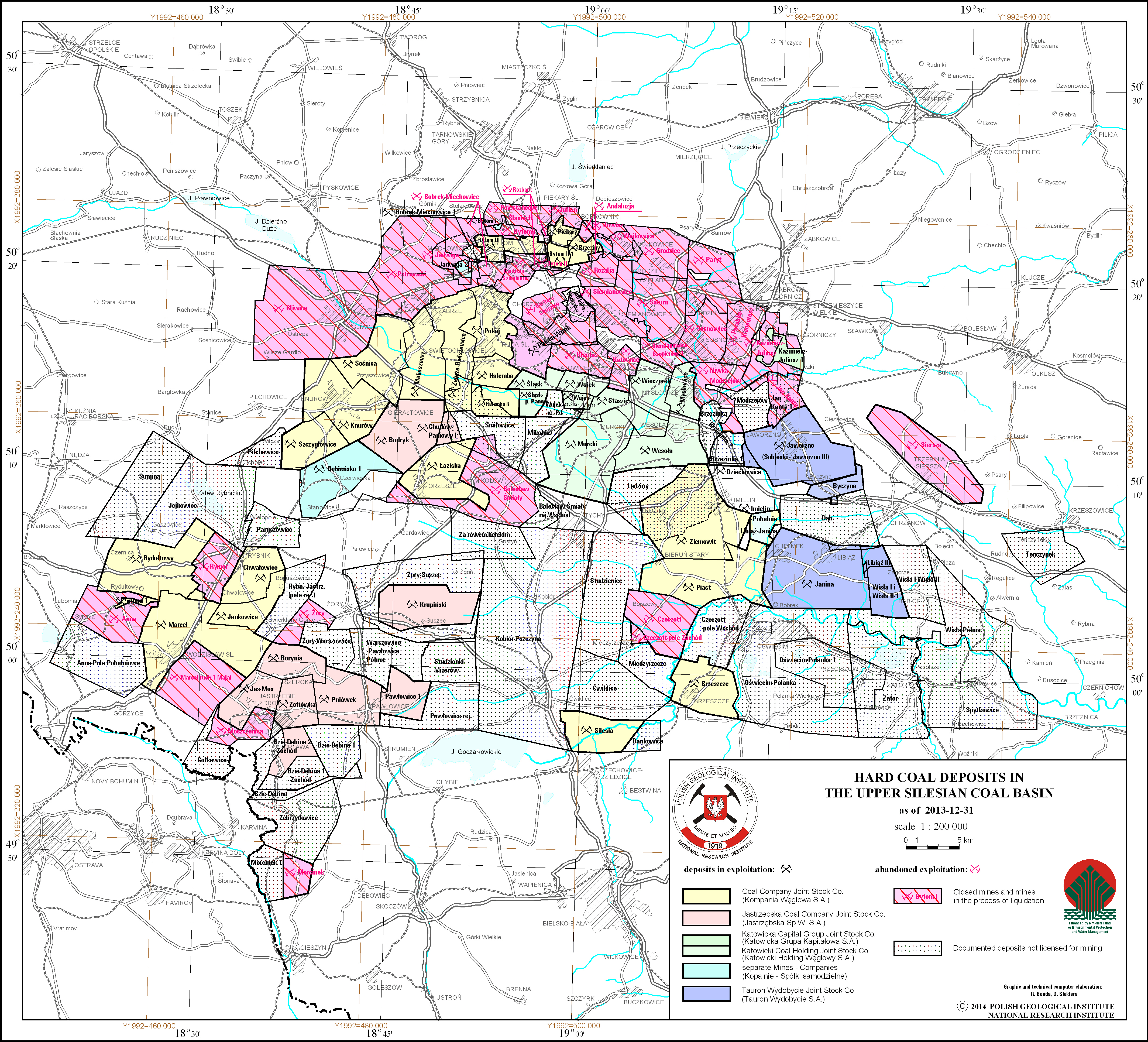
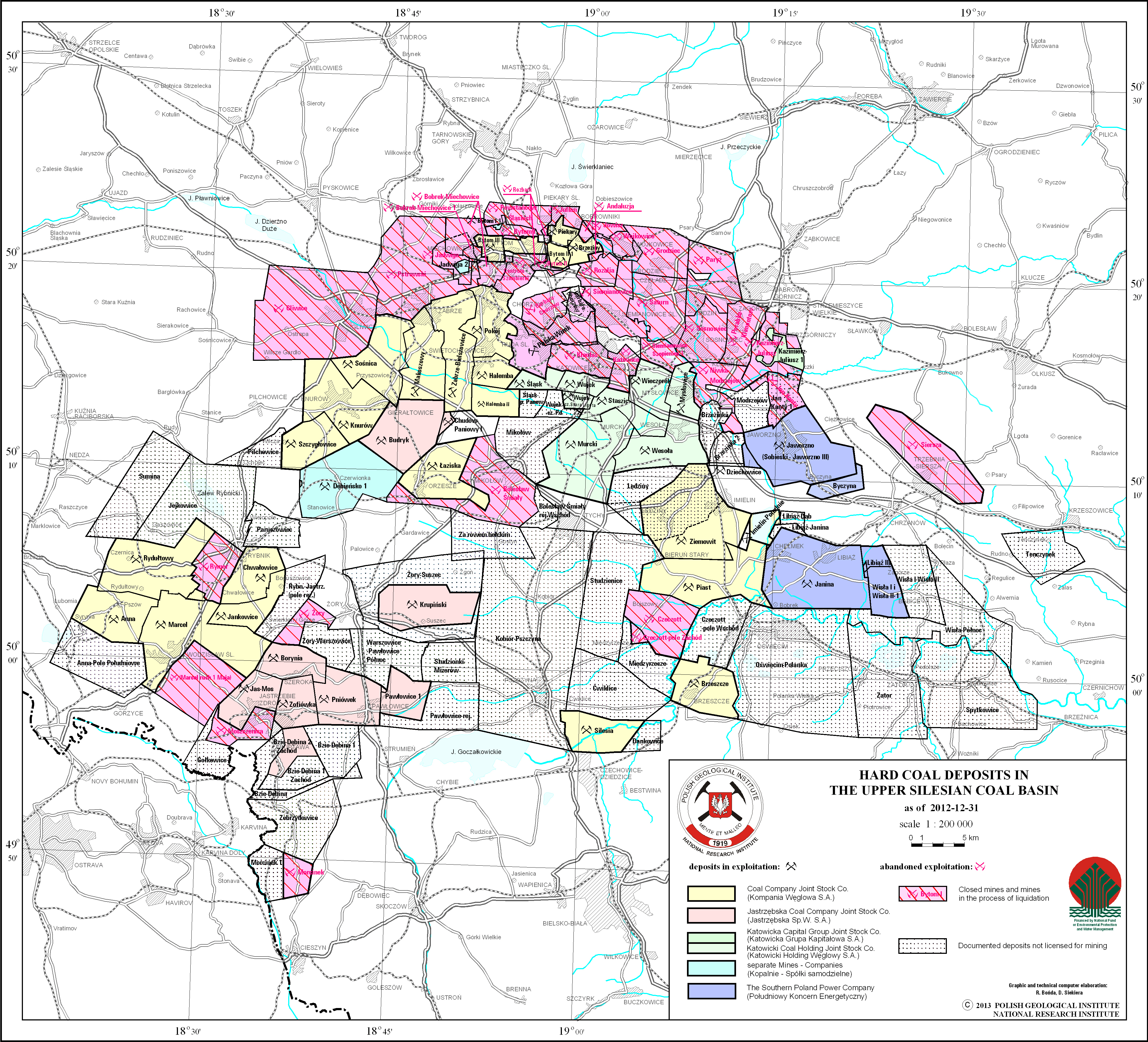
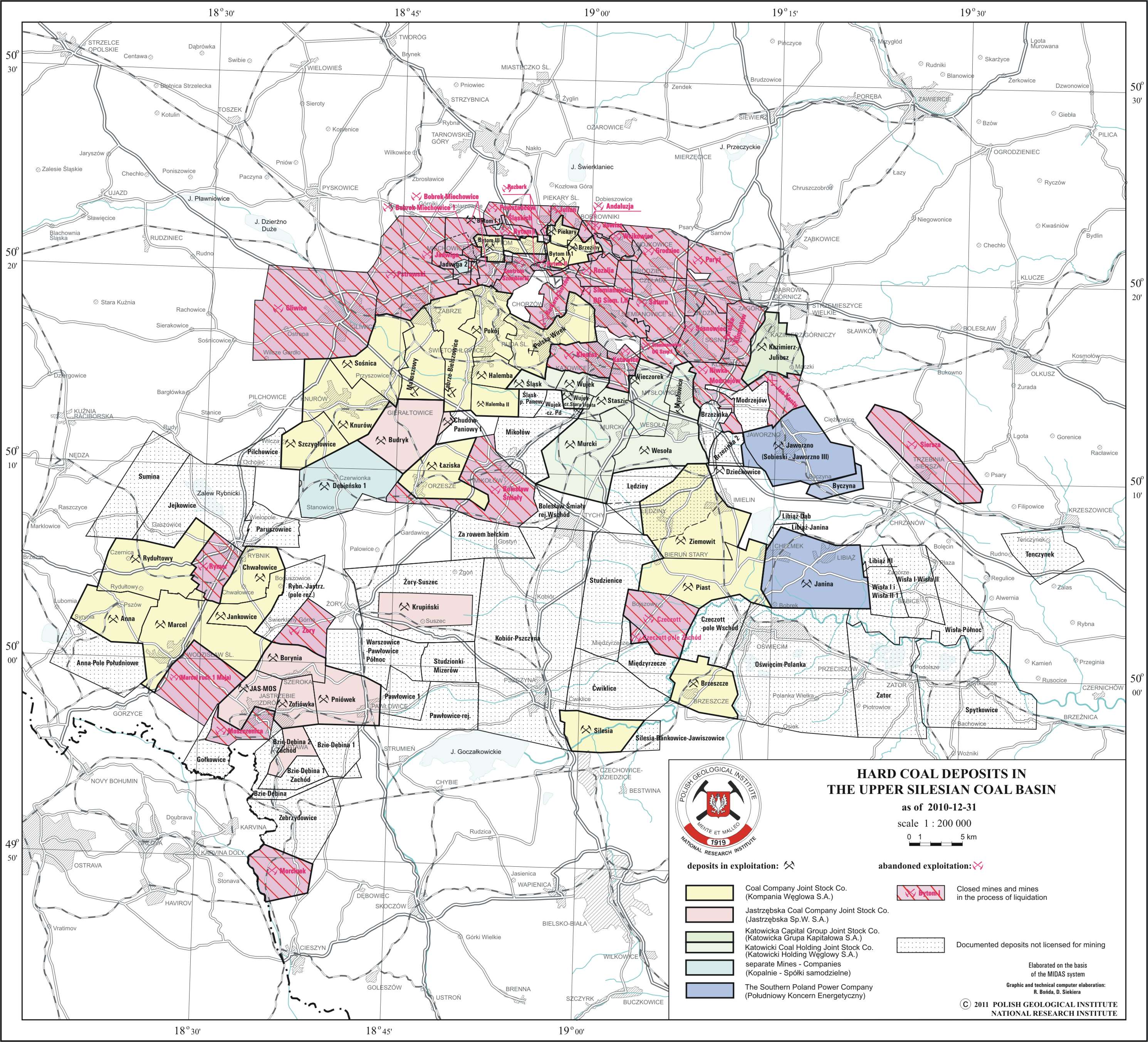
Hard coal deposits in the Upper Silesian Coal Basin
There are hard coal deposits in the Upper Silesian Coal Basin presented on the map. Deposits location is delineated by boundaries of deposits contoures. There is also information on a state of development and ownership (mining companies and business entities) of a particular deposit.
Download map.
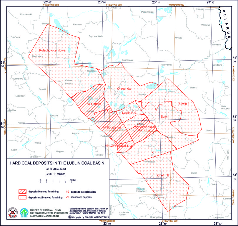
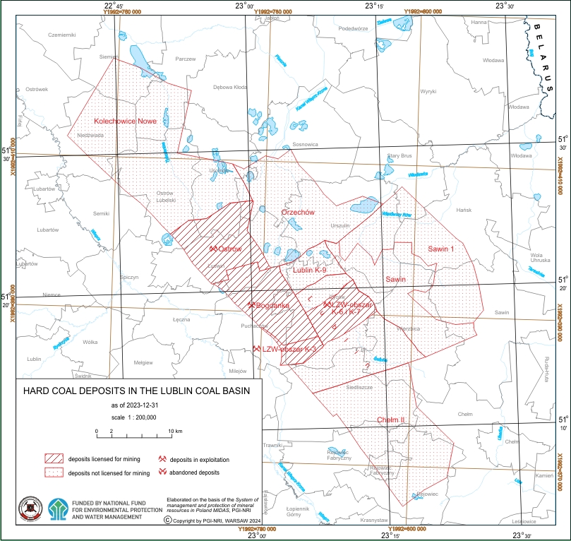
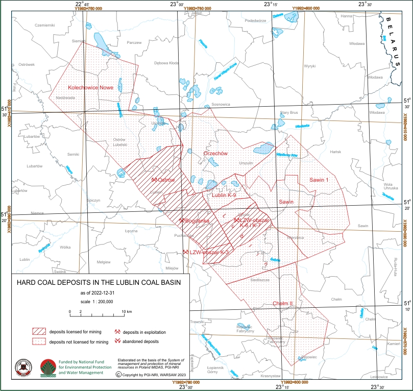
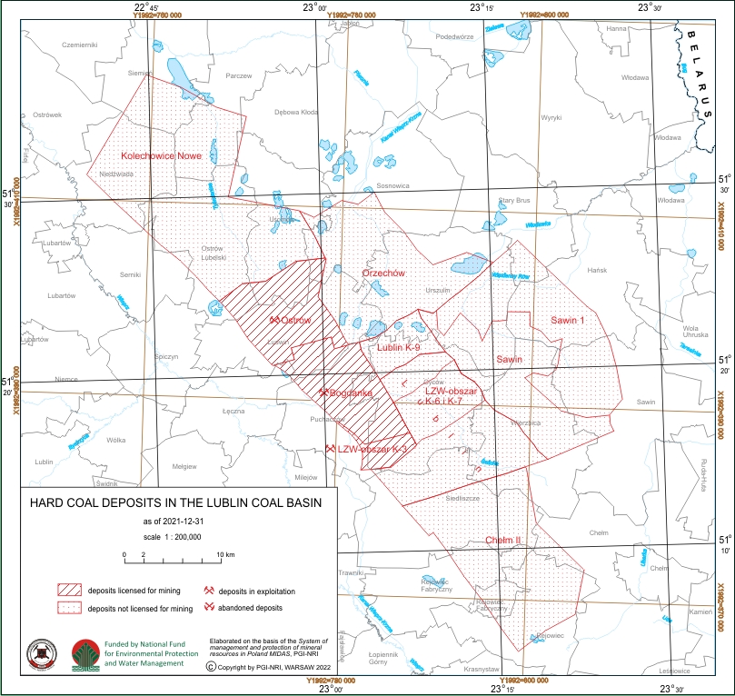
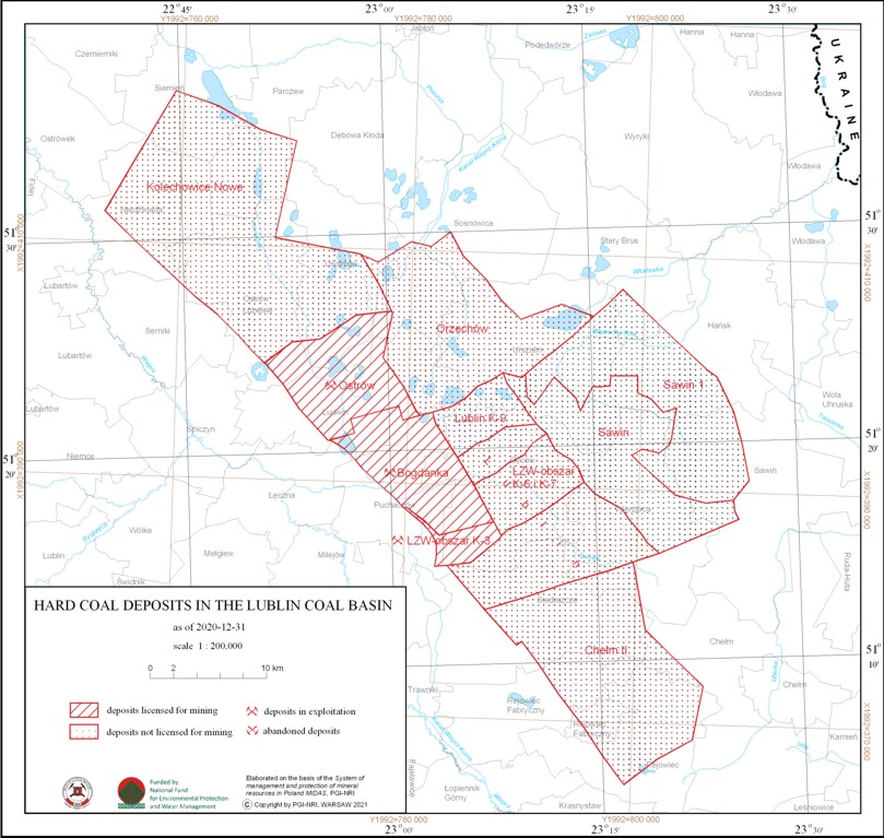
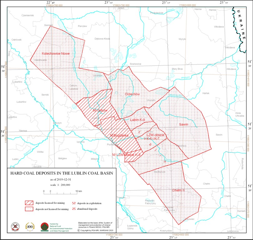
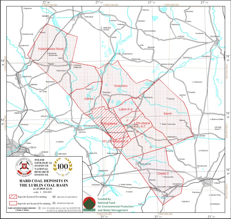
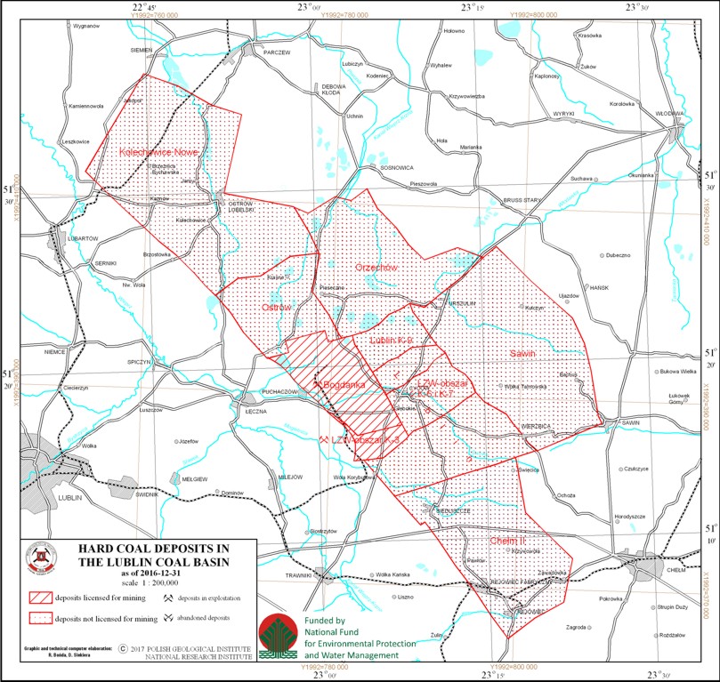
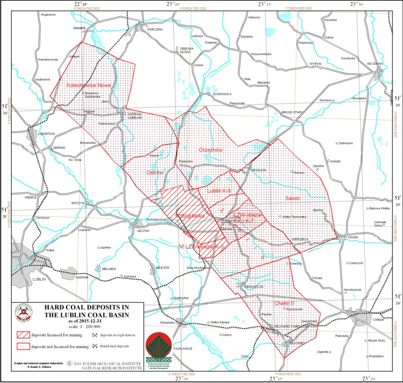
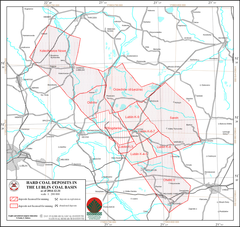
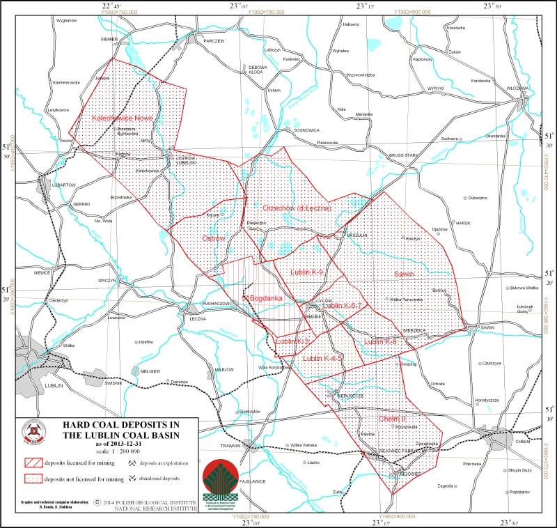
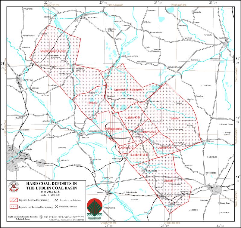
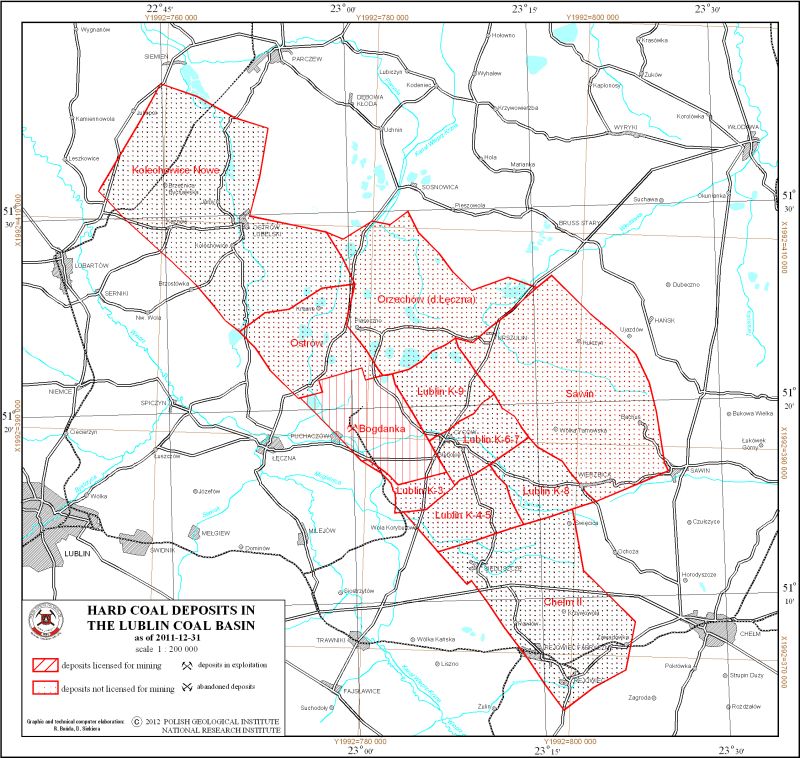
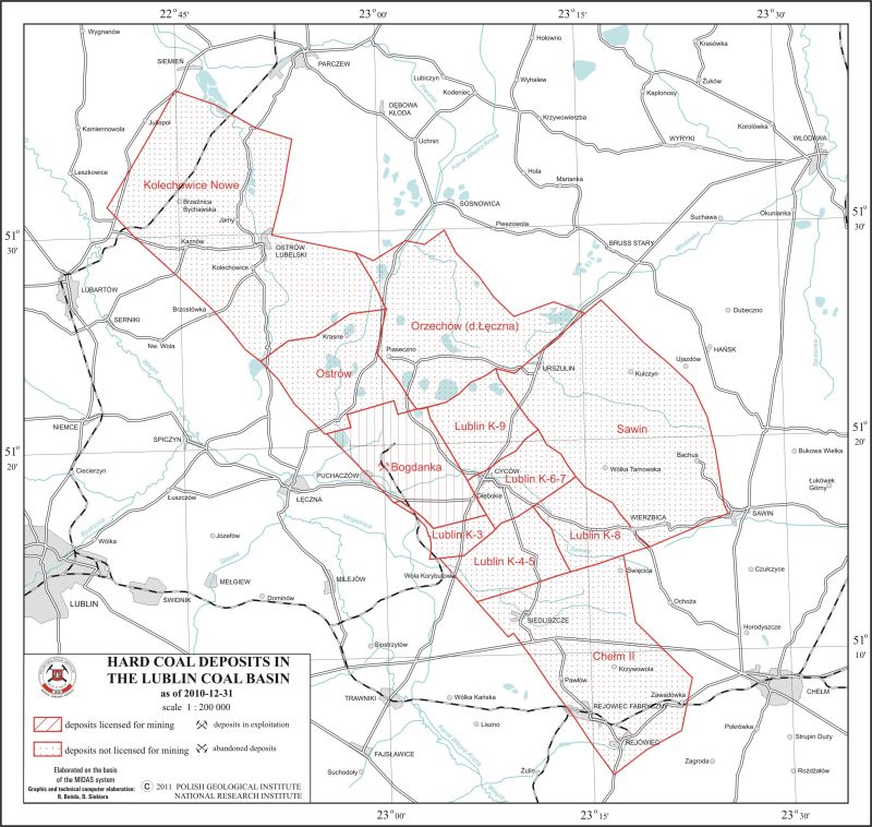
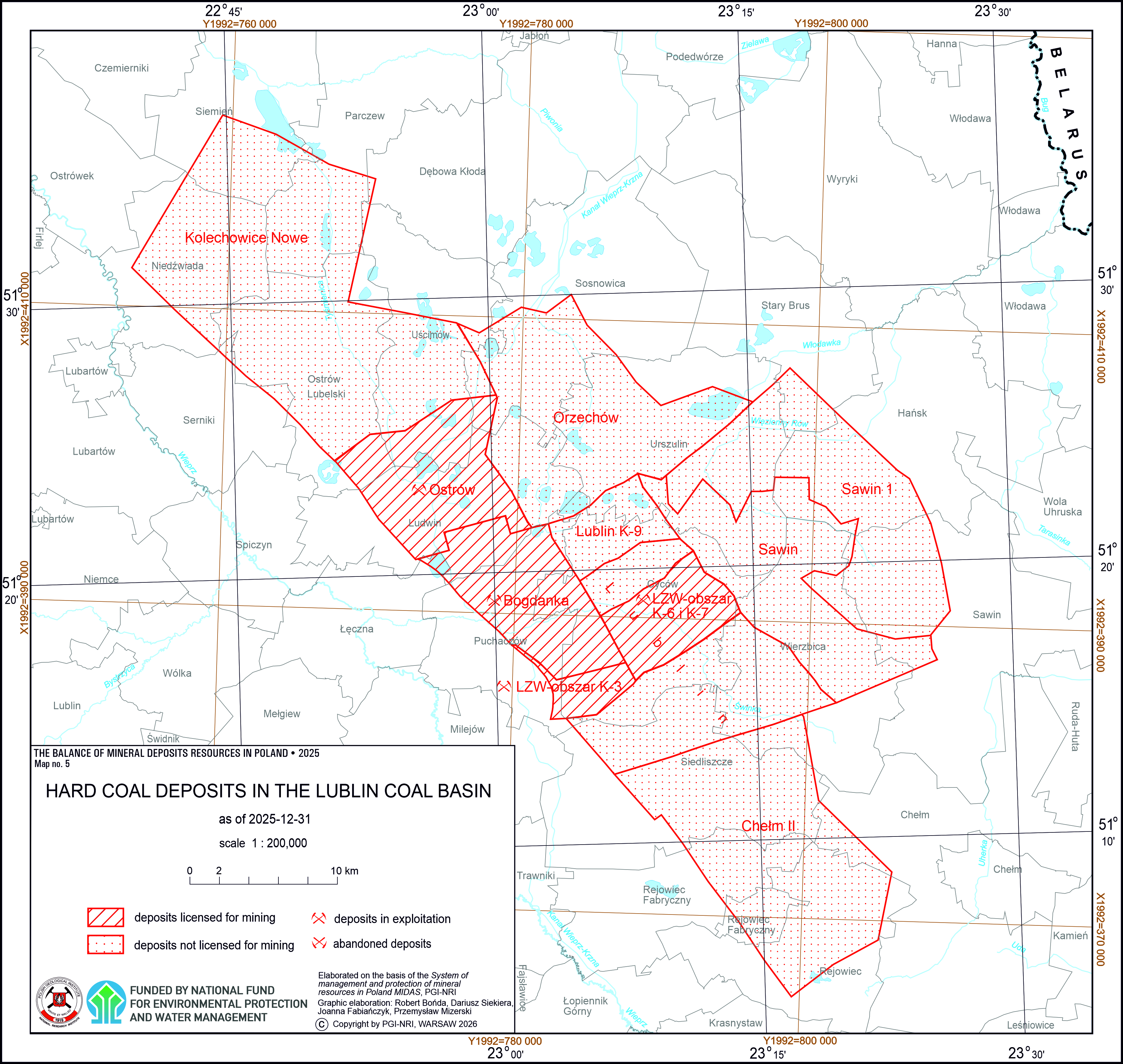
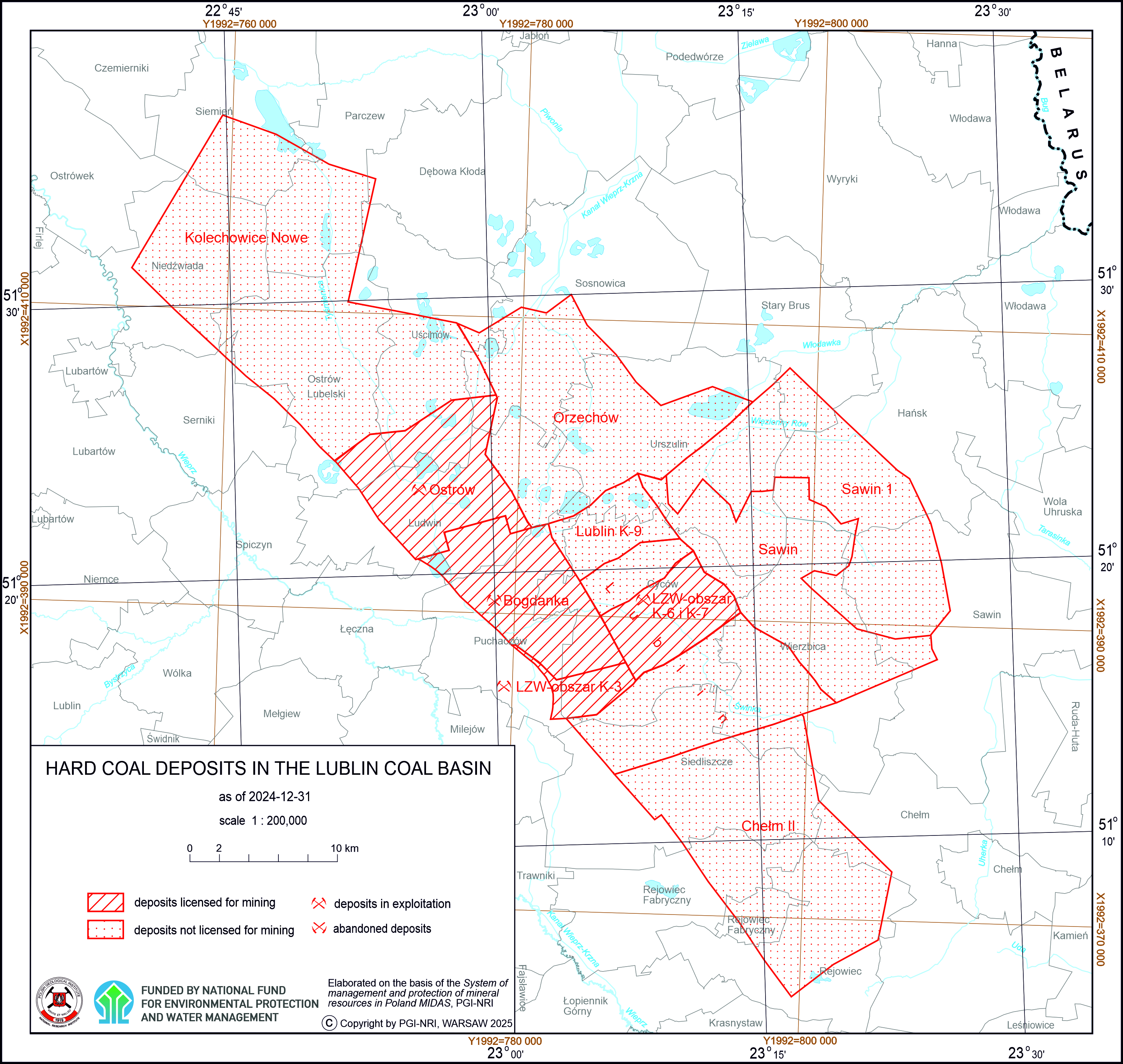
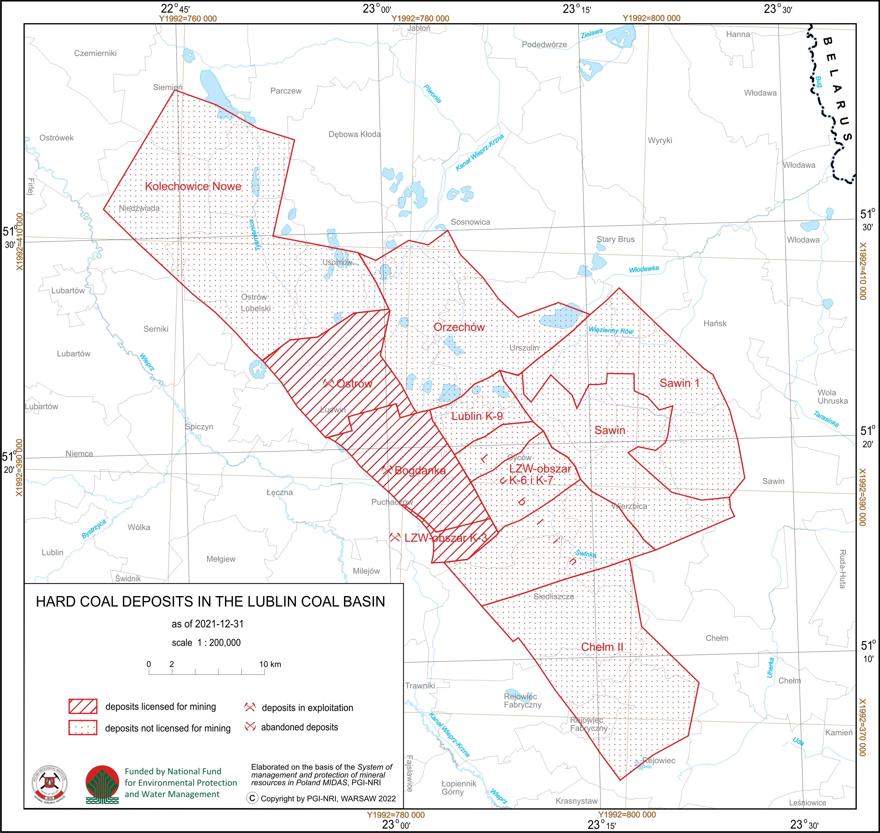
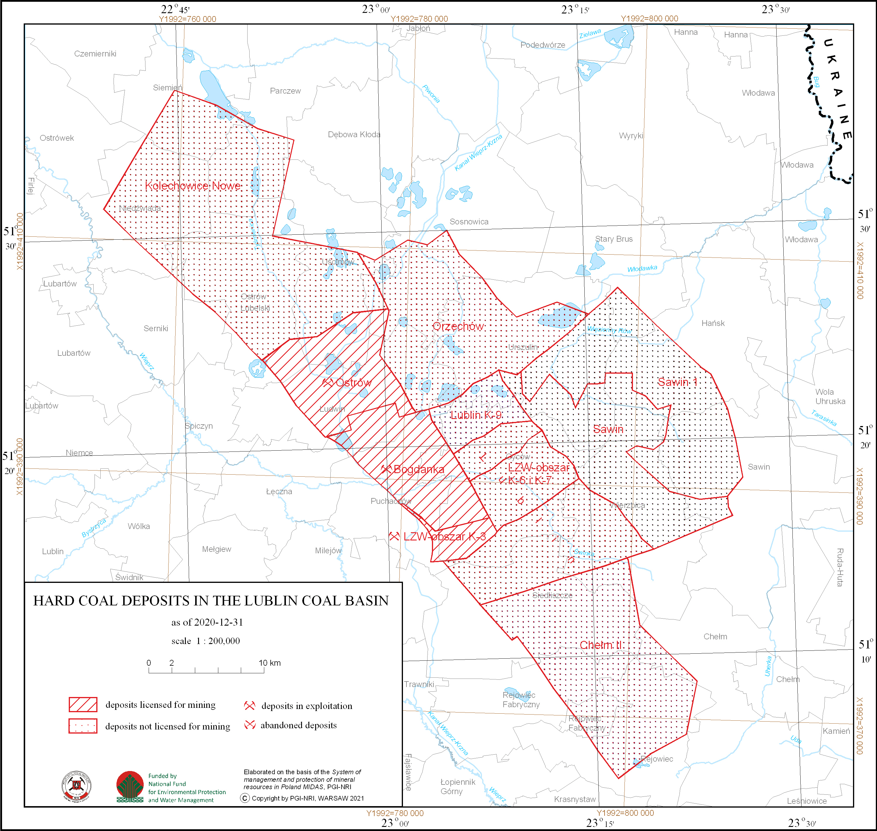
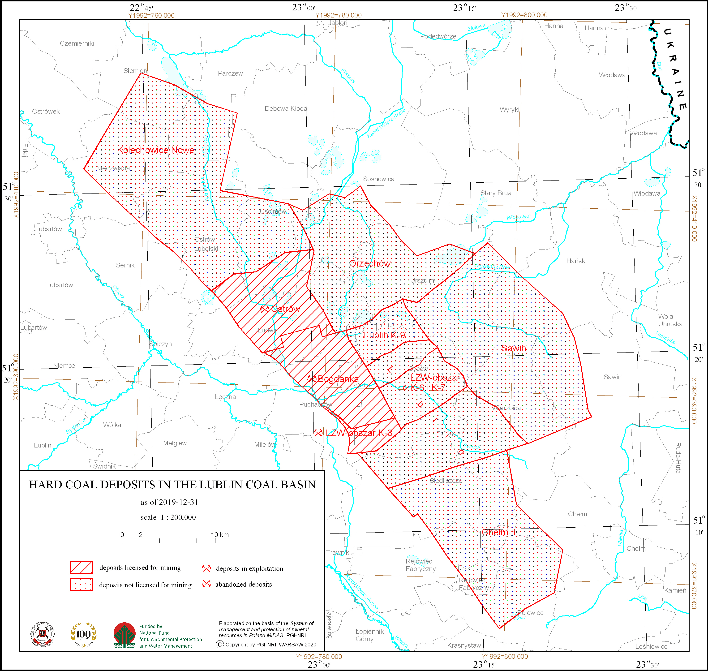
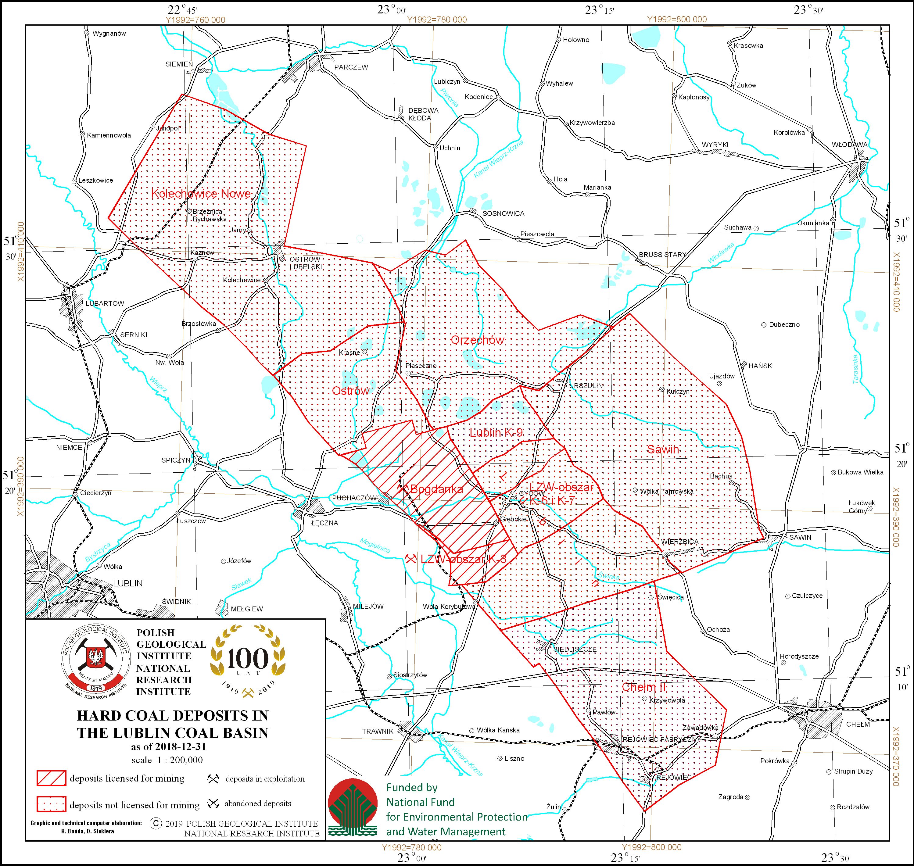
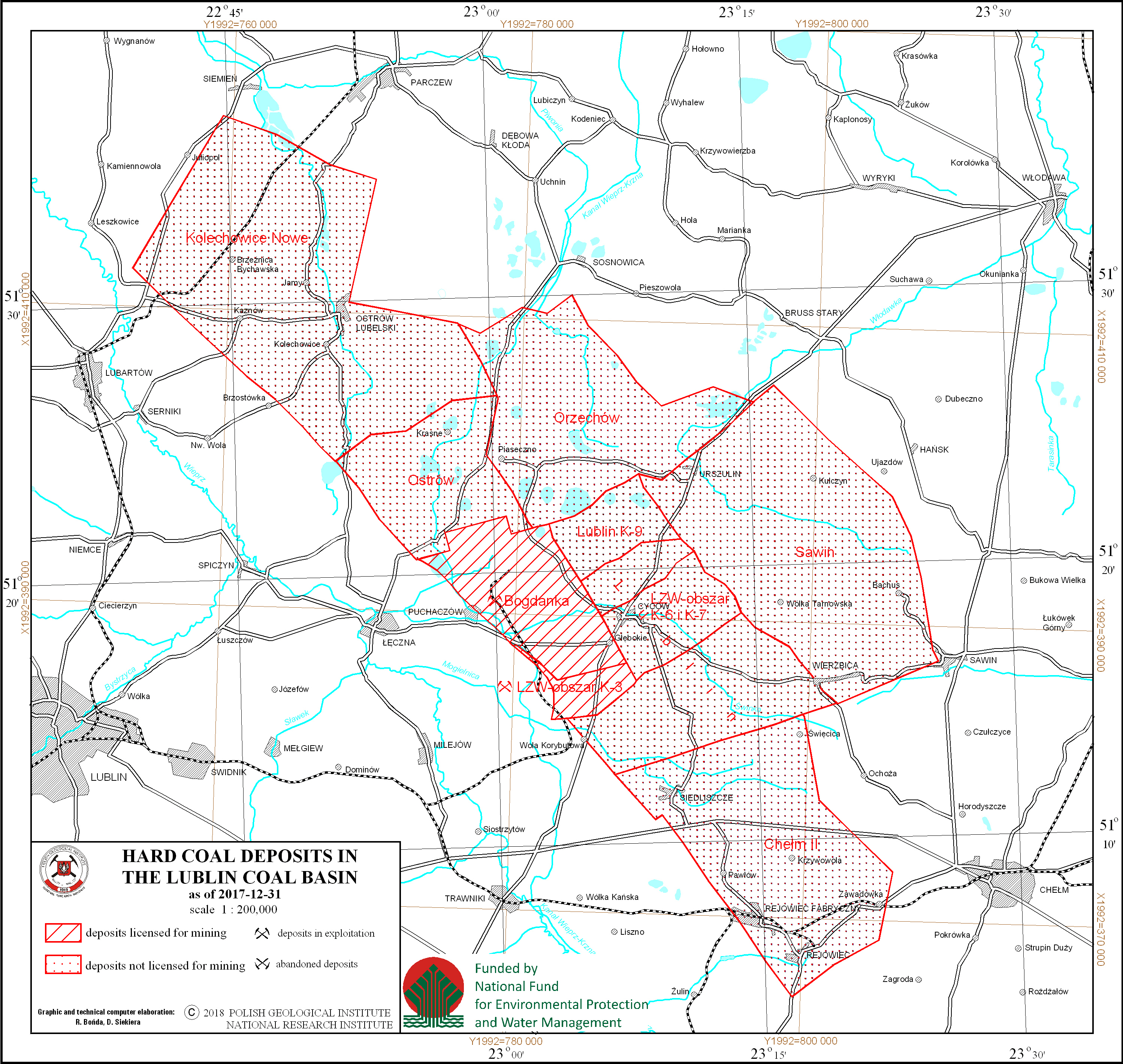
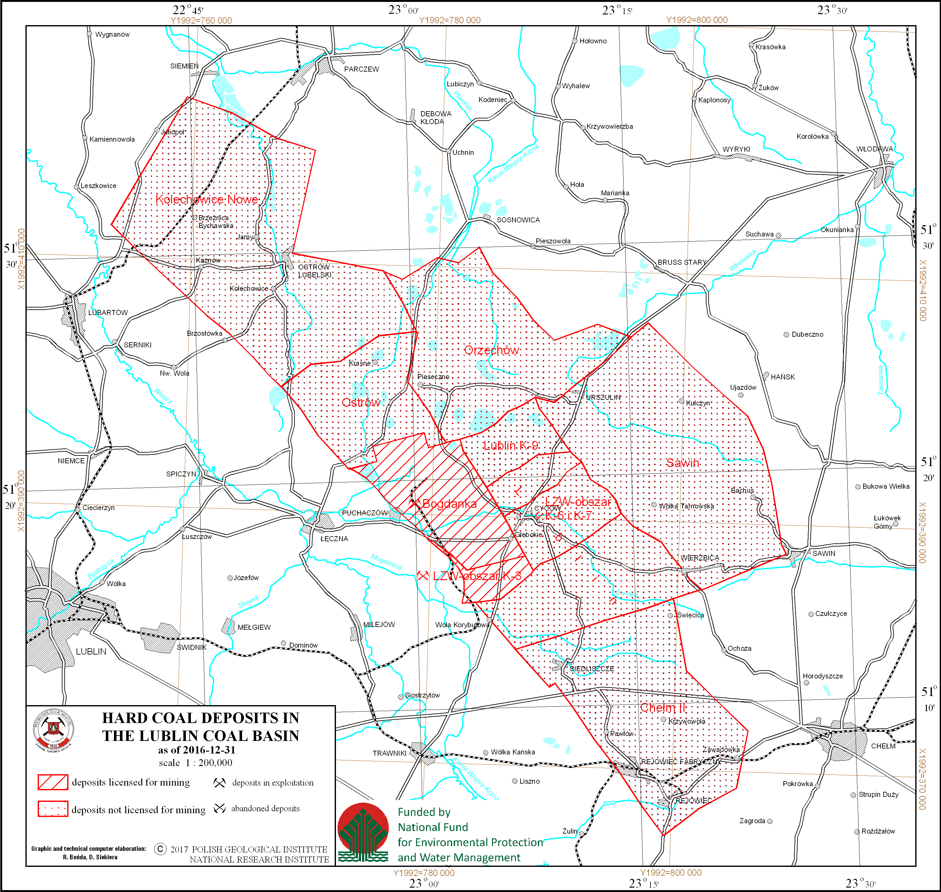
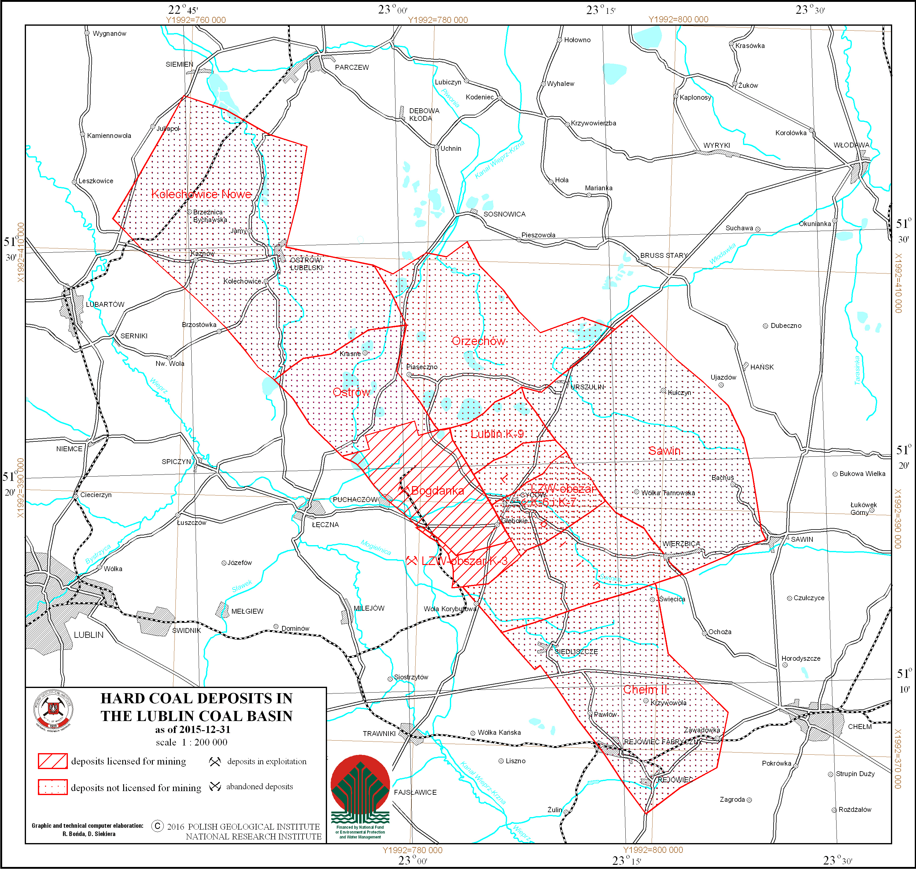
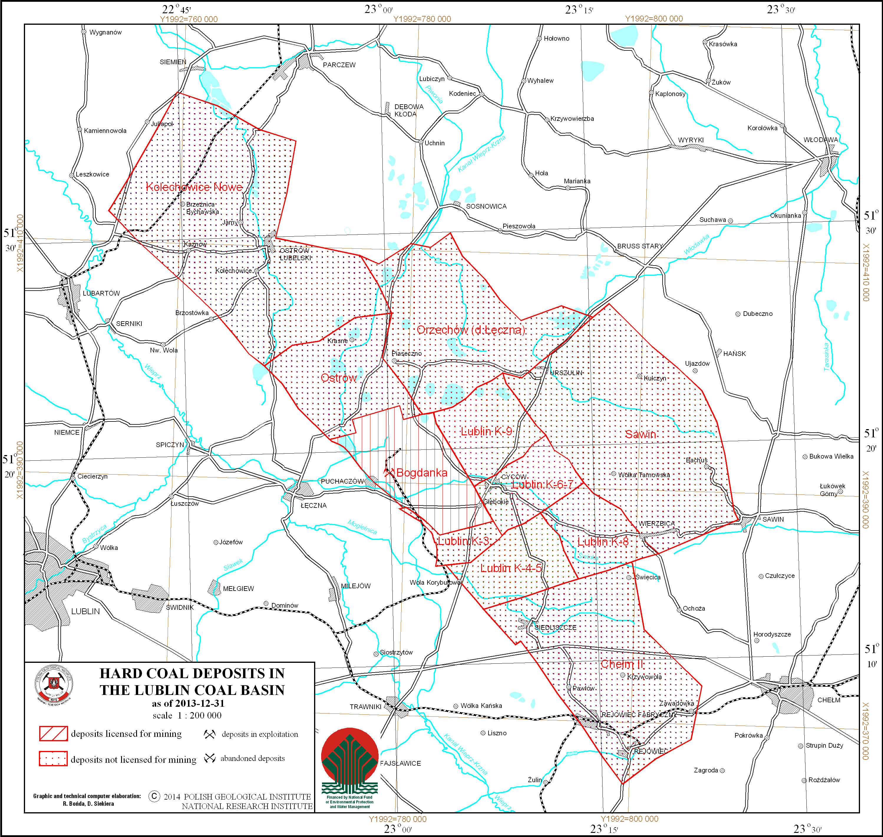
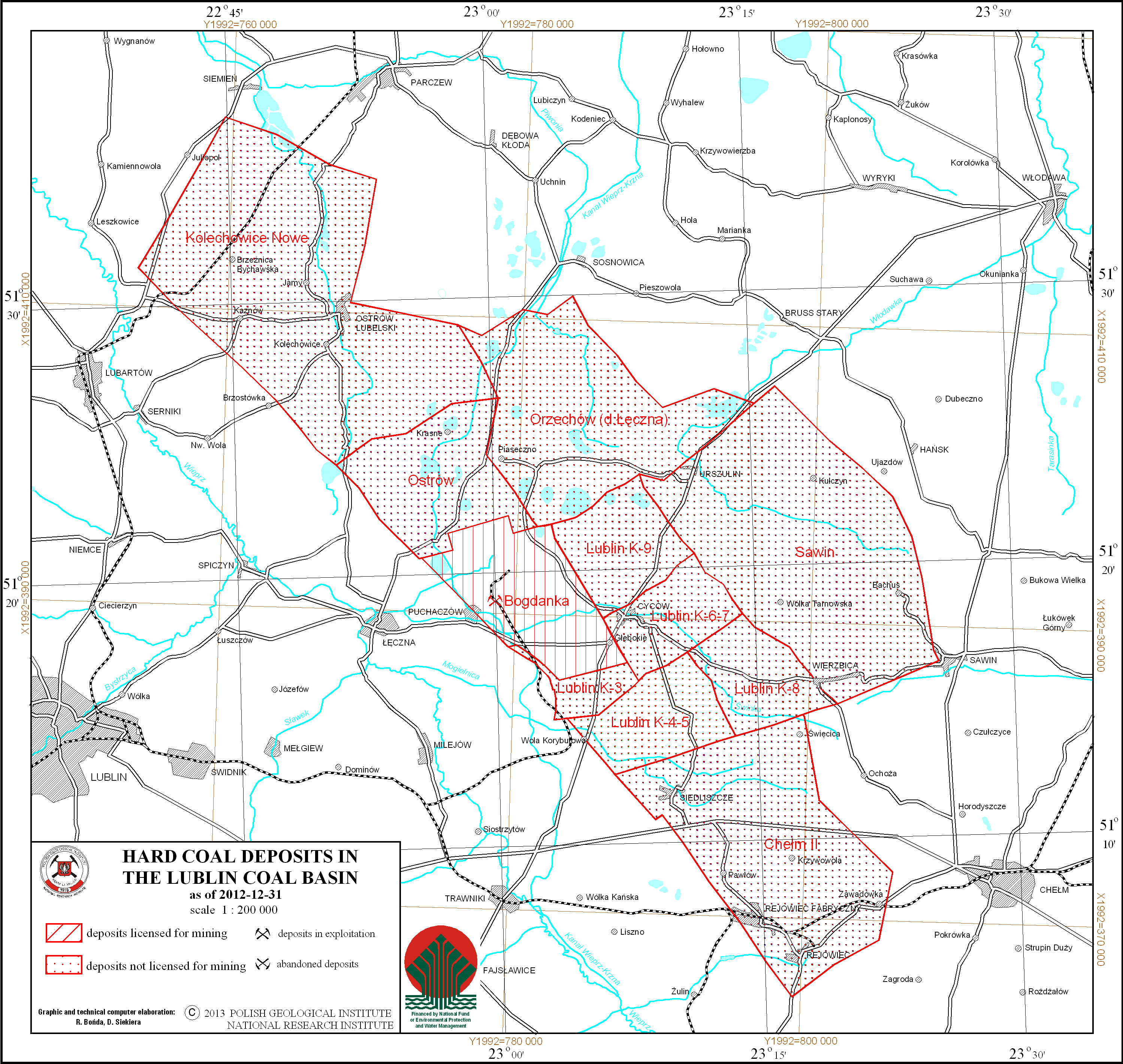
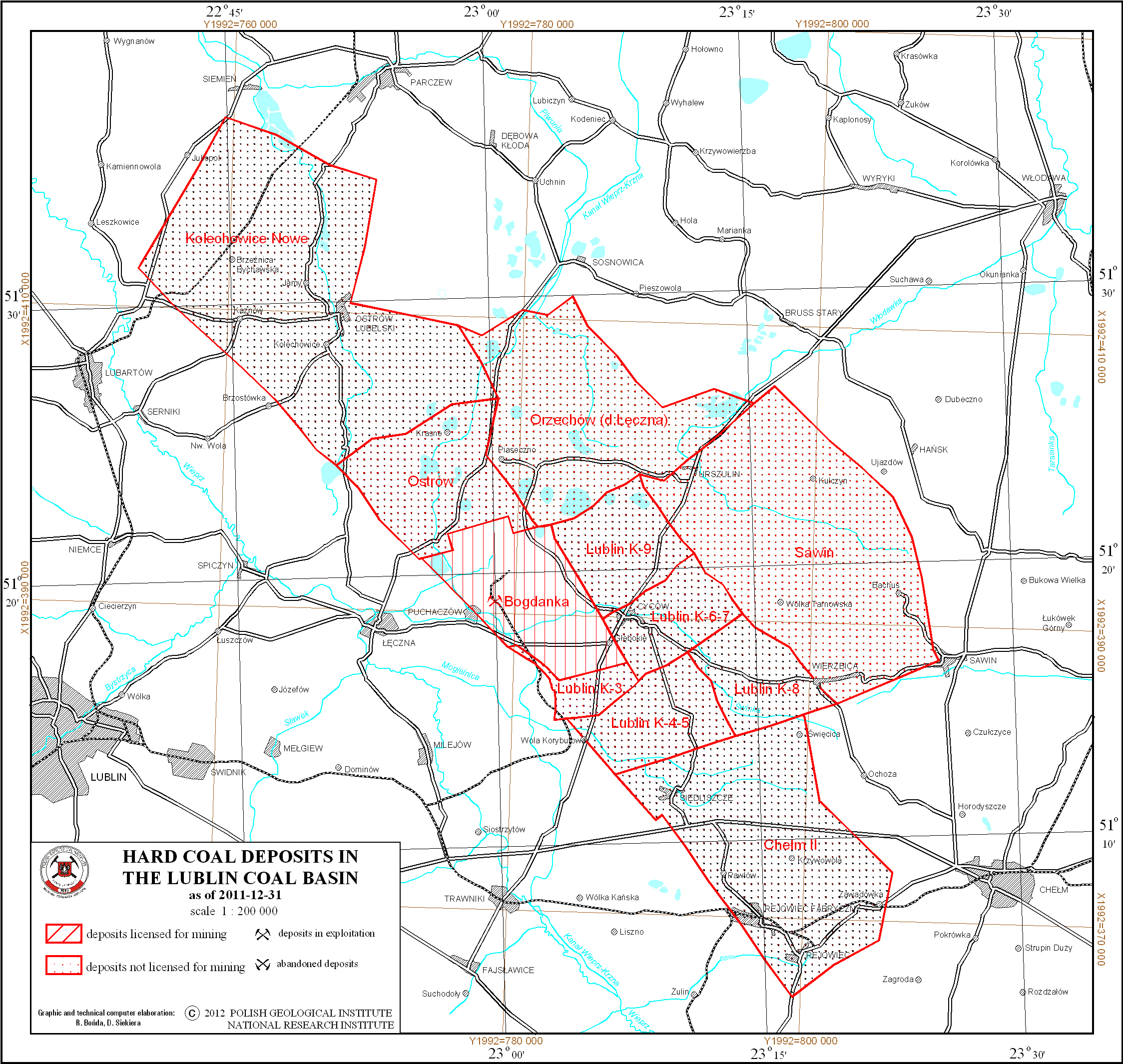
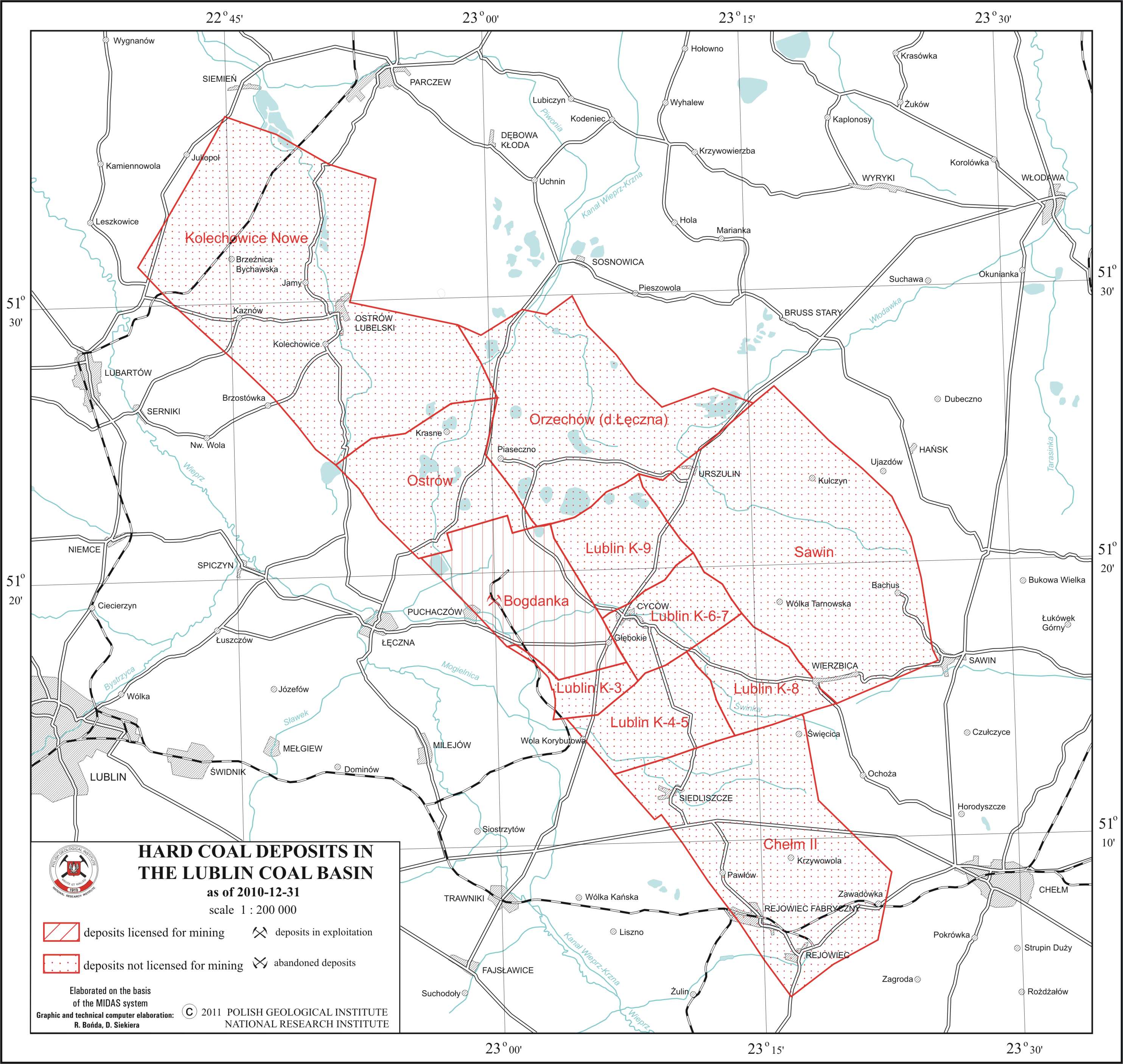
Hard coal deposits in the Lublin Coal Basin
There are hard coal deposits in the Lublin Coal Basin presented on the map. Deposits location is delineated by boundaries of deposits contoures. There is also information on a state of development and ownership (mining companies and business entities) of a particular deposit.
Download map.
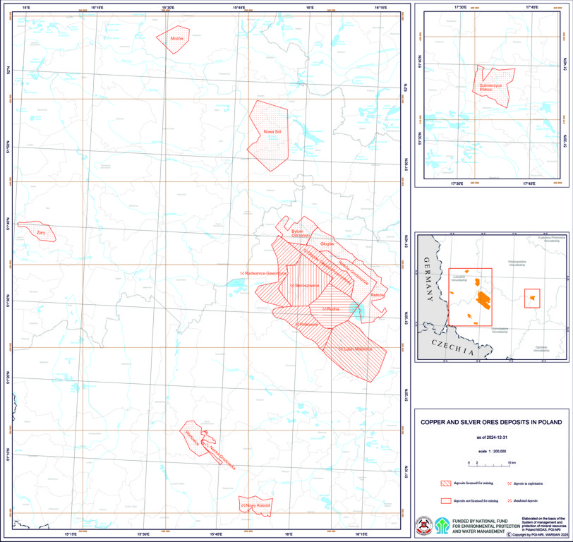
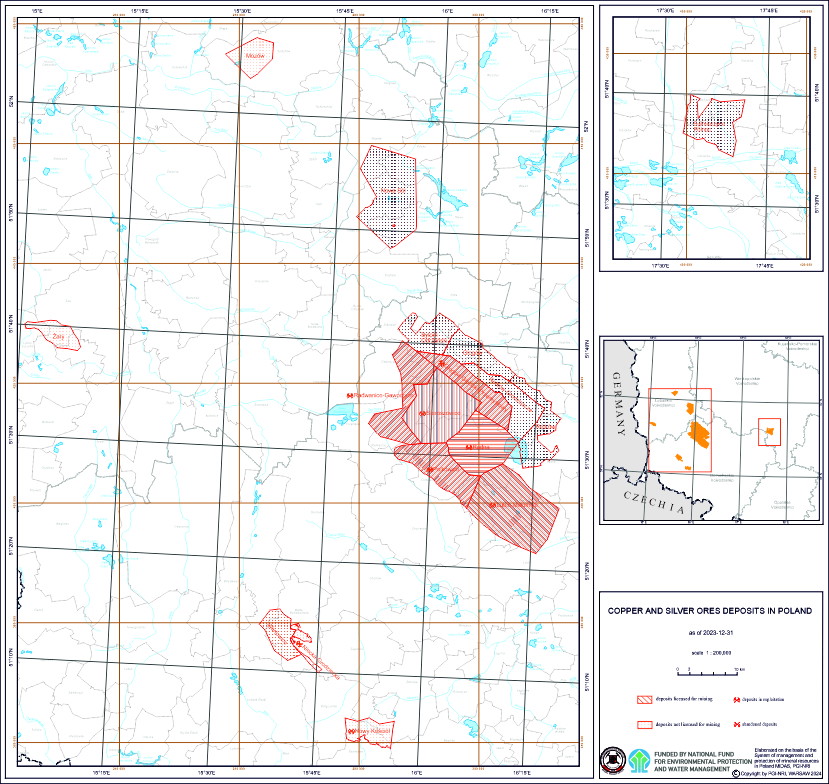
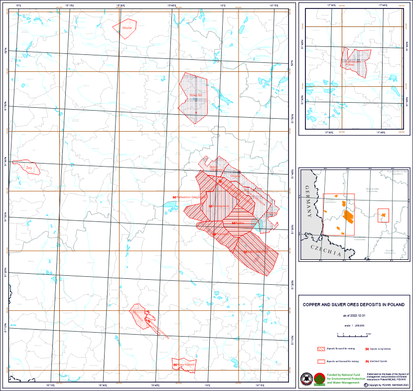
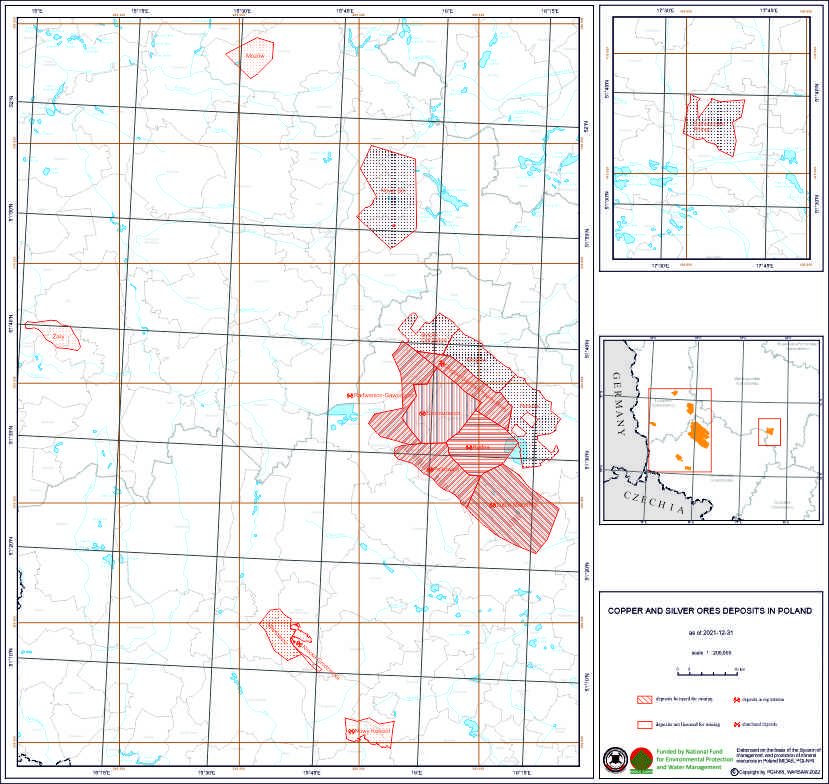
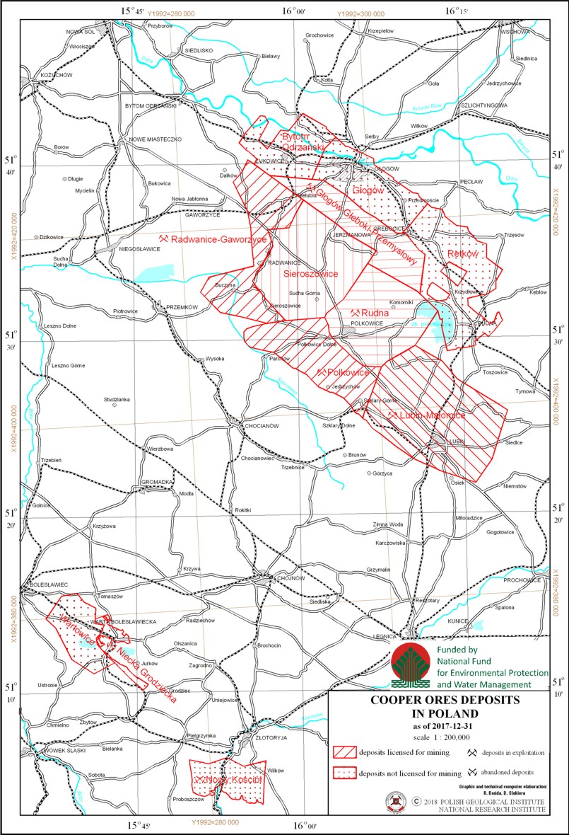
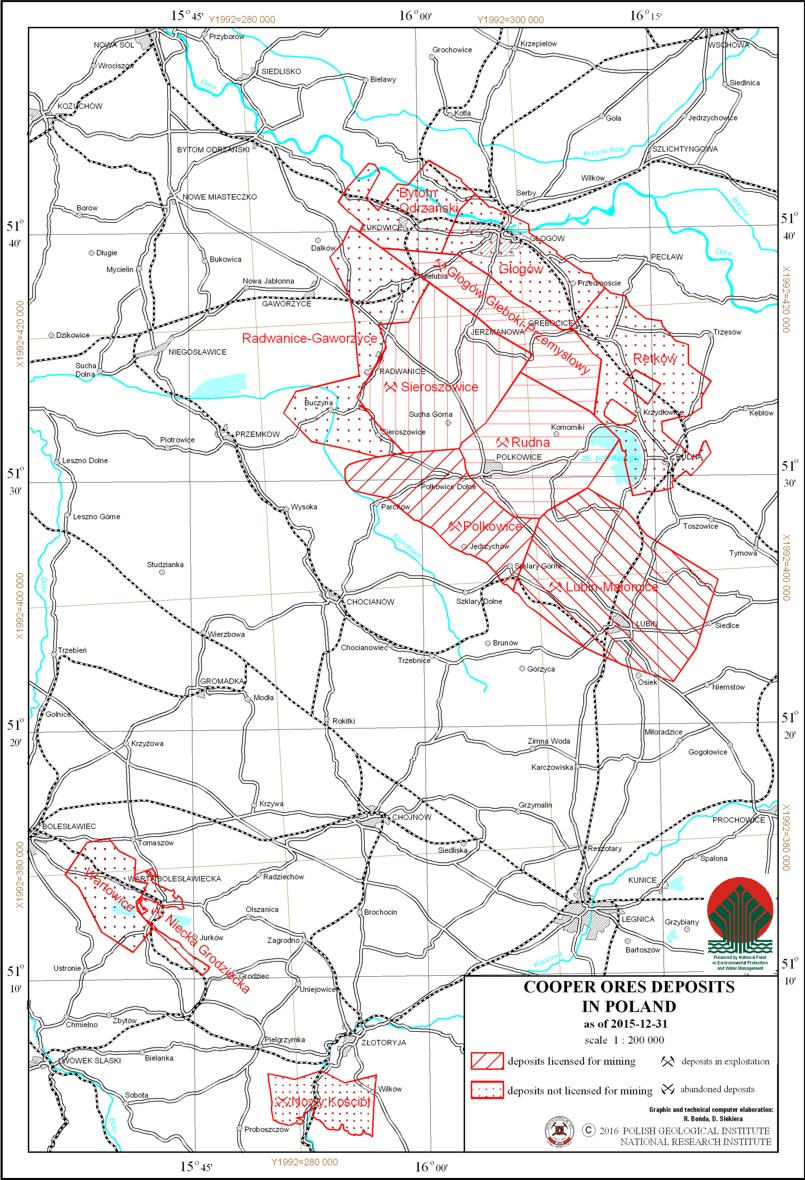
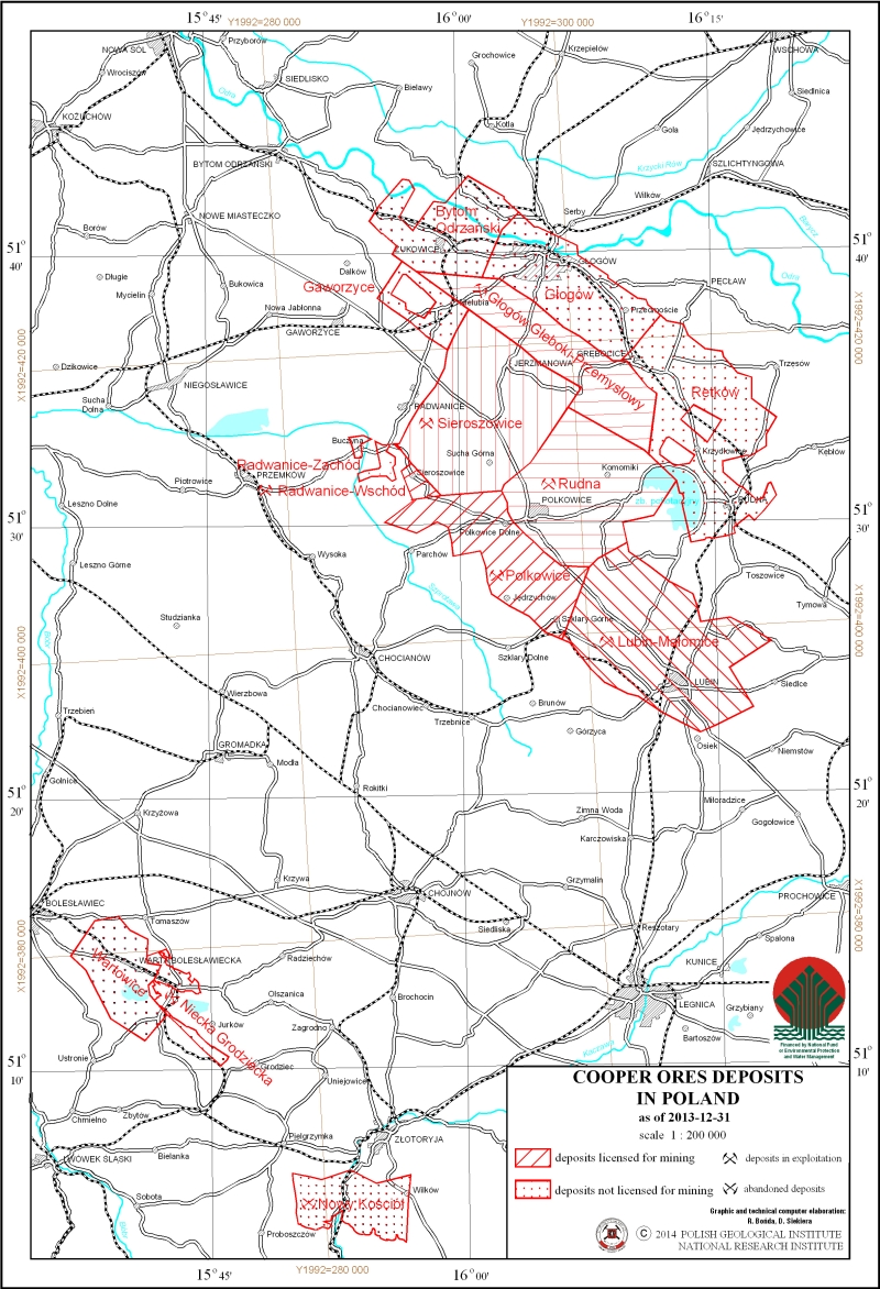
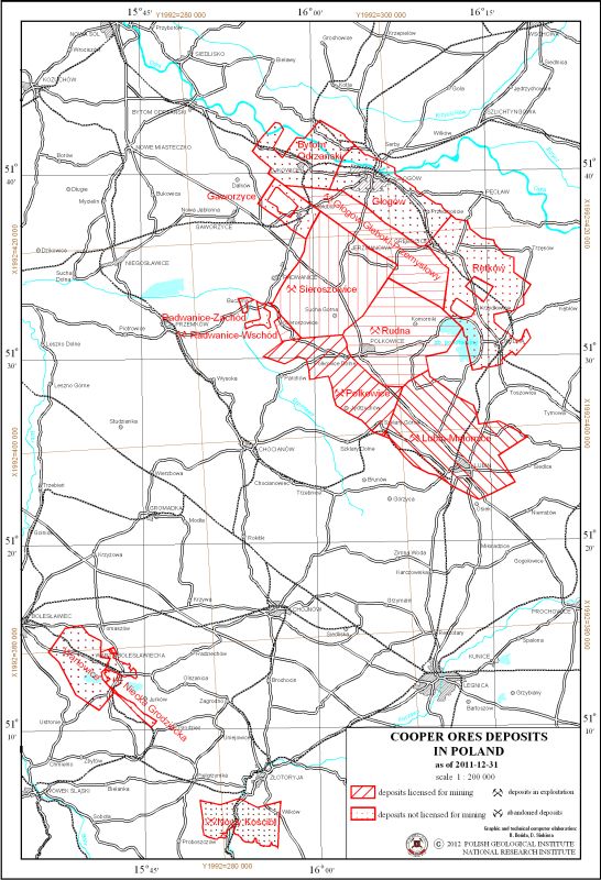
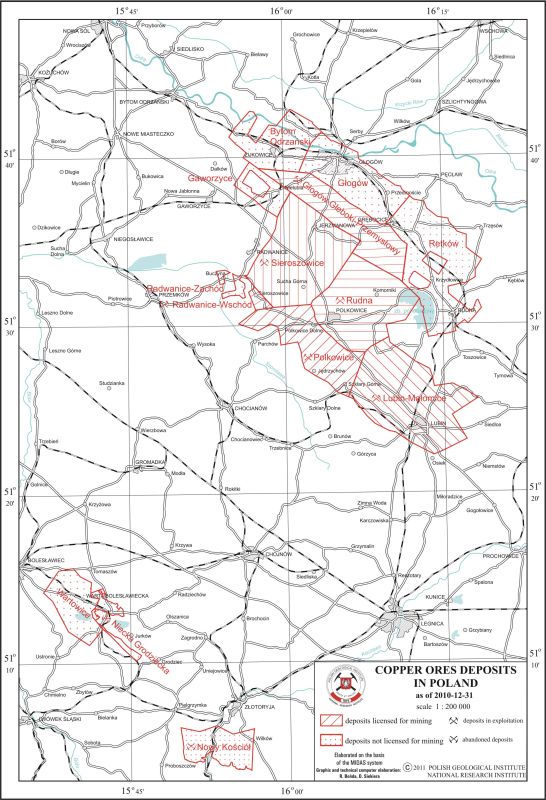
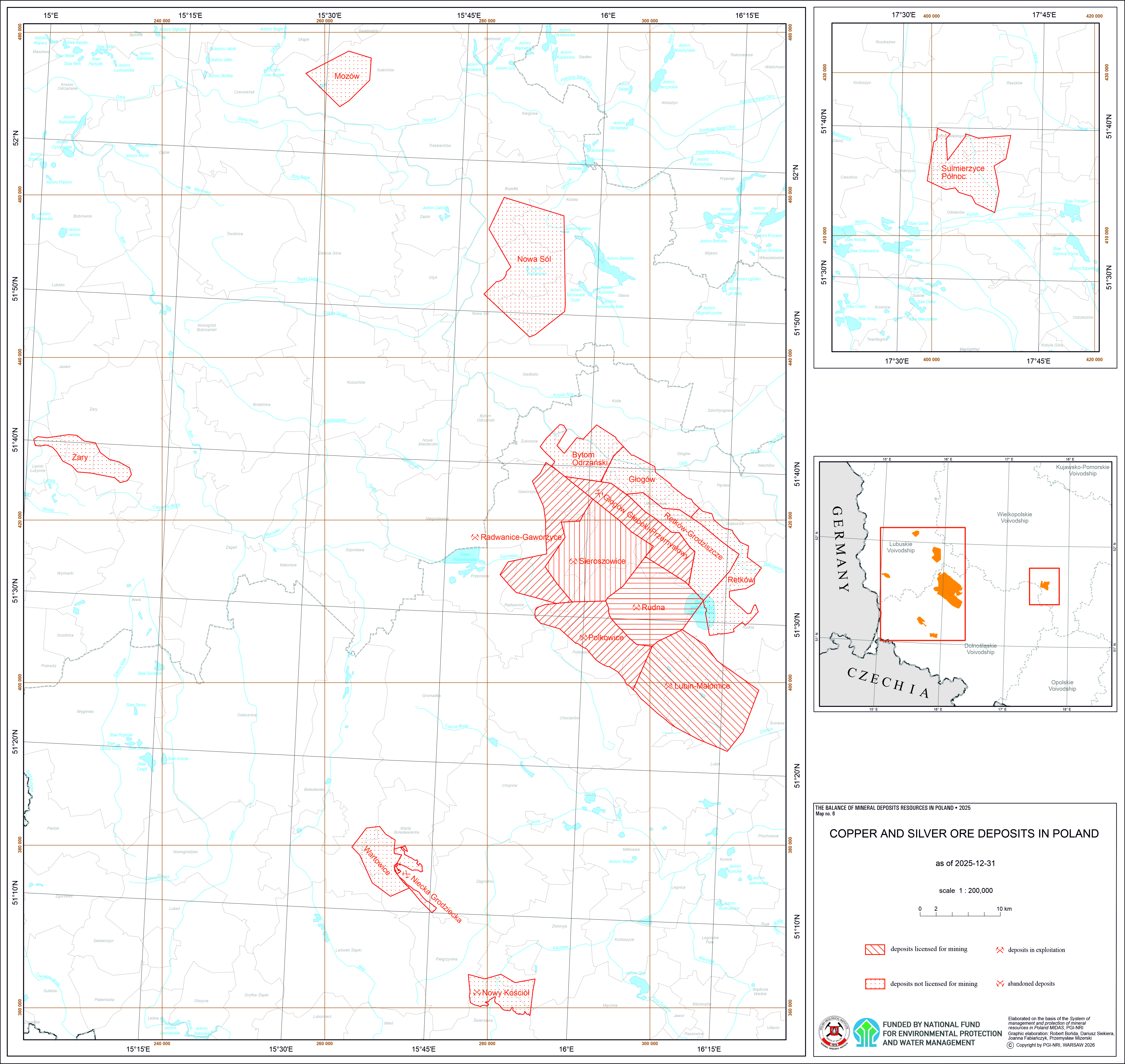
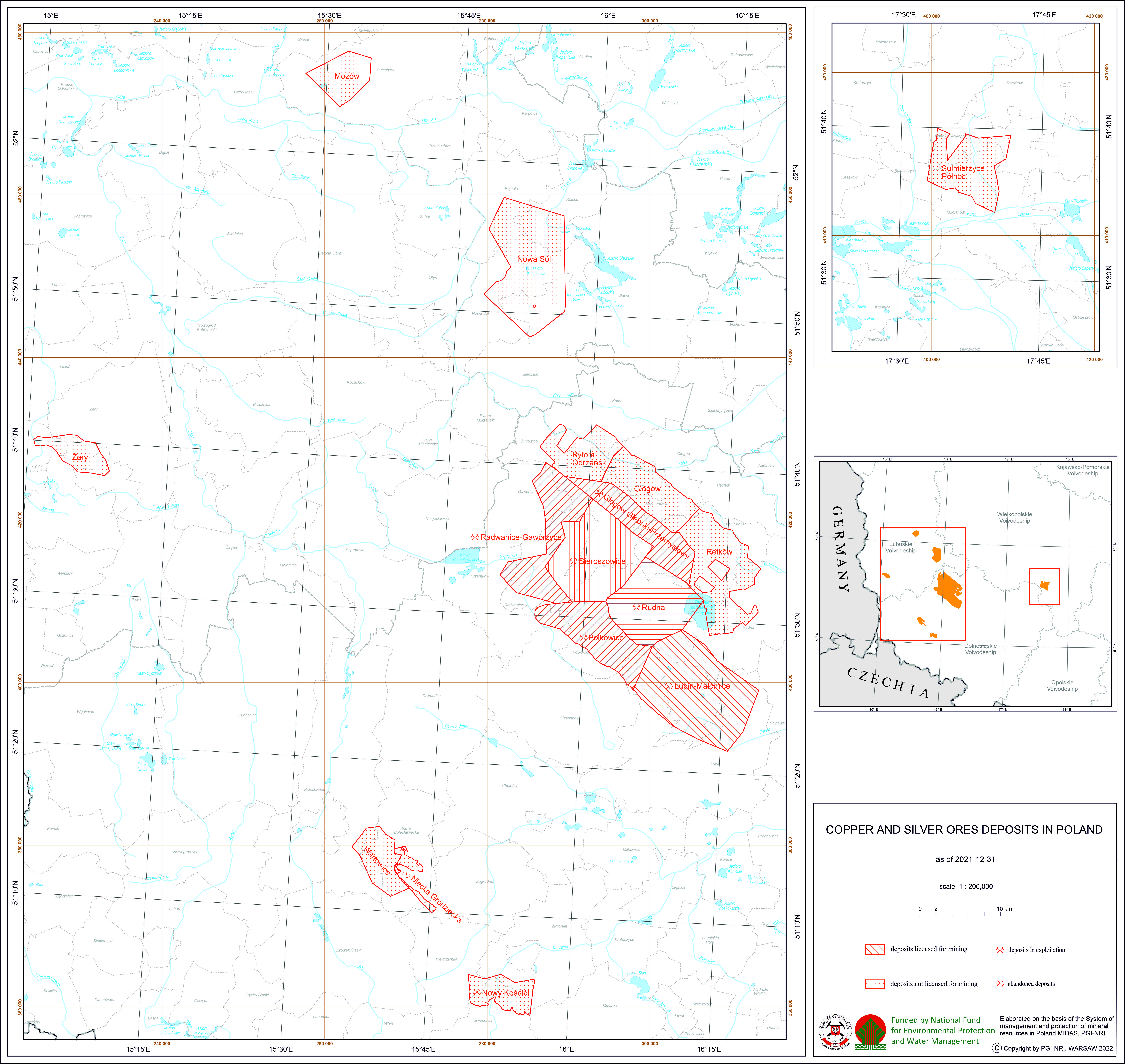
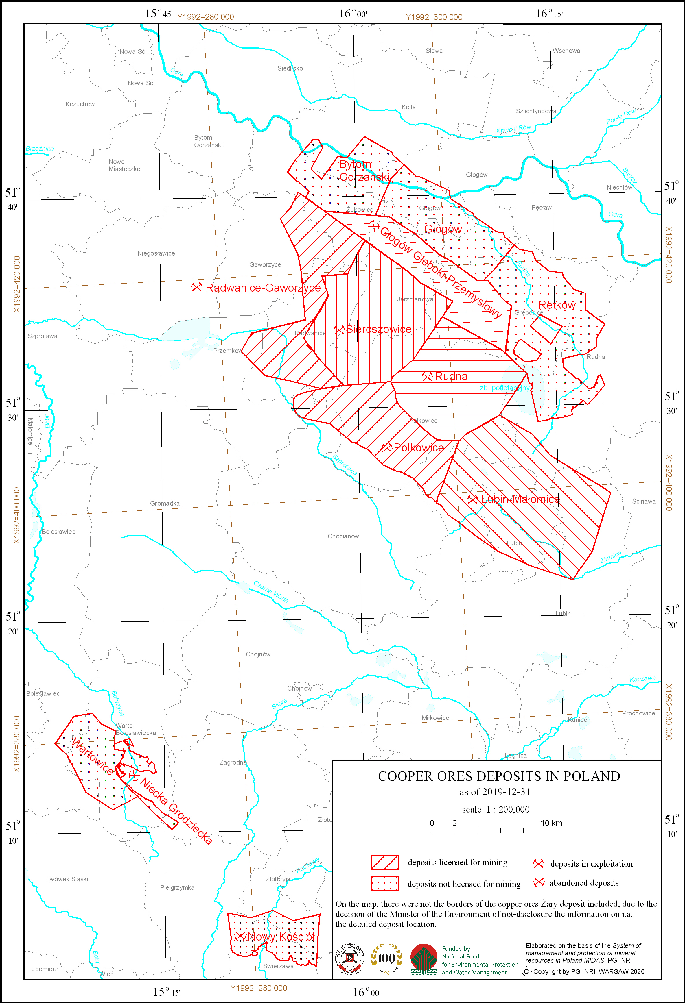
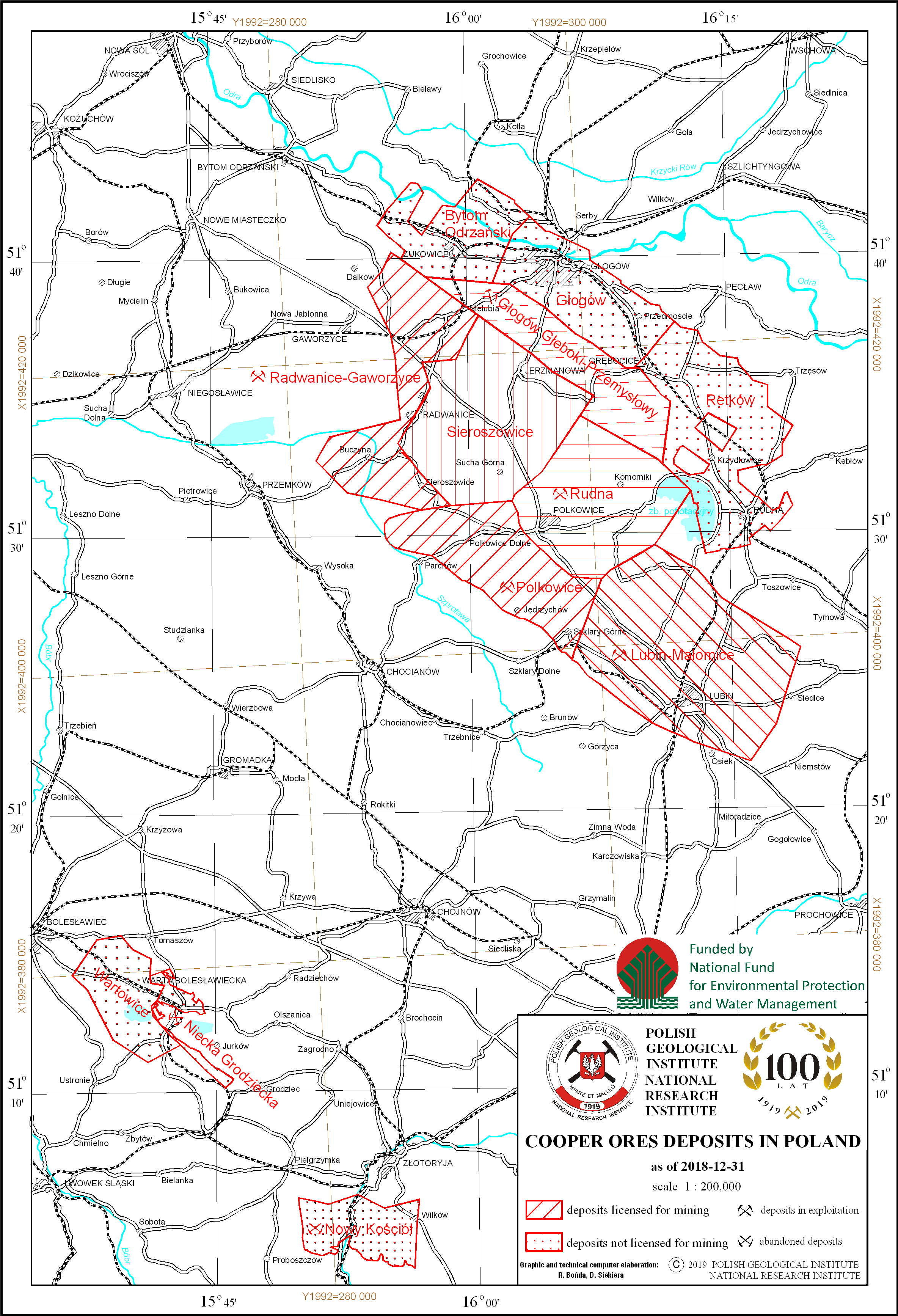
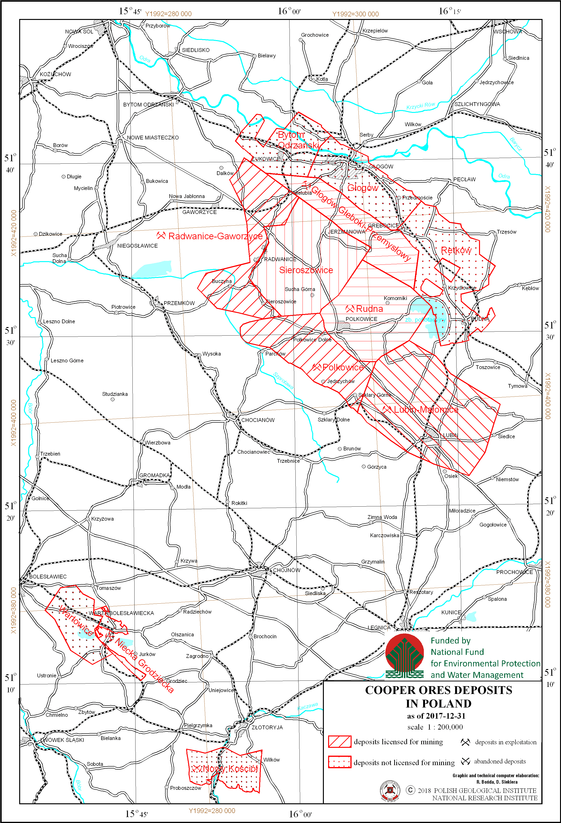
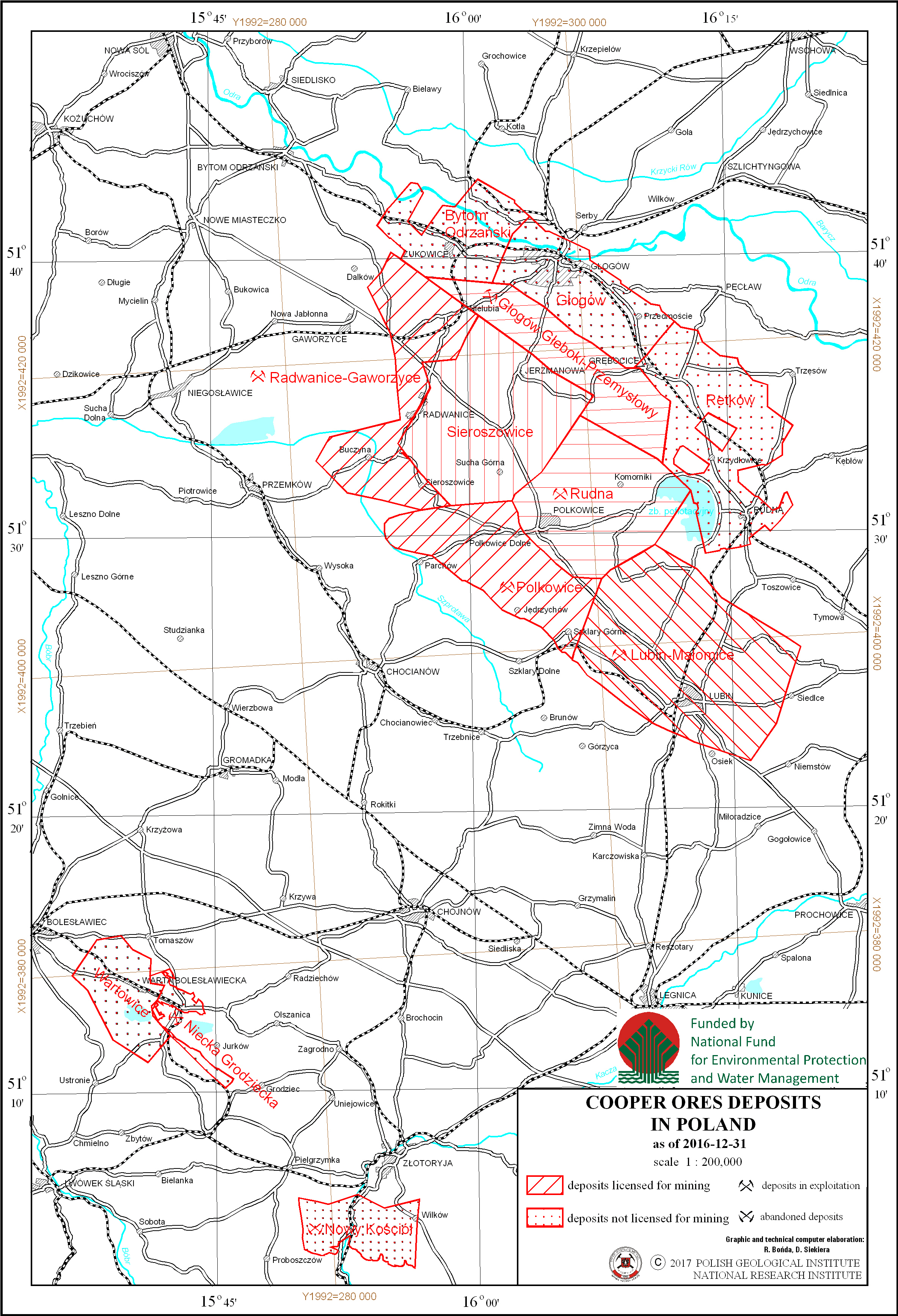
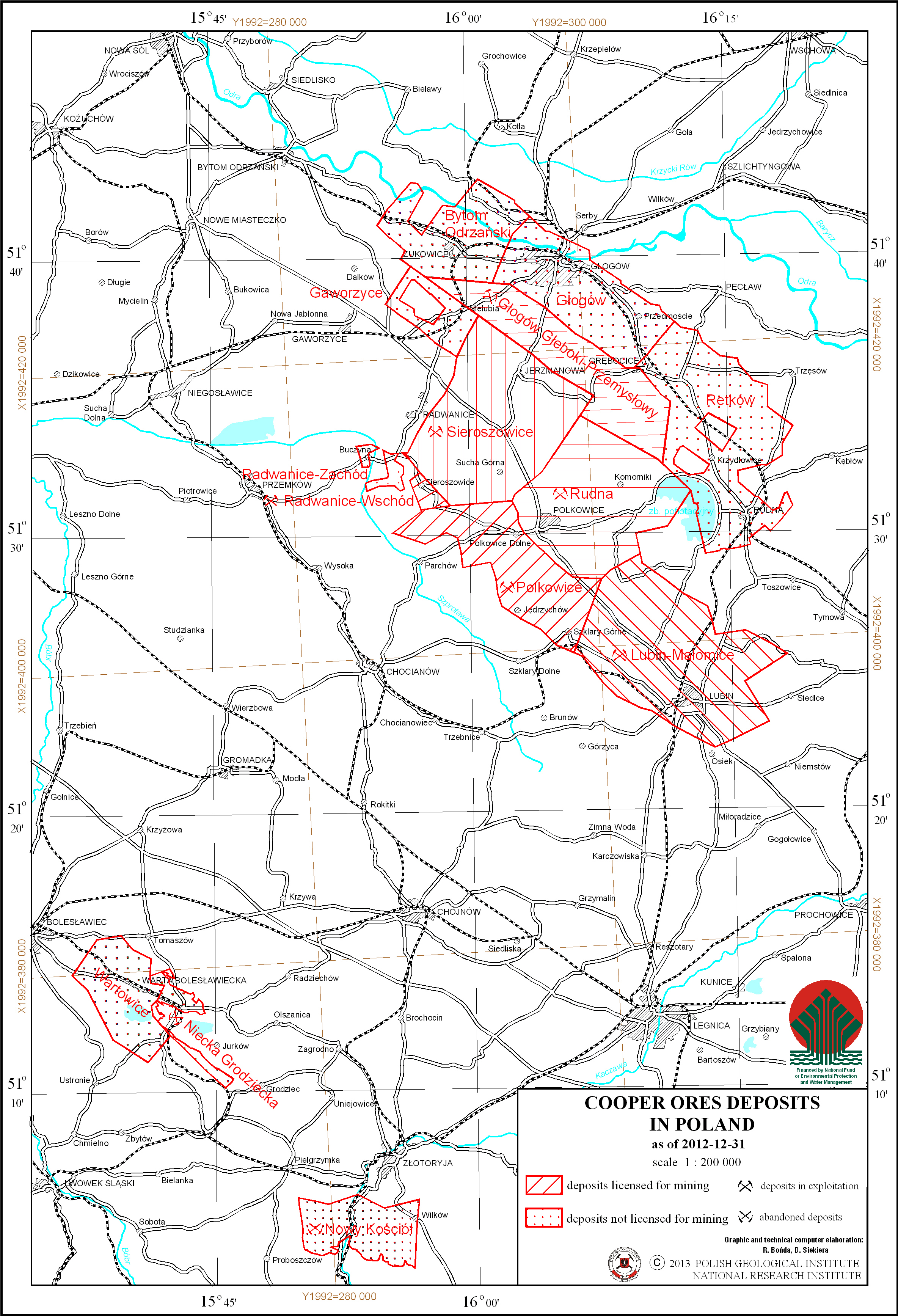
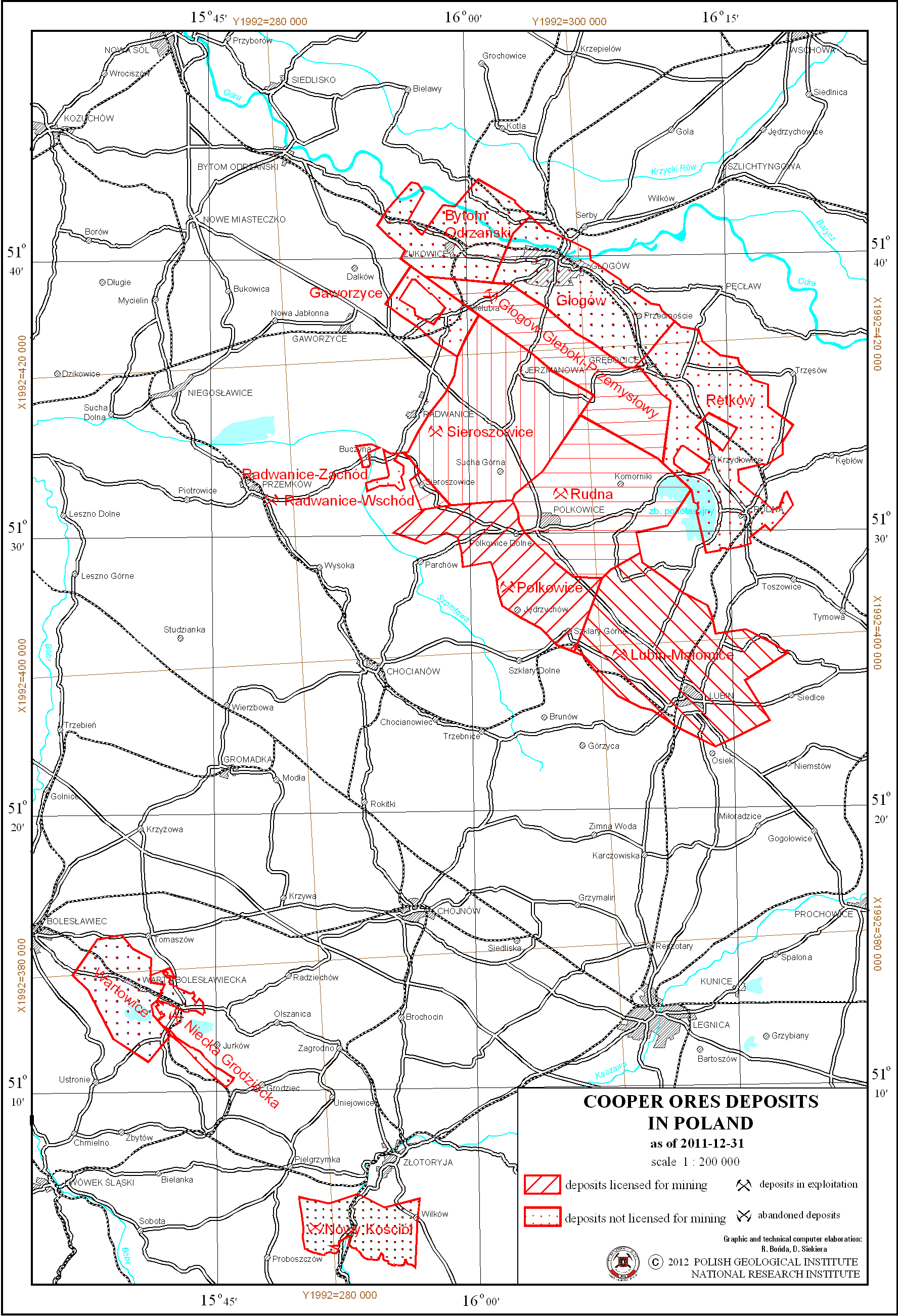
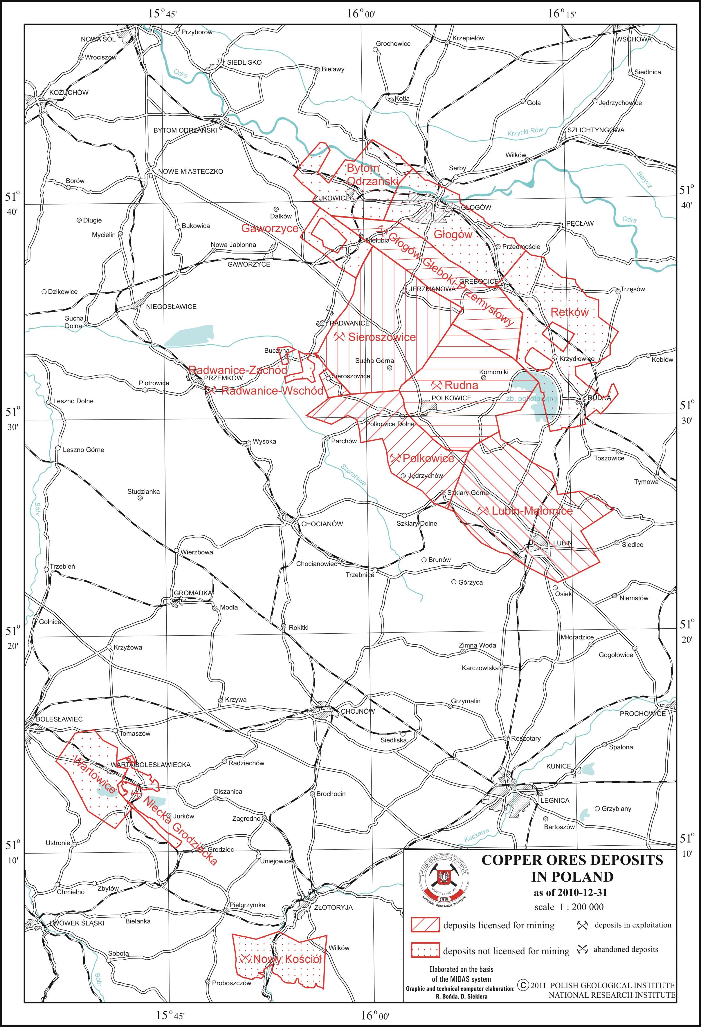
Copper and silver ores deposits in Poland
There are copper and silver ore deposits in Poland presented on the map. Deposits location is delineated by boundaries of deposits contoures. There is also information on a state of development of a particular deposit.
Download map.
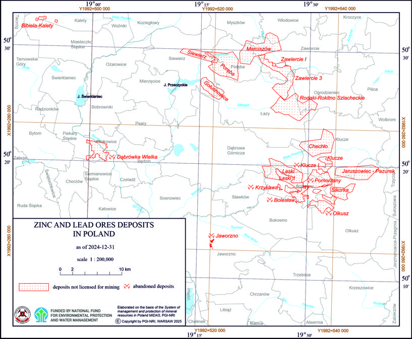
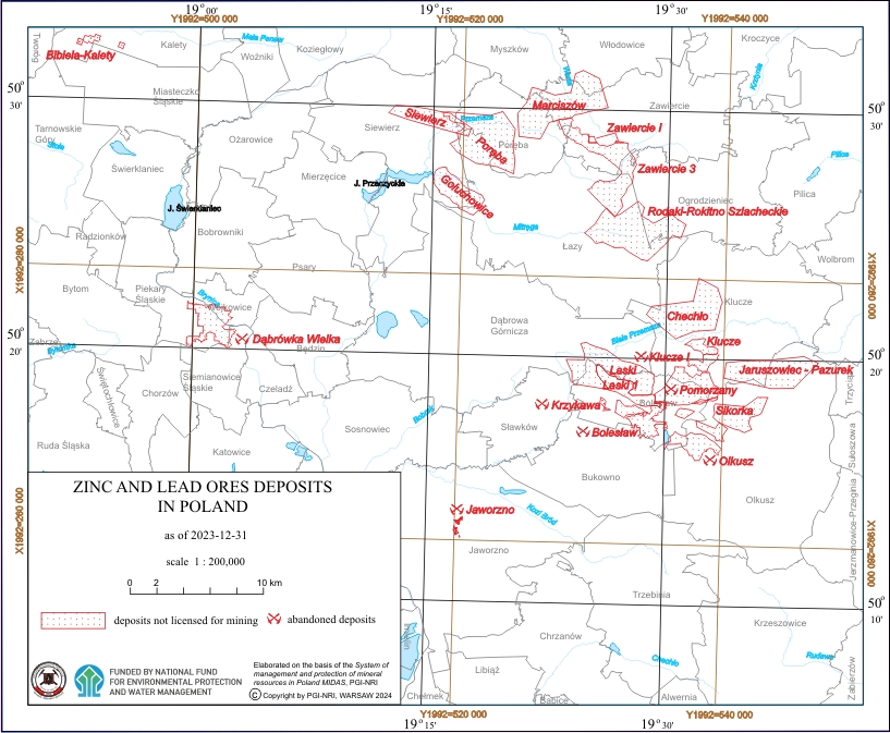
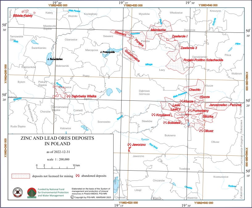
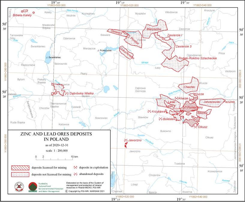
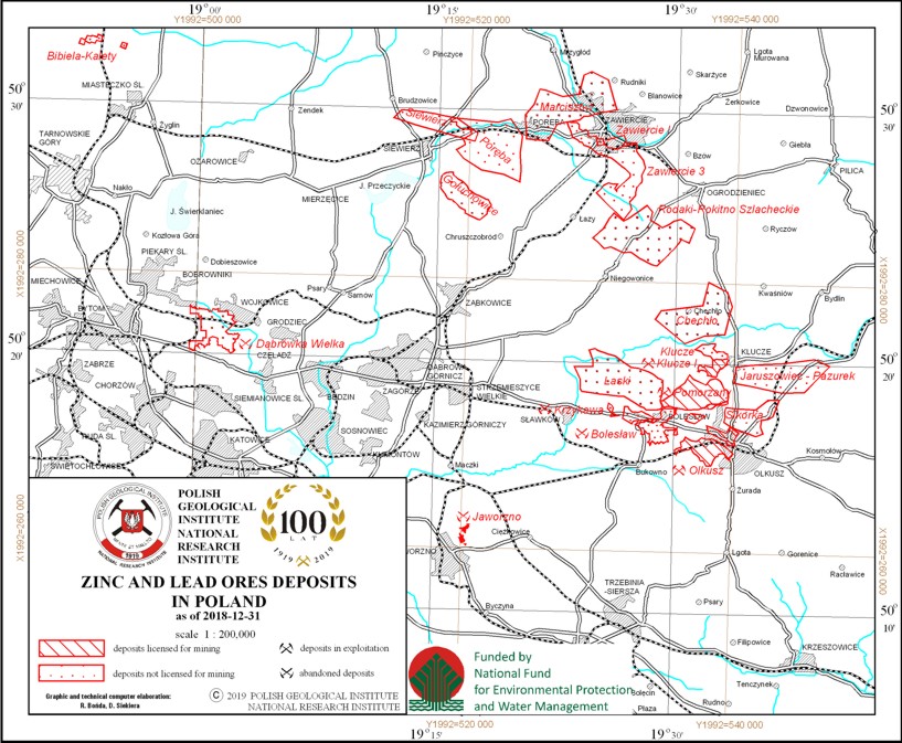
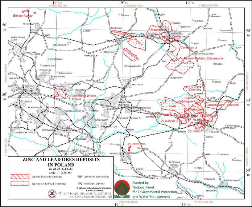
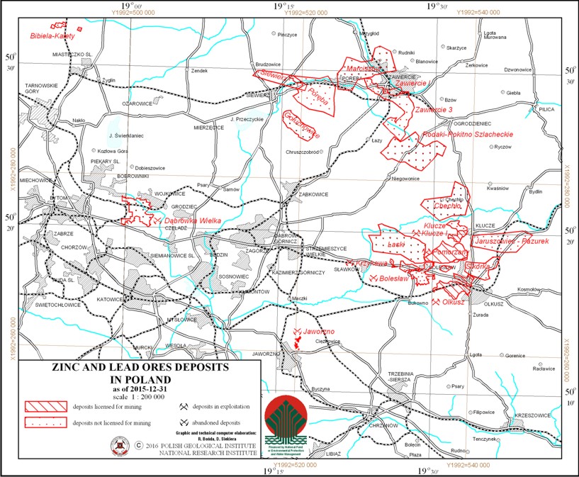
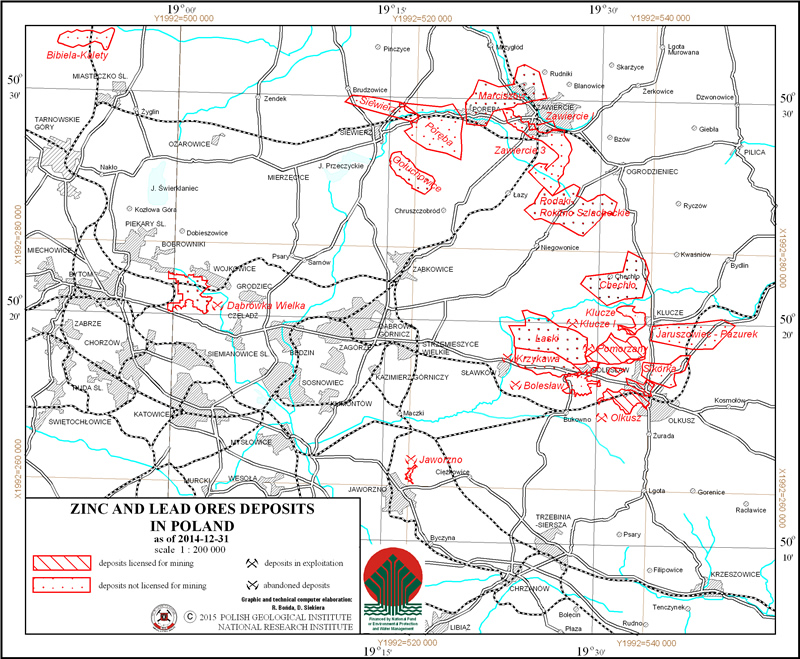
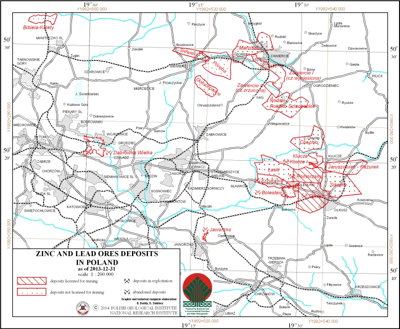
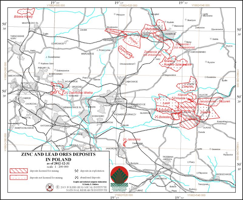
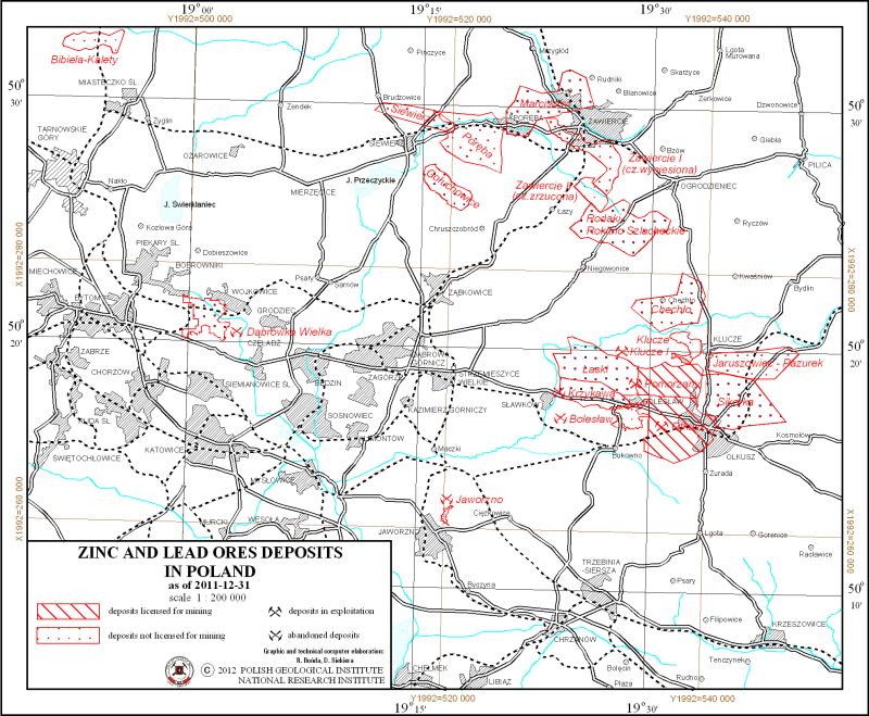
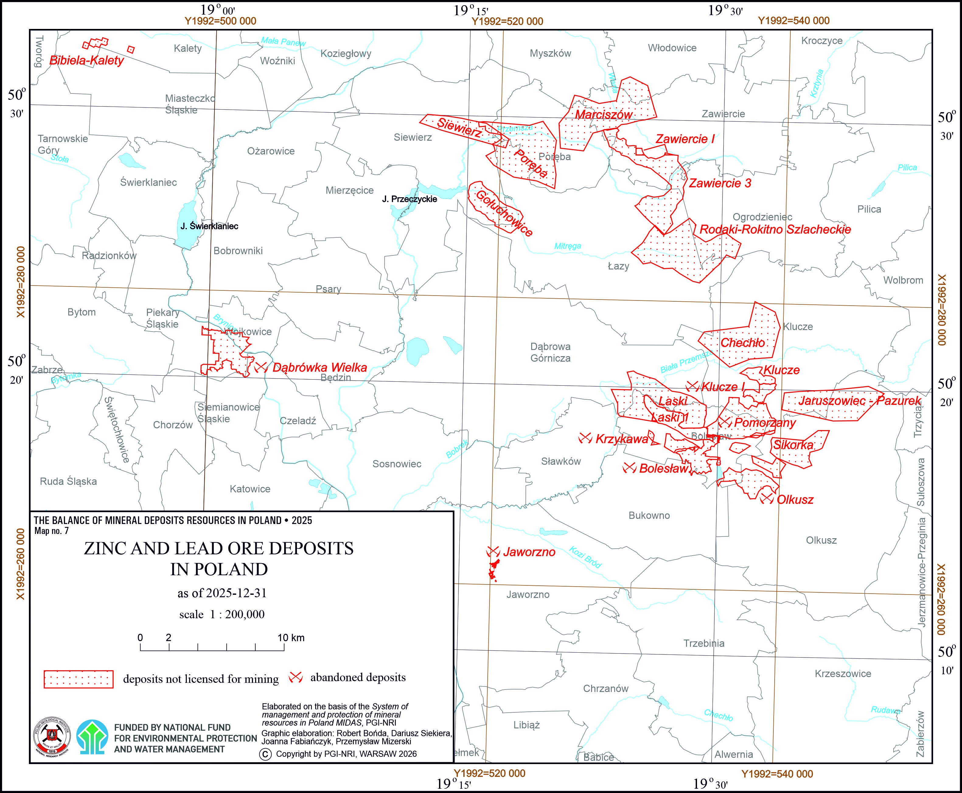
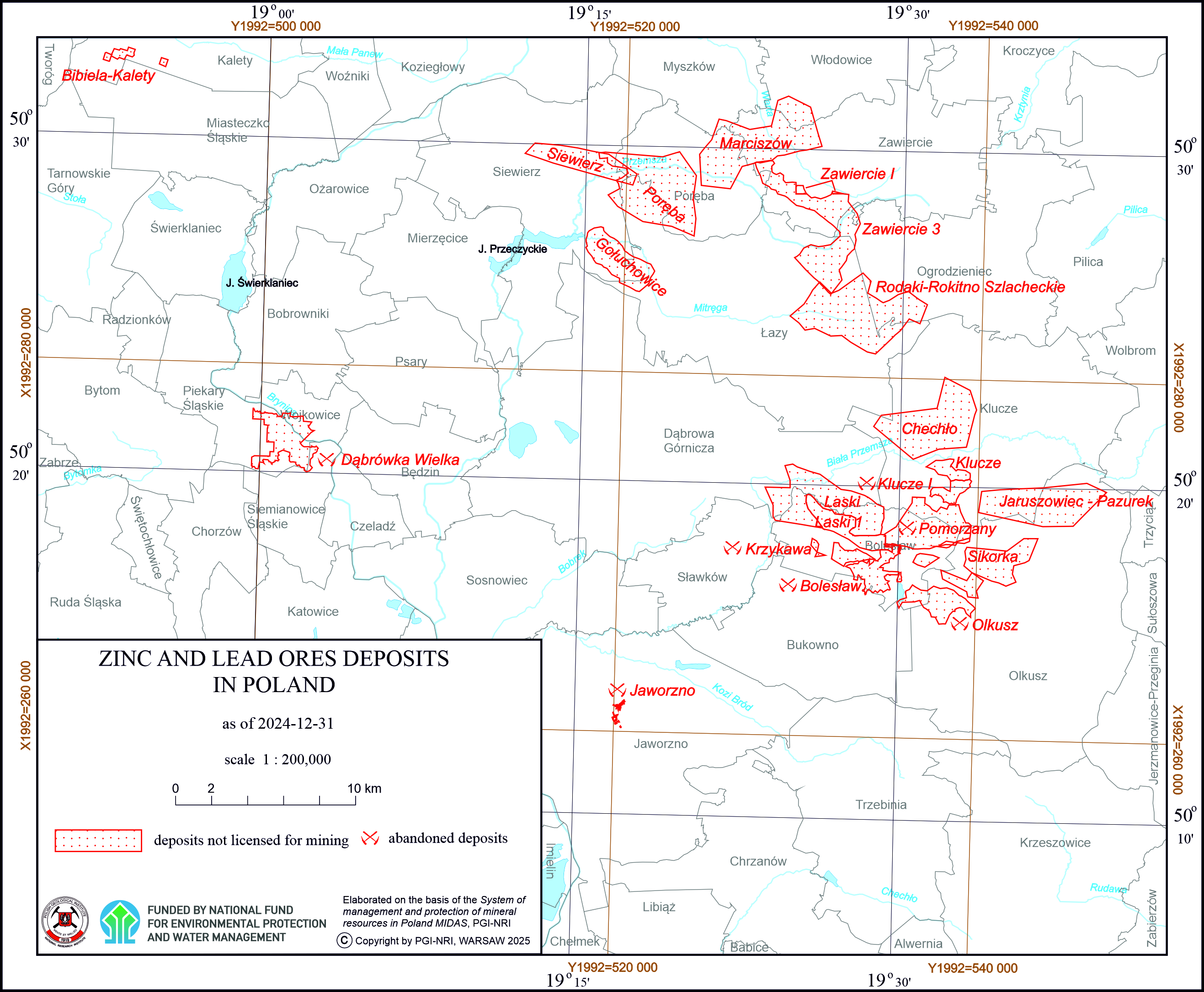
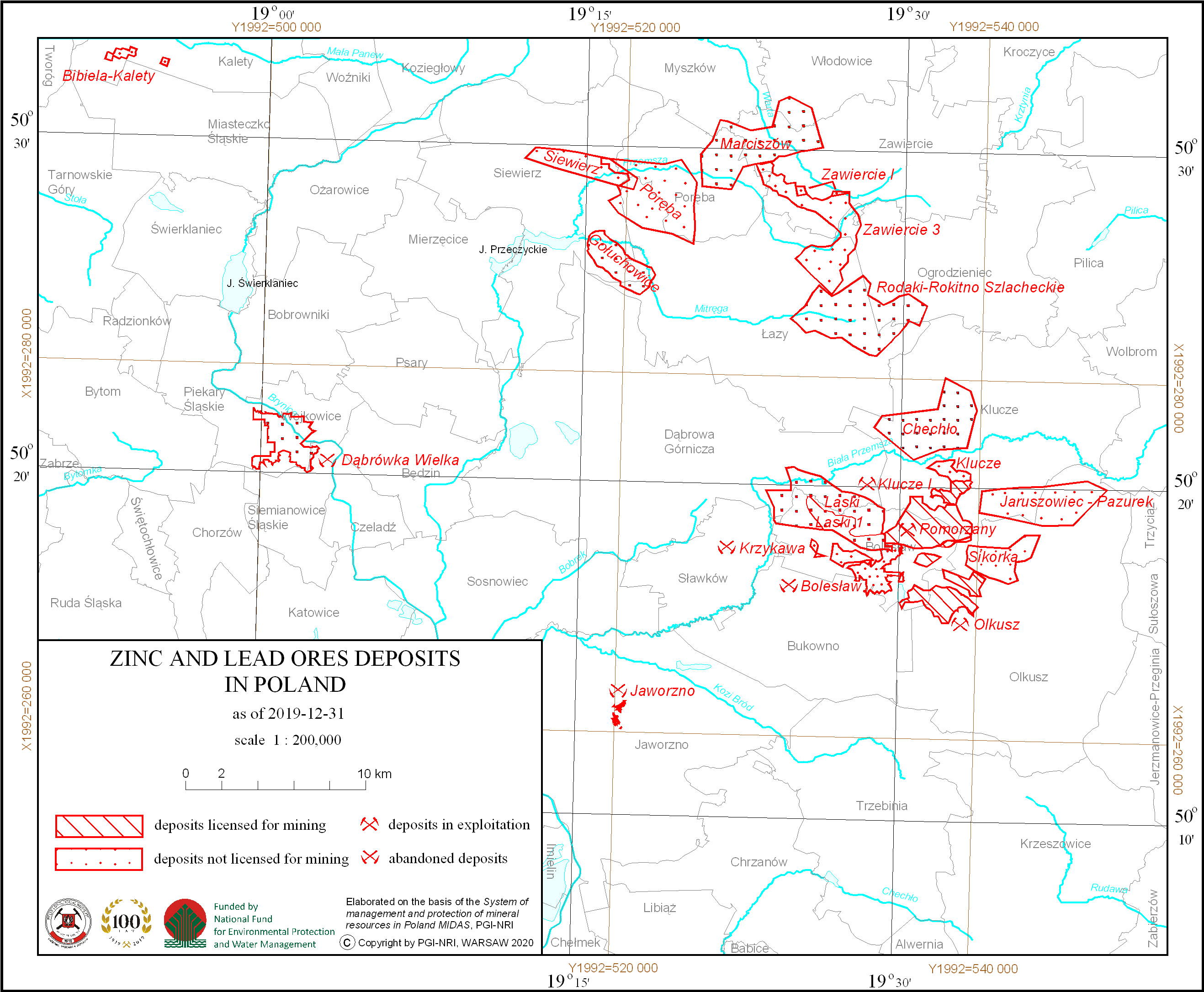
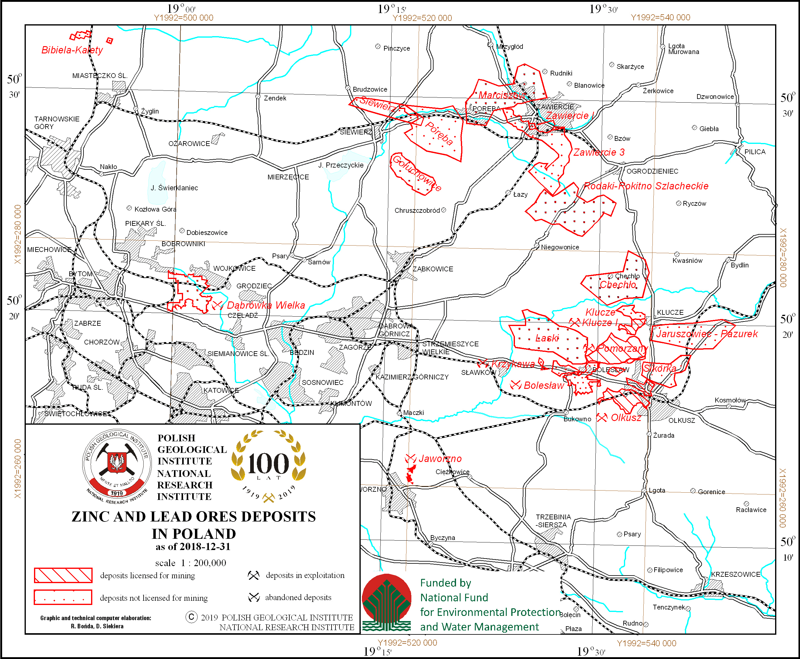
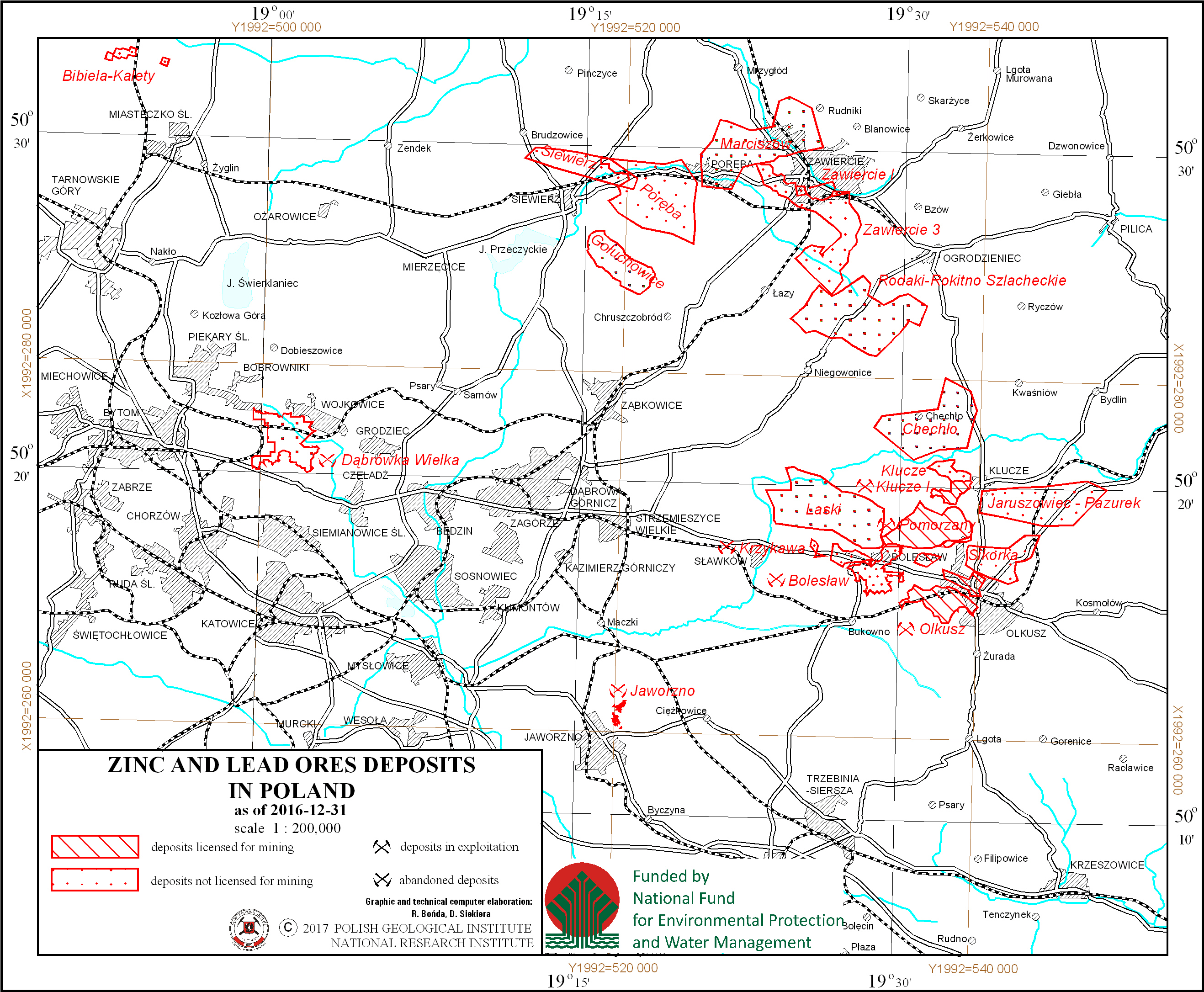
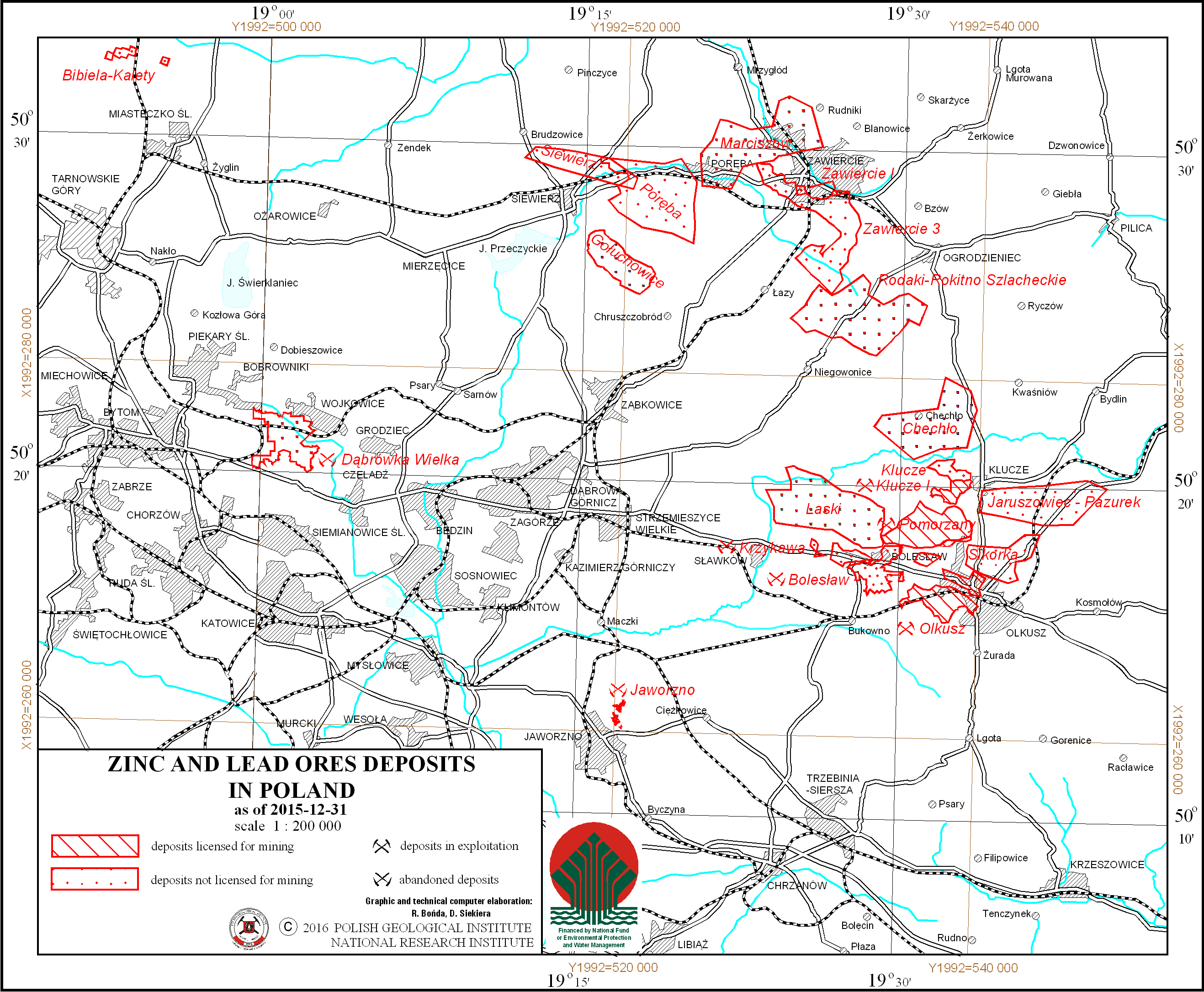
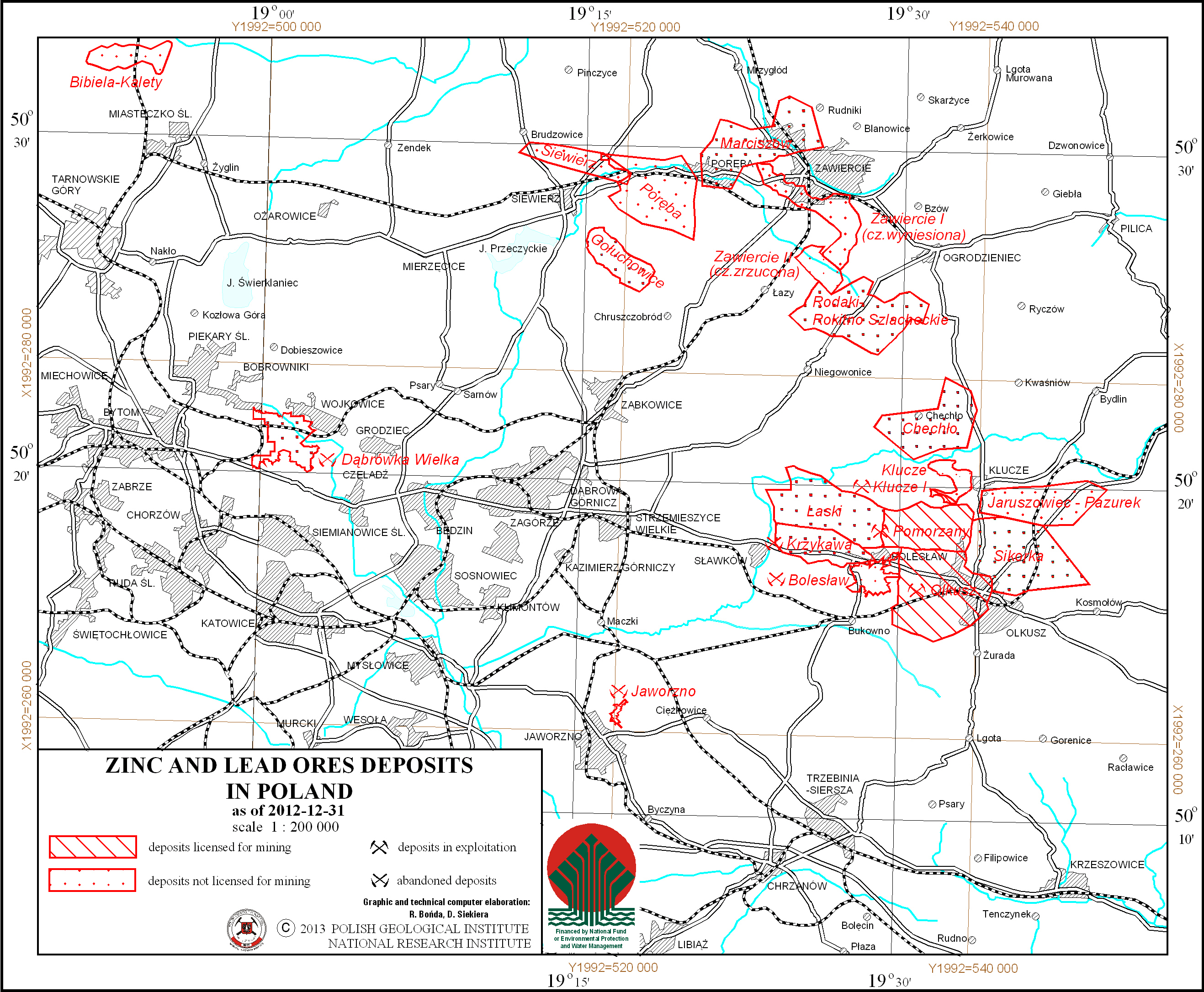
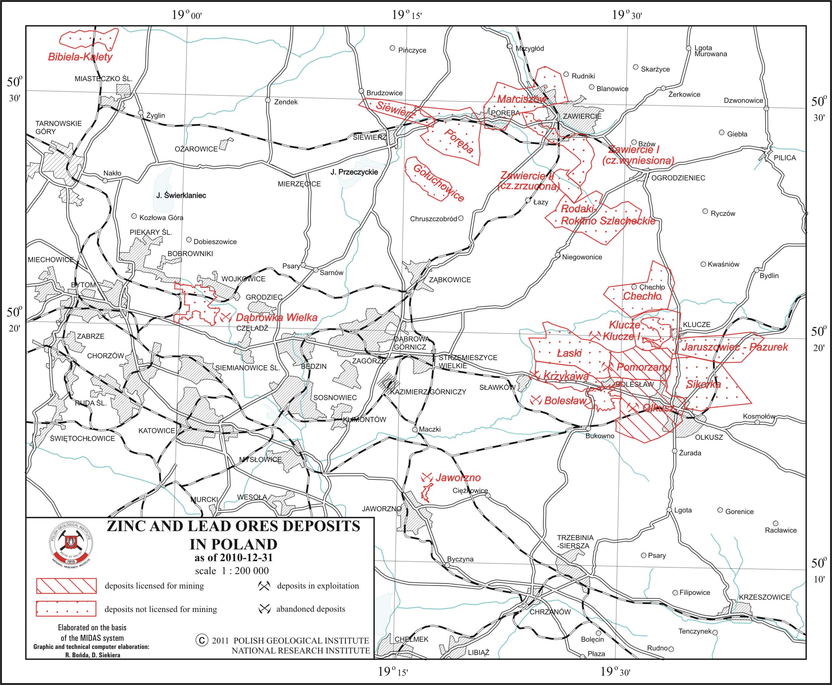
Zinc and lead ores deposits in Poland
There are zinc and lead ore deposits in Poland presented on the map. Deposits location is delineated by boundaries of deposits contoures. There is also information on a state of development of a particular deposit.
Download map.
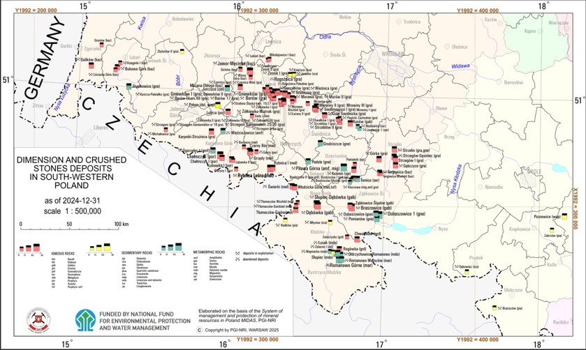
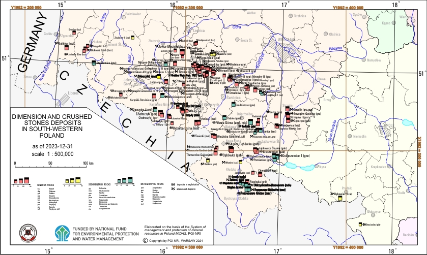
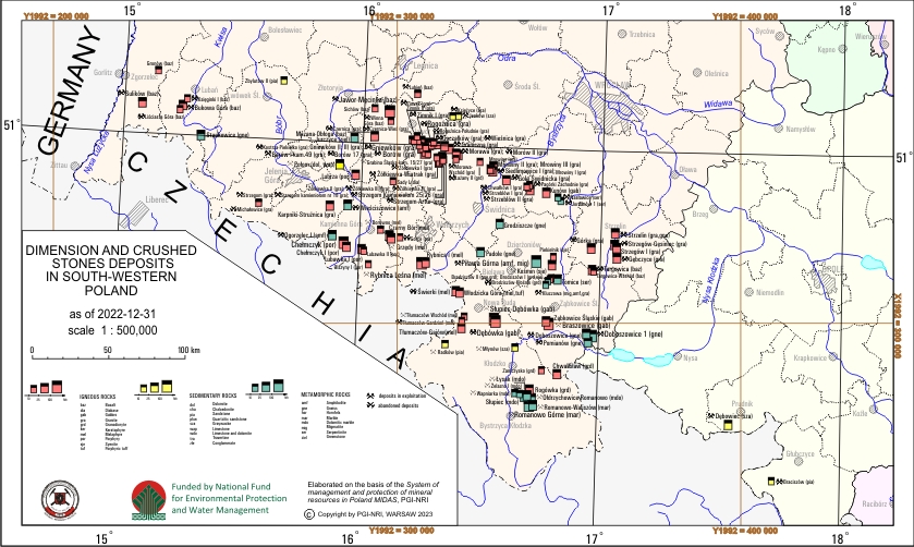
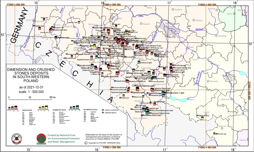
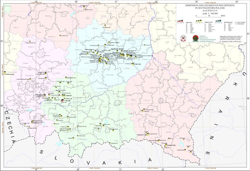
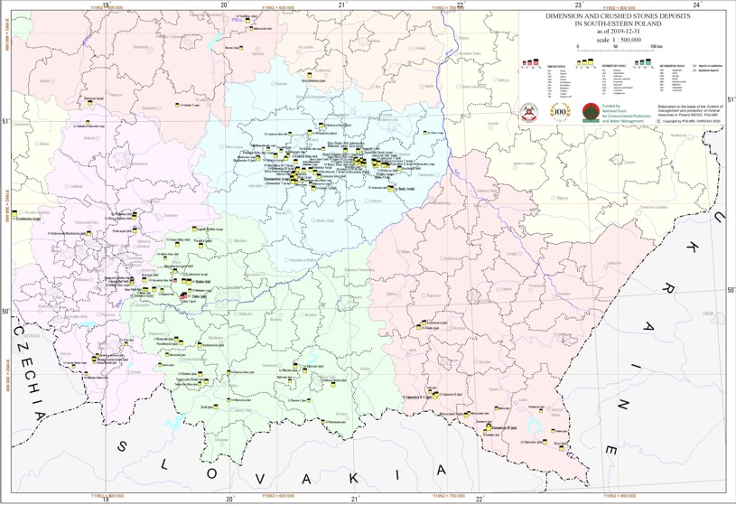
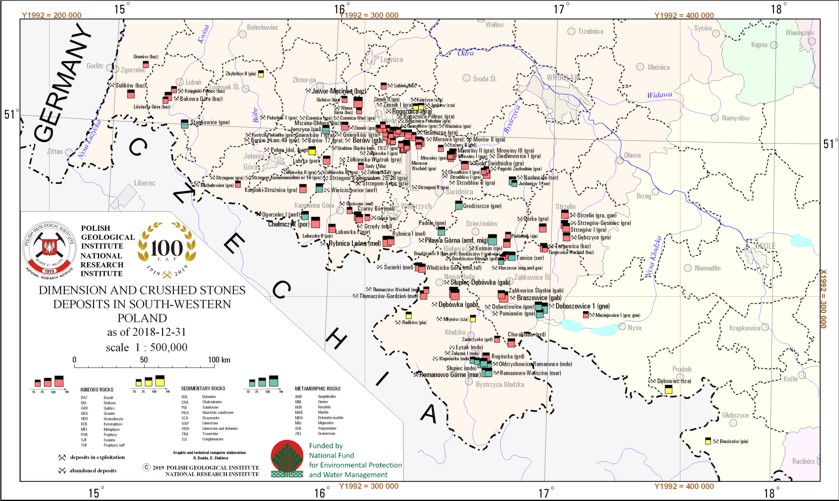
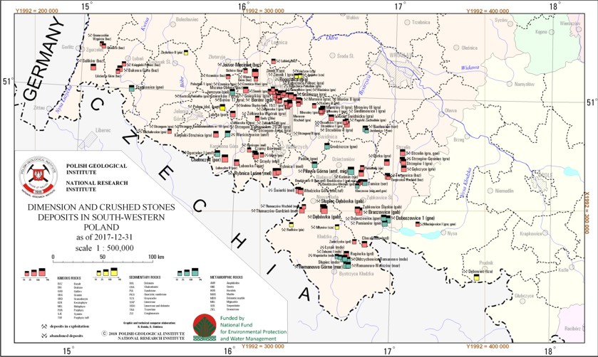
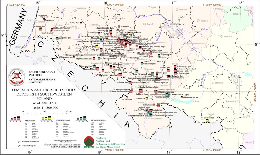
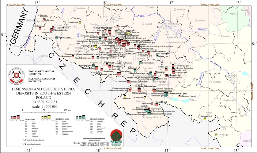
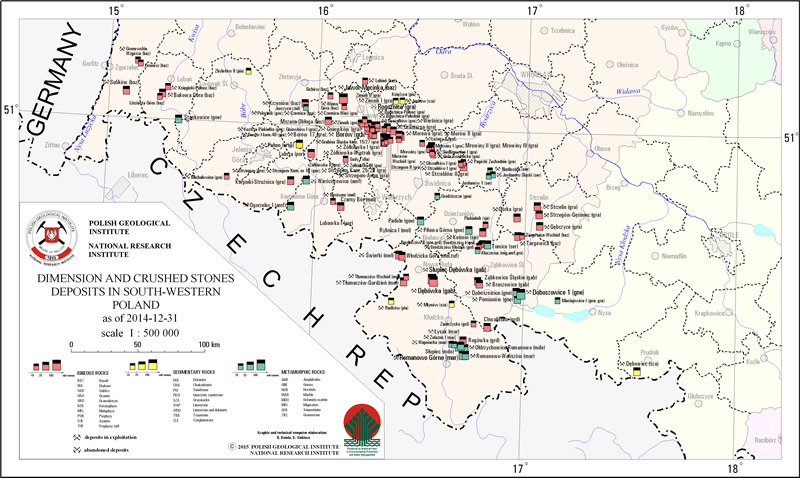
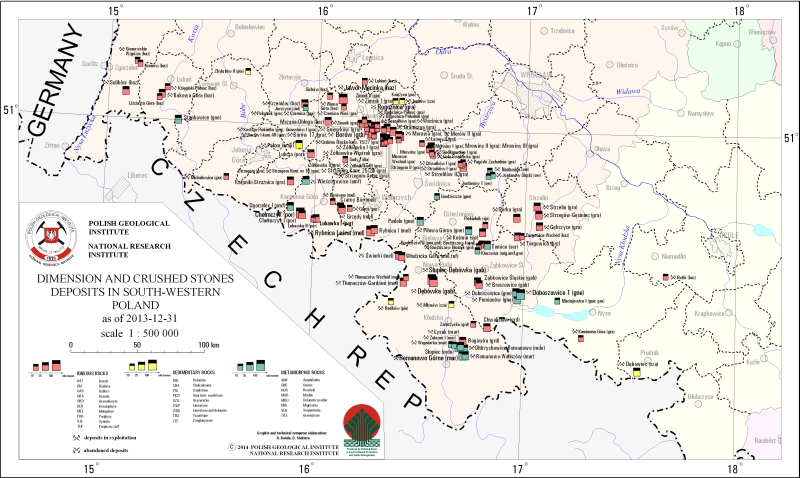
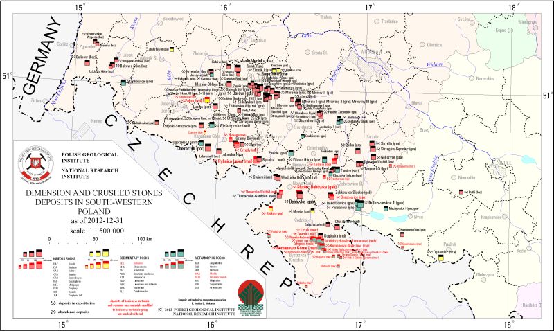
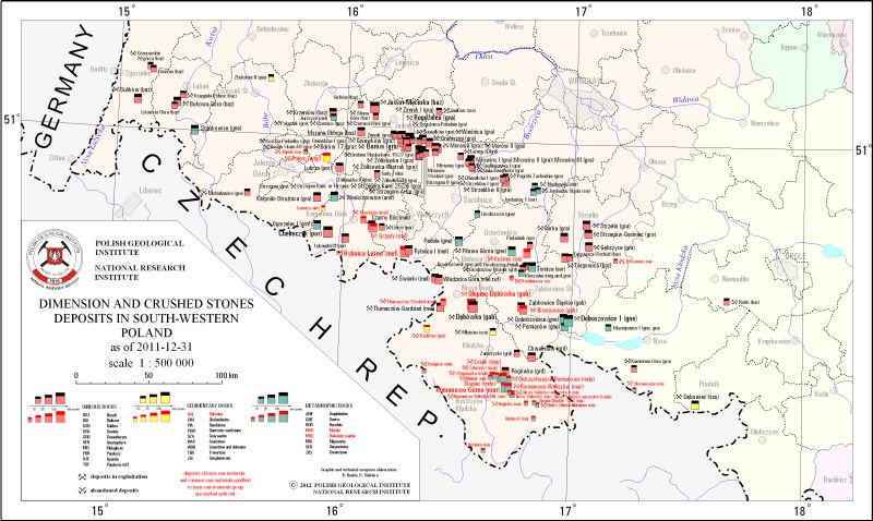
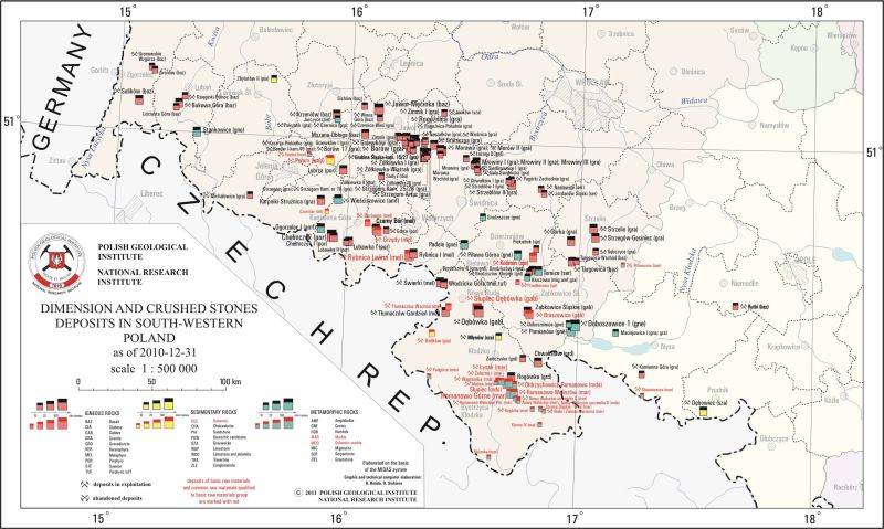
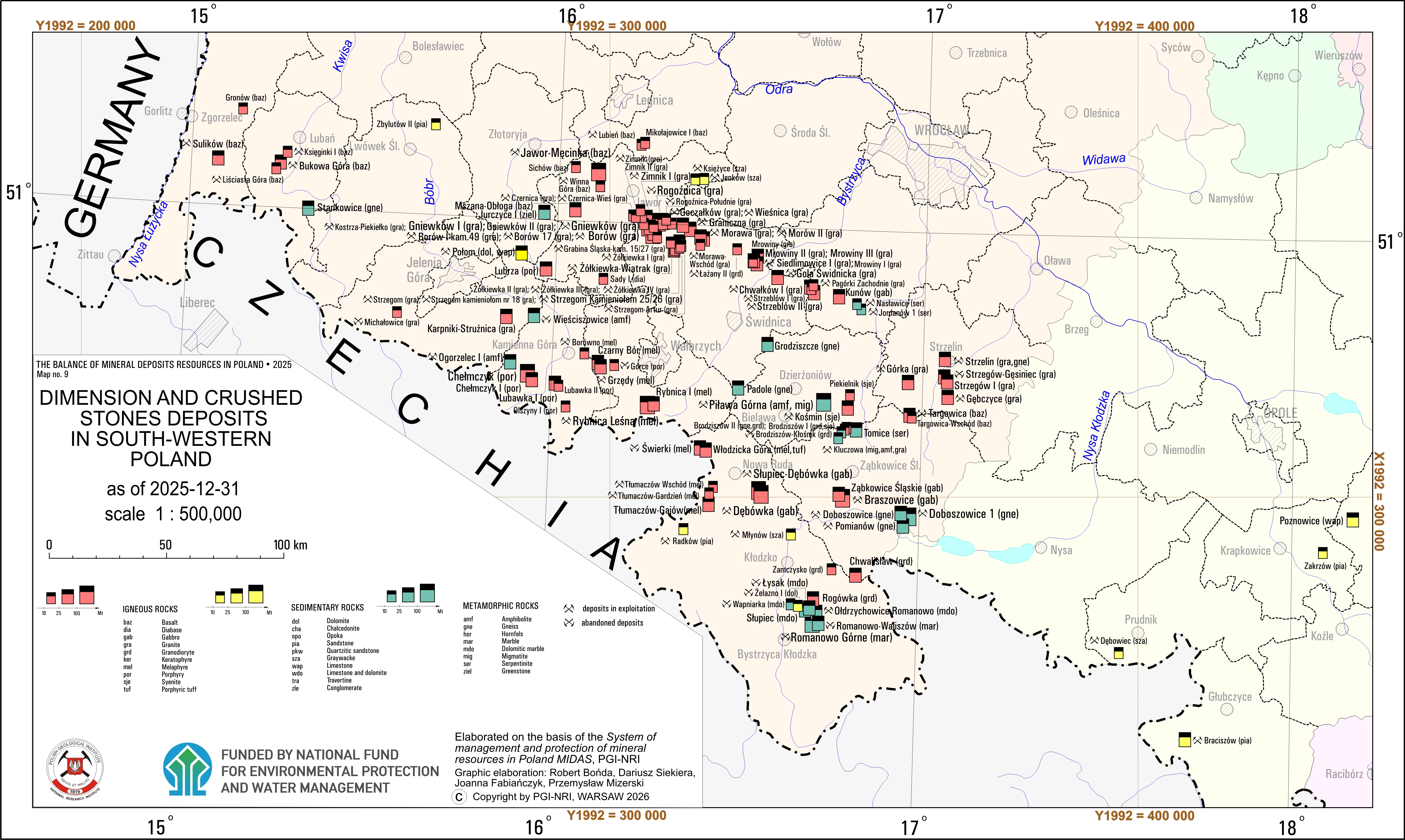
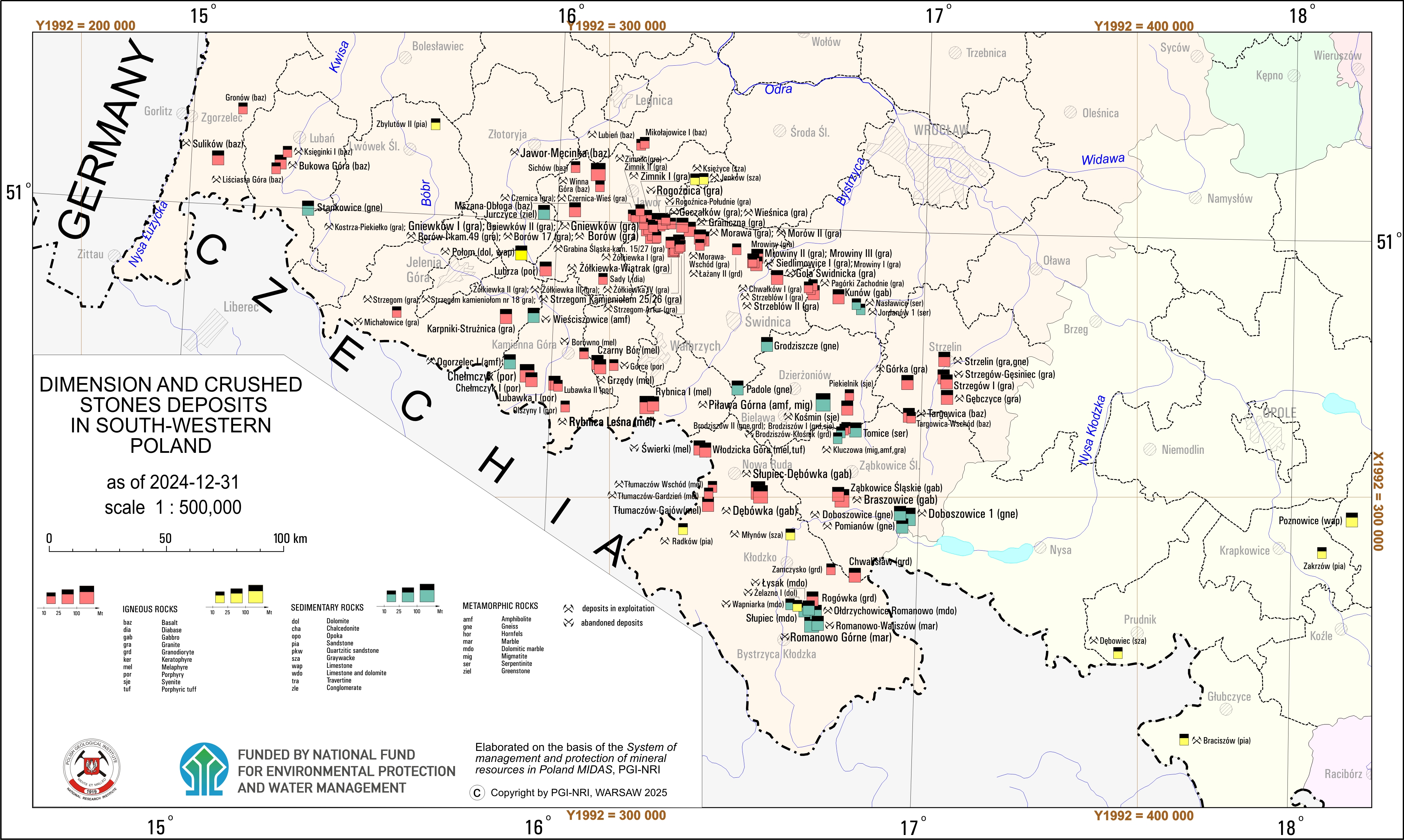
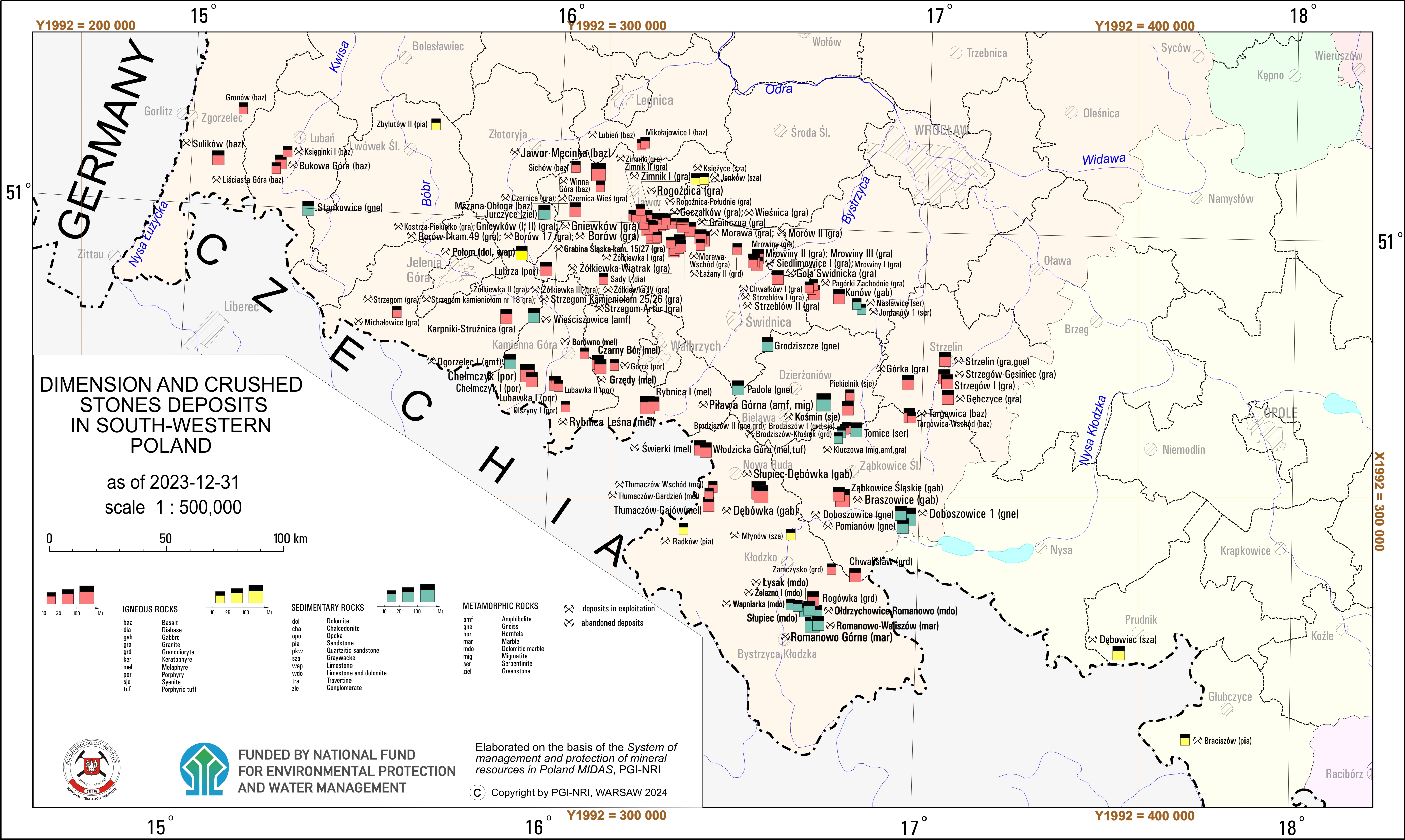
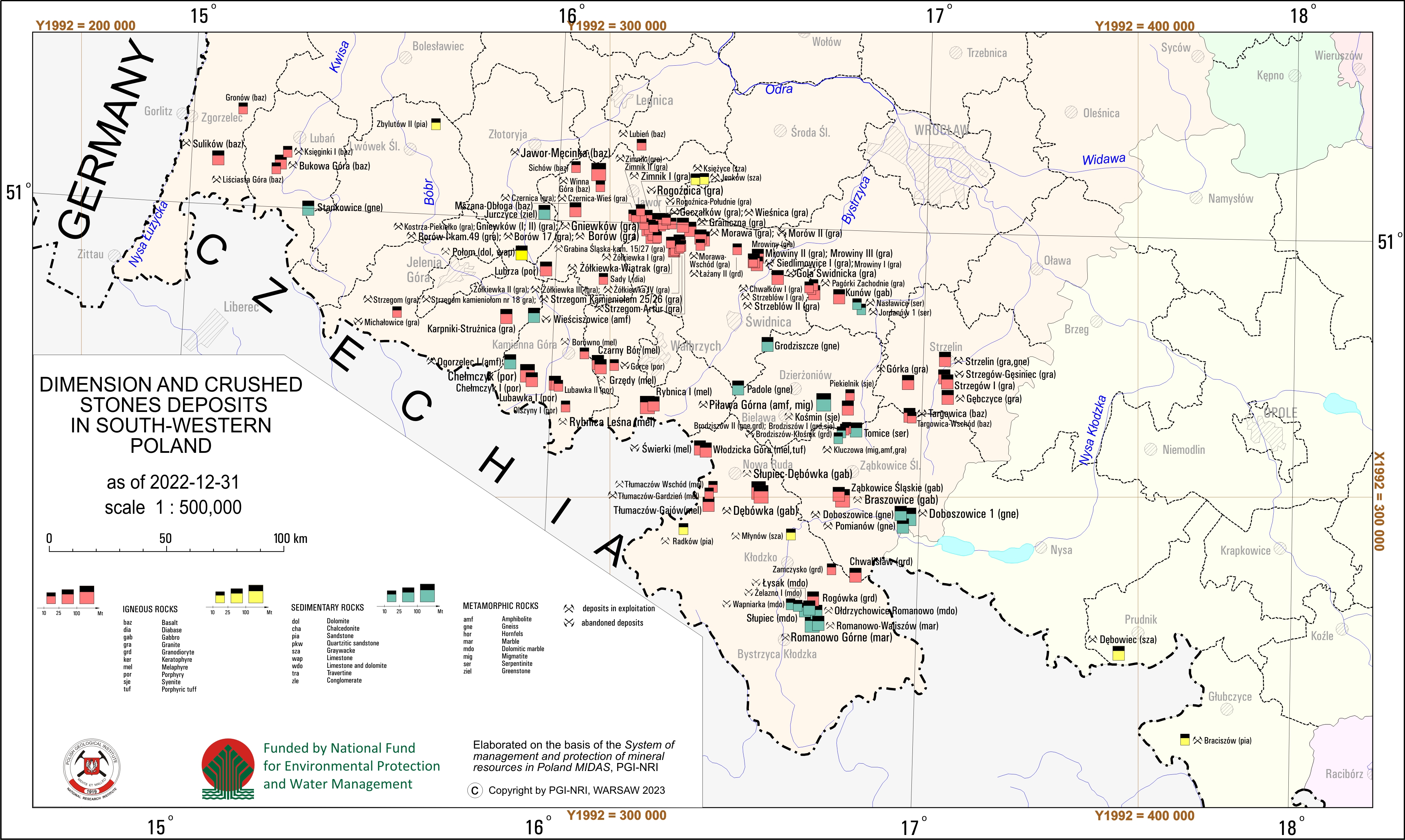
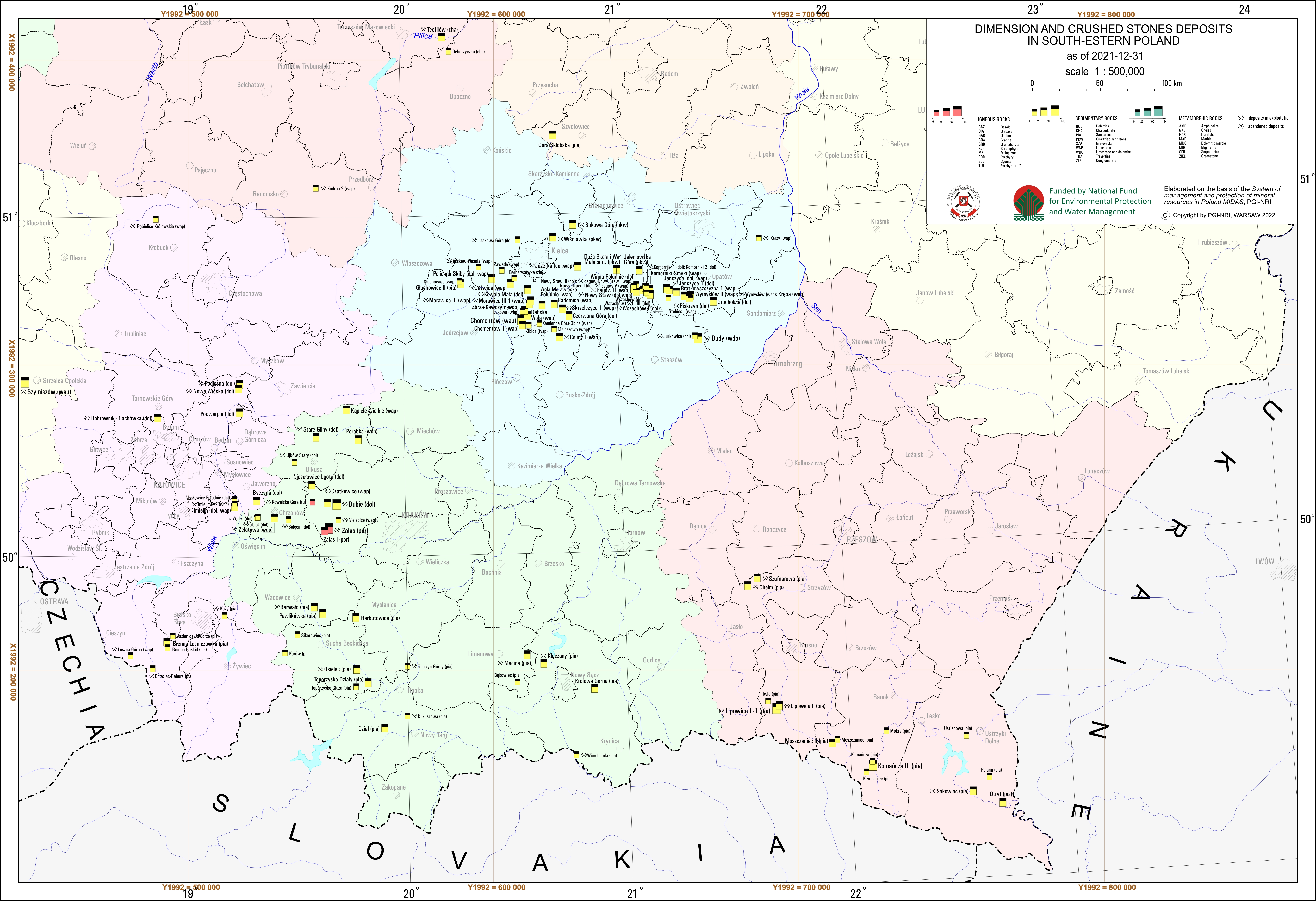
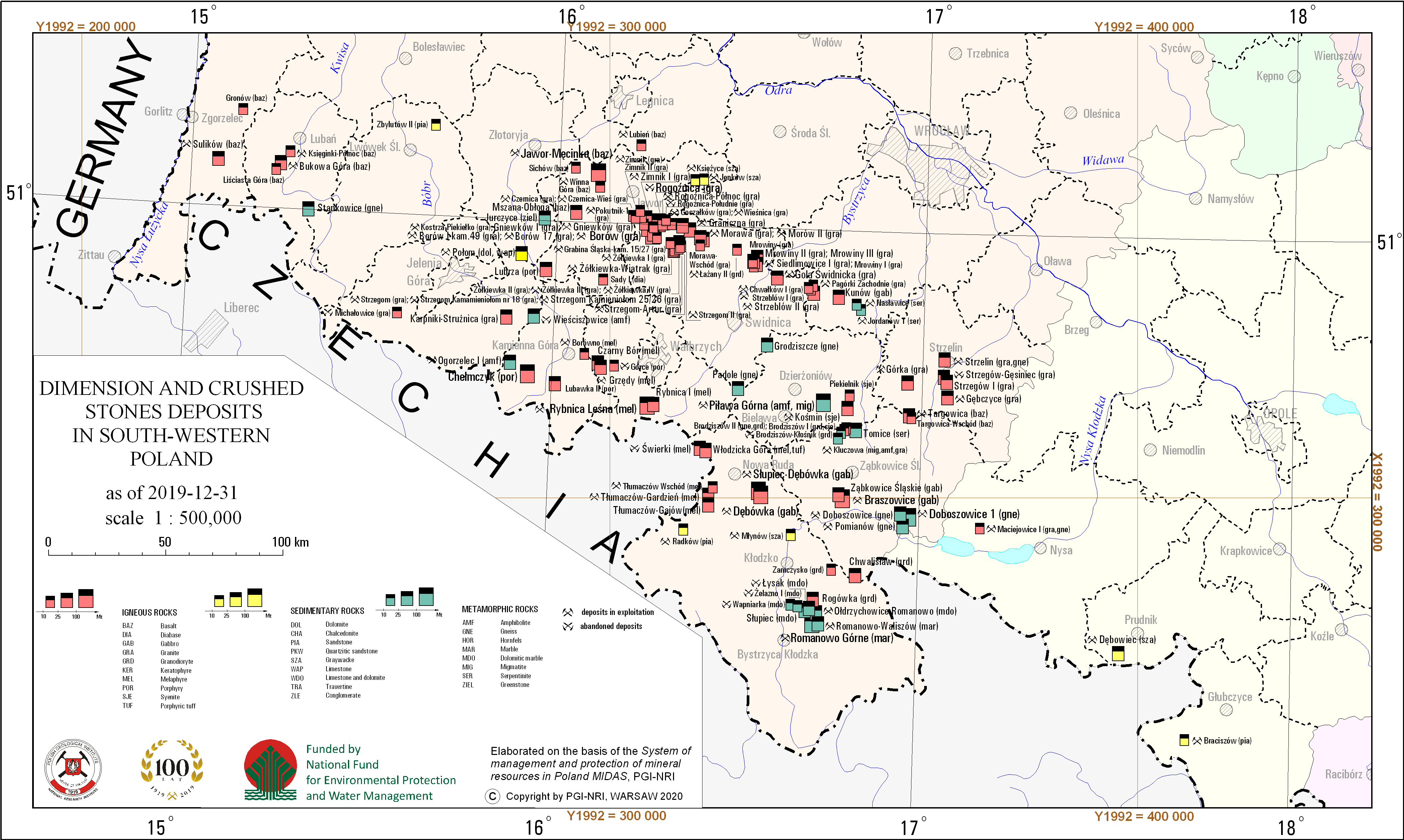
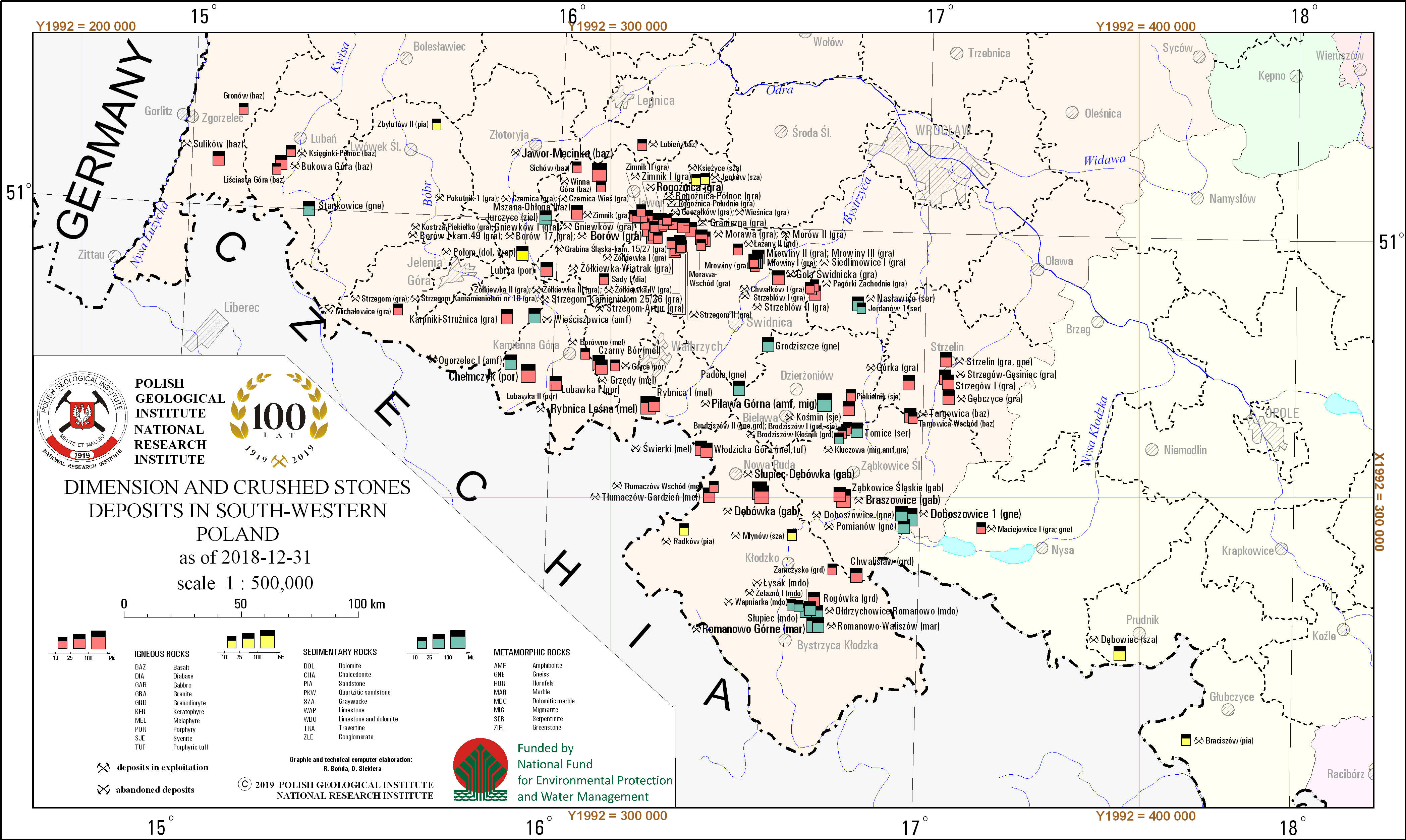
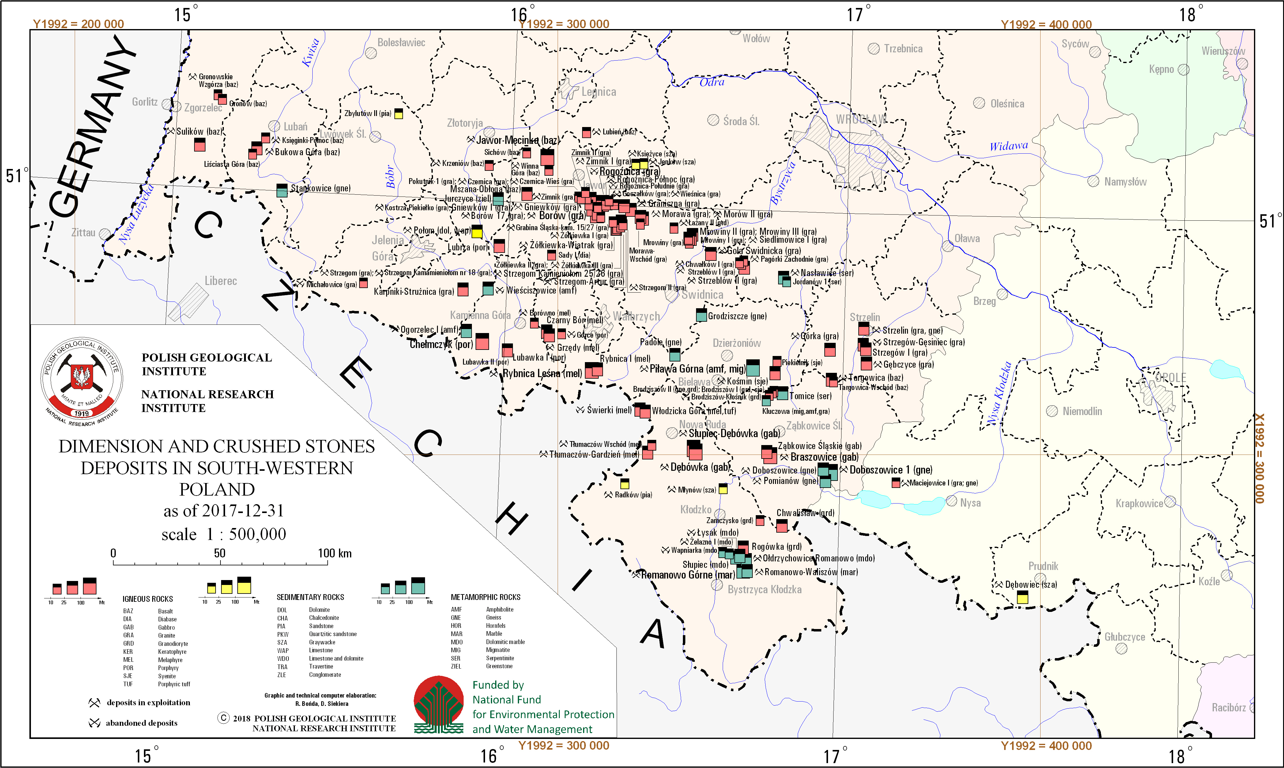
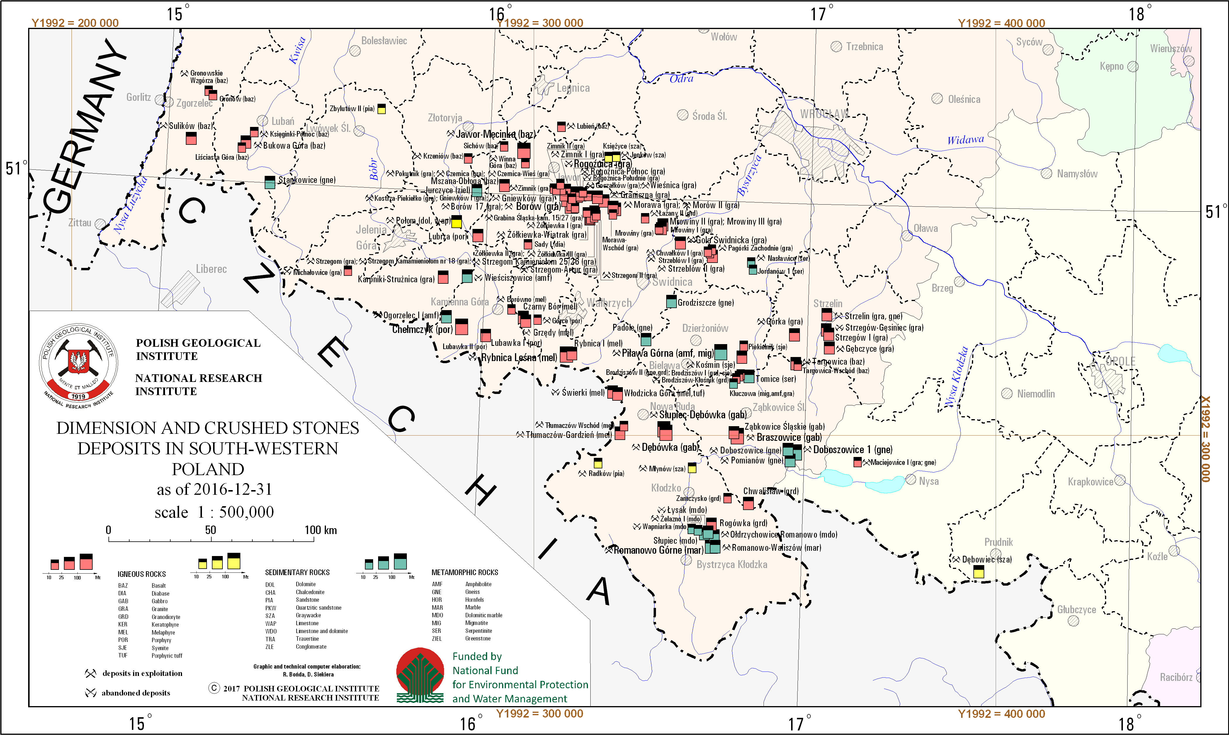
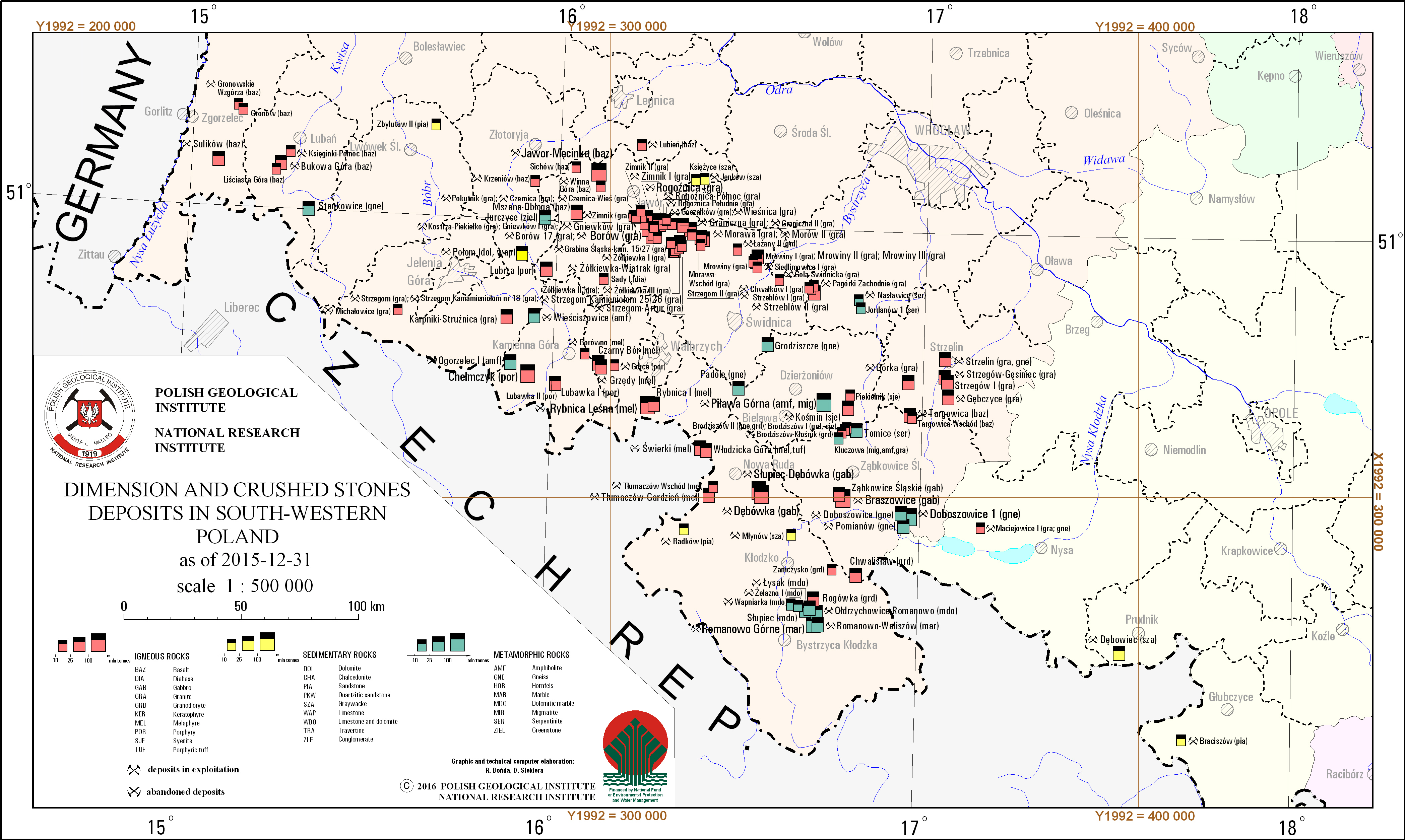
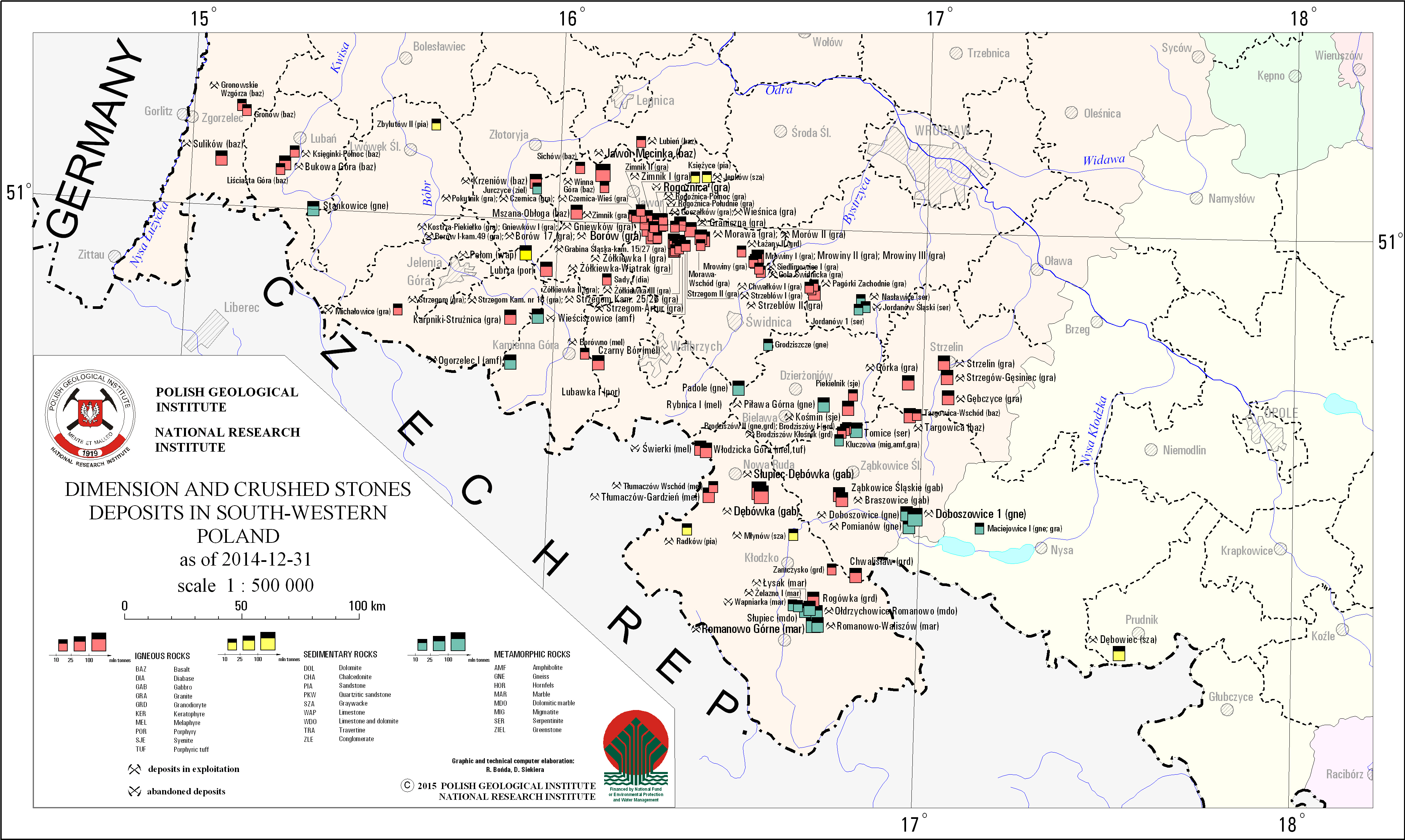
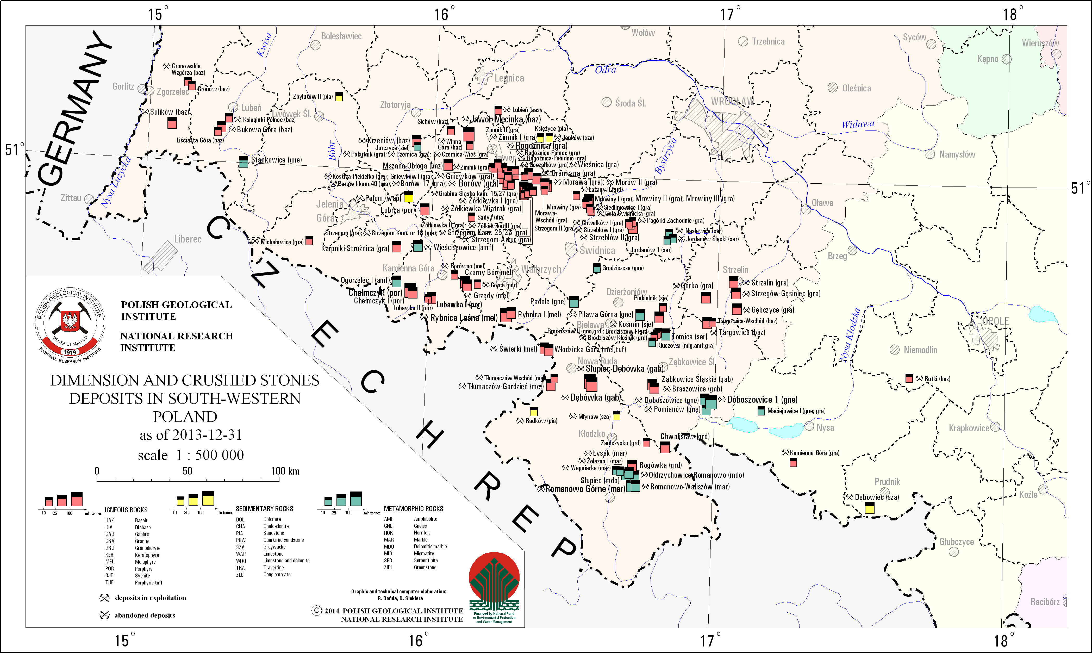
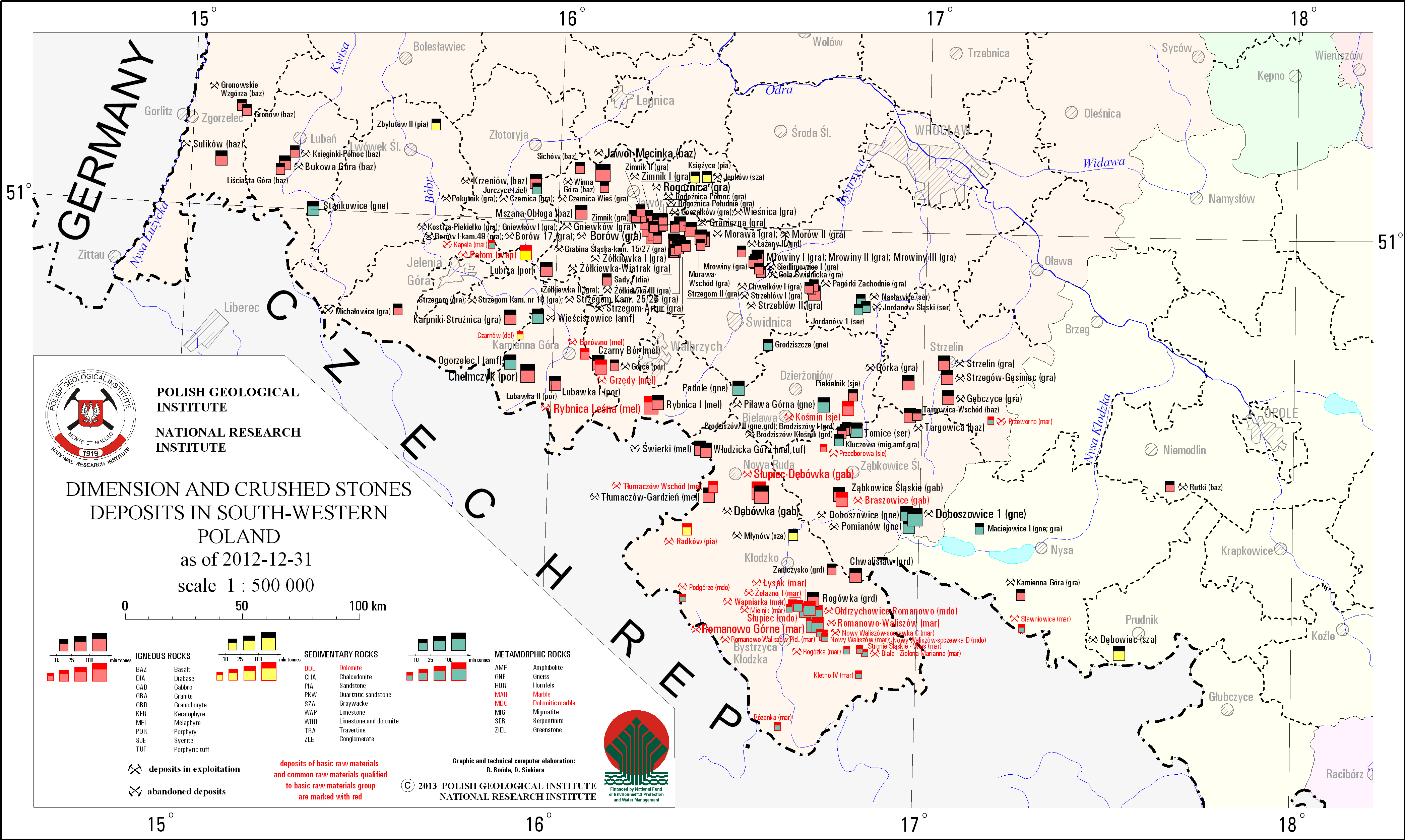
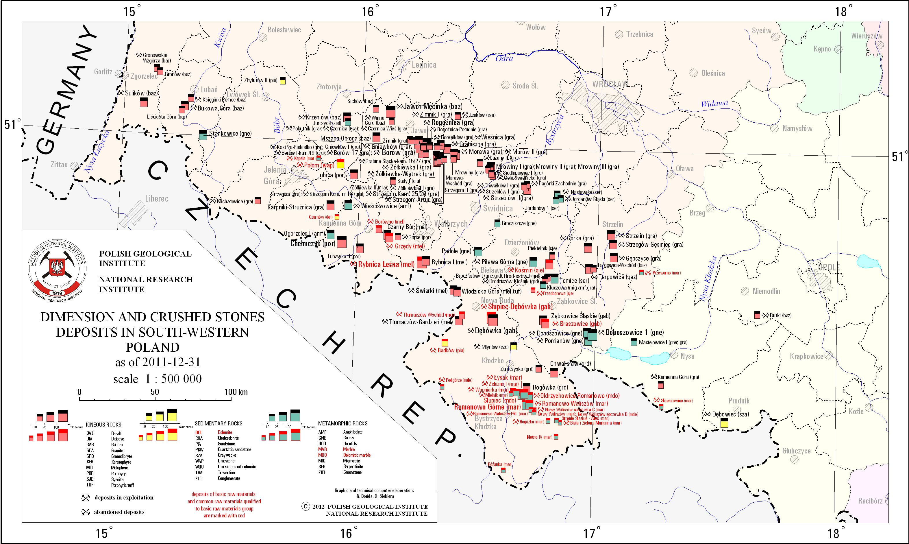
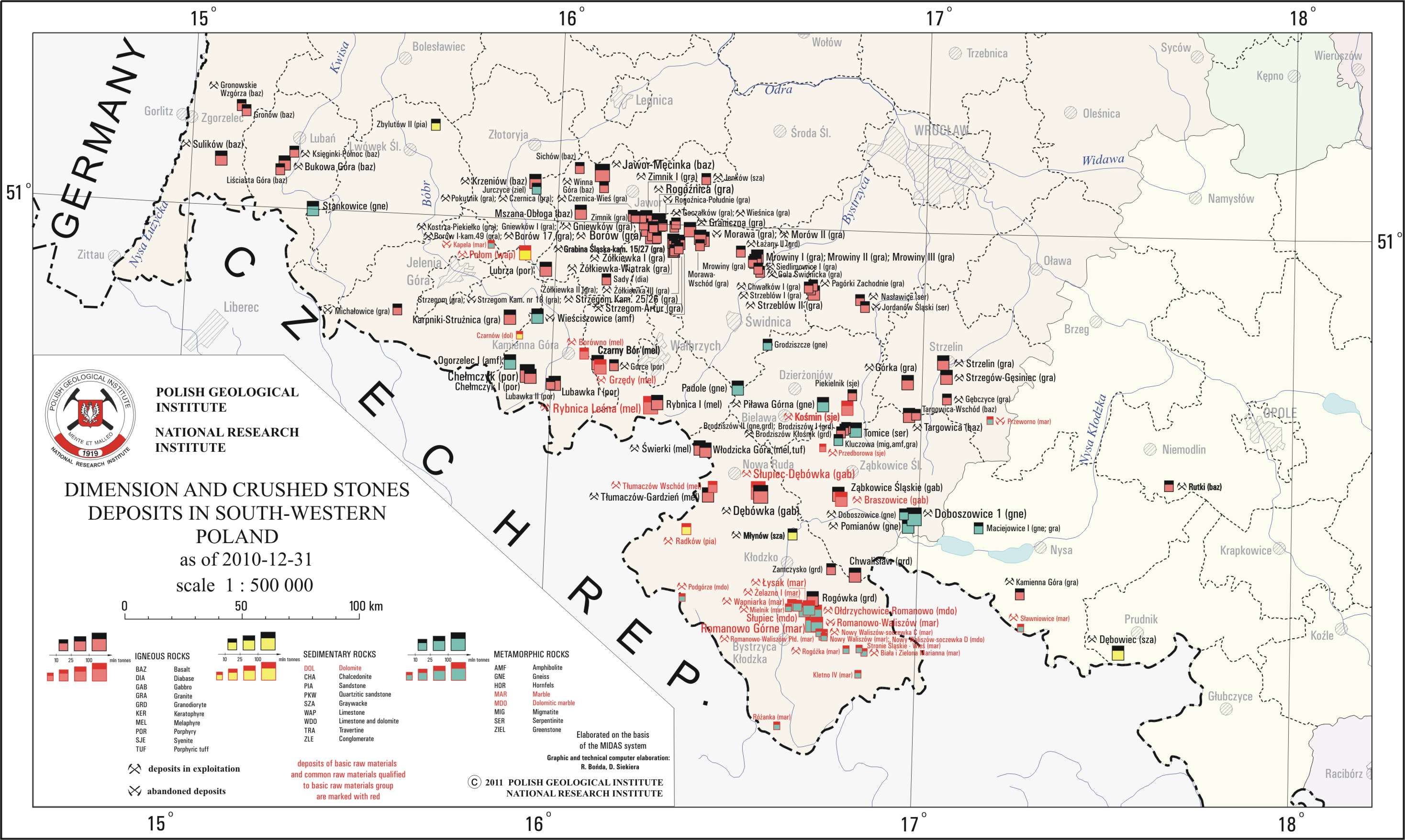
Dimension and crushed stones deposits in South-Western Poland
There are dimension and crushed stones deposits in South-Western Poland presented on the map. Deposits location is presented by signature marks with distinction of deposits classified as basic minerals. There is also information on a state of development of a particular deposit. The map takes into account an origin of the sotnes - sedimentary, igneous and metamorphic, and also their lithological types.
Download map.
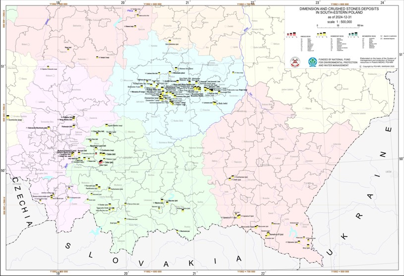
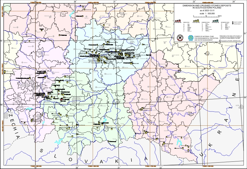
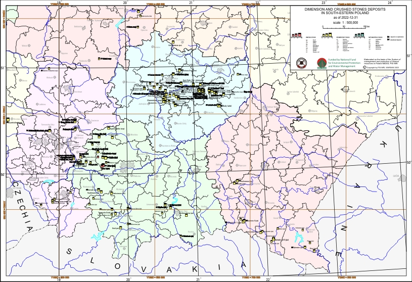
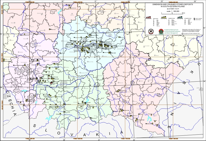
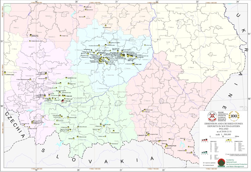
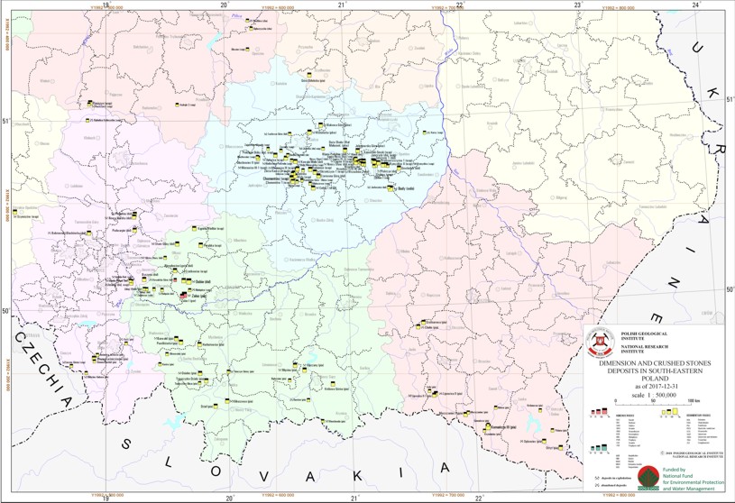
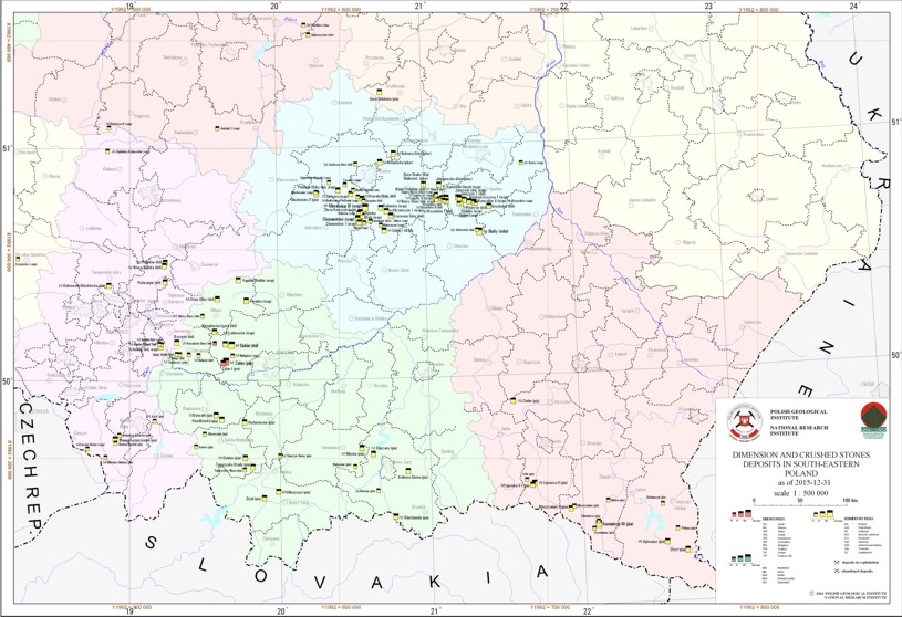
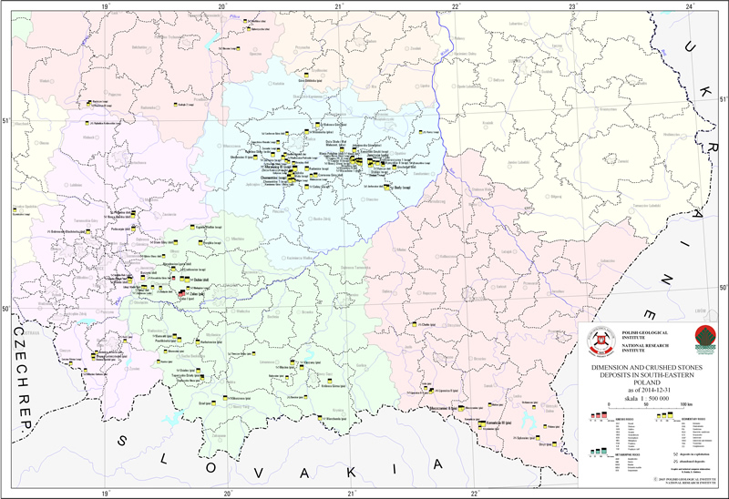
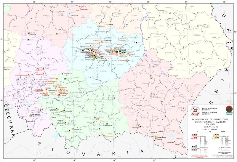
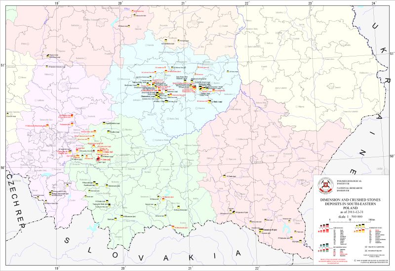
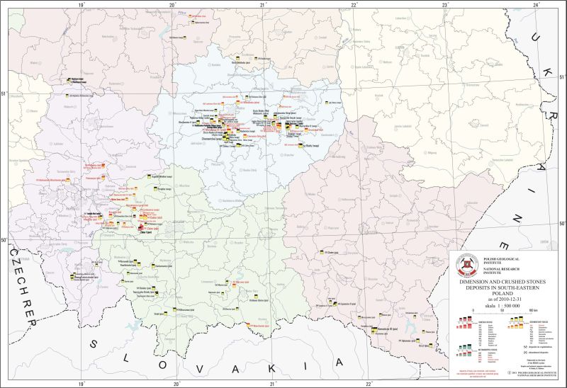
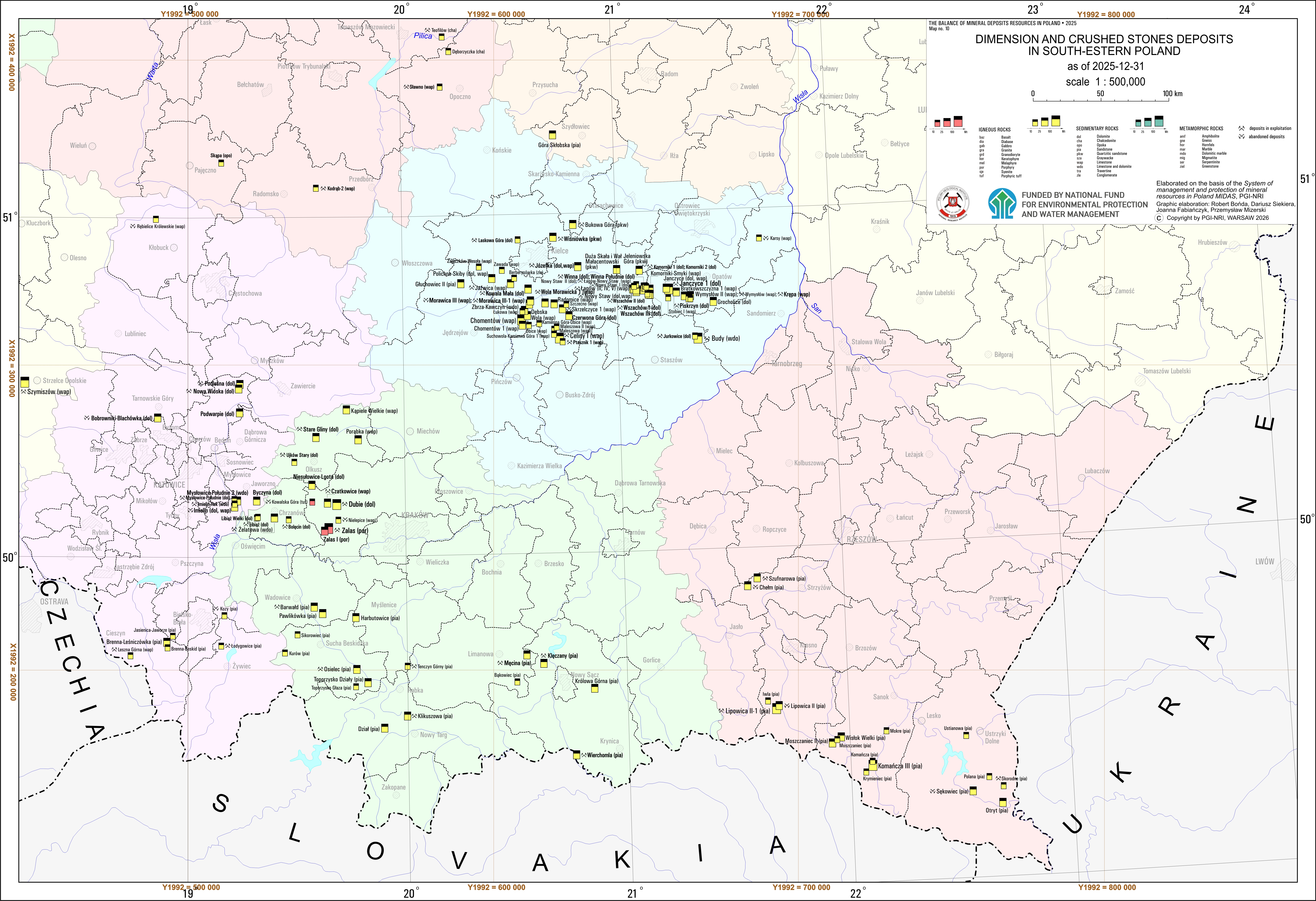
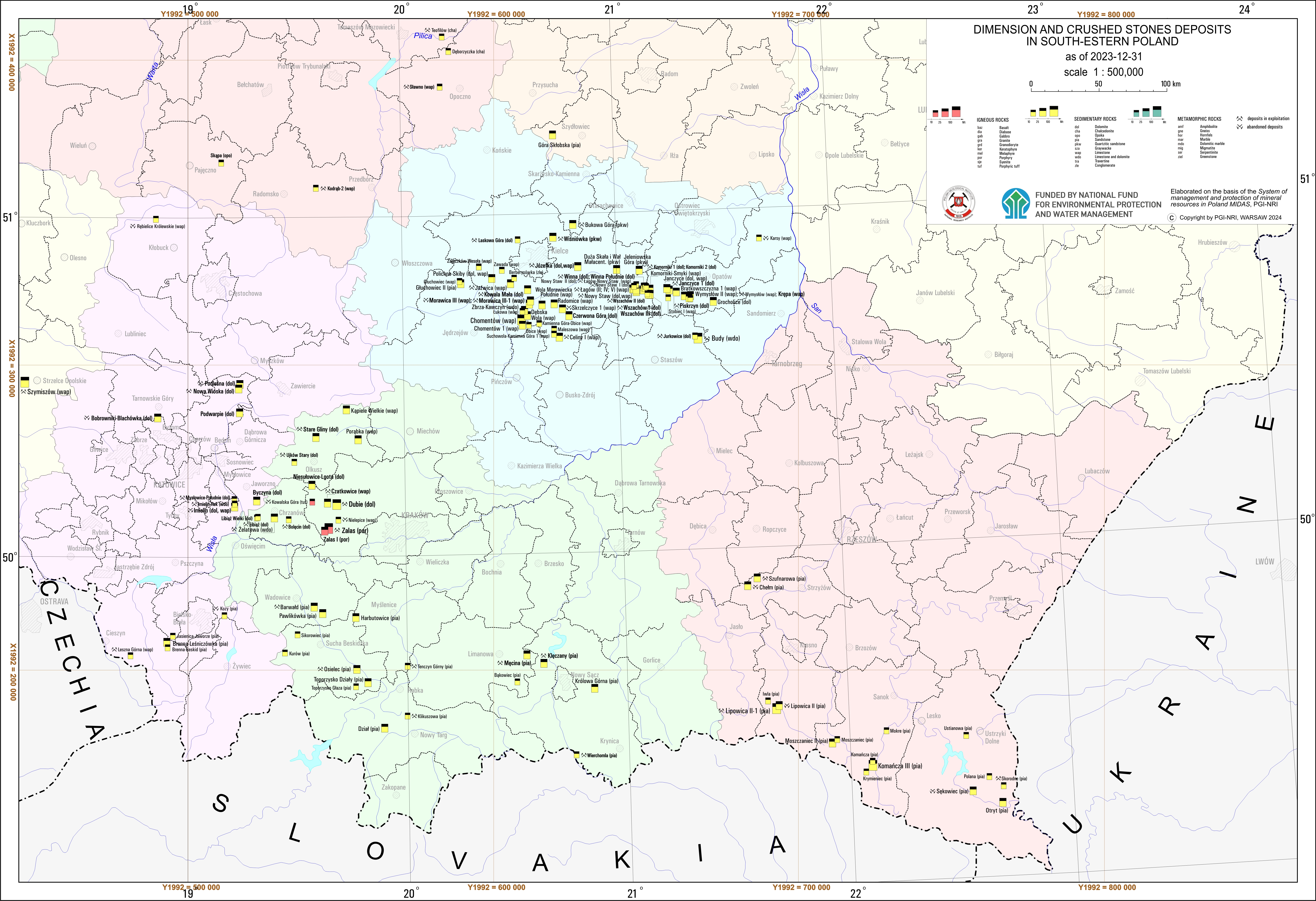
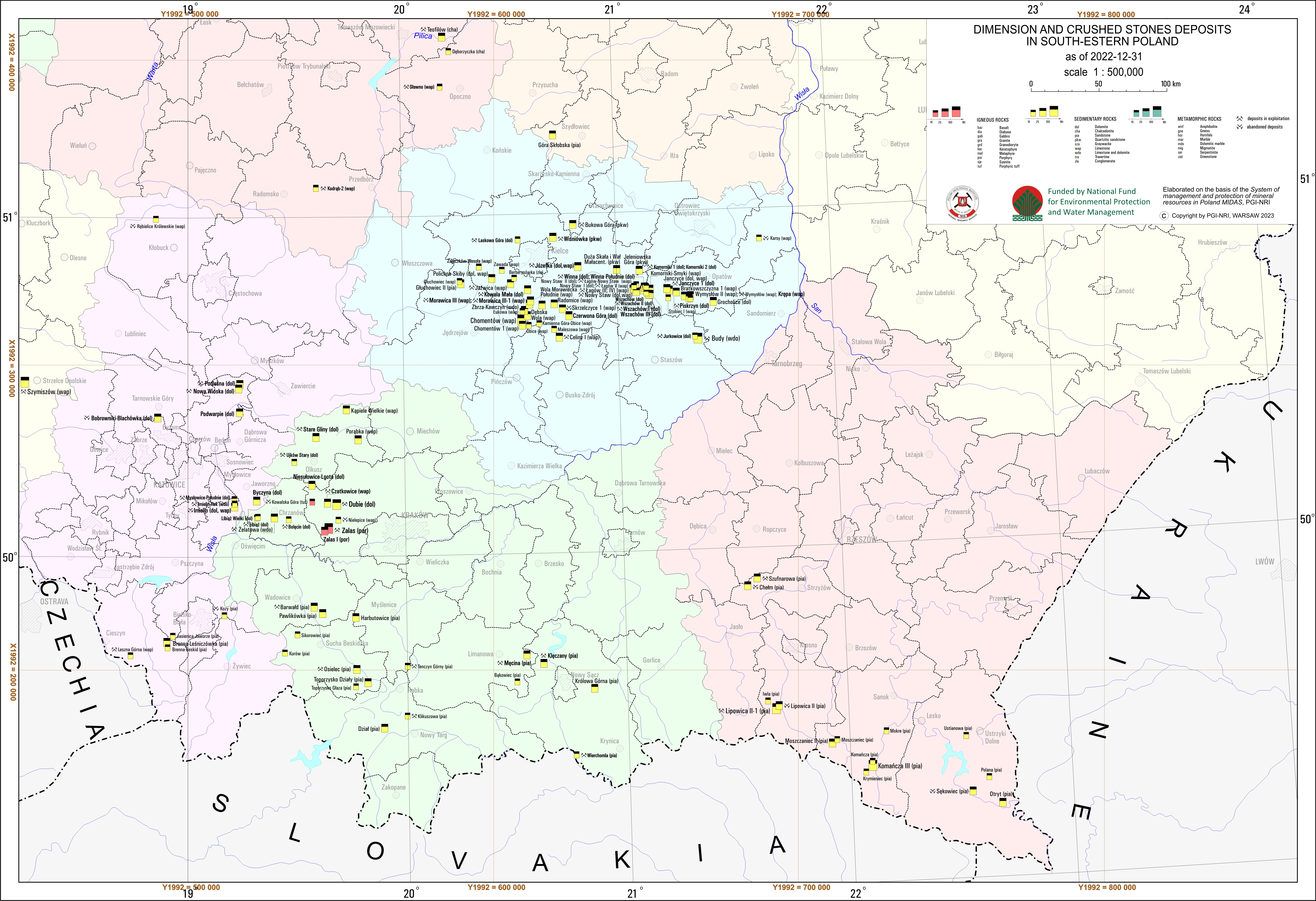
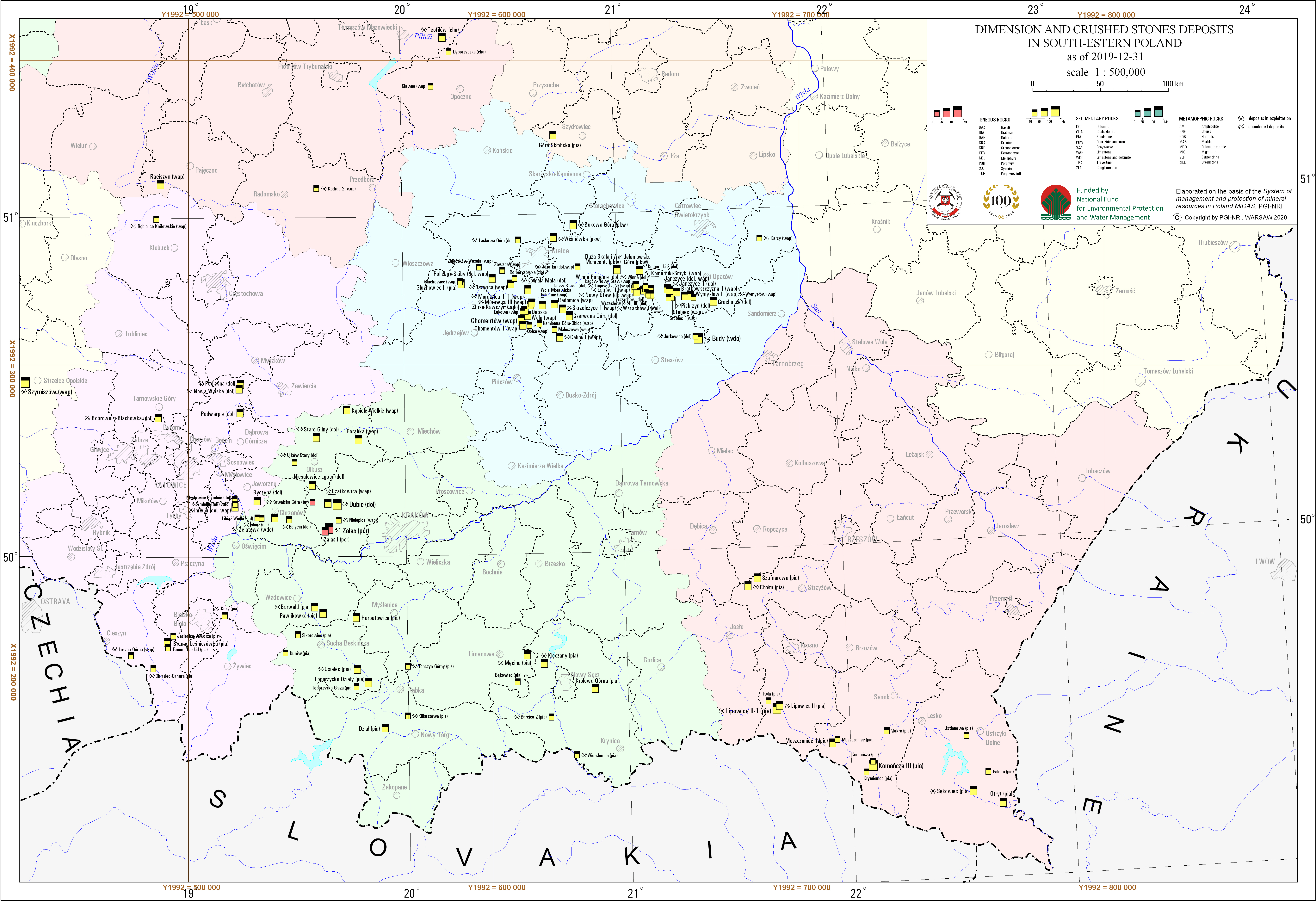
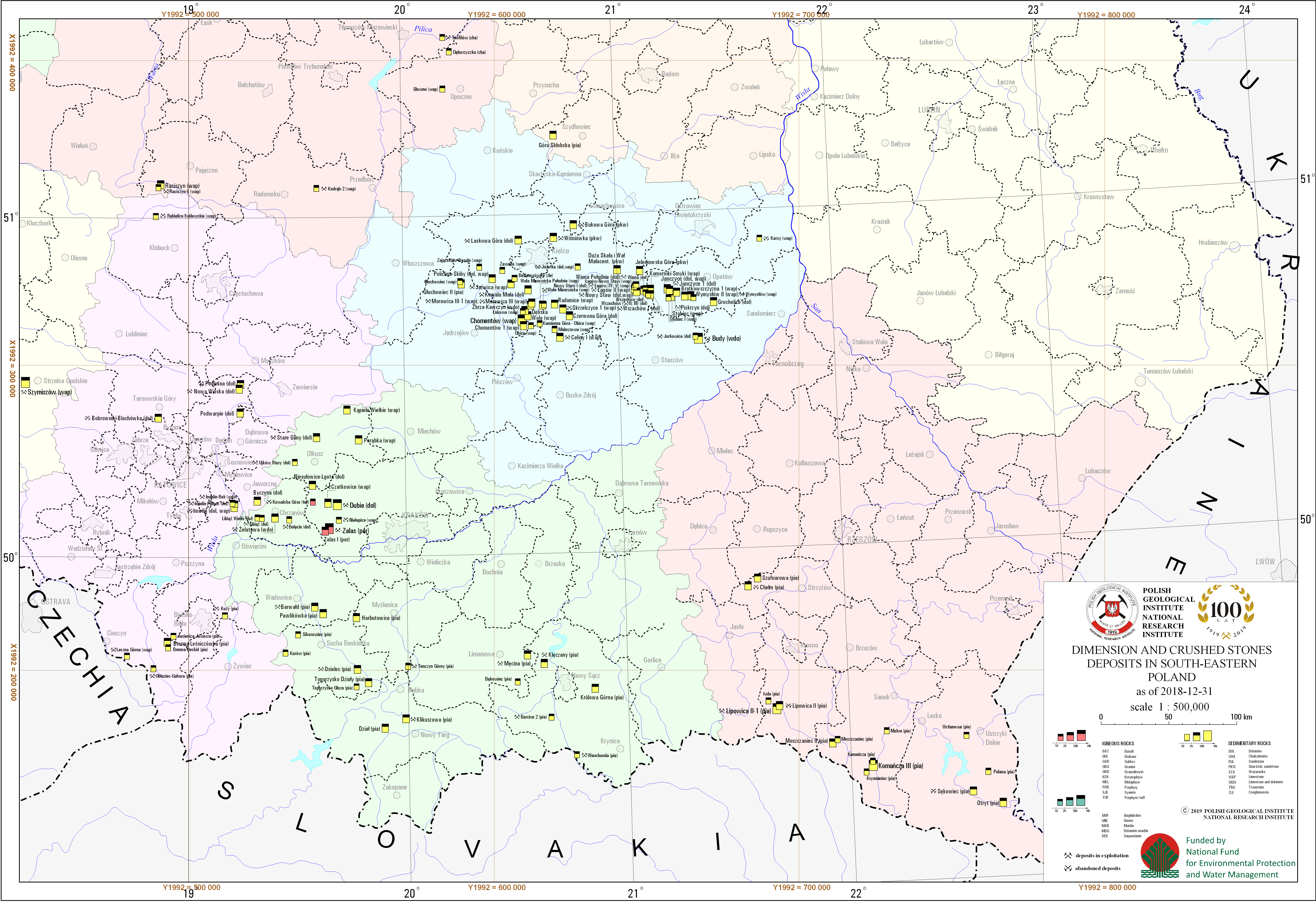
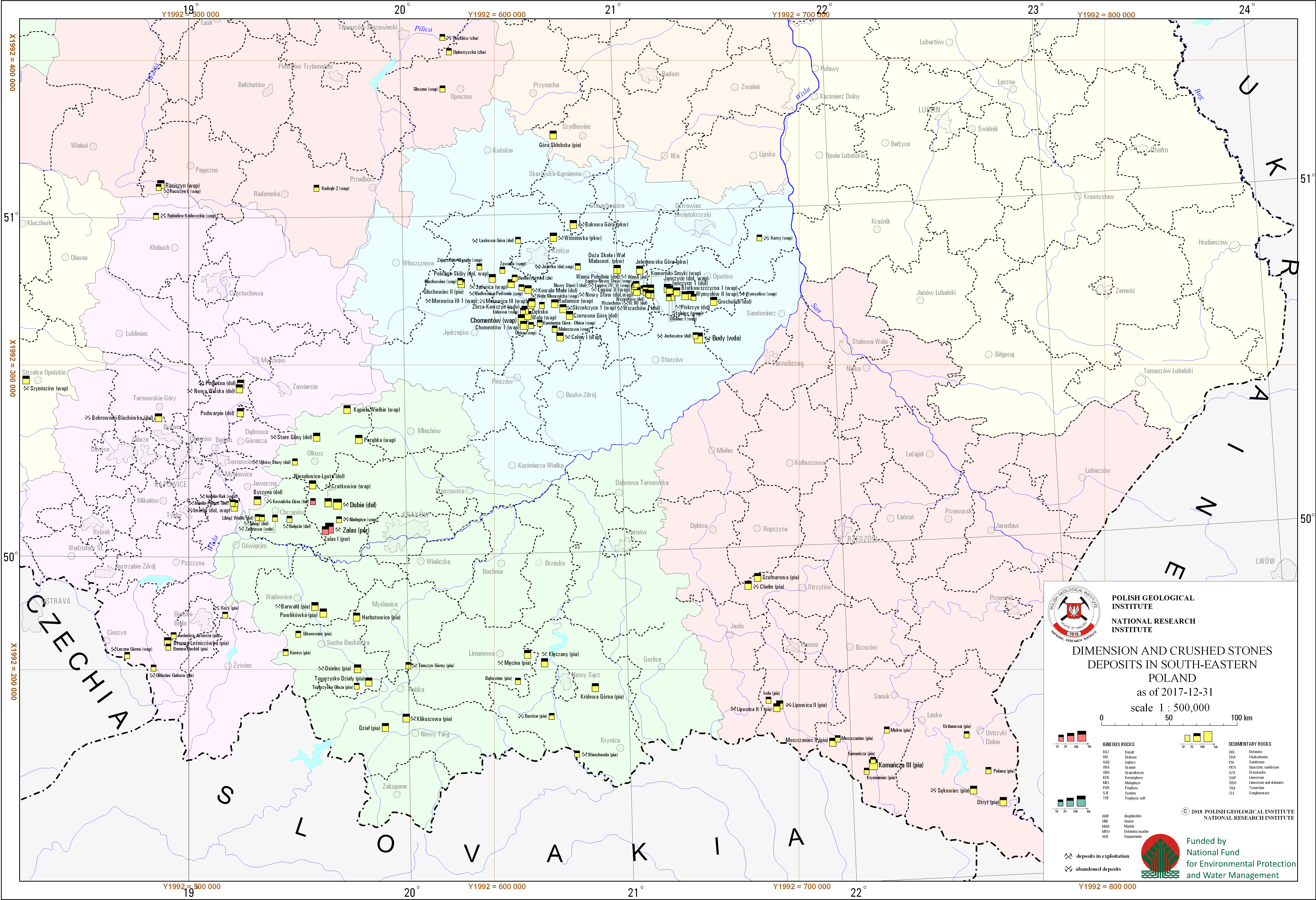
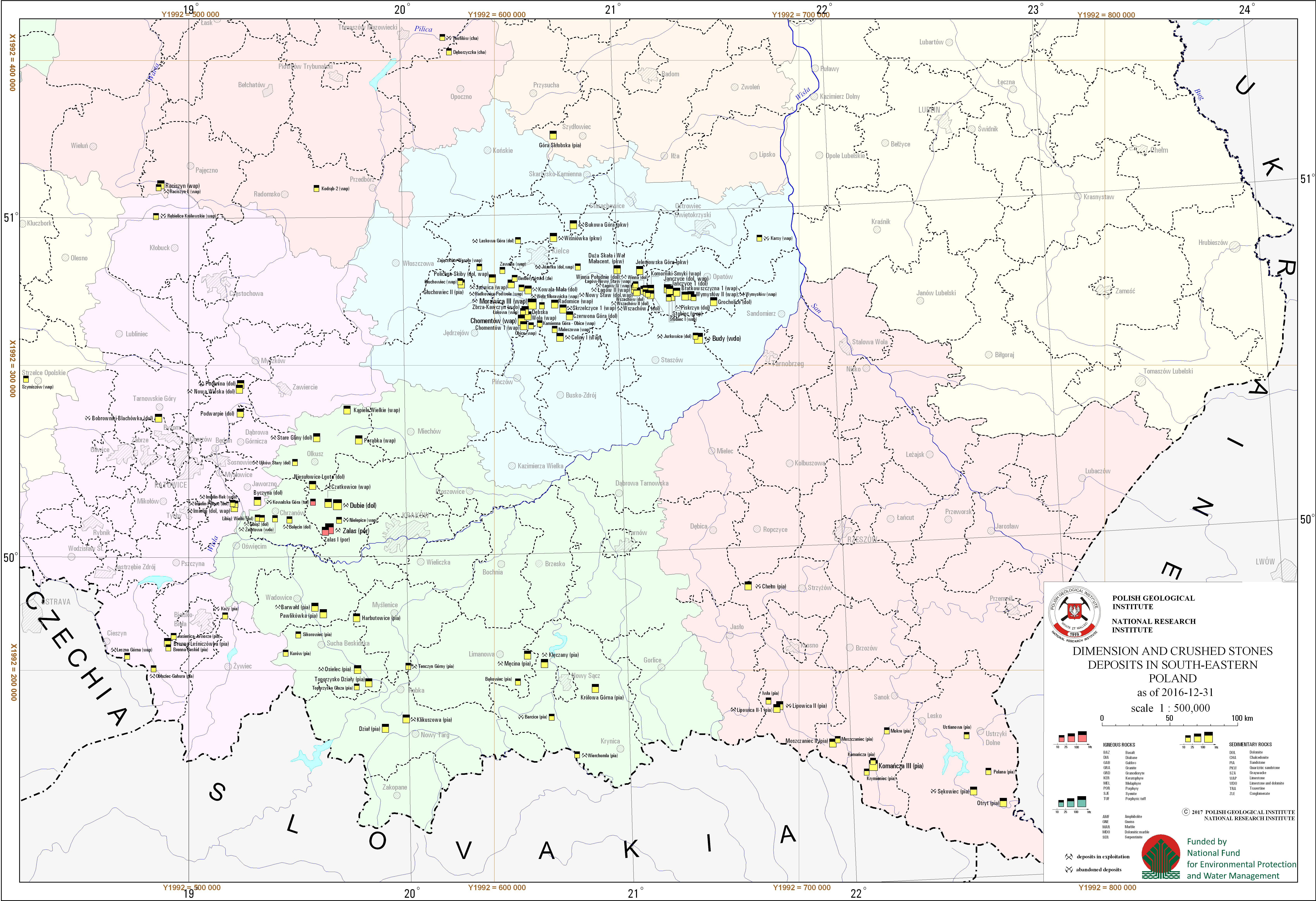
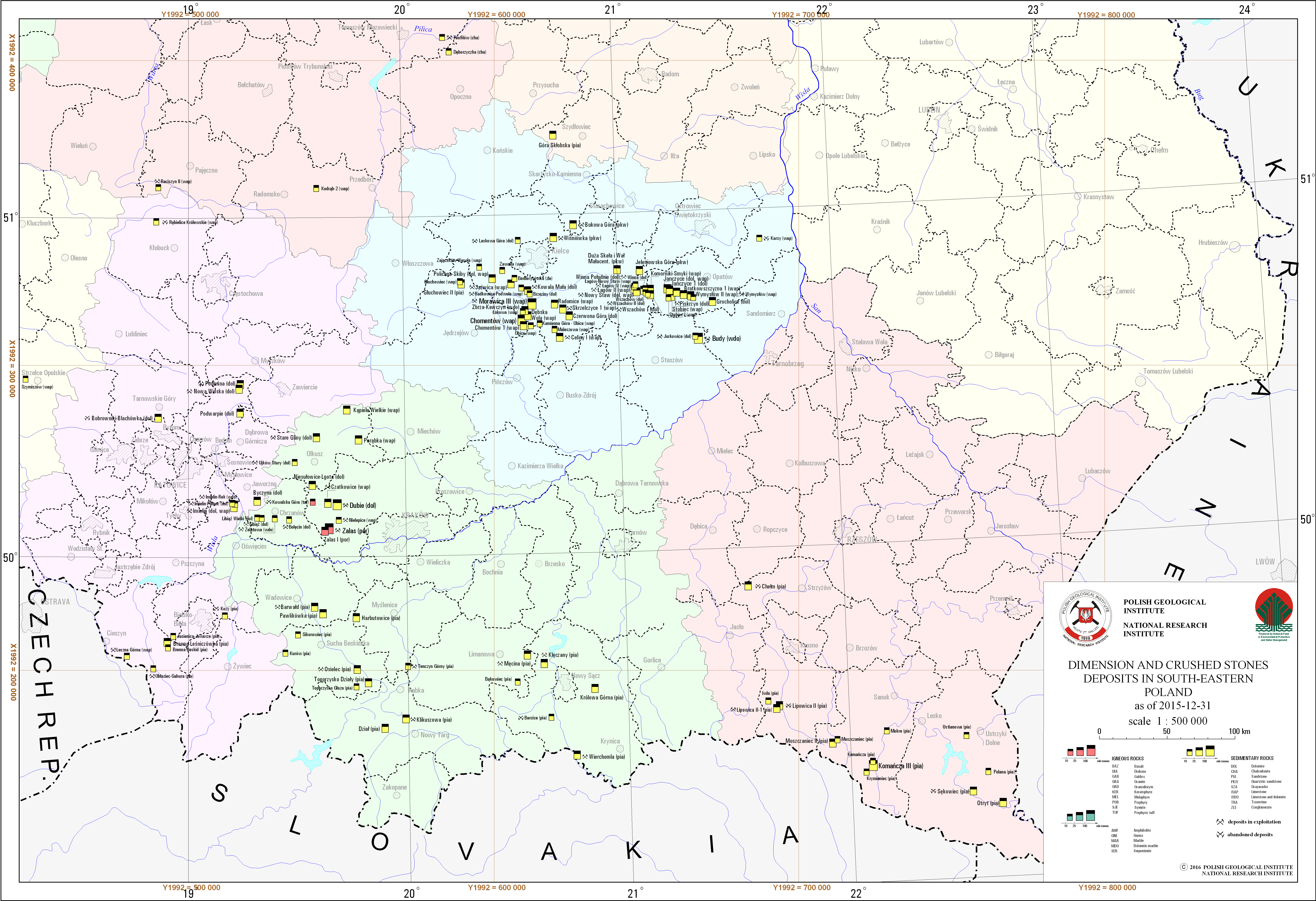
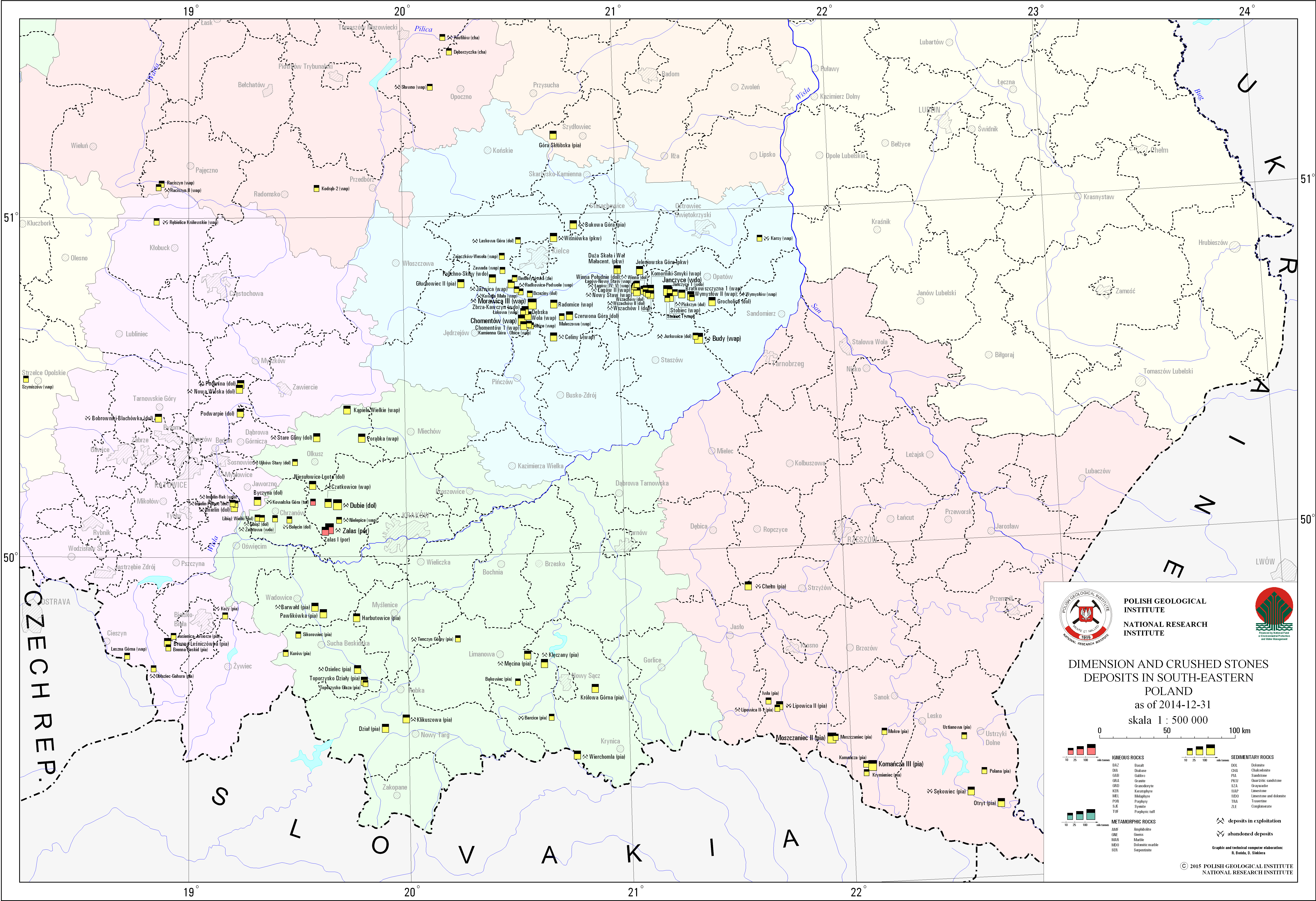
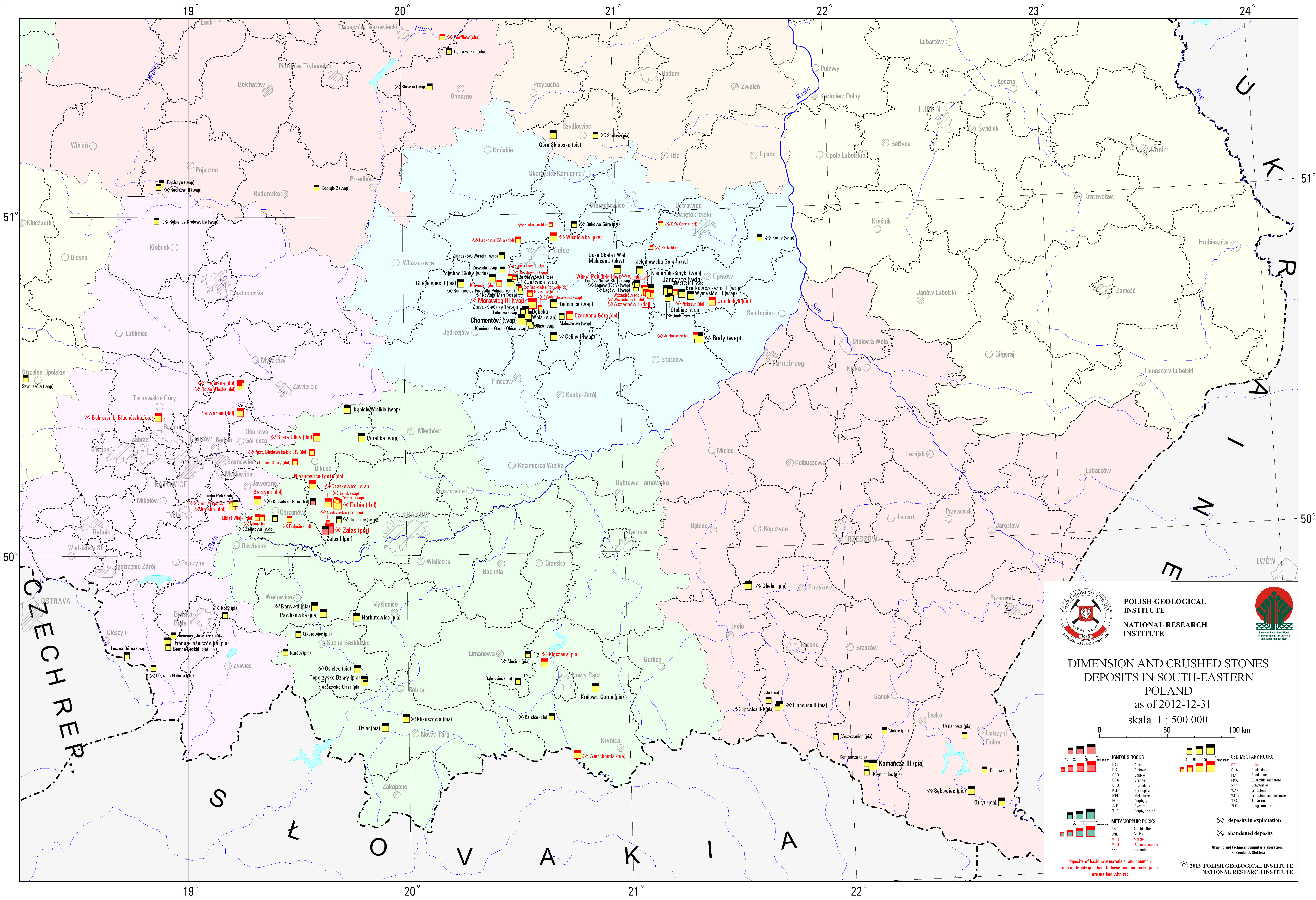
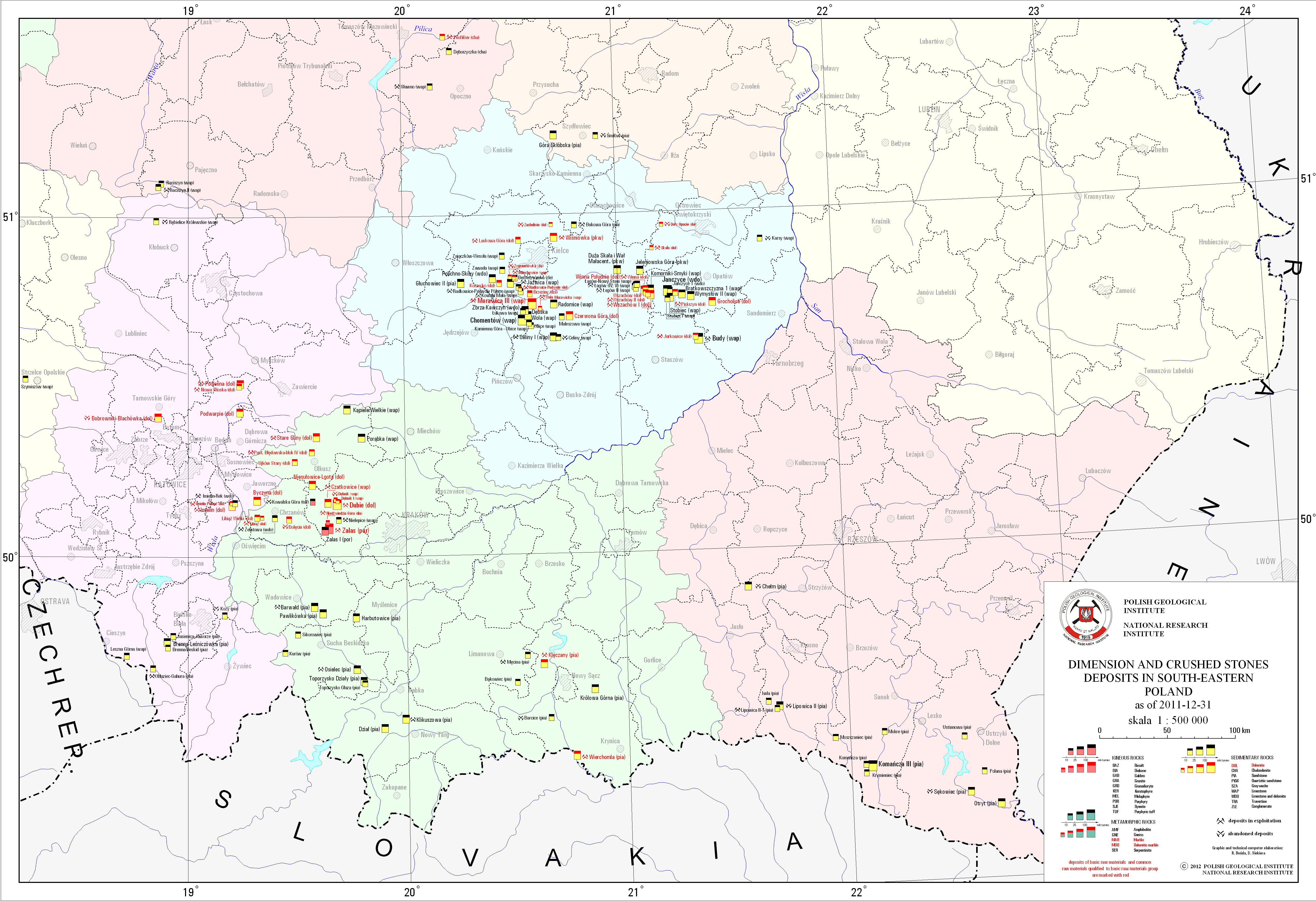
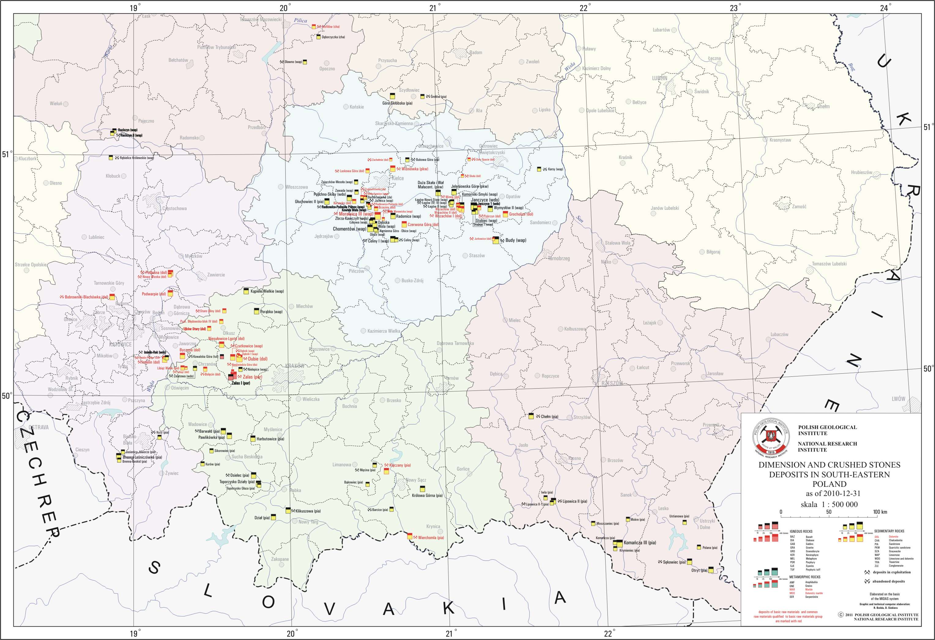
Dimension and crushed stones deposits in South-Eastern Poland
There are dimension and crushed stones deposits in South-Eastern Poland presented on the map. Deposits location is presented by signature marks with distinction of deposits classified as basic minerals. There is also information on a state of development of a particular deposit. The map takes into account an origin of the stones - sedimentary, igneous and metamorphic, and also their lithological types.
Download map.
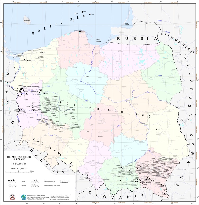
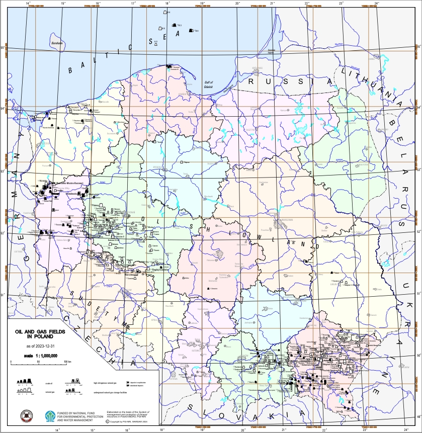
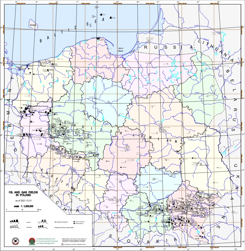
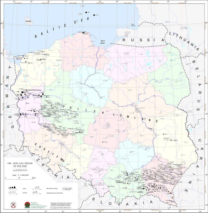
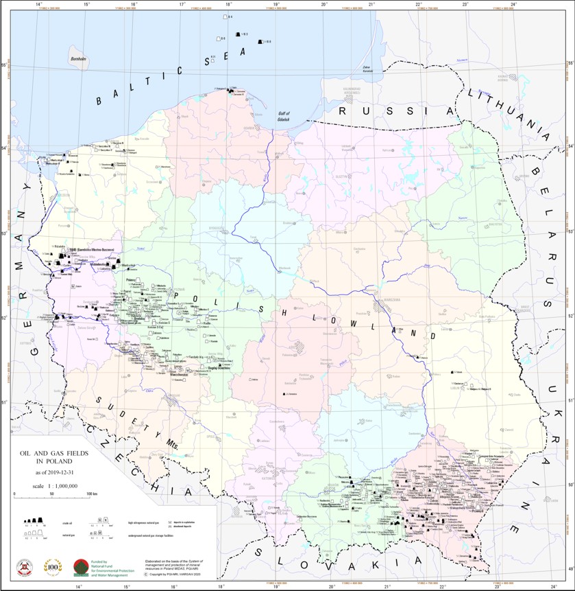
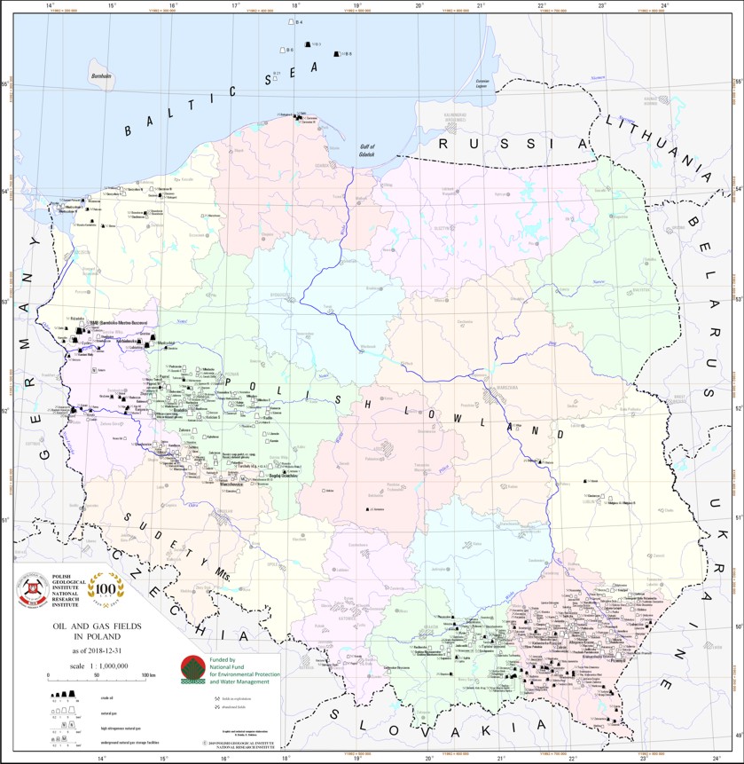
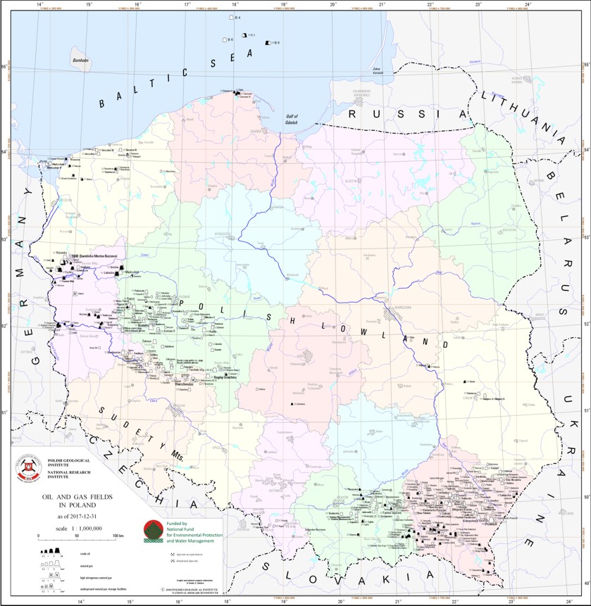
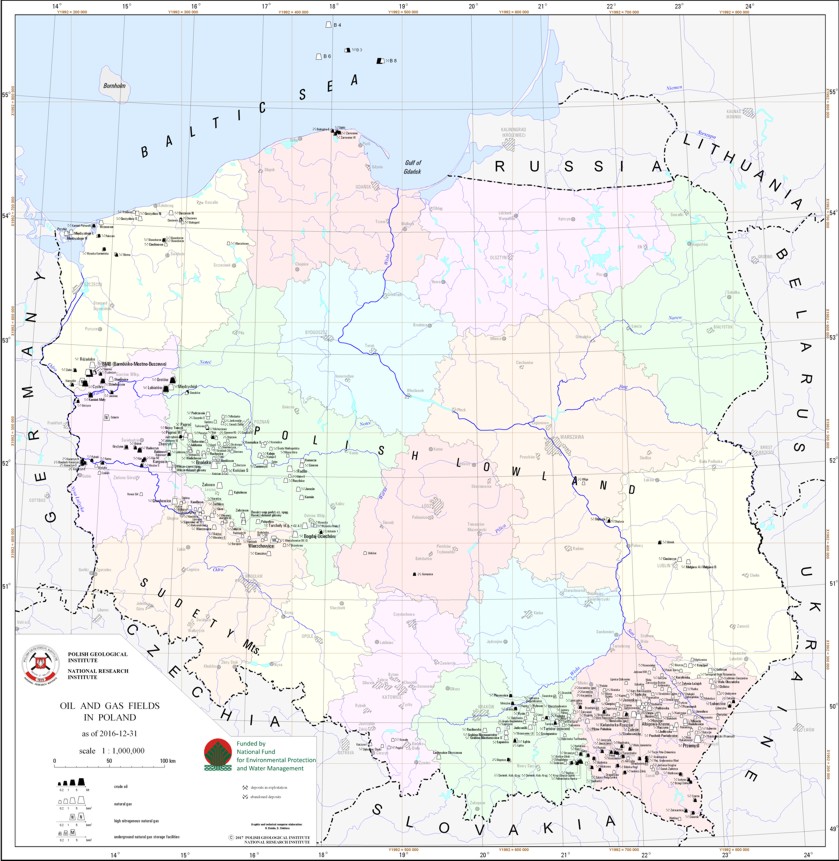
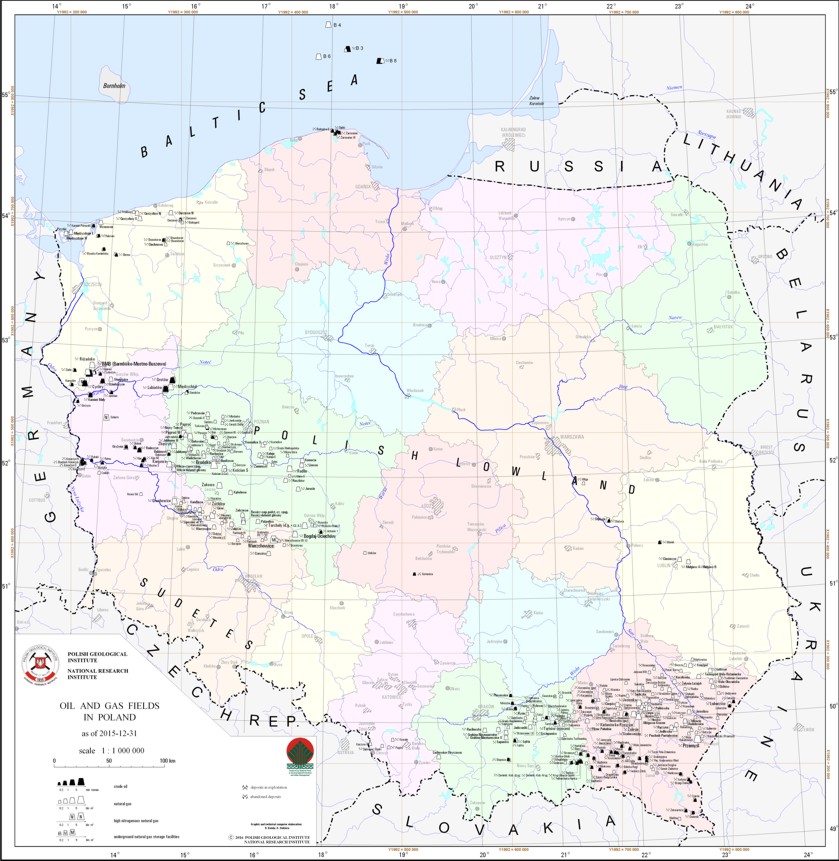
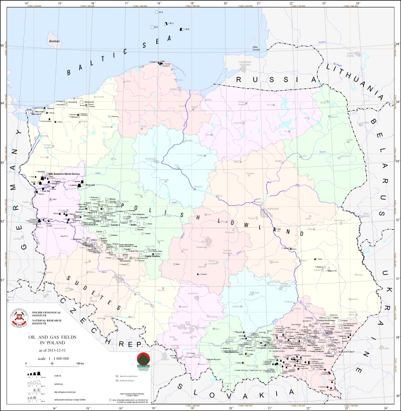
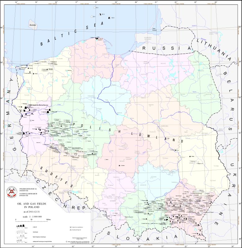
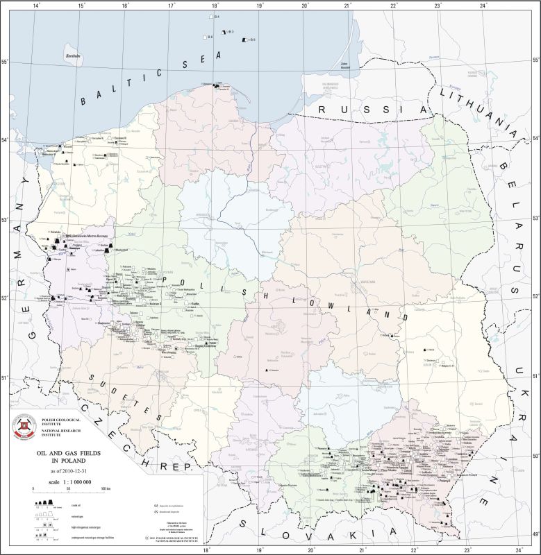
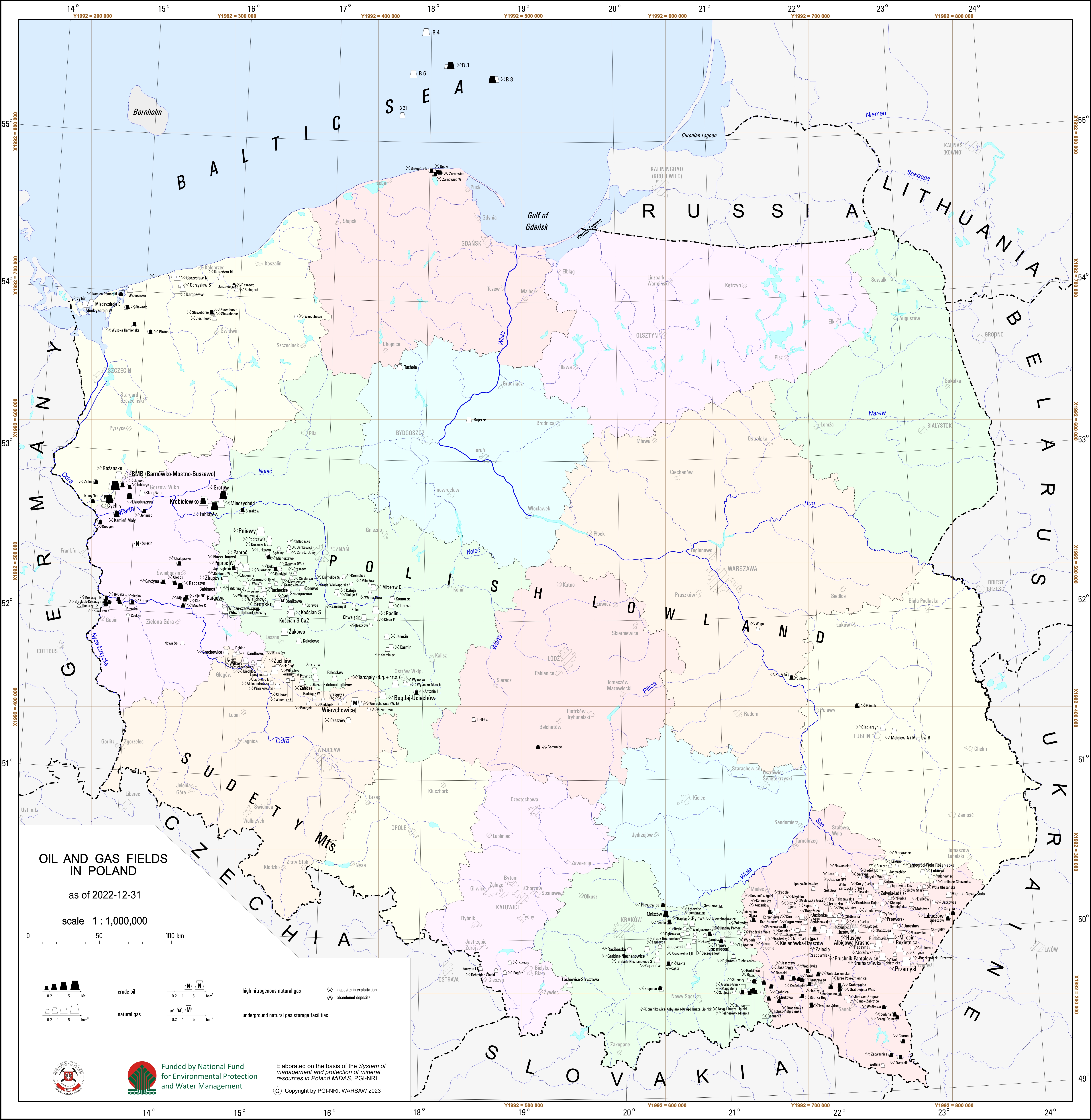
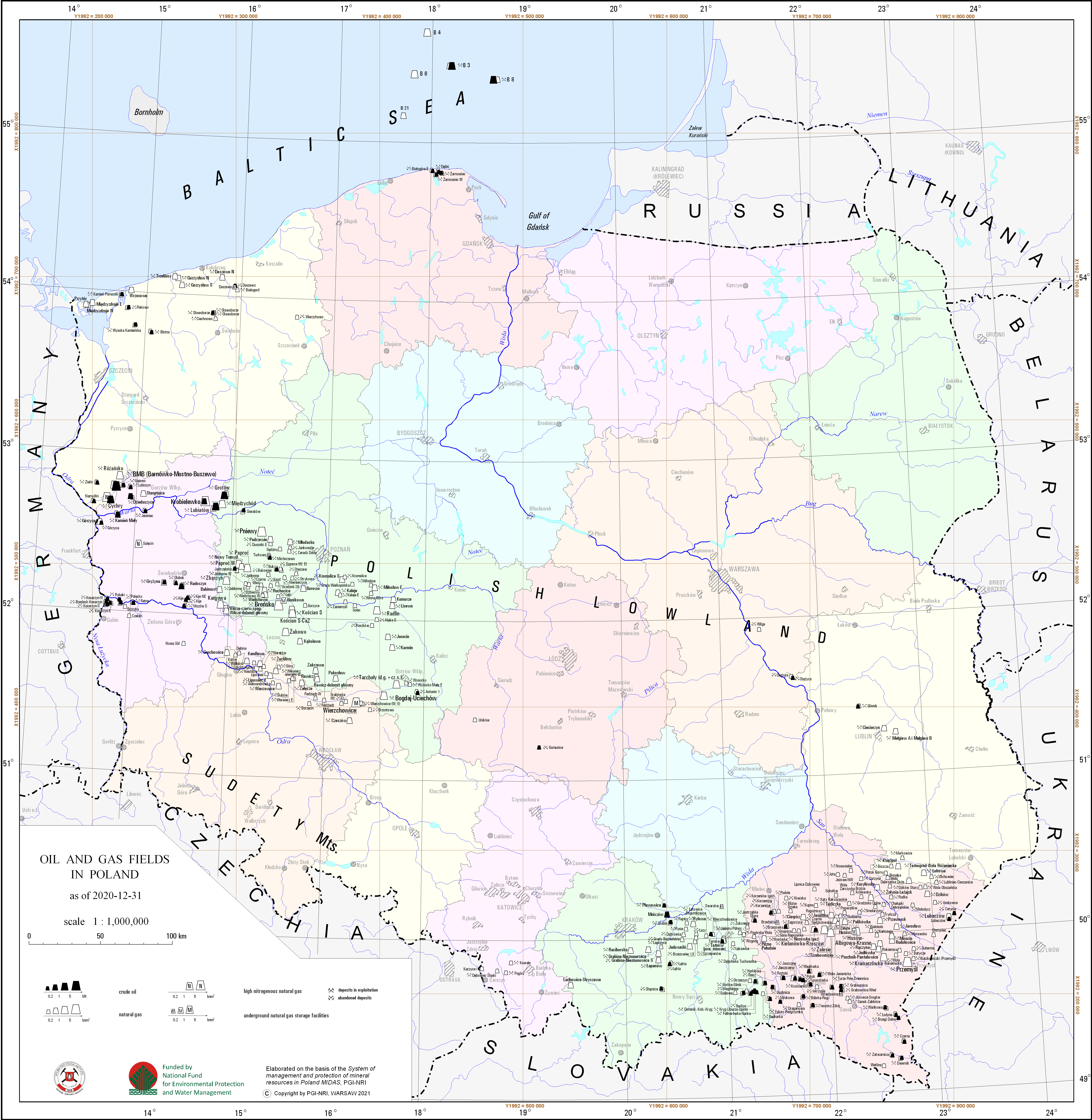
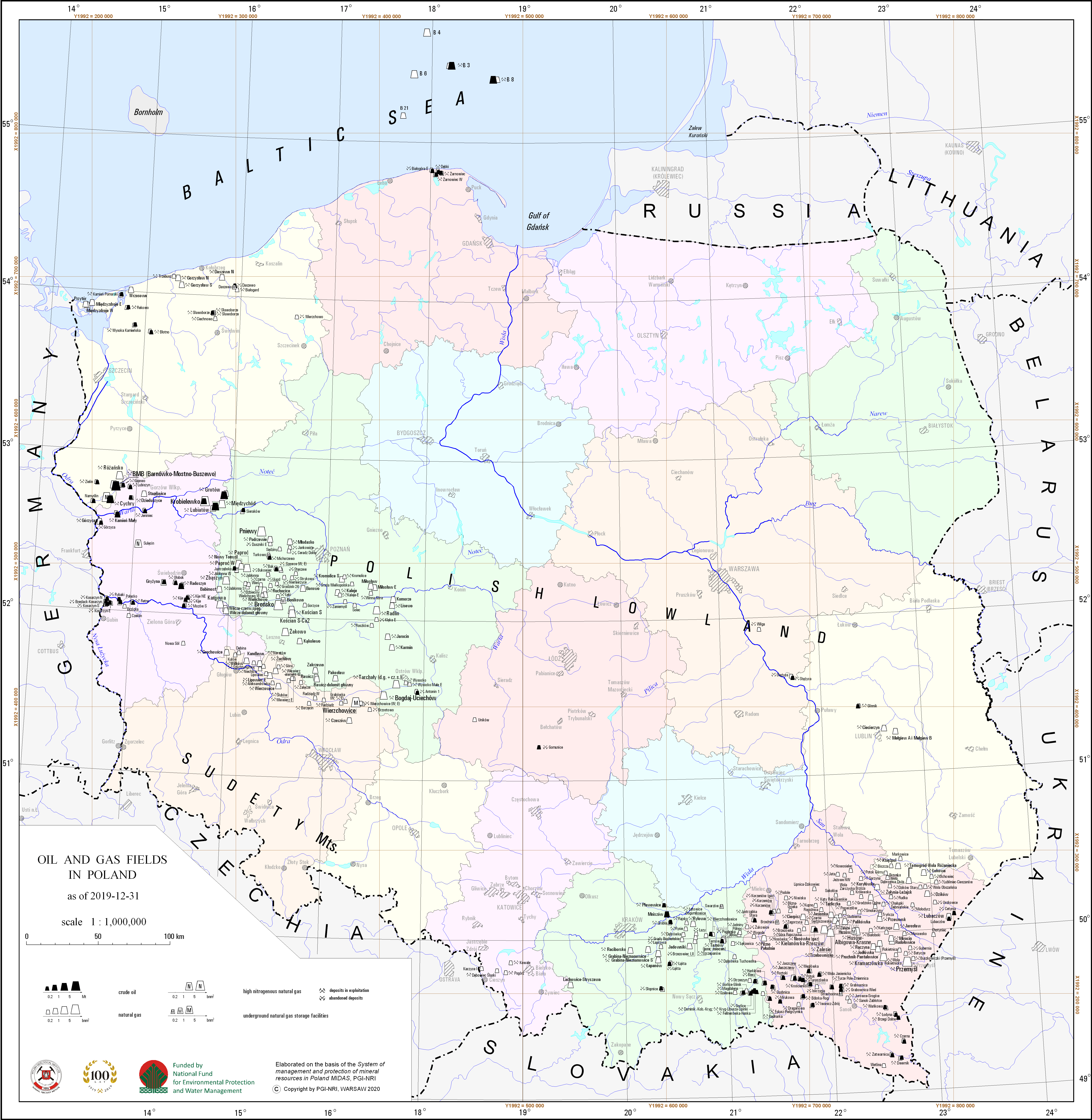
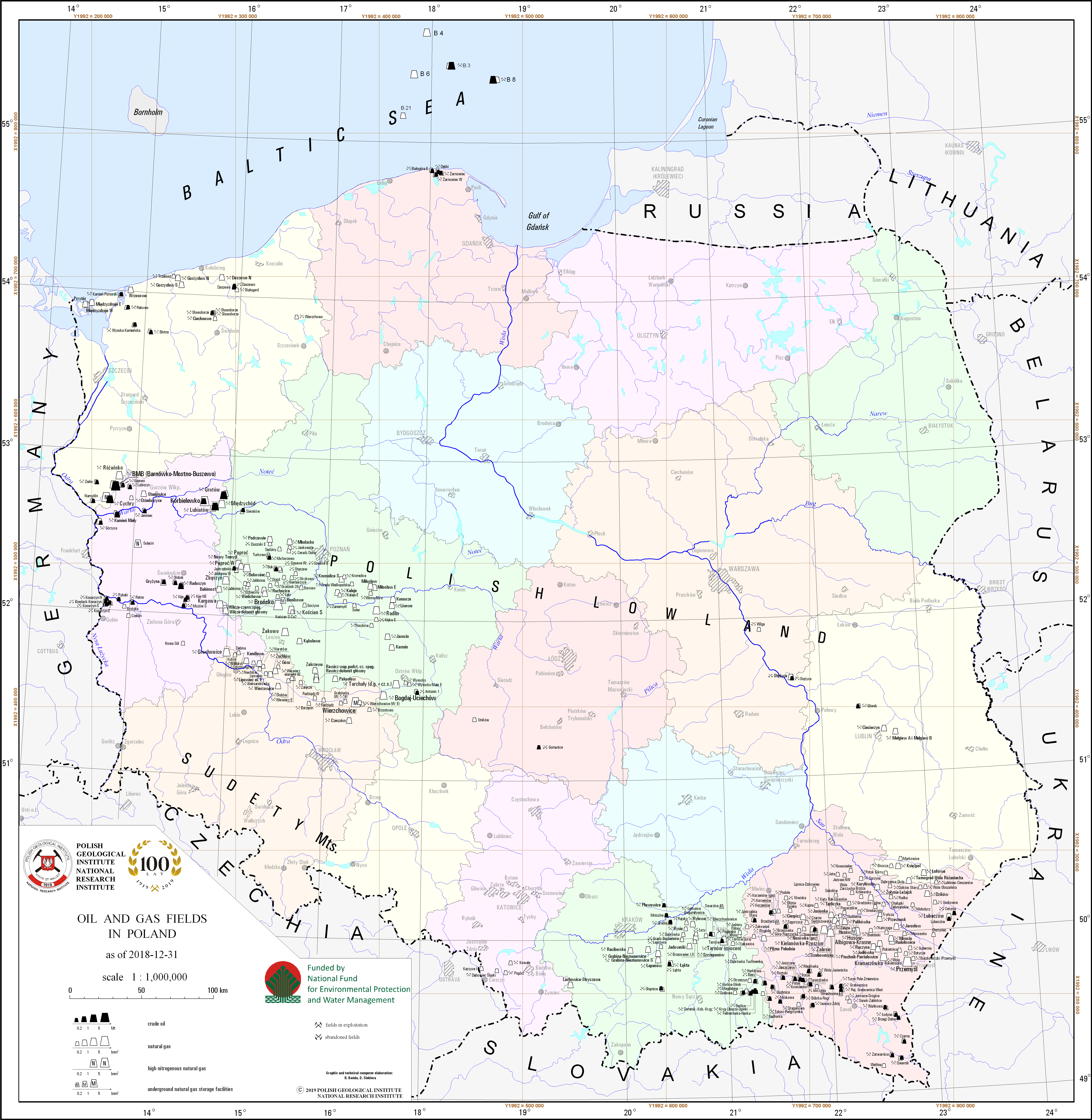
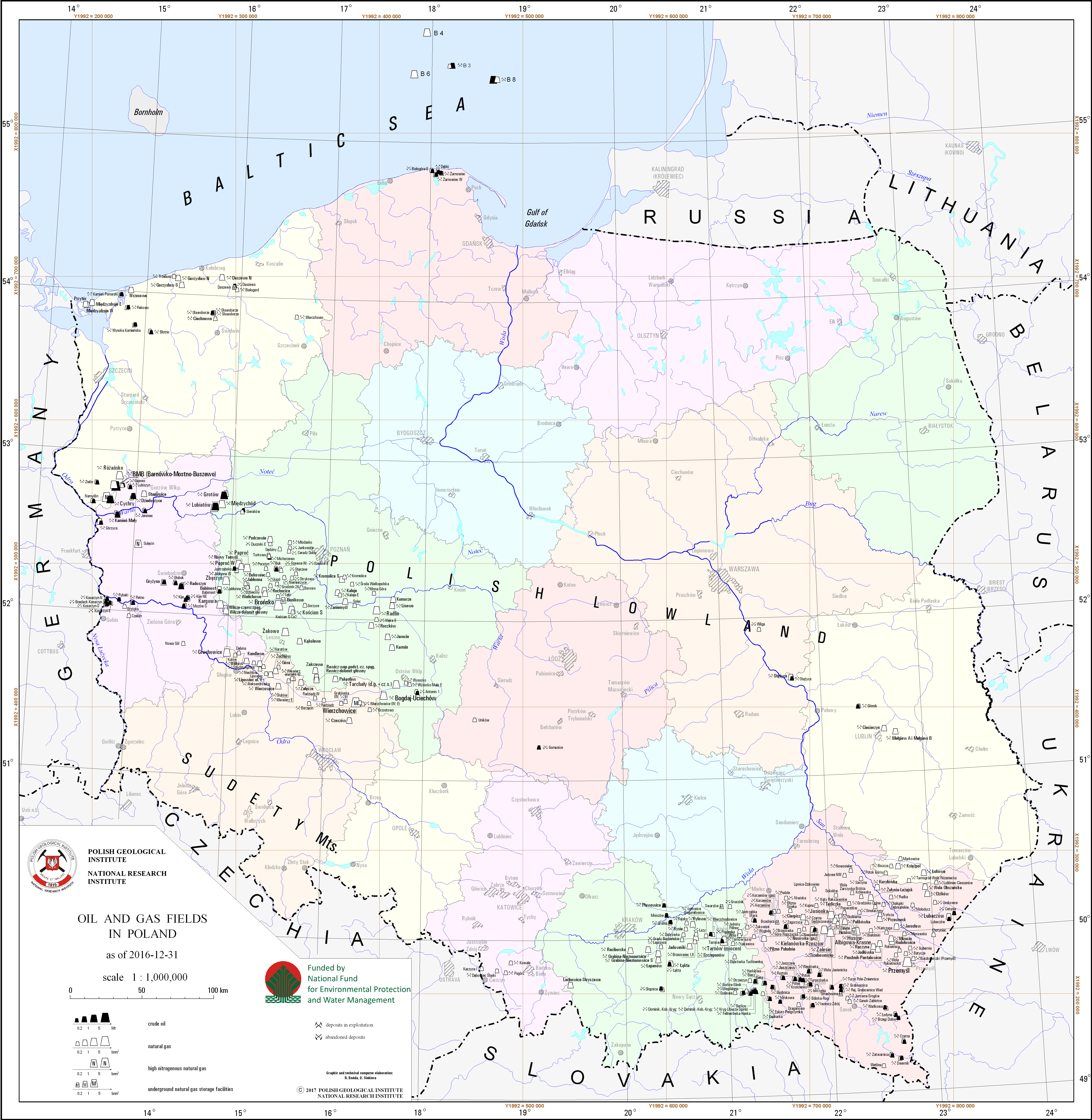
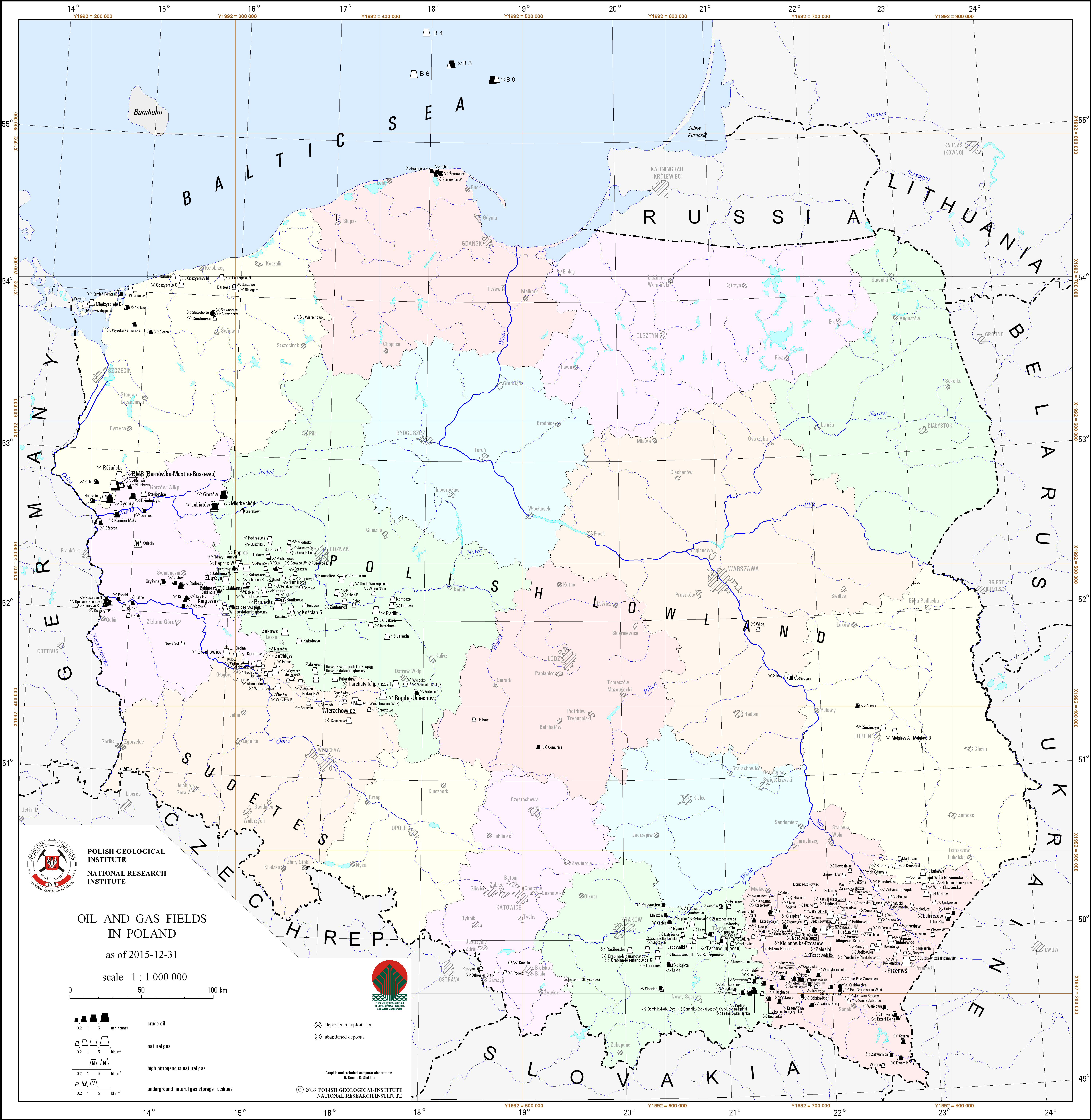
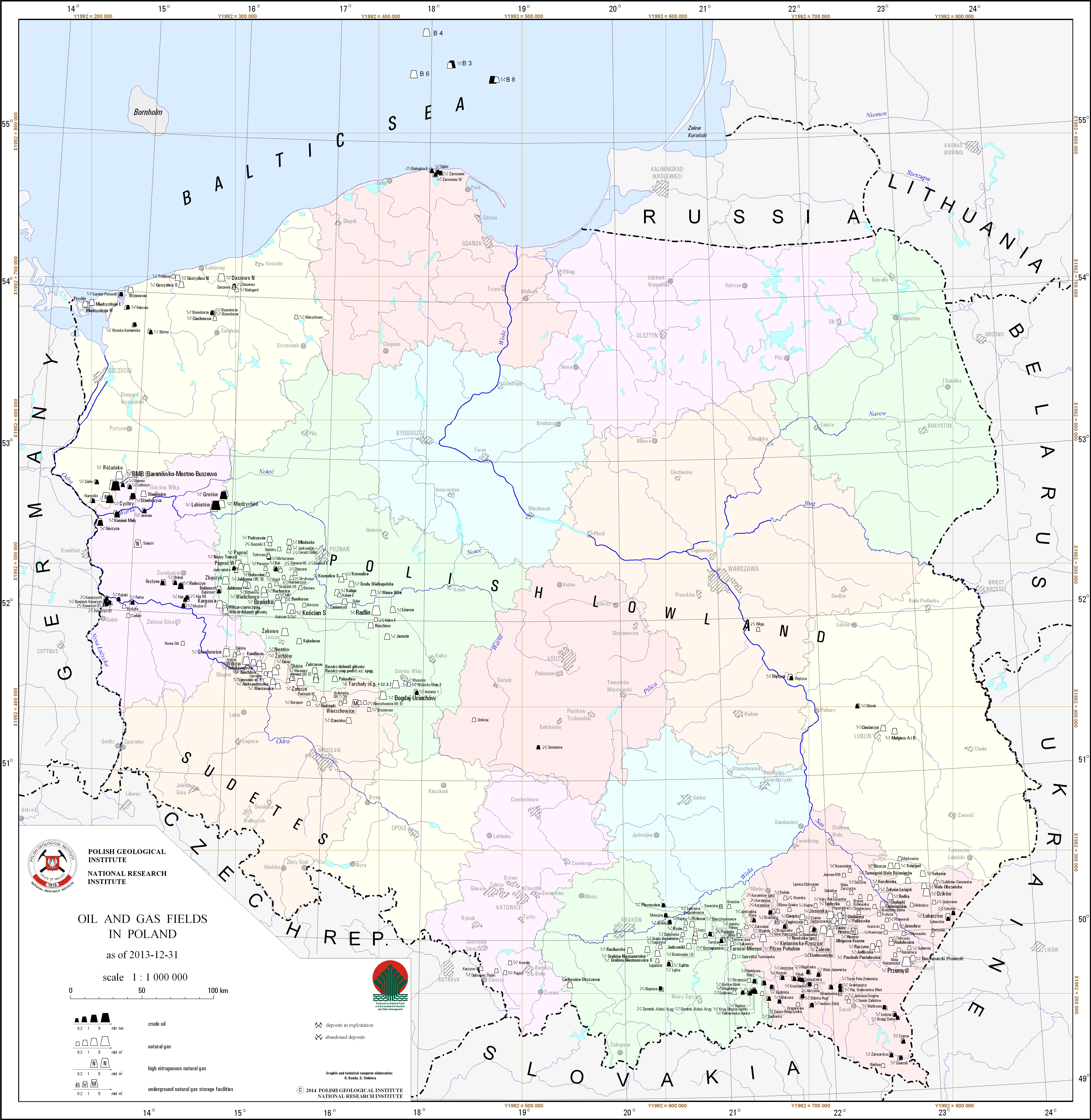
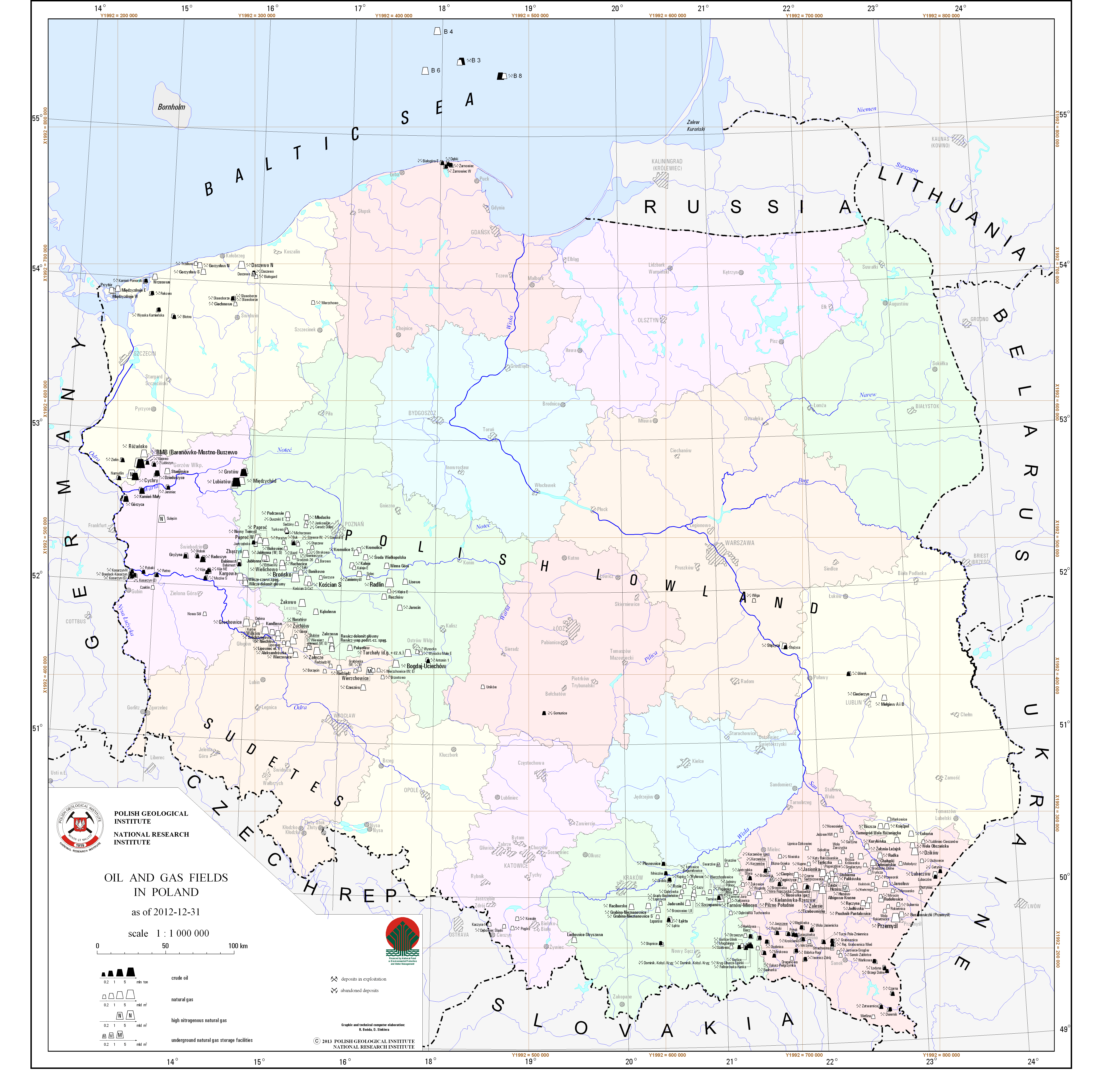
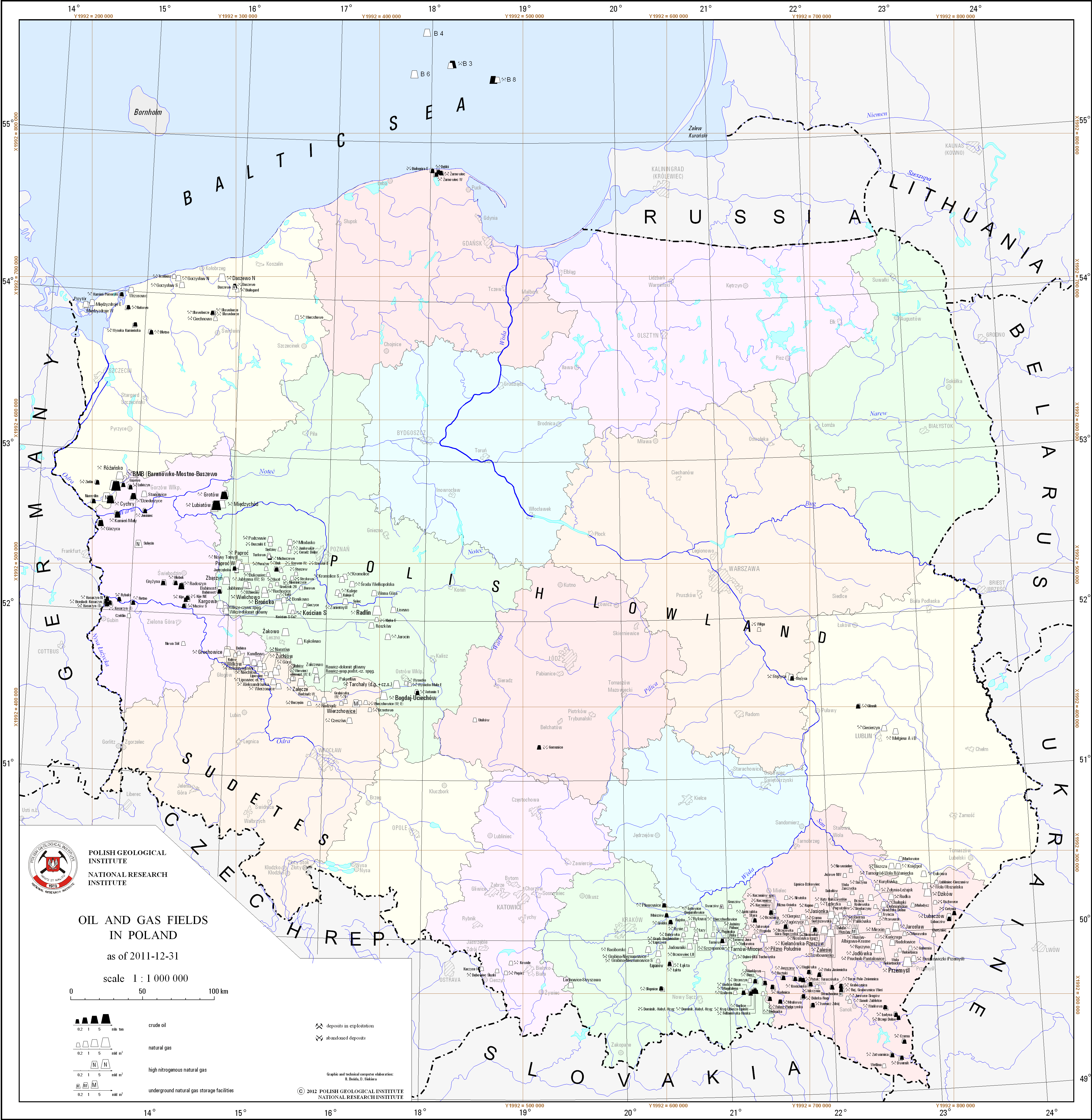
Oil and gas fields in Poland
There are oil and gas fields in Poland presented on the map.
Download map.
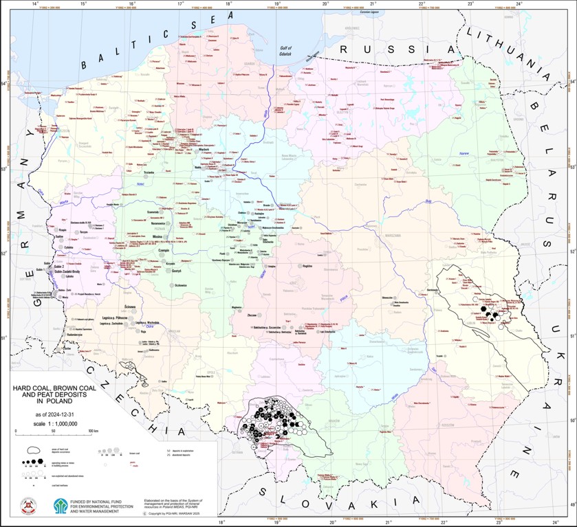
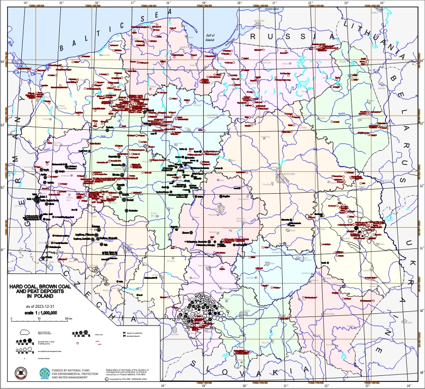
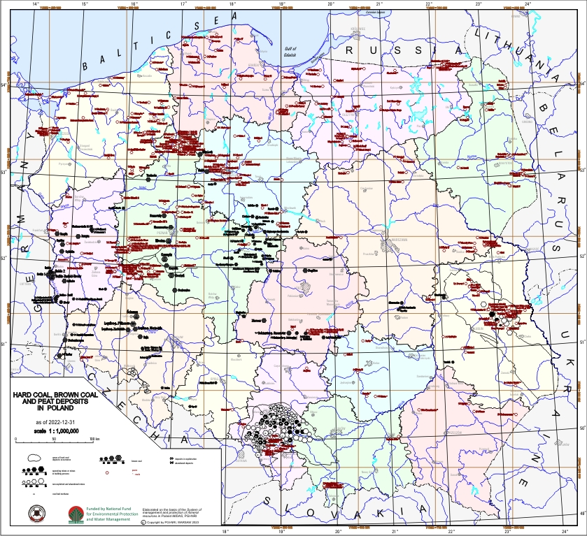
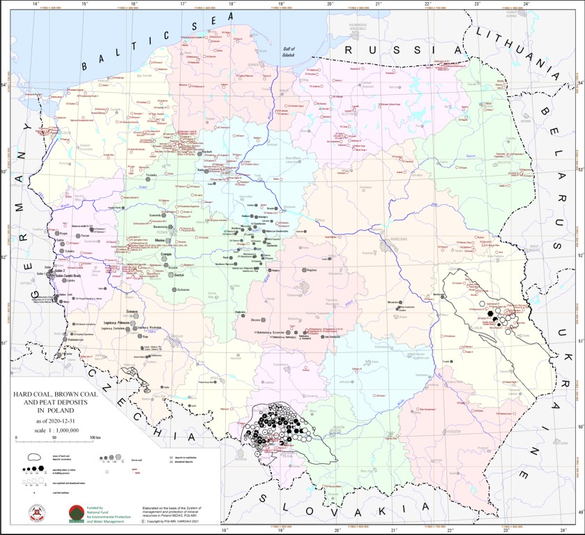
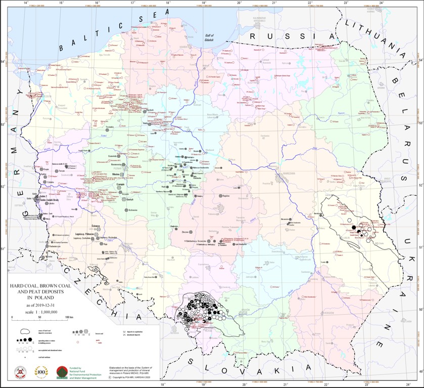
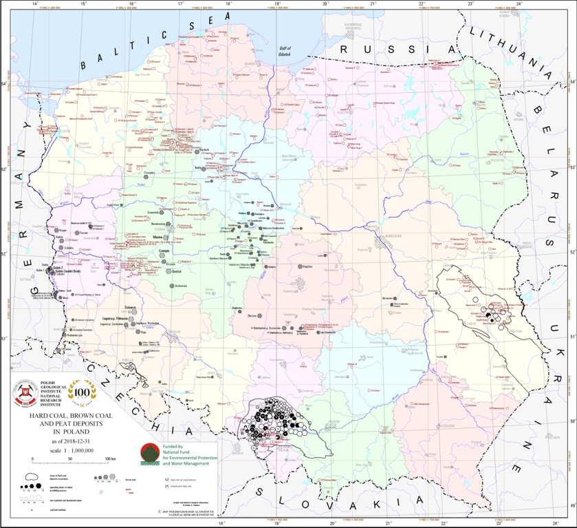
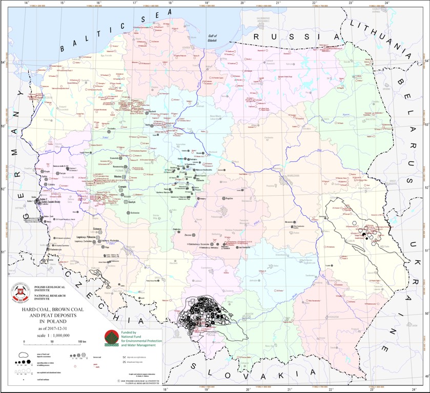
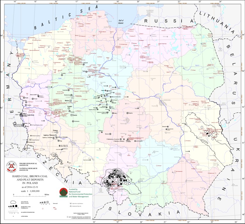
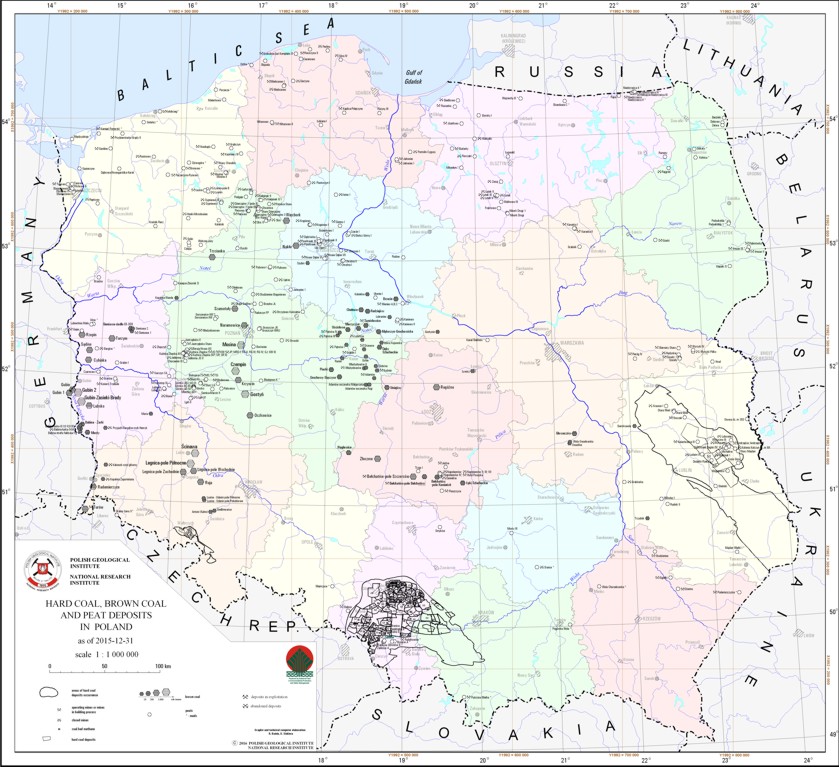
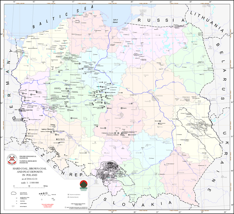
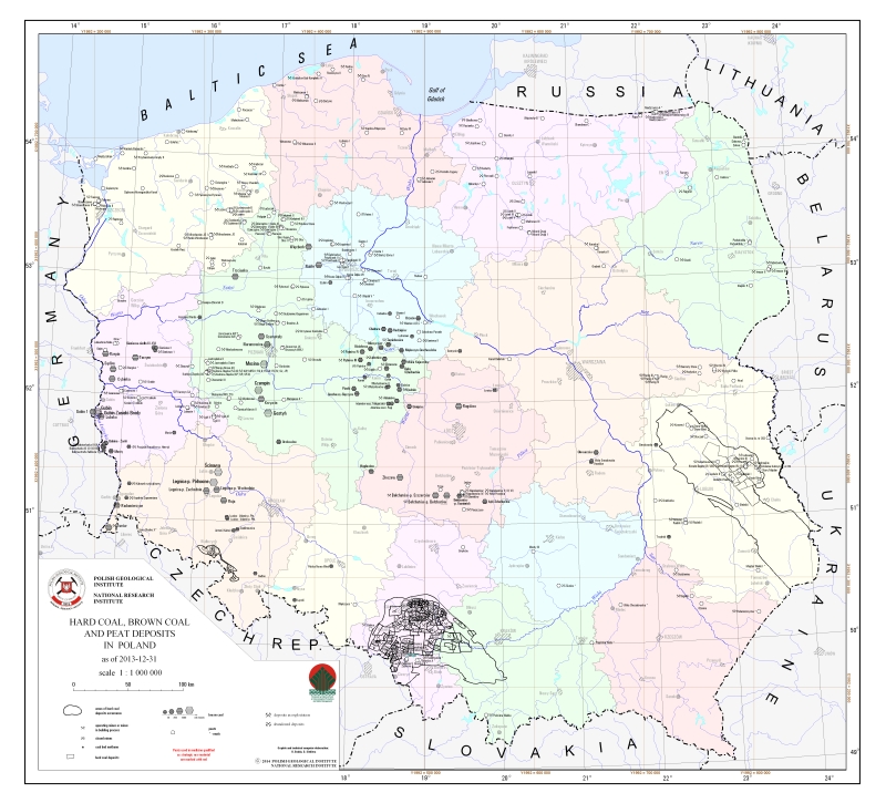
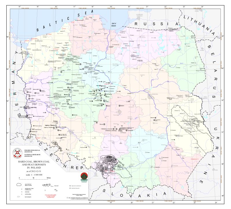
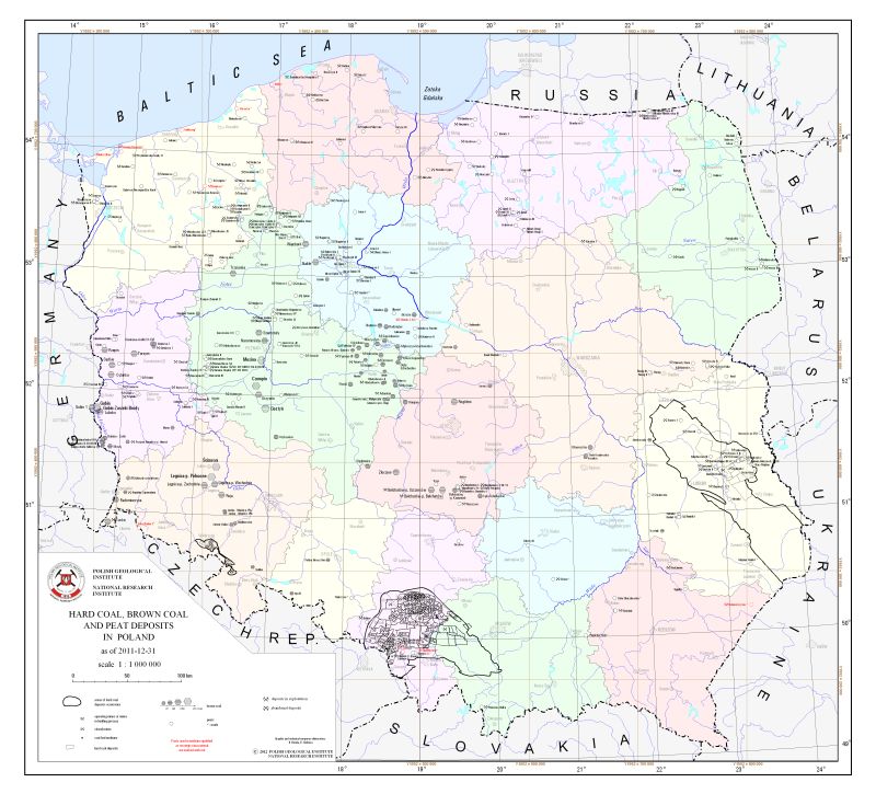
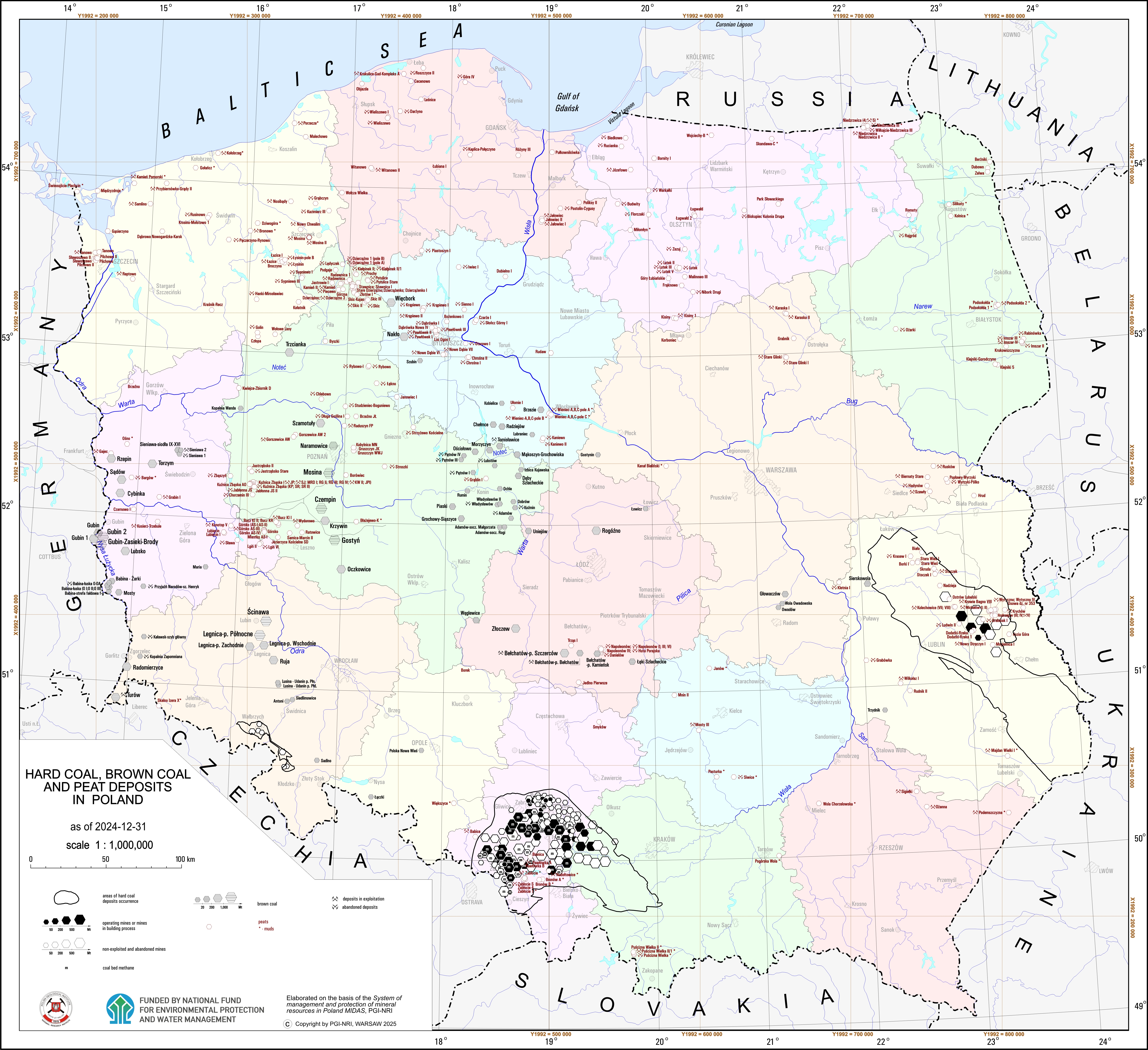
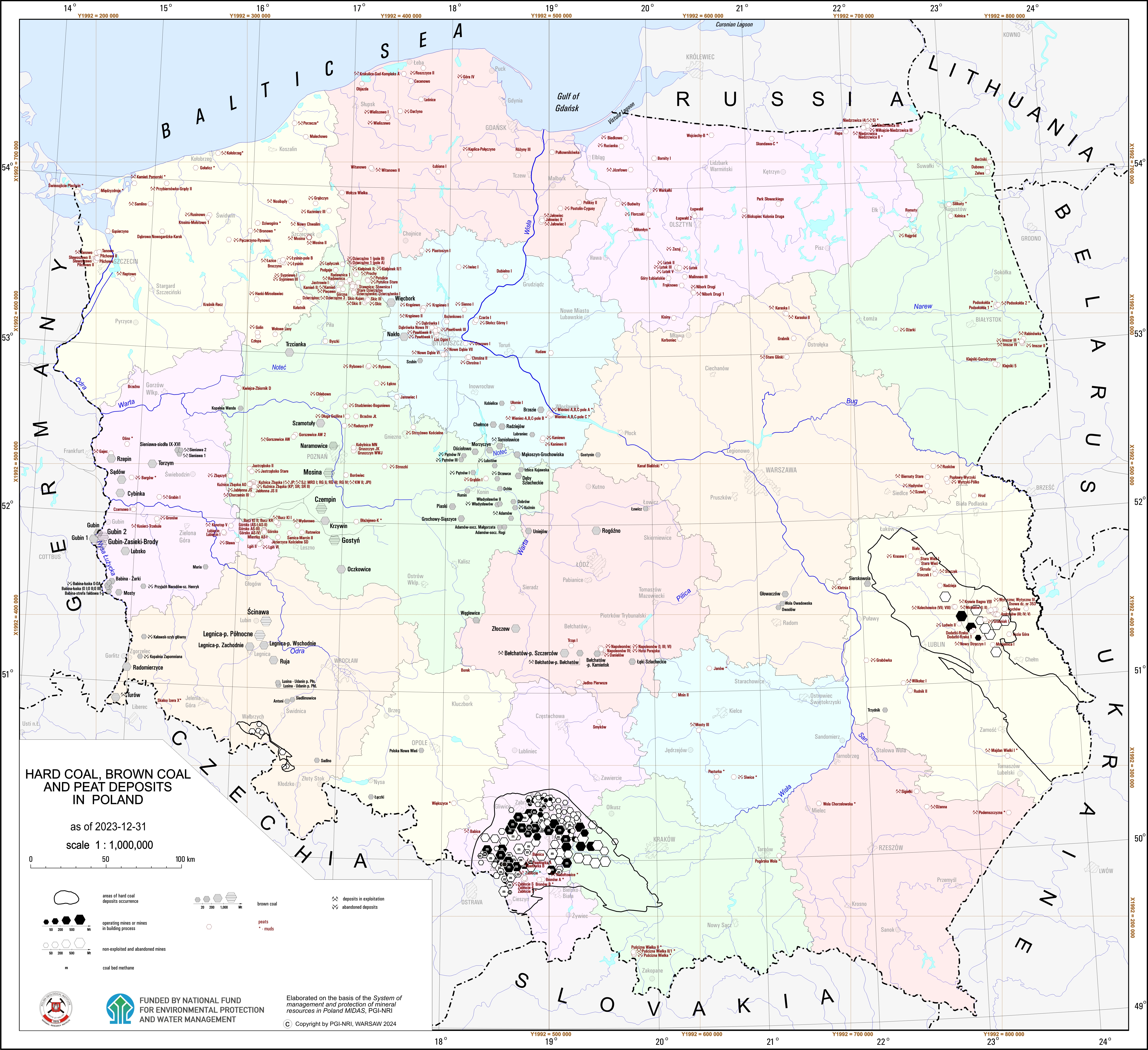
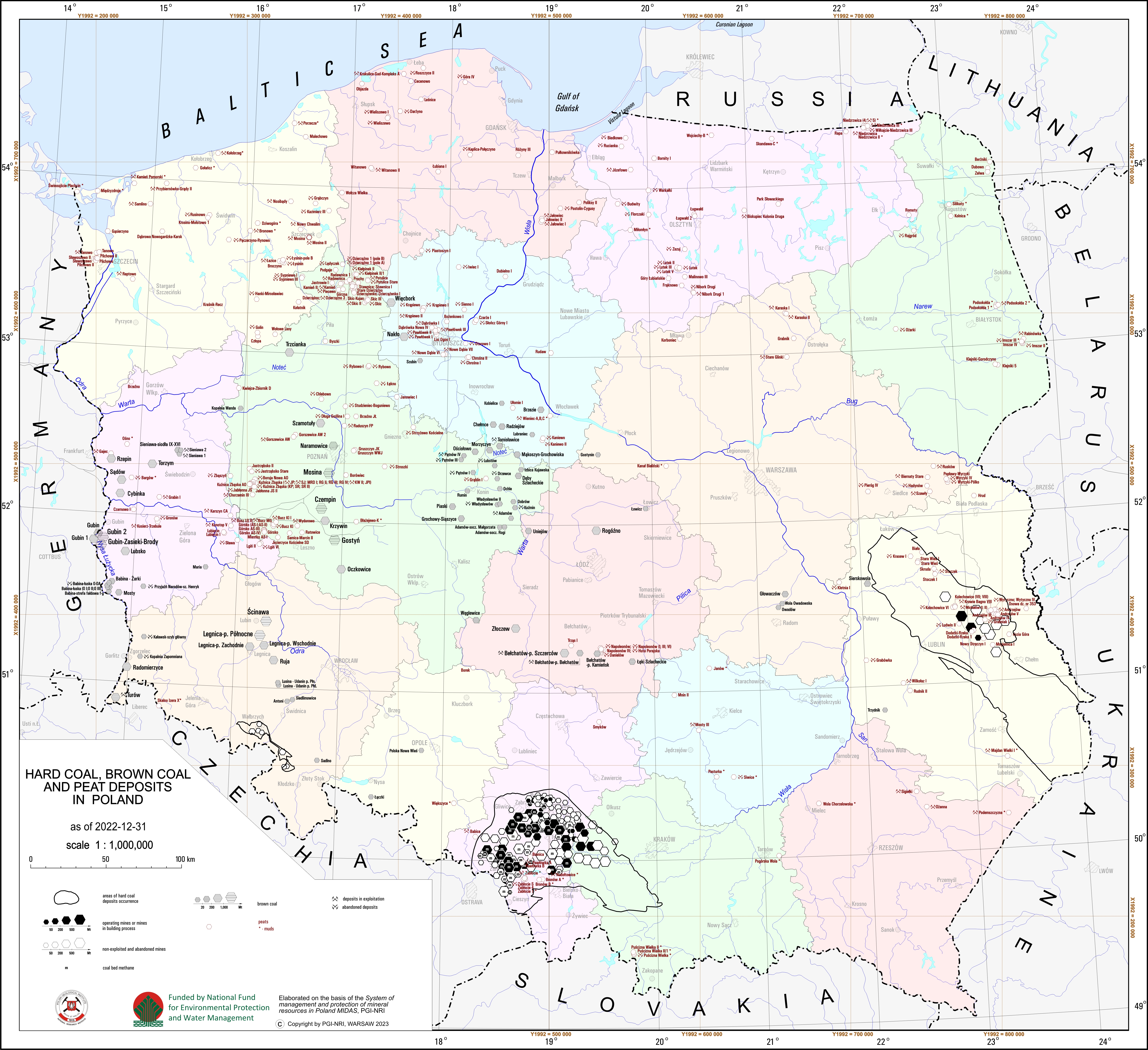
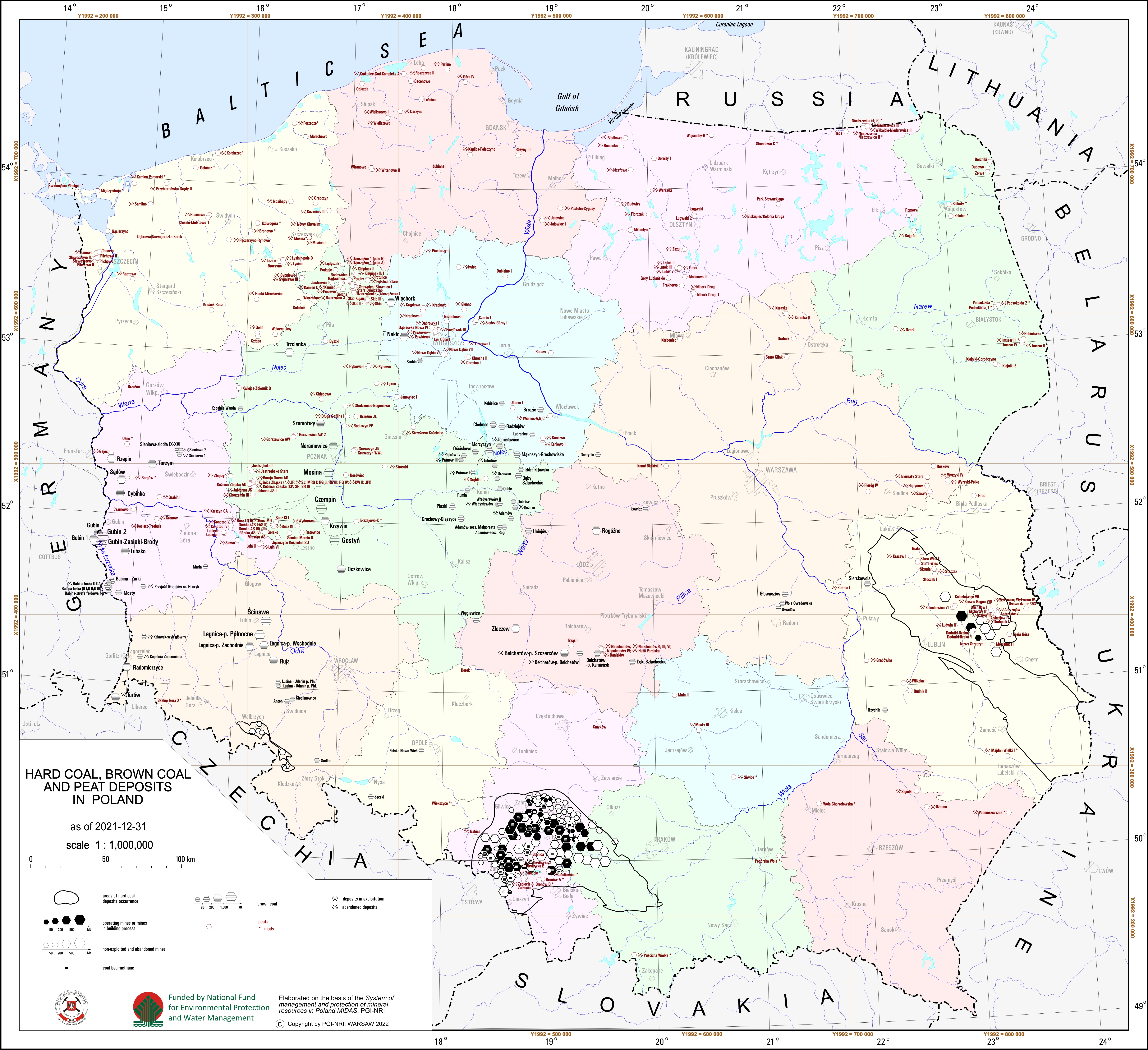
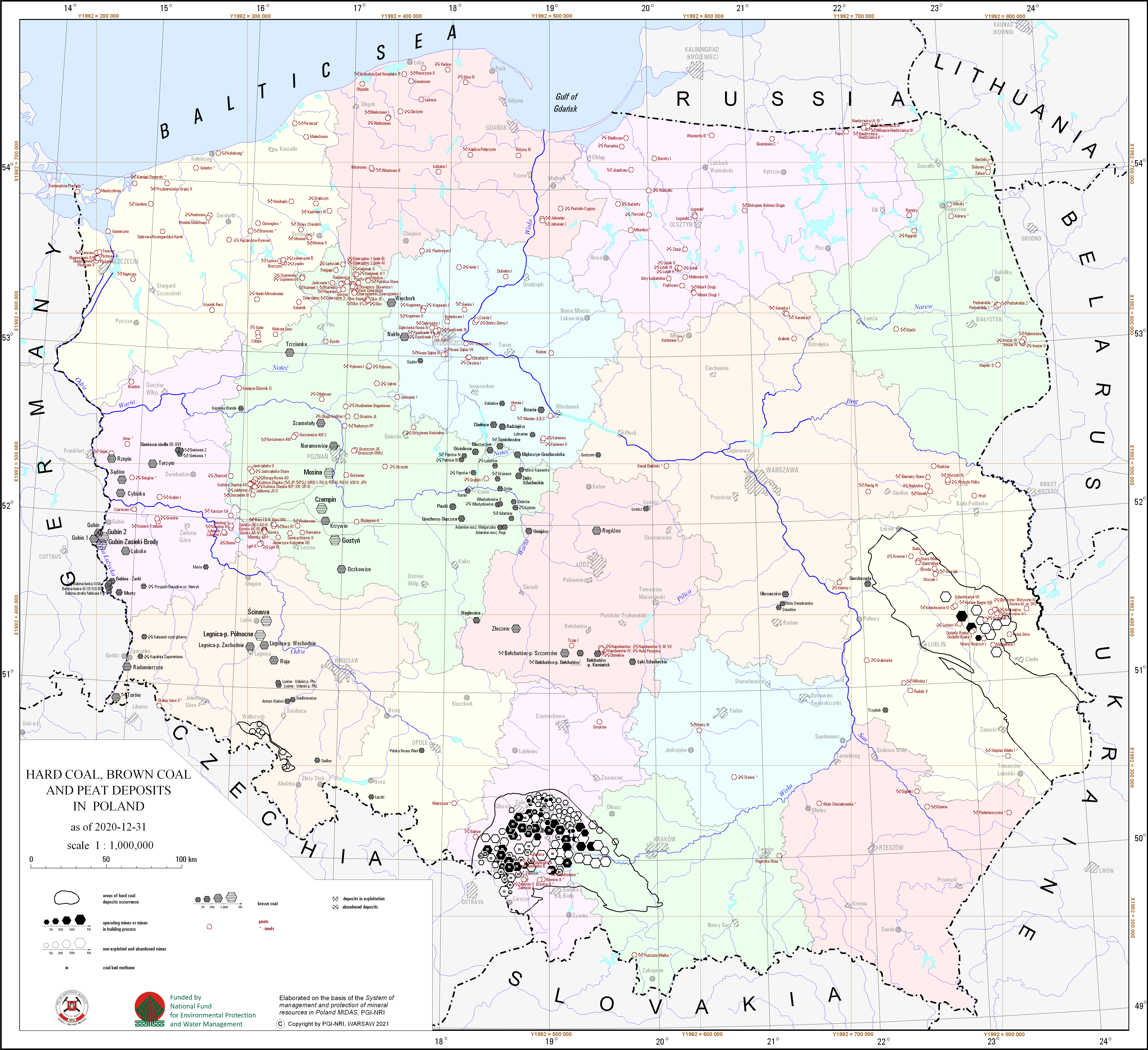
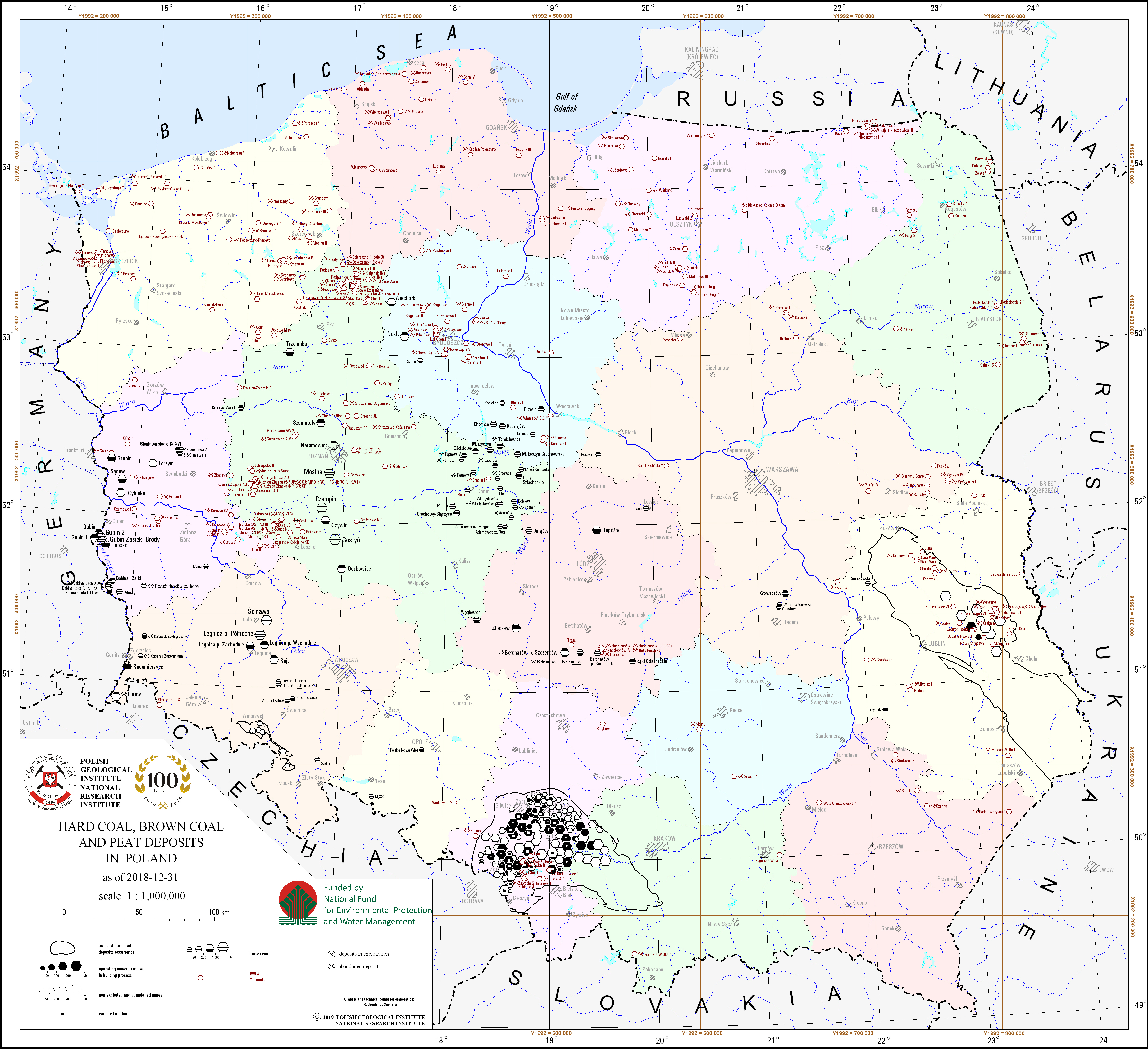
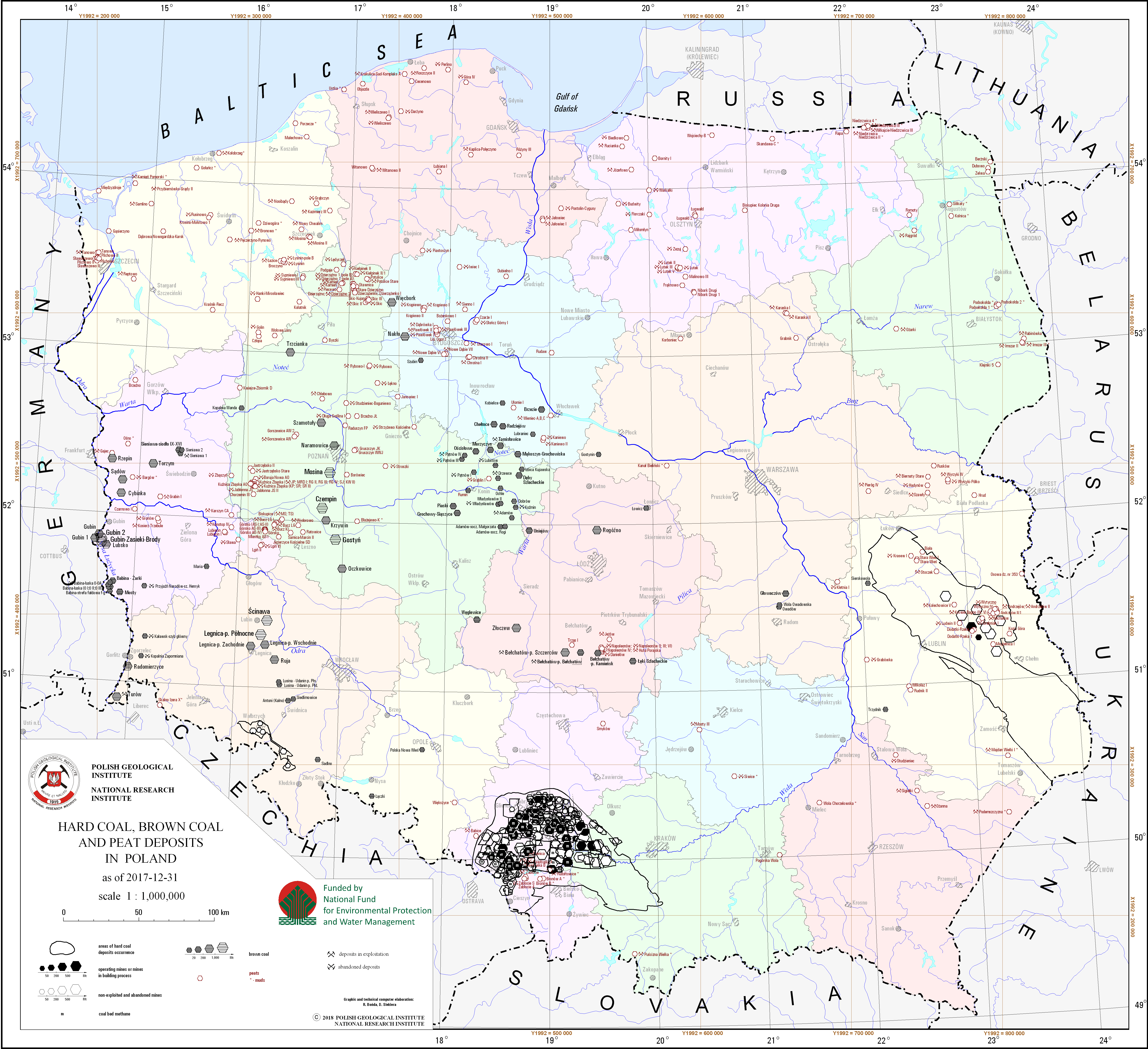
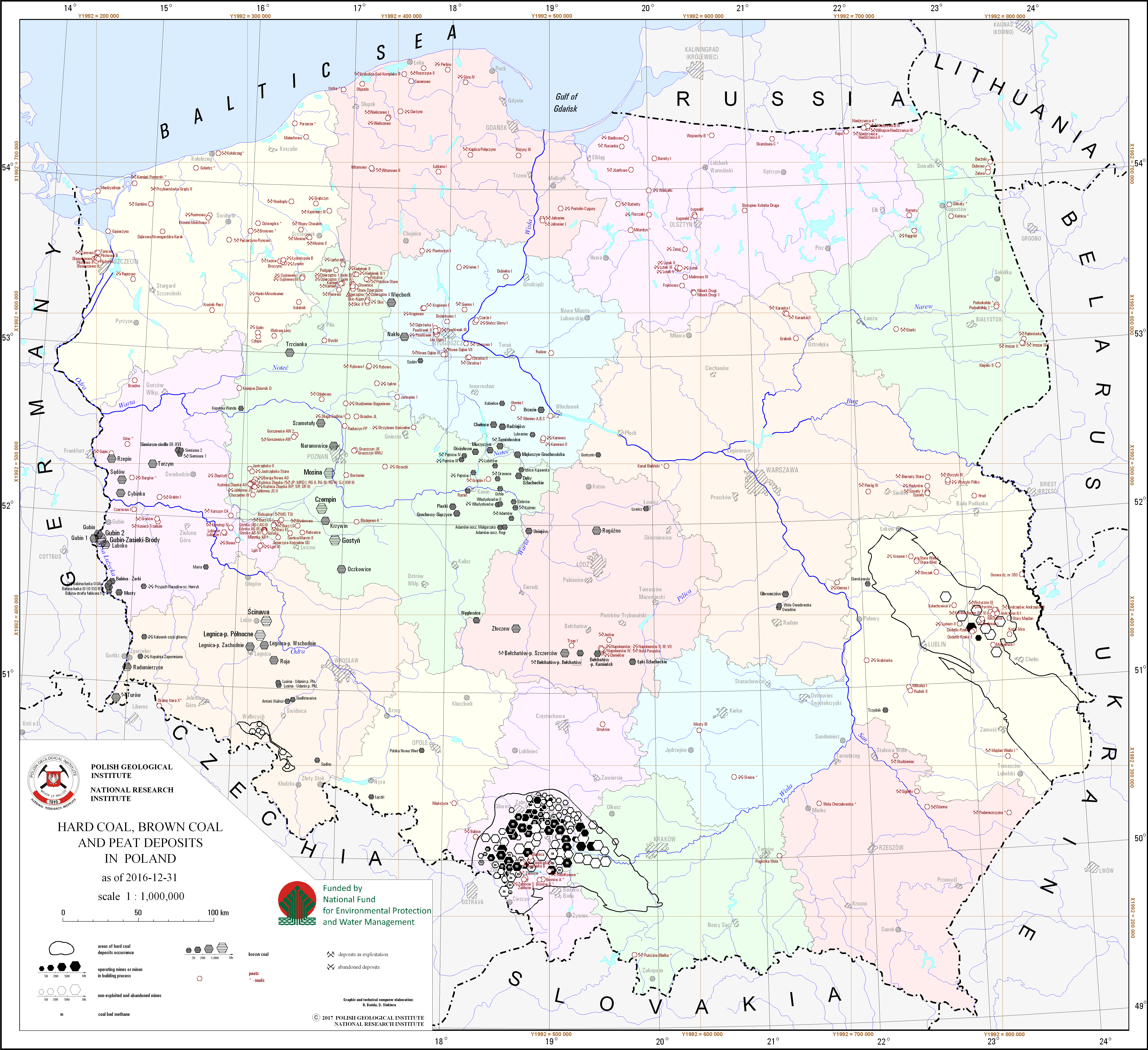
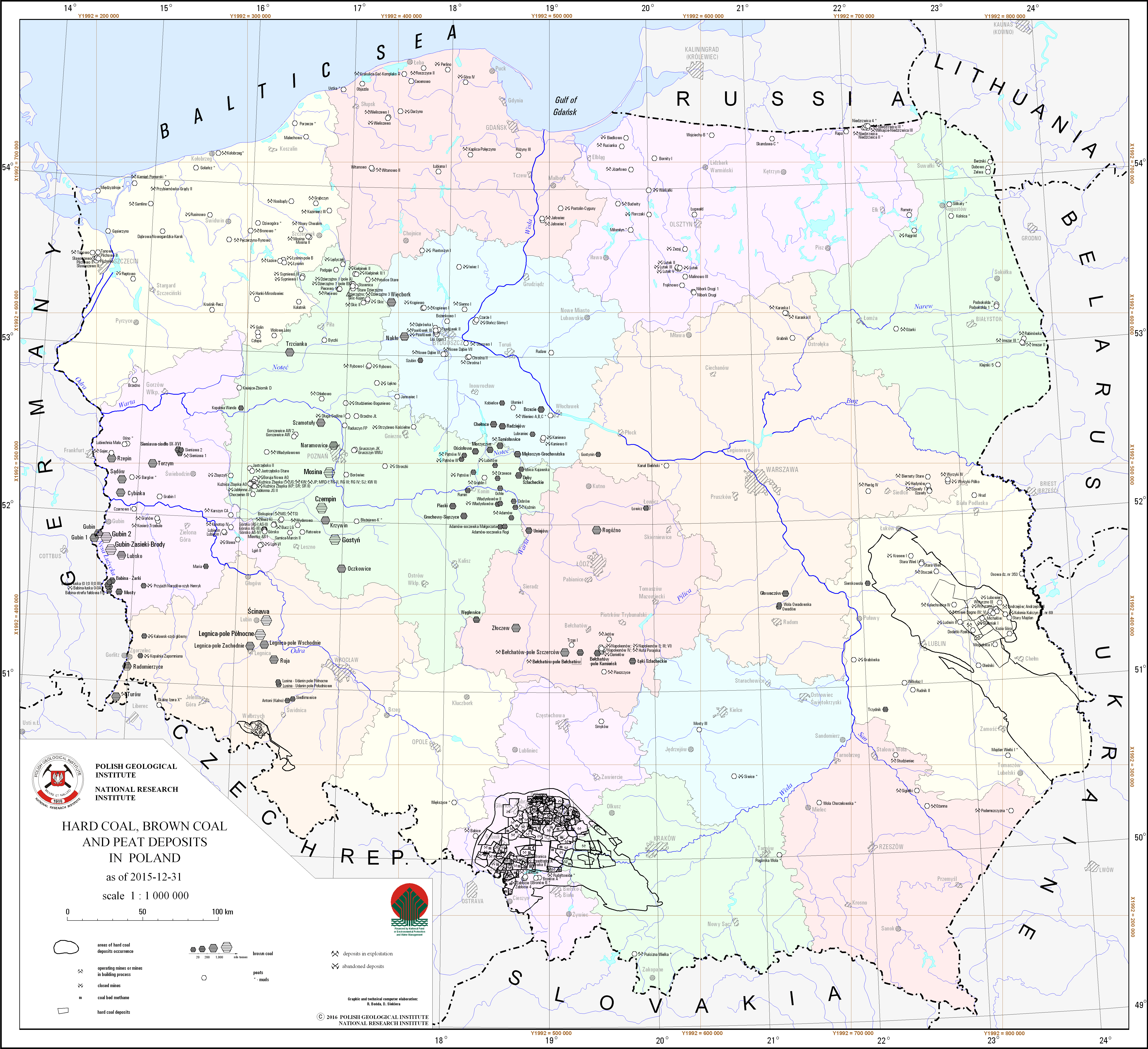
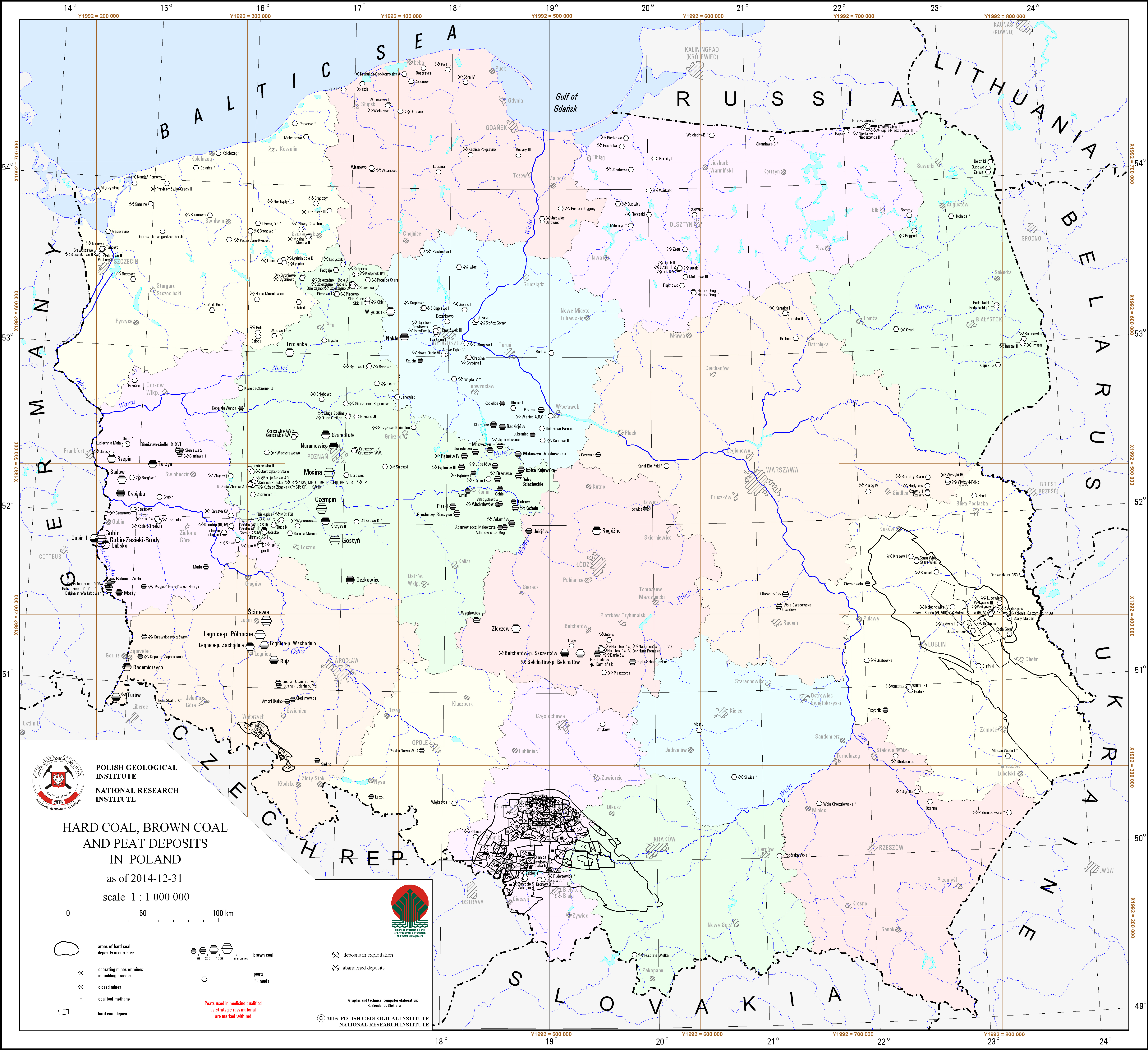
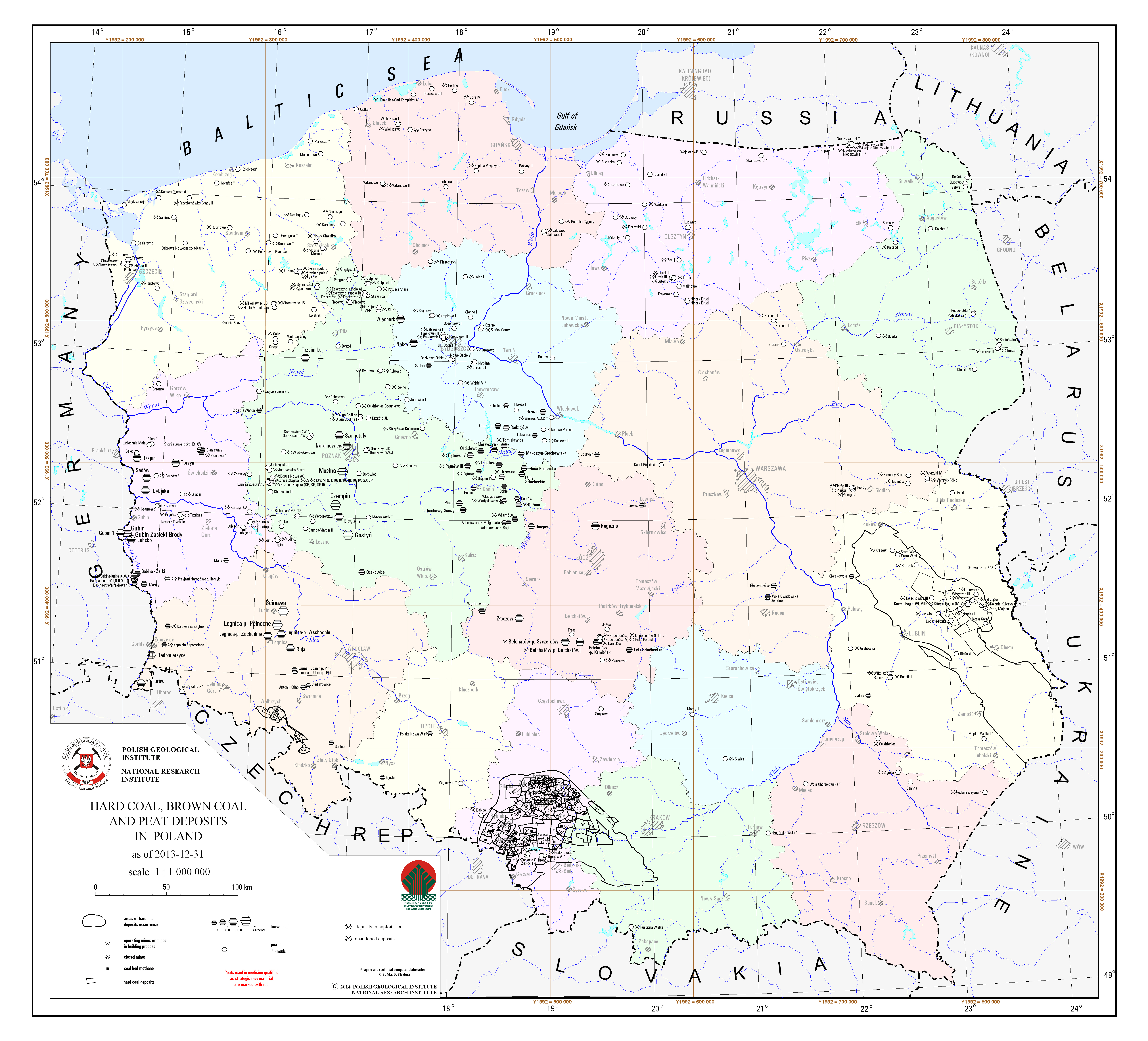
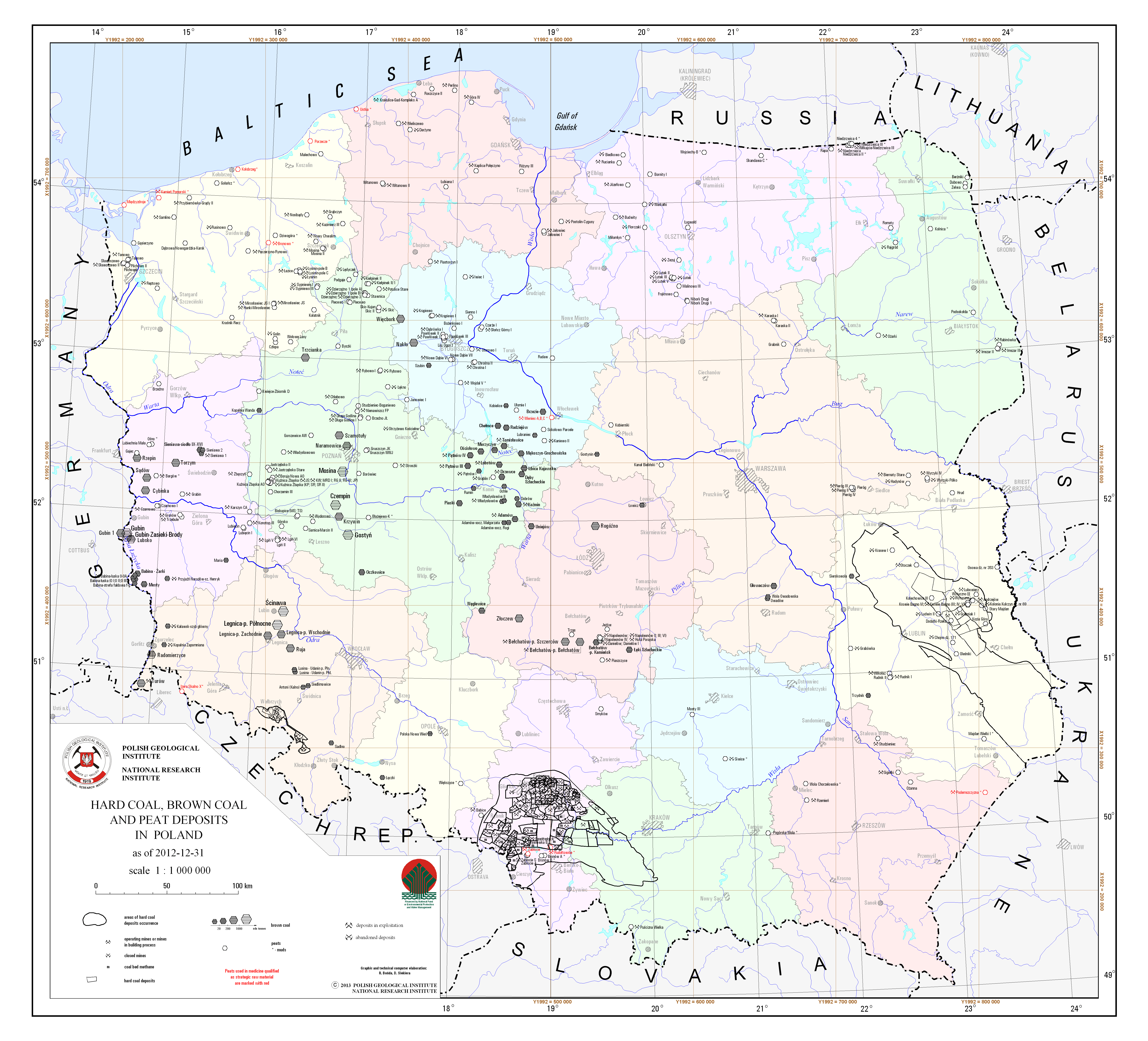
Hard coal, brown coal and peat deposits in Poland
There are hard coal, brown coal and peat deposits in Poland presented on the map. A particular deposit is presented by a graphic mark with distinction of deposits classified as basic minerals. There are two separeted maps - for the Upper Silesian Coal Basin and the Lublin Coal Basin, where deposits are presented in more details. There is also information on a state of development of a particular deposit.
Download map.
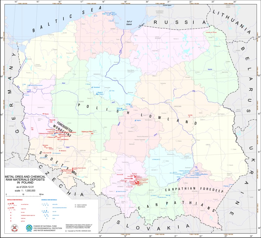
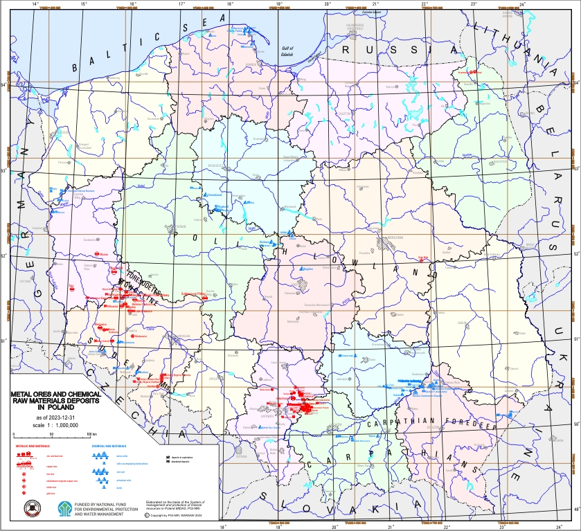
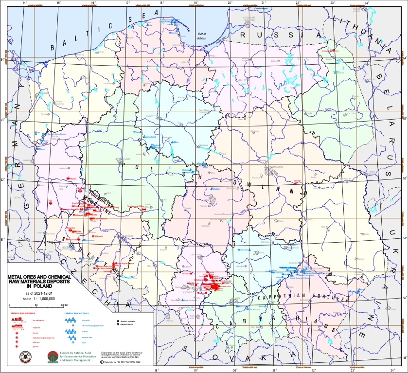
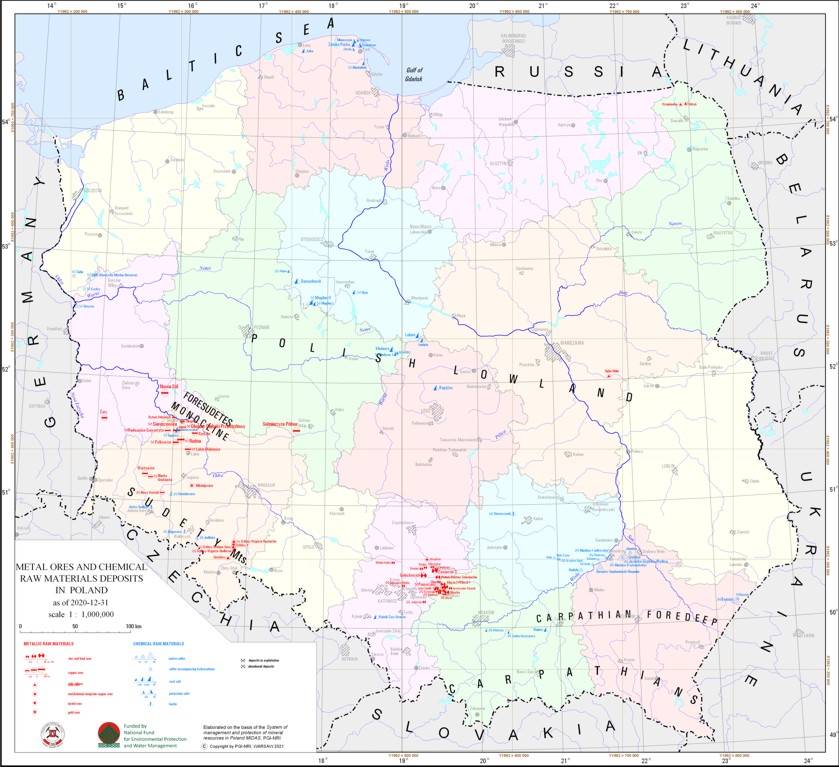
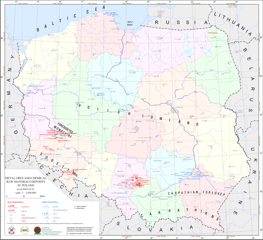
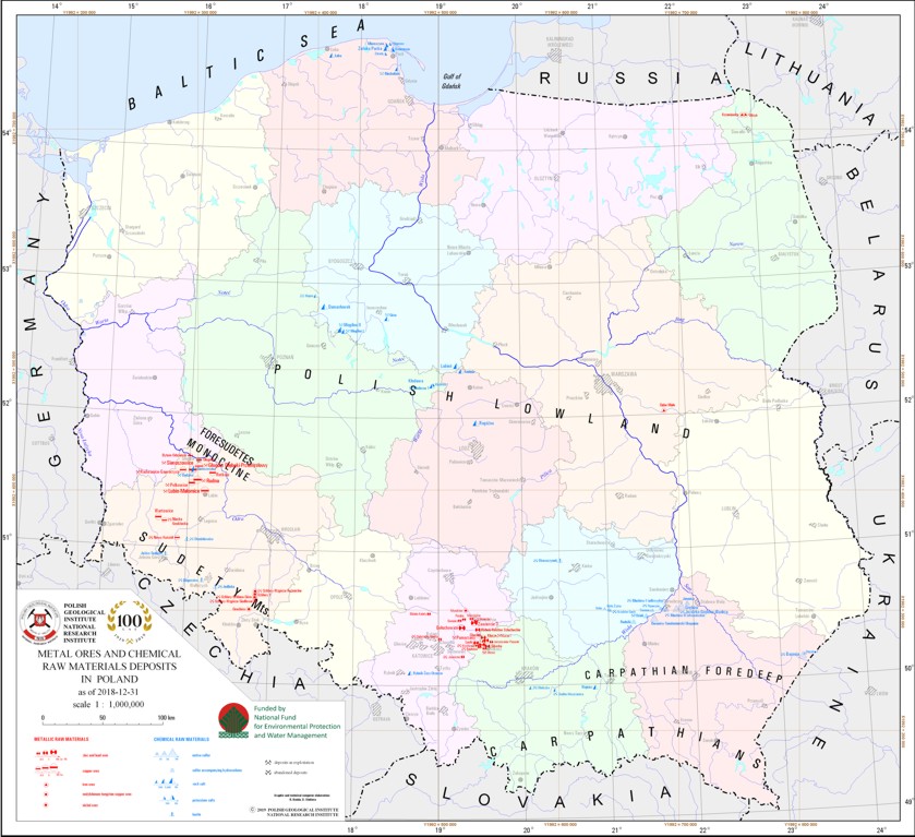
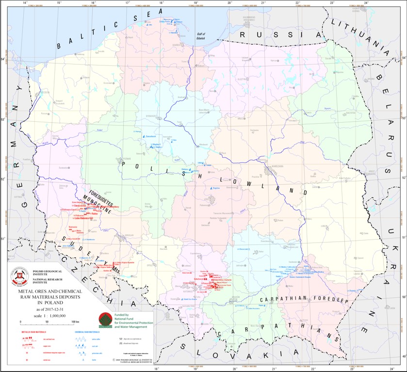
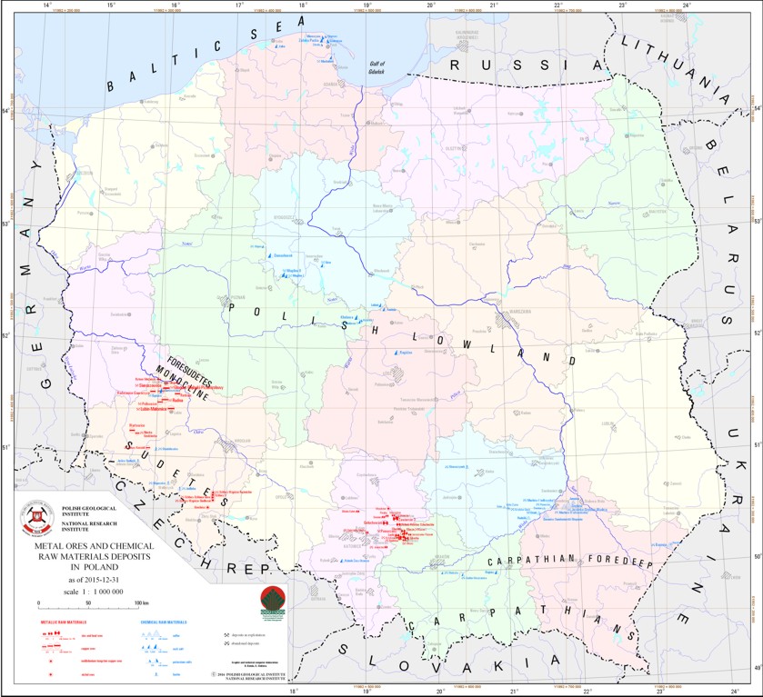
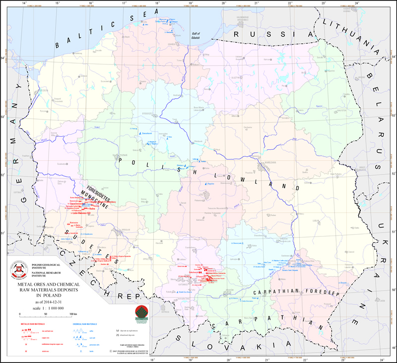
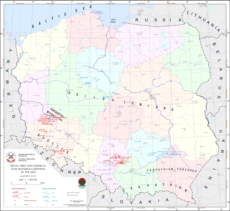
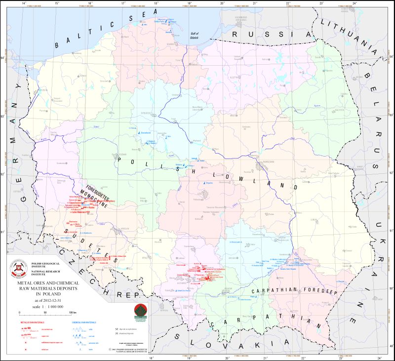
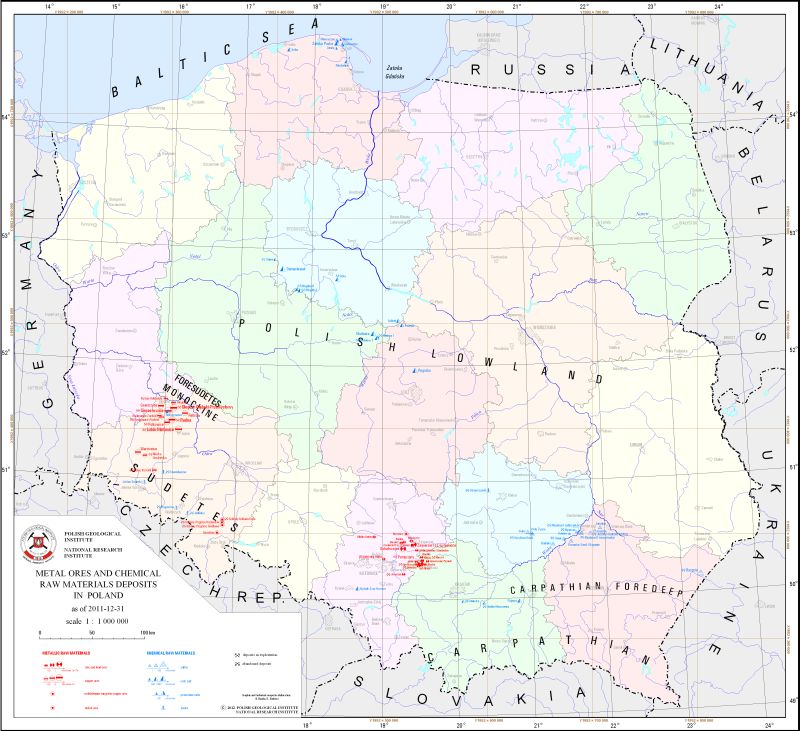
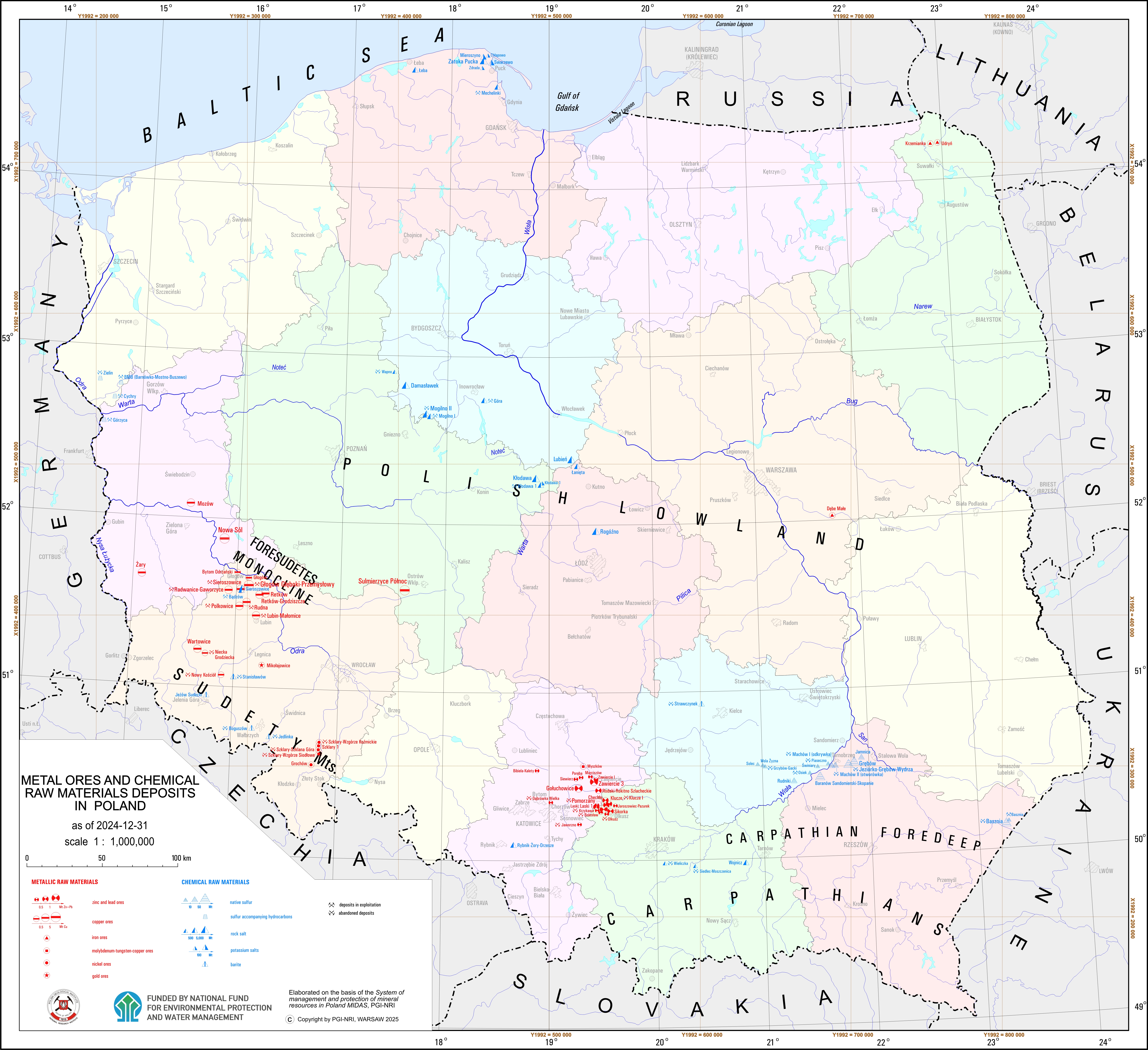
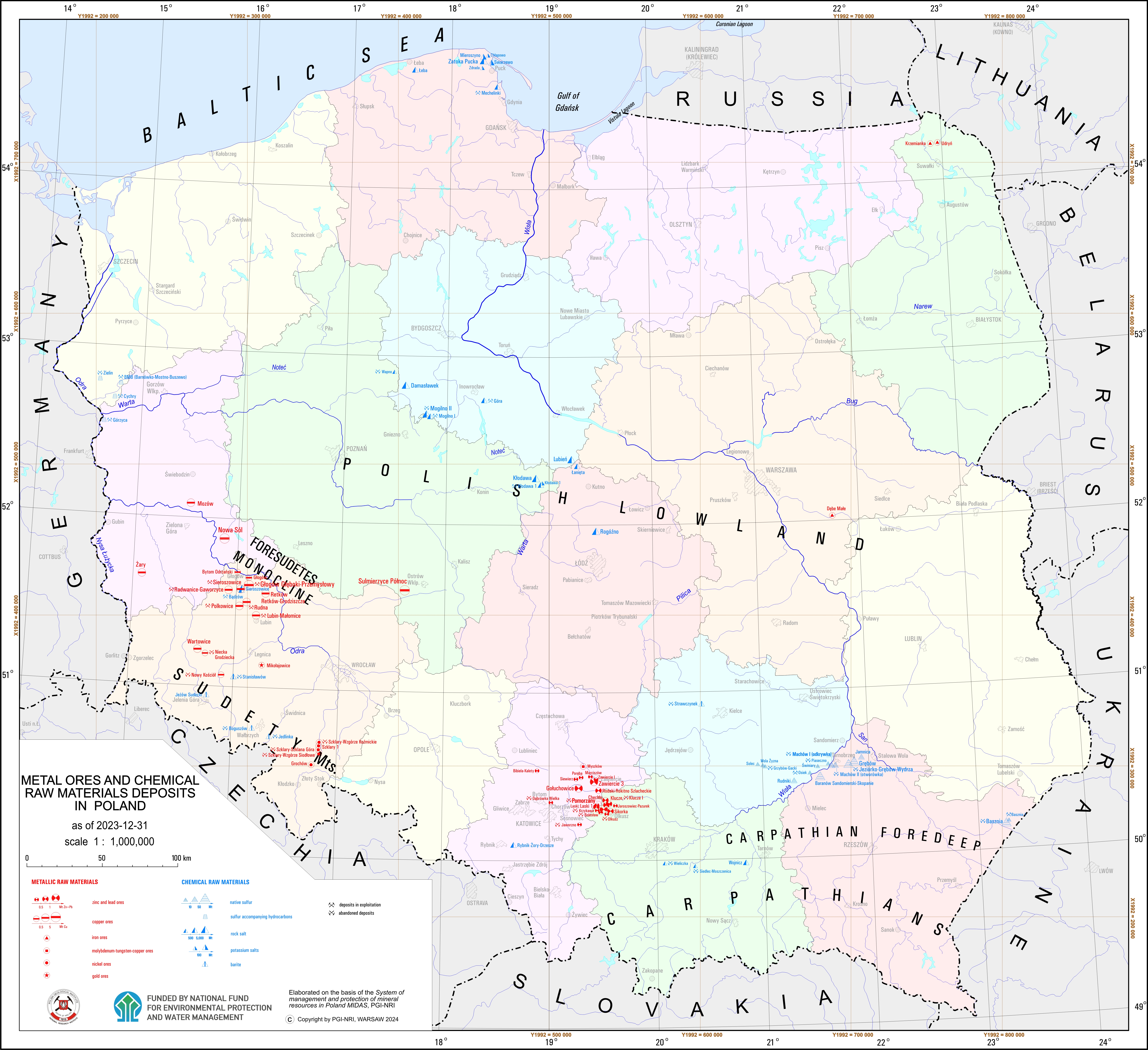
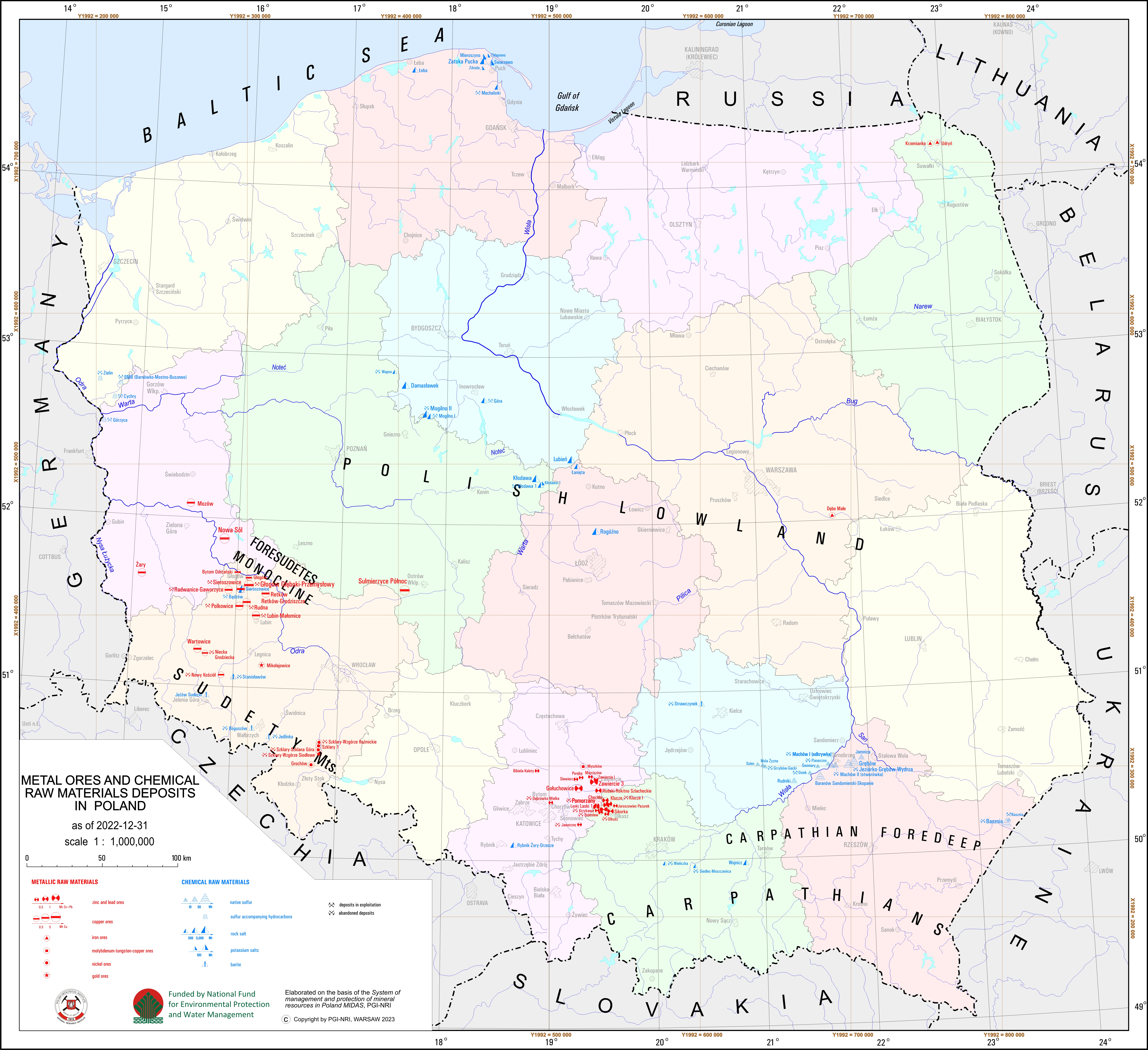
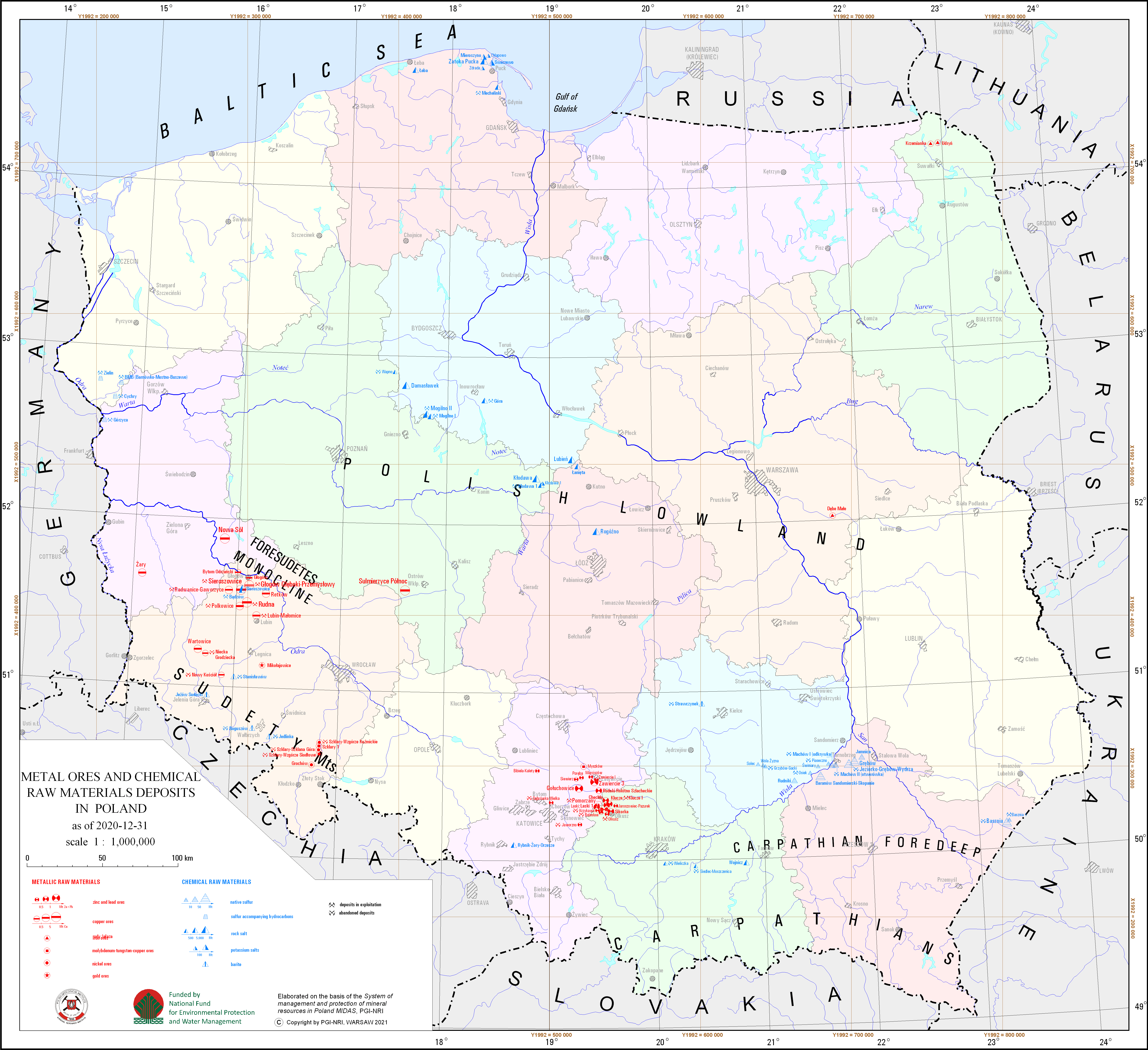
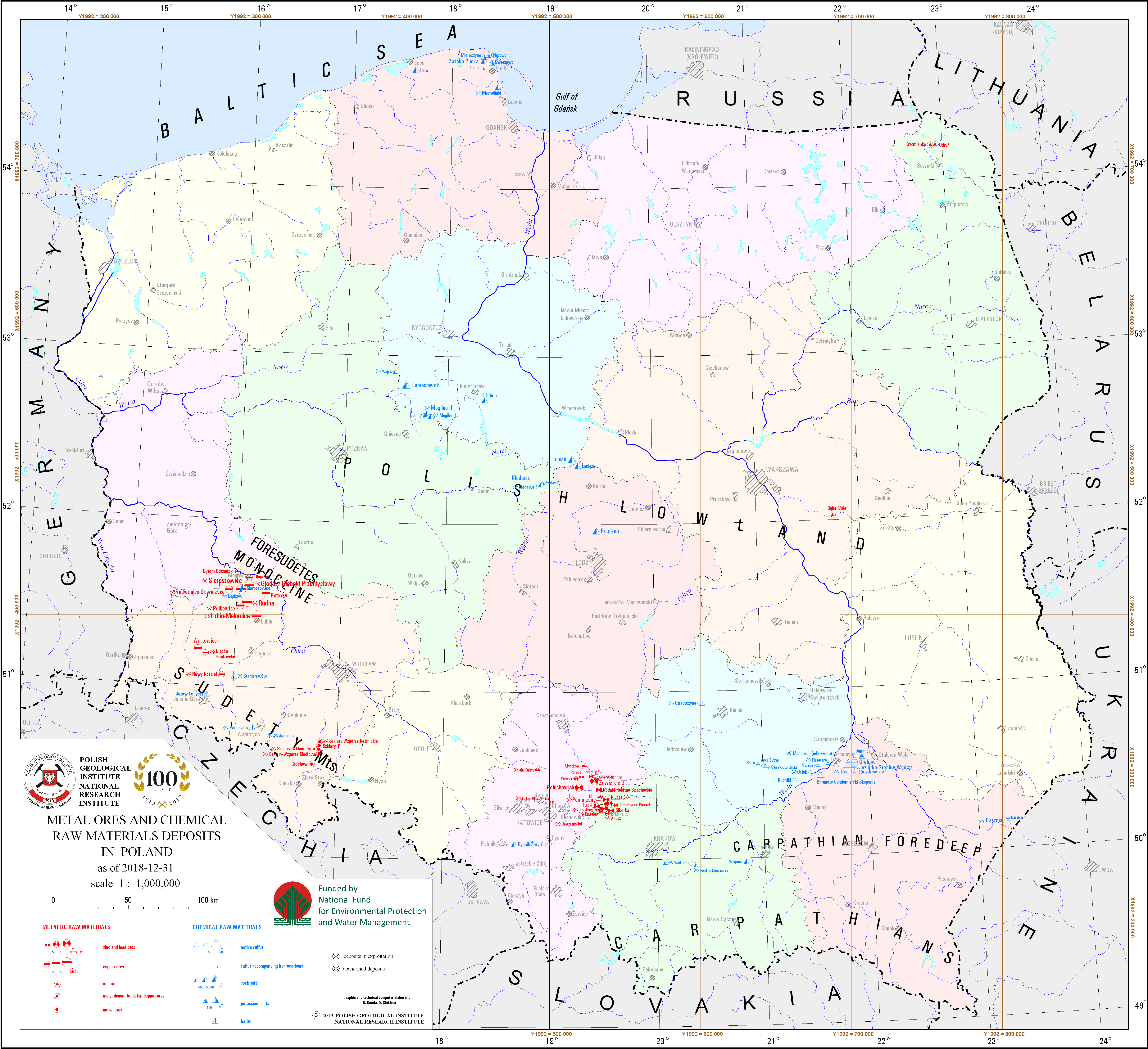
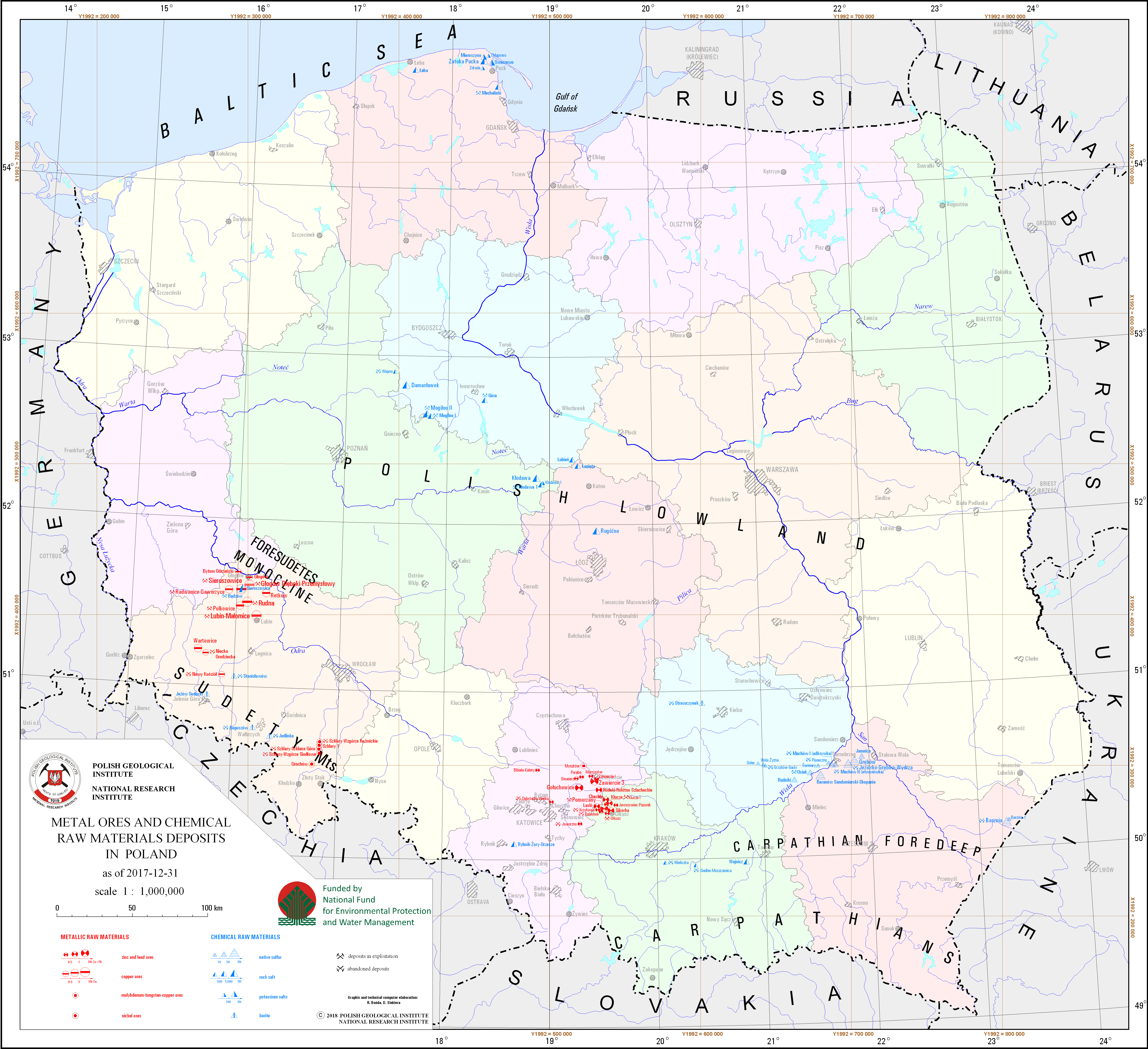
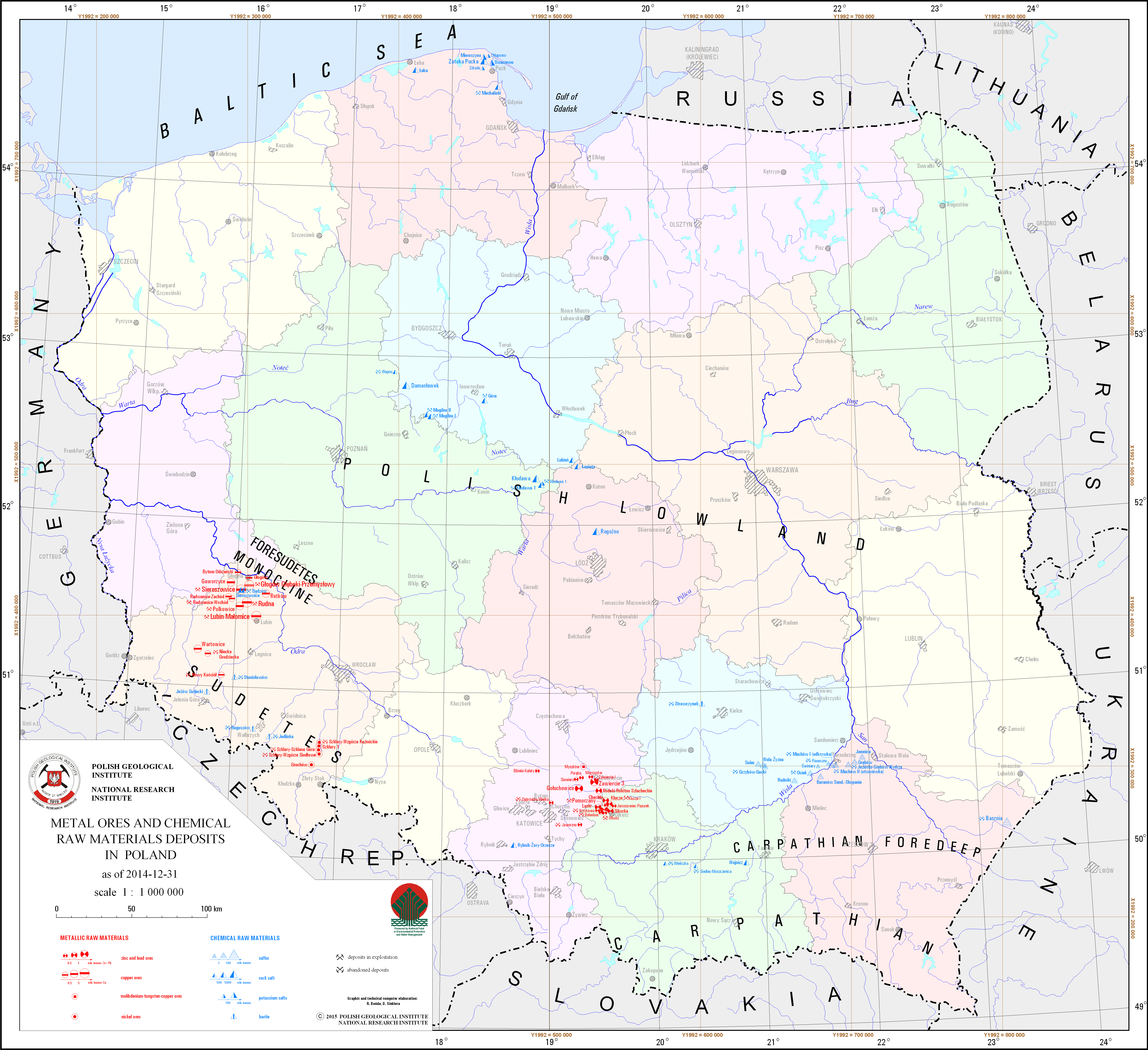
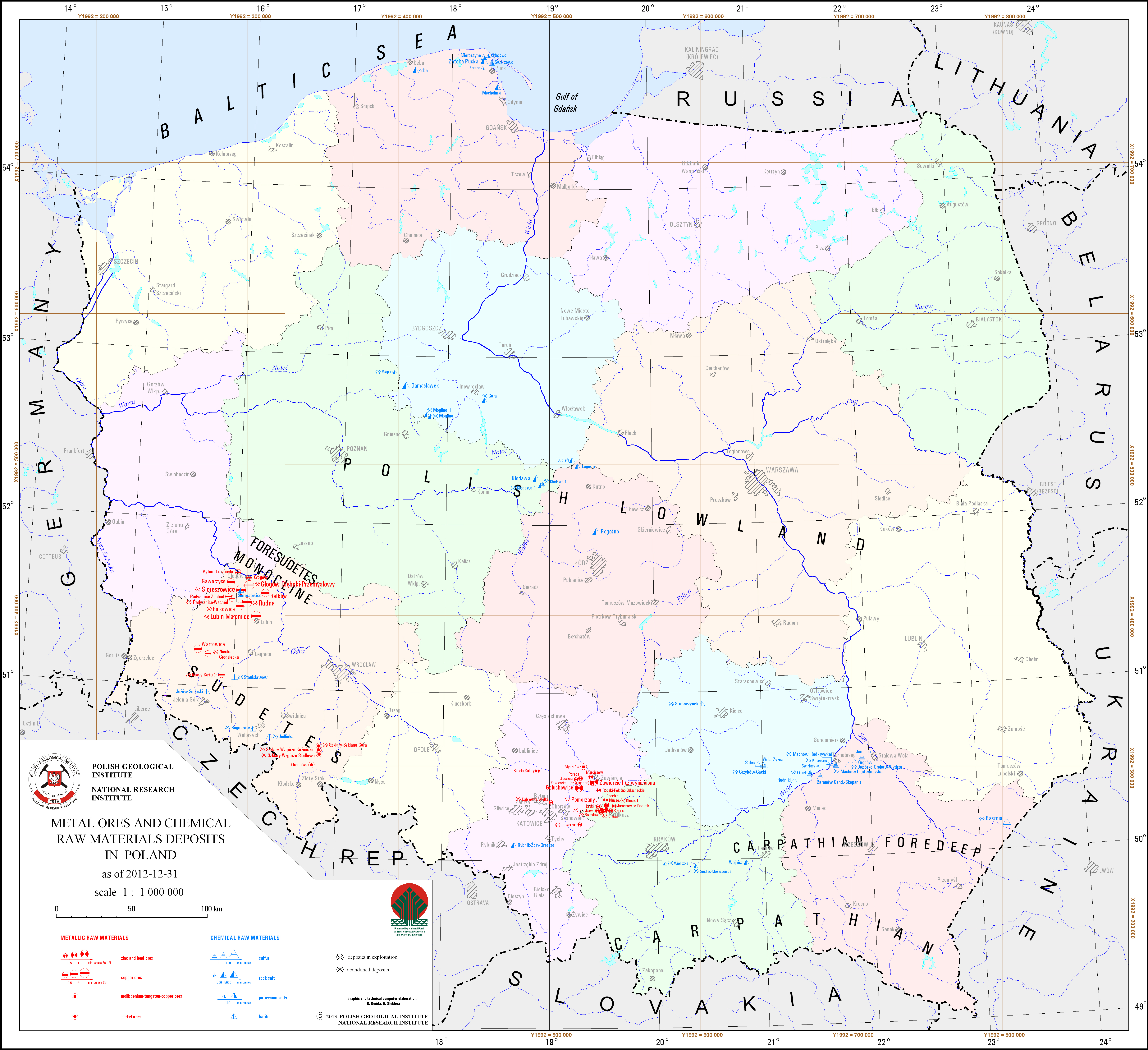
Metal ores and chemical raw materials deposits in Poland
There are copper and silver ore, zinc and lead ore, nickel ore, iron ore, molibdenium-tungsten-copper ore and native sulfur, sulphur accompanying hydrocarbons, rock salt, potassium salt, barite and fluorspar and phosphorite deposits in Poland presented on the map. Particular deposit is presented by graphic mark with distinction of deposits classified as basic minerals. There are separeted maps - for copper and silver ore, lead and zinc ore and native sulfur where deposits are presented in more details. There is also information on a state of development of a particular deposit.
Download map.
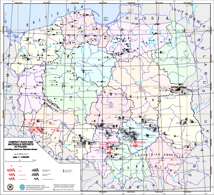
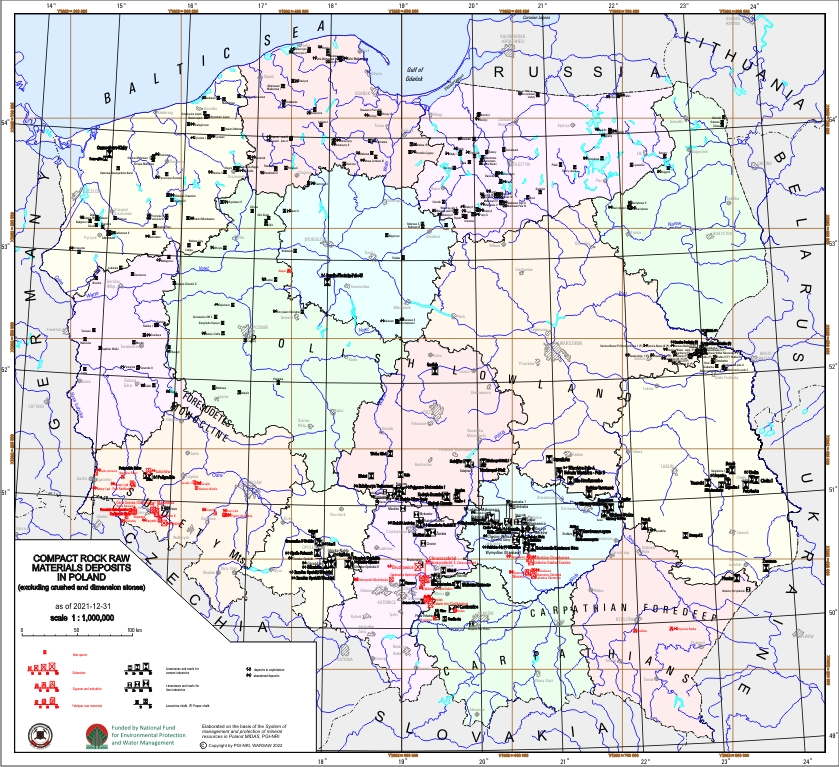
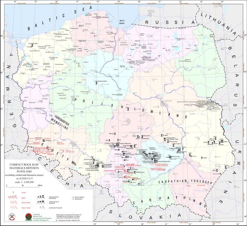
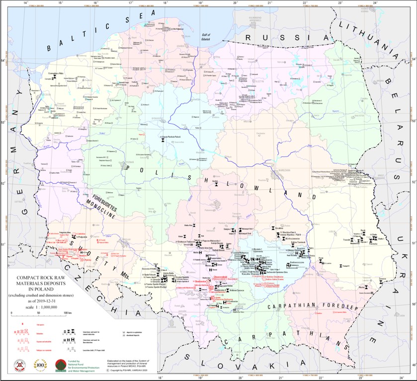
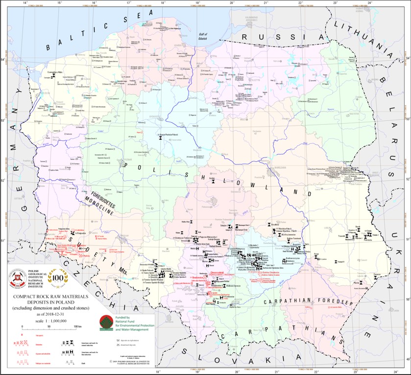
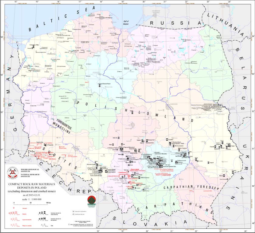
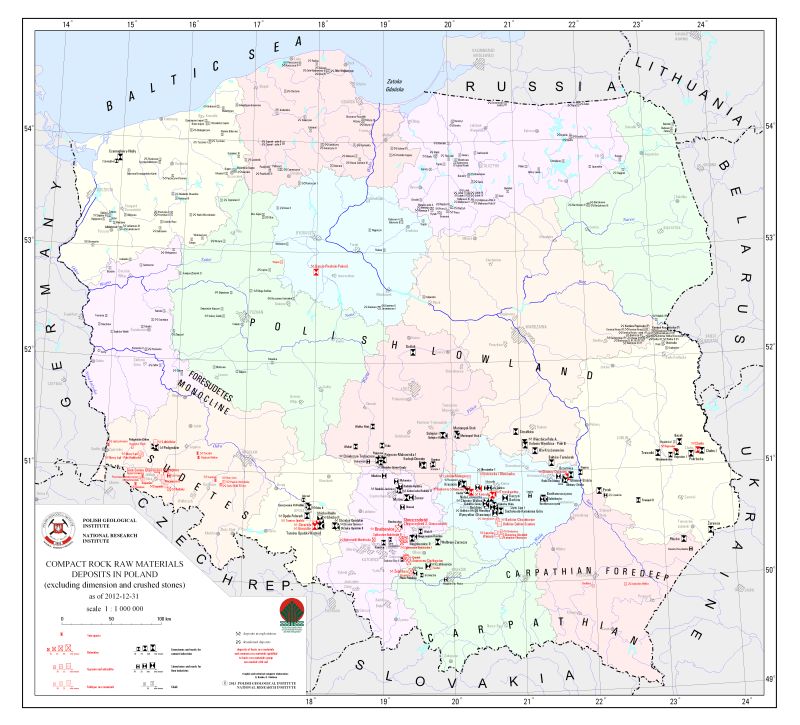
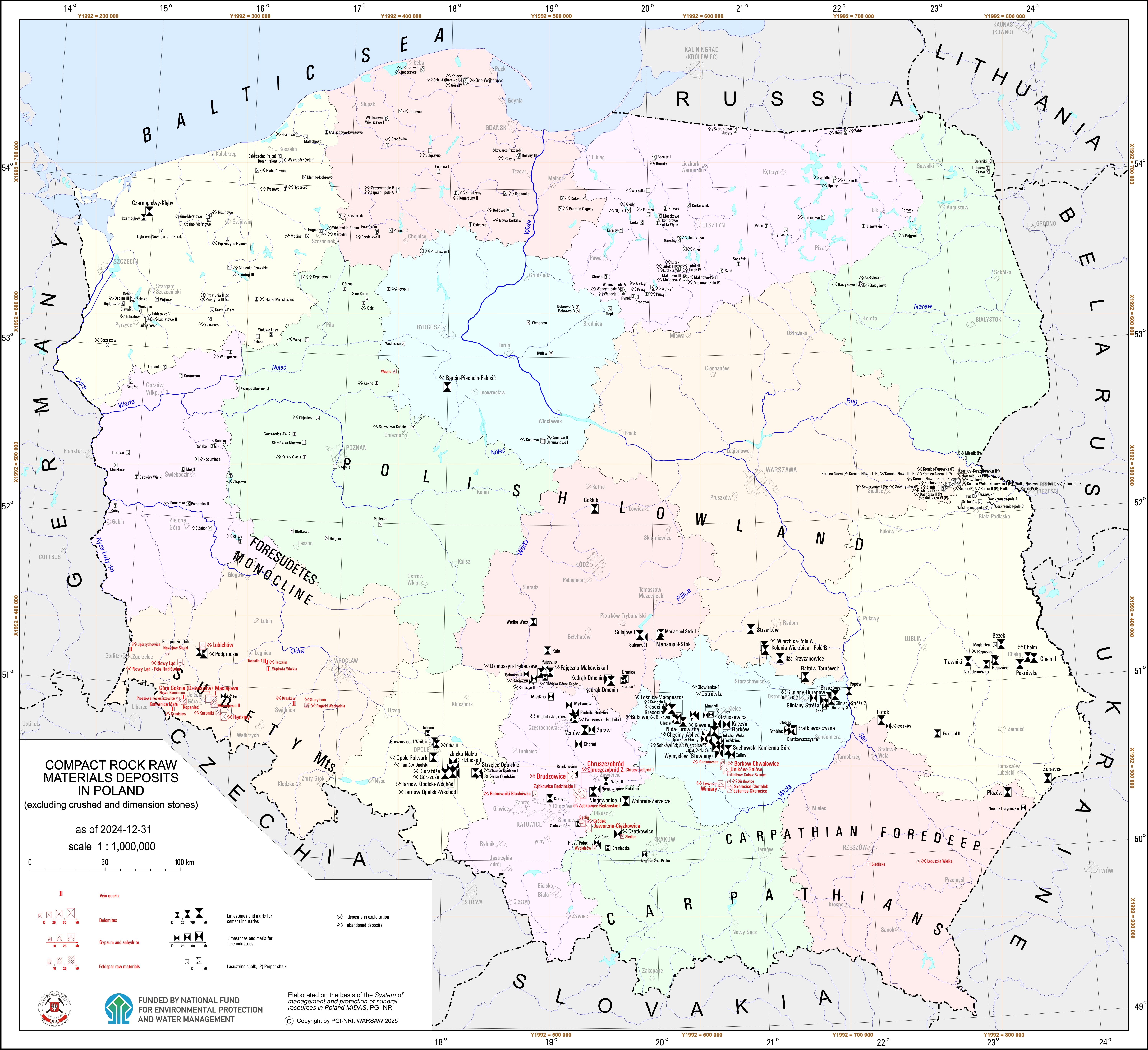
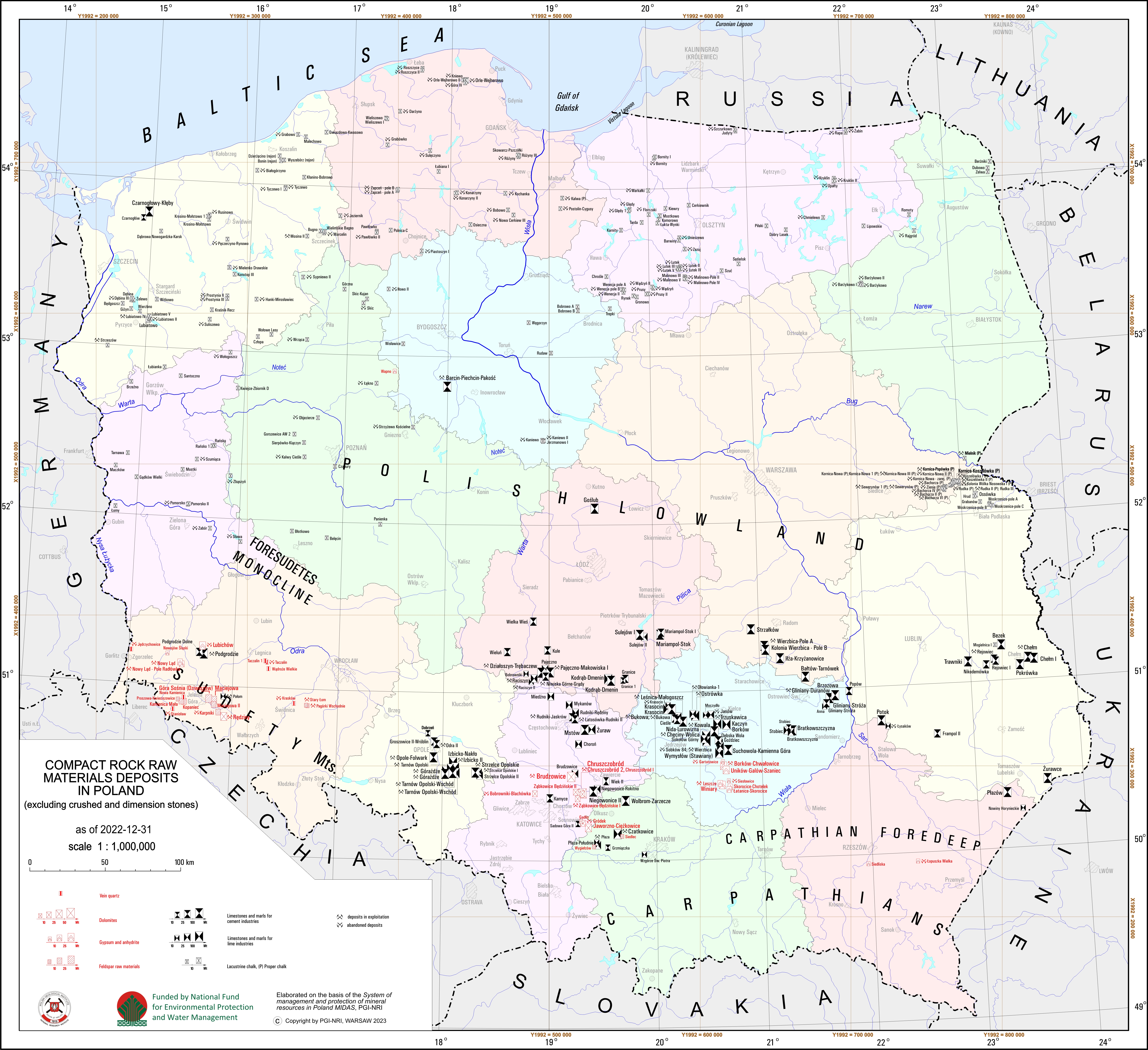
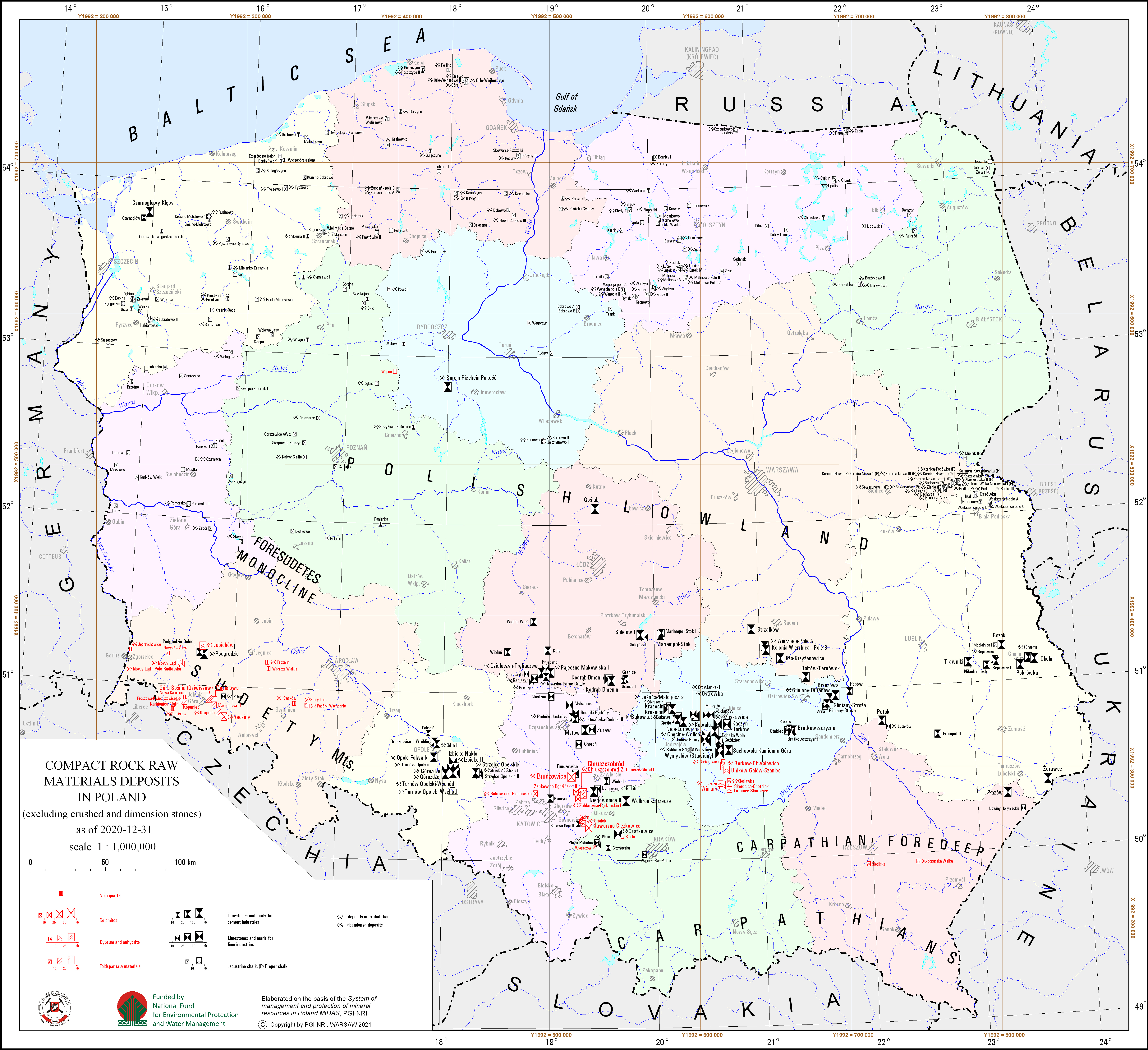
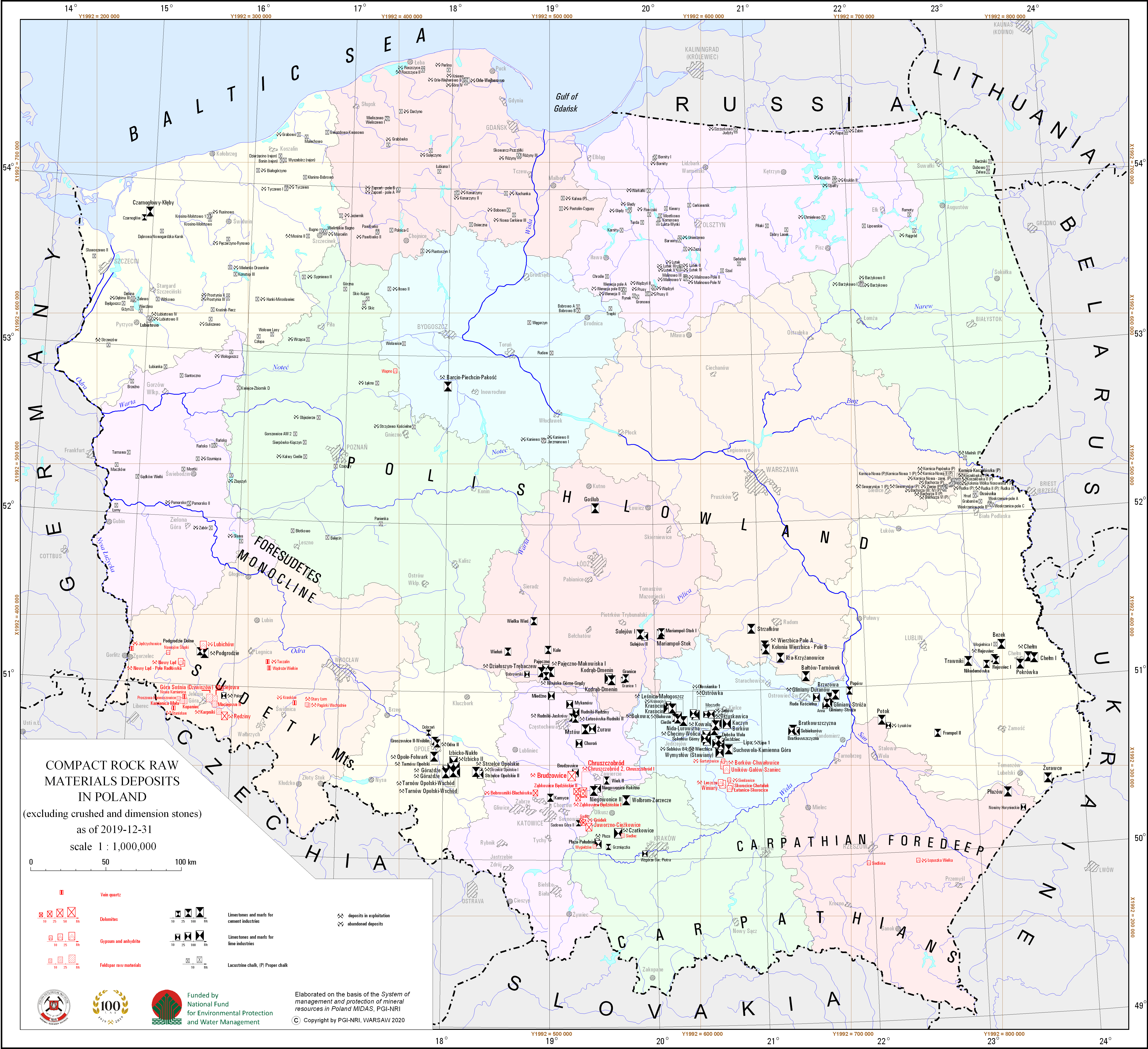
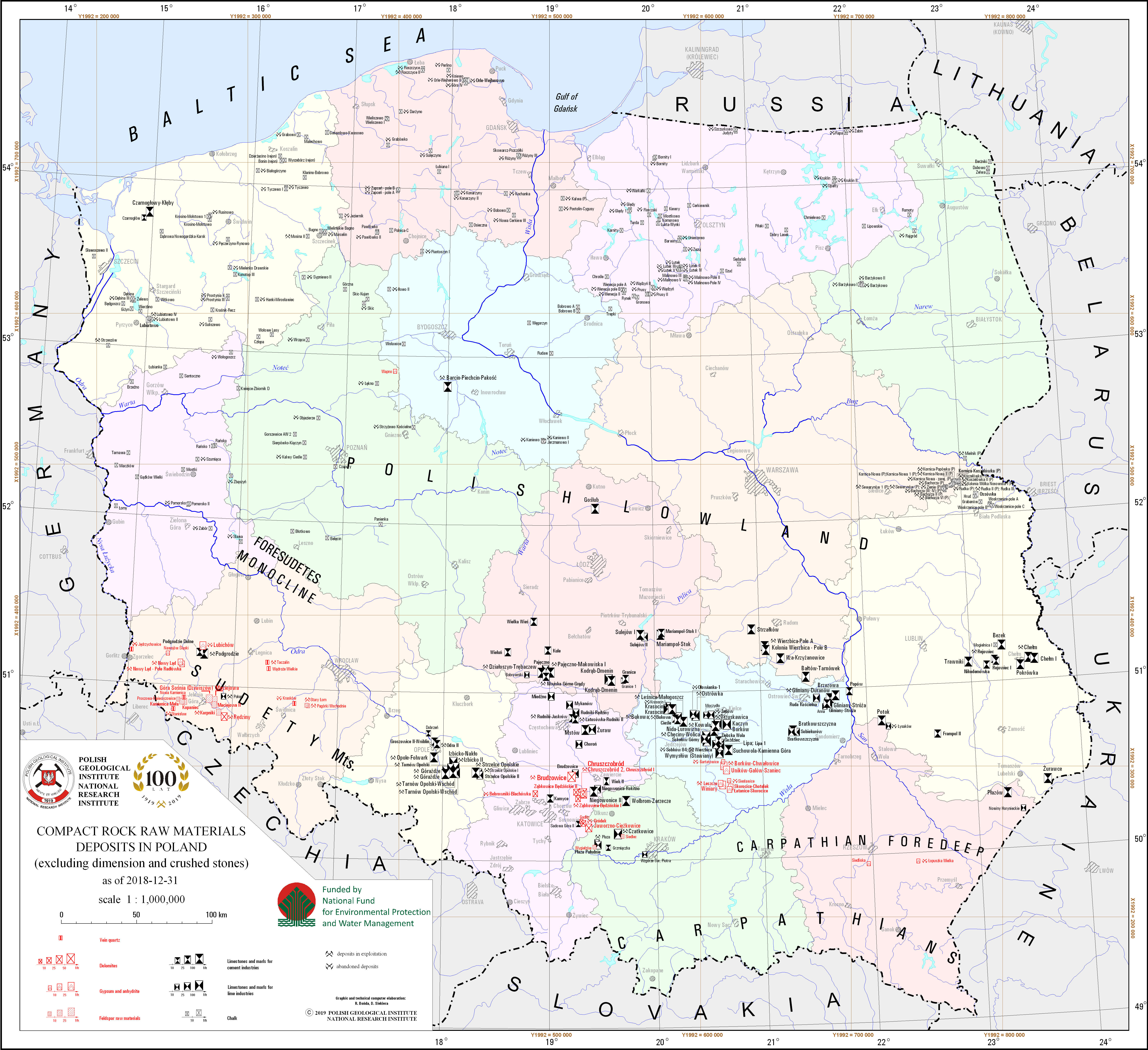
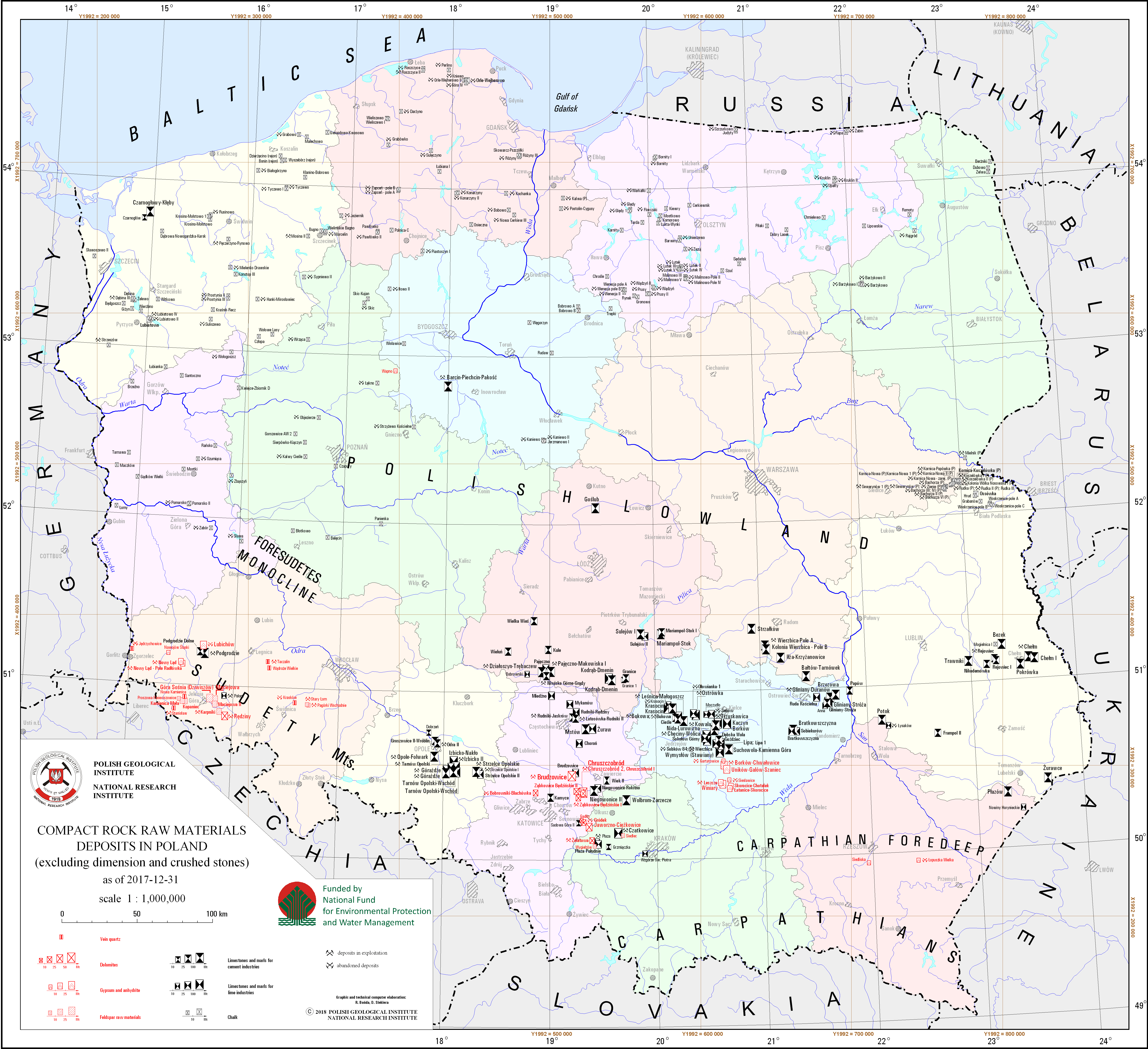
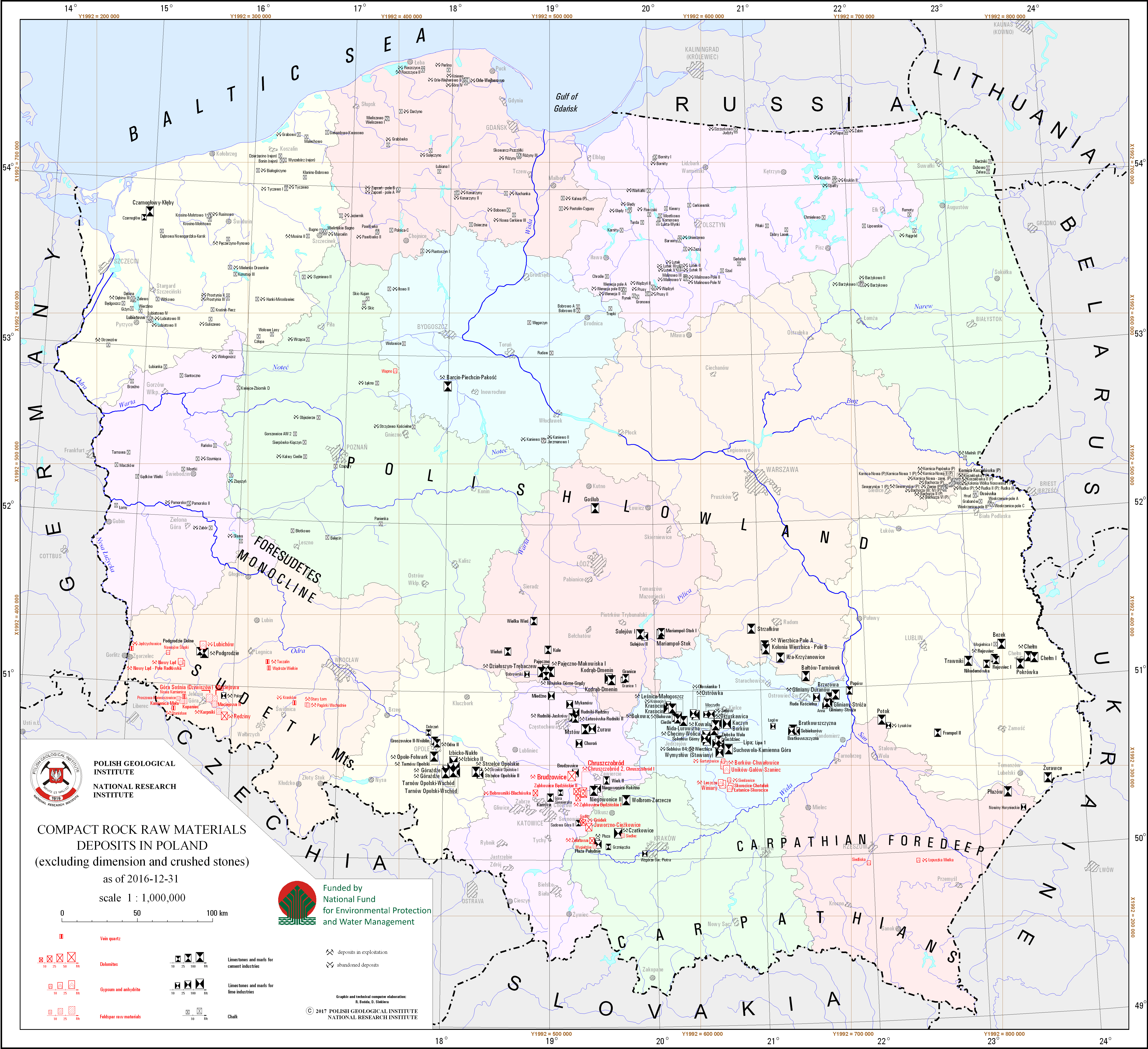
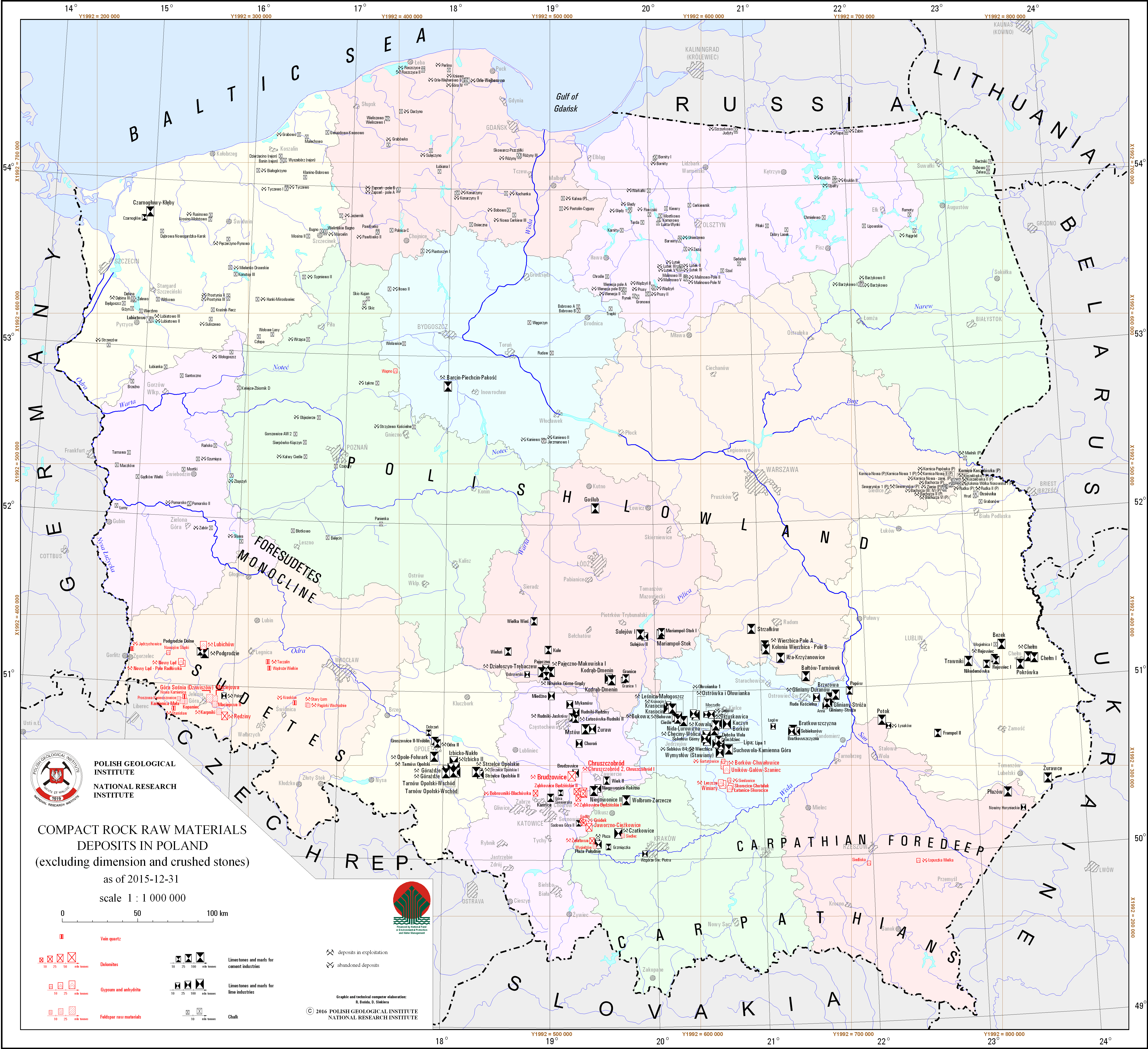
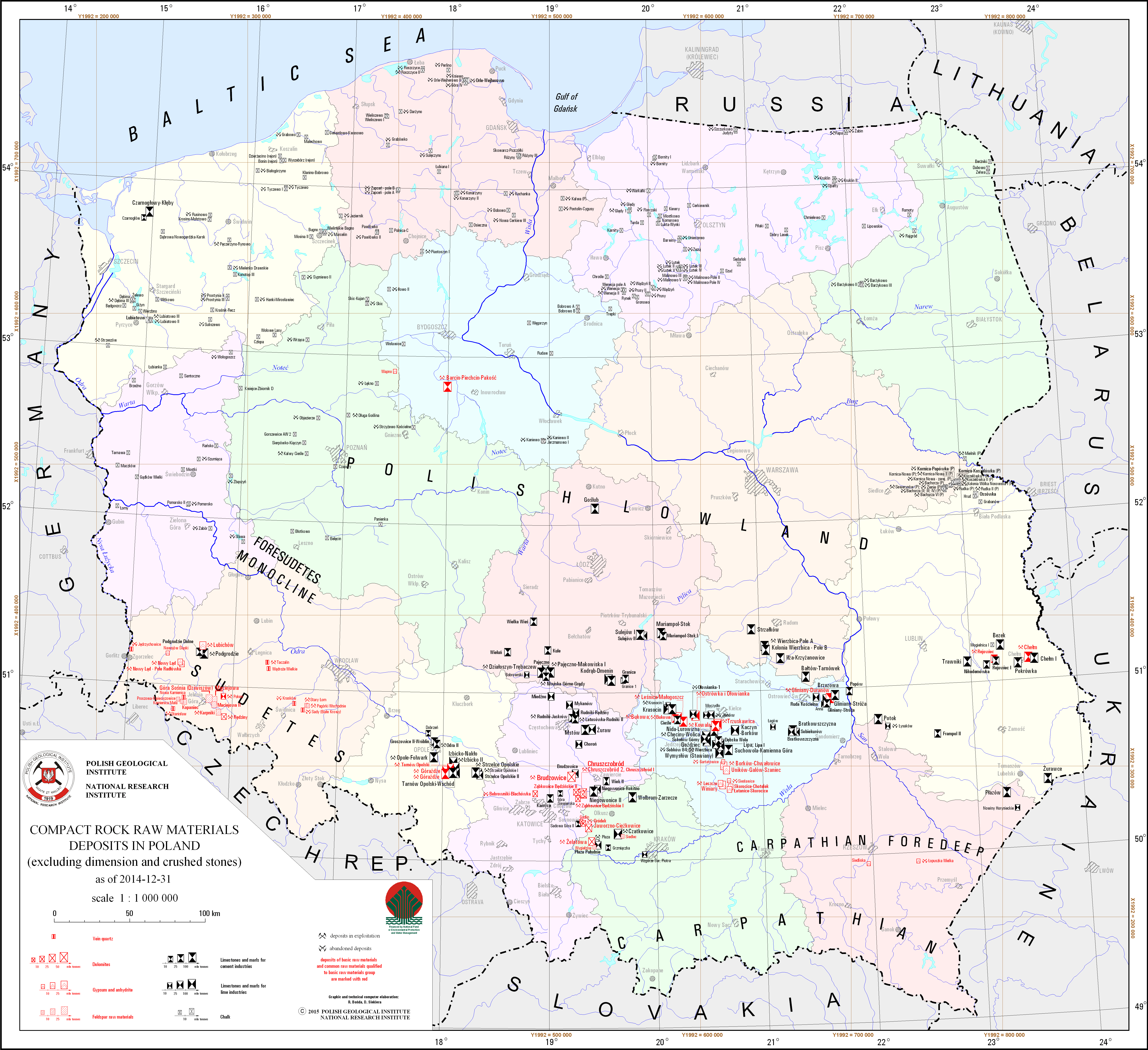
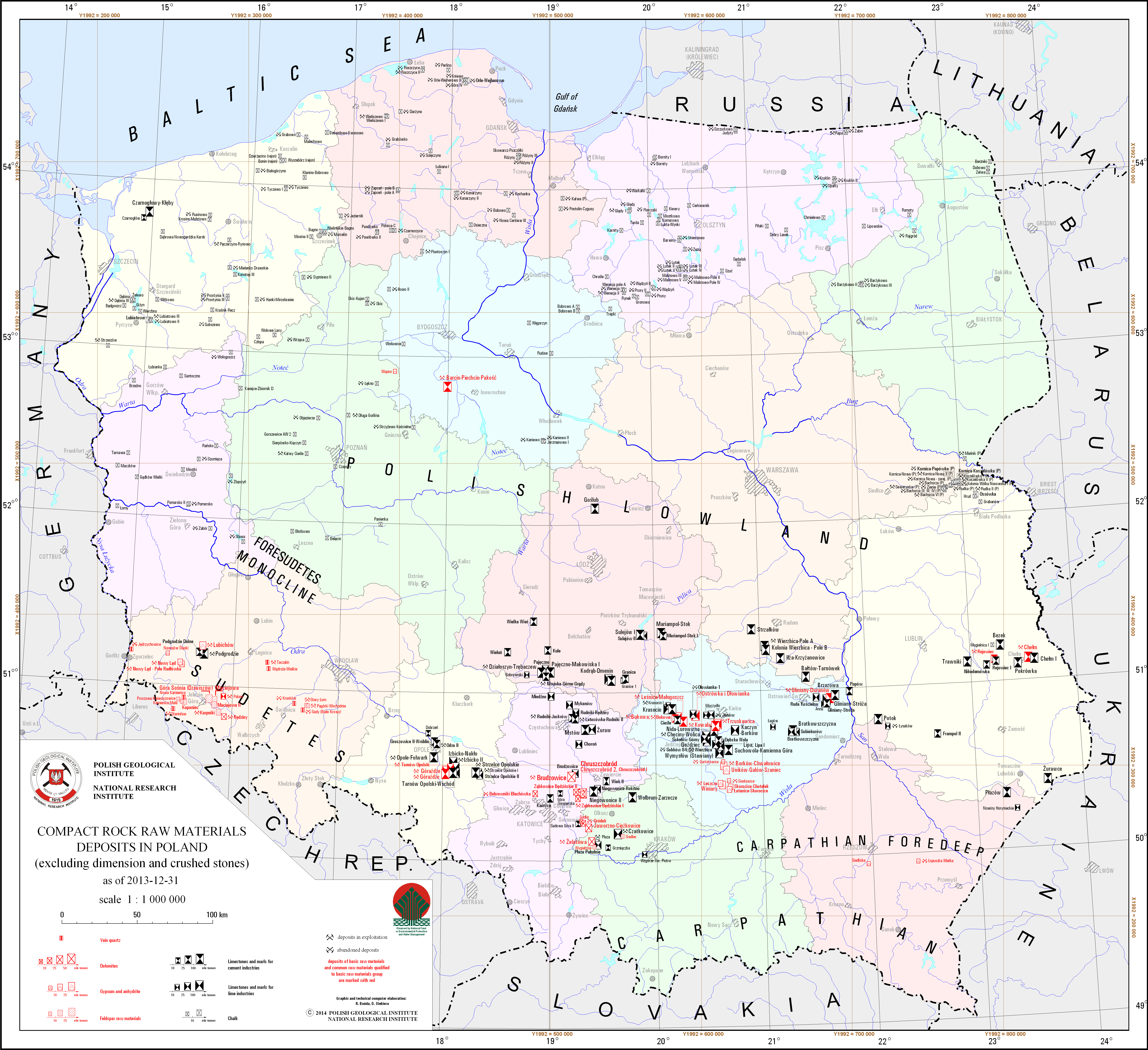
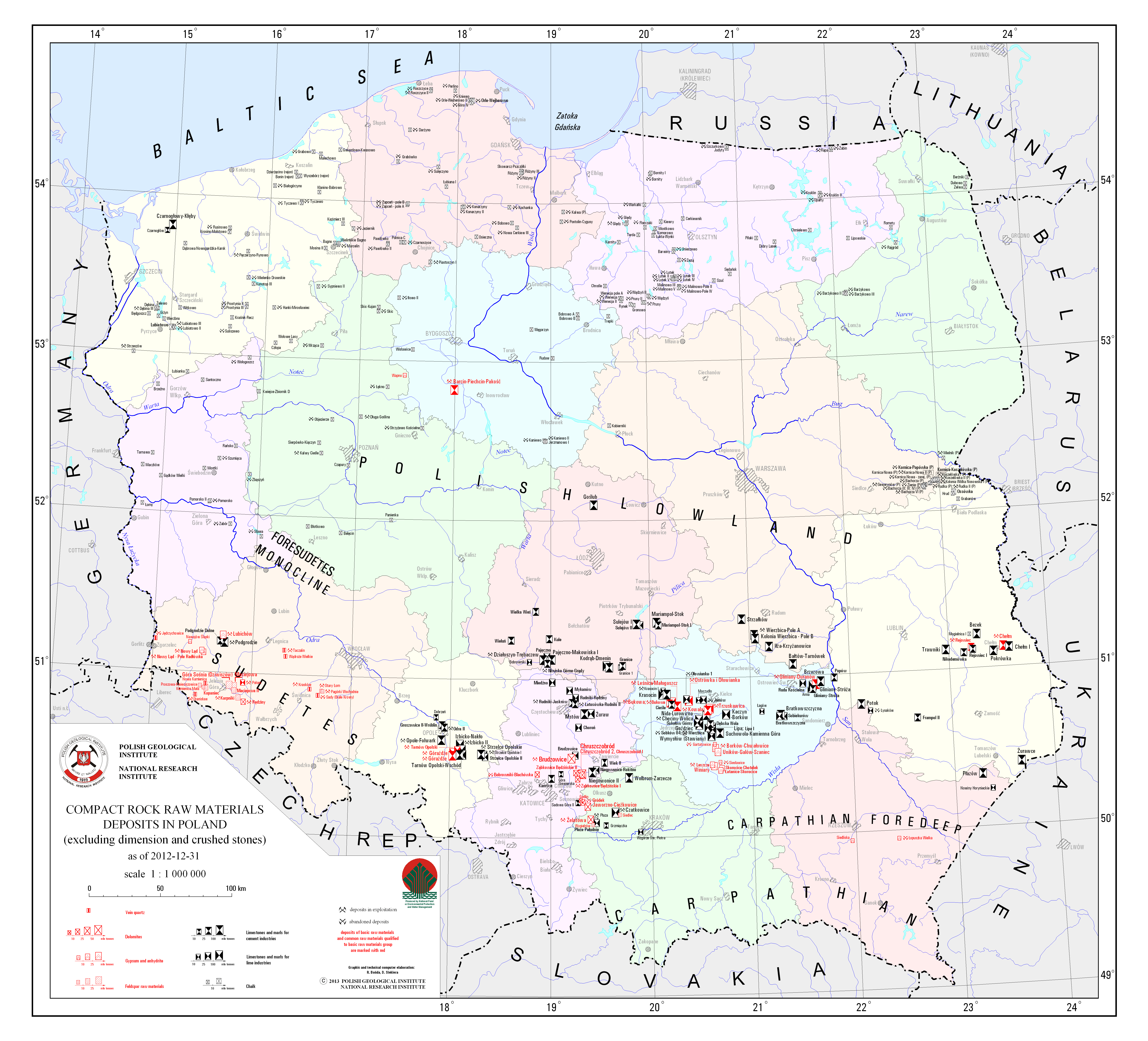
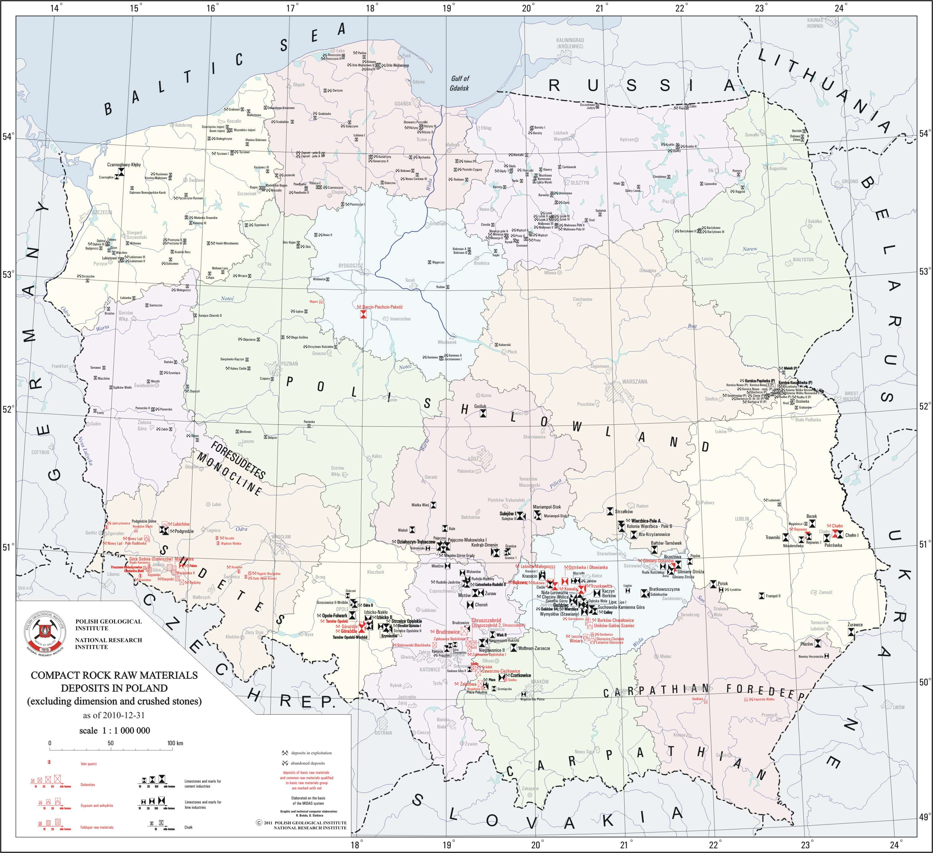
Compact rock raw materials deposits (excluding dimension and crushed stones)
There are compact rock raw materials deposits - dolomites, vein quartz, gypsum and anhydrite, feldspar, marl and limestone for cement and lime industries and chalk - in Poland presented on the map. To improve readability, deposits of marl and limestone for cement and lime industries, with resources volume below 10 million tonnes were not inlcuded on the map. There is also information on a state of development of a particular deposit.
Download map.
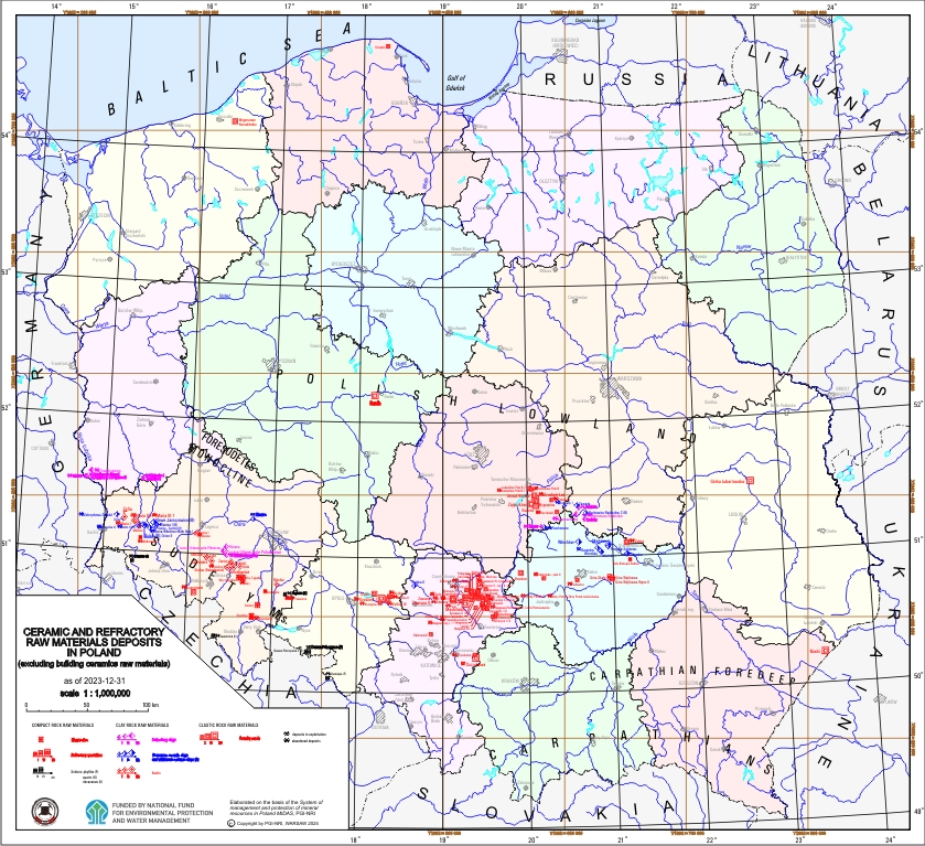
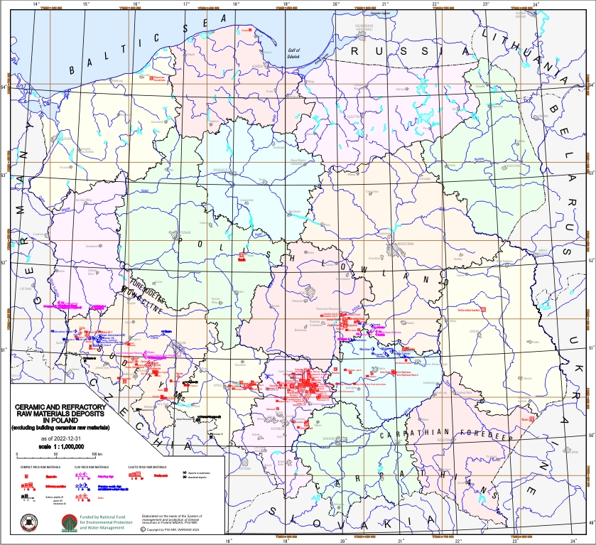
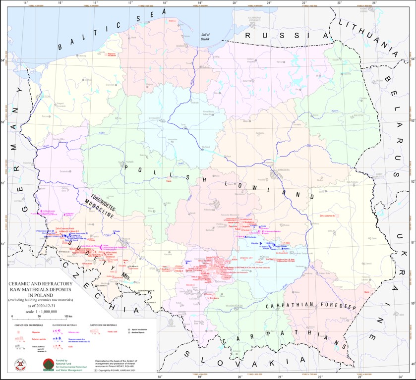
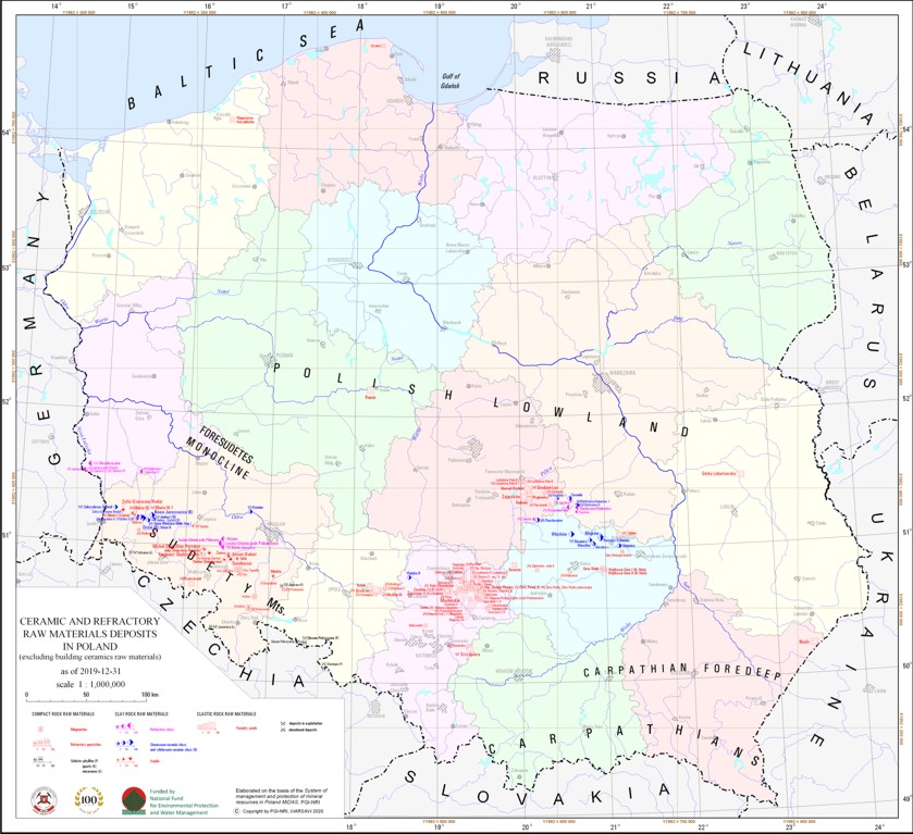
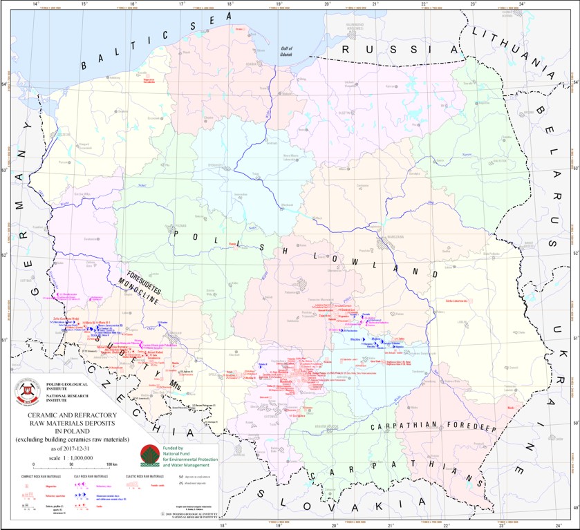
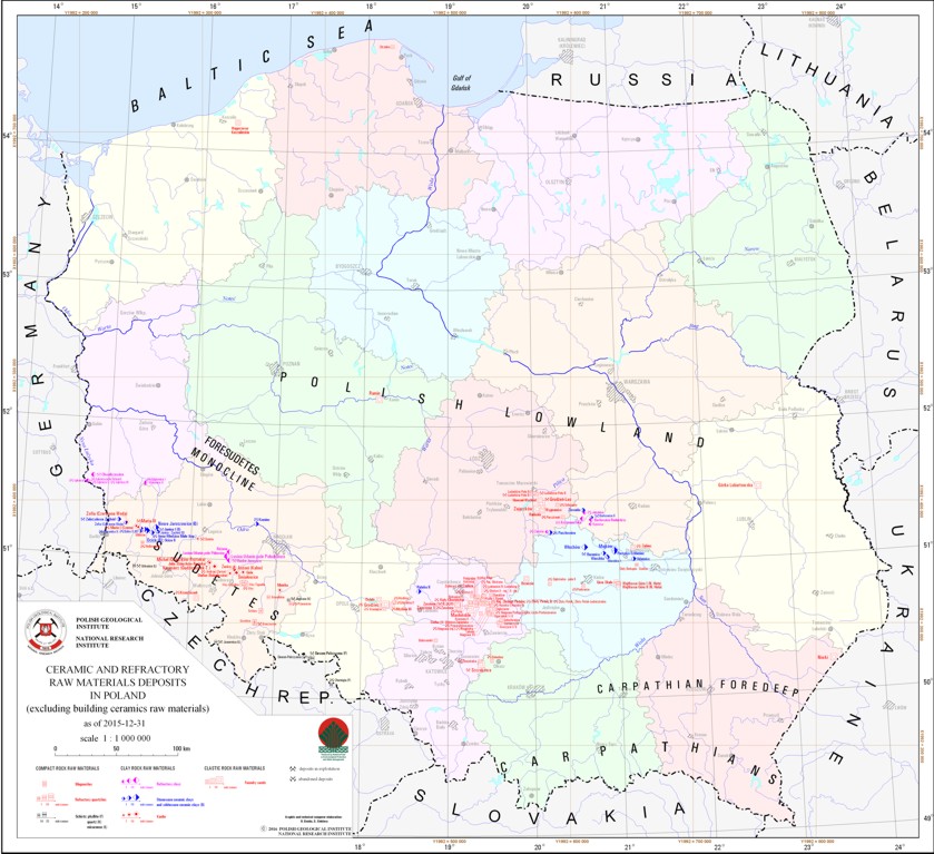
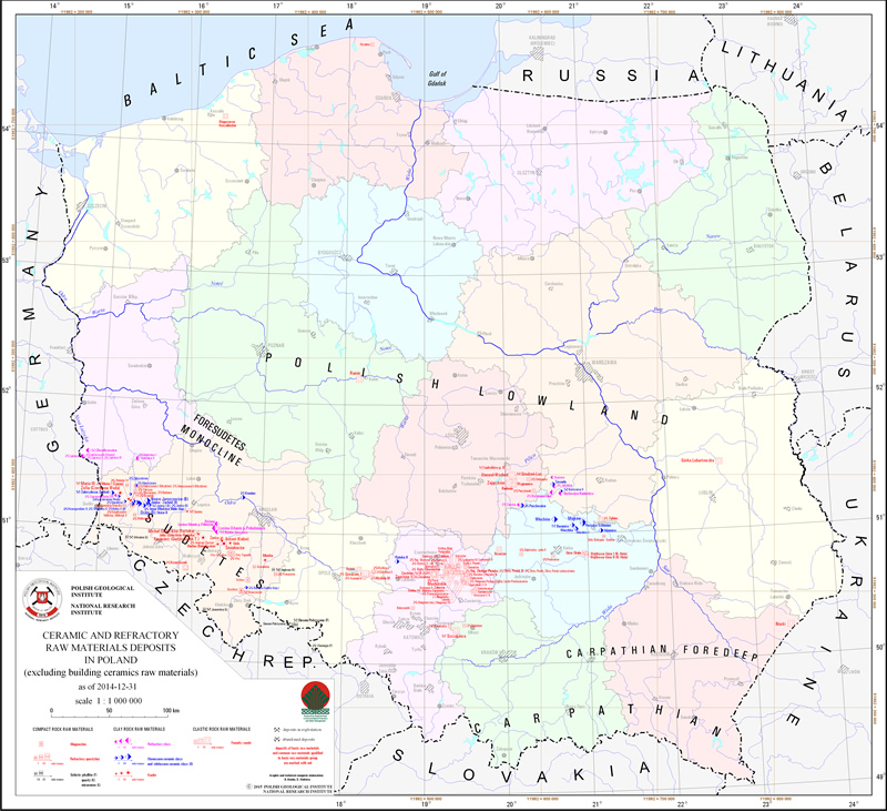
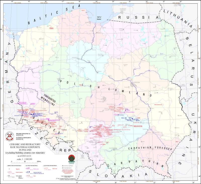
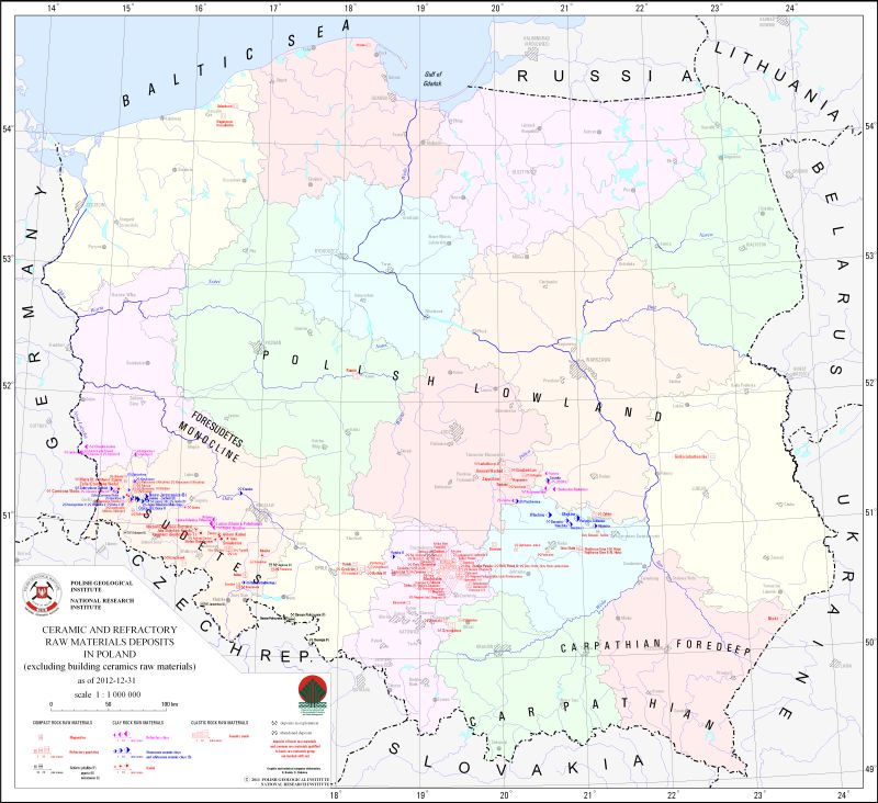
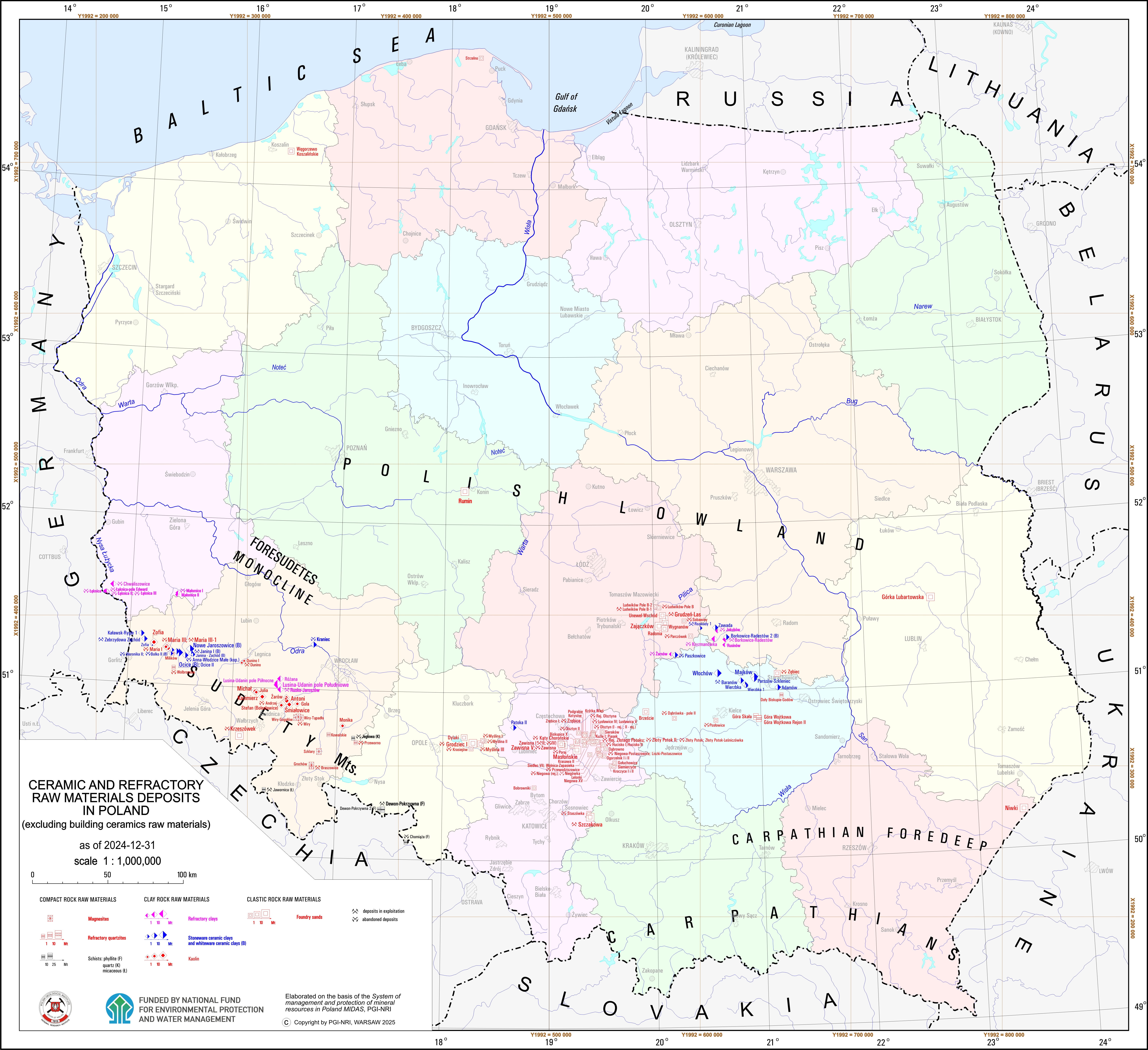
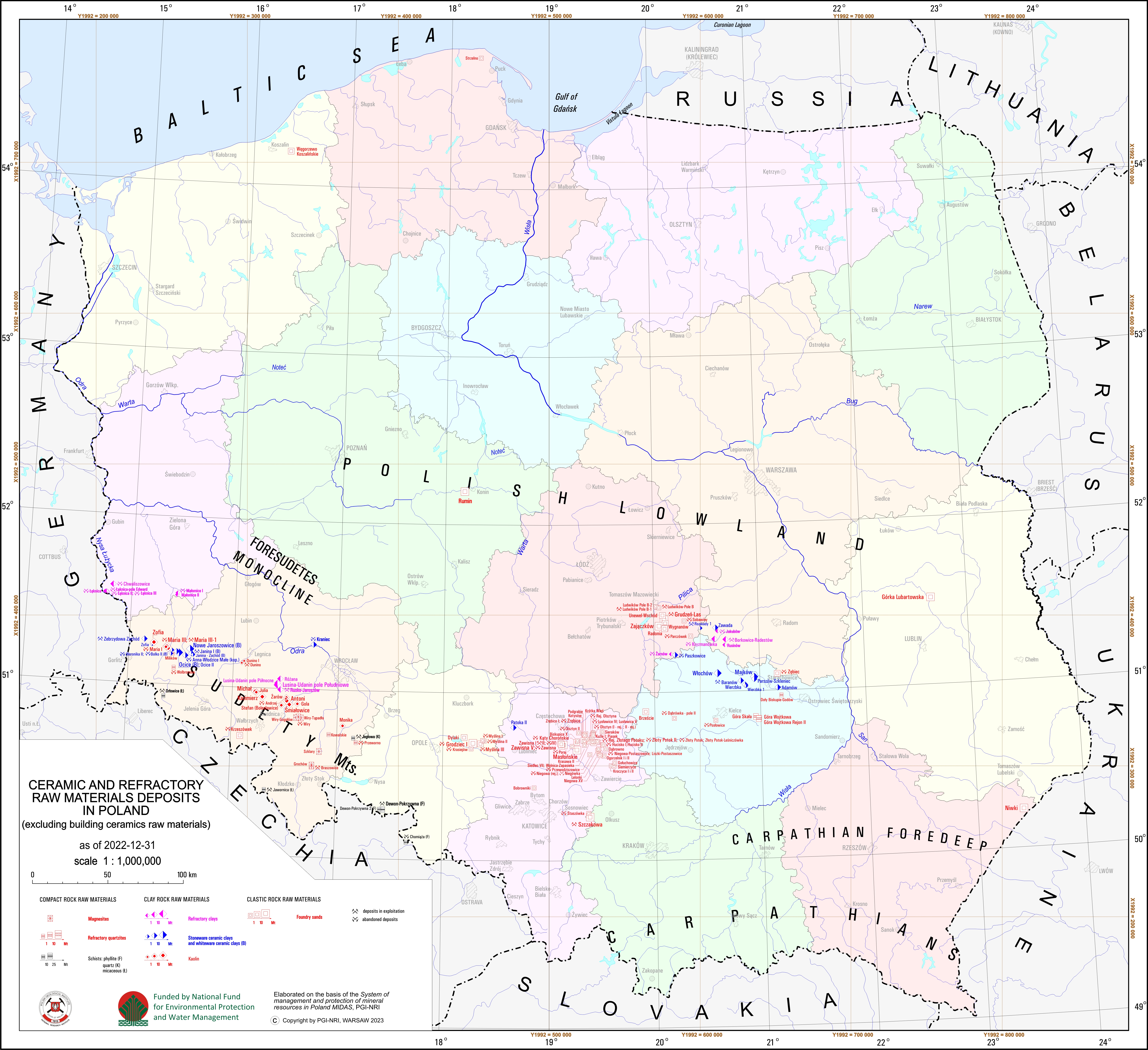
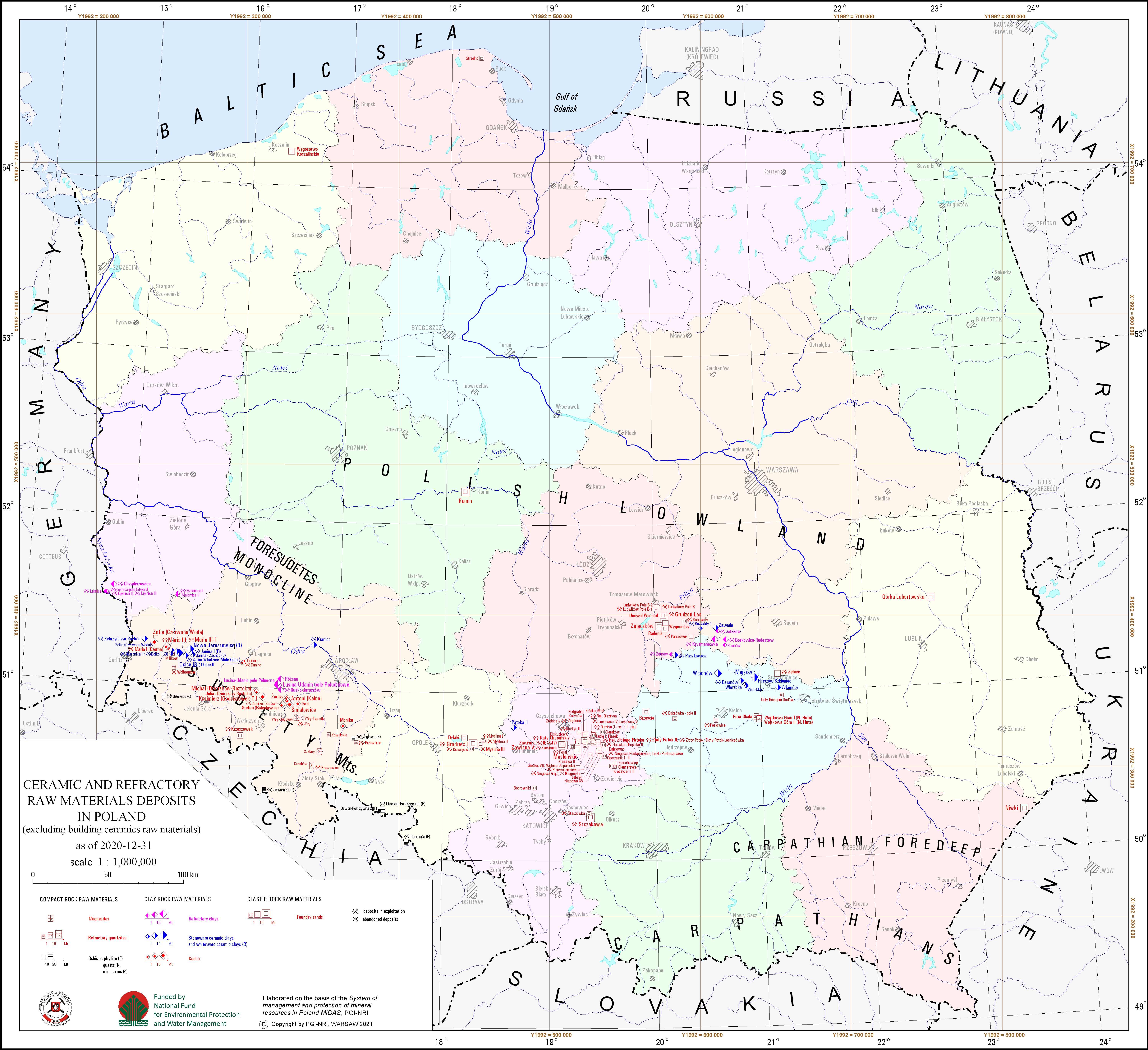
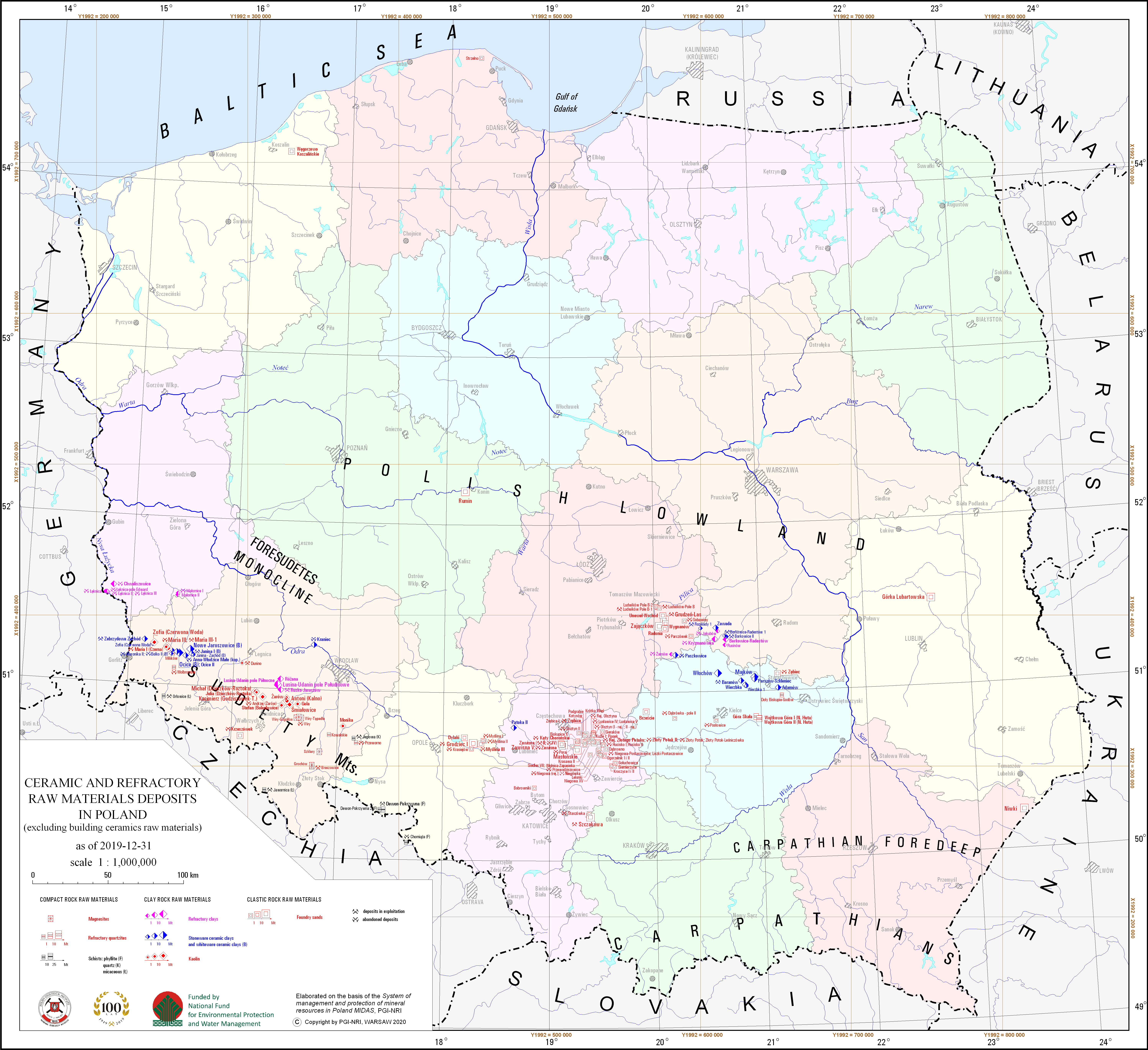
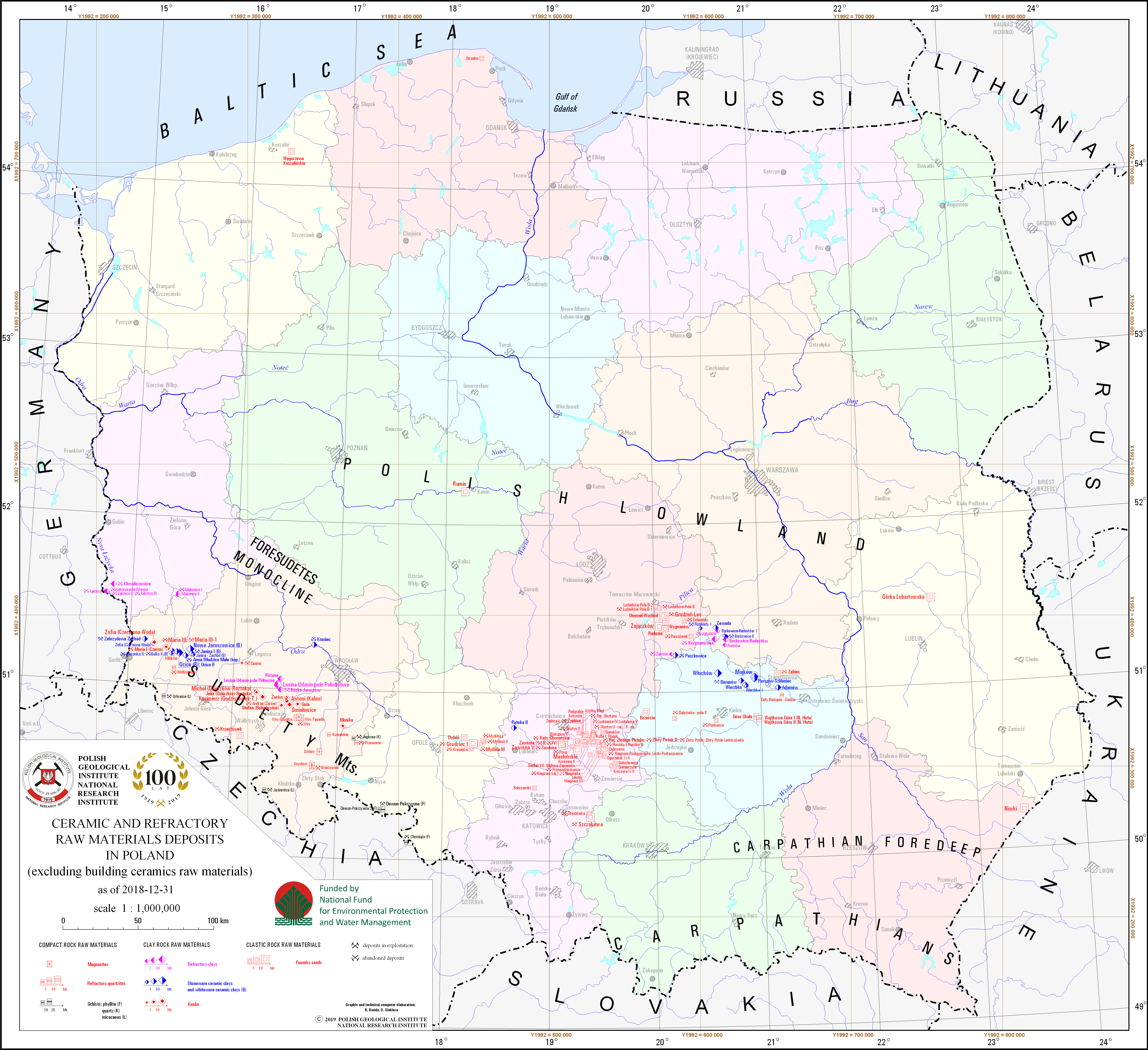
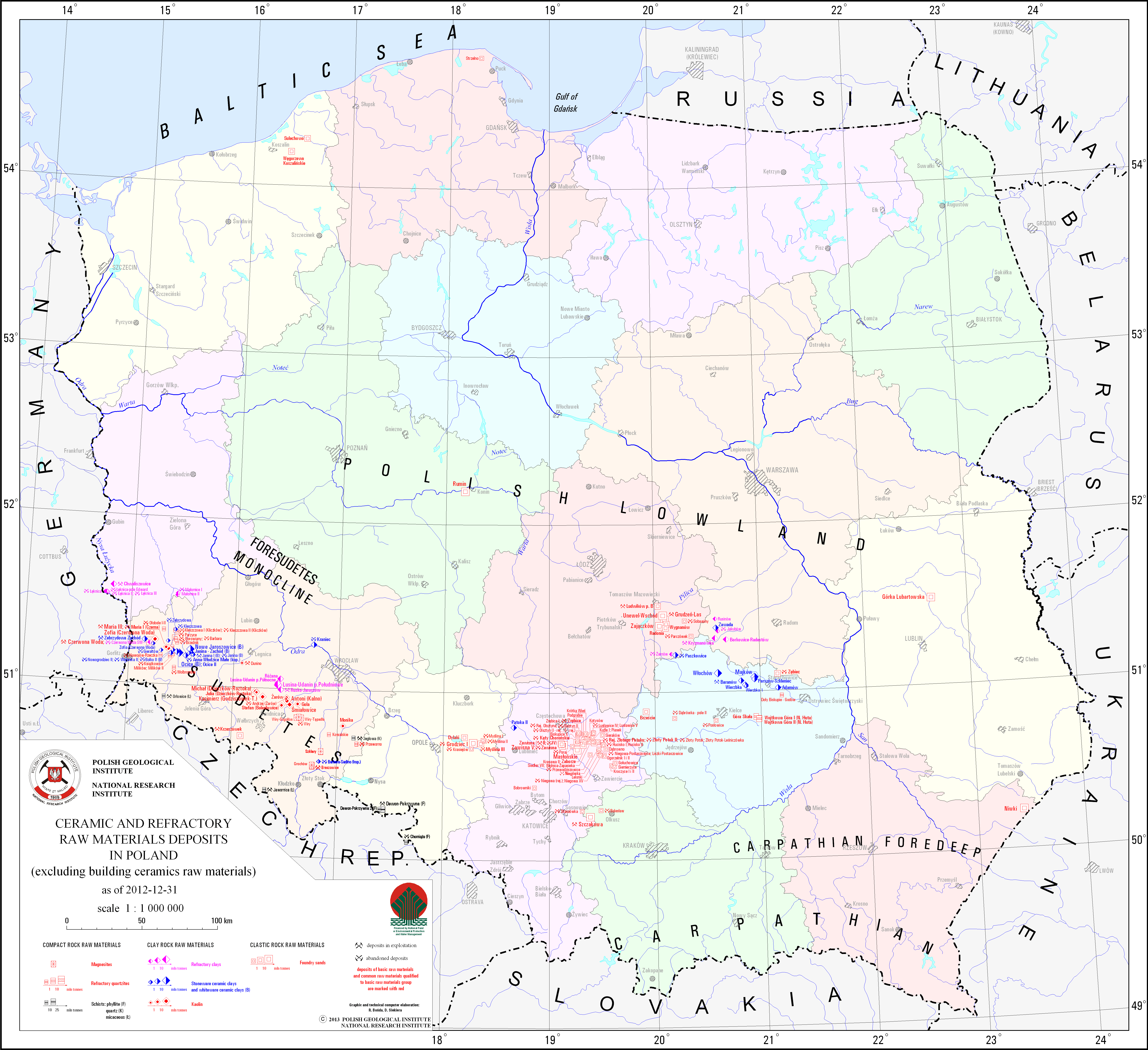
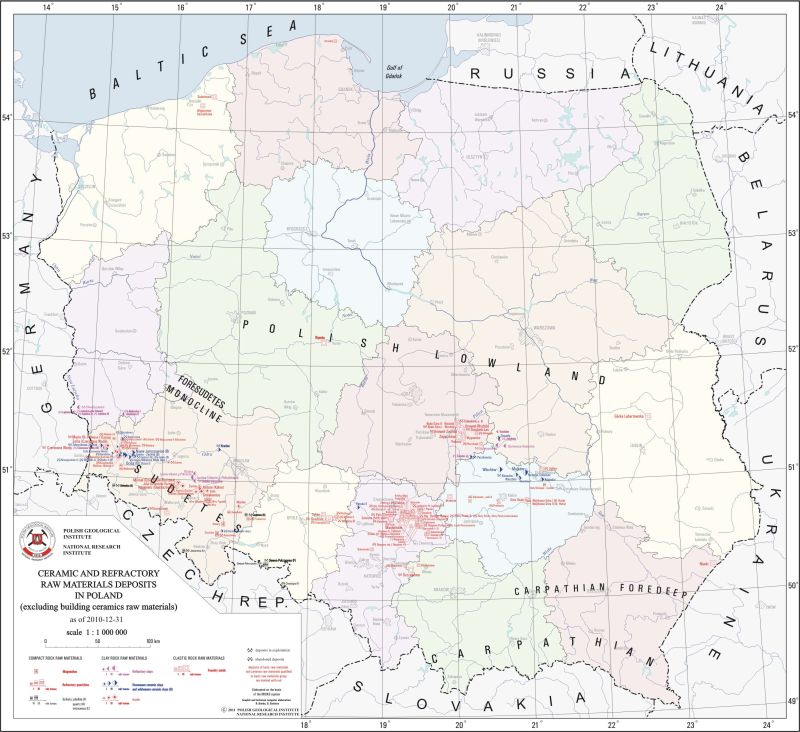
Ceramic and refractory raw materials deposits (excluding building ceramics raw materials)
There are ceramic and refractory raw materials deposits - ceramic clays, refractory clays, kaolin, phyllite, quarztzitic and micaceous schists, refractory quartzites, magnesites and foundry sands - in Poland presented on the map. A particular deposit is presented by a graphic mark with distinction of deposits classified as basic minerals. There is also information on a state of development of a particular deposit.
Download map.
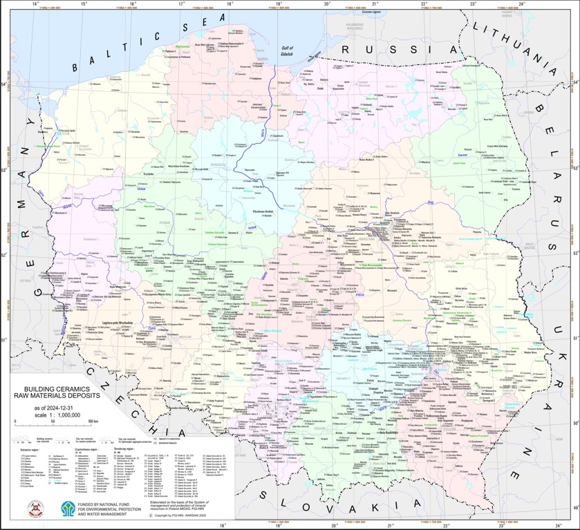
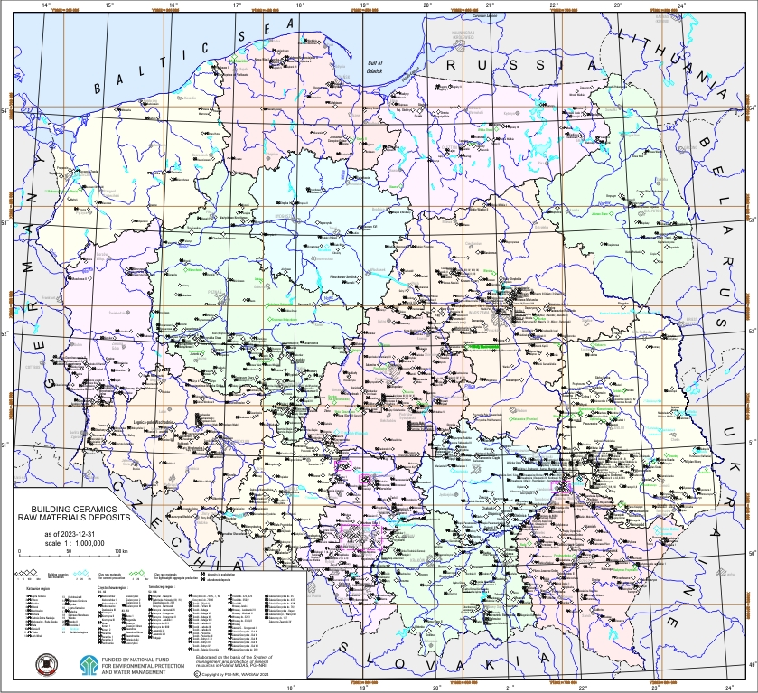
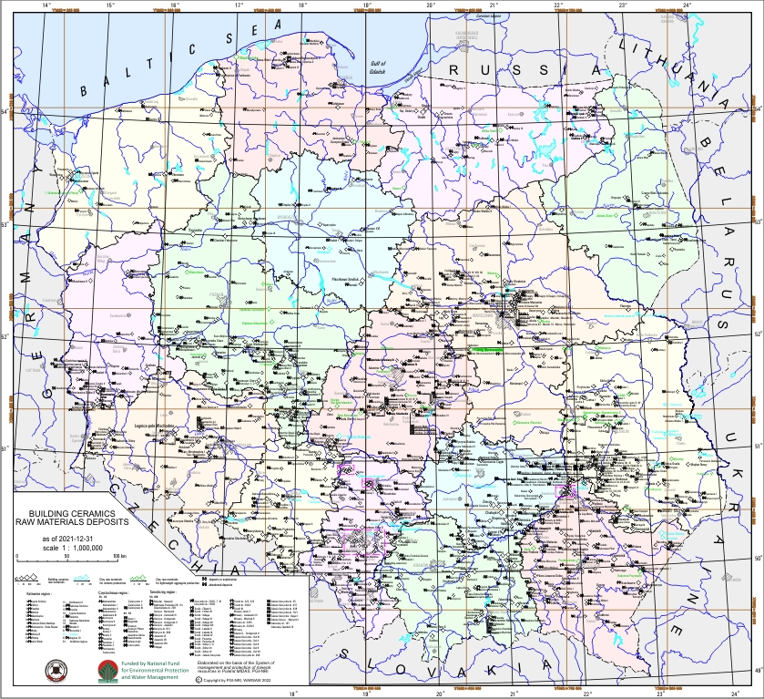
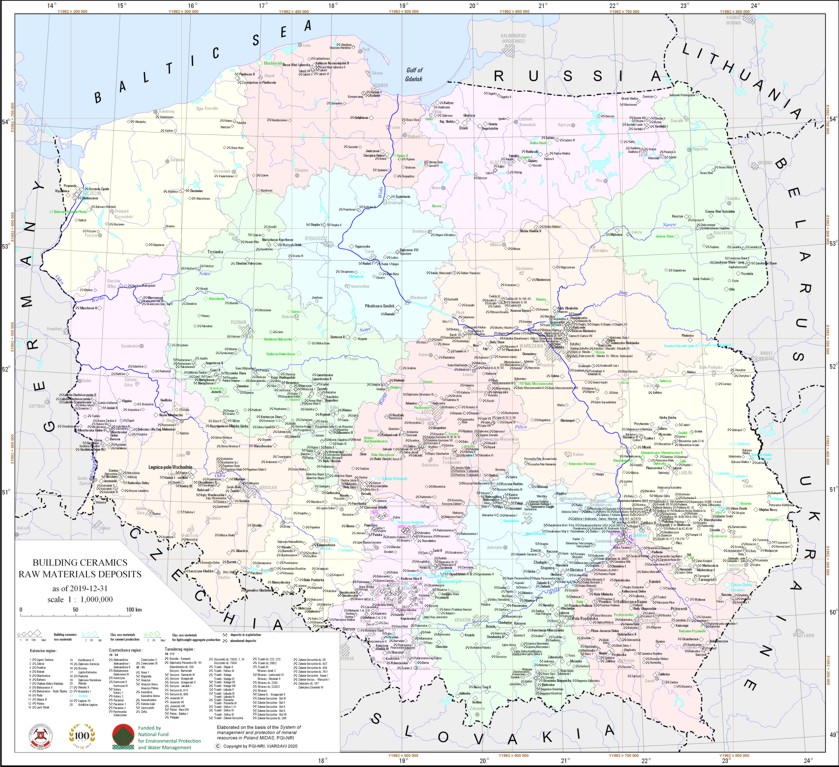
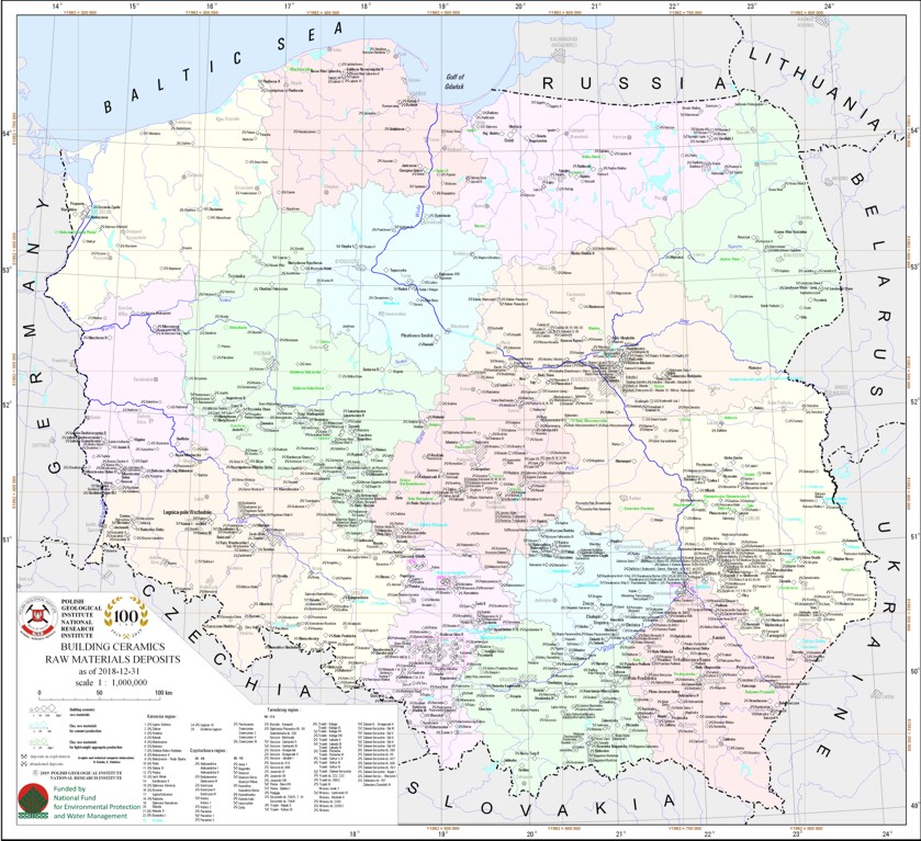
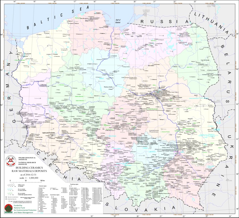
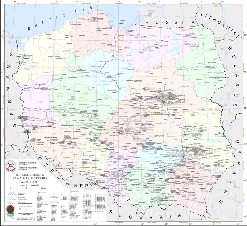
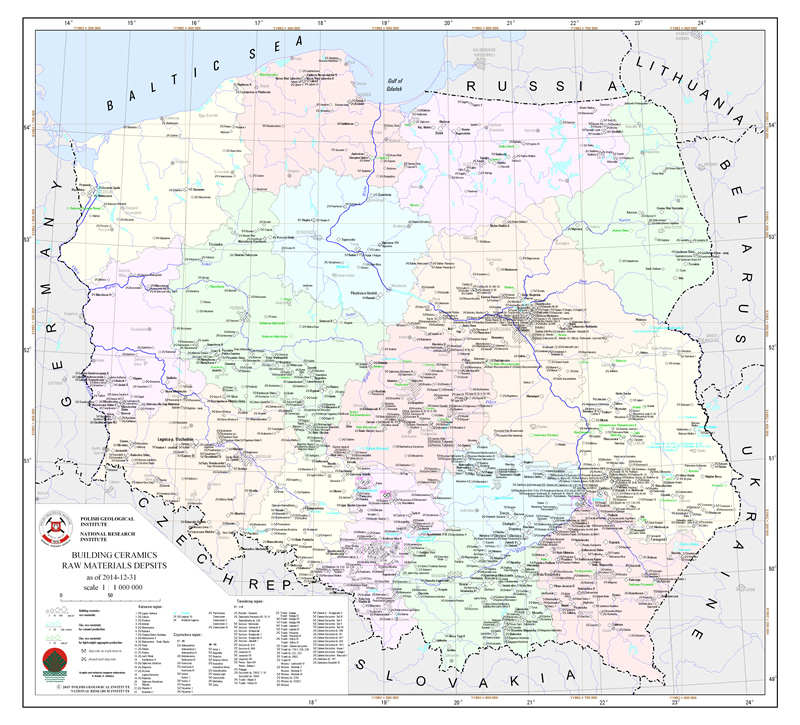
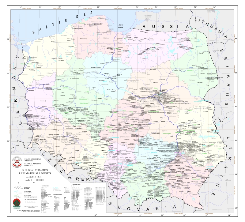
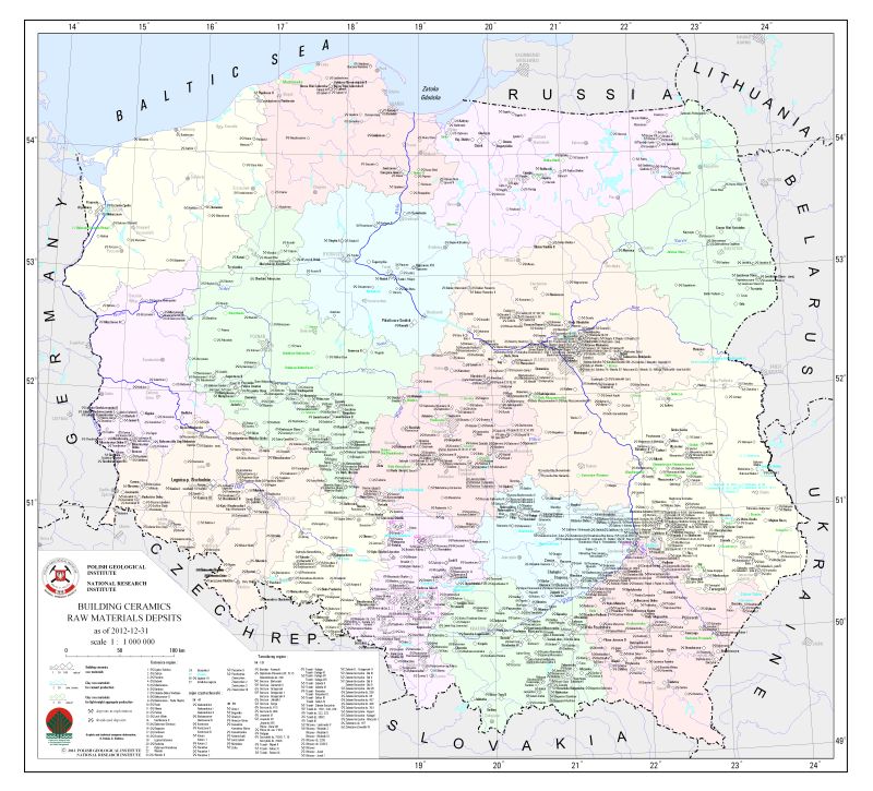
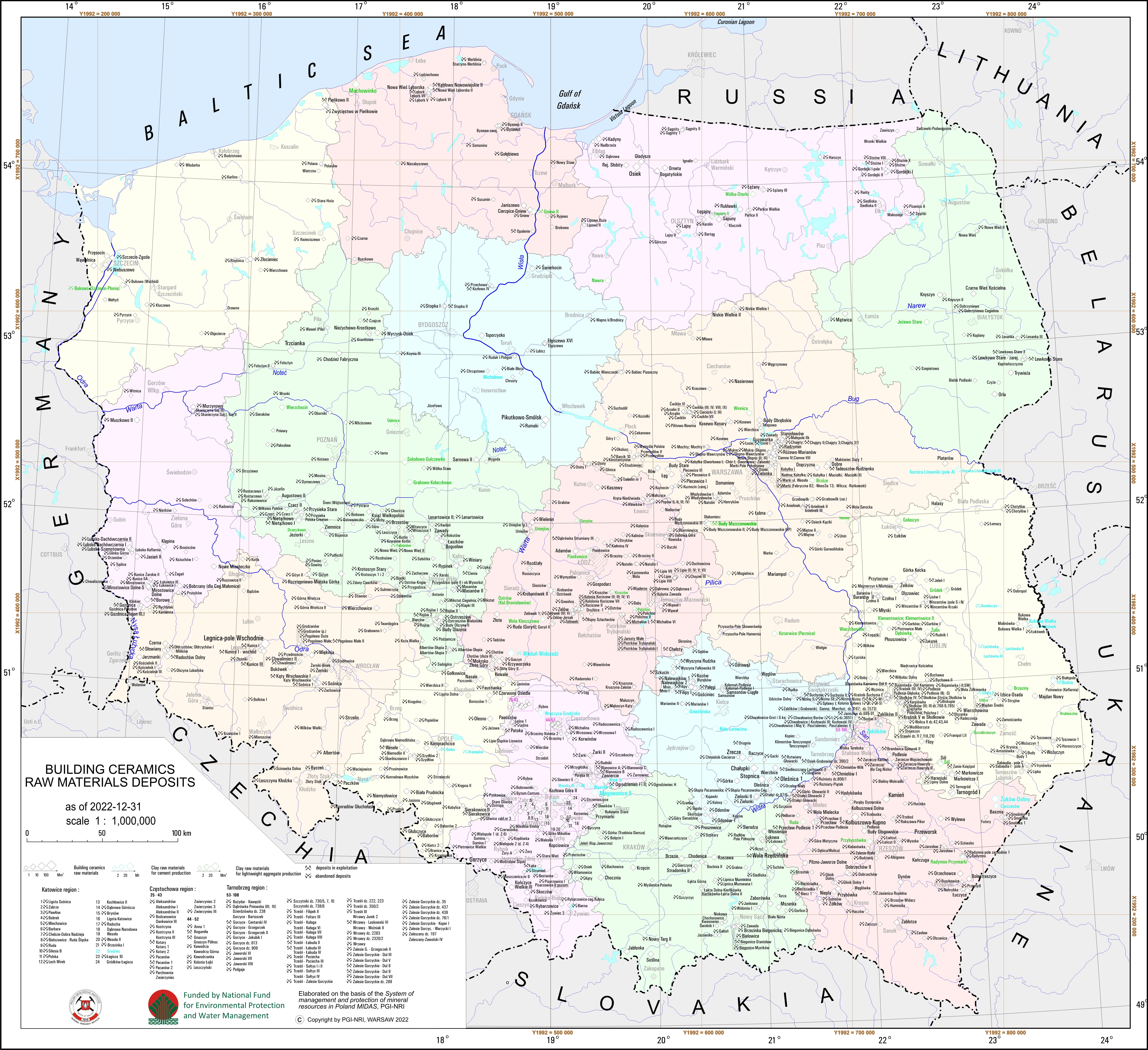
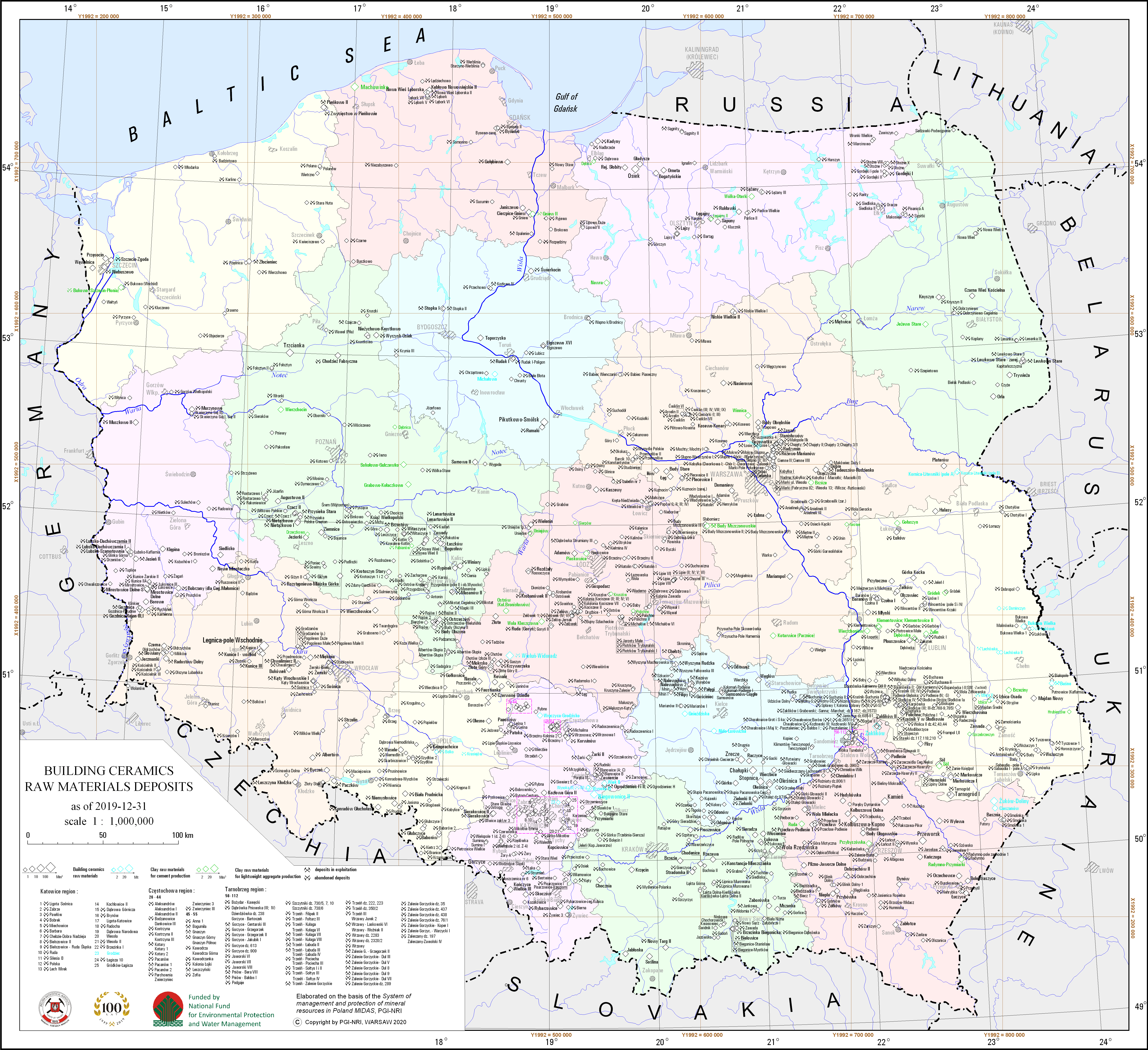
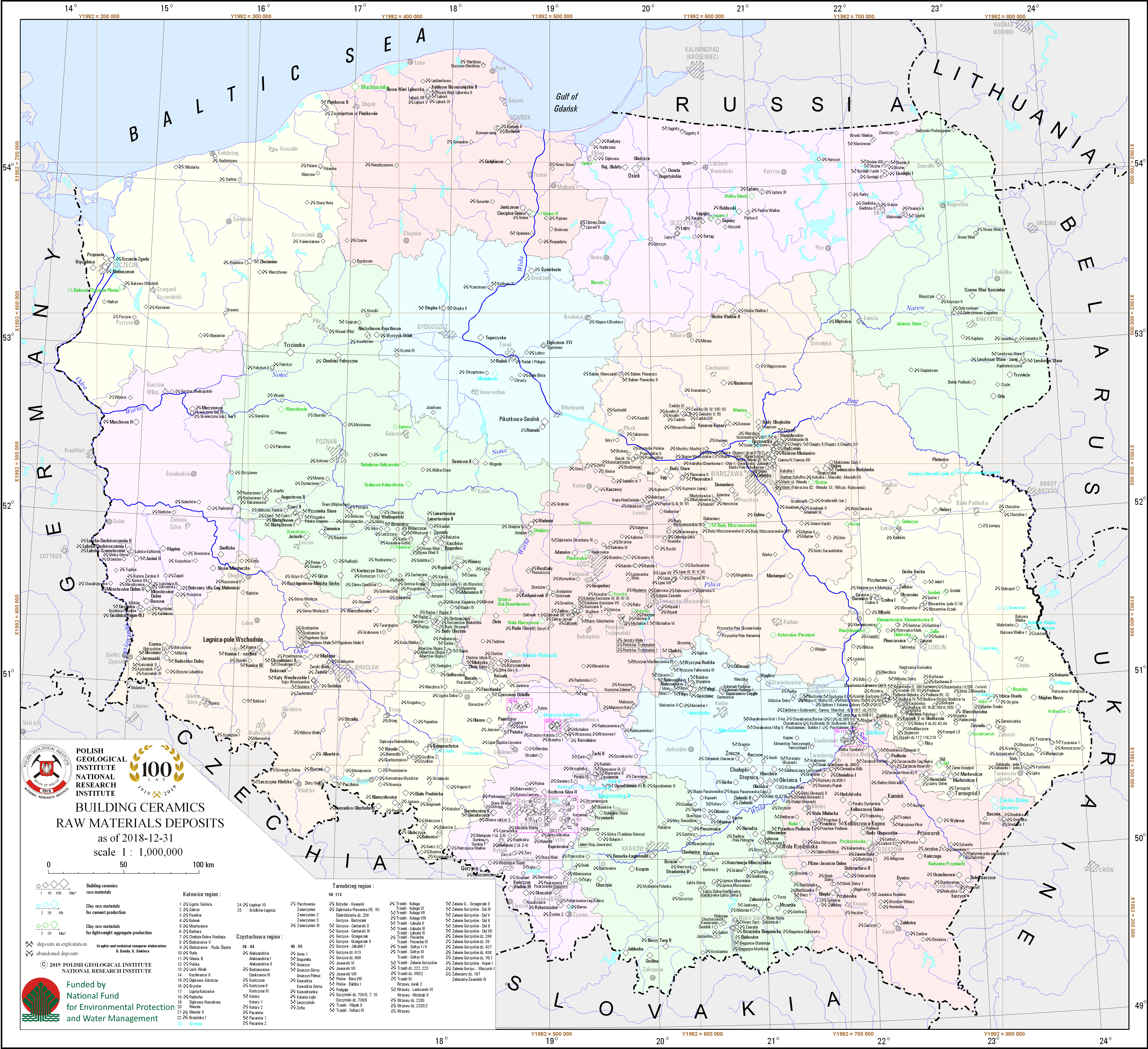
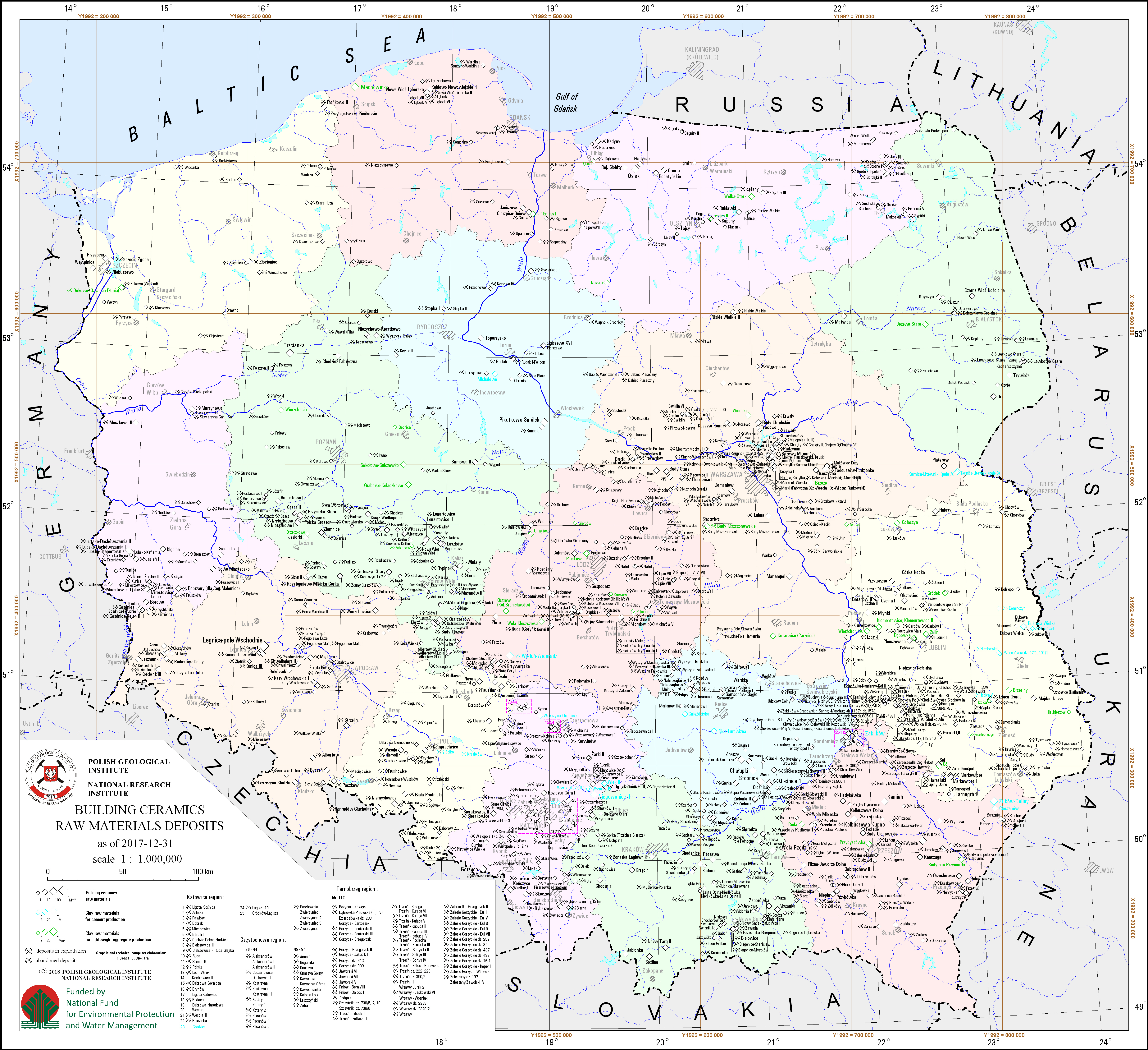
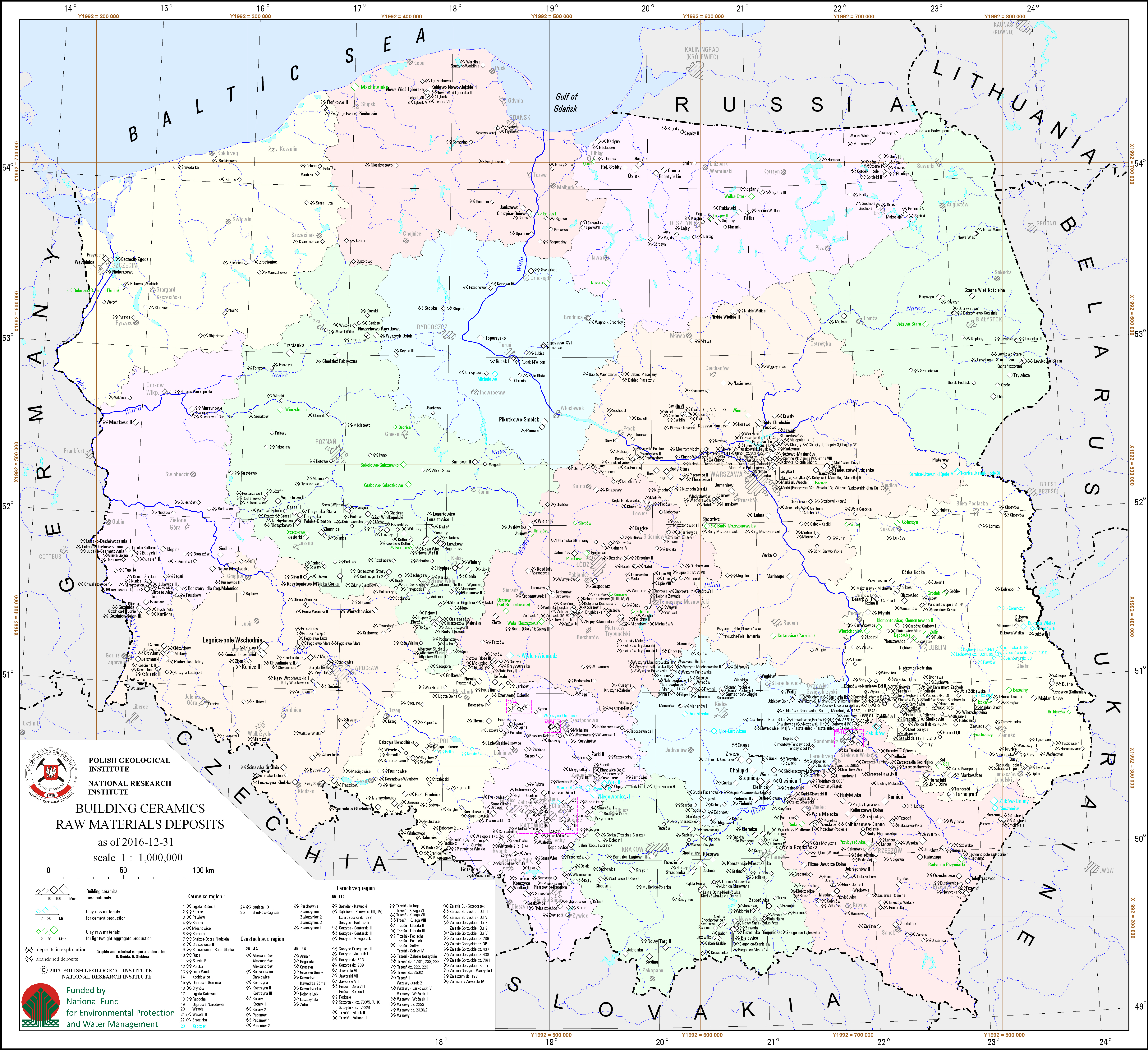
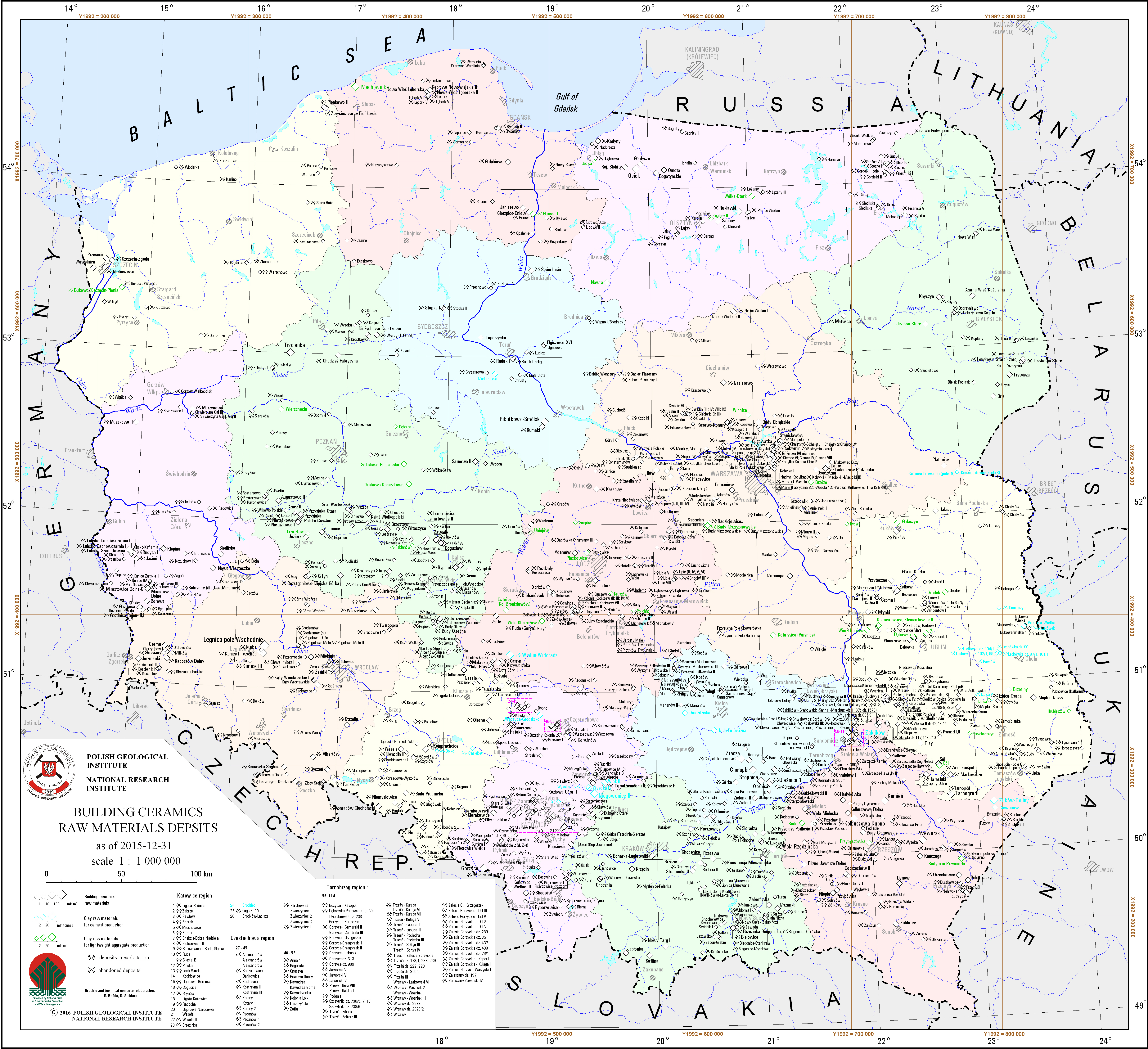
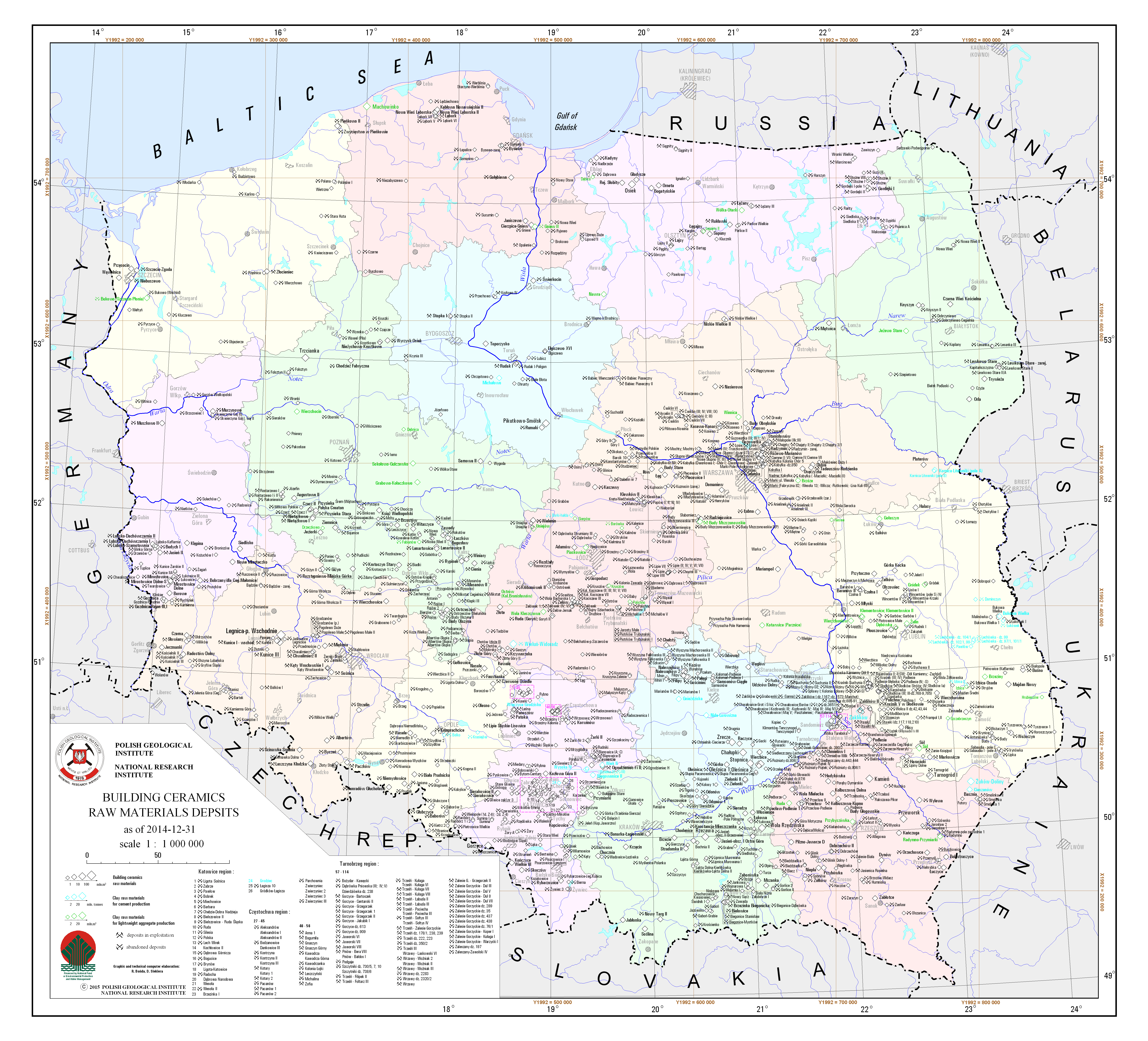
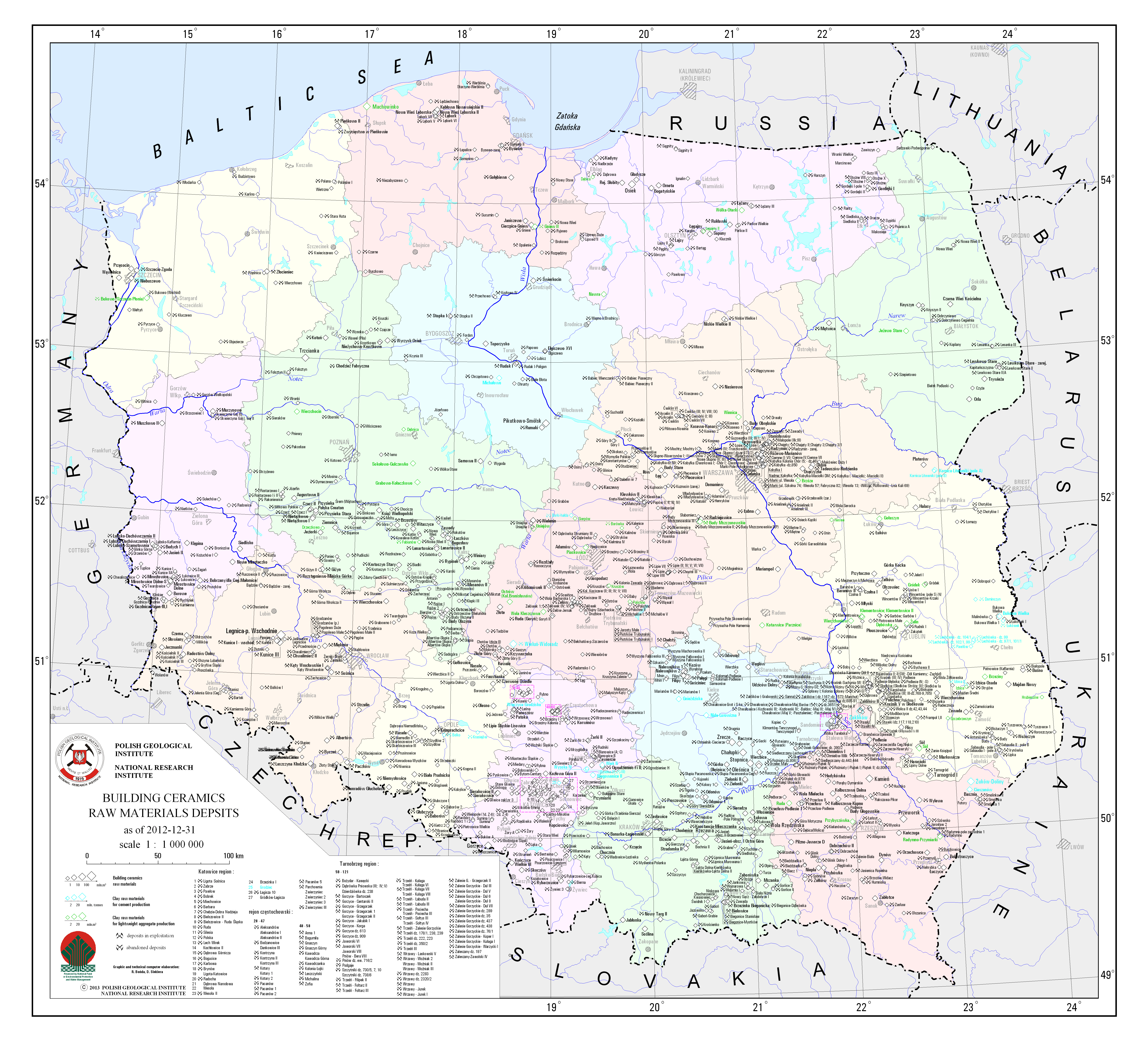
Building ceramics raw materials deposits
There are building ceramics raw materials, clay raw materials for cement production and clay raw materials for lightweight aggregate production deposits in Poland presented on the map. Due to a high concentration of deposits in the Częstochowa, Katowice and Tarnobrzeg regions, there are only numbers of deposits located on the map, without their names. Names of deposits assigned to particular number are specified in the legend. There is also information on a state of development of a particular deposit.
Download map.
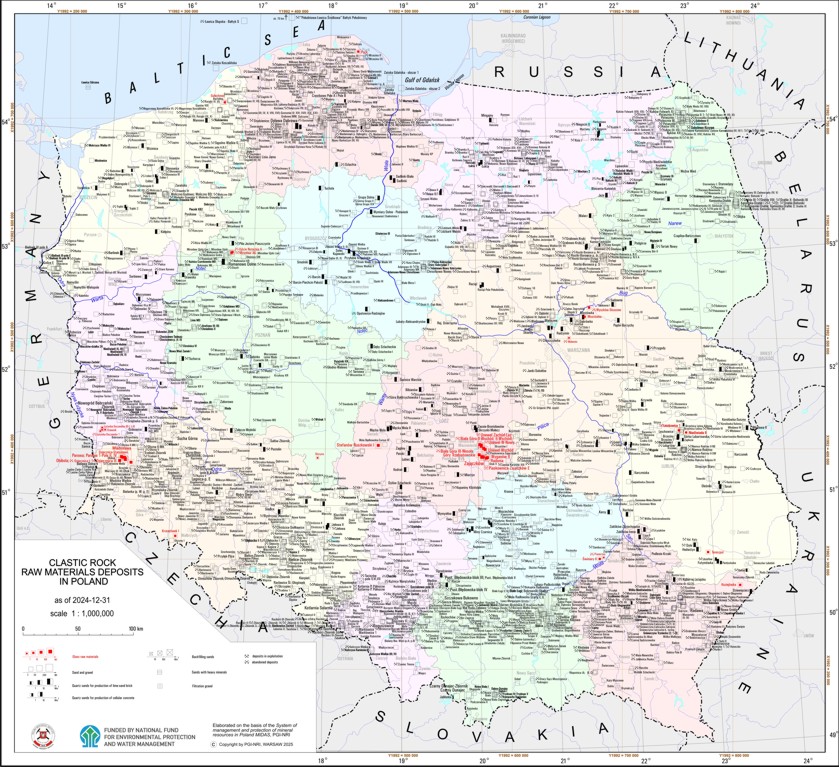
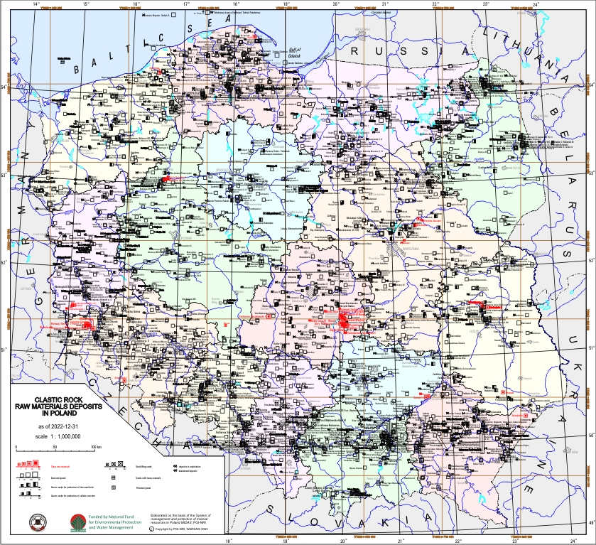
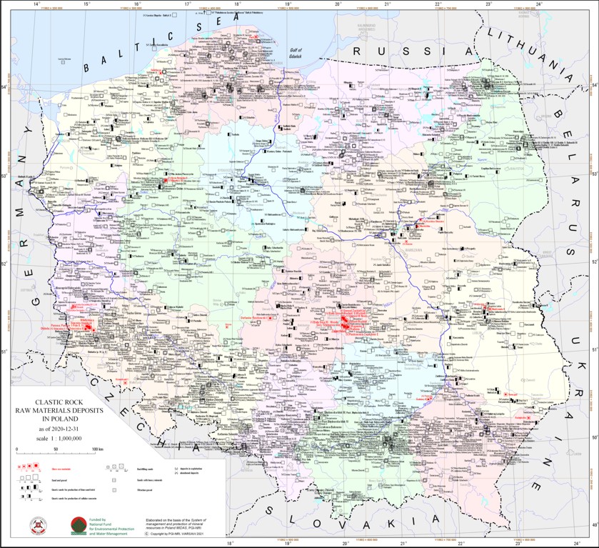
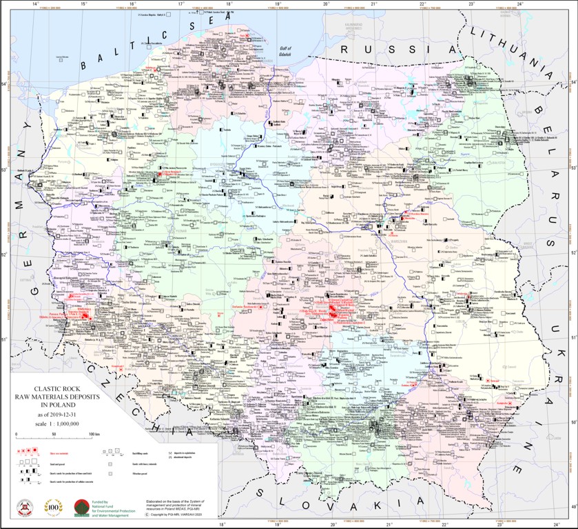
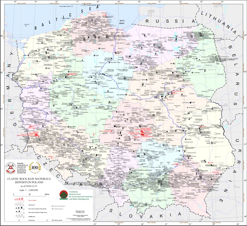
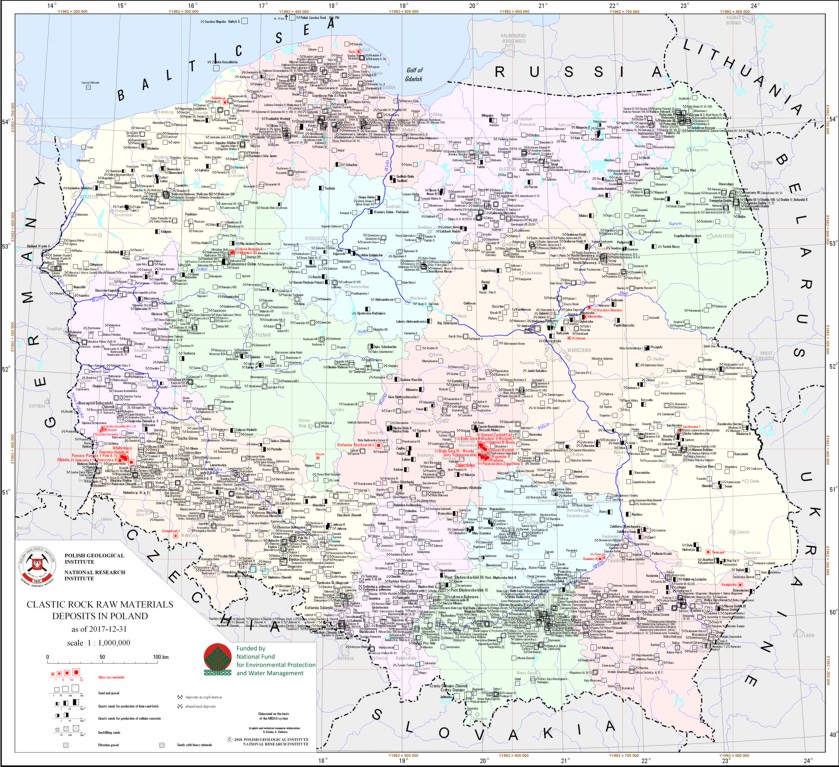
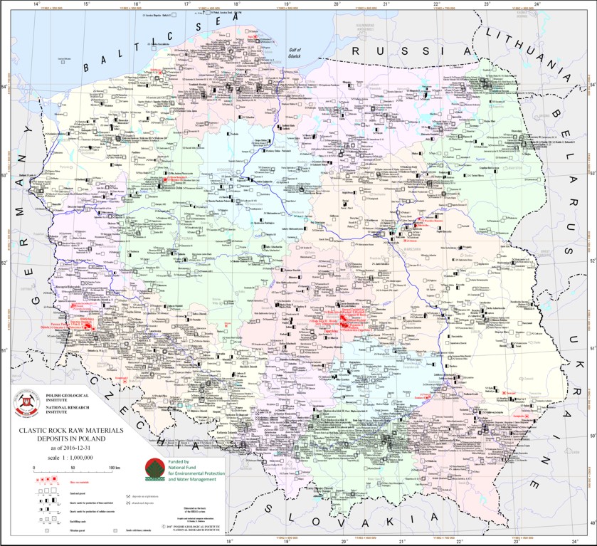
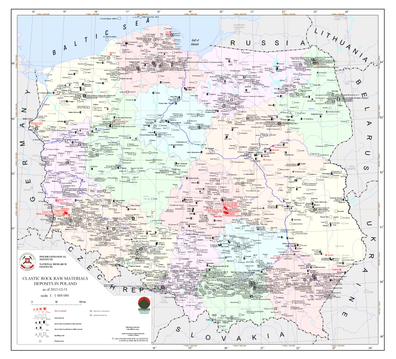
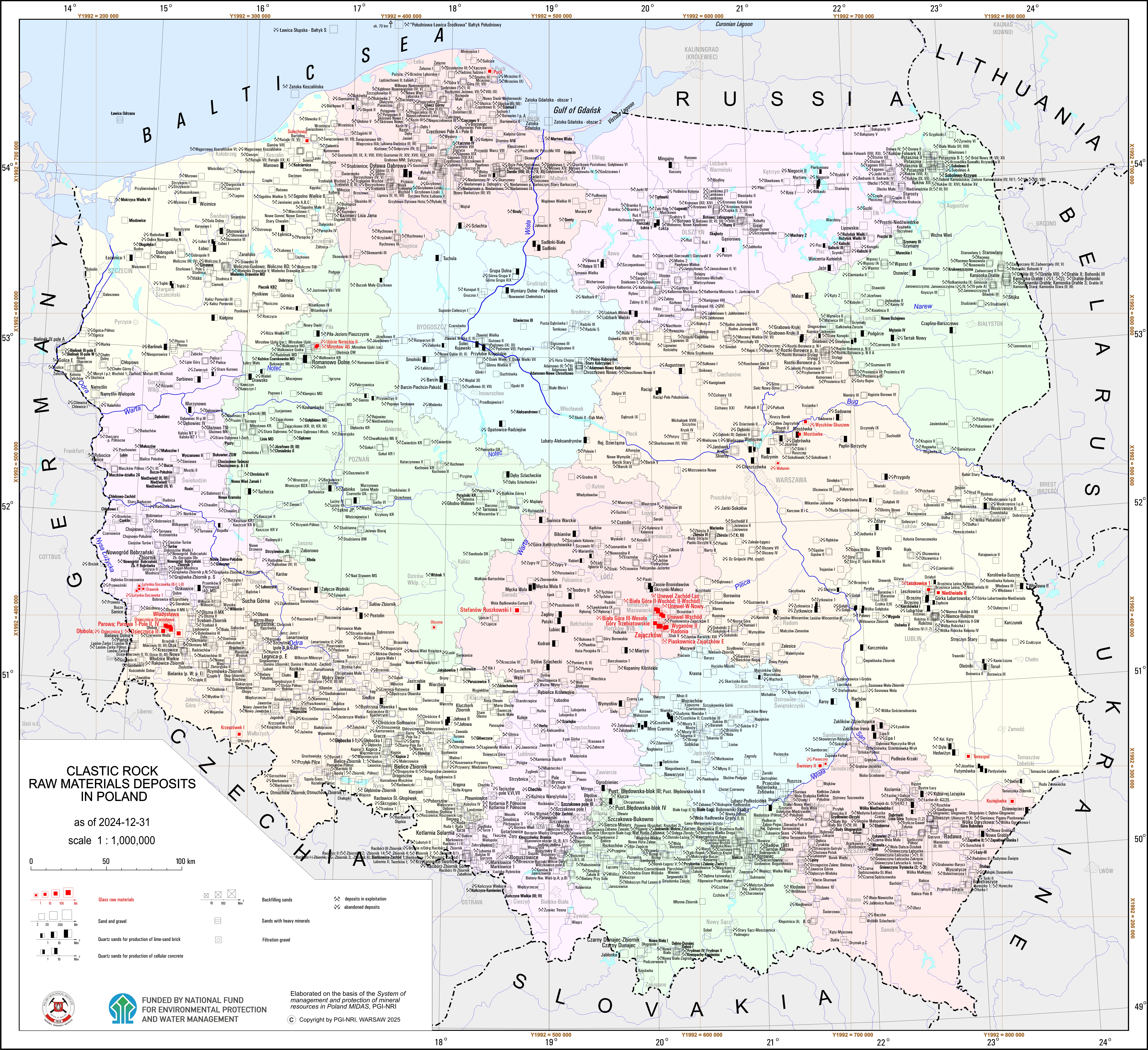
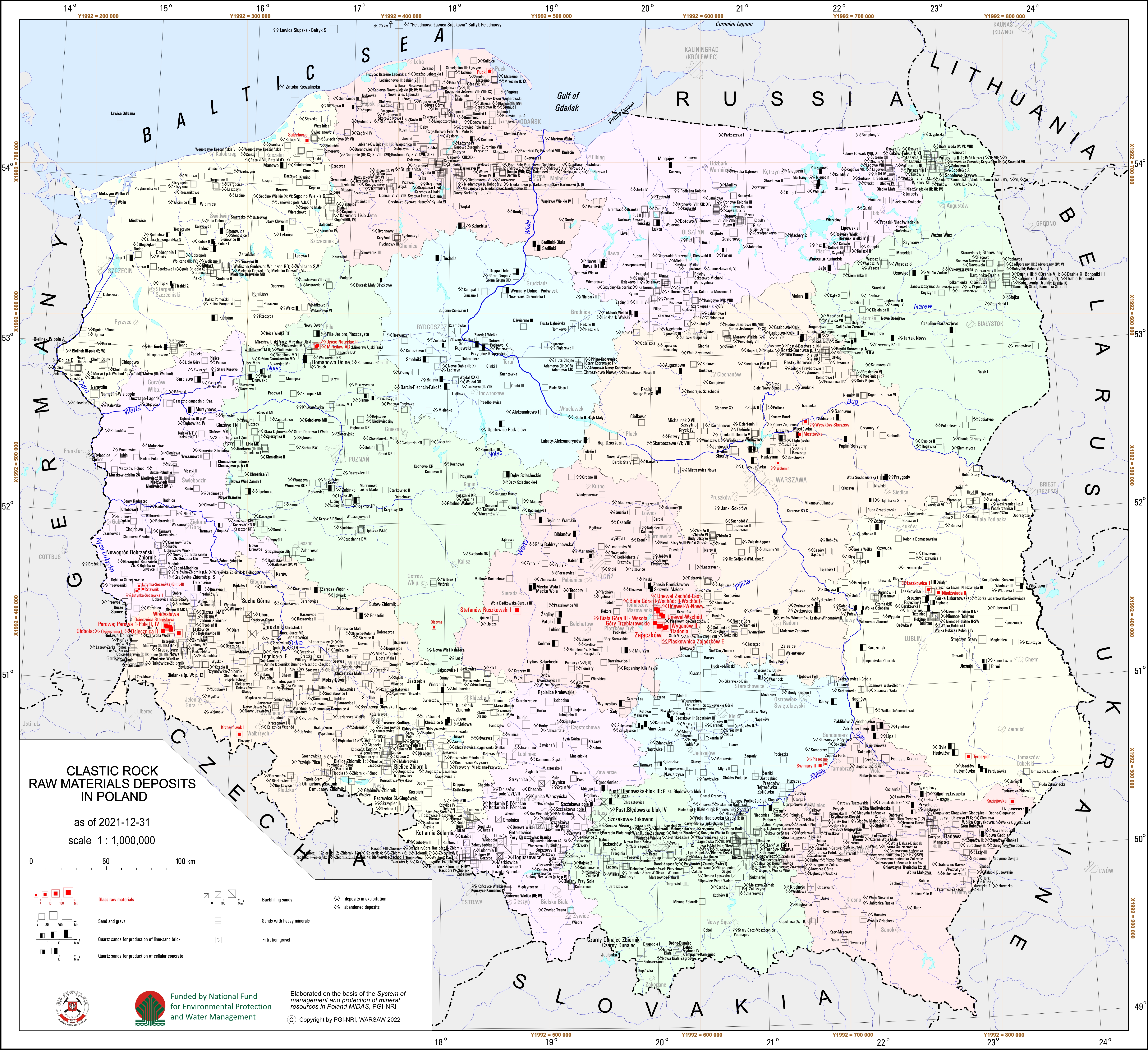
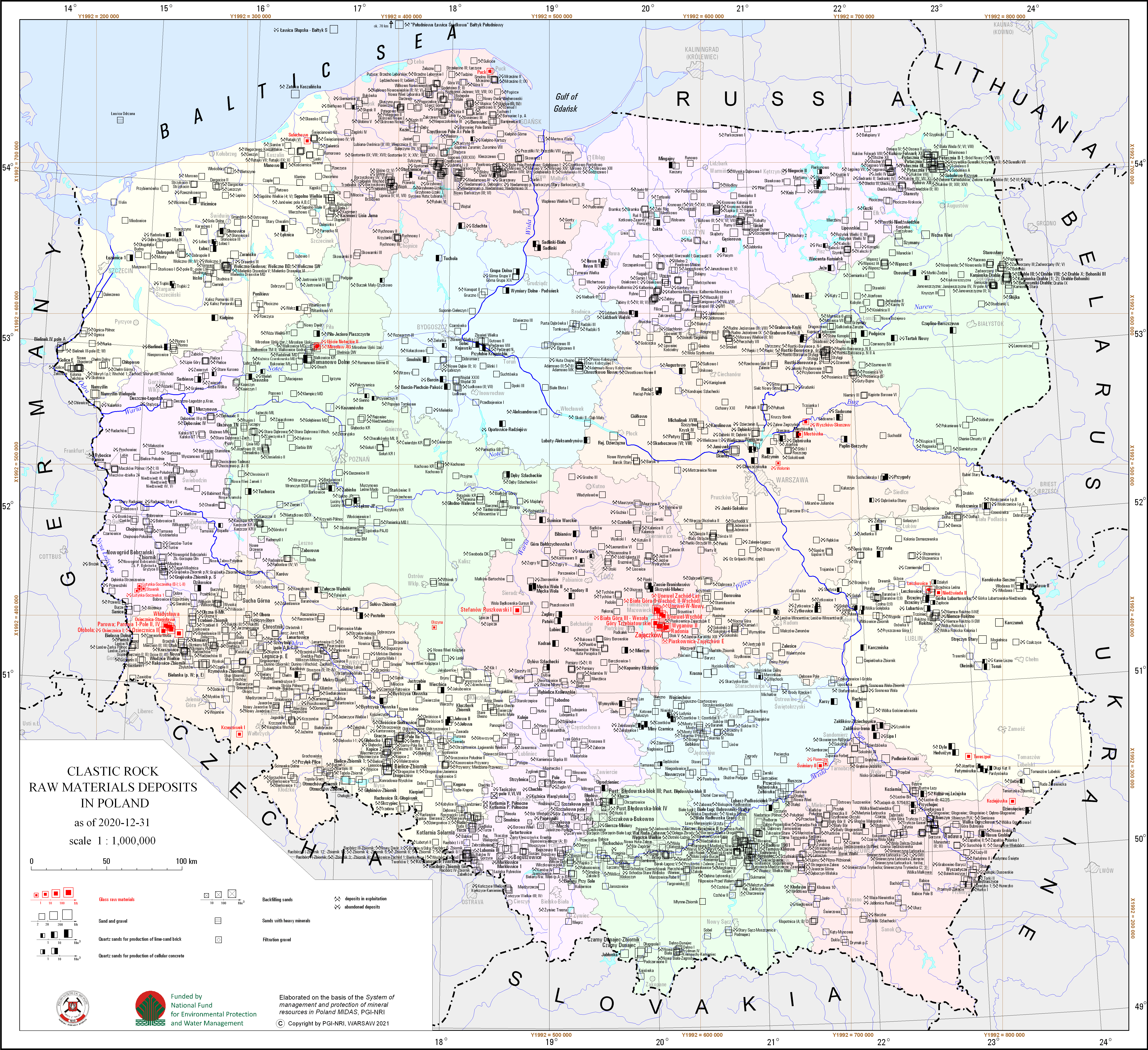
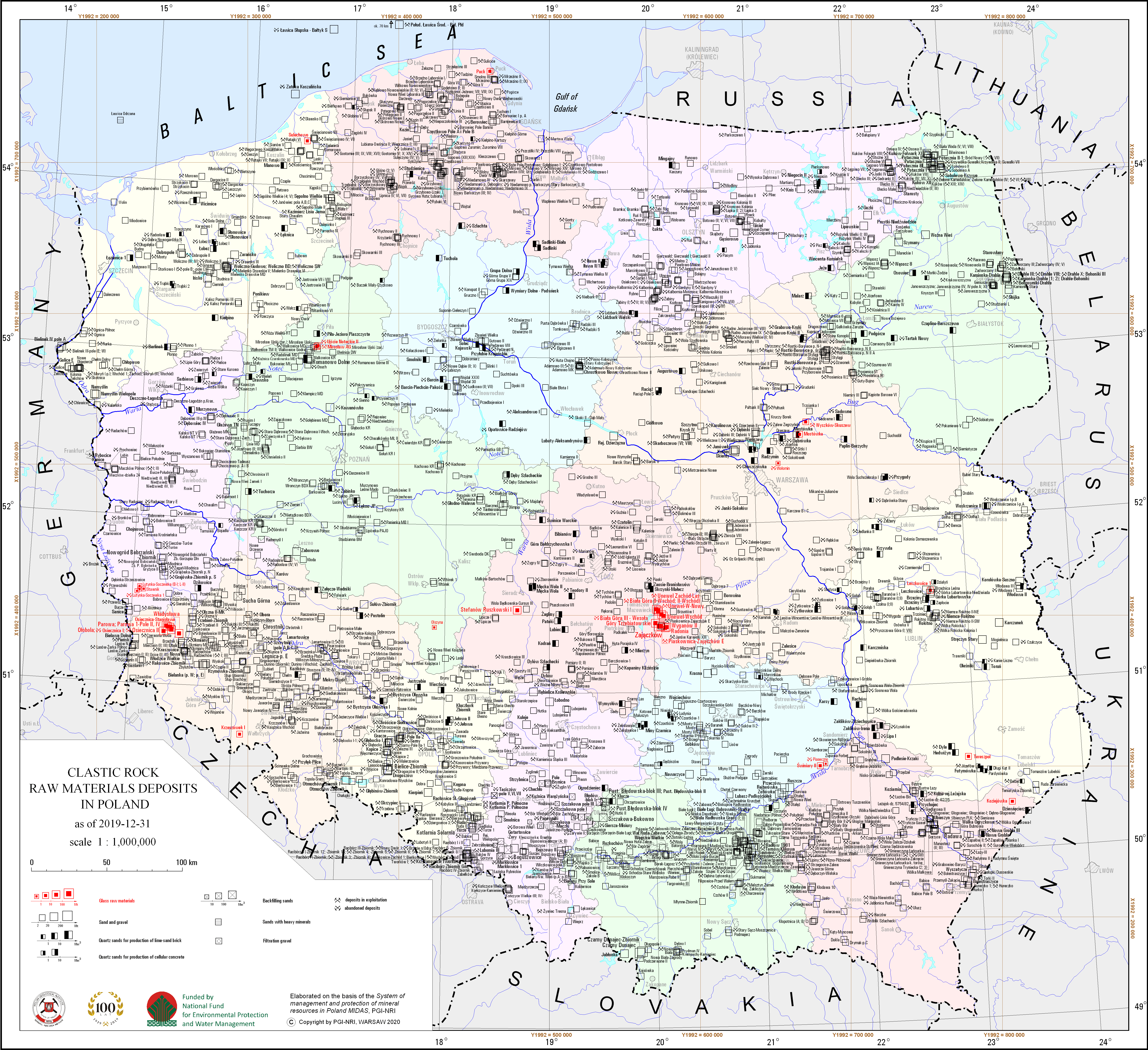
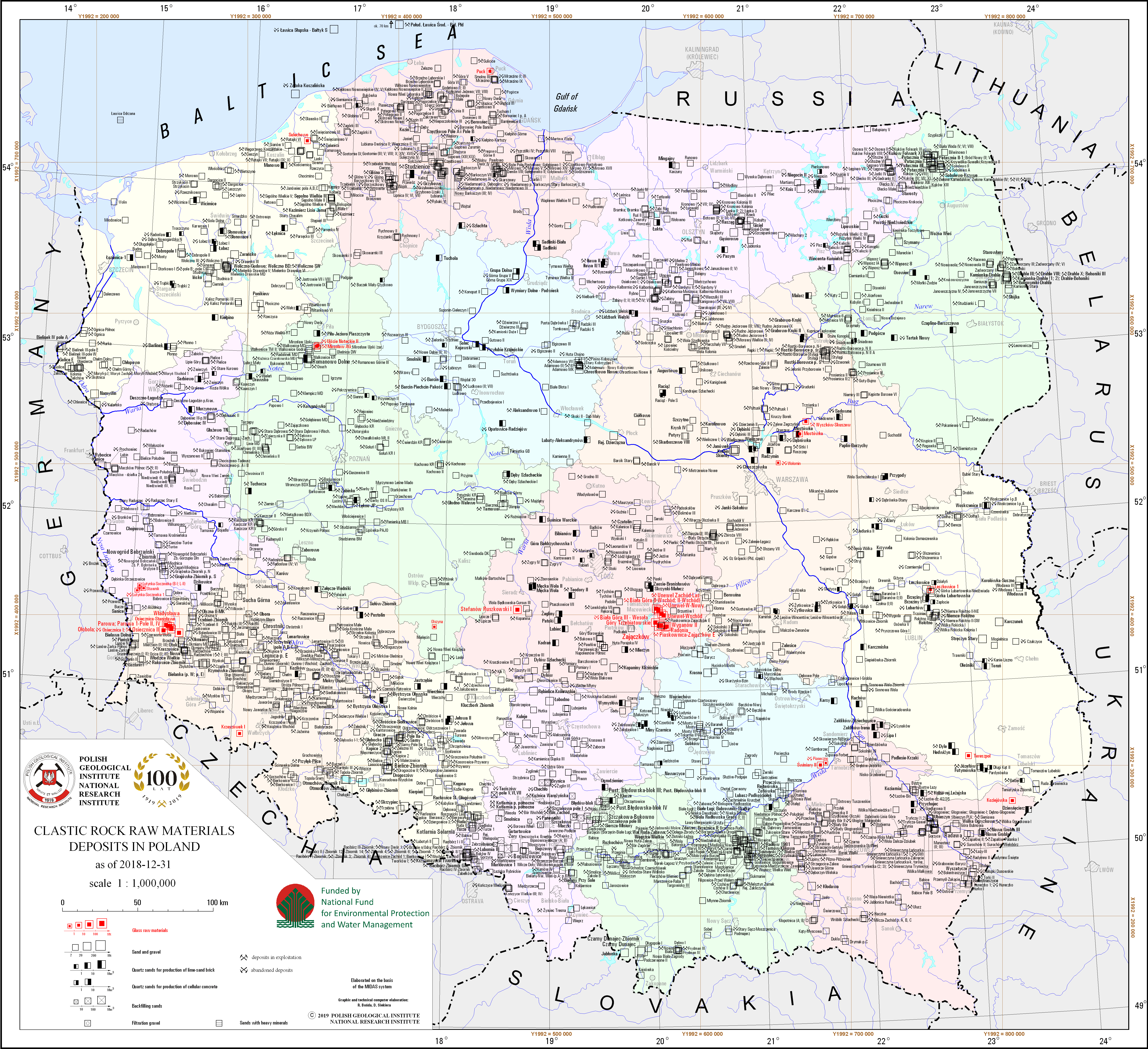
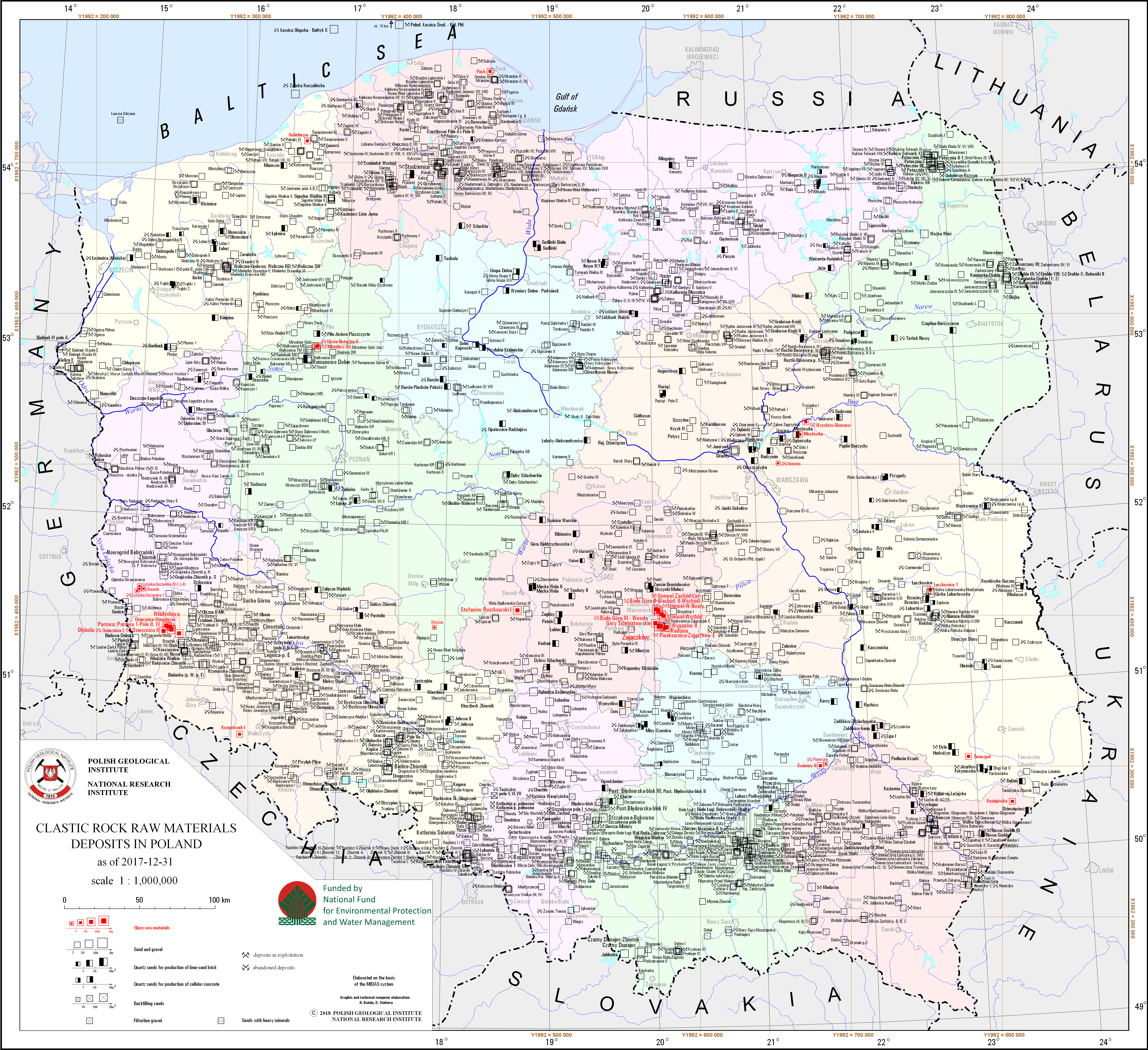
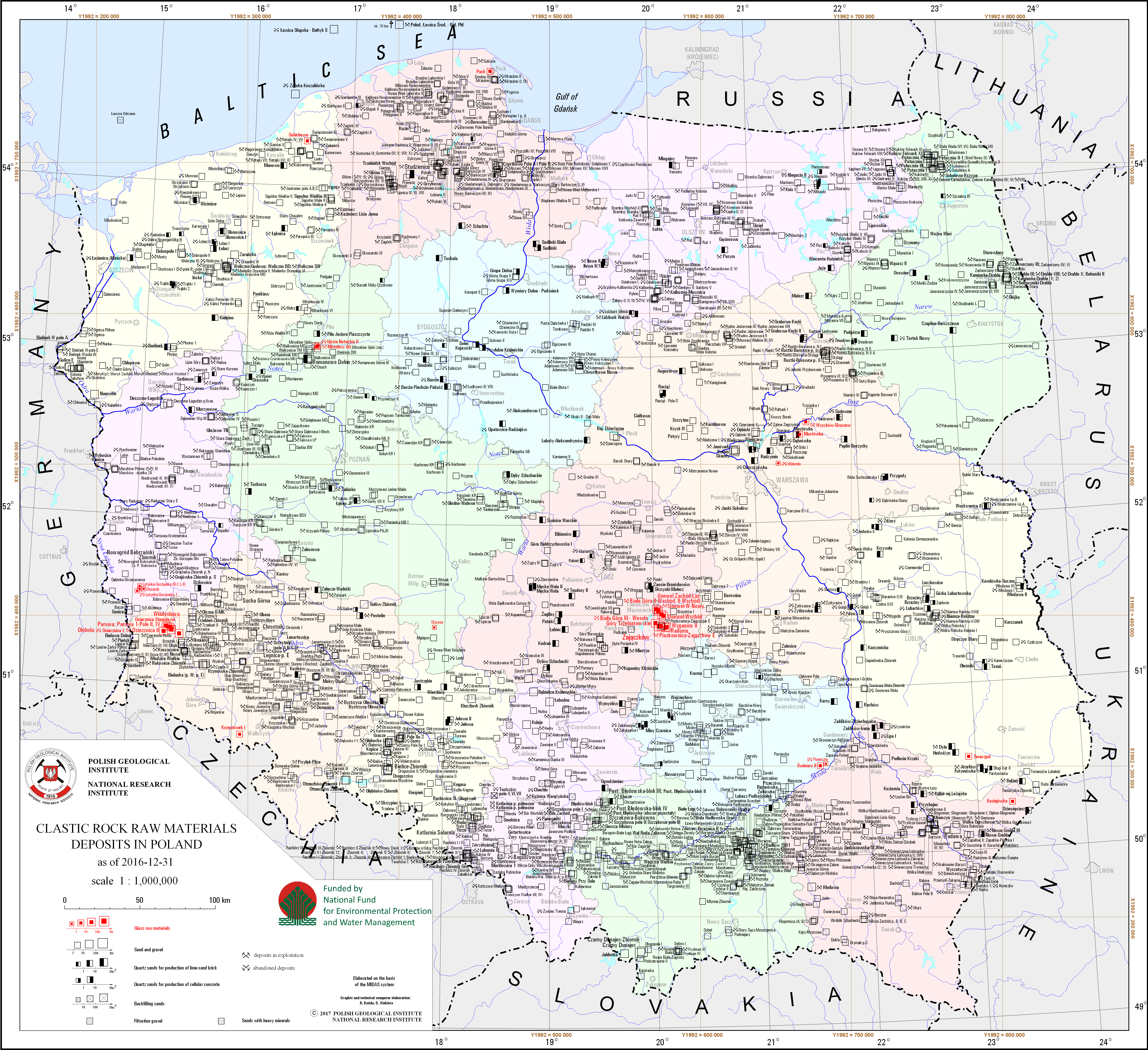
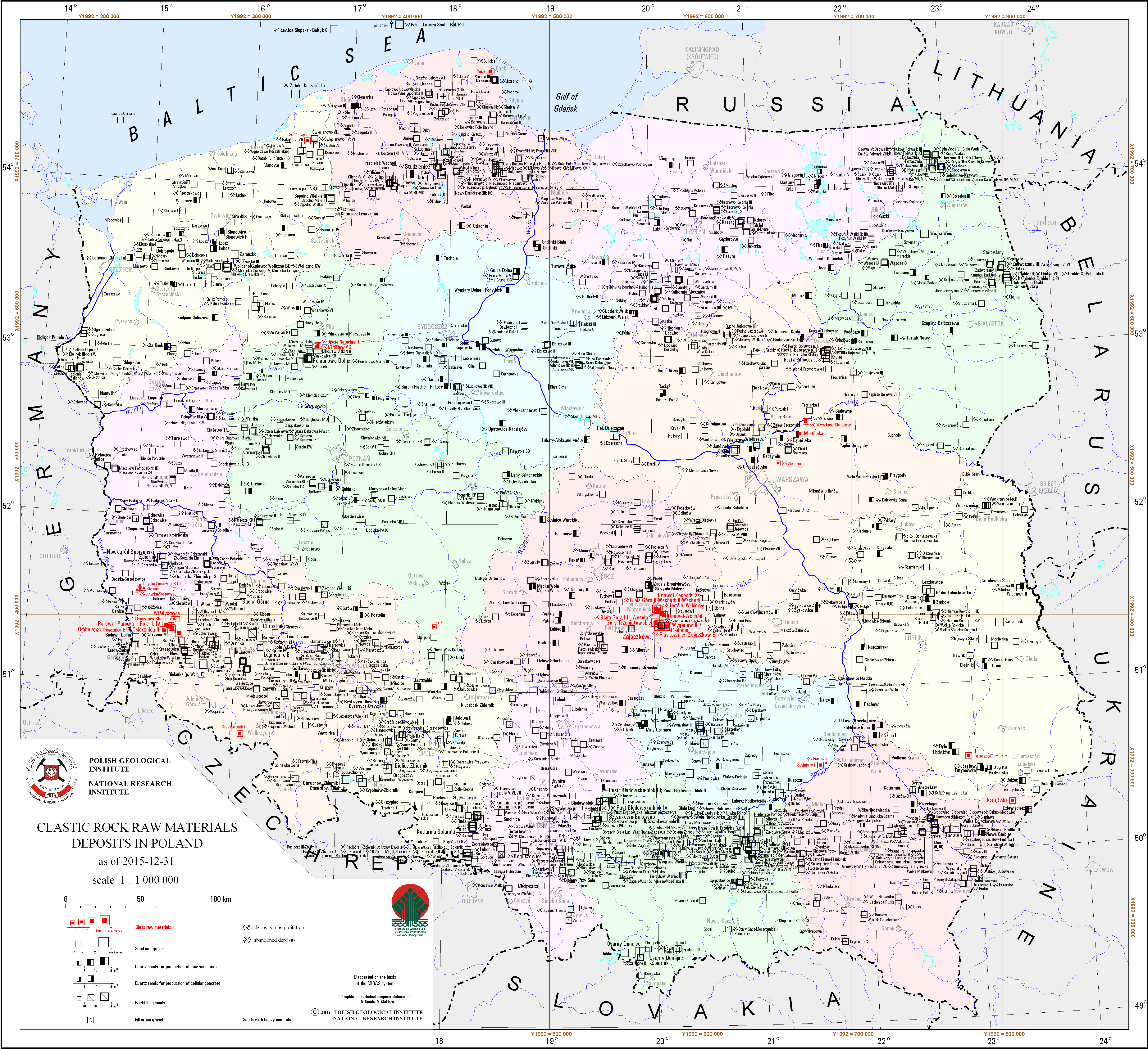
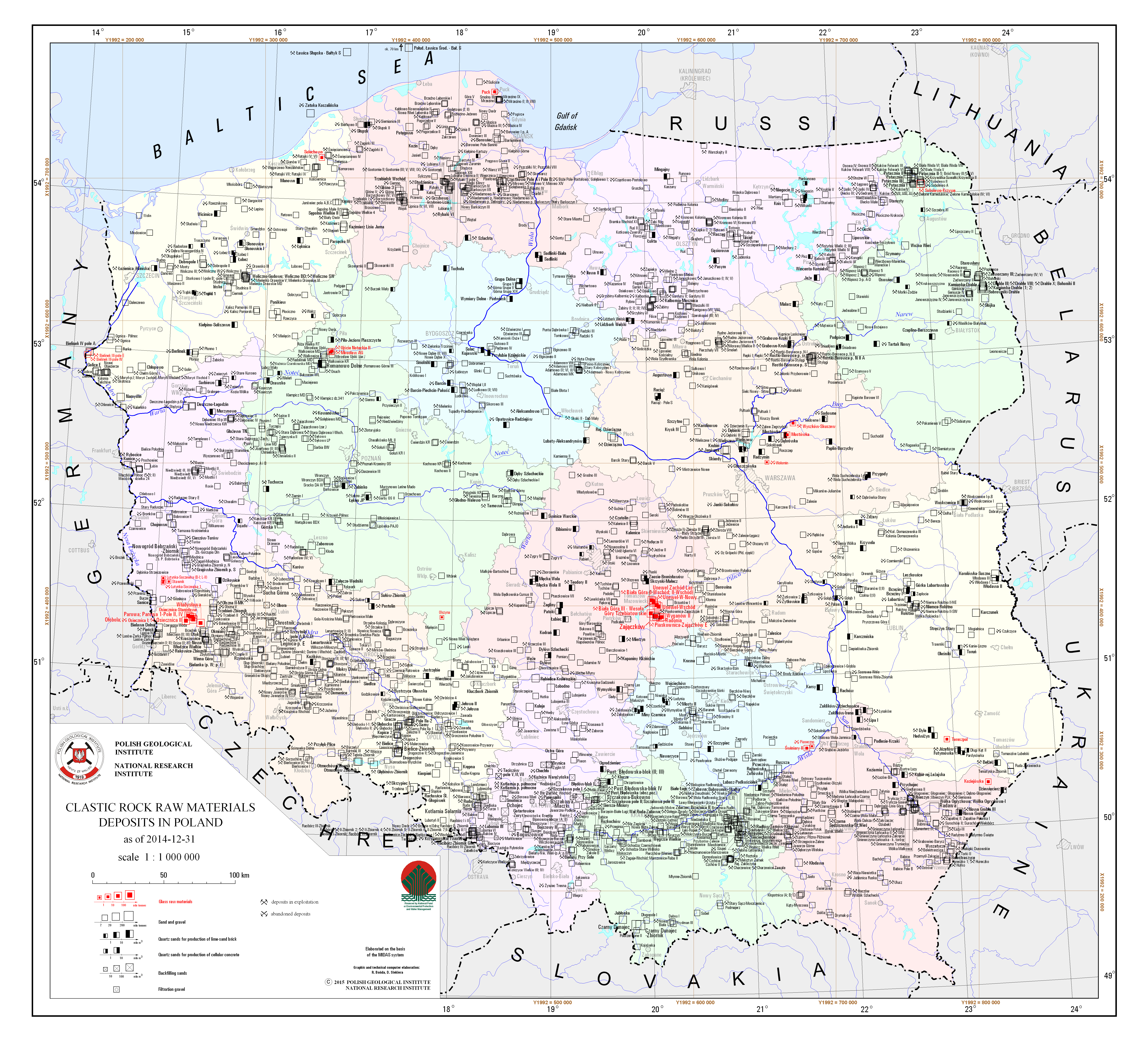
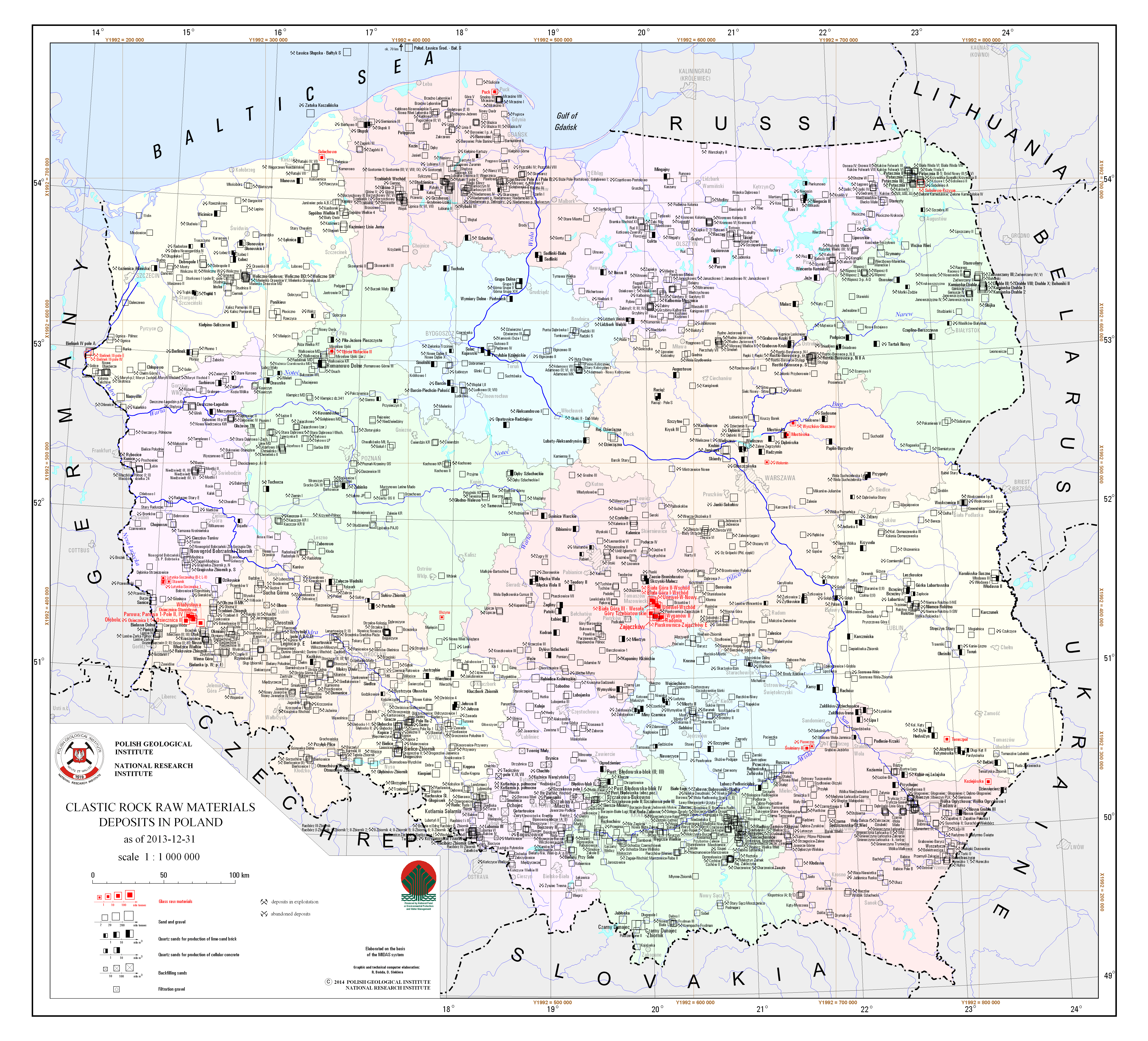
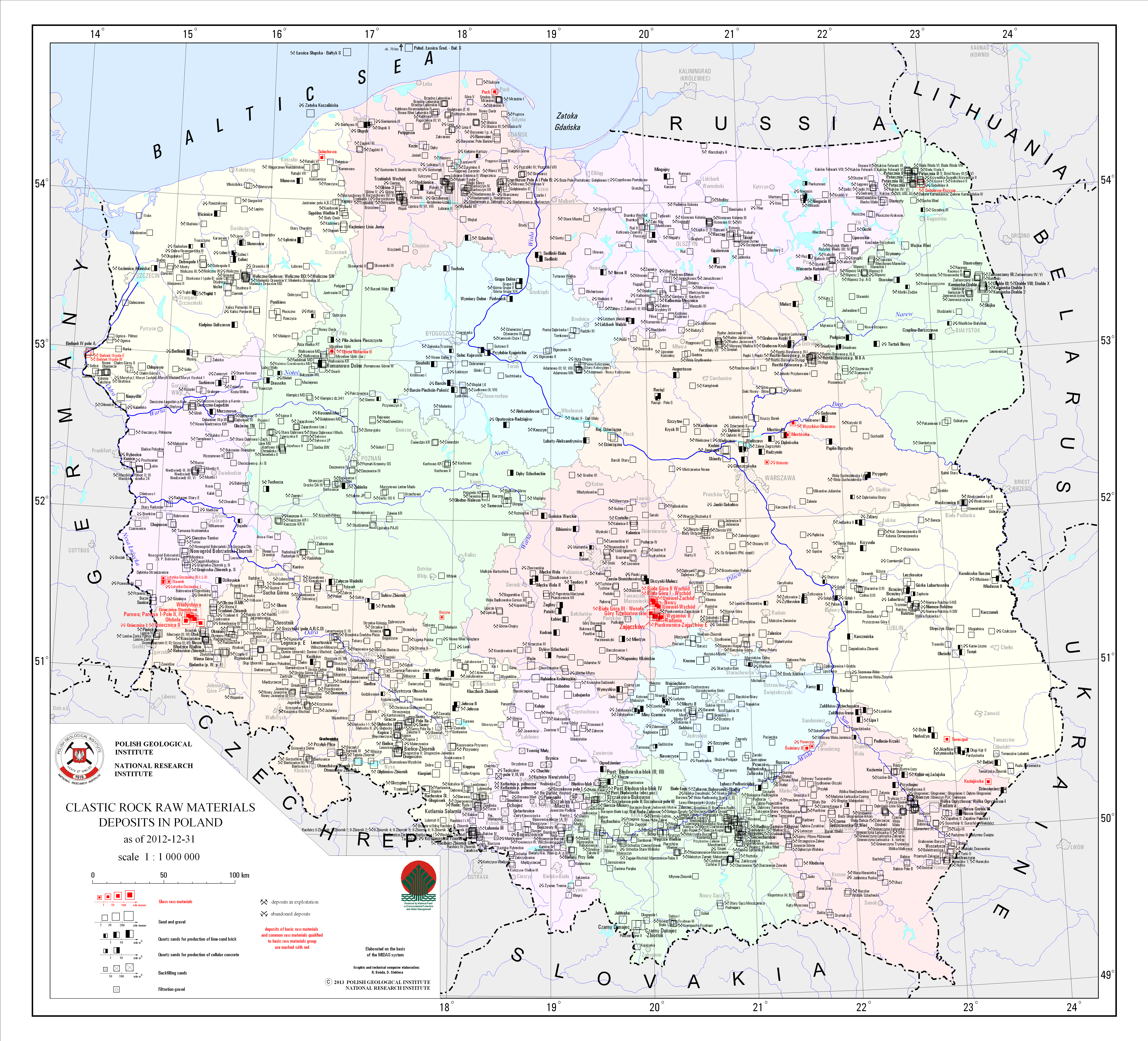
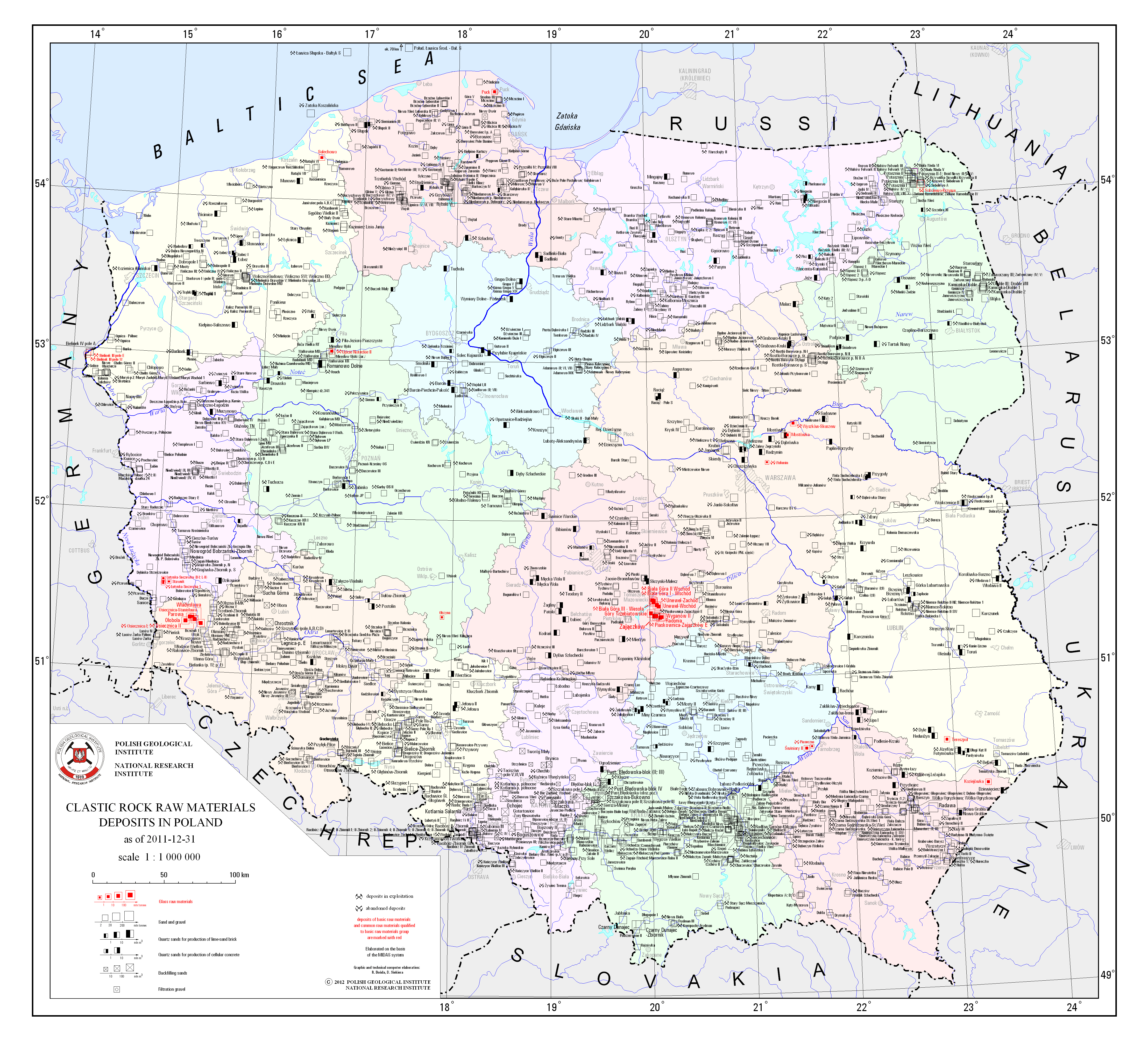
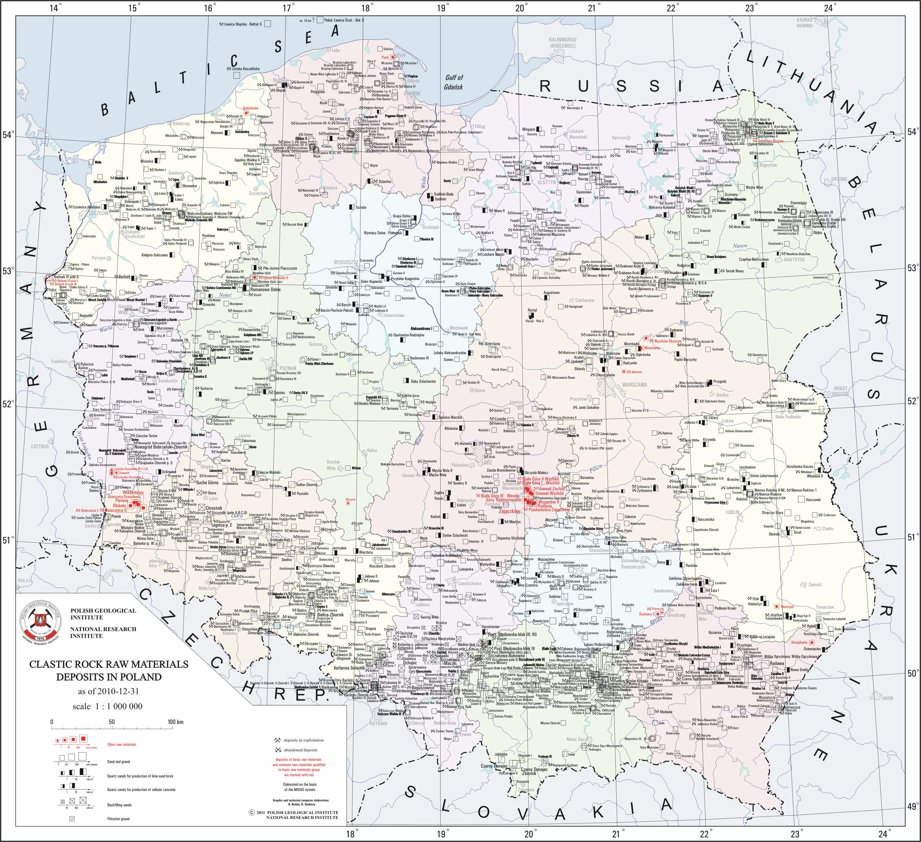
Clastic rock raw materials deposits
There are clastic rock raw materials deposits - glass sand and sandstone, quartz sands for production of lime-sand brick, quartz sands for production of cellular concrete, backfilling sands, sands with heavy minerals, filtration gravel and sand and gravel - in Poland presented on the map. Regarding sand and gravel, deposits with resources volume below 2 million tonnes, where not included on the map. A particular deposit is presented by a graphic mark with distinction of deposits classified as basic minerals. There is also information on a state of development of a particular deposit.
Download map.
Overview map of documented mineral deposits
On the map there are presented documented deposits of all mineral types occurring in Poland - according to the spatial information collected in the System of management and protection of mineral resources in Poland MIDAS. Deposits are marked with point signatures and divided into groups.
2024
Hard coal deposits in the Upper Silesian Coal Basin
map scale: 1:200,000
There are hard coal deposits in the Upper Silesian Coal Basin presented on the map. Deposits location is delineated by boundaries of deposits contoures. There is also information on a state of development and ownership (mining companies and business entities) of a particular deposit.
Download map.
Hard coal deposits in the Lublin Coal Basin
map scale: 1:200,000
There are hard coal deposits in the Lublin Coal Basin presented on the map. Deposits location is delineated by boundaries of deposits contoures. There is also information on a state of development and ownership (mining companies and business entities) of a particular deposit.
Download map.
Copper and silver ores deposits in Poland
map scale: 1:200,000
There are copper and silver ore deposits in Poland presented on the map. Deposits location is delineated by boundaries of deposits contoures. There is also information on a state of development of a particular deposit.
Download map.
Zinc and lead ores deposits in Poland
map scale: 1:200,000
There are zinc and lead ore deposits in Poland presented on the map. Deposits location is delineated by boundaries of deposits contoures. There is also information on a state of development of a particular deposit.
Download map.
Dimension and crushed stones deposits in South-Western Poland
map scale: 1:500,000
There are dimension and crushed stones deposits in South-Western Poland presented on the map. Deposits location is presented by signature marks with distinction of deposits classified as basic minerals. There is also information on a state of development of a particular deposit. The map takes into account an origin of the sotnes - sedimentary, igneous and metamorphic, and also their lithological types.
Download map.
Dimension and crushed stones deposits in South-Eastern Poland
map scale: 1:500,000
There are dimension and crushed stones deposits in South-Eastern Poland presented on the map. Deposits location is presented by signature marks with distinction of deposits classified as basic minerals. There is also information on a state of development of a particular deposit. The map takes into account an origin of the stones - sedimentary, igneous and metamorphic, and also their lithological types.
Download map.
Hard coal, brown coal and peat deposits in Poland
map scale: 1:1,000,000
There are hard coal, brown coal and peat deposits in Poland presented on the map. A particular deposit is presented by a graphic mark with distinction of deposits classified as basic minerals. There are two separeted maps - for the Upper Silesian Coal Basin and the Lublin Coal Basin, where deposits are presented in more details. There is also information on a state of development of a particular deposit.
Download map.
Metal ores and chemical raw materials deposits in Poland
map scale: 1:1,000,000
There are copper and silver ore, zinc and lead ore, nickel ore, iron ore, molibdenium-tungsten-copper ore and native sulfur, sulphur accompanying hydrocarbons, rock salt, potassium salt and barite and fluorspar deposits in Poland presented on the map. Particular deposit is presented by graphic mark with distinction of deposits classified as basic minerals. There are separeted maps - for copper and silver ore, lead and zinc ore and native sulfur where deposits are presented in more details. There is also information on a state of development of a particular deposit.
Download map.
Compact rock raw materials deposits (excluding dimension and crushed stones)

map scale: 1:1,000,000
There are compact rock raw materials deposits - dolomites, vein quartz, gypsum and anhydrite, feldspar, marl and limestone for cement and lime industries and chalk - in Poland presented on the map. To improve readability, deposits of marl and limestone for cement and lime industries, with resources volume below 10 million tonnes were not inlcuded on the map. There is also information on a state of development of a particular deposit.
Download map.
Ceramic and refractory raw materials deposits (excluding building ceramics raw materials)

map scale: 1:1,000,000
There are ceramic and refractory raw materials deposits - ceramic clays, refractory clays, kaolin, phyllite, quarztzitic and micaceous schists, refractory quartzites, magnesites and foundry sands - in Poland presented on the map. A particular deposit is presented by a graphic mark with distinction of deposits classified as basic minerals. There is also information on a state of development of a particular deposit.
Download map.
Building ceramics raw materials deposits
map scale: 1:1,000,000
There are building ceramics raw materials, clay raw materials for cement production and clay raw materials for lightweight aggregate production deposits in Poland presented on the map. Due to a high concentration of deposits in the Częstochowa, Katowice and Tarnobrzeg regions, there are only numbers of deposits located on the map, without their names. Names of deposits assigned to particular number are specified in the legend. There is also information on a state of development of a particular deposit.
Download map.
Clastic rock raw materials deposits
map scale: 1:1,000,000
There are clastic rock raw materials deposits - glass sand and sandstone, quartz sands for production of lime-sand brick, quartz sands for production of cellular concrete, backfilling sands, sands with heavy minerals, filtration gravel and sand and gravel - in Poland presented on the map. Regarding sand and gravel, deposits with resources volume below 2 million tonnes, where not included on the map. A particular deposit is presented by a graphic mark with distinction of deposits classified as basic minerals. There is also information on a state of development of a particular deposit.
Download map.
Overview map of documented mineral deposits
On the map there are presented documented deposits of all mineral types occurring in Poland - according to the spatial information collected in the System of management and protection of mineral resources in Poland MIDAS. Deposits are marked with point signatures and divided into groups.
2023
Hard coal deposits in the Upper Silesian Coal Basin
map scale: 1:200,000
There are hard coal deposits in Upper Silesian Coal Basin presented on the map. There is also information on the state of development and the ownership of particular deposit.
Download map.
Hard coal deposits in the Lublin Coal Basin
map scale: 1:200,000
There are hard coal deposits in Lublin Coal Basin presented on the map. There is also information on the state of development of particular deposit.
Download map.
Copper ores deposits in Poland
map scale: 1:200,000
There are copper ores deposits in Poland presented on the map. There is also information on the state of development of particular deposit.
Download map.
Zinc and lead ores deposits in Poland
map scale: 1:200,000
There are zinc and lead ores deposits in Poland presented on the map. There is also information on the state of development of particular deposit.
Download map.
Dimension and crushed stones deposits in South-Western Poland
map scale: 1:500,000
There are dimension and crushed stones deposits in South-Western Poland presented on the map. There is also information on the state of development of particular deposit.
Download map.
Dimension and crushed stones deposits in South-Eastern Poland
map scale: 1:500,000
There are dimension and crushed stones deposits in South-Eastern Poland presented on the map. There is also information on the state of development of particular deposit.
Download map.
Hard coal, brown coal and peat deposits in Poland
map scale: 1:1,000,000
There are hard coal, brown coal and peat deposits in Poland presented on the map. Particular deposit is presented by graphic mark. Deposits of basic raw materials are distinguished. There are two separeted maps - for Upper Silesian Coal Basin and Lublin Coal Basin, where deposits are presented in more details.
Download map.
Metal ores and chemical raw materials deposits in Poland
map scale: 1:1,000,000
There are copper ores, zinc and lead ores, nickel ores, molibdenium-tungsten-copper ores and sulfur, rock salt, potassium salt and barite and fluorspar deposits in Poland presented on the map. Particular deposit is presented by graphic mark. Deposits of basic raw materials are distinguished. there are separeted maps - for copper ores, lead and zinc ores and sulfur where deposits are presented in more details.
Download map.
Compact rock raw materials deposits (excluding dimension and crushed stones)
map scale: 1:1,000,000
There are compact rock raw materials deposits - dolomites, vein quartz, gypsum and anhydrite, feldspar, marls and limestones for cement and lime industries and chalk - in Poland presented on the map. There is also information on the state of development of particular deposit.
Download map.
Ceramic and refractory raw materials deposits (excluding building ceramics raw materials)
map scale: 1:1,000,000
There are ceramic and refractory raw materials deposits - ceramic clays, refractory clays, kaolin, schists, refractory quartzites, magnesites and foundry sands - in Poland presented on the map. There is also information on the state of development of particular deposit.
Download map.
Building ceramics raw materials deposits
map scale: 1:1,000,000
There are building ceramics raw materials, clay raw materials for cement production and clay raw materials for lightweight aggregate production deposits in Poland presented on the map. There is also information on the state of development of particular deposit.
Download map.
Clastic rock raw materials deposits

map scale: 1:1,000,000
There are clastic rock raw materials deposits - glass sands and sandstones, quartz sands for production of lime-sand brick, quartz sands for production of cellular concrete, backfilling sands, filtration gravel and sand and gravel - in Poland presented on the map. There is also information on the state of development of particular deposit.
Download map.
Overview map of documented mineral deposits
On the map there are presented documented deposits of all raw material types occurring in Poland - according to the spatial information collected in the System of management and protection of mineral resources in Poland MIDAS. Deposits are marked with point signatures and divided into groups.
2022
Hard coal deposits in the Upper Silesian Coal Basin

map scale: 1:200,000
There are hard coal deposits in Upper Silesian Coal Basin presented on the map. There is also information on the state of development and the ownership of particular deposit.
Download map.
Hard coal deposits in the Lublin Coal Basin
map scale: 1:200,000
There are hard coal deposits in Lublin Coal Basin presented on the map. There is also information on the state of development of particular deposit.
Download map.
Copper ores deposits in Poland
map scale: 1:200,000
There are copper ores deposits in Poland presented on the map. There is also information on the state of development of particular deposit.
Download map.
Zinc and lead ores deposits in Poland
map scale: 1:200,000
There are zinc and lead ores deposits in Poland presented on the map. There is also information on the state of development of particular deposit.
Download map.
Dimension and crushed stones deposits in South-Western Poland
map scale: 1:500,000
There are dimension and crushed stones deposits in South-Western Poland presented on the map. There is also information on the state of development of particular deposit.
Download map.
Dimension and crushed stones deposits in South-Eastern Poland
map scale: 1:500,000
There are dimension and crushed stones deposits in South-Eastern Poland presented on the map. There is also information on the state of development of particular deposit.
Download map.

Hard coal, brown coal and peat deposits in Poland
map scale: 1:1,000,000
There are hard coal, brown coal and peat deposits in Poland presented on the map. Particular deposit is presented by graphic mark. Deposits of basic raw materials are distinguished. There are two separeted maps - for Upper Silesian Coal Basin and Lublin Coal Basin, where deposits are presented in more details.
Download map.
Metal ores and chemical raw materials deposits in Poland

map scale: 1:1,000,000
There are copper ores, zinc and lead ores, nickel ores, molibdenium-tungsten-copper ores and sulfur, rock salt, potassium salt and barite and fluorspar deposits in Poland presented on the map. Particular deposit is presented by graphic mark. Deposits of basic raw materials are distinguished. there are separeted maps - for copper ores, lead and zinc ores and sulfur where deposits are presented in more details.
Download map.
Compact rock raw materials deposits (excluding dimension and crushed stones)

map scale: 1:1,000,000
There are compact rock raw materials deposits - dolomites, vein quartz, gypsum and anhydrite, feldspar, marls and limestones for cement and lime industries and chalk - in Poland presented on the map. There is also information on the state of development of particular deposit.
Download map.
Ceramic and refractory raw materials deposits (excluding building ceramics raw materials)
map scale: 1:1,000,000
There are ceramic and refractory raw materials deposits - ceramic clays, refractory clays, kaolin, schists, refractory quartzites, magnesites and foundry sands - in Poland presented on the map. There is also information on the state of development of particular deposit.
Download map.
Building ceramics raw materials deposits

map scale: 1:1,000,000
There are building ceramics raw materials, clay raw materials for cement production and clay raw materials for lightweight aggregate production deposits in Poland presented on the map. There is also information on the state of development of particular deposit.
Download map.
Clastic rock raw materials deposits
map scale: 1:1,000,000
There are clastic rock raw materials deposits - glass sands and sandstones, quartz sands for production of lime-sand brick, quartz sands for production of cellular concrete, backfilling sands, filtration gravel and sand and gravel - in Poland presented on the map. There is also information on the state of development of particular deposit.
Download map.
Overview map of documented mineral deposits
On the map there are presented documented deposits of all raw material types occurring in Poland - according to the spatial information collected in the System of management and protection of mineral resources in Poland MIDAS. Deposits are marked with point signatures and divided into groups.
2021
Hard coal deposits in the Upper Silesian Coal Basin

map scale: 1:200,000
There are hard coal deposits in Upper Silesian Coal Basin presented on the map. There is also information on the state of development and the ownership of particular deposit.
Download map.
Hard coal deposits in the Lublin Coal Basin
map scale: 1:200,000
There are hard coal deposits in Lublin Coal Basin presented on the map. There is also information on the state of development of particular deposit.
Download map.
Copper ores deposits in Poland
map scale: 1:200,000
There are copper ores deposits in Poland presented on the map. There is also information on the state of development of particular deposit.
Download map.
Zinc and lead ores deposits in Poland

map scale: 1:200,000
There are zinc and lead ores deposits in Poland presented on the map. There is also information on the state of development of particular deposit.
Download map.
Dimension and crushed stones deposits in South-Western Poland
map scale: 1:500,000
There are dimension and crushed stones deposits in South-Western Poland presented on the map. There is also information on the state of development of particular deposit.
Download map.
Dimension and crushed stones deposits in South-Eastern Poland
map scale: 1:500,000
There are dimension and crushed stones deposits in South-Eastern Poland presented on the map. There is also information on the state of development of particular deposit.
Download map.
Hard coal, brown coal and peat deposits in Poland

map scale: 1:1,000,000
There are hard coal, brown coal and peat deposits in Poland presented on the map. Particular deposit is presented by graphic mark. Deposits of basic raw materials are distinguished. There are two separeted maps - for Upper Silesian Coal Basin and Lublin Coal Basin, where deposits are presented in more details.
Download map.
Metal ores and chemical raw materials deposits in Poland
map scale: 1:1,000,000
There are copper ores, zinc and lead ores, nickel ores, molibdenium-tungsten-copper ores and sulfur, rock salt, potassium salt and barite and fluorspar deposits in Poland presented on the map. Particular deposit is presented by graphic mark. Deposits of basic raw materials are distinguished. there are separeted maps - for copper ores, lead and zinc ores and sulfur where deposits are presented in more details.
Download map.
Compact rock raw materials deposits (excluding dimension and crushed stones)
map scale: 1:1,000,000
There are compact rock raw materials deposits - dolomites, vein quartz, gypsum and anhydrite, feldspar, marls and limestones for cement and lime industries and chalk - in Poland presented on the map. There is also information on the state of development of particular deposit.
Download map.
Ceramic and refractory raw materials deposits (excluding building ceramics raw materials)

map scale: 1:1,000,000
There are ceramic and refractory raw materials deposits - ceramic clays, refractory clays, kaolin, schists, refractory quartzites, magnesites and foundry sands - in Poland presented on the map. There is also information on the state of development of particular deposit.
Download map.
Building ceramics raw materials deposits
map scale: 1:1,000,000
There are building ceramics raw materials, clay raw materials for cement production and clay raw materials for lightweight aggregate production deposits in Poland presented on the map. There is also information on the state of development of particular deposit.
Download map.
Clastic rock raw materials deposits

map scale: 1:1,000,000
There are clastic rock raw materials deposits - glass sands and sandstones, quartz sands for production of lime-sand brick, quartz sands for production of cellular concrete, backfilling sands, filtration gravel and sand and gravel - in Poland presented on the map. There is also information on the state of development of particular deposit.
Download map.
2020
Hard coal deposits in the Upper Silesian Coal Basin

map scale: 1:200,000
There are hard coal deposits in Upper Silesian Coal Basin presented on the map. There is also information on the state of development and the ownership of particular deposit.
Download map.
Hard coal deposits in the Lublin Coal Basin
map scale: 1:200,000
There are hard coal deposits in Lublin Coal Basin presented on the map. There is also information on the state of development of particular deposit.
Download map.
Copper ores deposits in Poland

map scale: 1:200,000
There are copper ores deposits in Poland presented on the map. There is also information on the state of development of particular deposit.
Download map.
Zinc and lead ores deposits in Poland
map scale: 1:200,000
There are zinc and lead ores deposits in Poland presented on the map. There is also information on the state of development of particular deposit.
Download map.
Dimension and crushed stones deposits in South-Western Poland

map scale: 1:500,000
There are dimension and crushed stones deposits in South-Western Poland presented on the map. There is also information on the state of development of particular deposit.
Download map.
Dimension and crushed stones deposits in South-Eastern Poland
map scale: 1:500,000
There are dimension and crushed stones deposits in South-Eastern Poland presented on the map. There is also information on the state of development of particular deposit.
Download map.
Hard coal, brown coal and peat deposits in Poland
map scale: 1:1,000,000
There are hard coal, brown coal and peat deposits in Poland presented on the map. Particular deposit is presented by graphic mark. Deposits of basic raw materials are distinguished. There are two separeted maps - for Upper Silesian Coal Basin and Lublin Coal Basin, where deposits are presented in more details.
Download map.
Metal ores and chemical raw materials deposits in Poland
map scale: 1:1,000,000
There are copper ores, zinc and lead ores, nickel ores, molibdenium-tungsten-copper ores and sulfur, rock salt, potassium salt and barite and fluorspar deposits in Poland presented on the map. Particular deposit is presented by graphic mark. Deposits of basic raw materials are distinguished. there are separeted maps - for copper ores, lead and zinc ores and sulfur where deposits are presented in more details.
Download map.
Compact rock raw materials deposits (excluding dimension and crushed stones)
map scale: 1:1,000,000
There are compact rock raw materials deposits - dolomites, vein quartz, gypsum and anhydrite, feldspar, marls and limestones for cement and lime industries and chalk - in Poland presented on the map. There is also information on the state of development of particular deposit.
Download map.
Ceramic and refractory raw materials deposits (excluding building ceramics raw materials)
map scale: 1:1,000,000
There are ceramic and refractory raw materials deposits - ceramic clays, refractory clays, kaolin, schists, refractory quartzites, magnesites and foundry sands - in Poland presented on the map. There is also information on the state of development of particular deposit.
Download map.
Building ceramics raw materials deposits

map scale: 1:1,000,000
There are building ceramics raw materials, clay raw materials for cement production and clay raw materials for lightweight aggregate production deposits in Poland presented on the map. There is also information on the state of development of particular deposit.
Download map.
Clastic rock raw materials deposits
map scale: 1:1,000,000
There are clastic rock raw materials deposits - glass sands and sandstones, quartz sands for production of lime-sand brick, quartz sands for production of cellular concrete, backfilling sands, filtration gravel and sand and gravel - in Poland presented on the map. There is also information on the state of development of particular deposit.
Download map.
2019
Hard coal deposits in the Upper Silesian Coal Basin
map scale: 1:200,000
There are hard coal deposits in Upper Silesian Coal Basin presented on the map. There is also information on the state of development and the ownership of particular deposit.
Download map.
Hard coal deposits in the Lublin Coal Basin
map scale: 1:200,000
There are hard coal deposits in Lublin Coal Basin presented on the map. There is also information on the state of development of particular deposit.
Download map.
Copper ores deposits in Poland

map scale: 1:200,000
There are copper ores deposits in Poland presented on the map. There is also information on the state of development of particular deposit.
Download map.
Zinc and lead ores deposits in Poland

map scale: 1:200,000
There are zinc and lead ores deposits in Poland presented on the map. There is also information on the state of development of particular deposit.
Download map.
Dimension and crushed stones deposits in South-Western Poland

map scale: 1:500,000
There are dimension and crushed stones deposits in South-Western Poland presented on the map. There is also information on the state of development of particular deposit.
Download map.
Dimension and crushed stones deposits in South-Eastern Poland
map scale: 1:500,000
There are dimension and crushed stones deposits in South-Eastern Poland presented on the map. There is also information on the state of development of particular deposit.
Download map.
Hard coal, brown coal and peat deposits in Poland
map scale: 1:1,000,000
There are hard coal, brown coal and peat deposits in Poland presented on the map. Particular deposit is presented by graphic mark. Deposits of basic raw materials are distinguished. There are two separeted maps - for Upper Silesian Coal Basin and Lublin Coal Basin, where deposits are presented in more details.
Download map.
Metal ores and chemical raw materials deposits in Poland
map scale: 1:1,000,000
There are copper ores, zinc and lead ores, nickel ores, molibdenium-tungsten-copper ores and sulfur, rock salt, potassium salt and barite and fluorspar deposits in Poland presented on the map. Particular deposit is presented by graphic mark. Deposits of basic raw materials are distinguished. there are separeted maps - for copper ores, lead and zinc ores and sulfur where deposits are presented in more details.
Download map.
Compact rock raw materials deposits (excluding dimension and crushed stones)
map scale: 1:1,000,000
There are compact rock raw materials deposits - dolomites, vein quartz, gypsum and anhydrite, feldspar, marls and limestones for cement and lime industries and chalk - in Poland presented on the map. There is also information on the state of development of particular deposit.
Download map.
Ceramic and refractory raw materials deposits (excluding building ceramics raw materials)
map scale: 1:1,000,000
There are ceramic and refractory raw materials deposits - ceramic clays, refractory clays, kaolin, schists, refractory quartzites, magnesites and foundry sands - in Poland presented on the map. There is also information on the state of development of particular deposit.
Download map.
Building ceramics raw materials deposits
map scale: 1:1,000,000
There are building ceramics raw materials, clay raw materials for cement production and clay raw materials for lightweight aggregate production deposits in Poland presented on the map. There is also information on the state of development of particular deposit.
Download map.
Clastic rock raw materials deposits
map scale: 1:1,000,000
There are clastic rock raw materials deposits - glass sands and sandstones, quartz sands for production of lime-sand brick, quartz sands for production of cellular concrete, backfilling sands, filtration gravel and sand and gravel - in Poland presented on the map. There is also information on the state of development of particular deposit.
Download map.
2018
Hard coal deposits in the Upper Silesian Coal Basin
map scale: 1:200,000
There are hard coal deposits in Upper Silesian Coal Basin presented on the map. There is also information on the state of development and the ownership of particular deposit.
Download map.
Hard coal deposits in the Lublin Coal Basin
map scale: 1:200,000
There are hard coal deposits in Lublin Coal Basin presented on the map. There is also information on the state of development of particular deposit.
Download map.
Copper ores deposits in Poland

map scale: 1:200,000
There are copper ores deposits in Poland presented on the map. There is also information on the state of development of particular deposit.
Download map.
Zinc and lead ores deposits in Poland
map scale: 1:200,000
There are zinc and lead ores deposits in Poland presented on the map. There is also information on the state of development of particular deposit.
Download map.
Dimension and crushed stones deposits in South-Western Poland
map scale: 1:500,000
There are dimension and crushed stones deposits in South-Western Poland presented on the map. There is also information on the state of development of particular deposit.
Download map.
Dimension and crushed stones deposits in South-Eastern Poland
map scale: 1:500,000
There are dimension and crushed stones deposits in South-Eastern Poland presented on the map. There is also information on the state of development of particular deposit.
Download map.
Hard coal, brown coal and peat deposits in Poland
map scale: 1:1,000,000
There are hard coal, brown coal and peat deposits in Poland presented on the map. Particular deposit is presented by graphic mark. Deposits of basic raw materials are distinguished. There are two separeted maps - for Upper Silesian Coal Basin and Lublin Coal Basin, where deposits are presented in more details.
Download map.
Metal ores and chemical raw materials deposits in Poland
map scale: 1:1,000,000
There are copper ores, zinc and lead ores, nickel ores, molibdenium-tungsten-copper ores and sulfur, rock salt, potassium salt and barite and fluorspar deposits in Poland presented on the map. Particular deposit is presented by graphic mark. Deposits of basic raw materials are distinguished. there are separeted maps - for copper ores, lead and zinc ores and sulfur where deposits are presented in more details.
Download map.
Compact rock raw materials deposits (excluding dimension and crushed stones)
map scale: 1:1,000,000
There are compact rock raw materials deposits - dolomites, vein quartz, gypsum and anhydrite, feldspar, marls and limestones for cement and lime industries and chalk - in Poland presented on the map. There is also information on the state of development of particular deposit.
Download map.
Ceramic and refractory raw materials deposits (excluding building ceramics raw materials)

map scale: 1:1,000,000
There are ceramic and refractory raw materials deposits - ceramic clays, refractory clays, kaolin, schists, refractory quartzites, magnesites and foundry sands - in Poland presented on the map. There is also information on the state of development of particular deposit.
Download map.
Building ceramics raw materials deposits
map scale: 1:1,000,000
There are building ceramics raw materials, clay raw materials for cement production and clay raw materials for lightweight aggregate production deposits in Poland presented on the map. There is also information on the state of development of particular deposit.
Download map.
Clastic rock raw materials deposits
map scale: 1:1,000,000
There are clastic rock raw materials deposits - glass sands and sandstones, quartz sands for production of lime-sand brick, quartz sands for production of cellular concrete, backfilling sands, filtration gravel and sand and gravel - in Poland presented on the map. There is also information on the state of development of particular deposit.
Download map.
2017
Hard coal deposits in the Upper Silesian Coal Basin
map scale: 1:200,000
There are hard coal deposits in Upper Silesian Coal Basin presented on the map. There is also information on the state of development and the ownership of particular deposit.
Download map.
Hard coal deposits in the Lublin Coal Basin

map scale: 1:200,000
There are hard coal deposits in Lublin Coal Basin presented on the map. There is also information on the state of development of particular deposit.
Download map.
Copper ores deposits in Poland
map scale: 1:200,000
There are copper ores deposits in Poland presented on the map. There is also information on the state of development of particular deposit.
Download map.
Zinc and lead ores deposits in Poland

map scale: 1:200,000
There are zinc and lead ores deposits in Poland presented on the map. There is also information on the state of development of particular deposit.
Download map.
Dimension and crushed stones deposits in South-Western Poland
map scale: 1:500,000
There are dimension and crushed stones deposits in South-Western Poland presented on the map. There is also information on the state of development of particular deposit.
Download map.
Dimension and crushed stones deposits in South-Eastern Poland
map scale: 1:500,000
There are dimension and crushed stones deposits in South-Eastern Poland presented on the map. There is also information on the state of development of particular deposit.
Download map.
Hard coal, brown coal and peat deposits in Poland
map scale: 1:1,000,000
There are hard coal, brown coal and peat deposits in Poland presented on the map. Particular deposit is presented by graphic mark. Deposits of basic raw materials are distinguished. There are two separeted maps - for Upper Silesian Coal Basin and Lublin Coal Basin, where deposits are presented in more details.
Download map.
Metal ores and chemical raw materials deposits in Poland
map scale: 1:1,000,000
There are copper ores, zinc and lead ores, nickel ores, molibdenium-tungsten-copper ores and sulfur, rock salt, potassium salt and barite and fluorspar deposits in Poland presented on the map. Particular deposit is presented by graphic mark. Deposits of basic raw materials are distinguished. there are separeted maps - for copper ores, lead and zinc ores and sulfur where deposits are presented in more details.
Download map.
Compact rock raw materials deposits (excluding dimension and crushed stones)

map scale: 1:1,000,000
There are compact rock raw materials deposits - dolomites, vein quartz, gypsum and anhydrite, feldspar, marls and limestones for cement and lime industries and chalk - in Poland presented on the map. There is also information on the state of development of particular deposit.
Download map.
Ceramic and refractory raw materials deposits (excluding building ceramics raw materials)
map scale: 1:1,000,000
There are ceramic and refractory raw materials deposits - ceramic clays, refractory clays, kaolin, schists, refractory quartzites, magnesites and foundry sands - in Poland presented on the map. There is also information on the state of development of particular deposit.
Download map.
Building ceramics raw materials deposits

map scale: 1:1,000,000
There are building ceramics raw materials, clay raw materials for cement production and clay raw materials for lightweight aggregate production deposits in Poland presented on the map. There is also information on the state of development of particular deposit.
Download map.
Clastic rock raw materials deposits
map scale: 1:1,000,000
There are clastic rock raw materials deposits - glass sands and sandstones, quartz sands for production of lime-sand brick, quartz sands for production of cellular concrete, backfilling sands, filtration gravel and sand and gravel - in Poland presented on the map. There is also information on the state of development of particular deposit.
Download map.
2016
Hard coal deposits in the Upper Silesian Coal Basin
map scale: 1:200,000
There are hard coal deposits in Upper Silesian Coal Basin presented on the map. There is also information on the state of development and the ownership of particular deposit.
Download map.
Hard coal deposits in the Lublin Coal Basin
map scale: 1:200,000
There are hard coal deposits in Lublin Coal Basin presented on the map. There is also information on the state of development of particular deposit.
Download map.
Copper ores deposits in Poland

map scale: 1:200,000
There are copper ores deposits in Poland presented on the map. There is also information on the state of development of particular deposit.
Download map.
Zinc and lead ores deposits in Poland
map scale: 1:200,000
There are zinc and lead ores deposits in Poland presented on the map. There is also information on the state of development of particular deposit.
Download map.
Dimension and crushed stones deposits in South-Western Poland
map scale: 1:500,000
There are dimension and crushed stones deposits in South-Western Poland presented on the map. There is also information on the state of development of particular deposit.
Download map.
Dimension and crushed stones deposits in South-Eastern Poland

map scale: 1:500,000
There are dimension and crushed stones deposits in South-Eastern Poland presented on the map. There is also information on the state of development of particular deposit.
Download map.
Hard coal, brown coal and peat deposits in Poland
map scale: 1:1,000,000
There are hard coal, brown coal and peat deposits in Poland presented on the map. Particular deposit is presented by graphic mark. Deposits of basic raw materials are distinguished. There are two separeted maps - for Upper Silesian Coal Basin and Lublin Coal Basin, where deposits are presented in more details.
Download map.
Metal ores and chemical raw materials deposits in Poland

map scale: 1:1,000,000
There are copper ores, zinc and lead ores, nickel ores, molibdenium-tungsten-copper ores and sulfur, rock salt, potassium salt and barite and fluorspar deposits in Poland presented on the map. Particular deposit is presented by graphic mark. Deposits of basic raw materials are distinguished. there are separeted maps - for copper ores, lead and zinc ores and sulfur where deposits are presented in more details.
Download map.
Compact rock raw materials deposits (excluding dimension and crushed stones)

map scale: 1:1,000,000
There are compact rock raw materials deposits - dolomites, vein quartz, gypsum and anhydrite, feldspar, marls and limestones for cement and lime industries and chalk - in Poland presented on the map. There is also information on the state of development of particular deposit.
Download map.
Ceramic and refractory raw materials deposits (excluding building ceramics raw materials)

map scale: 1:1,000,000
There are ceramic and refractory raw materials deposits - ceramic clays, refractory clays, kaolin, schists, refractory quartzites, magnesites and foundry sands - in Poland presented on the map. There is also information on the state of development of particular deposit.
Download map.
Building ceramics raw materials deposits
map scale: 1:1,000,000
There are building ceramics raw materials, clay raw materials for cement production and clay raw materials for lightweight aggregate production deposits in Poland presented on the map. There is also information on the state of development of particular deposit.
Download map.
Clastic rock raw materials deposits
map scale: 1:1,000,000
There are clastic rock raw materials deposits - glass sands and sandstones, quartz sands for production of lime-sand brick, quartz sands for production of cellular concrete, backfilling sands, filtration gravel and sand and gravel - in Poland presented on the map. There is also information on the state of development of particular deposit.
Download map.
2015
Hard coal deposits in the Upper Silesian Coal Basin

map scale: 1:200,000
There are hard coal deposits in Upper Silesian Coal Basin presented on the map. There is also information on the state of development and the ownership of particular deposit.
Download map.
Hard coal deposits in the Lublin Coal Basin
map scale: 1:200,000
There are hard coal deposits in Lublin Coal Basin presented on the map. There is also information on the state of development of particular deposit.
Download map.
Copper ores deposits in Poland
map scale: 1:200,000
There are copper ores deposits in Poland presented on the map. There is also information on the state of development of particular deposit.
Download map.
Zinc and lead ores deposits in Poland
map scale: 1:200,000
There are zinc and lead ores deposits in Poland presented on the map. There is also information on the state of development of particular deposit.
Download map.
Dimension and crushed stones deposits in South-Western Poland
map scale: 1:500,000
There are dimension and crushed stones deposits in South-Western Poland presented on the map. There is also information on the state of development of particular deposit.
Download map.
Dimension and crushed stones deposits in South-Eastern Poland
map scale: 1:500,000
There are dimension and crushed stones deposits in South-Eastern Poland presented on the map. There is also information on the state of development of particular deposit.
Download map.
Hard coal, brown coal and peat deposits in Poland
map scale: 1:1,000,000
There are hard coal, brown coal and peat deposits in Poland presented on the map. Particular deposit is presented by graphic mark. Deposits of basic raw materials are distinguished. There are two separeted maps - for Upper Silesian Coal Basin and Lublin Coal Basin, where deposits are presented in more details.
Download map.
Metal ores and chemical raw materials deposits in Poland
map scale: 1:1,000,000
There are copper ores, zinc and lead ores, nickel ores, molibdenium-tungsten-copper ores and sulfur, rock salt, potassium salt and barite and fluorspar deposits in Poland presented on the map. Particular deposit is presented by graphic mark. Deposits of basic raw materials are distinguished. there are separeted maps - for copper ores, lead and zinc ores and sulfur where deposits are presented in more details.
Download map.
Compact rock raw materials deposits (excluding dimension and crushed stones)
map scale: 1:1,000,000
There are compact rock raw materials deposits - dolomites, vein quartz, gypsum and anhydrite, feldspar, marls and limestones for cement and lime industries and chalk - in Poland presented on the map. There is also information on the state of development of particular deposit.
Download map.
Ceramic and refractory raw materials deposits (excluding building ceramics raw materials)
map scale: 1:1,000,000
There are ceramic and refractory raw materials deposits - ceramic clays, refractory clays, kaolin, schists, refractory quartzites, magnesites and foundry sands - in Poland presented on the map. There is also information on the state of development of particular deposit.
Download map.
Building ceramics raw materials deposits
map scale: 1:1,000,000
There are building ceramics raw materials, clay raw materials for cement production and clay raw materials for lightweight aggregate production deposits in Poland presented on the map. There is also information on the state of development of particular deposit.
Download map.
Clastic rock raw materials deposits

map scale: 1:1,000,000
There are clastic rock raw materials deposits - glass sands and sandstones, quartz sands for production of lime-sand brick, quartz sands for production of cellular concrete, backfilling sands, filtration gravel and sand and gravel - in Poland presented on the map. There is also information on the state of development of particular deposit.
Download map.
2014
Hard coal deposits in the Upper Silesian Coal Basin
map scale: 1:200,000
There are hard coal deposits in Upper Silesian Coal Basin presented on the map. There is also information on the state of development and the ownership of particular deposit.
Download map.
Hard coal deposits in the Lublin Coal Basin
map scale: 1:200,000
There are hard coal deposits in Lublin Coal Basin presented on the map. There is also information on the state of development of particular deposit.
Download map.
Copper ores deposits in Poland

map scale: 1:200,000
There are copper ores deposits in Poland presented on the map. There is also information on the state of development of particular deposit.
Download map.
Zinc and lead ores deposits in Poland
map scale: 1:200,000
There are zinc and lead ores deposits in Poland presented on the map. There is also information on the state of development of particular deposit.
Download map.
Dimension and crushed stones deposits in South-Western Poland
map scale: 1:500,000
There are dimension and crushed stones deposits in South-Western Poland presented on the map. There is also information on the state of development of particular deposit.
Download map.
Dimension and crushed stones deposits in South-Eastern Poland
map scale: 1:500,000
There are dimension and crushed stones deposits in South-Eastern Poland presented on the map. There is also information on the state of development of particular deposit.
Download map.

Hard coal, brown coal and peat deposits in Poland
map scale: 1:1,000,000
There are hard coal, brown coal and peat deposits in Poland presented on the map. Particular deposit is presented by graphic mark. Deposits of basic raw materials are distinguished. There are two separeted maps - for Upper Silesian Coal Basin and Lublin Coal Basin, where deposits are presented in more details.
Download map.
Metal ores and chemical raw materials deposits in Poland
map scale: 1:1,000,000
There are copper ores, zinc and lead ores, nickel ores, molibdenium-tungsten-copper ores and sulfur, rock salt, potassium salt and barite and fluorspar deposits in Poland presented on the map. Particular deposit is presented by graphic mark. Deposits of basic raw materials are distinguished. there are separeted maps - for copper ores, lead and zinc ores and sulfur where deposits are presented in more details.
Download map.
Compact rock raw materials deposits (excluding dimension and crushed stones)

map scale: 1:1,000,000
There are compact rock raw materials deposits - dolomites, vein quartz, gypsum and anhydrite, feldspar, marls and limestones for cement and lime industries and chalk - in Poland presented on the map. There is also information on the state of development of particular deposit.
Download map.
Ceramic and refractory raw materials deposits (excluding building ceramics raw materials)
map scale: 1:1,000,000
There are ceramic and refractory raw materials deposits - ceramic clays, refractory clays, kaolin, schists, refractory quartzites, magnesites and foundry sands - in Poland presented on the map. There is also information on the state of development of particular deposit.
Download map.
Building ceramics raw materials deposits
map scale: 1:1,000,000
There are building ceramics raw materials, clay raw materials for cement production and clay raw materials for lightweight aggregate production deposits in Poland presented on the map. There is also information on the state of development of particular deposit.
Download map.
Clastic rock raw materials deposits

map scale: 1:1,000,000
There are clastic rock raw materials deposits - glass sands and sandstones, quartz sands for production of lime-sand brick, quartz sands for production of cellular concrete, backfilling sands, filtration gravel and sand and gravel - in Poland presented on the map. There is also information on the state of development of particular deposit.
Download map.
2013
Hard coal deposits in the Upper Silesian Coal Basin
map scale: 1:200,000
There are hard coal deposits in Upper Silesian Coal Basin presented on the map. There is also information on the state of development and the ownership of particular deposit.
Download map.
Hard coal deposits in the Lublin Coal Basin
map scale: 1:200,000
There are hard coal deposits in Lublin Coal Basin presented on the map. There is also information on the state of development of particular deposit.
Download map.
Copper ores deposits in Poland
map scale: 1:200,000
There are copper ores deposits in Poland presented on the map. There is also information on the state of development of particular deposit.
Download map.
Zinc and lead ores deposits in Poland
map scale: 1:200,000
There are zinc and lead ores deposits in Poland presented on the map. There is also information on the state of development of particular deposit.
Download map.
Dimension and crushed stones deposits in South-Western Poland
map scale: 1:500,000
There are dimension and crushed stones deposits in South-Western Poland presented on the map. There is also information on the state of development of particular deposit.
Download map.
Dimension and crushed stones deposits in South-Eastern Poland

map scale: 1:500,000
There are dimension and crushed stones deposits in South-Eastern Poland presented on the map. There is also information on the state of development of particular deposit.
Download map.
Hard coal, brown coal and peat deposits in Poland
map scale: 1:1,000,000
There are hard coal, brown coal and peat deposits in Poland presented on the map. Particular deposit is presented by graphic mark. Deposits of basic raw materials are distinguished. There are two separeted maps - for Upper Silesian Coal Basin and Lublin Coal Basin, where deposits are presented in more details.
Download map.
Metal ores and chemical raw materials deposits in Poland
map scale: 1:1,000,000
There are copper ores, zinc and lead ores, nickel ores, molibdenium-tungsten-copper ores and sulfur, rock salt, potassium salt and barite and fluorspar deposits in Poland presented on the map. Particular deposit is presented by graphic mark. Deposits of basic raw materials are distinguished. there are separeted maps - for copper ores, lead and zinc ores and sulfur where deposits are presented in more details.
Download map.
Compact rock raw materials deposits (excluding dimension and crushed stones)

map scale: 1:1,000,000
There are compact rock raw materials deposits - dolomites, vein quartz, gypsum and anhydrite, feldspar, marls and limestones for cement and lime industries and chalk - in Poland presented on the map. There is also information on the state of development of particular deposit.
Download map.
Ceramic and refractory raw materials deposits (excluding building ceramics raw materials)
map scale: 1:1,000,000
There are ceramic and refractory raw materials deposits - ceramic clays, refractory clays, kaolin, schists, refractory quartzites, magnesites and foundry sands - in Poland presented on the map. There is also information on the state of development of particular deposit.
Download map.
Building ceramics raw materials deposits
map scale: 1:1,000,000
There are building ceramics raw materials, clay raw materials for cement production and clay raw materials for lightweight aggregate production deposits in Poland presented on the map. There is also information on the state of development of particular deposit.
Download map.
Clastic rock raw materials deposits
map scale: 1:1,000,000
There are clastic rock raw materials deposits - glass sands and sandstones, quartz sands for production of lime-sand brick, quartz sands for production of cellular concrete, backfilling sands, filtration gravel and sand and gravel - in Poland presented on the map. There is also information on the state of development of particular deposit.
Download map.
2012
Hard coal deposits in the Upper Silesian Coal Basin

map scale: 1:200,000
There are hard coal deposits in Upper Silesian Coal Basin presented on the map. There is also information on the state of development and the ownership of particular deposit.
Download map.
Hard coal deposits in the Lublin Coal Basin
map scale: 1:200,000
There are hard coal deposits in Lublin Coal Basin presented on the map. There is also information on the state of development of particular deposit.
Download map.
Copper ores deposits in Poland

map scale: 1:200,000
There are copper ores deposits in Poland presented on the map. There is also information on the state of development of particular deposit.
Download map.
Zinc and lead ores deposits in Poland
map scale: 1:200,000
There are zinc and lead ores deposits in Poland presented on the map. There is also information on the state of development of particular deposit.
Download map.
Dimension and crushed stones deposits in South-Western Poland
map scale: 1:500,000
There are dimension and crushed stones deposits in South-Western Poland presented on the map. There is also information on the state of development of particular deposit.
Download map.
Dimension and crushed stones deposits in South-Eastern Poland
map scale: 1:500,000
There are dimension and crushed stones deposits in South-Eastern Poland presented on the map. There is also information on the state of development of particular deposit.
Download map.

Hard coal, brown coal and peat deposits in Poland
map scale: 1:1,000,000
There are hard coal, brown coal and peat deposits in Poland presented on the map. Particular deposit is presented by graphic mark. Deposits of basic raw materials are distinguished. There are two separeted maps - for Upper Silesian Coal Basin and Lublin Coal Basin, where deposits are presented in more details.
Download map.
Metal ores and chemical raw materials deposits in Poland
map scale: 1:1,000,000
There are copper ores, zinc and lead ores, nickel ores, molibdenium-tungsten-copper ores and sulfur, rock salt, potassium salt and barite and fluorspar deposits in Poland presented on the map. Particular deposit is presented by graphic mark. Deposits of basic raw materials are distinguished. there are separeted maps - for copper ores, lead and zinc ores and sulfur where deposits are presented in more details.
Download map.
Compact rock raw materials deposits (excluding dimension and crushed stones)
map scale: 1:1,000,000
There are compact rock raw materials deposits - dolomites, vein quartz, gypsum and anhydrite, feldspar, marls and limestones for cement and lime industries and chalk - in Poland presented on the map. There is also information on the state of development of particular deposit.
Download map.
Ceramic and refractory raw materials deposits (excluding building ceramics raw materials)
map scale: 1:1,000,000
There are ceramic and refractory raw materials deposits - ceramic clays, refractory clays, kaolin, schists, refractory quartzites, magnesites and foundry sands - in Poland presented on the map. There is also information on the state of development of particular deposit.
Download map.
Building ceramics raw materials deposits
map scale: 1:1,000,000
There are building ceramics raw materials, clay raw materials for cement production and clay raw materials for lightweight aggregate production deposits in Poland presented on the map. There is also information on the state of development of particular deposit.
Download map.
Clastic rock raw materials deposits

map scale: 1:1,000,000
There are clastic rock raw materials deposits - glass sands and sandstones, quartz sands for production of lime-sand brick, quartz sands for production of cellular concrete, backfilling sands, filtration gravel and sand and gravel - in Poland presented on the map. There is also information on the state of development of particular deposit.
Download map.
2011
Hard coal deposits in the Upper Silesian Coal Basin
map scale: 1:200,000
There are hard coal deposits in Upper Silesian Coal Basin presented on the map. There is also information on the state of development and the ownership of particular deposit.
Download map.
Hard coal deposits in the Lublin Coal Basin
map scale: 1:200,000
There are hard coal deposits in Lublin Coal Basin presented on the map. There is also information on the state of development of particular deposit.
Download map.
Copper ores deposits in Poland
map scale: 1:200,000
There are copper ores deposits in Poland presented on the map. There is also information on the state of development of particular deposit.
Download map.
Zinc and lead ores deposits in Poland
map scale: 1:200,000
There are zinc and lead ores deposits in Poland presented on the map. There is also information on the state of development of particular deposit.
Download map.
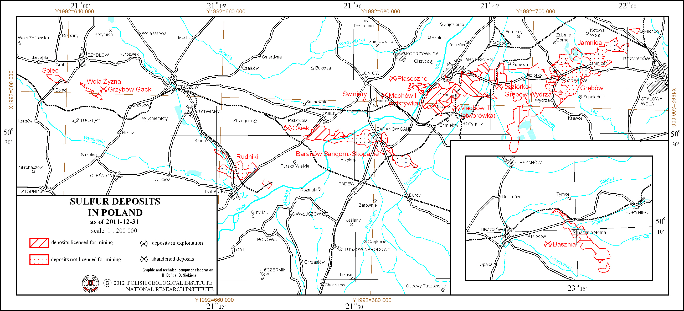
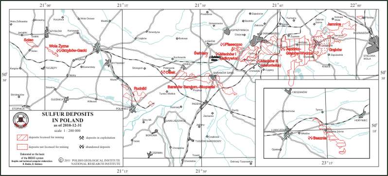
Sulfur deposits in Poland
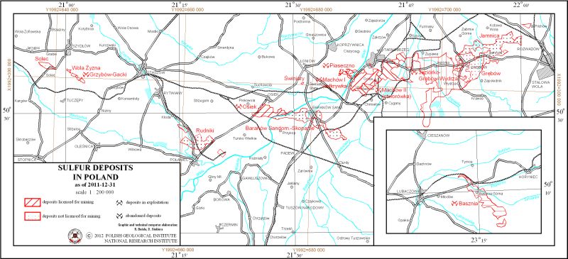
map scale: 1:200,000
There are sulfur deposits in Poland presented on the map. There is also information on the state of development of particular deposit.
Download map.
Dimension and crushed stones deposits in South-Western Poland
map scale: 1:500,000
There are dimension and crushed stones deposits in South-Western Poland presented on the map. There is also information on the state of development of particular deposit.
Download map.
Dimension and crushed stones deposits in South-Eastern Poland
map scale: 1:500,000
There are dimension and crushed stones deposits in South-Eastern Poland presented on the map. There is also information on the state of development of particular deposit.
Download map.
Hard coal, brown coal and peat deposits in Poland
map scale: 1:1,000,000
There are hard coal, brown coal and peat deposits in Poland presented on the map. Particular deposit is presented by graphic mark. Deposits of basic raw materials are distinguished. There are two separeted maps - for Upper Silesian Coal Basin and Lublin Coal Basin, where deposits are presented in more details.
Download map.
Metal ores and chemical raw materials deposits in Poland
map scale: 1:1,000,000
There are copper ores, zinc and lead ores, nickel ores, molibdenium-tungsten-copper ores and sulfur, rock salt, potassium salt and barite and fluorspar deposits in Poland presented on the map. Particular deposit is presented by graphic mark. Deposits of basic raw materials are distinguished. there are separeted maps - for copper ores, lead and zinc ores and sulfur where deposits are presented in more details.
Download map.
Compact rock raw materials deposits (excluding dimension and crushed stones)
map scale: 1:1,000,000
There are compact rock raw materials deposits - dolomites, vein quartz, gypsum and anhydrite, feldspar, marls and limestones for cement and lime industries and chalk - in Poland presented on the map. There is also information on the state of development of particular deposit.
Download map.
Ceramic and refractory raw materials deposits (excluding building ceramics raw materials)
map scale: 1:1,000,000
There are ceramic and refractory raw materials deposits - ceramic clays, refractory clays, kaolin, schists, refractory quartzites, magnesites and foundry sands - in Poland presented on the map. There is also information on the state of development of particular deposit.
Download map.
Building ceramics raw materials deposits
map scale: 1:1,000,000
There are building ceramics raw materials, clay raw materials for cement production and clay raw materials for lightweight aggregate production deposits in Poland presented on the map. There is also information on the state of development of particular deposit.
Download map.
Clastic rock raw materials deposits
map scale: 1:1,000,000
There are clastic rock raw materials deposits - glass sands and sandstones, quartz sands for production of lime-sand brick, quartz sands for production of cellular concrete, backfilling sands, filtration gravel and sand and gravel - in Poland presented on the map. There is also information on the state of development of particular deposit.
Download map.
2010
Hard coal deposits in the Upper Silesian Coal Basin
map scale: 1:200,000
There are hard coal deposits in Upper Silesian Coal Basin presented on the map. There is also information on the state of development and the ownership of particular deposit.
Download map.
Hard coal deposits in the Lublin Coal Basin
map scale: 1:200,000
There are hard coal deposits in Lublin Coal Basin presented on the map. There is also information on the state of development of particular deposit.
Download map.
Copper ores deposits in Poland
map scale: 1:200,000
There are copper ores deposits in Poland presented on the map. There is also information on the state of development of particular deposit.
Download map.
Zinc and lead ores deposits in Poland

map scale: 1:200,000
There are zinc and lead ores deposits in Poland presented on the map. There is also information on the state of development of particular deposit.
Download map.
Sulfur deposits in Poland

map scale: 1:200,000
There are sulfur deposits in Poland presented on the map. There is also information on the state of development of particular deposit.
Download map.
Dimension and crushed stones deposits in South-Western Poland
map scale: 1:500,000
There are dimension and crushed stones deposits in South-Western Poland presented on the map. There is also information on the state of development of particular deposit.
Download map.
Dimension and crushed stones deposits in South-Eastern Poland
map scale: 1:500,000
There are dimension and crushed stones deposits in South-Eastern Poland presented on the map. There is also information on the state of development of particular deposit.
Download map.
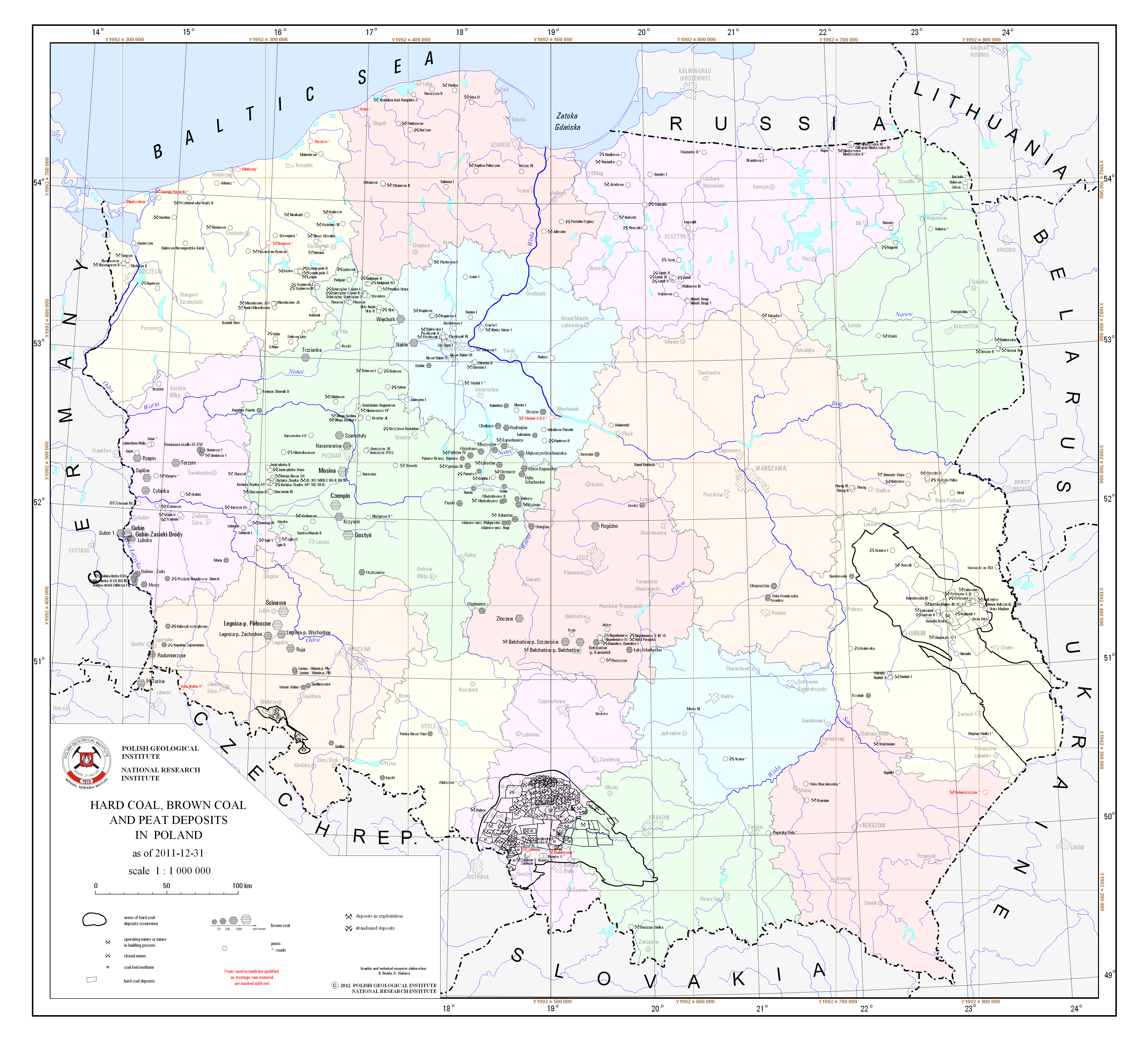
Hard coal, brown coal and peat deposits in Poland
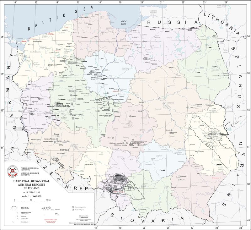
map scale: 1:1,000,000
There are hard coal, brown coal and peat deposits in Poland presented on the map. Particular deposit is presented by graphic mark. Deposits of basic raw materials are distinguished. There are two separeted maps - for Upper Silesian Coal Basin and Lublin Coal Basin, where deposits are presented in more details.
Download map.
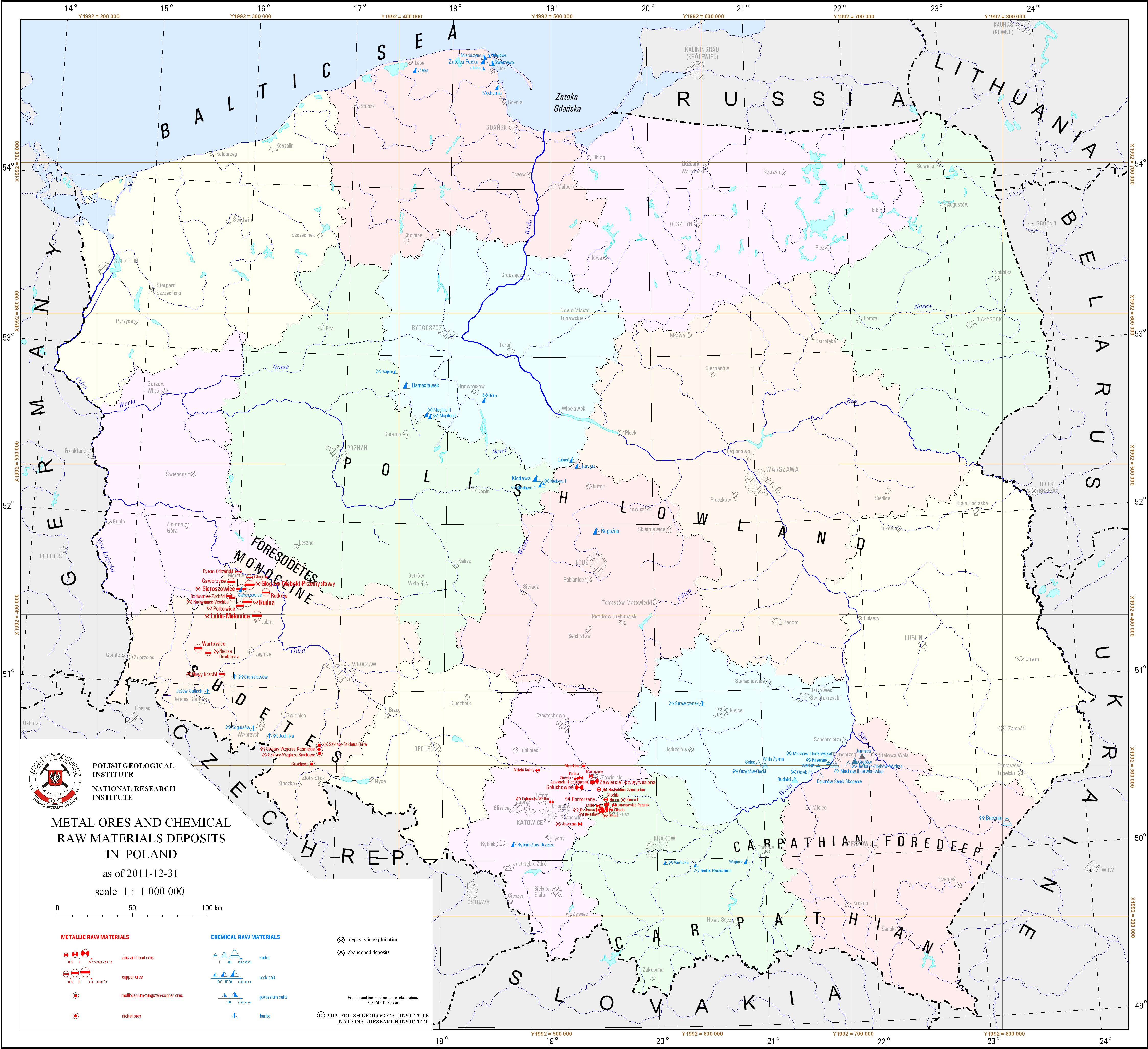
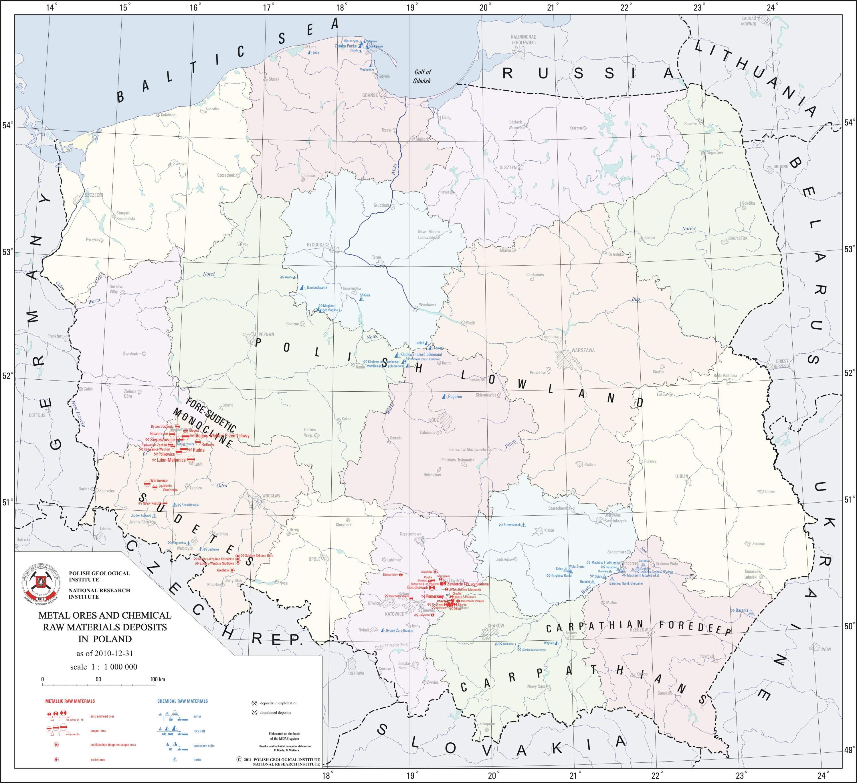
Metal ores and chemical raw materials deposits in Poland

map scale: 1:1,000,000
There are copper ores, zinc and lead ores, nickel ores, molibdenium-tungsten-copper ores and sulfur, rock salt, potassium salt and barite and fluorspar deposits in Poland presented on the map. Particular deposit is presented by graphic mark. Deposits of basic raw materials are distinguished. there are separeted maps - for copper ores, lead and zinc ores and sulfur where deposits are presented in more details.
Download map.
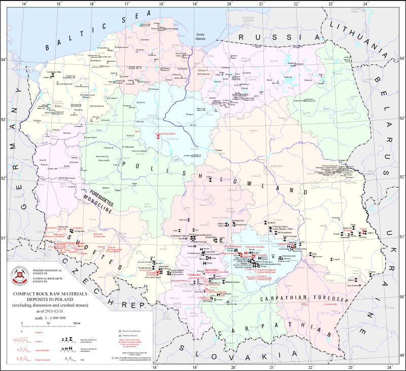
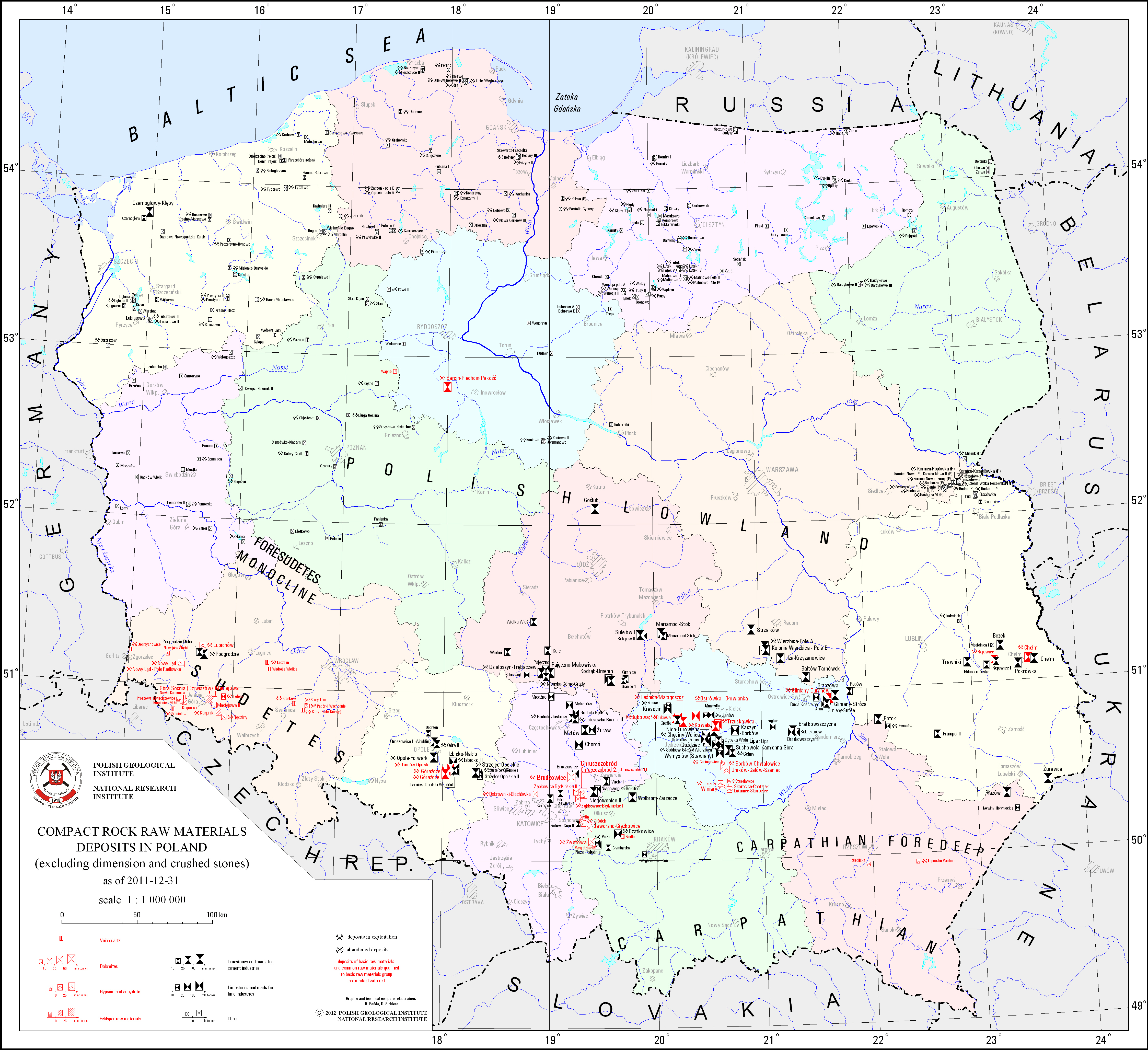
Compact rock raw materials deposits (excluding dimension and crushed stones)
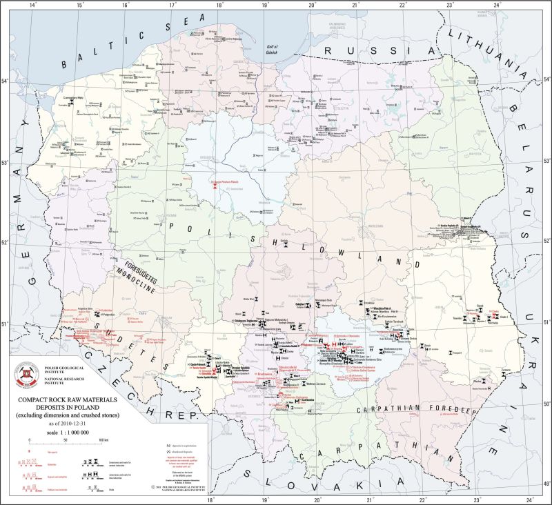
map scale: 1:1,000,000
There are compact rock raw materials deposits - dolomites, vein quartz, gypsum and anhydrite, feldspar, marls and limestones for cement and lime industries and chalk - in Poland presented on the map. There is also information on the state of development of particular deposit.
Download map.
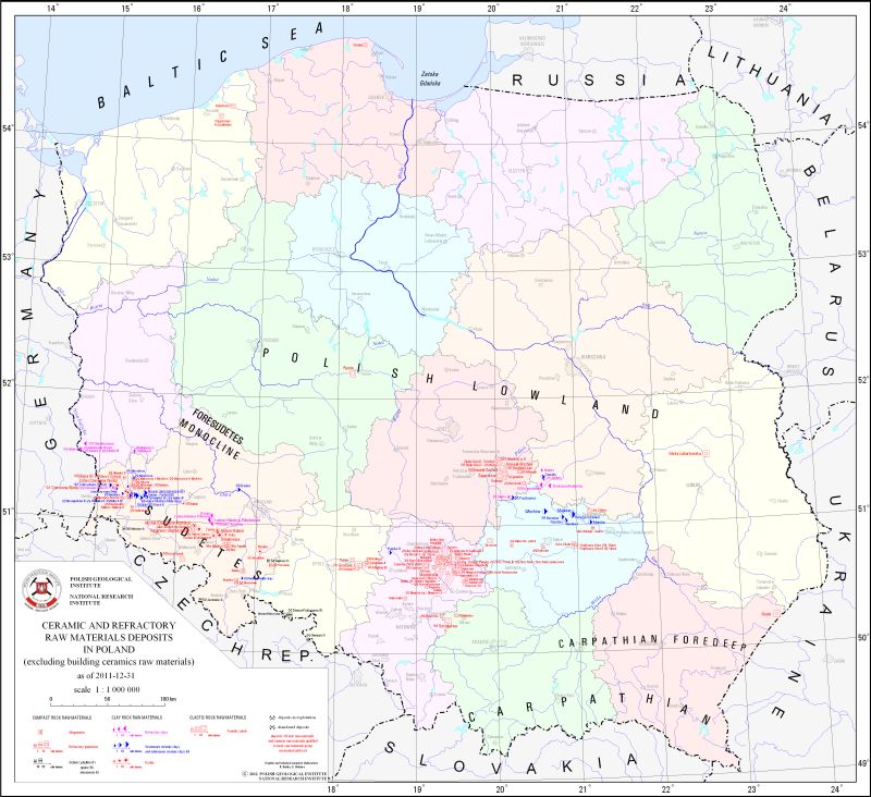
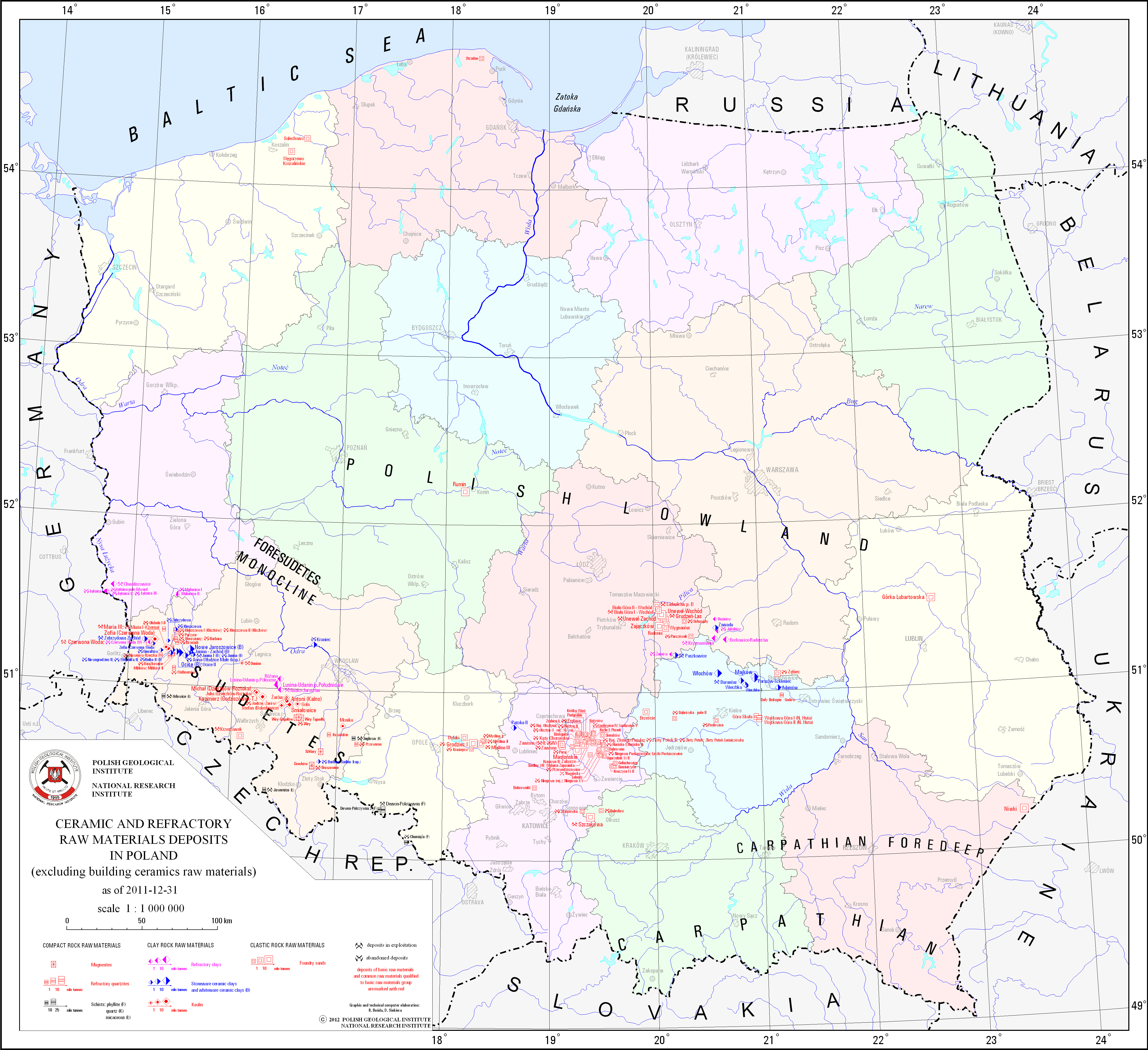
Ceramic and refractory raw materials deposits (excluding building ceramics raw materials)
map scale: 1:1,000,000
There are ceramic and refractory raw materials deposits - ceramic clays, refractory clays, kaolin, schists, refractory quartzites, magnesites and foundry sands - in Poland presented on the map. There is also information on the state of development of particular deposit.
Download map.
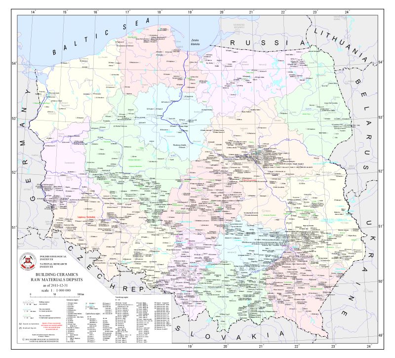
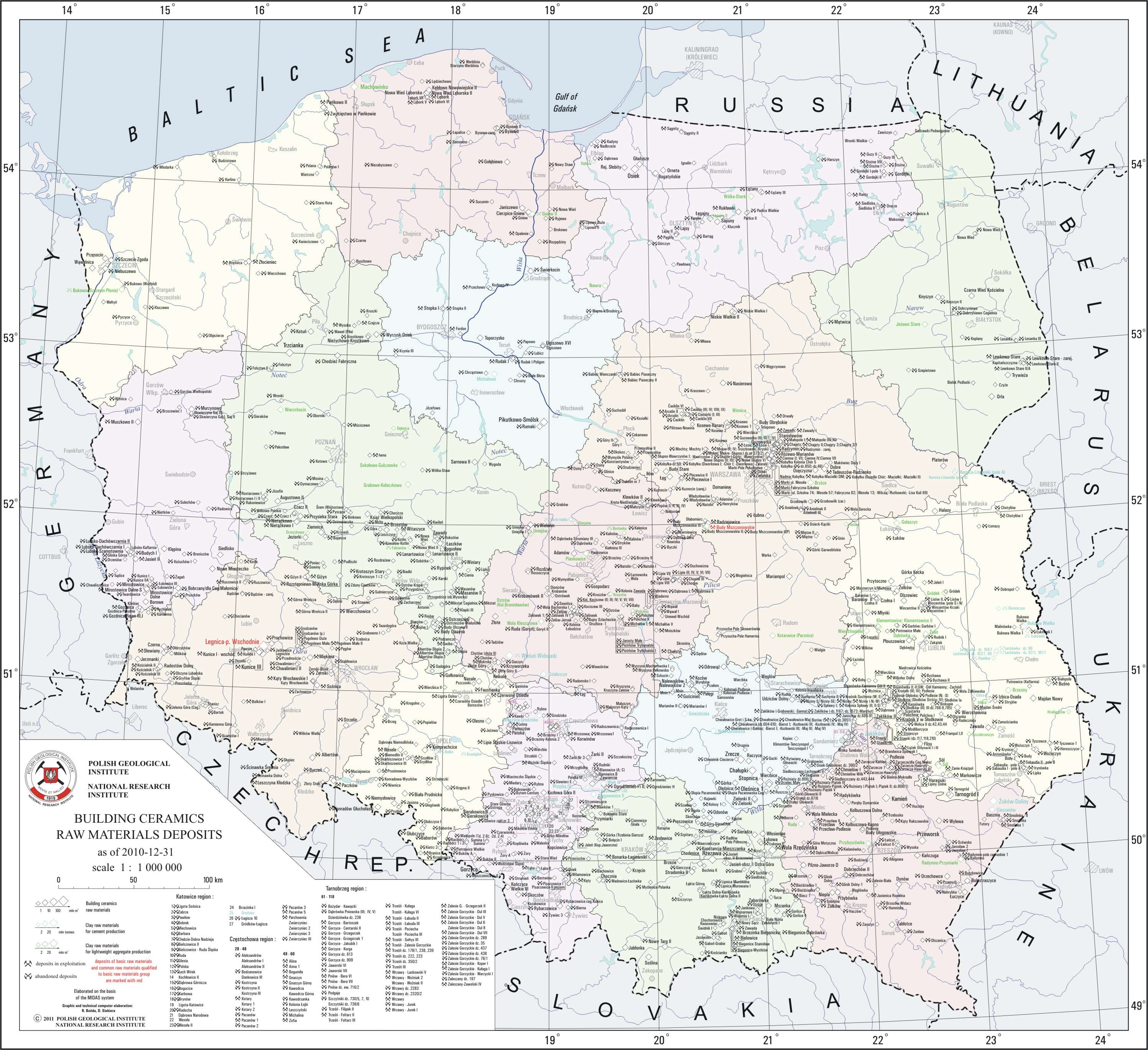
Building ceramics raw materials deposits
map scale: 1:1,000,000
There are building ceramics raw materials, clay raw materials for cement production and clay raw materials for lightweight aggregate production deposits in Poland presented on the map. There is also information on the state of development of particular deposit.
Download map.
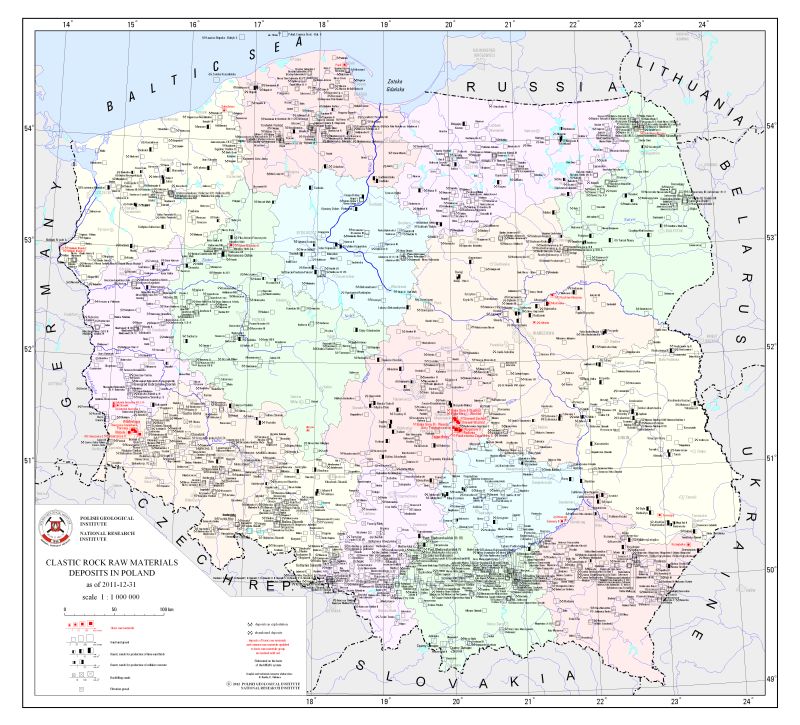
Clastic rock raw materials deposits
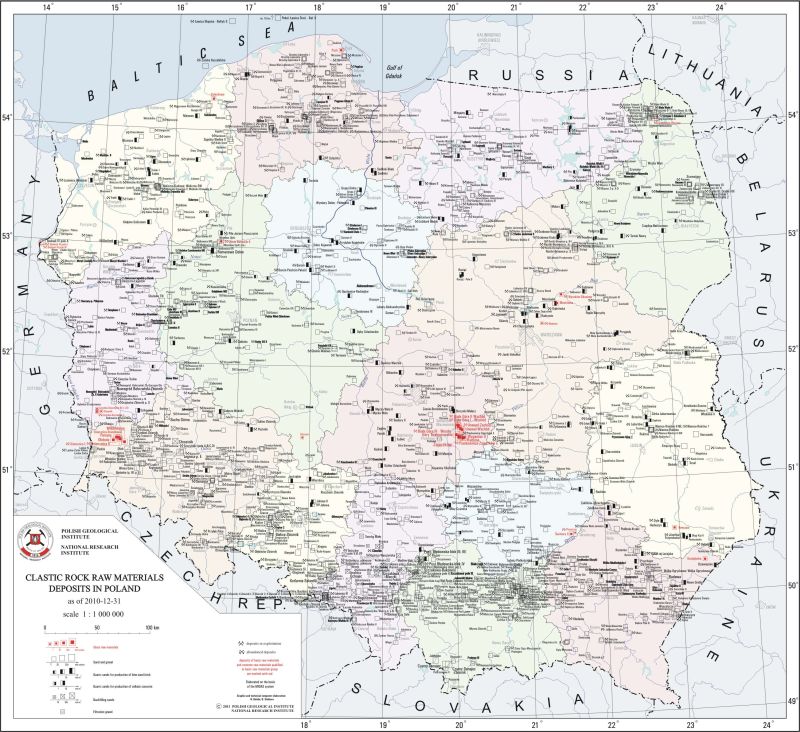
map scale: 1:1,000,000
There are clastic rock raw materials deposits - glass sands and sandstones, quartz sands for production of lime-sand brick, quartz sands for production of cellular concrete, backfilling sands, filtration gravel and sand and gravel - in Poland presented on the map. There is also information on the state of development of particular deposit.
Download map.