


The PGI-NRI has been collecting geological, raw material, geochemical and geophysical data from the studies of the Kenozik cover in Poland’s marine areas for over forty years. These data, are stored by the PGI-NRI Marine Geology Branch in NEPTUN and GEOECHO, databases and made available by the PGI-NRI National Geological Archive. Metadata of the GEOECHO database are integrated with the metabase of seismic and acoustic and sonar logs measured in the areas of the European seas by marine departments of European geological surveys. Work on the integration of the NEPTUN and GEOECHO bases with the Central Geological Database (CGDB) is now in progress. The PGI-NRI Marine Geology Branch has explored the geological structure of the bed in the Polish zone of the Baltic Sea and made basic geological maps of the Polish marine areas at medium scales and a detailed geodynamic map of the Polish Baltic Sea coast.
WE OFFER
- Compiling geological and geochemical maps of marine areas at various scales
- Preparing, at any scale, geological, hydrogeological, geoenvironmental, geological engineering, geochemical, geotourist maps of the Baltic Sea coast
Polish Geological Institute has constructed for the Polish zone of the Baltic Sea, among others:
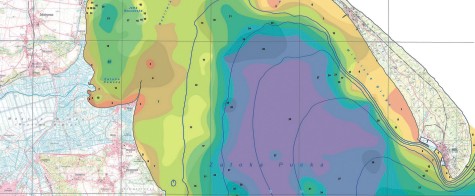
- Geological Map of the Baltic Seabed at a scale of 1:200,000
- Geological Map of the Baltic Seabed without Quaternary Measures at a scale of 1:500,000
- Geological Atlas of the Southern Baltic Sea at a scale of 1:500,000
- Atlas of the Lithological Parameters of the Superficial Deposits of the Southern Baltic Sea at a scale of 1:500,000
- Geochemical Atlas of the Southern Baltic Sea at the scale of 1:500,000
- Geochemical Atlas of the Vistula River Lagoon
- Geodynamic Map of the Polish Coastal Zone in the Baltic Sea at the scale of 1:10,000
The first three studies were given awards for joint work in the field of geology by the Minister of the Environment in the years: 1994, 2000, 1996.
More detailed geological, geochemical maps as well as maps of potential occurrence of mineral raw materials in selected regions of the Baltic Sea have been compiled in the recent years. In 2008, studies were completed and a set of various thematic maps of the Gdańsk Bay area was made. In 2008, similar studies began, focused on the area of the Pomeranian Bay This research project is to be finished in 2013.
We can offer integration and harmonization of geological maps of the European seas and geological databases as part of the initiatives taken by geological surveys OneGeology, EMODNET-geology i Geo-Seas.
CONTACT
Warsaw
National Geological Archive (NGA)
Section of Publications Distribution
tel. +48 22 45 92 403, +48 22 45 92 229
This email address is being protected from spambots. You need JavaScript enabled to view it.
Gdańsk
Gdańsk Branch of NGA in the PGI-NRI Marine Geology Branch
tel. +48 58 554 29 09 ext. 101, 103
Szczecin
Szczecin Branch of NGA in the PGI-NRI Pomeranian Branch
tel. +48 91 43 23 432