









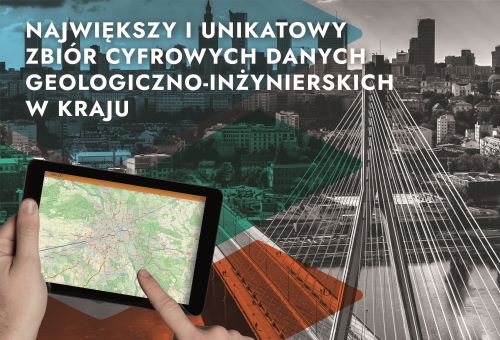
The Geo-Engineering Database (BDGI) is the largest and most unique collection of digital data in the country on construction conditions in selected areas of Poland.
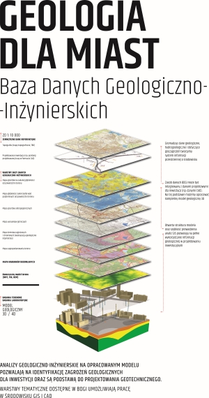
The BDGI consists of a borehole database (p-BDGI) and a spatial database (m-BDGI). It collects processed data from boreholes, results of tests on the physical and mechanical properties of soil and rock samples (BDGI-WFM), and BDGI GIS information layers. The data sources include geological-engineering, hydrogeological, and deposit documentation; geotechnical foundation conditions for structures; and the Central Geological Database.
- About project
- OBJECTIVES
- Methodology
- STATUS OF IMPLEMENTATION
- Results
- Data Access
- How to cite
- SIGNIFICANCE OF THE PROJECT
About project
TITLE OF THE PROJECT
Maintenance and updating of the Geo-Engineering Database (BDGI) and the Database of Physical and Mechanical Properties of Soils and Rocks (BDGI-WFM), along with the preparation of geo-engineering atlases of selected areas of the country at a scale of 1:10,000 (ongoing project) (2022 - 2026)
TIMEFRAME FOR THE CURRENT PHASE
01.10.2022 – 31.12.2026
CONTRACTING AUTHORITY/FUNDING AGENCY
Projects funded by the National Fund for Environmental Protection and Water Management (NFOŚiGW):
Maintenance and updating of the Geo-Engineering Database (BDGI), including the preparation of a Geo-Engineering Atlas of selected areas of the country at a scale of 1:10,000 (2013 - 2018)
Database of the physical and mechanical properties of the main lithogenic types of soils and rocks in Poland on a regional basis (2014 - 2017)
Maintenance and updating of the Geo-Engineering Database (BDGI) and the Database of Physical and Mechanical Properties of Soils and Rocks (BDGI-WFM), along with the preparation of Geological and Engineering Atlases of selected areas of the country at a scale of 1:10,000 (2018 - 2022)
Maintenance and updating of the Geo-Engineering Database (BDGI) and the Physical and Mechanical Properties of Soils and Rocks Database (BDGI-WFM), along with the preparation of geological and engineering atlases of selected areas of the country at a scale of 1:10,000 (ongoing task) (2022 - 2026)

CONTRACTOR
Polish Geological Institute - National Research Institute
RECIPIENTS
Local government agencies, companies in the geological and design sectors, investors, experts dealing with the broadly defined geological environment in the context of land-use planning and construction, as well as universities and research institutes
OBJECTIVES
The objective of this project is to carry out the tasks of the Polish Geological Survey (PSG) as defined in the Geological and Mining Law of June 9, 2011.
The objective of the project is to maintain (collect, make available, process, and archive) a unified Geo-Engineering Database (BDGI), the Database of Physical and Mechanical Properties of Soils and Rocks (BDGI-WFM), and the preparation of new Engineering-geological Atlases as well as feasibility studies for such atlases.
As part of efforts to promote knowledge of engineering geology, publications on engineering geology are issued, and an information service on engineering geology is maintained.
Maintaining the GeoEngineering Database (BDGI), linked to the Physical and Mechanical Properties Database (BDGI-WFM), and compiling Engineering-geological Atlases is in line with the directions of action specified in the National Urban Policy (KPM), which aims primarily to strengthen the capacity of cities and urbanized areas to foster sustainable development.
Methodology
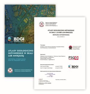
The current Guidelines for the Preparation of Atlases were developed in 2022 and are available for download: Geo-Engineering Atlases at a scale of 1:10,000 or smaller. Guidelines for Preparation (pdf)
STATUS OF IMPLEMENTATION
ATLASES
Geo-Engineering Atlases Completed Between 1998 and 2018
- Geo-Engineering Atlas of the Mazowieckie Voivodeship - Płock county (pilot project)
- Geo-Engineering Atlas of the Mazowieckie Voivodeship - Piaseczno county (pilot project)
- Geo-Engineering Atlas of the Bydgoszcz Metropolitan Area
- Geo-Engineering Atlas of the Koszalin Metropolitan Area
- Geo-Engineering Atlas of Selected Areas of the Polish Coastal Zone - rejon Kashubian Cliffs Region (Cetniewo-Jastrzębia Góra) (pilot project)
- Geo-Engineering Atlas of Selected Areas of the Polish Coastal Zone - Gdynia Cliffs Region (Oksywie-Babie Doły, Orłowo) (pilot project)
- Geo-Engineering Atlas of the Wałbrzych-Świebodzice- Kamienna Góra Metropolitan Area
- Geo-Engineering Atlas of the Łódź Metropolitan Area
- Geo-Engineering Atlas of the Rybnik-Jastrzębie Zdrój-Żory Metropolitan Area
- Geo-Engineering Atlas of the Wrocław Metropolitan Area
- Geo-Engineering Atlas of Poznań
- Geo-Engineering Atlas of the krakowskiej Metropolitan Area
- Geo-Engineering Atlas of the Gdańsk-Sopot-Gdynia Metropolitan Area
- Geo-Engineering Atlas of the Katowice Metropolitan Area
- Geo-Engineering Atlas of Warsaw
Geological and Engineering Atlases Completed in 2018 - 2022
- Geo-Engineering Atlas of Szczecin
- Geo-Engineering Atlas of Lublin-Świdnik
Geological and Engineering Atlases to Be Completed in 2022 - 2026
- Geo-Engineering Atlas of Białystok
- Geo-Engineering Atlas of Rzeszów
Geological and Engineering Atlases planned for completion starting in 2024
-
Geo-Engineering Atlas of Gorzów Wielkopolski
-
Geo-Engineering Atlas of Radom
FEASIBILITY STUDIES
Feasibility studies for geological and engineering atlases conducted between 2013 and 2017
-
Feasibility study for the preparation of the Geo-Engineering Atlas of the Lublin metropolitan area
-
Feasibility study for the preparation of the Geo-Engineering Atlas of the Szczecin metropolitan area
Feasibility studies for Geological and Engineering Atlases carried out between 2018 and 2021
- Feasibility Study for the Preparation of the Geo-Engineering Atlas of Białystok
- Feasibility Study for the Preparation of the Geo-Engineering Atlas of Bielsko-Biała
- Feasibility Study for the Preparation of the Geo-Engineering Atlas ofStudium wykonalności dla potrzeb sporządzenia Atlasu geologiczno-inżynierskiego Częstochowa
- Feasibility Study for the Preparation of the Geo-Engineering Atlas of Gorzów Wielkopolski
- Feasibility Study for the Preparation of the Geo-Engineering Atlas of Grudziądz
- Feasibility Study for the Preparation of the Geo-Engineering Atlas of Kalisz
- Feasibility Study for the Preparation of the Geo-Engineering Atlas o Kielce
- Feasibility Study for the Preparation of the Geo-Engineering Atlas of Legnica
- Feasibility Study for the Preparation of the Geo-Engineering Atlas of Olsztyn
- Feasibility Study for the Preparation of the Geo-Engineering Atlas of Opole
- Feasibility Study for the Preparation of the Geo-Engineering Atlas of Płock
- Feasibility Study for the Preparation of the Geo-Engineering Atlas of Radom
- Feasibility Study for the Preparation of the Geo-Engineering Atlas of Rzeszów
- Feasibility Study for the Preparation of the Geo-Engineering Atlas of Słupsk
- Feasibility Study for the Preparation of the Geo-Engineering Atlas of Tarnówa
- Feasibility Study for the Preparation of the Geo-Engineering Atlas of Toruń
- Feasibility Study for the Preparation of the Geo-Engineering Atlas of Włocławek
- Feasibility Study for the Preparation of the Geo-Engineering Atlas of Zielona Góra
Feasibility Studies for Geo-Engineering Atlases to Be Implemented in 2022 - 2026
- Feasibility Study for a Geological and Engineering Database for the Maritime Areas of the Republic of Poland
GEO-ENGINEERING BOREHOLE DATABASE (p-BDGI)
- Over 327,900 boreholes recorded between 1998 and 2017
- 90,520 boreholes recorded between 2018 and 2022
- 60,000 boreholes planned for recording between 2022 and 2026
SPATIAL GEO-ENGINEERING DATABASE (m-BDGI)
30 continuous GIS information layers covering all of Poland
DATABASE OF PHYSICAL AND MECHANICAL PROPERTIES OF THE MAIN LITHOGENETIC TYPES OF SOILS AND ROCKS IN POLAND (BDGI-WFM)
- 65,934 results of physical and mechanical tests of soil and rock samples entered between 1998 and 2017,
- 180,572 results of physical and mechanical tests of soil and rock samples entered between 2018 and 2022,
- 120,000 results of physical and mechanical tests of soil and rock samples planned for entry in 2022 - 2026.
Results
Tangible outputs:



BOREHOLES
The Geo-Engineering Database (BDGI) contains nearly 500,000 boreholes, including:
- 363,283 boreholes located within the areas covered by the Geo-Engineering Atlases,
- 55,526 boreholes drilled within the country (outside the Atlas areas), entered from geological and engineering documentation created since 2013,
- and over 77,500 boreholes from the Warsaw area in the form of Geotechnical Excavation Sheets.
The Geo-Engineering Borehole Database collects data on the stratigraphy, genesis, lithology, and physical and mechanical properties of the drilled soil and rock layers, macroscopic tests and designated geotechnical series (only for boreholes used in the creation of geotechnical atlases).
Borehole records contain information on location, x and y coordinates in the PL-1992 system, elevation (H), the investor, the client, the type and purpose of drilling, drilling dates, geological supervision, and other details, such as the documentation under which the drilling was performed.
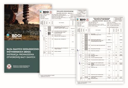
Since 2013, boreholes have been entered into a digital database in accordance with the Geo-Engineering Database (BDGI) manual. Instructions for maintaining the borehole database. Previously, the entry of boreholes was not standardized. Boreholes were digitized based on the experience of the database administrator.
Geotechnical Excavation Sheets in the Warsaw area that were not used in the preparation of the Geo-Engineering Atlas of Warsaw are stored in the database in scanned form.
ATLASES
The information contained in the Atlas supports the assessment of a site’s suitability for construction, the selection of the optimal location for a project, and the determination of land use for spatial planning purposes. The Atlas presents an assessment of geological and engineering conditions in the context of the regional geological structure, based on collected archival materials and the results of geological studies and surveys.
Geo-engineering atlases compiled between 1998 and 2012 (updated between 2013 and 2017)
The atlases were compiled between 1998 and 2012 and were updated (2013 - 2017) with regard to the maps and geological-engineering series, based on the following guidelines: “Geo-Engineering Atlases at a Scale of 1:10,000 or Smaller. Preparation Guidelines” and “Geo-Engineering Database. Guidelines for Maintaining a Borehole Database.”
Katowice
 Atlas of Katowice: The area covered by the Geo-Engineering Atlas of the Katowice Metropolitan Area spans 1,035 km². It includes the cities of the Upper Silesian metropolitan area: Będzin, Bytom, Chorzów, Czeladź, Dąbrowa Górnicza, Gliwice, Katowice, Mysłowice, Piekary Śląskie, Ruda Śląska, Siemianowice Śląskie, Sosnowiec, Świętochłowice, and Zabrze - LOCATION MAP.
Over 47,000 boreholes were selected from archival studies for the preparation of the Atlas - full text of the publication.
As part of the update, 14 maps were produced, including 3 maps at a scale of 1:100,000 and 11 maps at a scale of 1:10,000 (a total of 872 sheets).
The Atlas is available in:
Kraków
 Atlas of Kraków: The area covered by the Geo-Engineering Atlas of the Kraków metropolitan area spans nearly 380 km². It encompasses the city of Kraków, along with the northwestern part of the municipality of Wieliczka and the southeastern portions of the municipalities of Zabierzów and Wielka Wieś - LOCATION MAP.
More than 25,000 boreholes were selected from archival records for the Atlas, and 207 boreholes were drilled - full text of publication.
As part of the update, 14 maps were produced, including 3 maps at a scale of 1:100,000 and 11 maps at a scale of 1:10,000 (a total of 333 sheets).
The Atlas is available in:
Łódź
 Atlas of Łódź - The area covered by the Geo-Engineering Atlas of the Łódź Metropolitan Area spans over 505 km². It encompasses the territory of the Łódź City County and parts of the following districts: Eastern Łódź District (the municipalities of Nowosolna, Andrespol, Brójce, and Rzgów); Zgierz County (the municipalities of Zgierz-city, Aleksandrów Łódzki-city, and Aleksandrów Łódzki-rural municipality); and Pabianice County (the municipalities of Ksawerów, Pabianice-city, Pabianice, and Konstantynów Łódzki)- - LOCATION MAP.
For the preparation of the Atlas, over 27,100 boreholes were selected from archival studies, and 278 boreholes were drilled (totaling nearly 380,000 running meters) - full text of the publication.
As part of the update, 14 maps were produced, including 3 maps at a scale of 1:100,000 and 11 maps at a scale of 1:10,000 (a total of 366 sheets). The Atlas is available in:
The Atlas is available in:
Poznań
 Atlas of Poznań - The area covered by the Poznań Geo-Engineering Atlas spans approximately 450 km². It covers Poznań along with the area surrounding the city's borders (designated for future development), excluding restricted areas (the “Ławica” civilian airport and the “Krzesiny” military airport) - LOCATION MAP.
For the preparation of the Atlas, over 21,500 boreholes were selected from archival studies, and 219 boreholes were drilled - full text of the publication - full text of the publication.
As part of the update, 14 maps were produced, including 3 maps at a scale of 1:100,000 and 11 maps at a scale of 1:10,000 (a total of 343 sheets).
The Atlas is available in:
Rybnik
 Atlas of Poznań - The area covered by the Geo-Engineering Atlas of the Rybnik Metropolitan Area - Jastrzębie Zdrój - Żory covers an area of approximately 400 km². It encompasses the following cities and municipalities: Rybnik, Jastrzębie Zdrój, Żory, Wodzisław Śląski, Rydułtowy, Radlin, and Pszów - LOCATION MAP.
For the preparation of the Atlas, over 19,000 boreholes were selected from archival studies, and 280 boreholes were drilled - full text of the publication.
As part of the update, 15 maps were produced, including 3 maps at a scale of 1:100,000 and 12 maps at a scale of 1:10,000 (a total of 351 sheets).
The Atlas is available in:
Trójmiasto (Tri-City)
 Atlas of Trójmiasto - Tri-City Atlas - The area covered by the Geo-Engineering Atlas of the Tri-City metropolitan area spans over 417 km². It encompasses three cities: Gdańsk, Sopot, and Gdynia - LOCATION MAP.
For the preparation of the Atlas, over 20,500 boreholes were selected from archival studies - full text of the publication.
As part of the update, 14 maps were produced, including 3 maps at a scale of 1:100,000 and 11 maps at a scale of 1:10,000 (a total of 486 sheets).
The Atlas is available in:
Wałbrzych
 The area covered by the Geo-Engineering Atlas of the Wałbrzych - Świebodzice - Kamienna Góra metropolitan area spans over 380 km². It encompasses the counties of Kamienna Góra, Wałbrzych, and Świdnica, as well as the municipalities of Kamienna Góra (city), Kamienna Góra, Boguszów Gorce, Szczawno-Zdrój, Wałbrzych, Świebodzice, the city of Świdnica, and Świdnica - LOCATION MAP.
For the preparation of the Atlas, over 18,400 boreholes were selected from archival studies, and 289 boreholes were drilled (totaling nearly 159,000 running meters) - full text of the publication.
As part of the update, 14 maps were produced, including 3 maps at a scale of 1:100,000 and 11 maps at a scale of 1:10,000 (a total of 355 sheets).
The Atlas is available in:
Warsaw
 Atlas of Warsaw - The area covered by the Geo-Engineering Atlas of Warsaw spans nearly 494 km². It encompasses the capital city of Warsaw - LOCATION MAP.
For the preparation of the Atlas, over 27,000 boreholes were selected from archival studies, and 170 boreholes were drilled (totaling nearly 429,000 running meters) - full text of the publication.
As part of the update, 12 maps were produced, including 2 maps at a scale of 1:100 000 and 10 maps at a scale of 1:10,000 (a total of 412 sheets).
The Atlas is available in:
Wrocław
 Atlas of Wrocław - The area covered by the Geo-Engineering Atlas of Wrocław spans nearly 720 km². It encompasses the city of Wrocław (an urban county) and parts of the municipalities in Wrocław County that border it-Długołęka, Czernica, Święta Katarzyna, Żórawina, Kobierzyce, and Kąty Wrocławskie-as well as the municipality of Miękina in Środa County - LOCATION MAP.
For the preparation of the Atlas, over 50,000 boreholes were selected from archival studies, and 504 boreholes were drilled (totaling nearly 429,000 running meters) - full text of the publication.
As part of the update, 14 maps were produced, including 3 maps at a scale of 1:100 000 and 11 maps at a scale of 1:10,000 (a total of 542 sheets).
The Atlas is available in:
Geo-engineering atlases compiled between 2013 - 2017
The atlases were compiled between 2013 and 2017 based on the following guidelines: “Geo-Engineering Atlases at a Scale of 1:10,000 or Smaller: Guidelines for Preparation” and “Geo-Engineering Database. Instructions for Maintaining a Borehole Database," as well as on the basis of an approved geological works design.
Bydgoszcz
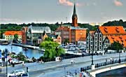 The area covered by the Geo-Engineering Atlas of the Bydgoszcz Agglomeration spans 782 km². It is located in the Kuyavian-Pomeranian Voivodeship and encompasses the City of Bydgoszcz as well as parts of the municipalities in Bydgoszcz County: Osielsko (entire municipality), Białe Błota, Dobrcz, Dąbrowa Chełmińska, Koronowo, Sicienko, and Solec Kujawski - LOCATION MAP.
For the preparation of the Atlas, over 17,106 boreholes were selected from archival studies, and 1,434 boreholes were drilled (totaling 181,300 running meters) - full text of the publication.
As part of the project, 14 maps were produced, including 3 maps at a scale of 1:100,000 and 11 maps at a scale of 1:10,000 (a total of 685 sheets).
The Atlas is available in:
Gdynia Cliff
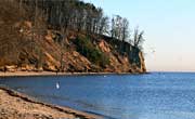 Atlas of the Gdynia Cliffs - The area covered by the Geo-Engineering Atlas of the Gdynia Cliffs Region (Oksywie - Babie Doły, Orłowo) spans approximately 4.1 km², including approximately 2.2 km² of the Oksywie Cliff and 1.9 km² of the Orłowo Cliff. It is located in the Pomeranian Voivodeship, almost entirely within the city of Gdynia. Only the northern part of the Oksywie - Babie Doły section lies within Puck County, in the Kosakowo Municipality - LOCATION MAP.
For the preparation of the Atlas, 89 boreholes were selected from archival studies, 108 boreholes were drilled, and 232 boreholes from the Geo-Engineering Atlas of the Tri-City Agglomeration (Gdańsk - Sopot - Gdynia) were incorporated (totaling 5,624.47 running meters) - full text of the publication. - full text of the publication.
As part of the project, 14 maps were produced, including 3 maps at a scale of 1:50,000 and 11 maps at a scale of 1:5,000 (a total of 58 sheets).
The Atlas is available in:
Kashubian Cliff
 The area covered by the Geo-Engineering Atlas of the Kashubian Cliffs Region (Cetniewo - Jastrzębia Góra) spans approximately 3.62 km². It is located in the Pomeranian Voivodeship, Puck County, within the urban-rural municipality of Władysławowo - LOCATION MAP.
For the preparation of the Atlas, 135 boreholes were selected from archival studies, and 145 boreholes were drilled (totaling 4,660 running meters) - full text of the publication.
As part of the project, 14 maps were produced, including 3 maps at a scale of 1:50,000 and 11 maps at a scale of 1:5,000 (a total of 58 sheets).
The Atlas is available in:
Koszalin
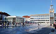 The area covered by the Geo-Engineering Atlas of the Koszalin Agglomeration spans over 330 km². It is located in the West Pomeranian Voivodeship and encompasses the City of Koszalin as well as parts of the municipalities in Koszalin County: Mielno (entire municipality), Sianów, Manowo, Świeszyno, and Bonin - LOCATION MAP.
For the preparation of the Atlas, over 11,400 boreholes were selected from archival studies, and 1,000 boreholes were drilled (totaling nearly 90,000 running meters) - full text of the publication.
As part of the project, 14 maps were produced, including 3 maps at a scale of 1:100,000 and 11 maps at a scale of 1:10,000 (a total of 355 sheets).
The Atlas is available in:
Piaseczno County
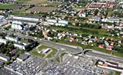 The area covered by the Geo-Engineering Atlas of Piaseczno County spans over 621 km². It is located in the Masovian Voivodeship. The county borders the City of Warsaw to the north, Grójec County to the south, Otwock County (across the Vistula River) to the east, and Pruszków and Grodzisk Mazowiecki Counties to the west. Piaseczno County comprises six municipalities: the rural municipalities of Lesznowola and Prażmów, and the urban-rural municipalities of Piaseczno, Konstancin-Jeziorna, Góra Kalwaria, and Tarczyn - LOCATION MAP.
For the preparation of the Atlas, over 11,176 boreholes were selected from archival studies, and 16 boreholes were drilled (totaling 200 running meters) - full text of the publication.
As part of the project, 12 maps were produced, including 3 maps at a scale of 1:100,000 and 9 maps at a scale of 1:10,000 (a total of 542 sheets).
The Atlas is available in:
Płock county
 The area covered by the Geo-Engineering Atlas of the Masovian Voivodeship - Płock County (pilot project) spans over 1,700 km². The study area is located in the Masovian Voivodeship and covers the entire Płock County, excluding the city of Płock, which has county status - LOCATION MAP.
For the preparation of the Atlas, over 8,905 boreholes were selected from archival studies, with a total drilled length of 68,720.47 running meters - full text of the publication.
As part of the project, 14 maps were produced, including 3 maps at a scale of 1:150,000 and 11 maps at a scale of 1:10,000 (a total of 1,400 sheets).
The Atlas is available in:
Geo-engineering atlases compiled between 2018 - 2022
The atlases were compiled between 2018 and 2022 based on the following guidelines: “Geo-Engineering Atlases at a Scale of 1:10,000 or Smaller: Guidelines for Preparation” and “Geo-Engineering Database. Instructions for Maintaining a Borehole Database," as well as on the basis of an approved geological works design.
Lublin-Świdnik
 Świdnik Agglomeration - The area covered by the Geo-Engineering Atlas of the Lublin - Świdnik Agglomeration spans 463.08 km². It is located in the Lublin Voivodeship and encompasses the Cities of Lublin and Świdnik as well as parts of the municipalities in Lublin County: Niemce, Wólka (entire municipality), Głusk (entire municipality), Konopnica (entire municipality), Jastków, and in Świdnik County: Świdnik (entire municipality) and Mełgiew - LOCATION MAP.
For the preparation of the Atlas, nearly 25,830 boreholes were selected from archival studies, and 1,305 boreholes were drilled (totaling nearly 203,990 running meters) - full text of the publication.
As part of the project, 14 maps were produced, including 3 maps at a scale of 1:100,000 and 11 maps at a scale of 1:10,000 (a total of 374 sheets).
The Atlas is available in:
Szczecin
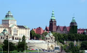 The area covered by the Geo-Engineering Atlas of Szczecin spans 648.4 km². It is located in the West Pomeranian Voivodeship and encompasses the City of Szczecin as well as parts of the municipalities in Police County (Dobra, Kołbaskowo, Police), Goleniów County (Goleniów), and Gryfino County (Gryfino) - LOCATION MAP.
For the preparation of the Atlas, over 24,160 boreholes were selected from archival studies, and 1,765 boreholes were drilled (totaling nearly 249,000 running meters) - full text of the publication.
As part of the project, 14 maps were produced, including 3 maps at a scale of 1:100,000 and 11 maps at a scale of 1:10,000 (a total of 608 sheets).
The Atlas is available in:
BDGI-WFM DATABASE
The work was carried out between 2014 and 2017 as part of a project by the Polish Geological Survey titled “Database of Physical and Mechanical Properties of the Main Lithogenic Types of Soils and Rocks in Poland at the Regional Level” (BDGI-WFM). The basis for carrying out the work under the BDGI-WFM project was the “Plan of Tasks of the Polish Geological Survey, to be implemented in 2014 and subsequent years,” approved by the Minister of the Environment. The project was financed from the National Fund for Environmental Protection and Water Management pursuant to a grant agreement.
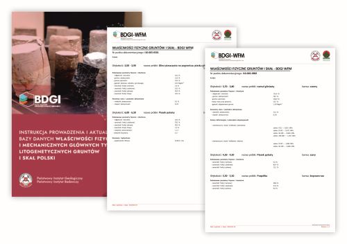
As part of this project, the Database of Physical and Mechanical Properties (BDGI-WFM) was created, which collects data on the physical and mechanical properties of soils and rocks found in Poland. The BDGI-WFM contains information on the location, date, and contractor of each data point, the number of samples collected, their category and type, and the measured parameters, along with an indication of the classification standards used. The BDGI-WFM database is an integral part of the borehole database of the Geo-Engineering Database (BDGI) and, as such, can be updated on an ongoing basis with data from studies conducted for the BDGI project.
The structure of the BDGI-WFM database was designed with a focus on compatibility with existing resources and products developed in parallel as part of other projects of the Polish Geological Survey carried out at PGI-NRI and funded by the National Fund for Environmental Protection and Water Management (NFOŚiGW). To ensure the highest level of standardization for the database being created, proven IT products that have been in use for many years were utilized, and new solutions implemented during other projects were applied. To support the database’s further development, tools were created to enable its conversion to the standards of the globally used Oracle relational database management system.
As part of this project, the following data were entered into the database:
- 65,934 results of physical and mechanical tests of soil and rock samples collected between 2014 and 2017,
- 180,572 results of physical and mechanical tests of soil and rock samples collected between 2018 and 2022.
Between 2022 and 2026, it is planned to enter 120,000 results of physical and mechanical tests of soil and rock samples.
Information on the properties of the soil and rock matrix comes from laboratory tests conducted as part of geological work during the preparation of geological and engineering documentation. The data comes from selected areas of Poland, located at 36,313 documentation points. The data sources include archived geological and engineering documentation from 2013 and later, as well as data from geo-engineering atlases.
As part of an effort to promote knowledge of engineering geology, a publication titled „Warunki geologiczno-inżynierskie na obszarze Polski (eng. Geological-Engineering Conditions of Poland)” by Prof. Ryszard Kaczyński, Ph.D., was released.
Data Access
The data is available for download via the GeoLOG, app, which is available free of charge for mobile devices on Google Play and App Store as well as through Portal CBDG - Geologia, under the BUILDING tab.
The information collected in the Geo-Engineering Database (BDGI) is for reference purposes only and under no circumstances should it replace the need to conduct geological and engineering surveys or geotechnical investigations. The data is intended for use at a scale of 1:10,000 and smaller (e.g., 1:25,000, 1:50,000, 1:100,000).
The Geo-Engineering Database (BDGI) serves, among other things, as a repository of borehole geological and engineering data derived from archival records. The provider assumes no liability for any errors in the information provided. It is recommended that the information be used for reference purposes only and that a detailed analysis of the source archival materials (as available) be conducted, along with fieldwork.
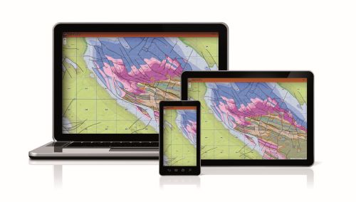
Mobile app GeoLOG

Map portal Geologia
CBDG GIS
Download Manager
How to cite
When using any data from the BDGI website, please follow the citation guidelines below.
DATABASE
Organization, year (as of access date) - database name, place of publication (access date)
Example
BDGI, 2025 - Geo-Engineering Database,, https://www.pgi.gov.pl/inzynierska/1-geologia-inzynierska/gi-projekty/13168-baza-danych-geologiczno-inzynierskich.html (accessed October 31, 2025)
SIGNIFICANCE OF THE PROJECT
In accordance with Article 162(1) of the Geological and Mining Law, the Polish Geological Survey (PSG) carries out the state’s tasks in the field of geology. The specific tasks of the Polish Geological Survey are set forth in Article 162(1), items 1 - 12, and in Article 162(2) of the Geological and Mining Law. This project falls within the scope of the tasks listed in Article 162(1), items 3, 4, and 7, of the Geological and Mining Law. The implementation of this task aligns with the action priorities set forth in the Sustainable Development Goals and the National Urban Policy. The Sustainable Development Goals are an action plan for transforming the world so that the needs of the current generation can be met in a sustainable manner, with respect for the environment and consideration for the needs of future generations. The Sustainable Development Goals are set forth in the document titled “Transforming our world: the 2030 Agenda for Sustainable Development,” which was adopted by the UN General Assembly. The implementation of the PSG task will support the following goals:
- Goal 7. Ensure access to affordable, reliable, sustainable and modern energy for all
- Goal 9. Build resilient infrastructure, promote inclusive and sustainable industrialization and foster innovation
- Goal 11. Make cities and human settlements inclusive, safe, resilient and sustainable
- Goal 13. Take urgent action to combat climate change and its impacts
The primary objective of the National Urban Policy, however, is to strengthen the capacity of cities and urban areas to foster sustainable development. This means that the Polish Geological Institute - National Research Institute, which serves as the polish geological survey under the supervision of the minister responsible for the environment, will, in carrying out the proposed task, support the achievement of the Sustainable Development Goals and the policy directions set forth in the National Urban Policy.
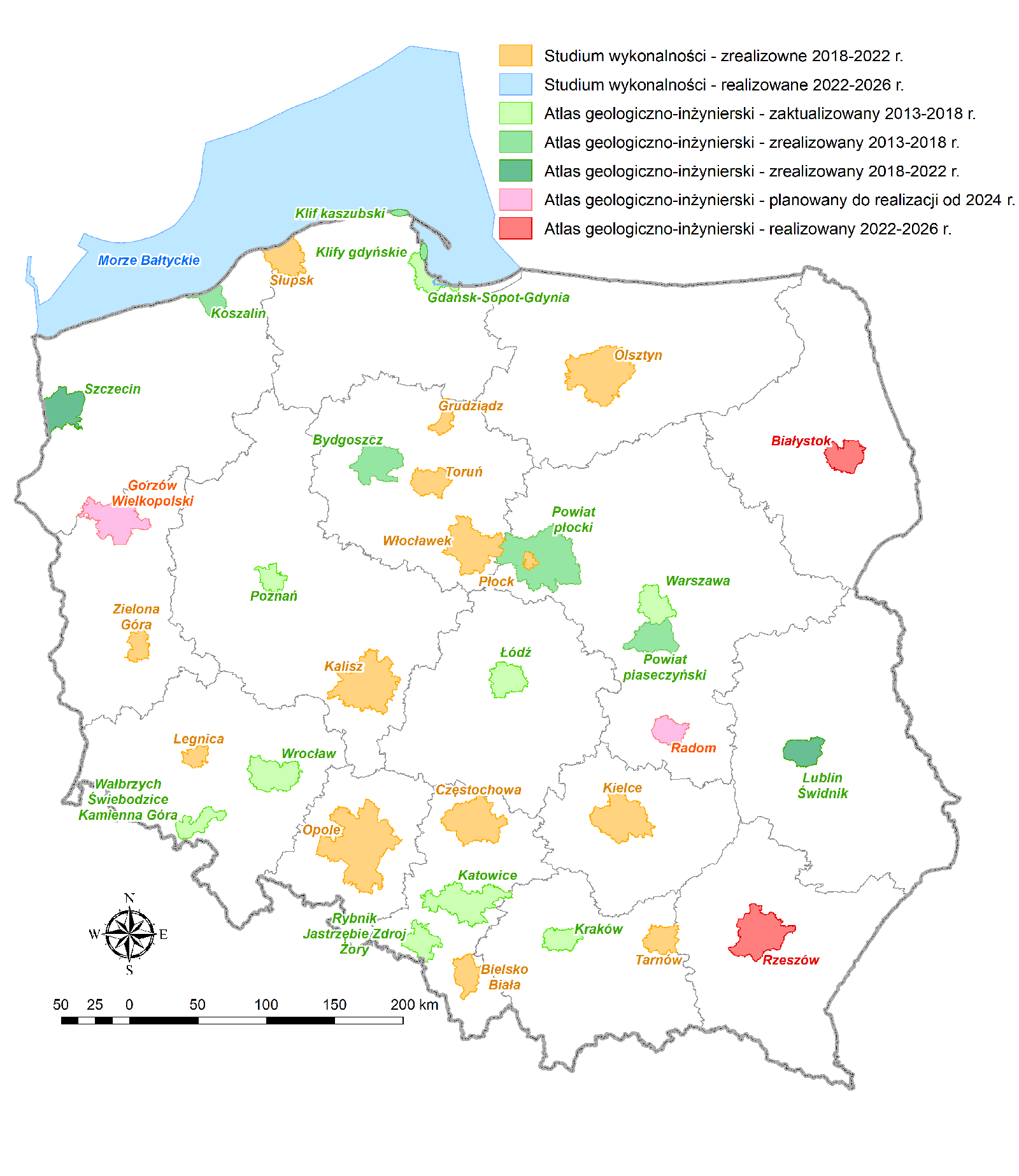
The Polish Geological Institute - National Research Institute has been developing the Geo-Engineering Database and Geo-Engineering Atlases of selected areas of the country since 1998. The first nine databases and atlases were completed by 2012. Another 6 were created as part of a research project conducted between 2013 and 2018. Furthermore, a project has been underway since 2018 that will result in an additional 2 atlases and 18 feasibility studies (the areas are shown on the attached map).
The continuity and systematic nature of its work reflect the Polish Geological Survey's response to the needs of state and local government agencies, investors, designers, and private geological companies operating in the investment and construction sectors and involved in urban planning and spatial planning, as well as citizens, whom we inform about the importance of detailed geological surveys of the terrain and the benefits that can be derived from the potential of the geological environment. It should be noted that the PSG project (since 2013) titled the Geo-Engineering Database (BDGI) and its accompanying database of the physical-mechanical properties of soils and rocks (BDGI-WFM), comprise over 300,000 boreholes and more than 3,200 sheets of geological-engineering and thematic maps at a scale of 1:10,000, stored on the CBDG servers at PGI-NRI. This is a vast resource of geological information intended for land-use planning and directly applicable in construction in urban areas, as well as for assessing the impacts of climate change. Another application of the BDGI database is the planning of sustainable use of underground space in urban areas, including the use of low-temperature geothermal energy.
The case for continuing this project is supported by the fact that it covers the largest urban agglomerations (Warsaw, the Tri-City, Kraków, Poznań, Wrocław, Rybnik-Jastrzębie Zdrój-Żory, Łódź, Wałbrzych, Bydgoszcz, Koszalin, Lublin, Szczecin, and others). These metropolitan areas cover only about 1% of Poland’s total area, but the population living in them accounts for about 18% of the country’s total population. The future of the country lies in urban development (see the concept of “Smart Cities - Resilient Cities”). Already today, Poland’s 18 largest cities generate nearly half of the country’s GDP (data from the Statistics Poland [GUS]); therefore, to ensure and support their sustainable development, it is reasonable to compile geological and engineering databases and atlases for them.
In addition to the geological boreholes collected in the National Geological Archive, the Geo-Engineering Database also includes geotechnical data (results of documentation of geotechnical foundation conditions and results of physical and mechanical tests of rocks and soils). Failure to include the collection of engineering geology data within the scope of the PSG tasks will result in the irreversible loss of information on shallow geology, which, under current legal and regulatory conditions, is not subject to any other forms of archiving or processing. The objective of the task is to increase access to digital geological data in the field of engineering geology. The results of the project will be made available in the form of PDF and SHP files, as well as WFS, WMS, and API services on the PGI-NRI websites; they will also be incorporated into the Central Geological Database (CBDG) and will expand the resources of the National Geological Archive (NAG).
 PGI-NRI offer
 Mineral resources of Poland
  Oil and Gas in Poland


 Subscribe to RSS Feed