


 Nowadays, it is difficult to find a sector of economy in which unmanned aerial vehicles (UAV’s) - drones - are not used. They are used, among others, in construction, agriculture, transport, rescue, sports and advertising, and their use is becoming more common every year.
They are also perfect for scientific research, including more and more often in geology. Polish Geological Institute - NRI uses drones for geological mapping, geological and engineering documentation, monitoring of mass movements of landslides and in the Baltic coastal area and for inventories of mining excavations.
Geodetic and cartographic data in the form of maps play an important role in geoengineering documentation, which are used as a location basis for geological work. Currently, a great potential in this area is demonstrated by drones, which quickly allow for precise measurements, with an accuracy of even several centimeters. Moreover, a great advantage of photogrammetric flights with the use of drones is their relatively low price and few limitations - under good weather conditions (no rainfall and strong winds) drones can reach practically anywhere. Within a few minutes, a drone, controlled from a cell phone with a dedicated application, is able to acquire data for several hectares of study area.
Point cloud, digital elevation model (DEM), foliage projective cover model (PFCM), and digital orthophotomosaic can be extracted from longitudinal and transverse coverage images acquired during flights using photogrammetric software. These products are georeferenced and cartometric, meaning that point, line, or area measurements can be made on them and compared to other georeferenced data in GIS and BIM software.

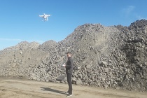
Unmanned aerial vehicle (UAV) in the study area
The following are opportunities to use drone flights during four (of the eight) stages of geoengineering documentation.
Gathering available field information
During a field inspection, using a UAV makes it possible to take photographic documentation, which will allow the verification of cartographic archival materials. Its purpose is to check the conformity of terrain morphology (including anthropogenic forms, such as waste heaps, excavations), localization of geodynamic processes (landslides, slope washouts), assessment of current land use (buildings, roads, etc.) and verification of feasibility of initially planned survey points. Moreover, by means of photogrammetric flight it is possible to obtain information on new infrastructure and undocumented forms of land development without the need to enter the sometimes inaccessible terrain.
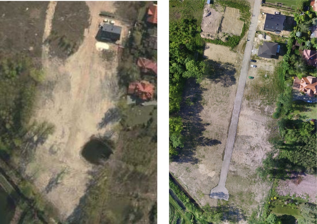
Comparison of orthophoto validity from the National Geodetic and Cartographic Resource with the UAV terrain photo
Research design
Up-to-date and well-resolved orthophotomosaics and numerical terrain model acquired during the on-site visit facilitate the process of designing research points and sequences along the assumed section lines and allow the verification of their locations in terms of accessibility of the area for research equipment.
Implementing tests
In the course of geoengineering mapping an unmanned aerial vehicle may serve as a tool for photographic documentation of e.g. natural and anthropogenic exposures, geodynamic processes and adverse geological phenomena, areas of mining and construction damage and floods. After processing the obtained data may help in the identification of morphological forms whose genesis is difficult to determine unambiguously in the field.
At this stage of documentation, orthophotomosaics can be used to design routes and to map the extent of selected geological formations, with the numerical terrain model helping to identify and define the boundaries of morphological forms. It can also provide information on the spatial orientation of areas with slopes of dangerous angle, meaning more than 10°.
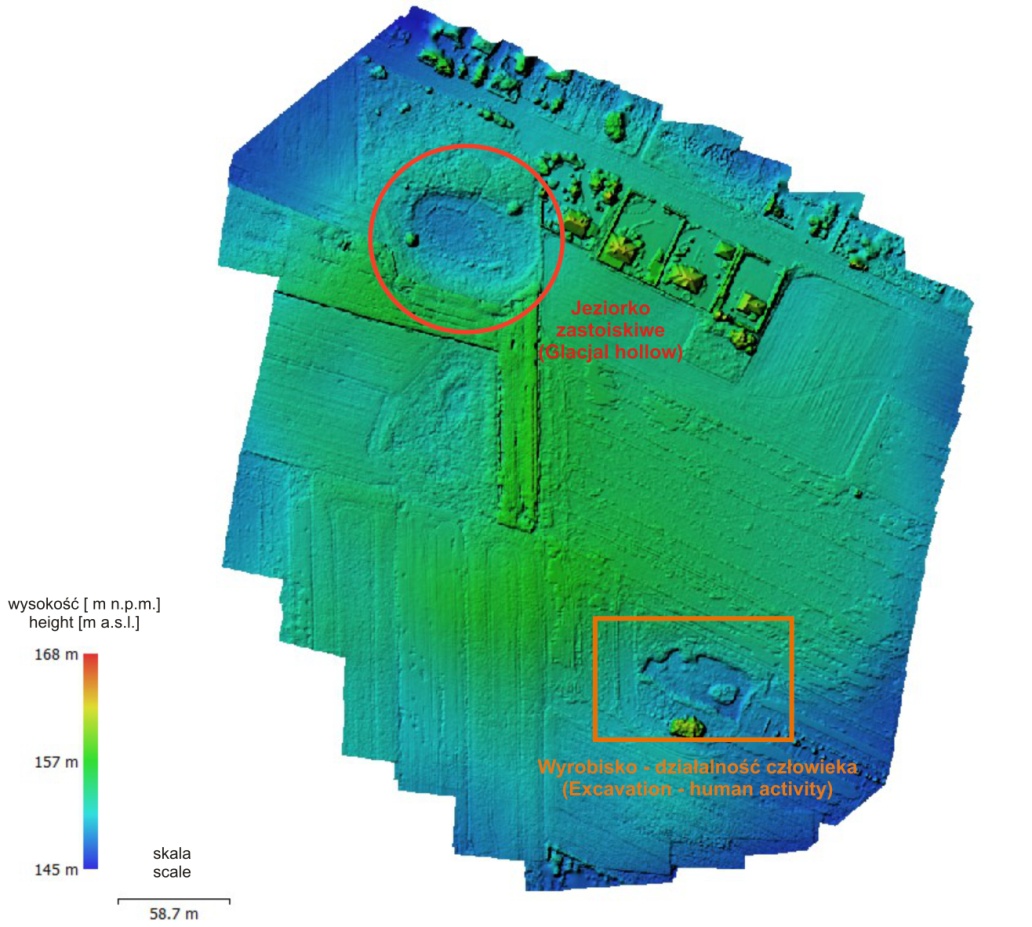
Identification of morphological forms from a UAV flight
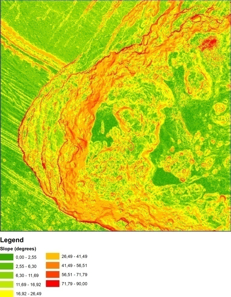
Example of terrain gradient map made from a UAV flight
Presentation of test results
When presenting the results of research, products such as orthophotomosaics and numerical terrain models can serve as a cartometric basis for documentation maps and thematic maps - for example, geomorphological, flood-prone areas, mine pits, and others.
With the help of GIS or BIM software, creating maps based on such primers becomes easier and less labor intensive..
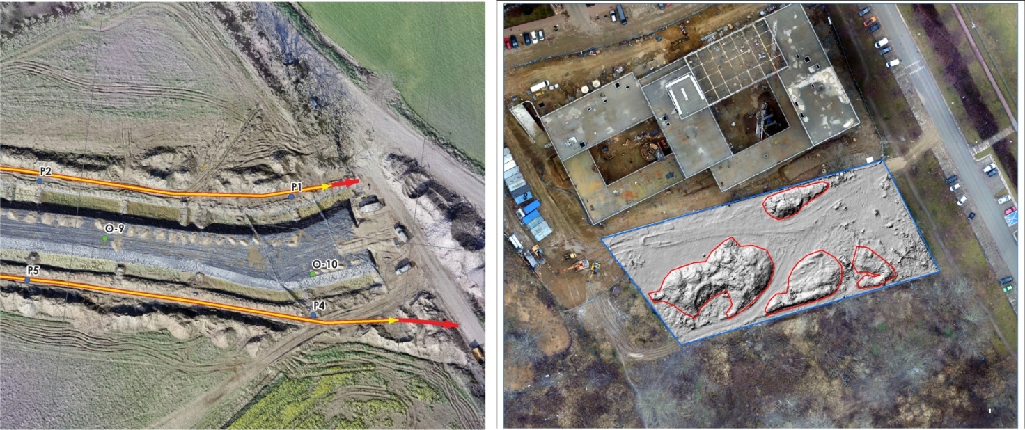
Examples of maps using products from a UAV
In order to check the accuracy at which one can obtain spatial data (plane geodetic coordinates and ordinates) from UAV flights for the purpose of geoengineering documentation in low visibility conditions, geologists from the Polish Geological Institute – NRI carried out an experiment. They carried out flights with an unmanned aerial vehicle with a 4000x3000 pixel camera at an altitude of 50 meters on an area of about 9 hectares. They generated a dense point cloud from the acquired 138 images with longitudinal and transverse coverage of 80%, and then made a numerical land cover model with a resolution of 8 cm/pixel and orthophotomosaics with a resolution of 2 cm/pixel.
An accuracy analysis was performed based on control point - places with limited visibility - centers of concrete slabs placed in prefabricated well coils. Coordinates obtained from direct GNSS-RTN measurement were compared with measurements on the model created from the air raid. The analysis shows that cartometric measurements with accuracy of more than 0.1 m can be performed on models created from photographs obtained from flights by unmanned aerial vehicles. Such results can be obtained by selecting appropriate flight parameters (e.g., flight altitude and speed, and the percentage of transverse and longitudinal coverage of the images), as well as camera resolution.
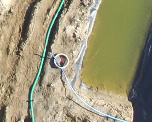
Photo of a checkpoint from a UAV flight
Prepared by: Editors on the basis of an article: A. Piechota, A. Sobótka- Zastosowanie bezzałogowych statków powietrznych w dokumentowaniu geologiczno-inżynierskim, Przegląd Geologiczny tom 69, 12/2021
Translated by: Tomasz Trzpil
![]()
This article was prepared under the project titled "National cooperation in the field of geology and promotion of activities of the Polish Geological Survey in 2021-2023" and was financed by the National Fund for Environmental Protection and Water Management.
 PGI-NRI offer
 Mineral resources of Poland
  Oil and Gas in Poland


 Subscribe to RSS Feed