


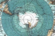
 In 2025, one of the initiated tasks of the State Geological Survey is the project entitled ‘Pilot work in the vicinity of the H. Arctowski and Carlini polar stations - testing and integration of research methods. Phase I’. The aim is to fill in the gaps in the geological recognition of the northern part of the South Shetland Islands, i.e. Nelson Island, King George Island, Elephant Island and several minor islands in the area.
During the implementation, geophysical methods will be significantly used to image the geological structure also under the ice domes. Isotopic dating of selected rocks, geochemical analyses and analyses of petrophysical parameters are planned in accessible areas.
The first phase of work, which has already begun, concerns two areas of King George Island (Isla de 25 Mayo) located in the vicinity of the Argentine ‘Carlini’ Polar Station and the Polish Henryk Arctowski Polar Station.
The project is possible thanks to close cooperation with the Argentine Mining Institute (Servicio Geológico Minero Argentino - SEGEMAR), which acts as the country's national geological service and is mainly concerned with its country's resource exploration. In West Antarctica, Argentina has more than a dozen polar bases and the Almirante Irizar icebreaker that serves them. Without such support, our researchers would have to limit their activities largely to the vicinity of the Henryk Arctowski Station.
Poland's international position as a signatory to the Antarctic Treaty depends not only on having polar bases, but above all on the scope of research conducted there. The PGI-NRI has been making a significant contribution to this very element since 2007.
The present stage of the project will end in mid-2026. Its tangible effect, apart from obtaining a large set of geophysical and other data from the field of geochemistry and isotopic analyses, will be guidelines on how to implement its subsequent stages in the most effective way.
Within the framework of this phase of the project, in mid-January 2025, a team of geologists from the Polish Geological Institute - National Research Institute, under the substantive leadership of Prof. dr hab. Jerzy Nawrocki, set off for Antarctica for the first expedition (and at the same time the fifth, whose destination is King George Island, located in West Antarctica). The return from the expedition took place at the beginning of March 2025. In addition to carrying out research work at the Henryk Arctowski Polish Antarctic Station, the PGI-NRI team mainly explored the areas around the ‘Carlini’ station.
The expedition focused on integrating research methods in geological mapping of ice-covered areas using geophysical techniques. The work involved, among other things, transferring geological data from sections of coastline devoid of ice cover to ice-covered areas of which we have only limited knowledge. Of particular value are the data on the ice thickness of the analysed area made available by the Institute of Biochemistry and Biophysics of the Polish Academy of Sciences. The expedition leader, Prof. dr hab. Jerzy Nawrocki, took three geologists to Antarctica: Weronika Czarnecka, responsible for preparing samples for geochemical and petrological research, mgr Marcin Olkowicz, who operated a drone with a magnetometer, and dr inż. Jakub Bazarnik, an experienced geologist and polar explorer. Thanks to this team structure, the work initiated by Prof. dr hab. Jerzy Nawrocki can be continued in the future by a younger generation of scientists.
The analyses initiated during the expedition will then be carried out, upon return, in the Institute's laboratories. Their results will allow assessment of the geological structure of the study area, including determination of the rocks' age. The collected data will allow interpretation of magnetic curves and analysis of anomalies. The research will result in geological-geophysical models and a set of geochemical and petrological data on the studied rocks.
If suitable minerals will be found, it will also be possible to determine their precise age. Cooperation with the Argentine Geological Survey will produce valuable guidelines for geological mapping of ice-covered areas.
 PGI-NRI offer
 Mineral resources of Poland
  Oil and Gas in Poland


 Subscribe to RSS Feed