
Acreage: 1,034.29 km2; 255,578 acres
Concession blocks: 209 and 229
Coordinates
| No. point | x [PUWG92] | y [PUWG92] |
| 1 | 515069,73 | 460758,48 |
| 2 | 505767,09 | 460565,18 |
| 3 | 502776,43 | 462823,39 |
| 4 | 502723,58 | 462657,47 |
| 5 | 502446,74 | 462504,16 |
| 6 | 502230,96 | 462445,82 |
| 7 | 502248,18 | 463222,26 |
| 8 | 498777,52 | 465842,91 |
| 9 | 491508,73 | 465830,81 |
| 10 | 491742,58 | 464701,41 |
| 11 | 491801,77 | 462529,31 |
| 12 | 491268,31 | 460812,82 |
| 13 | 489774,78 | 461013,24 |
| 14 | 490366,34 | 462408,58 |
| 15 | 488859,35 | 465826,40 |
| 16 | 477036,23 | 465806,72 |
| 17 | 474238,23 | 465787,33 |
| 18 | 474713,84 | 464525,73 |
| 19 | 475455,53 | 463034,92 |
| 20 | 475615,88 | 461207,31 |
| 21 | 475688,18 | 460217,04 |
| 22 | 474466,38 | 459804,48 |
| 23 | 472819,51 | 461806,86 |
| 24 | 472276,86 | 461805,14 |
| 25 | 471552,54 | 461936,38 |
| 26 | 470561,66 | 463335,51 |
| 27 | 471558,23 | 465111,74 |
| 28 | 471970,84 | 465771,61 |
| 29 | 468693,01 | 465748,89 |
| 30 | 468692,97 | 465748,89 |
| 31 | 487544,58 | 431628,47 |
| 32 | 515376,16 | 432138,19 |
| with exception of the following points: | ||
| 33 | 491907,23 | 436687,88 |
| 34 | 490066,04 | 439660,33 |
| 35 | 491866,69 | 439686,06 |
| 36 | 492438,87 | 441691,27 |
| 37 | 492511,46 | 443692,21 |
| 38 | 493442,35 | 445528,26 |
| 39 | 494722,64 | 445680,56 |
| 40 | 496188,94 | 445774,26 |
| 41 | 496594,43 | 445981,20 |
| 42 | 496868,35 | 444952,88 |
| 43 | 500631,80 | 445149,86 |
| 44 | 502783,76 | 445216,34 |
| 45 | 501400,57 | 448338,32 |
| 46 | 503876,06 | 449121,96 |
| 47 | 504566,30 | 448989,27 |
| 48 | 508438,44 | 445395,23 |
| 49 | 508066,61 | 441460,22 |
| 50 | 505847,49 | 438753,45 |
| 51 | 501637,55 | 437958,13 |
| 52 | 501589,05 | 440136,31 |
| 53 | 500091,28 | 439839,30 |
| 54 | 498515,65 | 437366,48 |
| 55 | 495903,97 | 436740,92 |
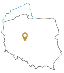
Location
Kujawsko-Pomorskie province:
- Mogilno county, commune: Jeziora Wielkie (0.90% participation in the concession block)
- Radziejów county, commune: Piotrków Kujawski (0.76%)
Wielkopolskie provincve:
- Koło county, communes: Kościelec (1.52%), Koło (0.08%), Osiek Mały (0.07%)
- Konin urban county, commune: Konin (7.94%)
- Konin county, communes: Ślesin (13.83%), Kramsk (11.36%), Krzymów (8.47%), Golina (7.34%), Wilczyn (6.77%), Skulsk (6.73%), Kazimierz Biskupi (5.05%), Kleczew (4.76%), Sompolno (4.14%), Wierzbinek (2.76%), Stare Miasto (2.68%), Rzgów (0.28%)
- Słupca county, communes: Ostrowite (6.27%), Orchowo (2.17%), Słupca (2.06%), Powidz (0.80%)
- Turek county, commune: Władysławów (3.28%)
Duration
Concession for 10 years, including:
- prospecting and exploration phase (5 years)
- extracting phase - after the investment decision
The proposed minimum work program of prospecting and exploration phase
Stage I (12 months) – interpretation and analyses of the archival geological data
Stage II (12 months) – reprocessing of the seismic data and execution of at least 50 km (SP) 2D seismic survey
Stage III (24 months) – drilling of one well to the minimum depth of 5100 m (TVD) and maximum depth of 6,500 m (TVD) with obligatory coring of perspective intervals and geophysical survey for petrographic and lithological analyses, hydrocarbon saturation and ensuring security during geological work. In case of discover – performing of production tests and preparing to exploitation
Stage IV (12 months) – analysis of the data obtained