Acreage: 1047.73 km2; 258,900 acres
Concession blocks: 276, 277, 296 and 297
Coordinates
| No. point | x [PUWG92] | y [PUWG92] |
| 1 | 407494,46 | 731105,39 |
| 2 | 398381,37 | 724478,08 |
| 3 | 391027,02 | 724815,79 |
| 4 | 398721,51 | 708533,60 |
| 5 | 406938,85 | 691560,89 |
| 6 | 417513,16 | 683035,52 |
| 7 | 420895,35 | 682945,76 |
| 8 | 420925,35 | 682944,96 |
| 9 | 421010,20 | 685294,80 |
| 10 | 420923,26 | 685271,71 |
| 11 | 420469,35 | 685725,44 |
| 12 | 420460,44 | 686189,02 |
| 13 | 419968,31 | 687320,49 |
| 14 | 419554,49 | 687716,99 |
| 15 | 419553,99 | 688409,45 |
| 16 | 420317,35 | 689664,43 |
| 17 | 420580,60 | 689659,36 |
| 18 | 421133,16 | 688618,60 |
| 19 | 421361,48 | 694639,27 |
| 20 | 424645,99 | 692342,61 |
| 21 | 435143,76 | 691942,04 |
| 22 | 435481,97 | 700604,25 |
Location
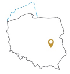
Lubelksie province:
- Lubartów county, communes: Abramów (4.57% powierzchni), Michów (0.82%)
- Puławy county, communes: Żyrzyn (12.33%), Puławy (7.91%), Kurów (7.53%), Baranów (7.35%), Końskowola (5.49%), urban Puławy (2.58%), Markuszów (0.38%), Nałęczów (0.16%)
- Ryki county, communes: Kłoczew (3,82%), Dęblin (3,66%), Ryki (14,83%), Nowodwór (1,34%), Ułęż (4,91%), Stężyca (8,44%)
Mazowieckie province:
- Garwolin county, commune: Trojanów (6.30%)
- Kozienice county, communes: Sieciechów (4.31%), Gniewoszów (2.94%), Kozienice (0.31%), Garbatka-Letnisko (0.02%)
Duration
Concession for 10 years, including:
- prospecting and exploration phase (5 years)
- extracting phase - after the investment decision
Petroleum play
I – conventional, Paleozoic (Devonian and Carboniferous)
II – unconventional, Paleozoic (Devonian)
Source rocks
I – Devonian (Frasnian and Famennian) and Carboniferous fine-grained clastic rocks
II – Frasnian limestones
Reservoir rocks
I - Upper Carboniferous and Upper Devonian (Famennian) clastic deposits
II – Upper Devonian (Frasnian) limestones
Seal rocks
I – Devonian clay-mudstones, marly-carbonate deposits, locally evaporites and complexes of Carboniferous mudstones, sandstones and claystones
II - Frasnian limestones
The proposed minimum work program of prospecting and exploration phase
Stage I (12 months) – interpretation and analyses of the archival geological data
Stage II (12 months) – execution of 2D seismic survey (at least 100 km) or drilling of one well to the maximum depth of 5000 m with obligatory coring of perspective intervals
Stage III (24 months) – drilling of one well maximum depth of 5,000 with obligatory coring of perspective intervals and geophysical survey for petrographic and lithological analyses, hydrocarbon saturation and ensuring security during geological work. In case of deposit discover – performing of production tests and preparing to exploitation
Stage IV (12 months) – analysis of the obtained data
